FULL ENJOY Call Girls In Mahipalpur Delhi Contact Us 8377877756
New wayfinding system for City of Toronto's underground walkway
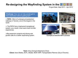
1. Team: Amy Chong & Stephanie Chow
Client: Hans Riekko, M.PI., MUDS, MCIP, RPP, Transportation Planner (City of Toronto)
Re-designing the Wayfinding System in the
Project Date: Sept 2011 – Apr 2012
PATH: 30km of underground pedestrian
walkway in Toronto; one of the largest in the
world
The PATH has a haphazard navigational
system, as a result, most users have horrible
experiences
Big expansion projects and strong user
growth calls for a better wayfinding system
Challenge: How can we help people get to
their destination without getting lost?
Retail Stores
Office buildings
Subway Stations
Cultural attractions
Examples of what the PATH connects
2. Users got lost for multiple reasons, including, poorly designed and
placed devices, and no connection to the street level
Poor device placement
Inconsistent
Information
Stakeholder Interview User Survey User Testing
I was lost for 2 hours down there. I should’ve left after
the first hour, but I thought I was going the right way.
“
”
I would rather walk outside in the blizzard than use the PATH.
“ ”
I never use the PATH when I need to get somewhere on time.
“ ”
3. We envisioned the future wayfinding system to be easy; information
will be clearly communicated on devices to support travel needs
New/ occasional
users, Visitors
“Get to my destination
easily […] Can explore
without getting lost”
Frequent users
“Get to my regular
destination quickly; bypass
huge crowds […] Don’t want
to get lost while travelling to
new or old places”
Intuitively understand and use
all wayfinding information
Transition in between
buildings easily
Easily access information to
guide their journey
Know where they are with
respect to street level
What we heard Design principles
4. All 7 location-based devices share information on street level, route,
and accessibility; placement principles were used to positions aids
Places signage at every decision point
Place transition
signs at connection
points
Cluster and angle
signage to
increase visibility
Place signs in sight of previous one
Route Information
states the buildings that the user is
travelling through
PATH logo
distinguishes wayfinding system
Arrows
provide egocentric direction
Accessibility Information
identifies the accessible routes
Street intersections
street level reference while
travelling underground
It doesn’t matter how good the aids are, if people can’t see them!
5. A virtual simulation was created to test our solution; all participants
reached the final destinations without any wrong turns or backtracking
Embedded videos and
our devices into
PowerPoint.
Users were shown video clips and transitional signs
to simulate the environment and distance travelled.
Users were shown hanging signs and
asked to decide which way to go next.
Pops up if user makes
wrong decision.