Gps
•Download as PPTX, PDF•
1 like•580 views

a quick overview of the Global Positioning System elements

Recommended
More Related Content
Similar to Gps
Similar to Gps (20)
More from Bertrand Bhikarry
More from Bertrand Bhikarry (20)
Recently uploaded
Recently uploaded (20)
Gps
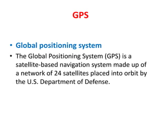
- 1. GPS Global positioning system The Global Positioning System (GPS) is a satellite-based navigation system made up of a network of 24 satellites placed into orbit by the U.S. Department of Defense.
- 5. RECEPTION FROM FOUR SATELLITES REQUIRED TO GET A POSITION (FIX)
- 6. GPS works in any weather conditions, anywhere in the world, 24 hours a day. There are no subscription fees or setup charges to use GPS. GPS antenna must have clear view of the sky. Some GPS with inbuilt antenna will get receive satellites even if it is inside the cabin of a boat.
- 7. THERE ARE TWO TYPES OF GPS RECEIVERS HANDHELD
- 8. FIXED GPS
- 9. FIXED GPS
- 10. How accurate is GPS? Today's GPS receivers are more accurate, thanks to their parallel multi-channel design and new land based infrastructure to enable pinpoint accuracy. Most marine GPS receivers however, are accurate to within 15 meters on average.
- 11. DIFFERENTIAL GPS OR DGPS
- 12. WAYPOINT A waypoint is a reference point or set of coordinates that precisely identify a location. A waypoint includes latitude and longitude data. Most GPS receivers allow the user to easily set, store, and reference multiple waypoints. Your GPS will allow you to save a large number of waypoints, any of which you can rename to something that you will recognize, rather than using the default name.
- 13. In practical use, GPS device displays can point to, or give specific directions to pre-set waypoints. Also, specific and detailed routes may be established with multiple waypoints. Waypoints may be set while a GPS user is physically positioned at the desired waypoint. Waypoints may also be set by manually entering known coordinates into the GPS receiver.
- 14. Most fishermen will store the following locations as waypoints in their GPS: Home port. Landing jetties etc. Good fishing grounds. Good anchoring location. Neighboring countries Various coastal cities / villages / atoll / islands in your own country. Navigational or marker buoys. Dangerous reefs or wrecks.
- 15. ROUTE In GPS navigation, a "route" is usually defined as a series of two or more waypoints. To follow such a route, the GPS user navigates to the nearest waypoint, then to the next one in turn until the destination is reached.
- 16. USES OF A MARINE GPS To mark productive fishing ground so that you can return to the exact location another day. To enable you to accurately navigate to the fishing ground and travel back to your home port after fishing activities. To enable rescuers to accurately come to your position in the event that you are in distress and requiring assistance. To enable you to travel accurately to another vessel that may be in need of assistance.
- 17. To mark the position of the existence of a reef or wreck that may cause a danger to mariners. To inform you of your present distance from land while fishing out at sea. To provide GPS coordinated to other fishing vessels on the existence of good fishing location. To be used to provide anchor alarm in the event that you are dragging anchor.
- 18. After leaving the fishing ground and you are travelling back to your home port, the GPS will enable you to provide information to your fish buyer or vessel owner of the estimated time of arrival ETA. To give you information of the distance to the nearest port in the event of an emergency on board your fishing vessel or of an impending threatening weather system. To provide time of day to fishermen out at sea. To give the speed of your vessel.