Urban Ecology Collaborative: A Multi-City Learning Network
•Download as PPTX, PDF•
2 likes•1,056 views

Urban Ecology Collaborative: A Multi-City Learning Network Colleen Murphy-Dunning, Hixon Center for Urban Ecology | Michael Leff, The Davey Institute | Phillip Rodbell, USDA Forest Service Northeastern Area

Recommended
Recommended
More Related Content
Similar to Urban Ecology Collaborative: A Multi-City Learning Network
Similar to Urban Ecology Collaborative: A Multi-City Learning Network (20)
More from Arbor Day Foundation
More from Arbor Day Foundation (20)
Recently uploaded
Recently uploaded (20)
Urban Ecology Collaborative: A Multi-City Learning Network
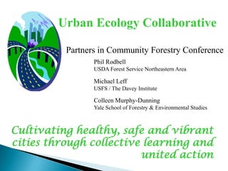
- 1. Urban Ecology Collaborative Partners in Community Forestry Conference Phil Rodbell USDA Forest Service Northeastern Area Michael Leff USFS / The Davey Institute Colleen Murphy-Dunning Yale School of Forestry & Environmental Studies Cultivating healthy, safe and vibrant cities through collective learning and united action
- 3. Baltimore: Parks and People Foundation Boston: Urban Ecology Institute/Boston College, Natural Cities Program partners New Haven: Urban Resources Initiative/Yale University, New Haven Ecology Project New York City: Parks and Recreation Programs and Citywide Non-Profits Pittsburgh: Nine Mile Run Watershed Association, Pittsburgh Parks Conservancy, 3 Rivers 2nd Nature (Carnegie-Melon University), Pennsylvania Environmental Council - Western Region Washington, DC: Casey Trees, Urban Forestry Administration Philadelphia: Pennsylvania Horticultural Society Providence: City Parks Dept Strategic Partners: USDA Forest Service Northern Research Station and Northeastern Area State and Private Forestry
- 4. Early goals of the UEC: Multi-city network for urban ecosystem research and restoration Complete “tools” for effectively addressing common urban ecosystem problems Develop an integrated “toolkit” for standardizing, evaluating, and sharing these tools Launch a national clearinghouse of urban ecosystem data
- 5. Initial UEC Committee Structure Executive Committee consisting of 1 representative from each city, plus working committees: WORKING COMMITTEES Leadership for community development and stewardship: education Leadership for community development and stewardship: job training Restoration tools Multi-city research agenda and database development
- 6. Collaborative model development MERGE: Methods for Engaging Residents and Grassroots in the Environment Model replication involves the adoption of one city’s successful program by another. URI Community Greenspace program replicated in Boston (CityRoots, 2003) and Pittsburgh (GreenLinks, 2003) Model Sharing included inventories, monitoring/evaluation and UTC
- 14. Develop and administer a survey to assess local priority concerns Host six forums in the UEC cities to create dialogue about outreach techniques Implement pilot projects to apply outreach methods Share our findings to other cities and partners in the region
- 15. Survey Question: Where do you get information about local activities and issues?
- 16. Overall, the participants were motivated: ◦ by the social aspects of getting involved ◦ the idea that it was the right thing to do and a good thing to do for the community ◦ usually not motivated by just one reason and address many different desires when participating in these community projects
- 17. 1) 2) 3) Organizations that work with citizen groups look toward the citizens for input on outreach strategies Investing in outreach is as important as investing in planting and maintenance Tailor outreach message and method
- 21. Restoration Tools ⇒ Urban Forestry Municipal and nonprofit reps, plus USFS “Coalition of the Willing” Staggered rotating co-chairs Workhorse website fell off, LinkedIn launched Dues structure in question Peer-to-peer learning, tech transfer, and support Wide-open opportunities for collaboration
- 28. Urban Ecology Collaborative Partners in Community Forestry Conference Phil Rodbell USDA Forest Service Northeastern Area Michael Leff USFS / The Davey Institute Colleen Murphy-Dunning Yale School of Forestry & Environmental Studies Cultivating healthy, safe and vibrant cities through collective learning and united action
Editor's Notes
- The detailed nature of the land cover mapping supports summarizing the information at multiple scales.
- High-resolution land cover is the basis for a UTC assessment. The land cover mapping is standardized for each community. What communities do with the data may differ.
- Baltimore Metro RegionParcels are typically the finest unit of analysis.
- Tree canopy summarized by parcel
- In Pittsburgh tree canopy was summarized at the neighborhood level.
- ..and then compared to surface temperature to clearly show the impact tree canopy has on the urban heat island.
- Philadelphia, PATree canopy metrics were computed for all US Census Block Groups within the city, allowing the tree canopy metrics to be integrated with socio-demographic data collected by the US Census. This type of information can help to inform tree planting initiatives by providing proxies for environmental justice (Existing TC %) and stewardship potential (% renter occupied and % vacant). Census block group 421010046001 is within the Girard Estates Neighborhood. Tree canopy is only 8% of the land area and Possible Tree Canopy is 59%. While most of the households are owner-occupied there are a relatively high percentage of vacant housing units.