SlideShare a Scribd company logo
1 of 137
Download to read offline
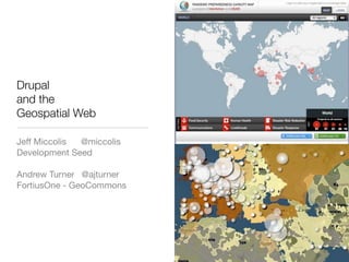
Drupal
and the
Geospatial Web

Jeff Miccolis @miccolis
Development Seed

Andrew Turner @ajturner
FortiusOne - GeoCommons
Jeff Miccolis
@miccolis
Development Seed


Andrew Turner
@ajturner
FortiusOne - GeoCommons
Drupal...

@miccolis


            photourl
Why maps?
Drupal
CMS


           Gmap module
Module


            Google maps
Display


          Google‘s mapdata
Data
Drupal
CMS


          Custom module
Module


          Custom php script
Display


          Young’s drawing
Data
Drupal
CMS


               Custom
Module


               mapnik
Display


          Map data somebody
Data
                had...
mapnik?

• “Mapnik is a Free Toolkit for developing
  mapping applications. Above all Mapnik is
  about making beautiful maps. “
• http://mapnik.org/
We’ve got problems.

• Language
• History
• Usage
• Privacy
• Look
We’ve got problems.

• Language
• History
• Usage
• Privacy
• Look
http://en.wikipedia.org/wiki/File:Map_of_USA_VA.svg
We’ve got problems.

• Language
• History
• Usage
• Privacy
• Look
We’ve got problems.

• Language
• History
• Usage
• Privacy
• Look
http://www.flickr.com/photos/vonbergendotnet/2496411369/
We’ve got problems.

• Language
• History
• Usage
• Privacy
• Look
Drupal
CMS


                 ?
Module


             Cloudmade
Display


          Open Street Maps
Data
We’ve got problems.

• Language
• History
• Usage
• Privacy
• Look
We’ve got options.

• CMS
• Modules
• Display
• Data
kidding :)
We’ve got options.

• CMS
• Modules
• Display
• Data
Drupal
CMS


           Gmap module
Module


            Google maps
Display


          Google’s mapdata
Data
Drupal
CMS


          Mapstraction module
Module


              Google maps
Display


           Google’s mapdata
Data
mapstraction?
• “Mapstraction is a library that provides a
  common API for various javascript mapping
  APIs to enable switching from one to
  another as smoothly as possible.”
• Support for eleven mapping providers.
• http://www.mapstraction.com/
• http://drupal.org/project/mapstraction
We’ve got options.

• CMS
• Modules
• Display
• Data
Drupal
CMS


          Mapstraction module
Module


               Cloudmade
Display


           Open Street Maps
Data
Drupal
CMS


          Mapstraction module
Module


               Free Earth
Display


            Satellite imagery
Data
Drupal
CMS


          Mapstraction module
Module


               Free Earth
Display


            Satellite imagery
Data
Drupal
CMS


          Nice map module
Module


               NASA
Display


          Satellite imagery
Data
Nice map?


• “Nice Map is a WMS client for Drupal.”
• http://drupal.org/project/nicemap
WMS?

• “An Open Geospatial Consortium Web
  Map Service (WMS) produces maps of
  spatially referenced data dynamically from
  geographic information.”
• http://www.opengeospatial.org/
We’ve got options.

• CMS
• Modules
• Display
• Data
Drupal
CMS


            Nice map module
Module


                 Mapnik
Display


Data      Whatever I can get my
               hands on!
We’ve got options.

• CMS
• Modules
• Display
• Data
Was he really kidding
  about Drupal?
cut to Andrew...
...and the Geospatial Web

@ajturner


                            photourl
What is this Geospatial Web?
The Web
The Drupal Web   http://www.aharef.info
The Geospatial Web
unread POI’s 1000+
Life Digitized
OK - so how is the Geospatial Web different?
Formats


          http://flickr.com/photos/wolfsoul/1352149315
Create
  Exif   GeoRSS      KML        GPX    Geocoding


                  Publish
GeoRSS    KML         Microformats    MachineTags


                Aggregate
 GML     KML       GeoRSS       WFS    GeoJSON


                  Consume
!


Standards Organizations
NOAA WMS
http://www.ngdc.noaa.gov/eog/maps/cgi-bin/public/ms/
poster?LAYERS=nighttime_lights_f152003
&SERVICE=WMS&VERSION=1.1.1
&REQUEST=GetMap
&STYLES=&EXCEPTIONS=application
%2Fvnd.ogc.se_inimage
&FORMAT=image%2Fjpeg
&SRS=EPSG%3A4326
&BBOX=53.81333333,-90.000,170.7208,26.906666&WIDT
H=256&HEIGHT=256


              WMS Request
Where’s my vector data?


                          http://code.flickr.com/blog/2009/02/04/100000000-geotagged-photos-plus/
http://giswebservices.massgis.state.ma.us/geoserver/wfs?
request=getfeature&version=1.0.0&service=wfs&propertyna
me=TOWN,POP2000&typename=massgis:GISDATA.TOWN
S_POLYM&filter=%3CFilter+xmlns=%22http://
www.opengis.net/ogc%22%3E%3CPropertyIsGreaterThan
%3E%3CPropertyName%3EPOP2000%3C/PropertyName
%3E%3CLiteral%3E100000%3C/Literal%3E%3C/
PropertyIsGreaterThan%3E%3C/Filter%3E


                WFS Request
<?xml version=quot;1.0quot; encoding=quot;UTF-8quot;?>
<wfs:FeatureCollection xmlns:wfs=quot;http://www.opengis.net/wfsquot; xmlns:gml=quot;http://www.opengis.net/gmlquot;
    xmlns:massgis=quot;http://massgis.state.ma.us/featuretypequot;
    xmlns:xsi=quot;http://www.w3.org/2001/XMLSchema-instancequot;
    xsi:schemaLocation=quot;http://massgis.state.ma.us/featuretype http://giswebservices.massgis.state.ma.us/
geoserver/wfs/DescribeFeatureType?typeName=massgis:GISDATA.TOWNS_POLYM http://www.opengis.net/wfs http://
giswebservices.massgis.state.ma.us/geoserver/schemas/wfs/1.0.0/WFS-basic.xsdquot;>
    <gml:boundedBy>
        <gml:Box srsName=quot;http://www.opengis.net/gml/srs/epsg.xml#26986quot;>
            <gml:coordinates xmlns:gml=quot;http://www.opengis.net/gmlquot; decimal=quot;.quot; cs=quot;,quot; ts=quot; quot;
                >107210.18360951201,868673.000913621
            252005.57369636302,935123.120655508</gml:coordinates>
        </gml:Box>
    </gml:boundedBy>
</wfs:FeatureCollection>


             WFS GML Response
Does it really have to be that hard?


                            http://code.flickr.com/blog/2009/02/04/100000000-geotagged-photos-plus/
GeoRSS   http://georss.org
+


GeoRSS   http://georss.org
<georss:point>
  +      45.256 -71.92
      </georss:point>


GeoRSS          http://georss.org
USGS   http://earthquake.usgs.gov/eqcenter/catalogs/
FriendFeed
KML
http://code.google.com/apis/kml/
documentation/kmlreference.html


                                   photourl
{ quot;typequot;: quot;Pointquot;, quot;coordinatesquot;: [100.0, 0.0] }


               GeoJSON
•   FeedAPI

•   KML Module

•   GeoRSS Module

•   NiceMap (WMS)

•   Atom


              Drupal Modules   FeedAPI
But how do I query data?


                           http://code.flickr.com/blog/2009/02/04/100000000-geotagged-photos-plus/
OpenSearch
http://example.com/search
?keyword={searchTerms}
&limit={count?}
&page={startPage?}


                          required
                         optional?

   OpenSearch Template
http://geo.example.com/search.atom?
  keyword={searchTerms}
  &location={geo:locationString?}
  &lat={geo:lat?}&lon={geo:lon?}&distance={geo:radius?}
  &bbox={geo:box?}


           OpenSearch-Geo
Where is the GeoREST?


                        http://code.flickr.com/blog/2009/02/04/100000000-geotagged-photos-plus/
KML + GeoRSS+HTML   http://highearthorbit.com/a-proposal-georss-kml
AtomPub-Geo
Create
  Exif   GeoRSS      KML        GPX    Geocoding


                  Publish
GeoRSS    KML         Microformats    MachineTags


                Aggregate
 GML     KML       GeoRSS       WFS    GeoJSON


                  Consume
Data


       http://flickr.com/photos/beija-flor/1217587004
Flickr Export
Google Picasa + Panoramio
GeoWeb2.0
What else is there besides blog posts?
Real-Time Data
User-Generated Content   http://nowpublic.com/tag/
                         DrupalCon/scan
Local Governments   http://data.octo.dc.gov
National Governments   http://www.recovery.gov/
Inter-Government   http://inspire.jrc.ec.europa.eu/
Global NGO   http://ungiwg.org
Registries   http://geonetwork.org
Repositories
                 http://geocommons.com
& Aggregators
But I’m already using GoogleMaps.
GoogleMaps   http://maps.google.com
Design
Usability
Data Ownership and
           Access
Data Ownership and
           Access
Data Coverage and
           Quality
Data Coverage and
           Quality
OpenStreetMap   http://openstreetmap.org
OSM in Flickr
OpenAerialMap   http://openaerialmap.org
ODbL    http://www.opendatacommons.org/
Open Database License
Community


        http://flickr.com/photos/wwworks/1384952210
http://flickr.com/photos/x180/2494170626/


“Geowankers”   yes, you heard me correctly
OSGeo   http://osgeo.org
OpenStreetMap   http://openstreetmap.org
Mapping Parties
Mappers Anonymous
Exponential Growth   http://wiki.openstreetmap.org/wiki/Stats
#osgeo
Geo-Web-Rest
                                                    #mapnik
http://groups.google.com/group/
geo-web-rest
                                                    #osm
GeoRSS
                                                    #openlayers
http://georss.org
                                                    #et al.
GeoJSON
http://geojson.org
geowanking
http://lists.burri.to/mailman/listinfo/geowanking


               Geo Communities
And why is this
important to me?


        http://flickr.com/photos/seandreilinger/2326448445
Apps for Democracy
A Drupal Example
KML


A Drupal Example
GeoRSS


              KML


A Drupal Example
WMS


     GeoRSS


              KML


A Drupal Example
WMS


     GeoRSS


              KML


A Drupal Example
WMS


     GeoRSS


              KML


A Drupal Example
WMS


GeoRSS


         KML


         A Drupal Example
A GeoWeb Example
A GeoWeb Example
Drupal
and the
Geospatial Web

Jeff Miccolis - @miccolis
Development Seed

Andrew Turner - @ajturner
FortiusOne - GeoCommons


slideshare.net/ajturner

More Related Content

What's hot

FreeMap Palestine November 2008
FreeMap Palestine November 2008FreeMap Palestine November 2008
FreeMap Palestine November 2008
mikel_maron
 
Open Source GeoSpatial
Open Source GeoSpatialOpen Source GeoSpatial
Open Source GeoSpatial
arno974
 
Agency Is the Intelligent Design of the Internet
Agency Is the Intelligent Design of the InternetAgency Is the Intelligent Design of the Internet
Agency Is the Intelligent Design of the Internet
Aaron Cope
 

What's hot (13)

FreeMap Palestine November 2008
FreeMap Palestine November 2008FreeMap Palestine November 2008
FreeMap Palestine November 2008
 
What to do when Classic Google Maps Go Away?
What to do when Classic Google Maps Go Away?What to do when Classic Google Maps Go Away?
What to do when Classic Google Maps Go Away?
 
Free GIS Resources on the Web
Free GIS Resources on the WebFree GIS Resources on the Web
Free GIS Resources on the Web
 
Open GeoData, Open GeoTools: An Introduction
Open GeoData, Open GeoTools: An IntroductionOpen GeoData, Open GeoTools: An Introduction
Open GeoData, Open GeoTools: An Introduction
 
Using geobrowsers for thematic mapping
Using geobrowsers for thematic mappingUsing geobrowsers for thematic mapping
Using geobrowsers for thematic mapping
 
Introduction to Open GeoData
Introduction to Open GeoDataIntroduction to Open GeoData
Introduction to Open GeoData
 
Open Source GeoSpatial
Open Source GeoSpatialOpen Source GeoSpatial
Open Source GeoSpatial
 
From Tyvek to Today - Bike Maps of Greater Portland
From Tyvek to Today - Bike Maps of Greater PortlandFrom Tyvek to Today - Bike Maps of Greater Portland
From Tyvek to Today - Bike Maps of Greater Portland
 
Agency Is the Intelligent Design of the Internet
Agency Is the Intelligent Design of the InternetAgency Is the Intelligent Design of the Internet
Agency Is the Intelligent Design of the Internet
 
What's The Fuss About Bing
What's The Fuss About BingWhat's The Fuss About Bing
What's The Fuss About Bing
 
Location.Aware
Location.AwareLocation.Aware
Location.Aware
 
Open data initiatives
Open data initiativesOpen data initiatives
Open data initiatives
 
Pervasive information architecture
Pervasive information architecturePervasive information architecture
Pervasive information architecture
 

Similar to Drupal and the GeoSpatial Web

Web enabling your survey business ppt version
Web enabling your survey business ppt versionWeb enabling your survey business ppt version
Web enabling your survey business ppt version
rudy_stricklan
 
CHUG_presentation_Hope
CHUG_presentation_HopeCHUG_presentation_Hope
CHUG_presentation_Hope
Lara Juliusson
 

Similar to Drupal and the GeoSpatial Web (20)

Maps, mashups and metadata:geospatial standards for access and retrieval
Maps, mashups and metadata:geospatial standards for access and retrievalMaps, mashups and metadata:geospatial standards for access and retrieval
Maps, mashups and metadata:geospatial standards for access and retrieval
 
Web enabling your survey business ppt version
Web enabling your survey business ppt versionWeb enabling your survey business ppt version
Web enabling your survey business ppt version
 
CHUG_presentation_Hope
CHUG_presentation_HopeCHUG_presentation_Hope
CHUG_presentation_Hope
 
Where20 2008 Ruby Tutorial
Where20 2008 Ruby TutorialWhere20 2008 Ruby Tutorial
Where20 2008 Ruby Tutorial
 
Open@EDINA
Open@EDINAOpen@EDINA
Open@EDINA
 
Performance and Scalability for Maps API Sites (Dev Fest '10 Mexico)
Performance and Scalability for Maps API Sites (Dev Fest '10 Mexico)Performance and Scalability for Maps API Sites (Dev Fest '10 Mexico)
Performance and Scalability for Maps API Sites (Dev Fest '10 Mexico)
 
Seti 09
Seti 09Seti 09
Seti 09
 
Of Nodes and Maps (Web Mapping with Drupal - Part II)
Of Nodes and Maps (Web Mapping with Drupal - Part II)Of Nodes and Maps (Web Mapping with Drupal - Part II)
Of Nodes and Maps (Web Mapping with Drupal - Part II)
 
Mapstraction
MapstractionMapstraction
Mapstraction
 
Location Based Services Without the Cocoa
Location Based Services Without the CocoaLocation Based Services Without the Cocoa
Location Based Services Without the Cocoa
 
3 Approaches to Mobile - An A to Z Primer.
3 Approaches to Mobile - An A to Z Primer.3 Approaches to Mobile - An A to Z Primer.
3 Approaches to Mobile - An A to Z Primer.
 
The User-participated Geospatial Web as Open Platform
The User-participated Geospatial Web as Open PlatformThe User-participated Geospatial Web as Open Platform
The User-participated Geospatial Web as Open Platform
 
Gmaps Railscamp2008
Gmaps Railscamp2008Gmaps Railscamp2008
Gmaps Railscamp2008
 
Where 2.0
Where 2.0Where 2.0
Where 2.0
 
ESRI Dev Meetup: Building Distributed JavaScript Map Widgets
ESRI Dev Meetup: Building Distributed JavaScript Map WidgetsESRI Dev Meetup: Building Distributed JavaScript Map Widgets
ESRI Dev Meetup: Building Distributed JavaScript Map Widgets
 
Map Styling Tools and Interactive maps on the web with OpenLayers - Addy Pope...
Map Styling Tools and Interactive maps on the web with OpenLayers - Addy Pope...Map Styling Tools and Interactive maps on the web with OpenLayers - Addy Pope...
Map Styling Tools and Interactive maps on the web with OpenLayers - Addy Pope...
 
Agi08 Jeremy Morley
Agi08 Jeremy MorleyAgi08 Jeremy Morley
Agi08 Jeremy Morley
 
NCGIC The Geospatial Revolution
NCGIC The Geospatial RevolutionNCGIC The Geospatial Revolution
NCGIC The Geospatial Revolution
 
GeOng presentation about OpenStreetMap
GeOng presentation about OpenStreetMapGeOng presentation about OpenStreetMap
GeOng presentation about OpenStreetMap
 
Open geo data - technical issue
Open geo data  - technical issueOpen geo data  - technical issue
Open geo data - technical issue
 

More from Andrew Turner

Crisis Cartography - AAG 2013
Crisis Cartography - AAG 2013Crisis Cartography - AAG 2013
Crisis Cartography - AAG 2013
Andrew Turner
 
OpenGovHub - Mapping Social Infrastructure with Social Media
OpenGovHub - Mapping Social Infrastructure with Social MediaOpenGovHub - Mapping Social Infrastructure with Social Media
OpenGovHub - Mapping Social Infrastructure with Social Media
Andrew Turner
 
OK festival Lightning Talk - Collaborative Open Geospatial Data
OK festival Lightning Talk - Collaborative Open Geospatial DataOK festival Lightning Talk - Collaborative Open Geospatial Data
OK festival Lightning Talk - Collaborative Open Geospatial Data
Andrew Turner
 
Geospatial Archiving - Society of American Archivists
Geospatial Archiving - Society of American ArchivistsGeospatial Archiving - Society of American Archivists
Geospatial Archiving - Society of American Archivists
Andrew Turner
 
Crisis Mapping Lightning Talk Geo Commons
Crisis Mapping Lightning Talk   Geo CommonsCrisis Mapping Lightning Talk   Geo Commons
Crisis Mapping Lightning Talk Geo Commons
Andrew Turner
 
Where2.0+Gov2.0 - Gov2.0 Summit
Where2.0+Gov2.0 - Gov2.0 SummitWhere2.0+Gov2.0 - Gov2.0 Summit
Where2.0+Gov2.0 - Gov2.0 Summit
Andrew Turner
 

More from Andrew Turner (20)

GeoDC June 2012 - GeoCommons
GeoDC June 2012 - GeoCommonsGeoDC June 2012 - GeoCommons
GeoDC June 2012 - GeoCommons
 
Charlottesville Data bootcamp 2017
Charlottesville Data bootcamp 2017Charlottesville Data bootcamp 2017
Charlottesville Data bootcamp 2017
 
State of the Map 2015
State of the Map 2015State of the Map 2015
State of the Map 2015
 
Crisis Cartography - AAG 2013
Crisis Cartography - AAG 2013Crisis Cartography - AAG 2013
Crisis Cartography - AAG 2013
 
OpenGovHub - Mapping Social Infrastructure with Social Media
OpenGovHub - Mapping Social Infrastructure with Social MediaOpenGovHub - Mapping Social Infrastructure with Social Media
OpenGovHub - Mapping Social Infrastructure with Social Media
 
OK festival Lightning Talk - Collaborative Open Geospatial Data
OK festival Lightning Talk - Collaborative Open Geospatial DataOK festival Lightning Talk - Collaborative Open Geospatial Data
OK festival Lightning Talk - Collaborative Open Geospatial Data
 
GeoIQ Stack - Where 2012
GeoIQ Stack - Where 2012GeoIQ Stack - Where 2012
GeoIQ Stack - Where 2012
 
Geospatial Archiving - Society of American Archivists
Geospatial Archiving - Society of American ArchivistsGeospatial Archiving - Society of American Archivists
Geospatial Archiving - Society of American Archivists
 
Playful Explorations of Public and Personal Data - OSCON Data 2011
Playful Explorations of Public and Personal Data - OSCON Data 2011Playful Explorations of Public and Personal Data - OSCON Data 2011
Playful Explorations of Public and Personal Data - OSCON Data 2011
 
Conversing around Data with Collaborative Analysis - Where2011
Conversing around Data with Collaborative Analysis - Where2011Conversing around Data with Collaborative Analysis - Where2011
Conversing around Data with Collaborative Analysis - Where2011
 
tech tools for global collaboration 4 good
tech tools for global collaboration 4 goodtech tools for global collaboration 4 good
tech tools for global collaboration 4 good
 
Where2.0 That Matters
Where2.0 That MattersWhere2.0 That Matters
Where2.0 That Matters
 
Humanitarian Mapping - Interaction ICCC
Humanitarian Mapping - Interaction ICCCHumanitarian Mapping - Interaction ICCC
Humanitarian Mapping - Interaction ICCC
 
Open Access to Multi-Domain Collaborative Geospatial Analysis - AGU 2009
Open Access to Multi-Domain Collaborative Geospatial Analysis - AGU 2009Open Access to Multi-Domain Collaborative Geospatial Analysis - AGU 2009
Open Access to Multi-Domain Collaborative Geospatial Analysis - AGU 2009
 
Crisis Mapping Lightning Talk Geo Commons
Crisis Mapping Lightning Talk   Geo CommonsCrisis Mapping Lightning Talk   Geo Commons
Crisis Mapping Lightning Talk Geo Commons
 
How Neogeography Killed GIS
How Neogeography Killed GISHow Neogeography Killed GIS
How Neogeography Killed GIS
 
Where2.0+Gov2.0 - Gov2.0 Summit
Where2.0+Gov2.0 - Gov2.0 SummitWhere2.0+Gov2.0 - Gov2.0 Summit
Where2.0+Gov2.0 - Gov2.0 Summit
 
GeoCommons Open-Source GeoCoder
GeoCommons Open-Source GeoCoderGeoCommons Open-Source GeoCoder
GeoCommons Open-Source GeoCoder
 
Geospatial Analysis in the Cloud
Geospatial Analysis in the CloudGeospatial Analysis in the Cloud
Geospatial Analysis in the Cloud
 
Loca(c)tion - Reboot 11
Loca(c)tion - Reboot 11Loca(c)tion - Reboot 11
Loca(c)tion - Reboot 11
 

Recently uploaded

+971581248768>> SAFE AND ORIGINAL ABORTION PILLS FOR SALE IN DUBAI AND ABUDHA...
+971581248768>> SAFE AND ORIGINAL ABORTION PILLS FOR SALE IN DUBAI AND ABUDHA...+971581248768>> SAFE AND ORIGINAL ABORTION PILLS FOR SALE IN DUBAI AND ABUDHA...
+971581248768>> SAFE AND ORIGINAL ABORTION PILLS FOR SALE IN DUBAI AND ABUDHA...
?#DUbAI#??##{{(☎️+971_581248768%)**%*]'#abortion pills for sale in dubai@
 
Artificial Intelligence: Facts and Myths
Artificial Intelligence: Facts and MythsArtificial Intelligence: Facts and Myths
Artificial Intelligence: Facts and Myths
Joaquim Jorge
 

Recently uploaded (20)

ProductAnonymous-April2024-WinProductDiscovery-MelissaKlemke
ProductAnonymous-April2024-WinProductDiscovery-MelissaKlemkeProductAnonymous-April2024-WinProductDiscovery-MelissaKlemke
ProductAnonymous-April2024-WinProductDiscovery-MelissaKlemke
 
Mastering MySQL Database Architecture: Deep Dive into MySQL Shell and MySQL R...
Mastering MySQL Database Architecture: Deep Dive into MySQL Shell and MySQL R...Mastering MySQL Database Architecture: Deep Dive into MySQL Shell and MySQL R...
Mastering MySQL Database Architecture: Deep Dive into MySQL Shell and MySQL R...
 
+971581248768>> SAFE AND ORIGINAL ABORTION PILLS FOR SALE IN DUBAI AND ABUDHA...
+971581248768>> SAFE AND ORIGINAL ABORTION PILLS FOR SALE IN DUBAI AND ABUDHA...+971581248768>> SAFE AND ORIGINAL ABORTION PILLS FOR SALE IN DUBAI AND ABUDHA...
+971581248768>> SAFE AND ORIGINAL ABORTION PILLS FOR SALE IN DUBAI AND ABUDHA...
 
GenCyber Cyber Security Day Presentation
GenCyber Cyber Security Day PresentationGenCyber Cyber Security Day Presentation
GenCyber Cyber Security Day Presentation
 
presentation ICT roal in 21st century education
presentation ICT roal in 21st century educationpresentation ICT roal in 21st century education
presentation ICT roal in 21st century education
 
Finology Group – Insurtech Innovation Award 2024
Finology Group – Insurtech Innovation Award 2024Finology Group – Insurtech Innovation Award 2024
Finology Group – Insurtech Innovation Award 2024
 
The 7 Things I Know About Cyber Security After 25 Years | April 2024
The 7 Things I Know About Cyber Security After 25 Years | April 2024The 7 Things I Know About Cyber Security After 25 Years | April 2024
The 7 Things I Know About Cyber Security After 25 Years | April 2024
 
Axa Assurance Maroc - Insurer Innovation Award 2024
Axa Assurance Maroc - Insurer Innovation Award 2024Axa Assurance Maroc - Insurer Innovation Award 2024
Axa Assurance Maroc - Insurer Innovation Award 2024
 
Exploring the Future Potential of AI-Enabled Smartphone Processors
Exploring the Future Potential of AI-Enabled Smartphone ProcessorsExploring the Future Potential of AI-Enabled Smartphone Processors
Exploring the Future Potential of AI-Enabled Smartphone Processors
 
Automating Google Workspace (GWS) & more with Apps Script
Automating Google Workspace (GWS) & more with Apps ScriptAutomating Google Workspace (GWS) & more with Apps Script
Automating Google Workspace (GWS) & more with Apps Script
 
GenAI Risks & Security Meetup 01052024.pdf
GenAI Risks & Security Meetup 01052024.pdfGenAI Risks & Security Meetup 01052024.pdf
GenAI Risks & Security Meetup 01052024.pdf
 
04-2024-HHUG-Sales-and-Marketing-Alignment.pptx
04-2024-HHUG-Sales-and-Marketing-Alignment.pptx04-2024-HHUG-Sales-and-Marketing-Alignment.pptx
04-2024-HHUG-Sales-and-Marketing-Alignment.pptx
 
Artificial Intelligence: Facts and Myths
Artificial Intelligence: Facts and MythsArtificial Intelligence: Facts and Myths
Artificial Intelligence: Facts and Myths
 
Real Time Object Detection Using Open CV
Real Time Object Detection Using Open CVReal Time Object Detection Using Open CV
Real Time Object Detection Using Open CV
 
Strategies for Unlocking Knowledge Management in Microsoft 365 in the Copilot...
Strategies for Unlocking Knowledge Management in Microsoft 365 in the Copilot...Strategies for Unlocking Knowledge Management in Microsoft 365 in the Copilot...
Strategies for Unlocking Knowledge Management in Microsoft 365 in the Copilot...
 
[2024]Digital Global Overview Report 2024 Meltwater.pdf
[2024]Digital Global Overview Report 2024 Meltwater.pdf[2024]Digital Global Overview Report 2024 Meltwater.pdf
[2024]Digital Global Overview Report 2024 Meltwater.pdf
 
Powerful Google developer tools for immediate impact! (2023-24 C)
Powerful Google developer tools for immediate impact! (2023-24 C)Powerful Google developer tools for immediate impact! (2023-24 C)
Powerful Google developer tools for immediate impact! (2023-24 C)
 
TrustArc Webinar - Stay Ahead of US State Data Privacy Law Developments
TrustArc Webinar - Stay Ahead of US State Data Privacy Law DevelopmentsTrustArc Webinar - Stay Ahead of US State Data Privacy Law Developments
TrustArc Webinar - Stay Ahead of US State Data Privacy Law Developments
 
Boost PC performance: How more available memory can improve productivity
Boost PC performance: How more available memory can improve productivityBoost PC performance: How more available memory can improve productivity
Boost PC performance: How more available memory can improve productivity
 
HTML Injection Attacks: Impact and Mitigation Strategies
HTML Injection Attacks: Impact and Mitigation StrategiesHTML Injection Attacks: Impact and Mitigation Strategies
HTML Injection Attacks: Impact and Mitigation Strategies
 

Drupal and the GeoSpatial Web