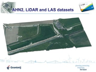
Playing around with LiDAR, AHN2, Aerial Photography and LAStools in ArcGIS 10.1
•
1 like•14,390 views

Presentation on using ArcObjects and LAStools to combine AHN2 raster data and aerial photography to create a LAS dataset and visualize it in the new ArcGIS 10.1

Recommended
Recommended
More Related Content
Similar to Playing around with LiDAR, AHN2, Aerial Photography and LAStools in ArcGIS 10.1
Similar to Playing around with LiDAR, AHN2, Aerial Photography and LAStools in ArcGIS 10.1 (20)
More from Xander Bakker
More from Xander Bakker (13)
Recently uploaded
Recently uploaded (20)
Playing around with LiDAR, AHN2, Aerial Photography and LAStools in ArcGIS 10.1
- 2. 2 AHN2 surface and bare earth 0.5m raster dataset Aerial Photography 0.5m Some ArcObjects code tot create text file LAStools to convert into LAS file ArcGIS 10.1 + 3D analyst to create LAS dataset Visualization in ArcGIS 10.1
- 3. 3 0.5m bare earth raster or bare earth + objects, but no point clouds
- 4. 4 Along with AHN2 you may obtain some aerial photography or just use one of the many web services available…
- 5. 5 Now use IIdentify::Identify(IPoint) or the much faster IPixelBlock3 to loop through the pixels and build a text file with the following format: X [TAB] Y [TAB] Z [TAB] R [TAB] G [TAB] B Use IRasterIdentifyObj::MapTip for the RGB values, note that the maptip gives a string with: Red = 100, Green = 150, Blue = 200 It would be nice if ArcGIS 10.1 would offer a way to create LAS data, but no worries that part is solved by…
- 6. 6 Using LAStools it is easy to convert a text file into LAS: txt2las -i input.txt -parse xyzRGB -skip 1 -o output.las -set_version 1.2 the input file (-i) is “input.txt" the output file (-o) is “output.las" the first 3 columns are parsed to xyz, columns 4th to 6th to RGB the first line (header) is skipped using "-skip 1" the output LAS version is set to 1.2 by "-set_version 1.2" LAStools can do a lot more! More information on LAStools: https://twitter.com/#!/LAStools http://www.cs.unc.edu/~isenburg/lastools/ http://www.linkedin.com/groups/LAStools-4408378 http://www.facebook.com/LAStools
- 7. 7 Recently Martin released a Toolbox for ArcGIS: … and yes, it supports ArcGIS 10.1! More information on LAStools: https://twitter.com/#!/LAStools http://www.cs.unc.edu/~isenburg/lastools/ http://www.linkedin.com/groups/LAStools-4408378 http://www.facebook.com/LAStools
- 8. 8 The LAS file can be imported into a LAS dataset in ArcGIS 10.1 Select your files of folder Specify the output lasd Define any surface constraints Coordinate system, etc … … and hit OK http://resourcesbeta.arcgis.com/en/help/main/10.1/index.html#/Create_LAS_Dataset/00170000016w000000/
- 9. 9 Use the LAS Dataset toolbar to view profile and edit classes http://resourcesbeta.arcgis.com/en/help/main/10.1/index.html#//015w00000053000000
- 10. 10 Use ArcScene to show the LAS data in RGB http://resourcesbeta.arcgis.com/en/help/main/10.1/index.html#/Point_display_options/015w0000005t000000/
- 11. http://twitter.com/#!/XanderBakker http://nl.linkedin.com/in/xanderbakker Xander Bakker Senior GIS Advisor Xander [DOT] Bakker [AT] Grontmij [DOT] NL http://software.grontmij.nl Grontmij Netherlands BV :: GIS & ICT – GIS Team :: http://www.Grontmij.com :: +31 30 220 79 11