TrustArc Webinar - Unlock the Power of AI-Driven Data Discovery
Extension arc gis
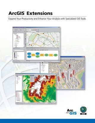
1. Expand Your Productivity and Enhance Your Analysis with Specialized GIS Tools
ArcGIS
®
Extensions
2. 2
ArcGIS Extensions
Specialized GIS Tools for Enhanced Productivity and Advanced Analysis
ESRI offers a wide range of optional extensions that can dramatically expand the capabilities of ArcGIS®
. While all these extensions are
available for ArcGIS Desktop, many are offered for ESRI’s server (ArcGIS Server) and developer (ArcGIS Engine) environments as well.
This common architecture gives you the flexibility to operate the same ArcGIS extensions across ESRI’s full suite of products, significantly
reducing your acquisition, training, and operating costs.
Analysis Key Benefits Page
ArcGIS Spatial Analyst Derive answers from your data using advanced
spatial analysis.
P. 4
ArcGIS 3D Analyst™
Analyze your data in a realistic perspective. P. 5
ArcGIS Geostatistical
Analyst
Use advanced statistical tools to investigate
your data.
P. 6
ArcGIS Network
Analyst
Perform sophisticated routing, closest facility,
and service area analysis.
P. 7
ArcGIS Schematics Represent and understand your networks to
shorten decision cycles.
P. 8
ArcGIS Survey Analyst Centrally locate, process, and manage your
survey and cadastral data.
P. 9
ArcGIS Tracking
Analyst
Reveal and analyze time-based patterns and
trends in your data.
P. 10
Productivity Key Benefits Page
ArcGIS Publisher Freely share your maps and data with a wide
range of users.
P. 11
ArcGIS Data
Interoperability
Eliminate barriers to data use and distribution. P. 12
Maplex™
for ArcGIS* Create maps that communicate more clearly
with automatically positioned text and labels.
P. 13
ArcScan™
for ArcGIS** Increase efficiency and speed up raster-to-
vector data conversion time.
P. 14
* Included with ArcInfo®
licenses
** Included with ArcEditor™
and ArcInfo licenses
Solution Based Key Benefits Page
ArcGIS Business
Analyst
Take advantage of a complete data package and
GIS tools for advanced business analysis.
P. 15
Production Line Tool
Set (PLTS™
) for ArcGIS
Simplify your high-volume map production and
workflow management.
P. 16
Job Tracking for
ArcGIS (JTX™
)
Standardize and streamline your personal,
departmental, and organizational workflows.
P. 17
Produce a wide range of charting products, including
International Civil Aviation Organization (ICAO)-compliant
charts, from a central database with PLTS for ArcGIS.
Use three-dimensional models and symbols with ArcGIS 3D
Analyst to enhance the display and realism of your data.
Easily share and distribute maps and data with ArcGIS
Publisher.
Learn more about how to evaluate these
extensions on page 19.
3. 3
Extensions
While you can use ArcGIS 3D Analyst, ArcGIS Spatial Analyst,
and ArcGIS Geostatistical Analyst separately, you can also
combine their usage to maximize your geographic information
system (GIS) analysis capabilities.
The Boulder County Land Use Department used these exten-
sions to analyze wildfire risk within its community. The depart-
ment used
• ArcGIS Spatial Analyst to create a reclassified grid for a
fire behavior index
• ArcGIS Geostatistical Analyst to create a probability map
of areas that are most susceptible to fires because of
lightning strikes
ArcGIS 3D Analyst creates a three-dimensional
view of the fire risk assessment.
In this example, ArcGIS Spatial Analyst and ArcGIS Geostatistical Analyst work
in concert to create an optimal probability map of positive polarity lightning
strikes in Boulder County.
• ArcGIS Spatial Analyst to combine building density, the
fire behavior index map, and the lightning strike probabil-
ity map for a final risk assessment map
• ArcGIS 3D Analyst to visualize the data in 3D with a real-
world perspective based on elevation
Working with all three extensions within one geospatial
environment can give you a much better understanding of
your data so you can make the most informed decision.
Data provided by the Boulder County Land Use Department, the
Wildfire Interface Group, and Global Atmospherics.
Take your GIS analysis to a new level with ArcGIS Spatial Analyst,
ArcGIS Geostatistical Analyst, and ArcGIS 3D Analyst working together.
4. 4
ArcGIS Spatial Analyst provides a broad range of power-
ful spatial modeling and analysis tools. You can create,
query, map, and analyze cell-based raster data; perform
integrated raster/vector analysis; derive new information
from existing data; query information across multiple
data layers; and fully integrate cell-based raster data
with traditional vector data sources. Integrated with the
geoprocessing framework, ArcGIS Spatial Analyst offers
easy access to numerous functions in ModelBuilder™
, a
graphic modeling tool.
ArcGIS Spatial Analyst
Derive Answers from Your Data Using Advanced Spatial Analysis
With ArcGIS Spatial Analyst, you can
Learn more about ArcGIS Spatial Analyst at
www.esri.com/spatialanalyst.
• Convert features (point, line, or polygon) to rasters.
• Create raster buffers based on distance from or proximity to features
or rasters.
• Generate density maps and continuous surfaces from point features.
• Derive contour, slope, viewshed, aspect, and hillshades of these surfaces.
• Perform map algebra (Boolean queries and algebraic calculations).
• Perform neighborhood and zone analyses.
• Carry out discrete cell-by-cell analysis.
• Perform grid classification and display.
Analysis Extensions
Perform density analysis.
Model and analyze raster and vector data.
Perform raster geoprocessing and modeling with ModelBuilder.
ArcGIS Spatial Analyst is also available as an extension to ArcGIS Server
and ArcGIS Engine.
5. 5
ArcGIS 3D Analyst provides powerful and advanced visualization,
analysis, and surface generation tools. Using ArcGIS 3D Analyst,
you can seamlessly view extremely large sets of data in three
dimensions from multiple viewpoints, query a surface, and create
a realistic perspective image that drapes raster and vector data
over a surface.
ArcGIS 3D Analyst
Analyze Your Data in a Realistic Perspective
With ArcGIS 3D Analyst, you can
• Perform spherical 3D visualization, fly-throughs, and animations.
• Build and visualize surface, subsurface, terrain, and draped features.
• Perform viewshed, corridor, line-of-sight analysis; spot height interpo-
lation profiling; and steepest path determination.
• View and create KML and view lidar data.
• Create contours and terrains.
• Import SketchUp®
, 3D Studio, and OpenFlight files.
• Use free 3D globes and imagery from ArcGIS
SM
Online Services.
• Calculate surface area, volume, slope, aspect, hillshade, and contours.
ArcGlobe™
, an application that is part of ArcGIS 3D Analyst,
offers whole-earth 3D visualization. With ArcGlobe, users can
visualize and manage geographic datasets from a local or global
perspective. ArcGlobe can easily and intelligently handle large
raster, vector, terrain, and image datasets.
Learn more about ArcGIS 3D Analyst at
www.esri.com/3danalyst.
Analysis Extensions
Terrain Modeling
Three-Dimensional Symbology
Whole-Earth Visualization
ArcGIS 3D Analyst is also available as an extension to ArcGIS Server and
ArcGIS Engine.
6. 6
ArcGIS Geostatistical Analyst
Use Advanced Statistical Tools to Investigate Your Data
ArcGIS Geostatistical Analyst provides a powerful suite of tools
for spatial data exploration and optimal surface generation using
sophisticated statistical methods. ArcGIS Geostatistical Analyst
allows you to create a surface from data measurements occurring
over an area where collecting information for every possible
location would be impractical. From improving estimation of
temperature values to assessing environmental risks or predicting
the existence of any geophysical element, ArcGIS Geostatistical
Analyst gives anyone with spatial data the ability to investigate,
visualize, and create optimal surfaces. ArcGIS Geostatistical Analyst
enables you to take advantage of these tools and techniques in a
friendly and dynamic graphical user interface (GUI).
Learn more about ArcGIS Geostatistical Analyst at
www.esri.com/geostatisticalanalyst.
• Explore data variability, look for data outliers, and examine global trends.
• Create prediction, prediction standard error, quantile, and
probability maps.
• Use different renderers to visualize surfaces including contours (iso-
lines), filled contours, regular grid (block interpolation), and hillshading.
• Investigate spatial autocorrelation and the correlation between
multiple datasets.
With ArcGIS Geostatistical Analyst,you can
Analysis Extensions
Perform trend analysis.
Investigate spatial
autocorrelation.
Analyze spatial data distributions.
Visualize patterns and trends.
7. 7
ArcGIS Network Analyst provides network-based spatial
analyses including routing, travel directions, closest facility,
and service area. Using a sophisticated network data model,
users can easily build networks from their GIS data.
ArcGIS Network Analyst enables users to dynamically model
realistic network conditions including turn restrictions, speed
limits, height restrictions, and traffic conditions at different
times of the day.
ArcGIS Network Analyst
Perform Sophisticated Routing, Closest Facility, and Service Area Analysis
With ArcGIS Network Analyst, you can
Learn more about ArcGIS Network Analyst at
www.esri.com/networkanalyst.
• Find the most efficient travel route.
• Generate travel directions.
• Locate the closest facility.
• Define service areas based on travel time.
• Generate an origin-destination matrix of the cost from each location
to all other locations on a network.
• Use your existing GIS data.
• Restrict solutions based on delivery time windows.
• Work with an easy-to-use GUI.
• Model complete problems using ModelBuilder.
Analysis Extensions
Analyze service areas.
Create driving directions.
Generate and display multiple routes.
ArcGIS Network Analyst is also available as an extension to ArcGIS Server
and ArcGIS Engine.
8. 8
ArcGIS Schematics is an innovative solution for the automation
of schematic representations of ArcGIS geodatabases. ArcGIS
Schematics allows you to better manage and visualize virtually any
linear physical and logical network including social and economic
networks. With ArcGIS Schematics, any kind of network, including
electric power, traffic lights, delivery rounds, and computers, can be
represented.
ArcGIS Schematics allows you to rapidly check network connectivity,
quickly understand network architecture, and shorten the decision
cycle by presenting synthetic and focused views of the network.
ArcGIS Schematics
Represent and Understand Your Networks to Shorten Decision Cycles
Learn more about ArcGIS Schematics at
www.esri.com/schematics.
• Automatically generate schematics from complex networks.
• Perform quality control of network data.
• Optimize network design and analysis.
• Conduct forecasting and planning (modeling, simulation,
comparative analysis).
• Dynamically interact with GIS through a schematic view.
• Perform commercial and market analyses.
With ArcGIS Schematics, you can
Analysis Extensions
Quickly understand network architecture.
Automatically generate and visualize schemata from network data.
Dynamically check the connectivity of any network.
ArcGIS Schematics is also available as an extension to ArcGIS Engine.
9. 9
ArcGIS Survey Analyst
Centrally Locate, Process, and Manage Your Survey and Cadastral Data
ArcGIS Survey Analyst adds a rich suite of survey measurement-
based processing and analysis tools, allowing surveyors and GIS
professionals to create and maintain survey and cadastral data
in ArcGIS. Introduced with a new dataset called Cadastral Fabric
and a new workflow called Cadastral Editor, ArcGIS Survey
Analyst enables you to continually enhance the accuracy of your
data using existing survey methodologies.
Learn more about ArcGIS Survey Analyst at
www.esri.com/surveyanalyst.
• Create, edit, and manage GIS features based on survey measurement
data and survey procedures.
• Reduce time needed to maintain parcel data in a cadastral fabric
dataset and track the history of all fabric changes.
• Improve feature geometry quality by linking survey features to
GIS features.
• Perform basic COGO computations.
• Perform survey computations such as traverse and least-squares
adjustments using original raw observations.
With ArcGIS Survey Analyst, you can
Analysis Extensions
Integrate survey measurements into a geodatabase.
Manage error ellipses based on survey management.
Evaluate the accuracy of measurements.
10. 10
ArcGIS Tracking Analyst
Reveal and Analyze Time-Based Patterns and Trends in Your Data
Learn more about ArcGIS Tracking Analyst at
www.esri.com/trackinganalyst.
ArcGIS Tracking Analyst provides capabilities for sophisticated
visualization, exploration, and analysis of time-related data. You
can reveal time-related trends or phenomena, allowing you to
see where and when an event occurred. You can “replay history”
and observe how any time period (hour, day, week, month, etc.)
is associated with the occurrence or location of various events.
ArcGIS Tracking Analyst allows users to observe temporal data
with either future time windows for mission planning or past
time windows for historical analysis.
Analysis Extensions
The Playback Manager allows users to repeat data display, and the Anima-
tion tool can save playback as an AVI video file or individual frames.
Playback controls allow the user to rewind, stop, fast-forward,
and play data in real time.
ArcGIS Tracking
Analyst monitors
and tracks events
such as wildfires.
• Display point, line, and polygon data.
• Apply layer-specific time windows to manage multiple temporal layers.
• Symbolize time by color, size, or shape to display the aging of the data.
• Interactively play back time-related data.
• Apply actions to individual temporal layers based on attributes, loca-
tion, or a combination of the two using highlight, suppression, or filter.
• Set temporal offset for comparisons of temporal events.
• Create animation files for AVI output.
• Create a data clock temporal chart for additional analysis.
With ArcGIS Tracking Analyst, you can
ArcGIS Tracking Analyst is also available as an extension to ArcGIS Engine.
11. 11
ArcGIS Publisher
Freely Share Your Maps and Data with a Wide Range of Users
ArcGIS Publisher gives you the freedom to easily share and
distribute your GIS maps, globes, and data with anyone.
ArcGIS Publisher converts ArcGIS map and globe documents to
published map files (PMFs). PMFs are viewable through ArcGIS
Desktop products including ArcReader™
, a free downloadable
product from ESRI.
PMFs contain instructions about the location and symbology of
data layers (rendering rules, scale dependencies, etc.) so you can
quickly, easily, and securely share dynamic electronic maps locally,
over networks, or via the Internet. ArcGIS Publisher also enables
you to easily package PMFs together with their data, if desired.
Developers can use ArcGIS Publisher extension’s ArcReaderControl
to create and distribute royalty-free, customized ArcReader
application 2D or 3D maps.
Learn more about ArcGIS Publisher at
www.esri.com/publisher.
• Easily provide interactive maps and 3D globes to your users.
• Protect your maps and data from inappropriate use.
• Create rich, interactive maps that meet your users’ needs.
• Provide efficient and controlled access to enterprise GIS data.
• Easily package the required data and maps for distribution.
• Build custom viewers for your maps with ArcReaderControl.
With ArcGIS Publisher, you can
Productivity Extensions
Publish map files for use with the free
ArcReader application.
Easily package data and maps for distribution within your organization.
Provide interactive maps and 3D globes to your users.
12. 12
ArcGIS Data Interoperability
Eliminate Barriers to Data Use and Distribution
Learn more about ArcGIS Data Interoperability at
www.esri.com/datainteroperability.
ArcGIS Data Interoperability eliminates barriers to data sharing
by providing state-of-the-art direct data access; data translation
tools; and the ability to build complex spatial extraction,
transformation, and loading (ETL) processes. Jointly developed
by ESRI and Safe Software—an ESRI corporate alliance—this
extension is built on Safe Software’s industry-standard
Feature Manipulation Engine (FME) technology. ArcGIS Data
Interoperability allows GIS professionals to use any standard
GIS data, regardless of format, within the ArcGIS Desktop
environment for mapping, visualization, and analysis. The
Workbench application, included with the extension, enables you
to build complex spatial ETL tools for data validation, migration,
and distribution.
• Directly read more than 85 spatial data formats, including GML, XML,
WFS,Autodesk®
, DWG™
/DXF™
, MicroStation®
Design, MapInfo®
, MID/
MIF and TAB, Oracle®
and Oracle Spatial, and Intergraph®
GeoMedia®
Warehouse, and export to more than 50 spatial data formats.
• Perform automated conversion between source and destination formats.
• Create, manipulate, and convert geometry and attributes using
spatial ETL tools built with the Workbench application.
• Enjoy full integration with the ArcGIS geoprocessing environment
including the ModelBuilder framework.
With ArcGIS Data Interoperability, you can
Productivity Extensions
Spatial ETL Process Using Workbench
Directly use data in many formats within the ArcGIS Desktop
environment.
Work directly with more than 85 data formats.
ArcGIS Data Interoperability is also available as an extension to
ArcGIS Server and ArcGIS Engine.
13. 13
Maplex for ArcGIS
Create Maps That Communicate More Clearly with Automatically Positioned Text and Labels
Maplex for ArcGIS is an advanced cartographic text placement
extension for ArcGIS Desktop. Using a comprehensive set of
placement options, Maplex for ArcGIS automatically positions
text to a high cartographic standard. Maplex for ArcGIS generates
clear, well-placed labels that minimize (or eliminate) the need
for manual editing. The text is placed quickly, without overlap or
ambiguity, and with the best aesthetic quality, reducing the time
and cost associated with map production. Maplex for ArcGIS is
included with ArcInfo, and it can be licensed for ArcView®
and ArcEditor.
Learn more about Maplex for ArcGIS at
www.esri.com/maplexforarcgis.
With Maplex for ArcGIS, you can
• Generate and place high-quality labels.
• Fit the maximum number of labels into the available space
without conflict.
• Reduce or eliminate time spent manually positioning text.
• Produce clearer maps that communicate better.
Productivity Extensions
Create advanced cartographic labels for maps and atlases.
Control where labels are placed on your maps.
Reduce manual labeling with automatic text placement.
Maplex for ArcGIS is also available as an extension to ArcGIS Engine.
14. 14
ArcScan for ArcGIS
Increase Efficiency and Speed Up Raster-to-Vector Data Conversion Time
ArcScan for ArcGIS provides a powerful and easy-to-use set of
tools for raster-to-vector data conversion. ArcScan allows you
to create line and/or polygon vector features directly from raster
images by interactively tracing the image. ArcScan also provides
batch vectorization capabilities to create vector features from
a selected area or the entire image. ArcScan provides simple
raster editing tools to erase or fill in areas of the raster prior to
performing batch conversion to increase efficiency and minimize
postprocessing. ArcScan is included with ArcInfo and ArcEditor,
and it can be licensed for ArcView.
Learn more about ArcScan for ArcGIS at
www.esri.com/arcscan.
• Create shapefile or geodatabase line and polygon features
directly from raster images.
• Perform interactive or batch mode raster-to-vector data conversion.
• Clean up unwanted parts of a raster image prior to batch
vectorization.
• Use raster snapping capabilities to make interactive tracing more
accurate and efficient.
• Select groups of raster cells by querying for connected areas.
With ArcScan for ArcGIS, you can
Productivity Extensions
Create polygons. Trace rasters.
Select settings for automatic
vectorization.
Interactively trace raster cells and generate vector features.
15. 15
ArcGIS Business Analyst
Take Advantage of a Complete Data Package and GIS Tools for Advanced Business Analysis
• Evaluate new locations.
• Identify your customers.
• Review site performance.
• Measure the impact of a new store or competitor.
• Evaluate store performance by measuring customer proximity
and penetration.
• Create simple, drive-time, and threshold areas.
• Identify market “pull” by creating desire lines drawn between cus-
tomers and their assigned stores.
• Build and implement marketing programs.
ArcGIS Business Analyst is a suite of GIS-enabled tools, wizards,
and data that provides a complete solution for site evaluation,
selective customer profiling, and trade area market analysis.
Running simple reports, mapping the results, and performing
complex probability models are among the capabilities ArcGIS
Business Analyst offers as a complete desktop analysis solution.
Learn more about ArcGIS Business Analyst at
www.esri.com/ba.
With ArcGIS Business Analyst, you can
Solution-Based Extensions
Create, edit, and manage territories with the Territory Design Module.
Customer Prospecting by Block in Oklahoma City
Use the wealth of data in ArcGIS Business Analyst along with your own
business data to create boardroom-quality maps and reports.
Market Profile Report
Demographic and Income Report
Trade Area Cannibalization Report
16. 16
PLTS for ArcGIS
Simplify Your High-Volume Map Production and Workflow Management
• Utilize the industry-specific business rules and
data models found within each solution.
• Make edits more efficiently with single-click
editing tools.
• Collect data from digital sources and
hard-copy maps.
• Use a standard map series or design a custom one
using wizards.
• Have multiple map layouts and create map
books rapidly.
• Batch export and print map sheets.
• Coordinate the data review effort in your enterprise
by logging error information easily and accurately.
• Perform batch validation of a geodatabase.
• Organize, standardize, and streamline project
workflows to provide a consistent user experience
and reduce repetitive setup processes.
• Simplify creation and management of geodata-
base versions with standard tools, facilitating
multiuser editing.
PLTS for ArcGIS is a suite of turnkey software applications developed for high-
volume database production, maintenance, quality control, cartographic product
generation, and workflow management. ESRI offers PLTS for ArcGIS in a number
of solutions for users in different industries. These solutions allow organizations to
turn standard, static products into a multiuse, enterprise-wide database, enabling
them to serve various digital and hard-copy cartographic products. In addition,
users can create custom solutions by implementing their own business rules.
Learn more about PLTS for ArcGIS at
www.esri.com/plts.
With PLTS for ArcGIS, you can
Solution-Based Extensions
PLTS for ArcGIS provides digital and hard-copy
cartographic product generation.
GIS Data
ReViewer
Map Production
System–Atlas
Job Tracking
for ArcGIS (JTX)
PLTS Foundation
PLTS for ArcGIS—
Aeronautical
Solution
PLTS for ArcGIS—
Defense
Solution
PLTS for ArcGIS—
Mapping Agency
Solution
PLTS for ArcGIS—
Nautical
Solution
PLTS for ArcGIS Suite of Products
Quality control, single-click editing, cartographic product generation, and workflow
management components enable an efficient production flow.
17. 17
Job Tracking for ArcGIS (JTX)
Standardize and Streamline Your Personal, Departmental, and Organizational Workflows
• Centralize job information for easy access and retrieval.
• Automatically record a history of job actions.
• Define the tasks within a workflow.
• Complete GIS tasks while tracking staffing resources and time schedules.
• Warehouse a complete record of feature edits.
• Manage geodatabase versions.
Job Tracking for ArcGIS (JTX) is a workflow
management application designed to improve the
efficiency of any multiuser GIS project. It provides
advanced job tracking and workflow management
tools to help your organization save time and
money. Using Job Tracking for ArcGIS (JTX), you
can complete GIS tasks while allocating resources,
automating tasks, and tracking the status and
progress of jobs from beginning to end.
Learn more about Job Tracking for ArcGIS (JTX) at
www.esri.com/jtx.
With Job Tracking for ArcGIS (JTX), you can
Solution-Based Extensions
Identify a feature on a map and view its edits.
Create, query, and track jobs.
Model advanced, real-world workflows.
Job Tracking for ArcGIS (JTX) is also available as an extension
to ArcGIS Server.
18. 18
ESRI Support
and Educational Services
ESRI has a long-standing commitment to serving and responding
to the GIS user community, which is exemplified by its breadth
of support services. ArcGIS support and educational services
consist of technical maintenance programs designed to meet the
needs of different types of users, software releases and updates,
technical support, online support services, publications, training,
and consulting services.
ArcGIS Maintenance Program
ESRI offers a cost-effective maintenance program that
includes software updates, technical support, and many other
benefits. Offered as an annual subscription, this program makes
it easy for you to plan for the cost of support and software
updates. Complimentary registrations to the ESRI International
User Conference are included with certain standard ESRI®
software maintenance programs. For more information, visit
www.esri.com/maintenance.
Technical Support
ESRI offers a rich array of technical support and user community
resources to help you meet your GIS challenges. From 24/7
technical support to online user groups and a variety of self-help
resources, ESRI has the tools to make you successful. For more
information, visit www.esri.com/support.
Training and Education
ESRI offers instructor-led courses at ESRI learning centers and
client facilities around the world as well as over the Internet.
Self-study Web courses are also available for those who prefer
online training. Courses cover a variety of topics related to ESRI
software, the theory underlying GIS technology, and applying
GIS tools to find solutions in particular fields. ESRI combines
hands-on experience, interactivity, and instructional support to
create an effective learning environment. For more information,
visit www.esri.com/training.
Books
ESRI Press books and workbooks on geographic information
science, GIS technology, and GIS applications are used in formal
university and corporate training programs everywhere. ESRI
Press titles help the first-time learner, as well as the professional
user, and are available through major booksellers and from ESRI
at www.esri.com/esripress.
Professional Services
ESRI GIS professionals offer consulting, design, programming,
and implementation services as well as database design and
assistance in data publishing. For more information, visit
www.esri.com/consulting.
19. 19
Evaluate
Try ArcGIS Desktop Extensions Free for 60 Days!
If you have a
single use license of ArcEditor or ArcView, use the
registration wizard found in the ArcGIS Desktop Administrator.
If you have a concurrent use license of
ArcInfo, ArcEditor, or ArcView, visit service.esri.com
and request a 60-day evaluation keycode.
If you do not have ArcGIS Desktop software, request the
ArcGIS Desktop evaluation CD at
www.esri.com/evaluate.
Evaluate an ArcGIS Desktop Extension
You can evaluate any ArcGIS Desktop extension* at no cost and with no
obligation for 60 days.
* Except for ArcGIS Business Analyst.
* To evaluate PLTS for ArcGIS, visit www.esri.com/plts.
ArcGIS Extensions Available as
an ArcGIS
Desktop
Extension
Available as
an ArcGIS
Server
Extension*
Available as
an ArcGIS
Engine
Extension**
ArcGIS Spatial Analyst x x x
ArcGIS 3D Analyst x x x
ArcGIS Geostatistical
Analyst
x
ArcGIS Network
Analyst
x x x
ArcGIS Schematics x x
ArcGIS Survey Analyst x
ArcGIS Tracking
Analyst
x x
ArcGIS Publisher x
ArcGIS Data
Interoperability
x x x
Maplex for ArcGIS x x
ArcScan for ArcGIS x
ArcGIS Business
Analyst
x
PLTS for ArcGIS x
Job Tracking for
ArcGIS (JTX)
x x
* For more information about ArcGIS Server extensions, visit www.esri.com/arcgisserver.
** For more information about ArcGIS Engine extensions, visit www.esri.com/arcgisengine.