InnovationM Webinar_Location Testing in Mobile
•
0 likes•666 views

Location is an important attribute in mobile apps today. Business people and developers are talking about it. Have you ever thought as to how a testing of apps based on location can be done? http://blogs.innovationm.com/location-testing-in-mobile-apps/

Recommended
More Related Content
Similar to InnovationM Webinar_Location Testing in Mobile
Similar to InnovationM Webinar_Location Testing in Mobile (20)
More from InnovationM
More from InnovationM (20)
Recently uploaded
Recently uploaded (20)
InnovationM Webinar_Location Testing in Mobile
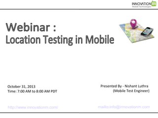
- 1. October 31, 2013 Time: 7:00 AM to 8:00 AM PDT Presented By - Nishant Luthra (Mobile Test Engineer) http://www.innovationm.com/ mailto:info@innovationm.com
- 2. About InnovationM Overview InnovationM provides specialized design & development services in the mobility space focusing on native and HTML5-based mobile solutions, with a deep focus on UX/UI Design. Services Design & Development for: - Native: Android & iOS - Mobile Web App (HTML5): PhoneGap, Sencha Touch 2 and jQuery Mobile - User Experience (UX) & UI Design Location Head-quartered in Noida, India with presence in US.
- 3. Table of Contents 1. What is Location? 2. Concept of Location Provider 3. A small case study 4. Mock Location using KML and GPX file 5. Tool for testing location based application
- 4. What is Location? Location is place or point that something is at on this earth. Each point on this earth is identified by two data points Latitude Longitude
- 5. Where Am I Where Am I on this Earth? What is My Location?
- 6. Where Am I If you look at map, it consist of horizontal and vertical lines. Horizontal line - Latitude Vertical line - Longitude Earth surface divided into degree,minute and sec. Suppose I am located at 38°53'23"N , 77°00'27"W (38 degrees, 53 minutes, and 23 seconds north of the equator and 77 degrees, no minutes and 27 seconds west of the meridian).
- 7. Concept of Location Provider A location provider provides current location of the device to the applications running in the device.
- 8. Types of Location Provider GPS – This provider determines location using satellites. Depending on conditions, this provider may take a while to return a location fix. Network – This provider determines location based on availability of cell tower and Wi-Fi access points. Results are retrieved by means of a network lookup. Passive – A special location provider for receiving locations without actually initiating a location fix. This provider will return locations generated by other providers.
- 9. Case Study Situation – Let us study with an example on how to track delivery of goods. Suppose a truck having goods moving along a road has to deliver goods to retail shops in the city. Truck driver is carrying a mobile device and an application. A Route is provided that carries address and location of retailers on that route and this data is provided to the application. Application gets the current location from Location Provider and compares the proximity of location of retailers with current location. If distance between current location and retailer location is within range then that retailer is marked as visited.
- 10. How to test this application? Is application getting correct location?
- 11. Two ways to Test 1. Physically go on that route and test 2. Emulate that user is moving on that route while physically elsewhere.
- 12. Mock Location Testing Physically going and testing on the road is very time consuming then how to mock/test location using android Emulator?
- 13. By simply uploading KML and GPX file to Android Emulator What is KML and GPX files?
- 14. KML - KML is a file format used to display geographic data in Google Earth, Google Maps, and Google Maps for mobile. - KML uses a tag-based structure with nested elements and attributes and is based on the XML standard <?xml version="1.0" encoding="UTF-8"?> <kml xmlns="http://earth.google.com/kml/2.2"> <Document> <name>GE2ADT</name> <Placemark><name>0</name><description>GE2ADT Route</description><Point><coordinates>77.313931,28.581661</coordinates></Point>< /Placemark> <Placemark><name>1</name><description>GE2ADT Route</description><Point><coordinates>77.313842,28.581918</coordinates></Point>< /Placemark> </Document> </kml>
- 15. GPX GPX (the GPS Exchange Format) is a light-weight XML data format <?xml version="1.0" encoding="UTF-8"?> <gpx version="1.1" creator="Created by Google My Tracks on Android." xmlns="http://www.topografix.com/GPX/1/1" <trkseg> <trkpt lat="28.581475" lon="77.314435"> <ele>137.5</ele> <time>2013-04-03T14:37:10.000Z</time> </trkpt> </trkseg> </trk> </gpx>
- 16. Load, Play and Test - Run your application as android emulator. - In DDMS, select Emulator Control(Location Control). - For loading GPX file, select your application and then click on ‘Load GPX’
- 17. - Select your GPX file and click on play button.
- 18. - GPX file start mocking your location as you are moving along that road in real.
- 19. Question - But how to generate this files - Are there any tool for kml and gpx generator Answer - Yes
- 20. Tools for testing Location based application My Tracks - It is an Android application useful for creating KML, GPX file. My Tracks records your path, speed, distance, and elevation while you walk, run, bike, or do anything else outdoors. You can download My Tracks from Google Play. URL - https://play.google.com/store/apps/details?id=com.google.android.maps.mytracks) Usage - Somebody can physically record the path by actually moving on that Good Delivery Route and generate the file for testing team.
- 21. KML Generator KML Generator It is website that generate KML file using GPS coordinate. We just have to put latitude and longitude under GPS coordinate column and output as KML (download). You can go to this website through this url – http://kmltools.nobletech.com/ Usage - If you know the Coordinates (Latitude and Longitude) of the points on the Path then you can generate KML file.
- 22. Google Earth to ADT plugin Google Earth to ADT plugin - This application helps in converting KML file to another format of KML that Android development tools (Suitable for Eclipse Android ADT plugin) can understand. Here a link to the url – (http://ge2adt.appspot.com/) This application help in generating kml file for make path or placemark in google earth or convert Google Earth routes to a format suitable for Eclipse Android ADT plugin 0.8.0
- 23. Google Earth Google Earth - You can visually see the path / route on Google Earth. Ex. You can have a Delivery Route KML file, the Actual KML file that was played and see the points on Google Earth.