Eops 2014 07_28
•
1 like•278 views

Warmer and sunnier days result in higher than normal river flows from the Skagit and Nisqually. Biological activity in the water column is high. Abundant organic surface debris in Hood Canal, Padilla Bay, and many Inlets. Red-brown blooms in South Sound, Discovery Bay, and regions of Bellingham Bay. Different blooms in Skagit Bay, Padilla Bay, and Sinclair Inlet. Jelly fish are numerous in all southernmost South Sound Bays. Hood Canal remains cold but Puget Sound-wide temperatures are now warmer and less salty. Data from the Victoria Clipper and our sampling in the Strait provides important information on water exchange with the ocean.

Recommended
More Related Content
What's hot
Viewers also liked
Similar to Eops 2014 07_28
Similar to Eops 2014 07_28 (17)
Recently uploaded
Recently uploaded (20)
Eops 2014 07_28
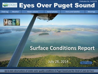
- 1. Eyes Over Puget Sound Field log Weather Water column Aerial photos Ferry and Satellite Moorings Publication No. 14-03-075 Surface Conditions Report Start hereJuly 28, 2014 Up-to-date observations of visible water quality conditions in Puget Sound and the Strait of Juan de Fuca
- 2. Personal field log p. 4 By plane or by boat the Strait stays remote! Weather conditions p. 5 The past several days have been warmer and sunnier than normal with higher than normal river flows from the Skagit and Nisqually rivers. Winds are generally light and from the north. Water column p. 7 In early 2014, colder, saltier conditions developed in Puget Sound with lower oxygen in Whidbey Basin, Central and South Sound. Hood Canal remains cold but Puget Sound-wide temperatures are now warmer and less salty. Moorings p. 37 In the Mukilteo moorings, two dominant water masses are observed. This year, temperature is cooler and salinity is lower. Aerial photography p. 10 Abundant organic surface debris in Hood Canal, Padilla Bay, Eld Inlet, Carr Inlet, Port Madison, and Sinclair Inlet. Red-brown blooms in all bays of South Sound, Discovery Bay, and regions of Bellingham Bay. Different blooms in Skagit Bay, Padilla Bay, and Sinclair Inlet. Jellyfish numerous in all southern South Sound Bays. Ferry and satellite p. 35 Hardware upgrades on the Victoria Clipper IV have been completed! Impressive phytoplankton bloom observed offshore earlier in the week. LONG-TERMMARINEMONITORINGUNIT Mya Keyzers Laura Hermanson Joe Leatherman Skip Albertson Dr. Christopher Krembs Suzan Pool Guest: Dr. Brandon Sackmann, Integral Julia Bos Suzan Pool www.ecy.wa.gov/programs/eap/mar_wat/eops/Previous Eyes Over Puget Sound reports: Marine conditions from 7-28-2014 at a glance Field log Weather Water column Aerial photos Ferry and Satellite Moorings
- 3. Monthly sampling in the Strait 7-28-2014 Ecology is sampling the Strait of Juan de Fuca Field log Weather Water column Aerial photos Ferry and Satellite Moorings The Strait of Juan de Fuca connects Puget Sound to the Pacific Ocean. Long-term monitoring of these waters reveal the ocean’s influence on the water quality of Puget Sound. Seaplanes aren’t able to land on rough waters in the Strait, so we sample the Strait by boat. These stations are important because they are the most seaward of our monitoring sites and give us information about oceanic conditions. The Straits sampling program started in 1999 with the help of numerous partners. Staff at Shannon Point Marine Center, operated through Western Washington University, currently conduct this work. We thank Friday Harbor Labs for 13 years of dedicated sample collection! Oh no….
- 4. Shannon Point Marine Center staff at work Diving Safety Officer Nate Schwarck deploys our CTD. Marine Research Technologist Jay Diamond records data and collects zooplankton samples for UW research. Shannon Point Marine Center staff sample 4 sites in the Strait monthly on the R/V Zoea. Monthly sampling in the Strait 7-28-2014 Wires woven into the winch cable transmit live data to on-deck computers. Field log Weather Water column Aerial photos Ferry and Satellite Moorings
- 5. Field log Weather Water column Aerial photos Ferry and Satellite Moorings Weather of the past two weeks before 7-28-2014 Our new presentation of meteorological conditions! For monthly data and an explanation of the figures, see our weather webpage at: http://www.ecy.wa.gov/programs/eap/mar_wat/weather.html. Two week summary: Air temperatures. Daily air temperatures in the Puget Sound lowlands have been above normal for the past several days, but below average for the prior week. Sunshine levels have been above normal for the past four days. River flows are above normal on the Skagit and Nisqually rivers and below normal on the Fraser and Puyallup rivers. Warm, sunny weather has generally increased flows on glacially-fed rivers. Winds have primarily been from the north. Higher than expected Lower than expected
- 6. We use a chartered float plane to access our monthly monitoring stations most cost effectively. We communicate data and environmental marine conditions using: 1. Marine Water Condition Index (MWCI) 2. Eyes Over Puget Sound (EOPS) 3. Anomalies and source data Field log Weather Water column Aerial photos Ferry and Satellite Moorings Our long-term marine monitoring stations in Washington Start here Isl. .
- 7. Physical conditions tracked in statistically historic context Salinity decreasing Oxygen increasing The 2012 colder, fresher, higher oxygen conditions are gone. In 2013, Puget Sound was warmer, with normal salinity. In early 2014, colder, saltier conditions developed throughout Puget Sound with lower oxygen in Whidbey Basin, Central and South Sound. Hood Canal remains unusually cold but Puget Sound-wide, temperatures are warmer and salinities are now lower than expected. Field log Weather Water column Aerial photos Ferry and Satellite Moorings June 2014: Temperature increasing
- 8. -25 -20 -15 -10 -5 0 5 10 15 20 25 -1.5 -1 -0.5 0 0.5 1 1.5 1945 1950 1955 1960 1965 1970 1975 1980 1985 1990 1995 2000 2005 2010 2015 a) Pacific Decadal Oscillation Index (PDO, temperature) (explanation) b) Upwelling Index (anomalies) (Upwelling, low oxygen) (explanation) c) North Pacific Gyre Oscillation Index (NPGO, productivity) (explanation) NPGO(x10) PDO/UpwellingIndex Three-year running average of PDO, Upwelling, and NPGO indices scores Ocean boundary conditions have been favorable for water quality in Puget Sound: (a) colder water (PDO), (b) less upwelled low oxygen and high nutrient ocean water reaching Puget Sound (Upwelling Index), and (c) higher surface productivity along the coast (NPGO). Where are we heading next? Field log Weather Water column Aerial photos Ferry and Satellite Moorings . The ocean affects water quality: Ocean Climate Indices
- 9. Explore the data Is the food web changing in Puget Sound? The story in 5 min Follow the experts Hypothesis! Should we pay greater attention to nutrient ratios, energy transfer, and material cycling in Puget Sound? Noctiluca blooms are a visible harbinger of a changing microbial food web in Puget Sound’s waters.
- 10. Summary: Aerial photography 7-28-2014 Abundant organic surface debris in Hood Canal, Padilla Bay, Eld Inlet, Carr Inlet, Port Madison, and Sinclair Inlet. Strong red-brown blooms in all bays of South Sound, Discovery Bay, and regions of Bellingham Bay. Brown-green or green blooms in Skagit Bay, Padilla Bay, and Sinclair Inlet. Jellyfish numerous in all southern South Sound bays. Field log Weather Water column Aerial photos Ferry and Satellite Moorings Start here Mixing and Fronts: Tidal fronts in Admiralty Reach, large eddy in Sinclair Inlet. Debris: Very abundant in Padilla Bay, Hood Canal, Sinclair Inlet, Eld Inlet, Budd Inlet. Visible blooms: Green-brown: Sinclair Inlet, Saratoga Passage, Carr Inlet Red-brown: Discovery Bay, all south Sound Bays Green: Fidalgo Bay, Scow Bay Green macro-algae: Hidden Cove, Delano Bay Jellyfish: Jellyfish patches numerous in all southern inlets of South Sound. BloomDebrisFront Suspended sediment: Sediment in glacier-fed rivers, such as Skagit River, are visible. Plume McMicken Island, Case Inlet Green bloom, Scow Bay, Mystery Bay 1 5 6 1 2 9 15 16 2018 Boat Boat Bloom Bloom 11:07 AM 5:43 PM Debris 11 2 3 4 3 4 8 9 10 11 1 2 3 4 5 6 7 10 11 12 13 14 16 17 201918 11 17
- 11. Strait of Juan de Fuca San Juan Islands Padilla Bay Main Basin Hood Canal South Sound Field log Weather Water column Aerial photos Ferry and Satellite Moorings Observation Maps: Afternoon flight, photos 8-20: Blue sky, high visibility, waves Flight Information: Morning flight, photos 1-7 Blue sky, high visibility, calm 8 19 11 10 9 2 13 14 15 Aerial photography and navigation guide 20 1 6 Central and North Sound Hood Canal and South Sound SeattleTides:H.tide:5:53AM7:29PM,,L.tide:12:50AM,12:27PM 4 7 3 12 Whidbey Basin 5 Altered flight route! Electrical malfunction forced plane layover 17 16 18
- 12. A. Red-brown bloom and large organic debris lines. B. Suspended sediment from bay mix into bloom. Location: A. Entrance Channel, Budd Inlet. B. Gull Harbor, Budd Inlet (South Sound), 10:24 AM. 1 Aerial photography 7-28-2014 Navigate Debris Boat Bloom A. B. Field log Weather Water column Aerial photos Ferry and Satellite Moorings
- 13. 2 NavigateAerial photography 7-28-2014 Field log Weather Water column Aerial photos Ferry and Satellite Moorings Red-brown bloom and large organic debris patches. Jellyfish patches present. Location: Green Cove, Eld Inlet (South Sound), 10:26 AM. Boat Debris Bloom Jellyfish
- 14. 3 NavigateAerial photography 7-28-2014 Red-brown bloom, jellyfish, and sediment-rich river plume with internal waves at its fringes. Location: Snyder Cove, Eld Inlet (South Sound), 10:26 AM. Field log Weather Water column Aerial photos Ferry and Satellite Moorings Boat Bloom Plume Waves Jellyfish
- 15. 4 Navigate Field log Weather Water column Aerial photos Ferry and Satellite Moorings Aerial photography 7-28-2014 Red-brown bloom mixed into sediment-rich river plume. Jellyfish patches. Location: Deepwater Point, Totten Inlet (South Sound), 10:27 AM. Bloom Shellfish farm Jellyfish Plume
- 16. 5 NavigateAerial photography 7-28-2014 Field log Weather Water column Aerial photos Ferry and Satellite Moorings Red-brown bloom and line of organic debris accumulating on tidal front. Location: Chapman Cove, Oakland Bay (South Sound), 10:31 AM. Bloom Debris Boat
- 17. Red-brown bloom flowing out of Port Townsend Bay. Location: Port Townsend (Central Sound), 11:10 AM. 6 NavigateAerial photography 7-28-2014 Field log Weather Water column Aerial photos Ferry and Satellite Moorings Boat Bloom
- 18. Strong and patchy red-brown bloom and cabin reflections on airplane window. Location: Across Karlset Point, Discovery Bay (Strait of Juan de Fuca), 11:15 AM. 7 NavigateAerial photography 7-28-2014 Field log Weather Water column Aerial photos Ferry and Satellite Moorings Boat Bloom
- 19. Internal waves breaking at surface. Effect seen because of sediment-rich water overlaying red-brown bloom. Location: Across Penn Cove (Whidbey Basin), 3:16 PM. 8 NavigateAerial photography 7-28-2014 Field log Weather Water column Aerial photos Ferry and Satellite Moorings Boat Boat Internal waves Reflections
- 20. Patchy mosaic of sediment-rich water from the glacier-fed Skagit River against Mount Baker backdrop. Location: Skagit Bay (Whidbey Basin), 3:20 PM. 9 NavigateAerial photography 7-28-2014 Field log Weather Water column Aerial photos Ferry and Satellite Moorings Debris Boat Boat Plume Plume Plume Mount Baker
- 21. 10 NavigateAerial photography 7-28-2014 Green bloom developing along shallow water edge. Location: Dugualla Bay, Skagit Bay (Whidbey Basin), 3:22 PM. Field log Weather Water column Aerial photos Ferry and Satellite Moorings Bloom Boat Plume Plume
- 22. 11 NavigateAerial photography 7-28-2014 Red-brown bloom nested between Hope and Skagit islands despite incoming tide from Deception Pass. Location: Kiket Bay (Whidbey Basin), 3:23 PM. Field log Weather Water column Aerial photos Ferry and Satellite Moorings Boat Bloom Plume Fish pens Debris
- 23. Golden brown and red-brown blooms. Location: Similk Bay (Whidbey Basin), 3:24 PM. 12 Navigate Field log Weather Water column Aerial photos Ferry and Satellite Moorings Aerial photography 7-28-2014 Bloom Bloom Boat Fish pen Fish pen
- 24. A. Patches of organic surface debris above eelgrass beds. B. Bloom advecting in from Fidalgo Bay. Location: A. Guemes Channel, Hat Island, Anacortes (Padilla Bay), B. Fidalgo Bay, 3:28 PM. 13 NavigateAerial photography 7-28-2014 Boat Bloom Debris Debris Eelgrass Eelgrass Eelgrass Boat B. A. Field log Weather Water column Aerial photos Ferry and Satellite MooringsBloom
- 25. Patches of red-brown bloom diverging around Jack Island due to tides. Location: North of Guemes Island (North Sound), 3:31 PM. 14 Navigate Field log Weather Water column Aerial photos Ferry and Satellite Moorings Aerial photography 7-28-2014 Bloom Boat Boat
- 26. 15 Navigate Field log Weather Water column Aerial photos Ferry and Satellite Moorings Large mats of floating organic surface debris near Miller Bay. Location: Port Madison (Central Sound), 5:20 PM. Aerial photography 7-28-2014 Debris Debris Debris Boat Boat Boat Boat
- 27. 16 Navigate A. Green bloom and patches of organic surface debris. B. Red-brown bloom. Location: A. Treasure Island, Hidden Cove, B. Eagle Harbor (Bainbridge Island, Central Sound), 5:21 PM. Aerial photography 7-28-2014 Debris A. B. Field log Weather Water column Aerial photos Ferry and Satellite Moorings Bloom Bloom
- 28. 17 Navigate Field log Weather Water column Aerial photos Ferry and Satellite Moorings Large tidal eddy with organic surface debris accumulated inside. Brown-green bloom mixing around eddy. Location: Off Point White, Bainbridge Island, Sinclair Inlet (Central Sound), 5:26 PM. Aerial photography 7-28-2014 Eddy Bloom Debris Boat “Our first algae-crop circle”
- 29. 18 Navigate Field log Weather Water column Aerial photos Ferry and Satellite Moorings Red-brown blooms in Carr Inlet and eastern smaller bays (Horsehead Bay and Raft Island). Location: Horsehead Bay, Carr Inlet (South Sound), 5:39 PM. Aerial photography 7-28-2014 BoatBloom Debris
- 30. 19 Navigate Field log Weather Water column Aerial photos Ferry and Satellite Moorings Red-brown phytoplankton bloom mixed in turquoise bloom along shore. Location: Peale Passage (South Sound), 5:46 PM. Aerial photography 7-28-2014 Bloom Boat Fish pens Bloom
- 31. 20 Navigate A. Red-brown and green-brown blooms border incoming tide. B. Red-brown bloom in Henderson Inlet. Location: A. Dana Passage, B. Henderson Inlet (South Sound), 5:47 PM. Aerial photography 7-28-2014 Bloom Boat Bloom Debris Bloom Bloom A. B. Field log Weather Water column Aerial photos Ferry and Satellite Moorings
- 32. North Sound/San Juan Islands Numbers on map refer to picture numbers for spatial reference Date: 7-28-2014 Central Sound Aerial photography observations in Central SoundObservations in Central and North Sound Navigate Field log Weather Water column Aerial photos Ferry and Satellite Moorings 13 14 10 9 8 11 12 15 17 16 6 7
- 33. South SoundHood Canal Date: 7-28-2014 Observations in Hood Canal and South Sound Numbers on map refer to picture numbers for spatial reference Navigate Field log Weather Water column Aerial photos Ferry and Satellite Moorings 1 20 2 3 15 17 4 5 19 18 16 6 7
- 34. Legend to map annotations Comments: Maps are produced by observers during and after flights. They are intended to give an approximate reconstruction of the surface conditions on scales that connect to and overlap with satellite images in the section that follows. Debris: Debris can be distinguished into natural and anthropogenic debris floating at the surface sensu Moore and Allen (2000). The majority of organic debris in Puget Sound is natural mixed with discarded man-made pieces of plastic, wood, etc. From the plane, we cannot differentiate the quality of debris at the surface and therefore, call it for reasons of practicality just “debris”. S.L. Moore, M. J. Allen. 2000. Distribution of Anthropogenic and Natural Debris on the Mainland Shelf of the Southern California Bight. Marine Pollution Bulletin, 40(1): 83–88. Navigate Field log Weather Water column Aerial photos Ferry and Satellite Moorings
- 35. Impressive Phytoplankton Bloom off the Washington Coast! 26 July 2014 28 July 2014 Present Conditions: Warm, fresh water entering central Puget Sound from Whidbey Basin. Sea surface temperatures > 15 °C. Moderate fluorescence in central Puget Sound. Upwelling-favorable winds promote phytoplankton bloom off the Washington coast. Left: Dr. Brandon Sackmann: bsackmann@integral-corp.com Right: Suzan Pool suzan.pool@ecy.wa.gov Field log Weather Water column Aerial photos Ferry and Satellite Moorings Ferry and satellite observations 7-28-2014 Start here
- 36. Hardware upgrades simplify data logging and telemetry using wireless technology! Wiring Schematic for 2014 Upgrades Brandon, Suzan in the belly of the ship. Hardware upgrades on the Victoria Clipper IV have been completed! (Near real-time data restored as of July 23, 2014) Field log Weather Water column Aerial photos Ferry and Satellite Moorings Ferry and satellite observations 7-28-2014
- 37. At Mukilteo we observed strong vertical gradients between our upper and lower moorings based on temperature, salinity, and dissolved oxygen. Large Skagit river discharge and strong northerly winds hasten the export of freshwater leaving Puget Sound. Mooring observations and trends 7-16-2014 to 7-28-2014 Field log Weather Water column Aerial photos Ferry and Satellite Moorings These plots show the probability of observations over the past two-week period. High probability shown in warm colors. Left Panels: Density is defined by salinity and temperature. Right Panel: Dissolved oxygen concentration in relation to salinity. 12-16 m depth 2-6 m depth Dissolved oxygen not measured
- 38. Mooring observations and trends 7-16-2014 to 7-28-2014 Click on icon to view real- time data of the moorings We present data of daily means for the past 31 days. Data are plotted in Pacific Standard Time. Wind data are from Paine Field in Everett. River flow data are from USGS. Field log Weather Water column Aerial photos Ferry and Satellite Moorings Our mooring station in Mukilteo is located in Whidbey Basin near Everett. The mooring is located at the transition between Possession and Central Sounds at a depth that is influenced by the Skagit and Snohomish river discharges, prevailing winds, and tidal mixing. As the largest regional contributor of freshwater to Puget Sound, understanding the timing and magnitude of Skagit river flow is important.
- 39. Mooring observations and trends Mukilteo 2010 to 2014 Field log Weather Water column Aerial photos Ferry and Satellite Moorings At the Mukilteo mooring, we use the near-bottom sensor (12-16 m deep) to measure significant inter-annual variability in temperature, salinity and dissolved oxygen. Inter-annual variability is shown over a 4.5-year period. All three variables show strong seasonality. In 2014, trends in salinity and dissolved oxygen appear to decline whereas trends in temperature are similar to 2013. (Our bath calibrations indicated the dissolved oxygen sensor failed in early July and thus is not being reported.) Please note that data are provisional. Data are in GMT.
- 40. Access mooring data: ftp://www.ecy.wa.gov/ea p/Mooring_Raw/Puget_S ound/ Ferry and satellite : Suzan.Pool@ecy.wa.gov Get data from Ecology’s Marine Monitoring Programs Long–Term Monitoring Network Real–Time Sensor Network Access core monitoring data: http://www.ecy.wa.gov/a pps/eap/marinewq/mwda taset.asp christopher.krembs@ecy.w a.gov Ecology’s long-term marine monitoring stations Ferry track Field log Weather Water column Aerial photos Ferry and Satellite Moorings River and Stream Water Quality Monitoring http://www.ecy.wa.gov/programs/eap/fw_riv /rv_main.html Discontinued (funding cuts)
- 41. You may subscribe or unsubscribe to the Eyes Over Puget Sound email listserv by going to: http://listserv.wa.gov/cgi-bin/wa?A0=ECOLOGY-EYES-OVER-PUGET-SOUND Many thanks to our business partners: Clipper Navigations, Swantown Marina, and Kenmore Air. We are looking for feedback to improve our products. Dr. Christopher Krembs christopher.krembs@ecy.wa.gov Marine Monitoring Unit Environmental Assessment Program WA Department of Ecology Field log Weather Water column Aerial photos Ferry and Satellite Moorings