Solid Terrain Modeling, Inc.- Case Study - Firefighter Training
•
1 like•296 views

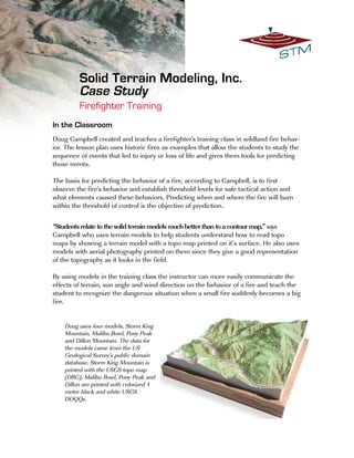
Doug uses four models, Storm King Mountain, Malibu Bowl, Pony Peak and Dillon Mountain. The data for the models came from the US Geological Survey's public domain database. Storm King Mountain is printed with the USGS topo map (DRG), Malibu Bowl, Pony Peak and Dillon are printed with colorized 1 meter black and white USGS DOQQs.

Recommended
Recommended
More Related Content
Recently uploaded
Recently uploaded (20)
Featured
Featured (20)
Solid Terrain Modeling, Inc.- Case Study - Firefighter Training
- 1. In the Classroom Doug Campbell created and teaches a firefighter's training class in wildland fire behav- ior. The lesson plan uses historic fires as examples that allow the students to study the sequence of events that led to injury or loss of life and gives them tools for predicting those events. The basis for predicting the behavior of a fire, according to Campbell, is to first observe the fire's behavior and establish threshold levels for safe tactical action and what elements caused these behaviors. Predicting when and where the fire will burn within the threshold of control is the objective of prediction. “Students relate to the solid terrain models much better than to a contour map,” says Campbell who uses terrain models to help students understand how to read topo maps by showing a terrain model with a topo map printed on it’s surface. He also uses models with aerial photography printed on them since they give a good representation of the topography as it looks in the field. By using models in the training class the instructor can more easily communicate the effects of terrain, sun angle and wind direction on the behavior of a fire and teach the student to recognize the dangerous situation when a small fire suddenly becomes a big fire. Doug uses four models, Storm King Mountain, Malibu Bowl, Pony Peak and Dillon Mountain. The data for the models came from the US Geological Survey's public domain database. Storm King Mountain is printed with the USGS topo map (DRG), Malibu Bowl, Pony Peak and Dillon are printed with colorized 1 meter black and white USGS DOQQs. Solid Terrain Modeling, Inc. Case Study Firefighter Training
- 2. Planning The San Jose Fire Department is responsible for responding to calls along the eastern edge of the city where the mountains rise and access becomes difficult. The situation is typical of urban/rural boundaries and is made more complex by a mixed-use public recreation area called Alum Rock Park. The park is in a canyon above which are small tracts of homes and ranches connected by two lane streets. The ground is covered in places by dense trees and by grass and brush in others and landscaping in others. To complicate the situation further there are jurisdictional boundaries running through the area where responsibility shifts from local to State control. The San Jose Fire Department commissioned a solid terrain model of the area to assist their internal planning and the public communication of those plans. During an actual event the model will be transported to the Command Center to help with tactical plan- ning. The model was made from commercially available data. The elevation model came from Intermap and was collected with Synthetic Aperture Radar (SAR) technology which captured the ground shape and the tree canopies at 5 meter postings. The image was from AirPhotoUSA, 1 meter color derived from aerial photography. S o l i d T e r r a i n M o d e l i n g , I n c . 340 Fillmore St Fillmore, CA 93015 800 548-7621 toll free 805 524-7307 w w w . s t m – u s a . c o m i n f o @ s t m – u s a . c o m