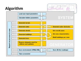
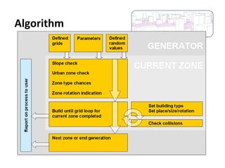
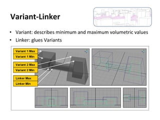
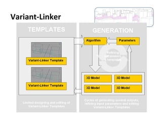
The document presents Matei Lunca's master's thesis on automatically generating 3D environments. It discusses previous work, demonstrates a software tool for world-scale and object-scale generation, and analyzes parameters, algorithms, results, and techniques like the Variant-Linker template. The goal is parameter-driven world and object generation that combines human design skills and computer speed/calculation.

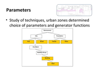

![• chance_grid[type] (4x)
– the percentage chance that a matrix cell of overall
building decisions will be of a type: business,
urban, suburb or empty
• grid[grid][building] (20x)
– the percentage chance for buildings of a certain
type (4x) will be built when building city blocks of
a certain type (4x) + the chance that a city blocks
of a certain type will be rotated
Parameters](https://image.slidesharecdn.com/6113365a-c903-4a22-a084-153742c228a1-170206130053/85/WorldGenerator-17-320.jpg)