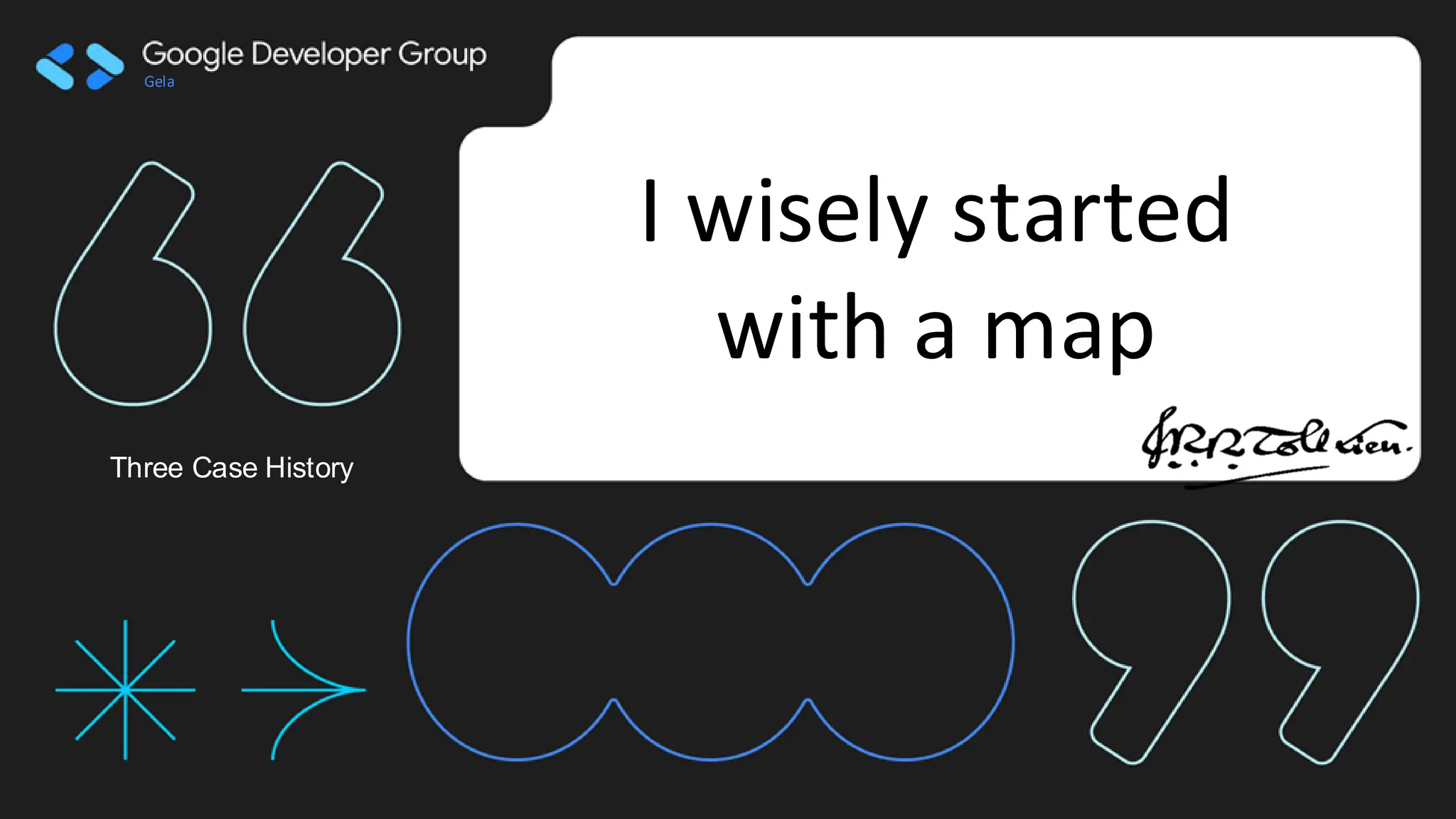
Il geospatial oggi, slide di presentazione di una Live con Bacarotech tech il 31/03/2025 (https://www.youtube.com/live/uEdtLqzKzsY)
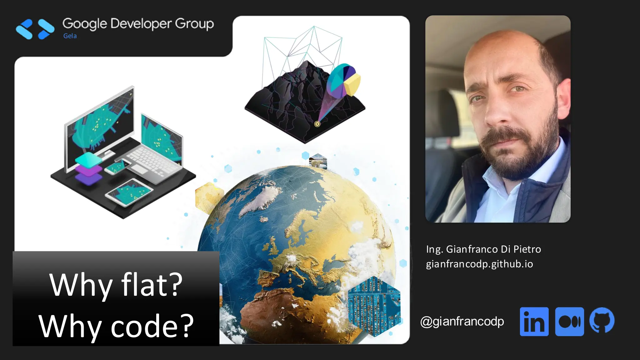
Why Flat Why Code, perché ancora oggi parliamo di riproduzione su 2D delle mappe?
Google Developers Group - Gela
Gela
Images credit InternationalCentre for Global Earth Models (ICGEM)
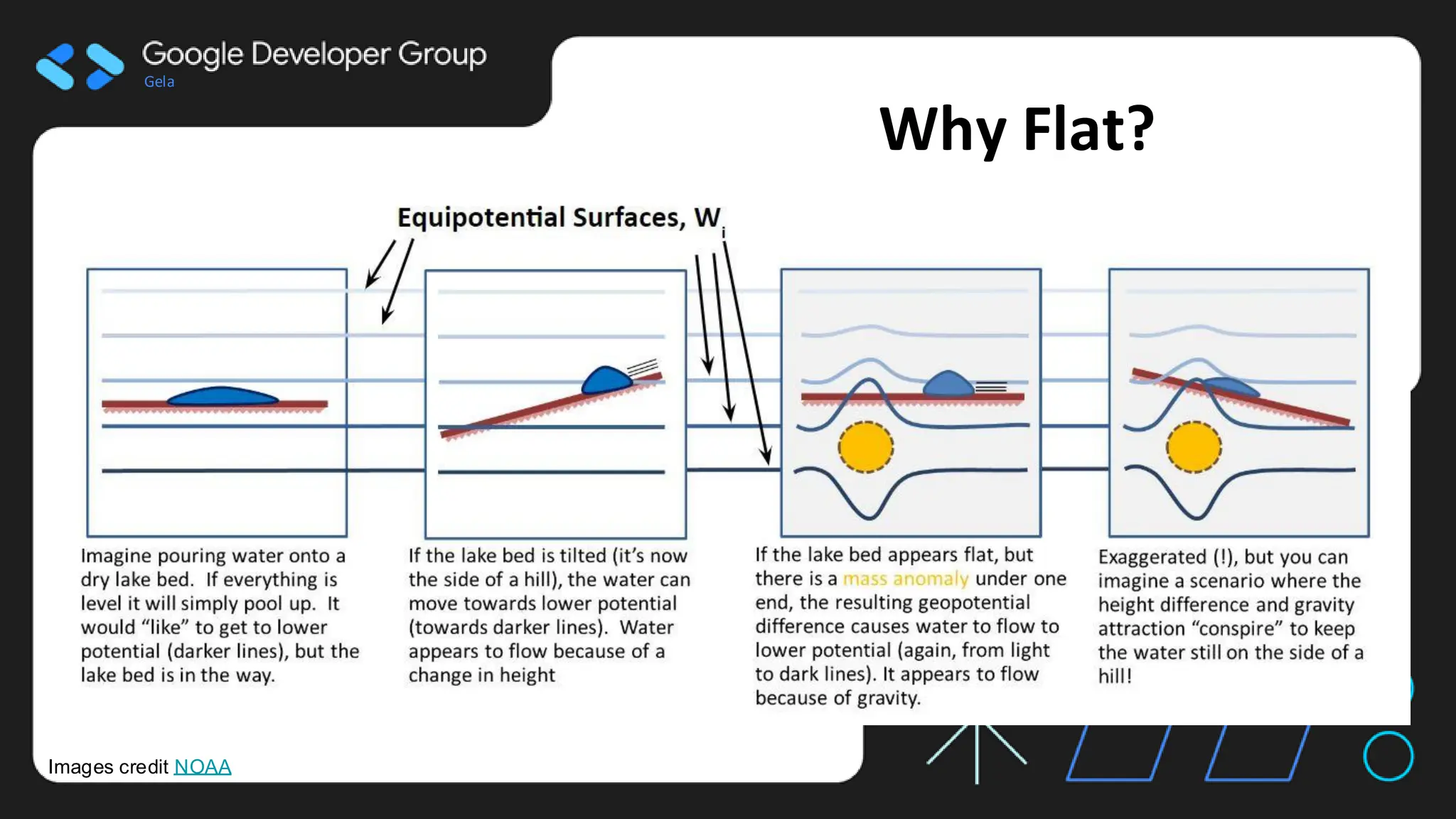
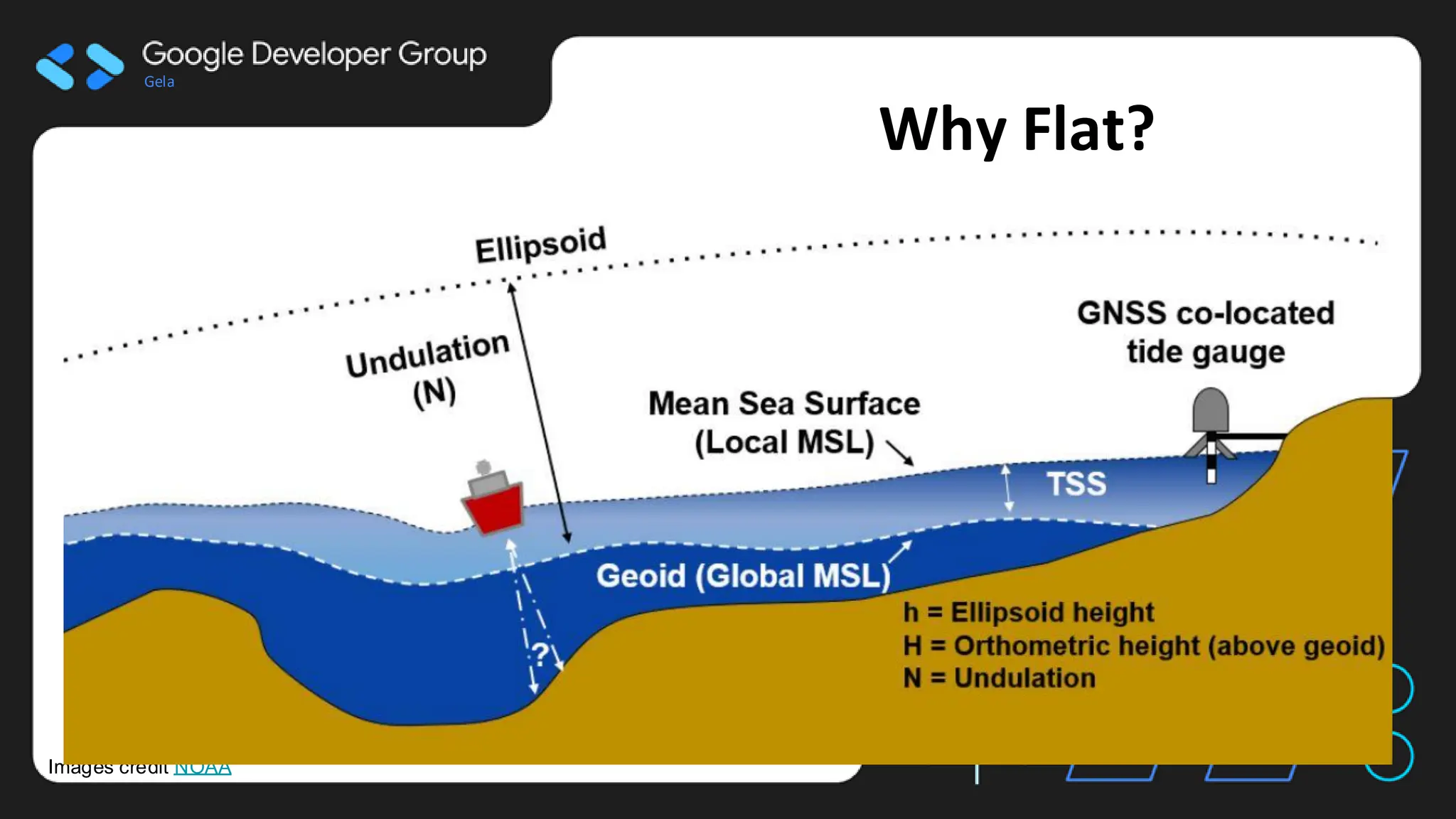
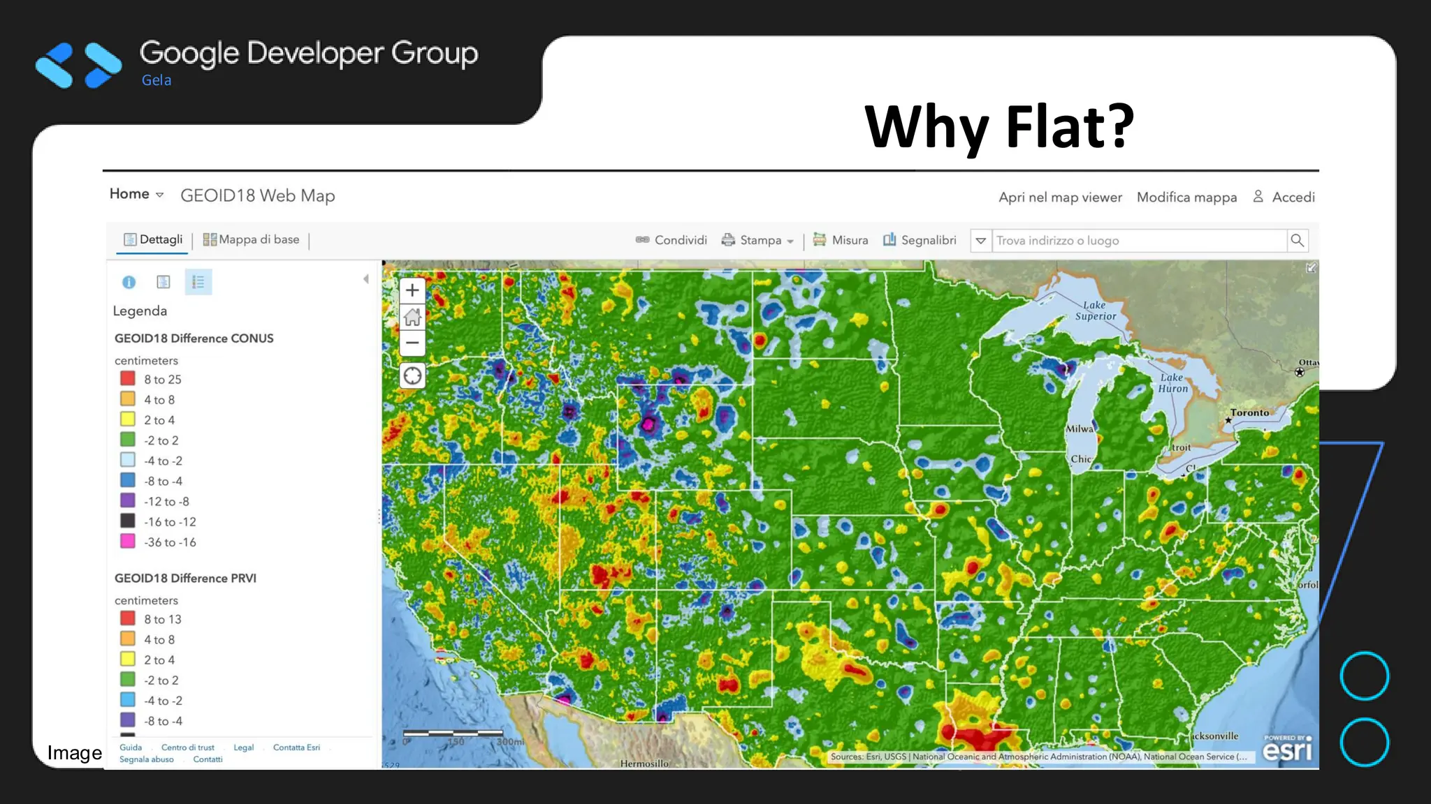
Why Flat?
- Timeseries of Gravity anomalies
- Geoid data as anomalies from
simplified geometries (ellipsoid)
6.
Gela
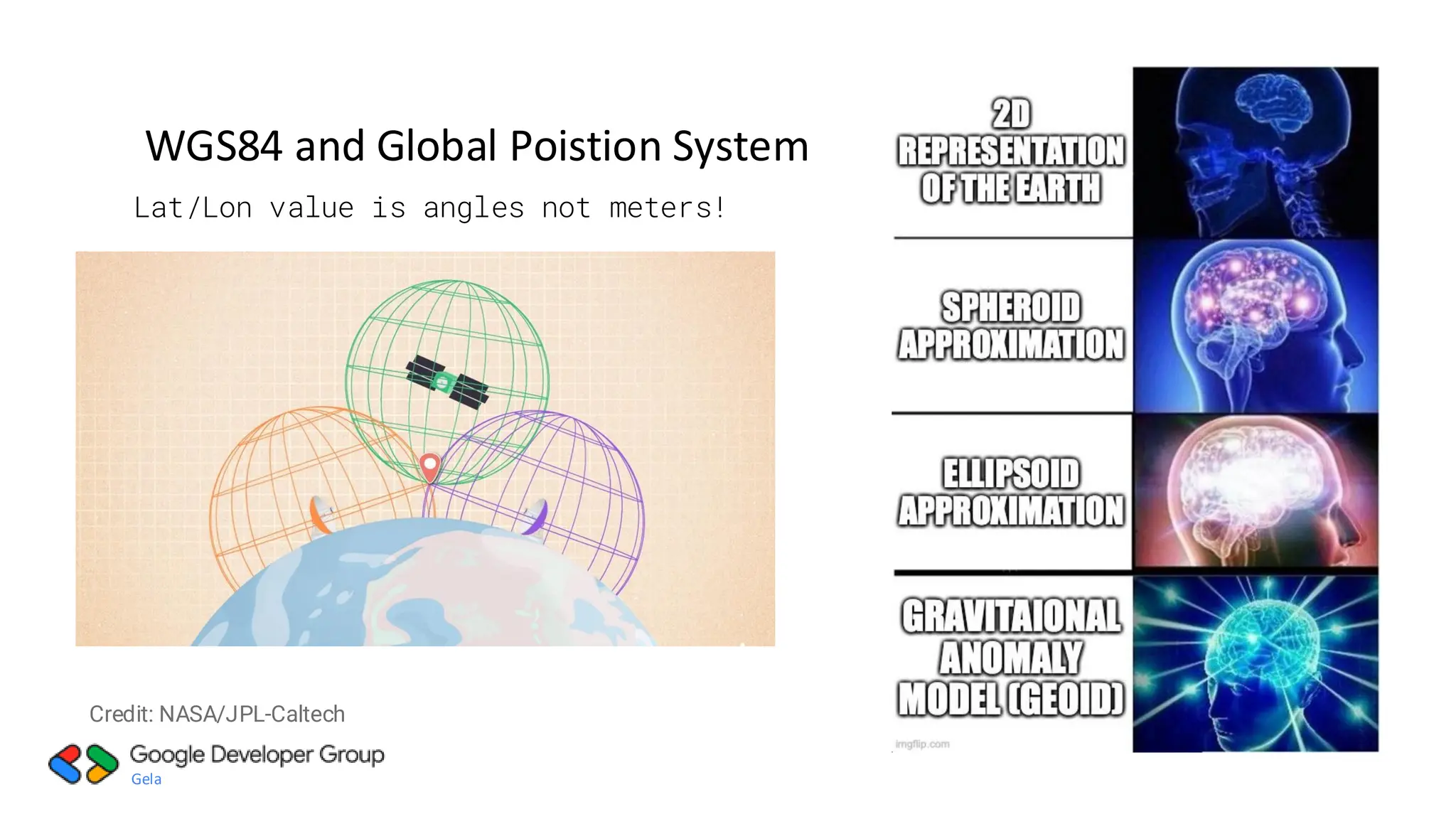
WGS84 and GlobalPoistion System
Lat/Lon value is angles not meters!
Credit: NASA/JPL-Caltech
7.
Gela
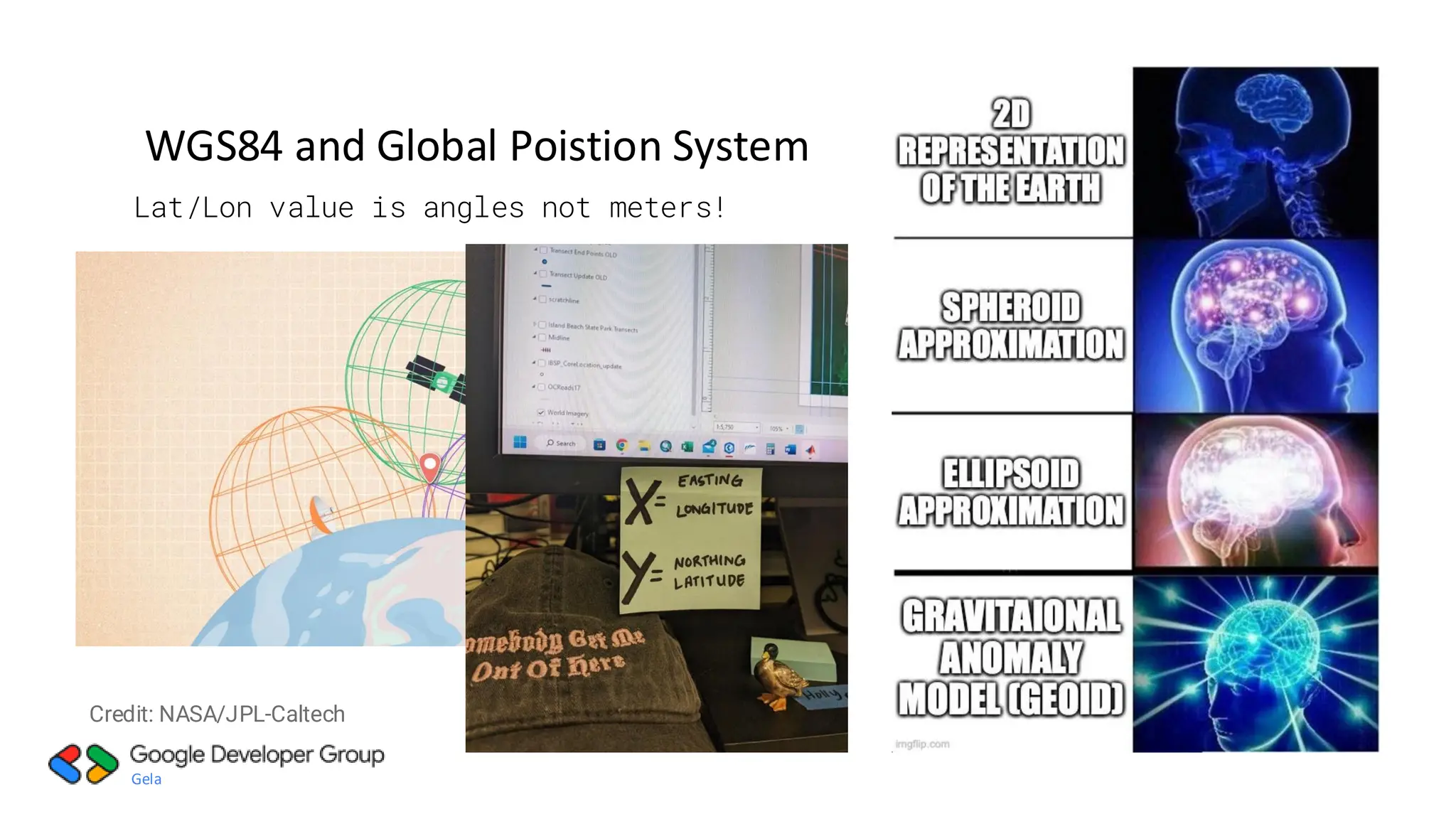
WGS84 and GlobalPoistion System
Lat/Lon value is angles not meters!
Credit: NASA/JPL-Caltech
Gela
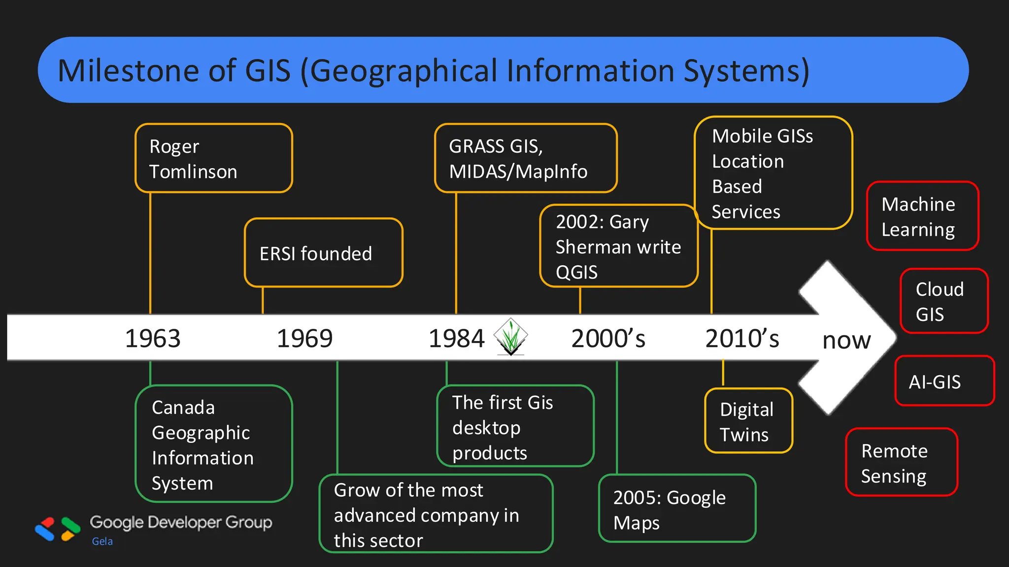
Milestone of GIS(Geographical Information Systems)
Roger
Tomlinson
GRASS GIS,
MIDAS/MapInfo
Mobile GISs
Location
Based
Services
ERSI founded
2002: Gary
Sherman write
QGIS
Grow of the most
advanced company in
this sector
Canada
Geographic
Information
System
The first Gis
desktop
products
2005: Google
Maps
1963 1969 1984 2000’s 2010’s
Remote
Sensing
now
Machine
Learning
Cloud
GIS
Digital
Twins
AI-GIS
Gela
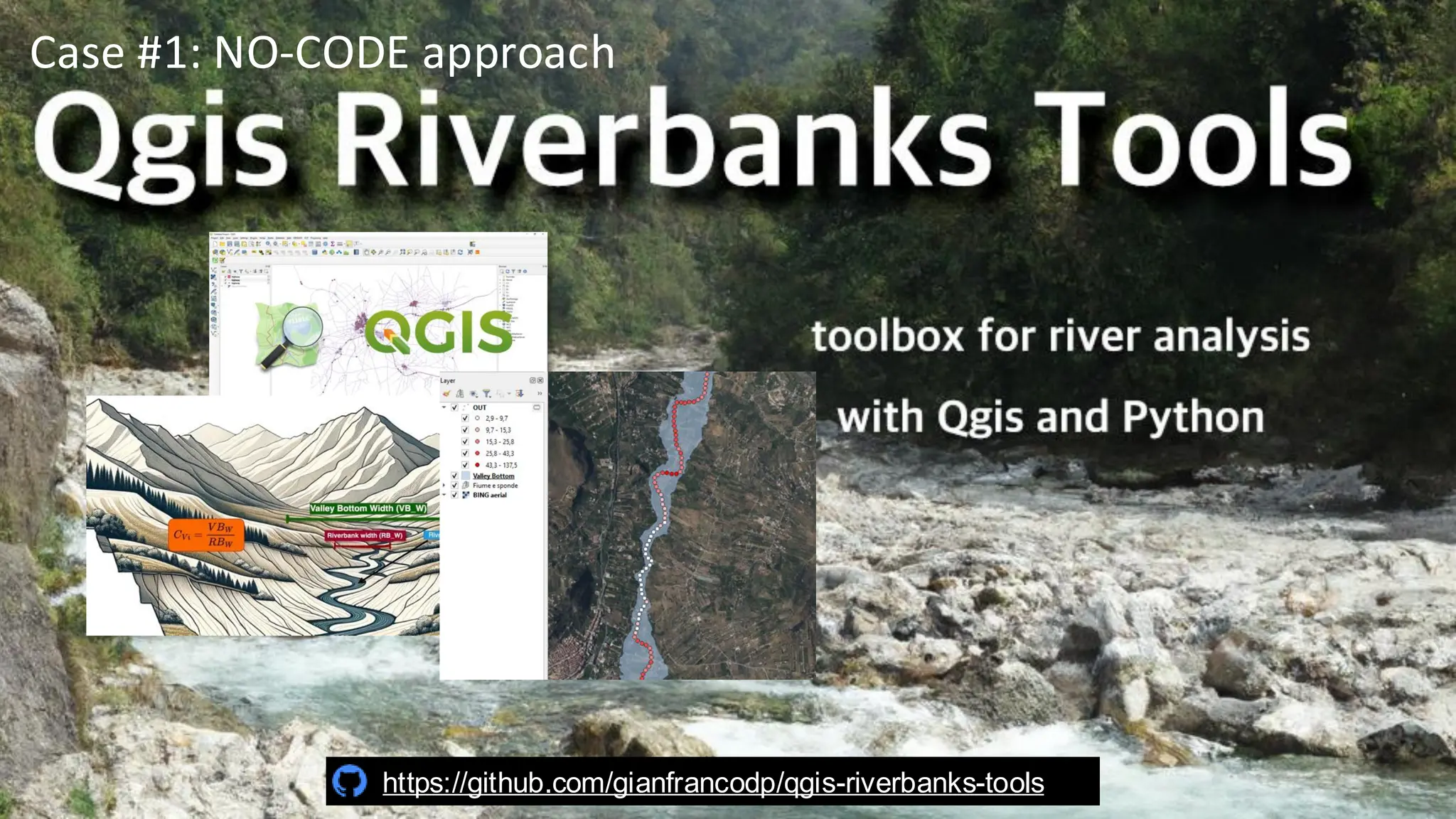
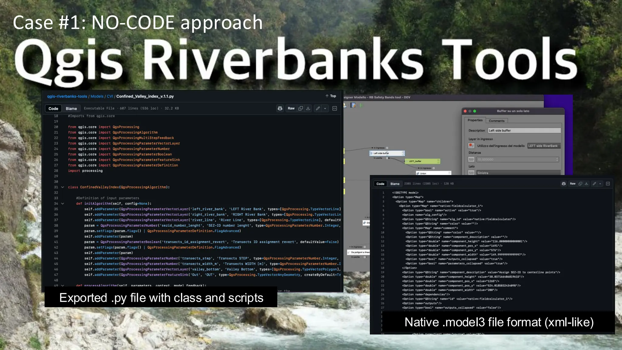
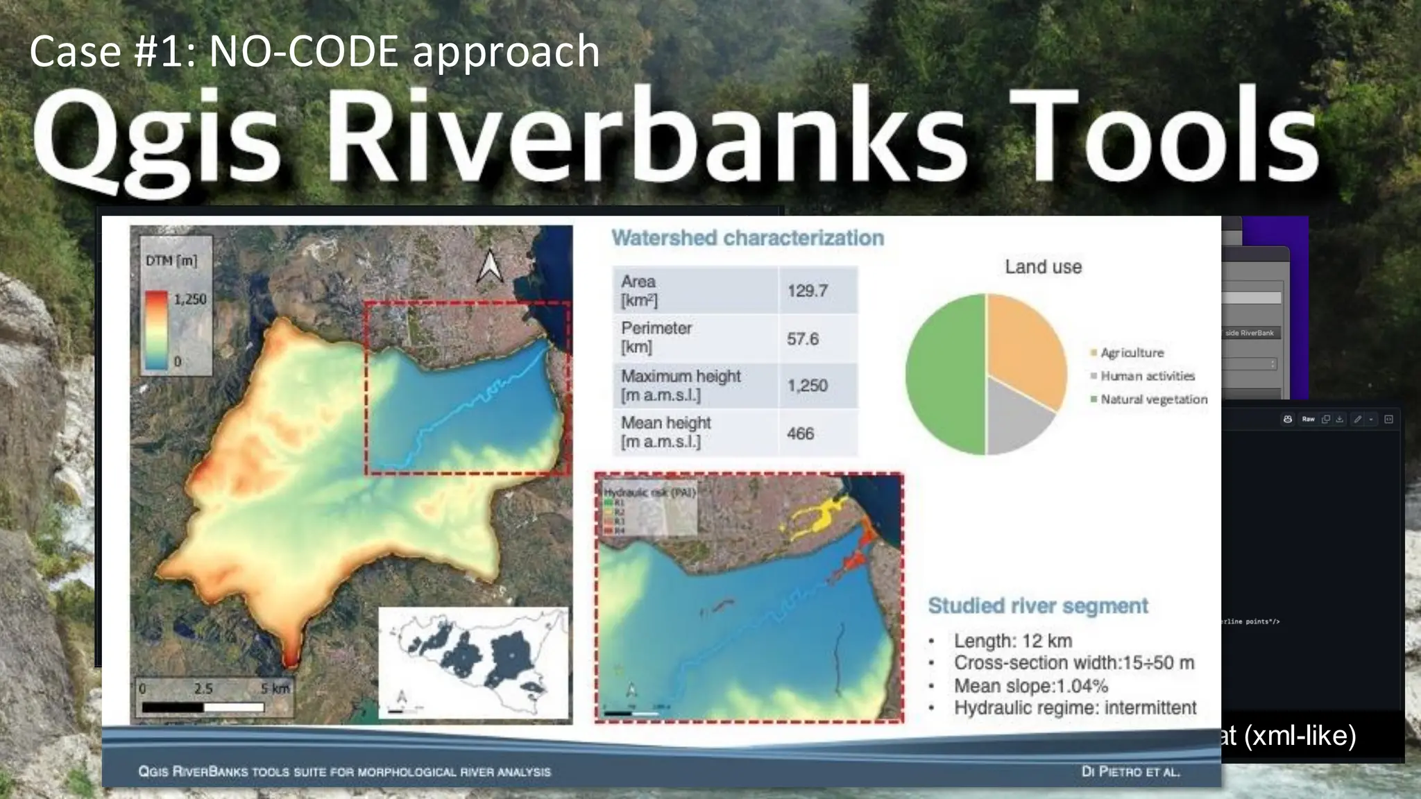
Developed in no-code
environmentcalled “model
designer”; a GUI inside the
QGIS desktop application
(Open-source project also
developed in Python and QT)
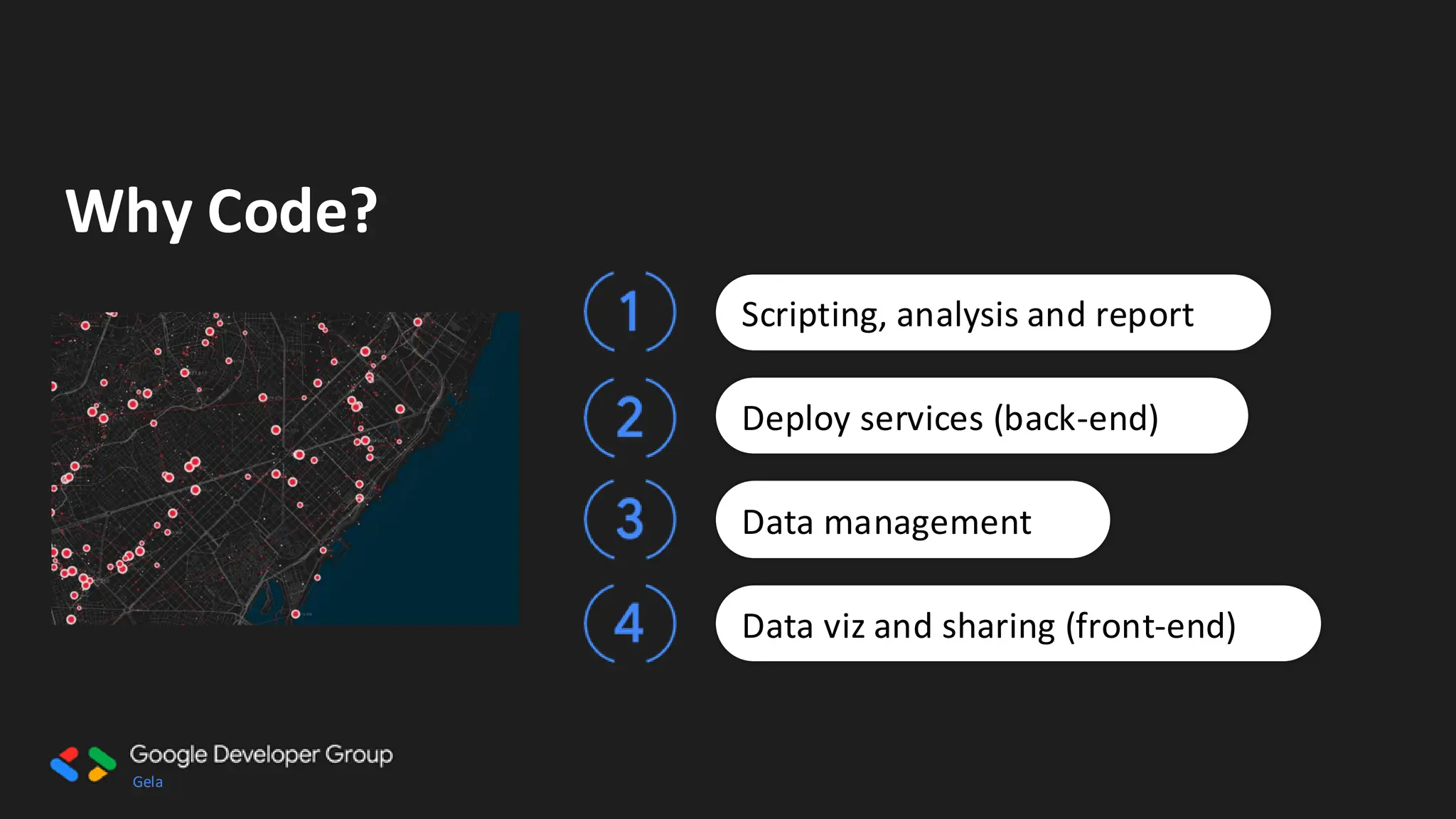
Case #1: NO-CODE approach
Native .model3 file format (xml-like)
Exported .py file with class and scripts
21.
Gela
Developed in no-code
environmentcalled “model
designer”; a GUI inside the
QGIS desktop application
(Open-source project also
developed in Python and QT)
Case #1: NO-CODE approach
Native .model3 file format (xml-like)
Exported .py file with class and scripts
22.
Gela
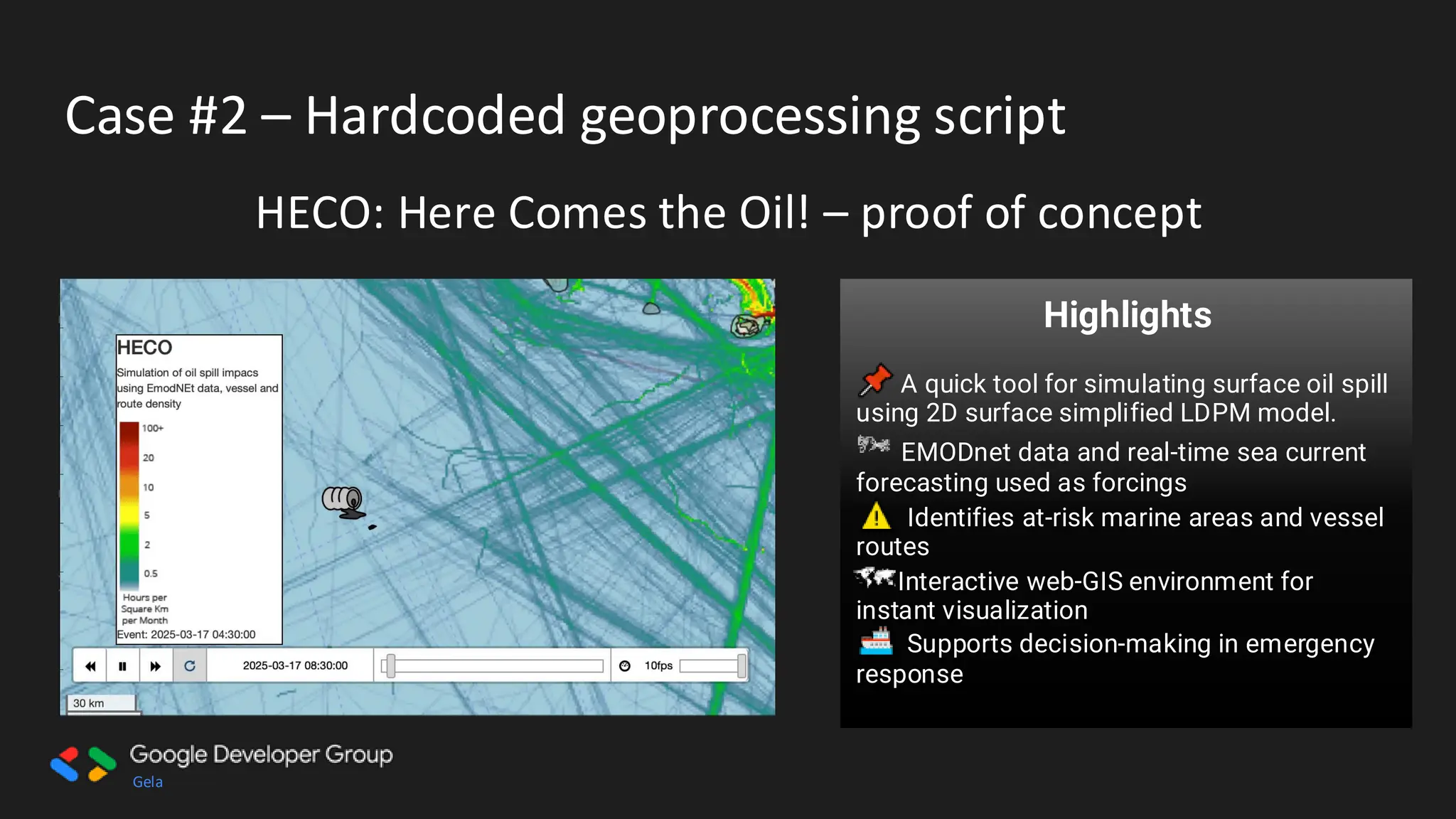
Case #2 –Hardcoded geoprocessing script
HECO: Here Comes the Oil! – proof of concept
Users Target:
• Marine Authorities – Faster
emergency response
• Coastal Communities – Protect
livelihoods & environment
• Environmental Agencies – Support
conservation strategies
• Shipping Companies – Reduce risks
& liabilities
Highlights
A quick tool for simulating surface oil spill
using 2D surface simplified LDPM model.
EMODnet data and real-time sea current
forecasting used as forcings
Identifies at-risk marine areas and vessel
routes
Interactive web-GIS environment for
instant visualization
Supports decision-making in emergency
response
23.
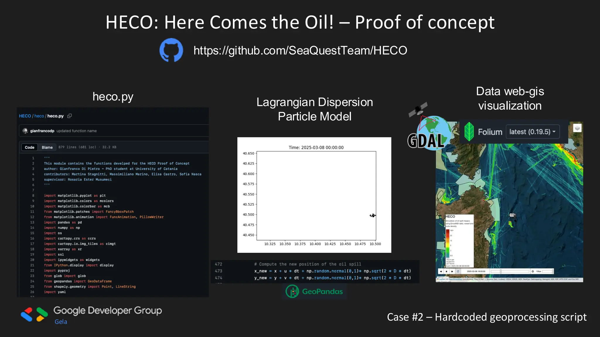
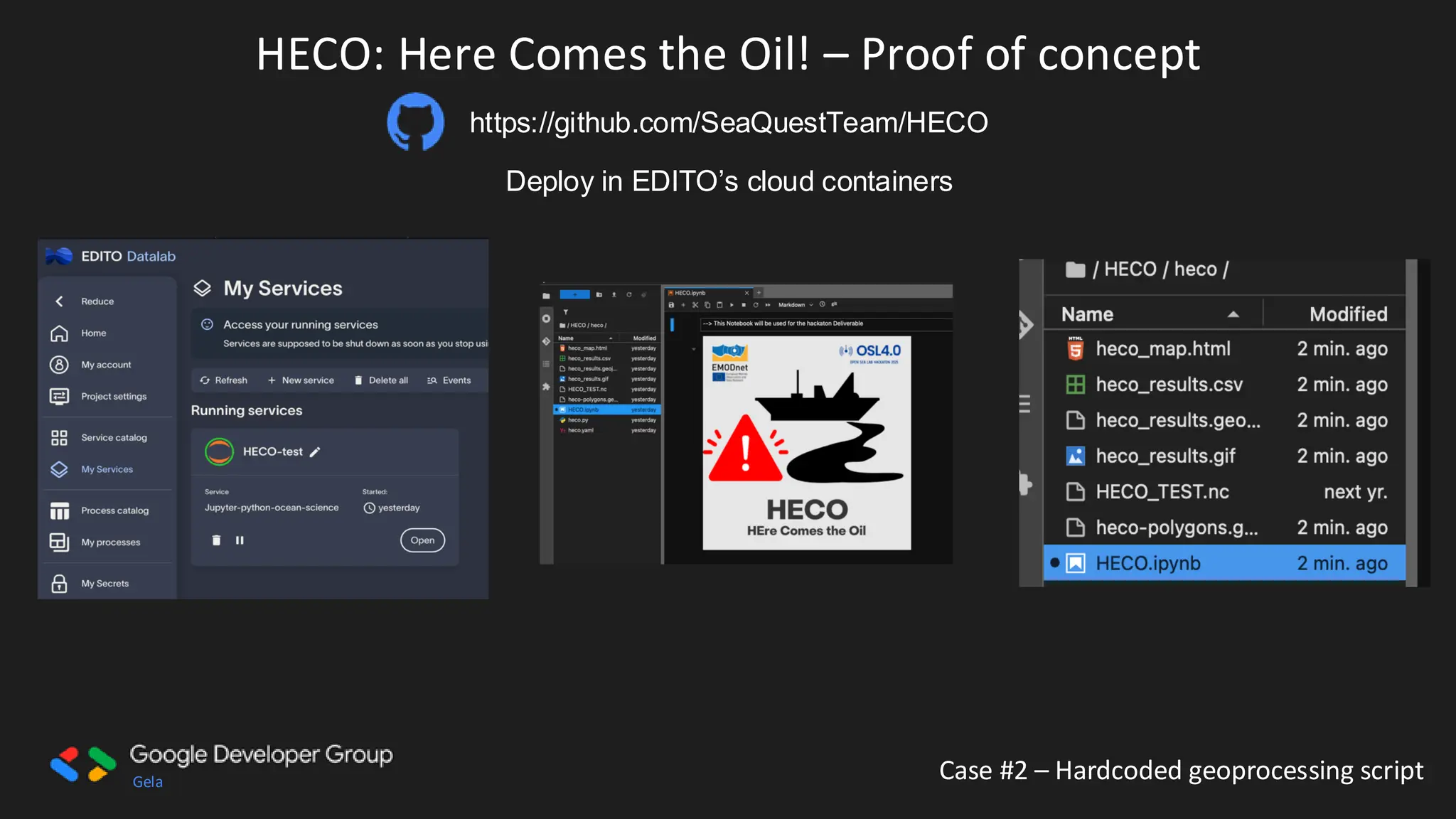
Gela Case #2– Hardcoded geoprocessing script
HECO: Here Comes the Oil! – Proof of concept
https://github.com/SeaQuestTeam/HECO
heco.py Lagrangian Dispersion
Particle Model
Data web-gis
visualization
24.
Gela Case #2– Hardcoded geoprocessing script
HECO: Here Comes the Oil! – Proof of concept
https://github.com/SeaQuestTeam/HECO
Deploy in EDITO’s cloud containers
A screenshot of a computer
AI-generated content may be incorrect.
25.
Gela
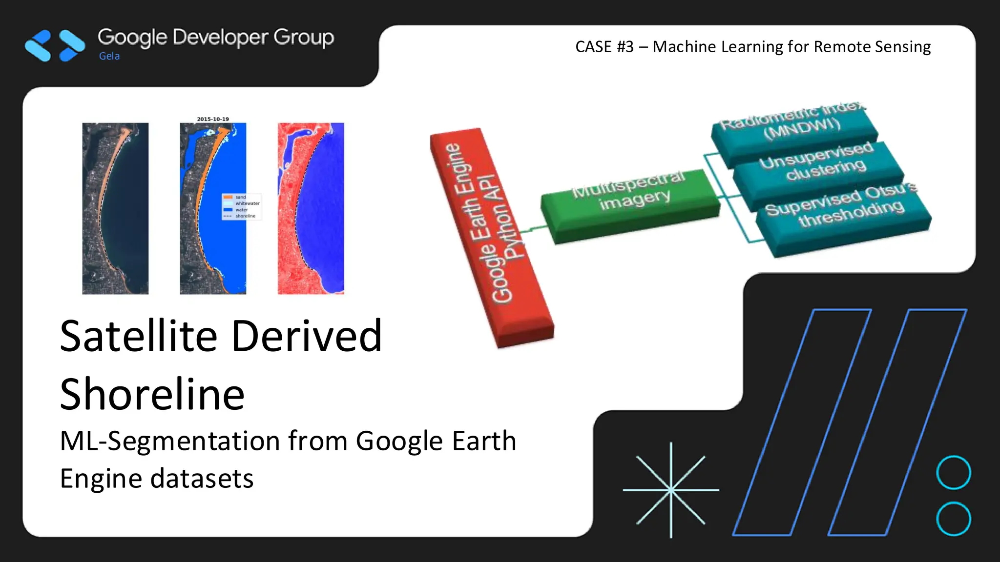
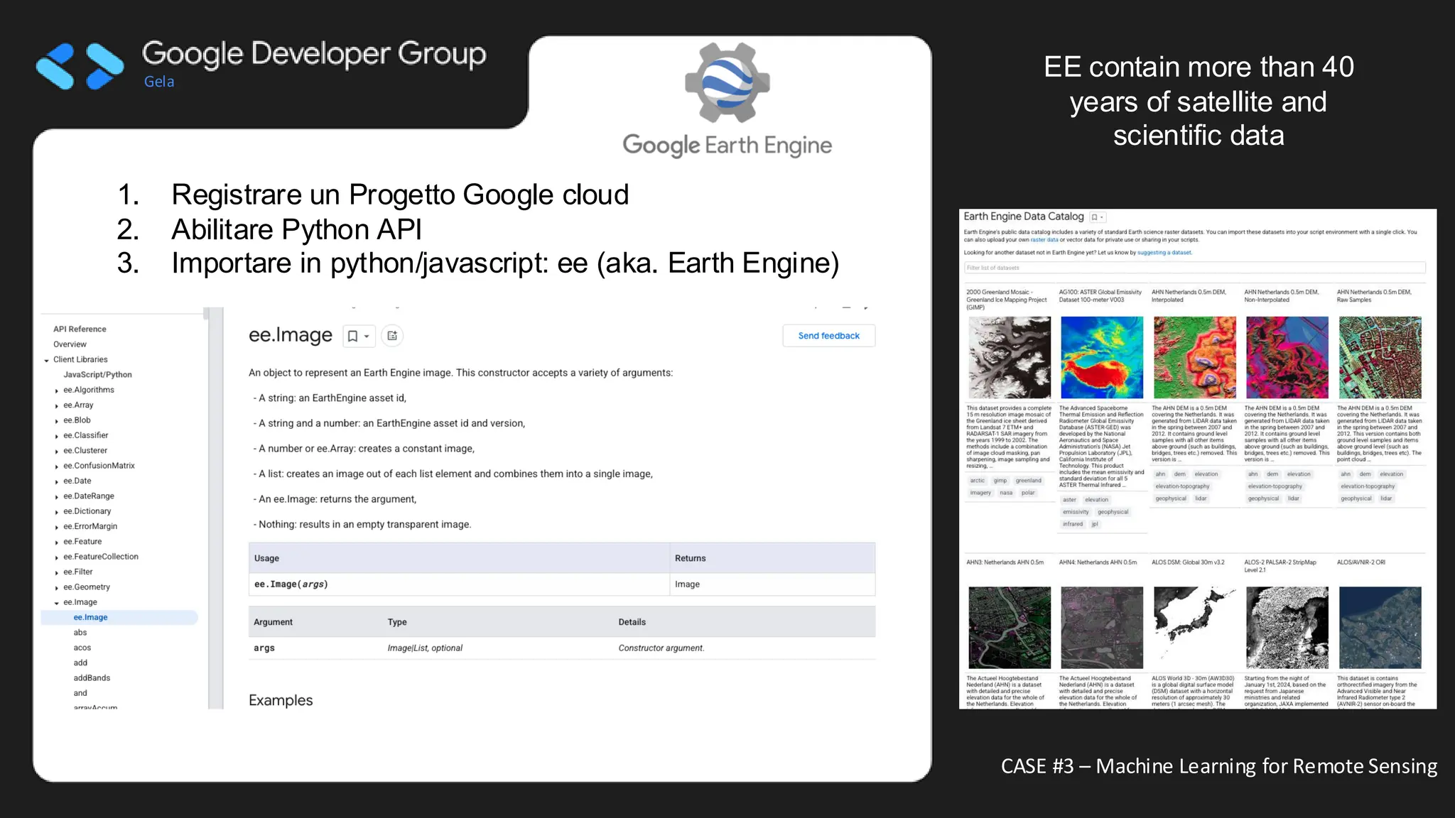
CASE #3 –Machine Learning for Remote Sensing
Satellite Derived
Shoreline
ML-Segmentation from Google Earth
Engine datasets
26.
Gela
CASE #3 –Machine Learning for Remote Sensing
1. Registrare un Progetto Google cloud
2. Abilitare Python API
3. Importare in python/javascript: ee (aka. Earth Engine)
EE contain more than 40
years of satellite and
scientific data
Immagine che contiene testo, schermata, grafica
Descrizione generata automaticamente
27.
Gela
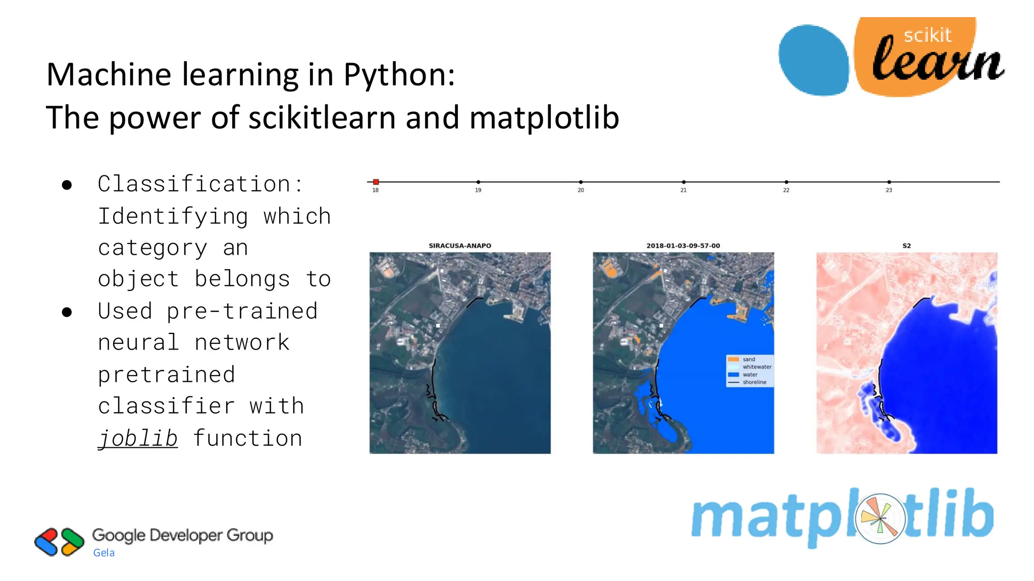
● Classification:
Identifying which
categoryan
object belongs to
● Used pre-trained
neural network
pretrained
classifier with
joblib function
Machine learning in Python:
The power of scikitlearn and matplotlib
28.
Gela
● Classification:
Identifying which
categoryan
object belongs
to.
● Used pre-trained
neural network
pretrained
classifier with
joblib function
Machine learning in Python:
The power of scikitlearn and matplotlib
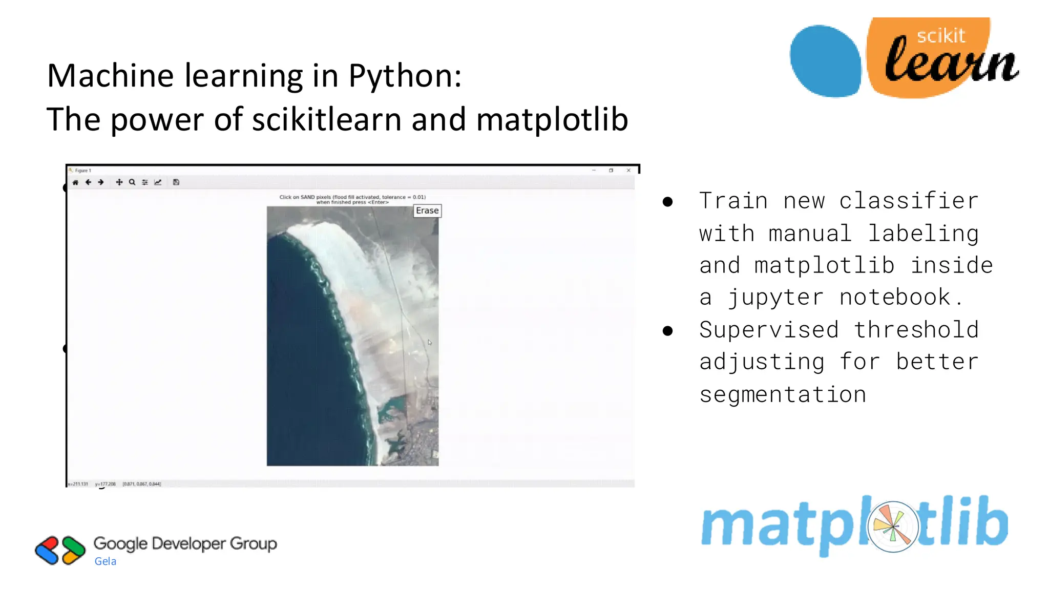
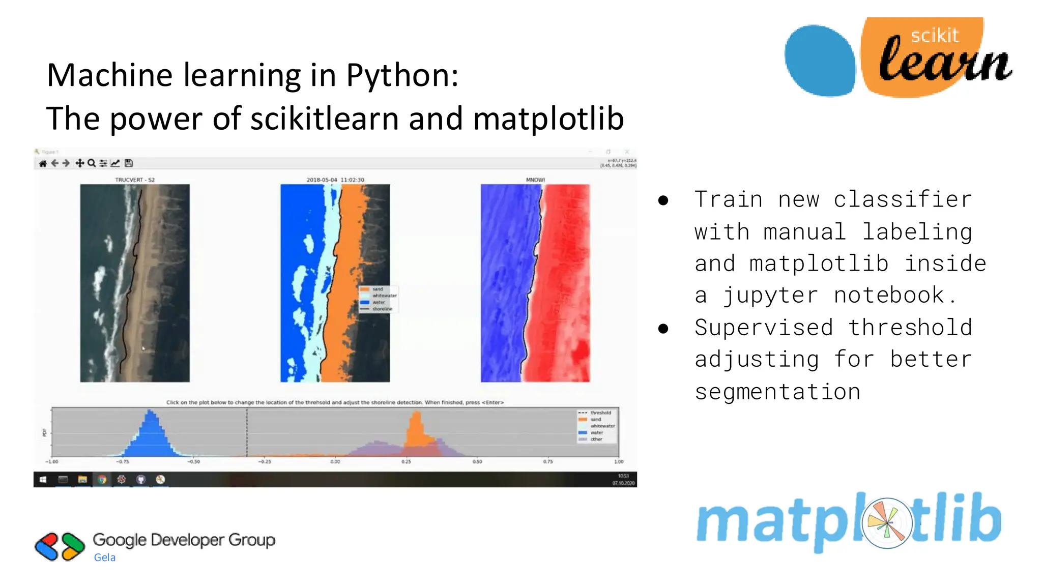
● Train new classifier
with manual labeling
and matplotlib inside
a jupyter notebook.
● Supervised threshold
adjusting for better
segmentation
29.
Gela
● Classification:
Identifying which
categoryan
object belongs
to.
● Used pre-trained
neural network
pretrained
classifier with
joblib function
Machine learning in Python:
The power of scikitlearn and matplotlib
● Train new classifier
with manual labeling
and matplotlib inside
a jupyter notebook.
● Supervised threshold
adjusting for better
segmentation

![Gela
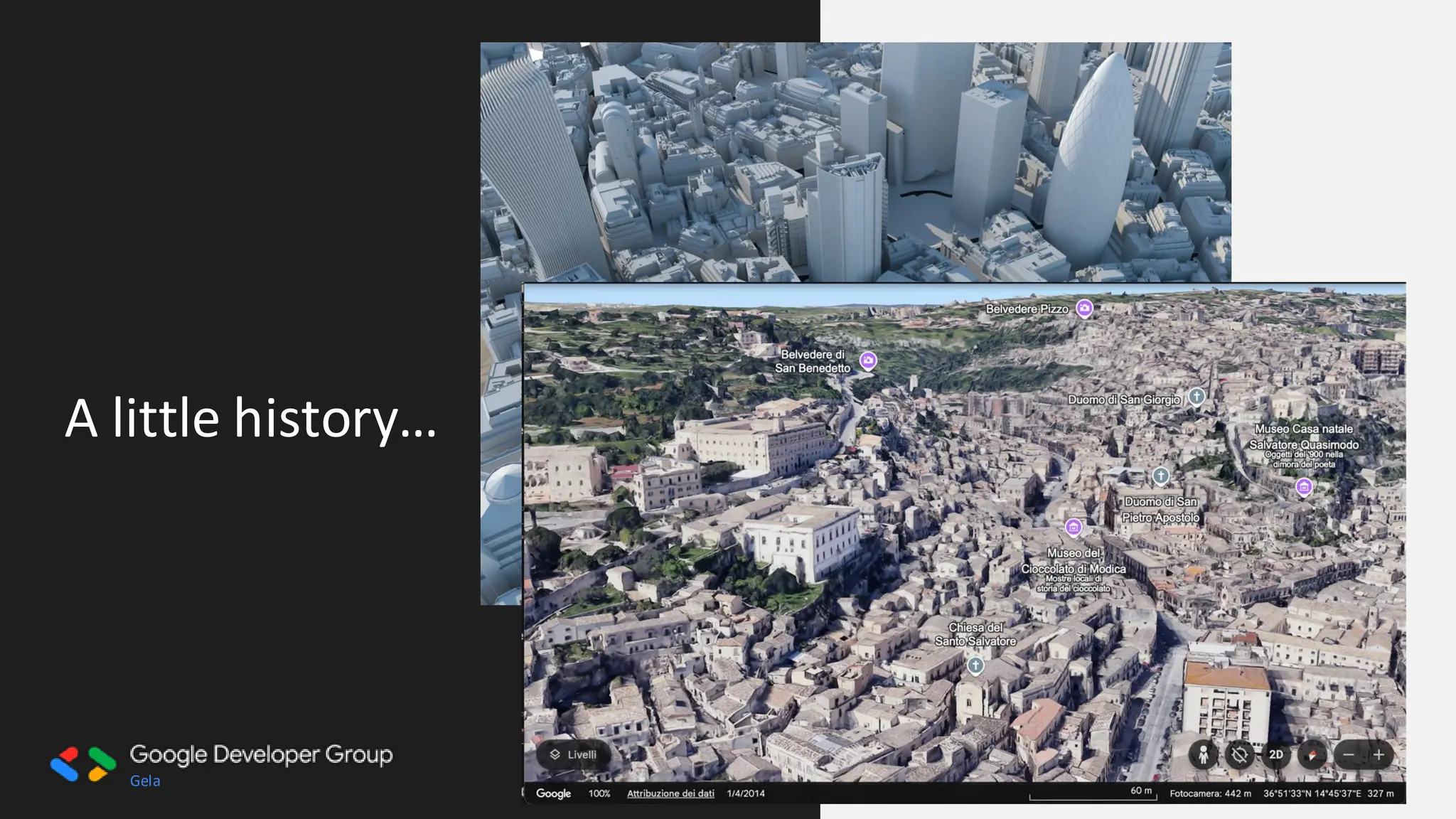
A little history…
Benedetto Bordone, 1534
Paolo Forlani, [Africa], 1566](https://image.slidesharecdn.com/whyflat-whycode2025pub-250430040357-f721cad4/75/Why-Flat-Why-Code-geospatial-people-do-it-14-2048.jpg)
![Gela
A little history…
British Patè [Making Maps], 1961](https://image.slidesharecdn.com/whyflat-whycode2025pub-250430040357-f721cad4/75/Why-Flat-Why-Code-geospatial-people-do-it-15-2048.jpg)