
Recommended
Recommended
More Related Content
Similar to Wetland Science by David D'amore
Similar to Wetland Science by David D'amore (10)
Recently uploaded
Recently uploaded (20)
Wetland Science by David D'amore
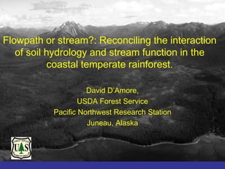
- 1. Flowpath or stream?: Reconciling the interaction of soil hydrology and stream function in the coastal temperate rainforest. David D’Amore, USDA Forest Service Pacific Northwest Research Station Juneau, Alaska
- 2. Hydropedology is the linkage between soil science and hydrology that studies the multi-scale interaction between pedologic and hydrologic properties of the earth’s critical zone.
- 3. The functional response to structural restoration measures is uncertain and varies through time.
- 4. The Alaskan coastal temperate rainforest (ACTR) is a sub-region of the perhumid zone of the coastal temperate rainforest biome that extends from northern California to Prince William Sound. Map courtesy of inforain: www.Inforain.org
- 5. Stream: A body of water with a current, confined within a bed and stream banks.
- 6. The riparian zone definition for the coastal temperate rainforest is: • “The area outside of the active river channel that is influenced by or influences the adjacent terrestrial ecosystem”
- 7. The study of soil hydrology is concerned with: 1) The duration of saturation within a soil; 2) The flow routing or how water moves through a system; 3) The quality of water that is derived from a water source.
- 8. There are two key concepts for integrating hydrology and biogeochemistry in the ACTR: 1) Hydropedology is the combination of soil science and hydrology that studies the relationships between soil, landscape, and hydrology. 2) Flowpath integration is the study of how the flowpath of water and the material entrained in the flowpath integrates stream and landscape heterogeneity.
- 9. Landscape hierarchies can partition the watershed into functional units.
- 10. The catena provides a good model for hydrologic soil formation on hillslopes in the CTR. Uplands Typic Cryohumods Forested Wetlands Euic Terric Cryosaprists Upper Backslope Bogs Dysic Typic Cryohemists Lower Backslope Footslope Toeslope
- 11. The Juneau hydrologic observatory has three hydropedomorphic systems replicated within three watersheds: sloping bogs, forested wetlands, and uplands.
- 13. Water, water everywhere…. The CTR receives an average of three meters of precipitation per year.
- 14. 0.2 Type I 0.18 Precipitation Discharge Discharge varies with watershed 0.16 0.14 0.12 0.1 elevation, and slope 0.08 0.06 0.04 0.02 0 jan feb m ar apr m ay jun jul aug sep oct nov dec Type II 0.2 0.18 Precipitation 0.16 Discharge 0.14 0.12 0.1 0.08 0.06 0.04 0.02 0 jan feb m ar apr m ay jun jul aug sep oct nov dec Type III 0.2 0.18 Precipitation 0.16 Discharge 0.14 0.12 0.1 0.08 0.06 0.04 0.02 0 jan feb mar apr may jun jul aug sep oct nov dec
- 15. Distribution of Watershed Types Type I in Southeast Alaska # 1525 Area (km2) 17,870 Type 1 Mean elev (m) 142 Glacier Bay National Park Type 2 Mean max (m) 455 Type 3 Annual Q (km3) 42 Area not included in analyses DOC flux (Tg) 0.29 JUNEAU Mean % wetland 9.0 Type II C A USA NA # 1213 DA Area (km2) 28,456 Mean elev (m) 381 Mean max (m) 978 Sitka Annual Q (km3) 95 Petersburg DOC flux (Tg) 0.40 Mean % wetland 11.8 Pa Type III cif ic # 110 Oc Area (km2) 19,962 ea n Mean elev (m) 857 Ketchikan Mean max (m) 1846 Annual Q (km3) 70 DOC flux (Tg) 0.10 0 50 100 Mean % wetland 4.2 Kilometers
- 16. The coastal temperate rainforest is nearly always in a state of moisture excess. 200 200 Precipitation Evapotranspiration 150 150 P-PET 100 100 Ppt, ET (mm) P-PET (mm) 50 50 0 0 -50 -50 -100 -100 ary ary rch April y Ma Jun e y t r r r Jul ugus embe ctobe embe embe r J anu Febru Ma A ept O No v c S De
- 17. Seasonal water table patterns vary across the hydropedomorphic gradient. 10 Upland Forested Wetland Sloping Bog 0 Water Table Depth (cm) -10 -20 -30 -40 -50 May Jun Jul Aug Sep Oct Nov
- 18. The production and export of dissolved organic carbon is influenced by soil biogeochemical cycles. 30 Sloping Bog Forested Wetland 25 Upland 20 DOC (mg C L-1) 15 10 5 0 May Jun Jul Aug Sep Oct Nov
- 19. The forested wetlands and bogs have distinct seasonal patterns in water table depth. 0 -5 Water Tables Water Table Depth (cm) -10 -15 -20 -25 -30 Forested Wetland Bog -35 -40 ay ly ne t r er s be Ju gu ob M Ju em Au ct O pt Se
- 20. Soil saturation influences the biochemical transformations in the soil profile. -0.10 700 -0.15 Aerobic 600 Water table depth (cm) -0.20 Redox potential (eH) 500 -0.25 -0.30 400 -0.35 Anaerobic 300 -0.40 Water Table Depth Redox Potential -0.45 200 Jun Jul Aug Sep Oct Nov Dec
- 21. All dissolved organic matter is not created equal. Fluorescence Excitation Emission Matrices (EEMs) PARAFAC 600 50 550 40 Relative % Contribution 500 30 Emission (nm) 450 20 400 10 350 0 1 2 3 4 5 6 7 8 Components 300 240 260 280 300 320 340 360 380 400 420 440 Excitation (nm) Protein-like fluorescence (Tyrosine and Tryptophan-like)
- 22. Biodegradable DOC is related to protein, which varies according to soil type. 50 A 40 BDOC (% C loss) B B 30 C 20 60 10 50 BDOC (% of initial DOC) 0 40 Bog FW Fen Up 30 6.2 7.2 7.3 2.7 mg C L-1 20 10 0 0 10 20 30 40 Fellman et al., Biogeochemistry, 2008 Protein-like fluorescence (% relative contribution)
- 23. Inlet Outlet Reduced terrestrial organic matter is oxidized during processing in aquatic systems. Miller et al., 2009, Fellman et al., 2009
- 24. Soil types can be arrayed by functional attributes for evaluation of performance standards. 1.2 1.0 Fen Fen Protein-like fluorescence 0.8 Fen 0.6 0.4 Axis 2 Bog 0.2 Bog 0.0 Upland Bog Upland -0.2 -0.4 FW -0.6 FW FW -0.8 -0.4 -0.3 -0.2 -0.1 0.0 0.1 0.2 0.3 Axis 1 Humic-like fluorescence
- 25. Southeast Alaska has the highest area weighted flux of dissolved organic carbon in the world. 14 12 Tongass Mg C km-2 y-1 10 Amazon Yukon 8 6 4 • Persistent fluxes of water 2 through soils provide a 0 terrestrial carbon pump to streams.
- 26. The terrestrial and aquatic ecosystems are intimately connected due to extensive shorelines. Dissolved Organic Carbon Flux from Southeast Alaska Rivers Surface Chlorophyll Concentrations Total DOC Flux, Tg/Year Glacier Bay 0.000004 - 0.000353 National Park during summer 0.000354 - 0.001013 0.001014 - 0.002728 0.002729 - 0.008332 JUNEAU Area not included in analyses ! CA SA NA U DA ! Sitka Petersburg ! Pa cif ic Oc ea n ! Ketchikan 0 Æ 50 100 Kilometers
- 27. The North Pacific coastal fringe is a focal point for changes in key environmental drivers such as temperature and precipitation. http://www.assessment.ucar.edu/modeling_scaling/img/future.gif
- 28. Predictions for temperature change show increases for southeast Alaska, while predictions for precipitation change show increases, but the uncertainty in estimates for SE Alaska are high.
- 29. Evapotranspiration may expand the aerobic zone of soils during times of soil moisture deficit. 0 Water Table Depth (cm) -10 -20 -30 Sloping Bog Forested Wetland Forested wetland 2050 -40 May Jun Jul Aug Sep Oct Nov
- 30. The catotelm, or aerobic zone in surface soils will increase during soil moisture deficit. 0 Water Table Depth (cm) -10 -20 -30 Forested wetland Sloping bog Forested wetland 2050 -40 6/5/2006 6/12/2006 6/19/2006 6/26/2006
- 31. The water table relationships can be extraploated to the watershed through soil drainage class categories.
- 32. Drainage classes can be scaled to finer landscape units using digital elevation models.
- 33. Flowpath models can be applied using water table depths to array classes in accurate categories.
- 34. Hydropedologic studies can provide watershed models for: flow routing, duration of saturation, quantitative hydrologic evaluations and biogeochemical characterization.
- 35. Landscape wetland distributions can be used for planning functions at broad scales.