Watershed Management In India
•Download as PPT, PDF•
1 like•834 views

This presentation is about the Watershed Management In India and areas where their is further scope of development with a sustainable approach.

Recommended
More Related Content
What's hot
What's hot (20)
Similar to Watershed Management In India
Similar to Watershed Management In India (20)
Recently uploaded
Recently uploaded (20)
Watershed Management In India
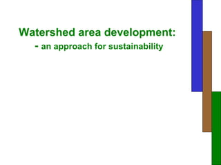
- 1. Watershed area development: - an approach for sustainability
- 2. In India 70% of landmass is underlain by hard rocks so percolation is very slow
- 3. Millions of hectares of prime agricultural land being laid waste due to over-irrigation induced waterlogging and salinity.
- 4. Why we talk about dry lands only • Worlds major land mass is part of dry land • Major biodiversity located in this system • Dry land system is most fragile system • Desertification is an irreversible process • Extinction of species is reduction of gene pool for future • Water and soil are most essential input for food grain
- 5. Social characteristics of dry-land
- 10. Geology of India
- 11. S tatus of irrig ation in India Irrigated 36% Non irrigated 64%
- 13. Hydrosphere: water in earth’s environment…some hard facts • Global water balance – Average precipitation less than 1000mm annually – More than 95% is sea water • Of all fresh water – Large part locked up as ice- caps – More than 95% of usable fresh water is groundwater – Less than 1% is surface water – Not all groundwater is accessible to man P = E + RO + GW + ET + SM P= Precipitation E= Evaporation RO= Run off GW= Ground Water ET= Evapo-transpiration SM= Soil moisture
- 14. Water balance • Input: –Rainfall • Output: • Evaporation • Percolation (ground water) • Evapotranspiration • Soil moisture • Run off
- 15. Nomenclature of watershed in India Category Numbers Size (000 ha) Region 6 25000-100000 Basin 35 3000-25000 Catchments 112 1000-3000 Sub Catchments 500 200-1000 Watershed 3237 50-200 Sub Watershed 12000 10-50 Mille watershed 72000 1-10 Micro watershed 400000 0.5-1
- 16. The life of a river is its catchment area or watershed, that is the area from where it literally catches its water
- 17. Watershed development is aimed at treating these catchments areas to slow down the intensely flowing water at every point to make it walk rather than run so that it remains available for use in the village for a longer period of time
- 18. Different order of streams in a watershed area
- 19. What is watershed development Watershed development is not an activity Watershed development is not just a program Watershed development is a concept It is an approach for sustainability
- 20. Objectives • To reduce run off • To reduce soil erosion • To increase soil moisture • To make water streams perennial • To increase ground water level • To rejuvenate the past flora and fauna • To enhance productivity of land • Overall sustainability of ecosystem Ridge Valley
- 21. PRINCIPLE OF SOIL AND WATER CONSERVATION MEASURE Increase the time of concentration and thereby allowing more runoff water to be absorbed and held in the soil profile. Intercepting a long slope into several short ones, so as to maintain less than a critical velocity for the runoff water. Protection against damages owing to excessive runoff. Prevent excessive soil and water losses.
- 22. Natural treatment . . . Protective Regeneration and Afforestation
- 23. On slightly lower gradients, staggered or continuous trenches along contour lines are recommended.
- 24. Continuous Contour Trenches with Plantation
- 25. On gentle slopes, contour bunds are recommended
- 26. Gully plugs or boulder checks are small rock dams made on small drainage lines or gullies
- 27. GULLY PLUGS ( Stone Wall Terrace ) Increased cultivation Area Gully treatment in progress
- 28. GABION STRUCTURE Breaking run-off velocity Increase in irrigated area
- 29. On larger streams and flatter land, rock and wire dams called gabion structures are recommended using local stones
- 30. Low cost masonry gabion structure
- 31. PERCOLATION TANK Pre Operational status Post Operational status
- 32. Types of Farm ponds • Dugout farm ponds • Embankment type farm ponds
- 33. Dugout farm ponds harvest rainwater within the farm for protecting the crop from gaps in rain
- 34. Farm pond meant for protective irrigation and the seven harvests 1.With the first major rains, fish fingerlings are released 2.The second harvest is of edible water plants 3.The major harvest is, of course, the kharif crop 4.Rice is grown at the edge of the pond 5.There is sufficient water to irrigate the rabi crop 6.Unirrigated rabi crops like gram after the water recedes 7.The seventh harvest is of silt deposits
- 35. Stone masonry check dams built on larger streams can used to support Community Lift Irrigation Projects
- 36. Design of Masonry Check dam
- 37. BUNDING Acts as barrier to check run-off Reduced soil erosion and increased soil moisture, productivity and biomass
- 38. LAND LEVELING AND BUNDING Increased infiltration and time of concentration
- 39. BRUSHWOOD CHECK DAM LOOSE ROCK DAM Reduce runoff velocity and stabilize the gully Increase cultivated Area GRADE STABILISATION STRUCTURE
- 40. Bench terracing Bench terracing is practised on steep hilly slopes where agriculture has replaced natural forest and grasslands since time immemorial. Thus, more reduction in slope length will not be able to reduce the intensity of runoff water.
- 41. Bench terracing involves converting the original ground into level step like fields constructed by half cutting and half filling, which reduces the degree of the slope. In hilly areas of Nilgiri hills, in North East hill areas of India and in Himachal Pradesh, this approach of bench terracing for agro-forestry models is gradually getting popular.
- 43. INCREASE IN WATER LEVEL IN WELL INCREASE IN IRRIGATED AREA
- 44. watershed management has been defined as an integration of technology with in the natural boundaries of a drainage area for optimum development of land , water and plant resources to meet the basic minimum needs of the people in a sustainable manner
- 45. Villager resting under energy plant to restore his energy.
- 46. Lets save each and every drop of water for next generation