Download to read offline

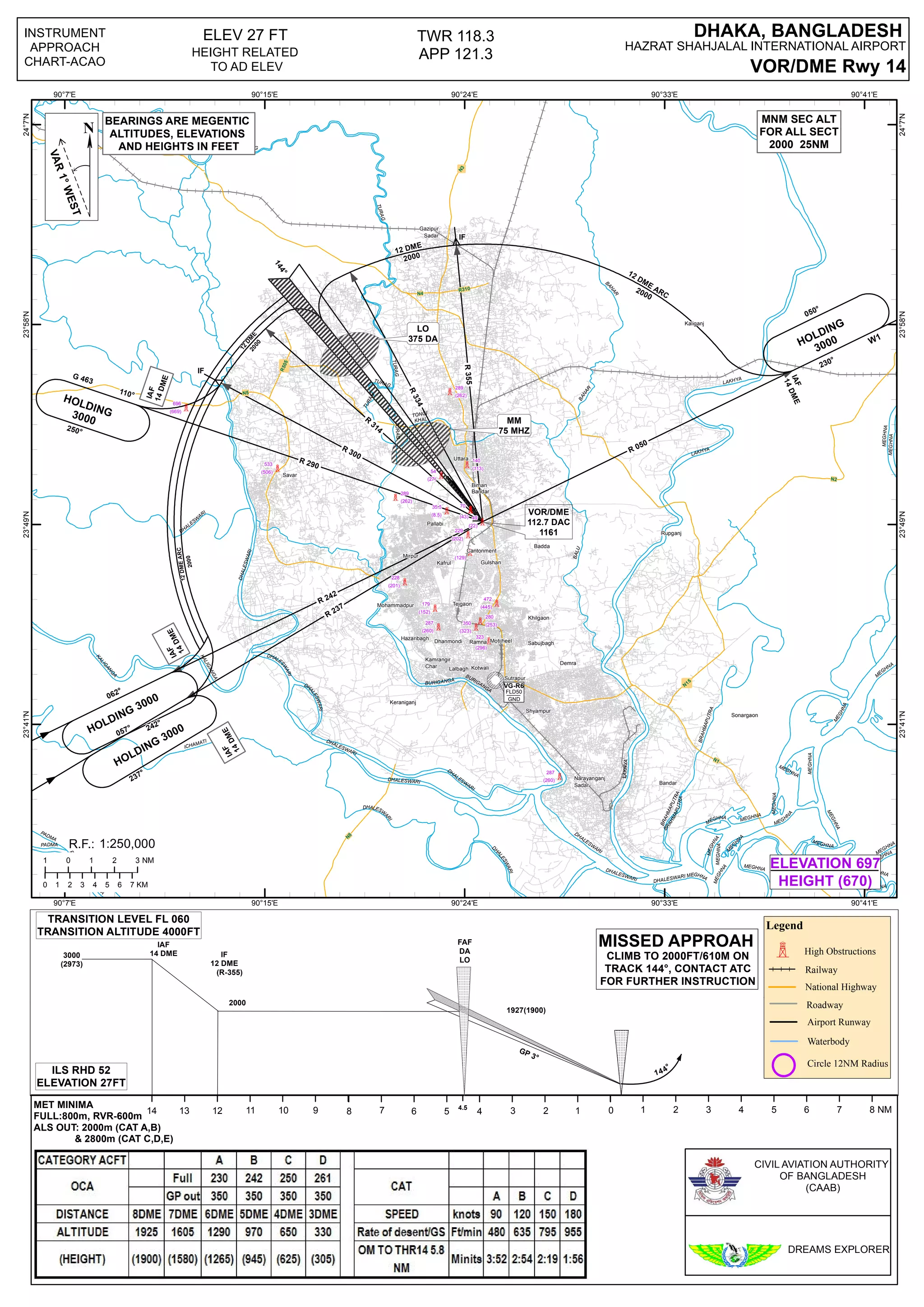

This document appears to be an instrument approach chart for Hazrat Shahjalal International Airport in Dhaka, Bangladesh. It provides information such as airport runway details, navigation aids, altitudes and heights, obstructions, approach procedures, missed approach instructions, and other relevant details to guide aircraft in performing instrument approaches. Key waterways mentioned include the Dhaleswari, Meghna, and Padma rivers. The chart covers areas within 12 nautical miles of the airport at elevations between 27-670 feet.


