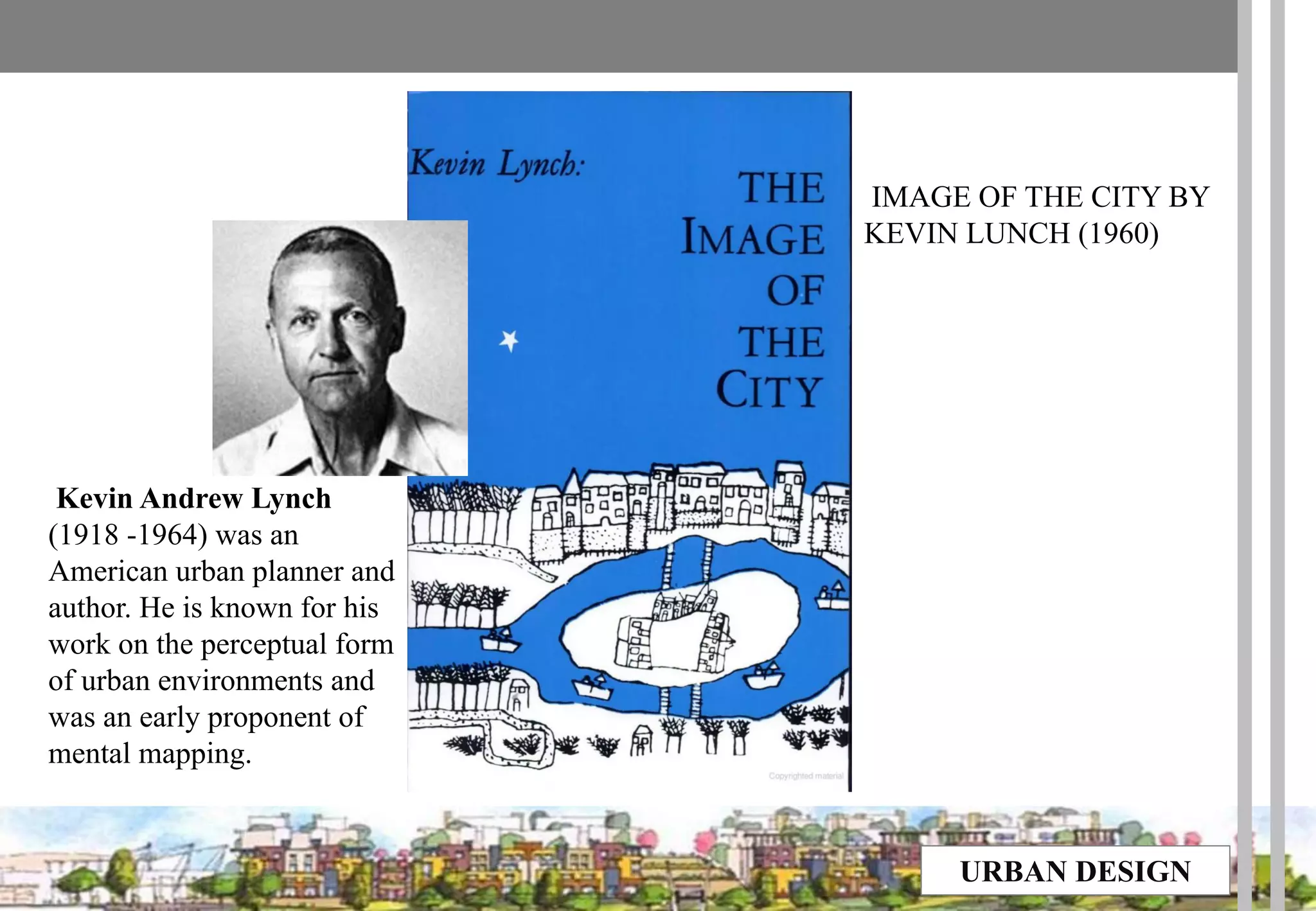
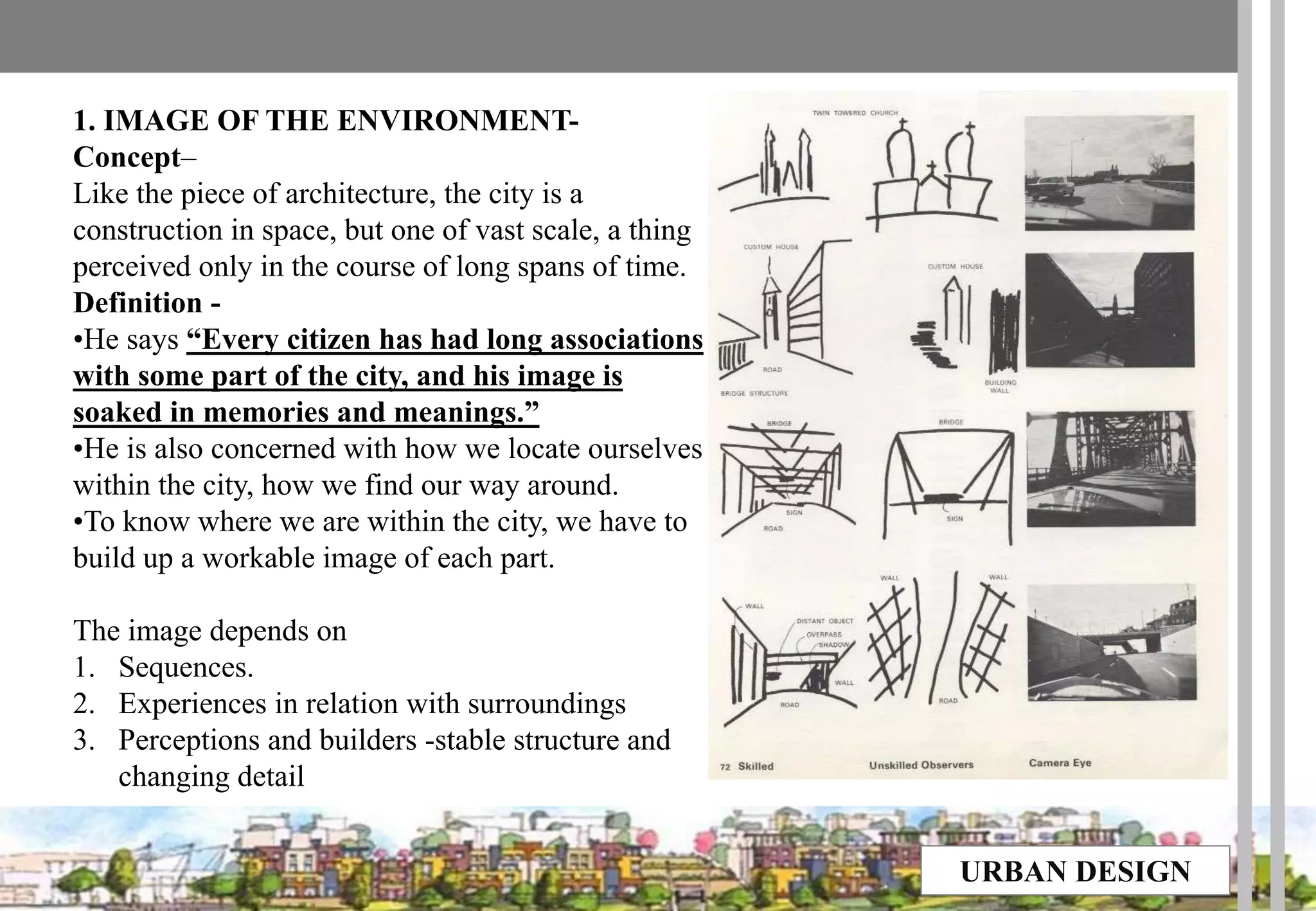
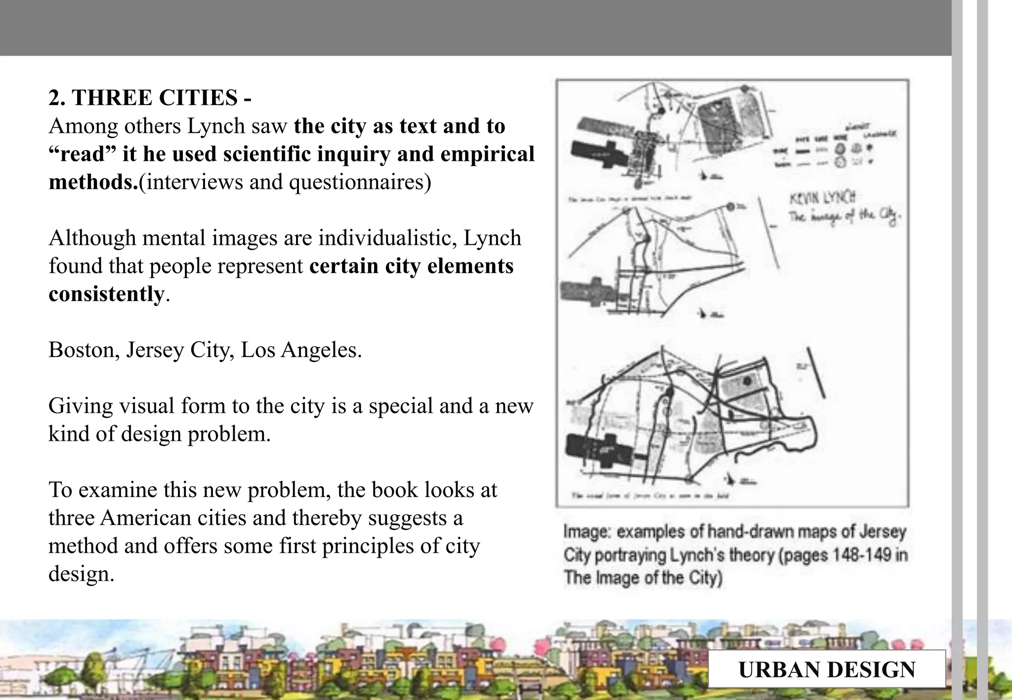
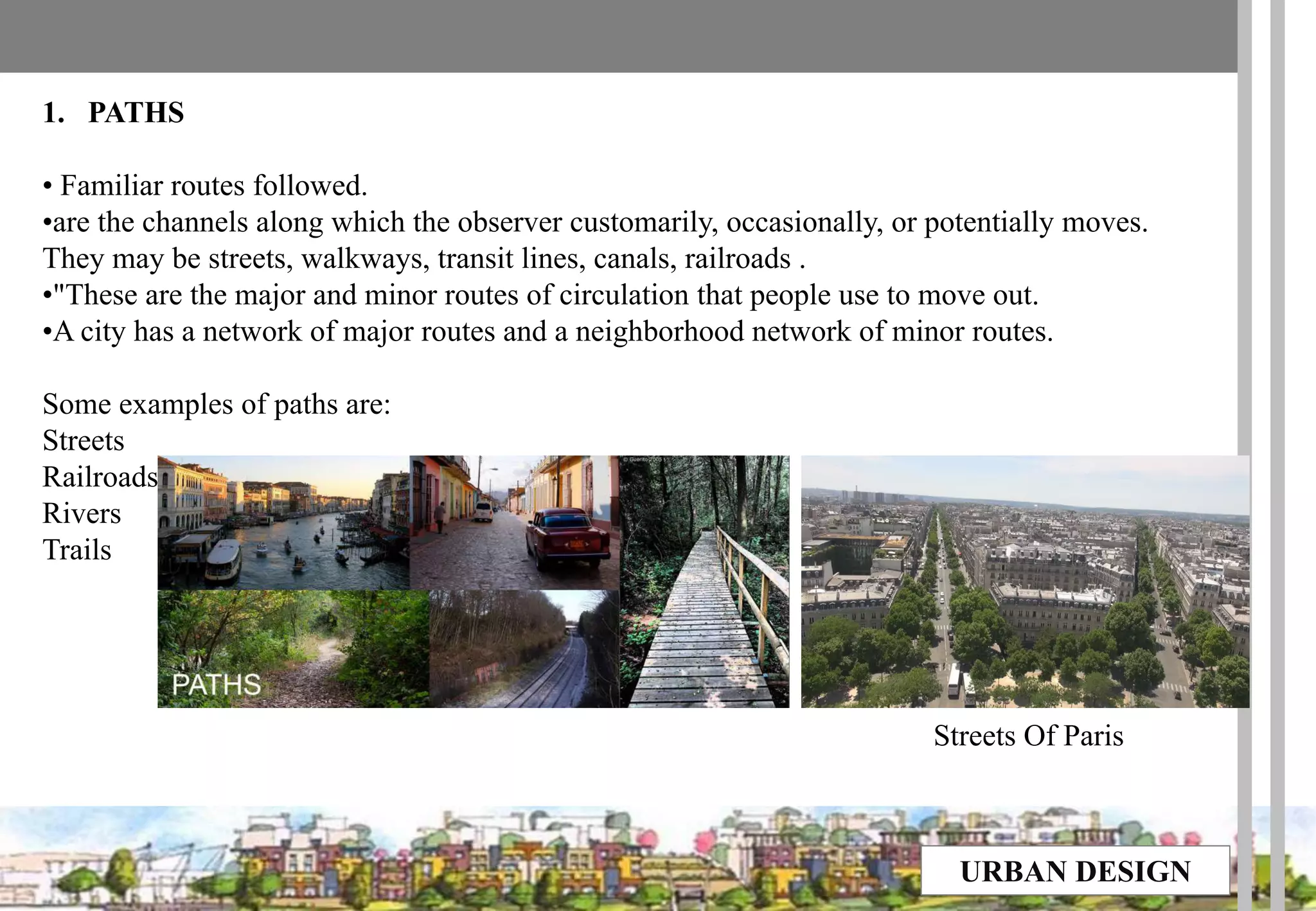
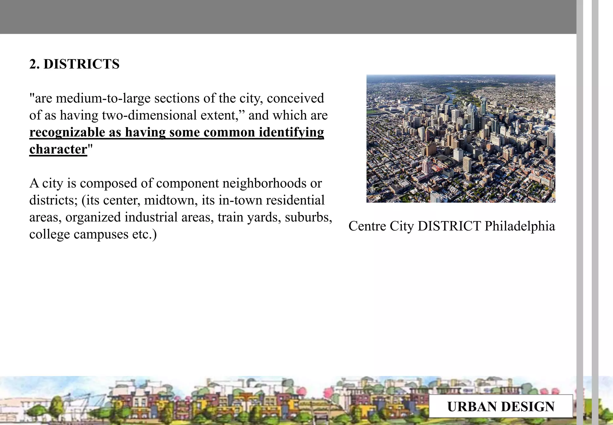
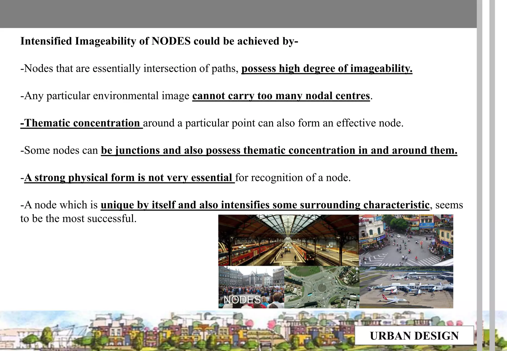
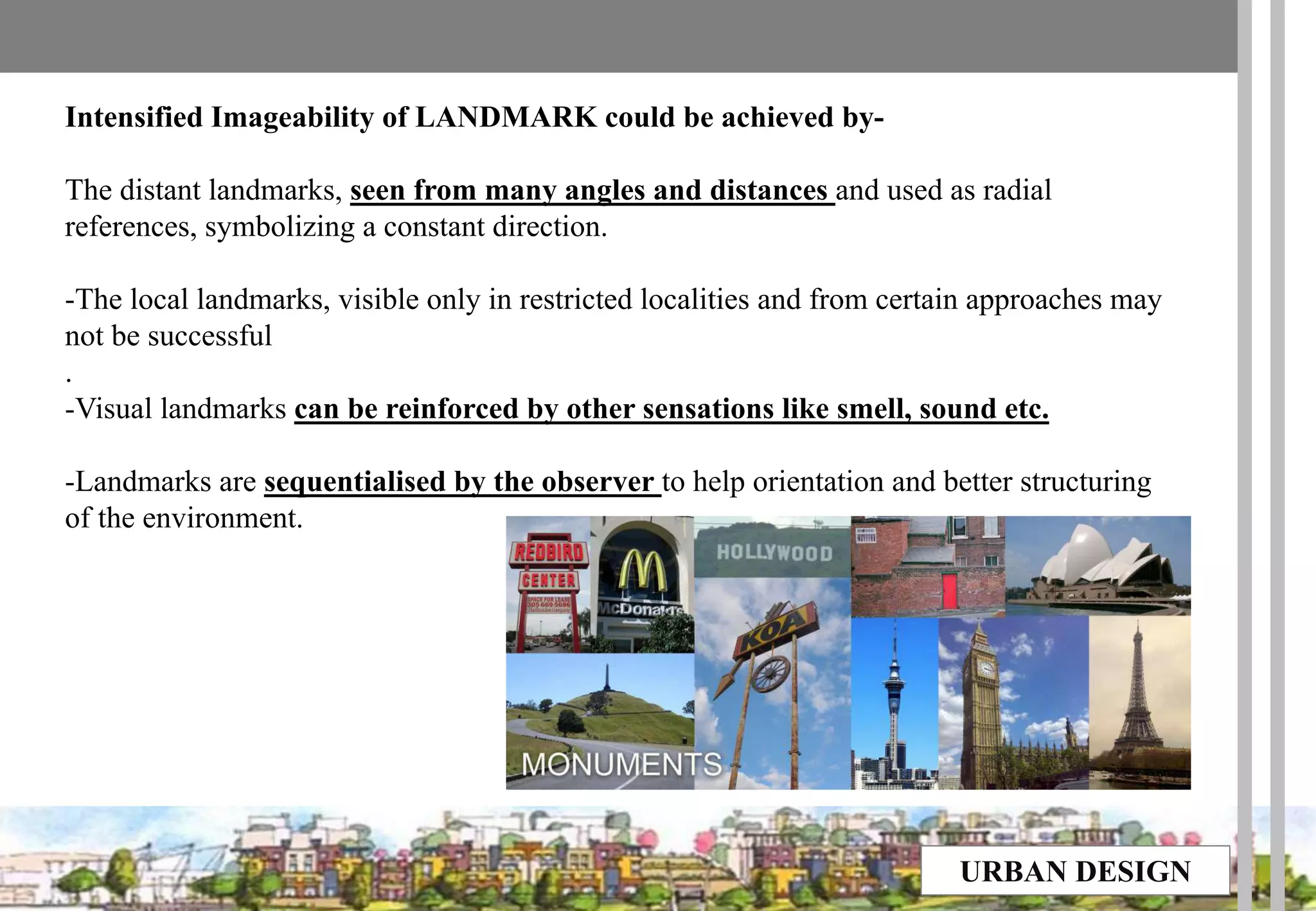
Kevin Lynch was an American urban planner known for his work on the perceptual form of cities. In his influential book "The Image of the City", Lynch introduced the concept of mental maps and examined how people navigate and perceive the layout of Boston, Jersey City, and Los Angeles. He identified five key elements that form cognitive maps and influence urban navigation - paths, edges, districts, nodes, and landmarks. Lynch's work has greatly influenced how urban design can impact wayfinding and the user experience of cities.
The document summarizes Kevin Lynch's book "Image of the City". Lynch studied how people perceive and understand cities based on mental maps. He identified 5 key elements that shape a person's mental map of a city: paths, edges, districts, nodes, and landmarks. Lynch also coined the terms "imageability" and "wayfinding". The book was influential in urban planning and psychology. It provided a framework to evaluate a city's form and image from a resident's perspective.
The document provides a review of Kevin Lynch's book "The Image of the City". It summarizes the key points of each chapter, including Lynch's analysis of how people perceive and navigate urban environments through mental maps containing paths, edges, districts, nodes, and landmarks. It also analyzes Lynch's writing style, praising the logical flow of ideas, focus on the central topic of a city's image, effective use of illustrations, and coherence. The review evaluates Lynch's influential work on urban planning and how understanding human perception can influence city design.
1) The document discusses a shift in urban planning paradigms from prioritizing cars and traffic to prioritizing people and public life.
2) It provides examples of cities like Copenhagen that transformed their urban spaces by reducing car infrastructure and increasing bike lanes and pedestrianized areas.
3) The result has been more vibrant and livable cities with increases in walking, cycling, and public life compared to cities planned primarily around traffic and cars.
Kevin Lynch was an urban planner, scholar, and writer known for his work on the perception of urban form. He found that people mentally construct images of cities using five main elements: pathways, districts, edges, landmarks, and nodes. Pathways are routes of movement like streets or walkways. Districts are recognizable areas of a city. Edges are linear elements like walls or shorelines that are not pathways. Landmarks are external reference points like buildings or signs. Nodes are strategic locations like junctions or focal points that people travel to or from. Lynch applied this framework to analyze the legibility and imageability of cities like Boston and Jersey City. His work influenced urban planning and design.
Urban design the image of the city-Kevin Lynchnitin boppanna
The Image Of The City Is A 1960 Book By American Urban Theorist Kevin Lynch. The Book Is The Result Of A Five-year Study Of Boston, Jersey City And Los Angeles On How Observers Take In Information Of The City, And Use It To Make Mental Maps.". . .
Kevin Lynch has come up with a readable, tautly organized,
authoritative volume that may prove as important to city building as
Camillo Sitte's The Art of Building Cities." — Architectural Forum
The document discusses elements of urban design that shape cities, including buildings, public spaces, streets, landscape, and their interrelationships. It also summarizes Kevin Lynch's book "The Image of the City", which examines how residents mentally map their city based on paths, edges, districts, nodes, and landmarks. Finally, it provides examples of these elements in Mysore, India, highlighting landmarks like the Ambavilas Palace, focal points like Chamaraja Circle, and the city's planned layout with vistas, public squares, and response of buildings to the street network.
This document discusses urban design principles and controls. It begins by defining urban design and its role in shaping public spaces and urban patterns. It then covers various design principles like scale, enclosure, grain, texture and morphology. It discusses the importance of factors like building height, ground coverage, and floor area ratio that are regulated through urban controls. The document uses examples from Chandigarh to explain how zoning and architectural controls were used to shape its development according to Le Corbusier's plan. In summary, the document outlines key urban design concepts and analyzes how regulations and controls were applied in Chandigarh to achieve its planned urban form.
Urban design can significantly impact the economic, environmental, social, and cultural outcomes of a place. It influences factors like local business success, housing costs, transportation access, and how people interact. Key elements of urban design include buildings, public spaces, streets, transportation systems, and landscape features. Buildings define the streetscape while public spaces are where people come together. Streets connect places and their design impacts walkability. Transportation networks enable movement throughout the city. Landscape provides green spaces that enhance character and beauty.
Urban squares have historically served as important public gathering spaces, often located at crossroads of trade routes. They function to provide shelter from traffic and represent psychological parking areas within cities. Factors that influence squares include surrounding buildings, proportions, entrance angles and central features. Squares can take different forms such as closed spaces enclosed by uniform buildings, dominated squares oriented around a focal point, nuclear squares with a central monument, grouped squares that combine into a whole, and amorphous squares without coherent shape. Over time, squares may evolve as new structures are added or old ones changed or destroyed.
Kevin Lynch proposes criteria for evaluating good city form, including vitality, sense, fit, access, and control. He tests these criteria on issues of city size, growth, conservation, and planning practices. The book provides a comprehensive discussion of urban theory and a normative theory relating the value of a city to its spatial characteristics. Lynch argues that independent forces transform human settlements and that the first cities emerged after agricultural revolutions, developing new skills to serve new elites within carefully planned layouts.
This document provides a book review and summary of Kevin Lynch's book "The Image of the City". It discusses Lynch's design principles for analyzing and improving the visual form of cities, including legibility and imagability. Lynch proposed that the image of a city is composed of paths, edges, districts, nodes, and landmarks. Nodes are points in a city that act as destinations or junctions, such as street corners or public squares. Landmarks are external physical objects that help people navigate, such as buildings, signs, or natural features. Examples of nodes included subway stations and enclosed public squares. Landmarks were described as objects that are easily identifiable from a distance, such as signage or distinctive building structures.
The document discusses the forms and functions of squares and plazas in city design. It describes squares and plazas as open civic spaces framed by important buildings and thoroughfares. The document outlines various ways squares can be classified, including by function, regular vs irregular shape, number of symmetric axes, and forms described by Paul Zucker such as closed, dominated by a central feature, nuclear with a center, grouped combinations, and amorphous/formless. Well-known examples like St. Peter's Square and Piazza del Popolo are referenced.
Jane Jacobs critiques modern urban planning practices in her influential book "The Death and Life of Great American Cities". She argues cities should focus on people, not traffic, and observes neighborhoods like Greenwich Village in New York to understand what makes some areas successful while others fail. Jacobs introduces new principles of urban planning by examining topics such as sidewalks, parks, and the importance of aged buildings and mixed uses to generate diversity within cities.
Kevin Lynch studied how people perceive and navigate urban environments through mental maps. He identified 5 key elements that people use to construct their mental map of a city: paths (streets, roads), edges (barriers like walls or rivers), districts (recognizable sections of the city), nodes (junctions or intersections), and landmarks (external reference points like buildings or mountains). Understanding how people perceive and mentally map cities through these elements can help with urban planning and design that facilitates navigation and cooperation within the environment.
1. The document describes the rational planning method which involves understanding existing conditions, exploring alternatives, and deciding on a preferred alternative.
2. The understanding phase involves preparing maps and materials, gathering data through meetings and site measurements, and analyzing this information to identify strengths, weaknesses, and other insights.
3. In the exploring phase, ideas are brainstormed and preliminary principles and design alternatives are developed based on the understanding phase.
4. The deciding phase is where a preferred alternative is selected and final presentation materials are prepared based on what was learned throughout the process.
CAMILLO SITTE
He was an Austrian architect, born Vienna in 1843
Camillo Sitte was the son of the architect Franz Sitte(1808–79) and the father of the architect Siegfried Sitte (1876–1945).
He was an art historian and architect whose writings, according to Eliel Saarinen, were familiar to German-speaking architects of the late 19th century.
He was also an painter and urban theorist whose work influenced urban planning and land use regulation.
Sitte traveled extensively in Western Europe, seeking to identify the factors that made certain towns feel warm and welcoming.
Sitte saw architecture was a process and product of culture.
BOOKS BY SITTE-
1. City Planning According to Artistic Principles, 1889
2. The Birth of Modern City Planning. Dover Publications, 2006.
Aldo Rossi and The Architecture of the Cityhollan12
My presentation for ARC434 with Kevin Weiss. I will look at the theories in "The Architecture of the City" and how these ideas are reflected in Rossi's built work. Enjoy!
Gordon Cullen was an English urban designer and landscape architect known for developing the concept of townscape. He studied architecture and worked as a draughtsman and writer for the Architectural Review. Cullen produced influential editorials on planning theory and urban design that informed improvements in Britain during the 1950s and 1960s. He authored the influential book The Concise Townscape in 1961, which popularized his ideas and has been republished over 15 times. Cullen worked as a freelance consultant, advising cities on reconstruction and redevelopment plans. He received several honors over his career, including being appointed a CBE in 1978 for his contribution to architecture.
Urban Design Scales and Spaces for ArchitectureMimi Alguidano
The document discusses the key elements of urban design that shape urban spaces, including buildings, public spaces, streets, transportation systems, and landscaping. It then focuses on sidewalks and streetscapes, describing the characteristics of great streets and the various elements that make up street design, such as lane width, sidewalks, curb extensions, vertical speed controls, and amenities like street trees, landscaping, lighting, and furniture. The goal is to balance the needs of all street users through designs that prioritize pedestrian experience and safety.
The document discusses elements that contribute to the legibility and navigability of cities, as analyzed by urban planner Kevin Lynch. It examines four cities - Athens, Paris, Jaipur, and Rome - and how each city utilizes Lynch's elements of paths, edges, districts, and landmarks to create a coherent structure that is easy for people to understand and navigate. The document analyzes features of each city like pathways in Athens, water edges in Paris, distinct districts in Jaipur, and prominent landmarks in Rome that make the layout and organization of each city clear.
Urban, Historical development of urbanism, New urbanismBiya Girma Hirpo
Urbanism is the study of how inhabitants of urban areas interact with the built environment. It involves the planning and development of cities and towns. New urbanism emerged as a planning movement in response to the low-density, car-centric development patterns that resulted from industrialization. The principles of new urbanism promote walkable, mixed-use neighborhoods with a range of housing and transportation options. New urbanism aims to create sustainable communities that improve public health and quality of life.
Urban design involves arranging all elements of cities, including buildings, public spaces, transportation, and amenities. It considers urban patterns, building forms, streetscapes, connections within a city, movement systems, public open spaces, and infrastructure. The key elements of urban design are urban fabric, which is the physical form of cities made up of blocks and streets, building forms that define street walls and spaces, and connections within a city through visual lines and physical routes to facilitate movement.
Kevin Lynch studied the mental maps and images that people form of cities. He identified 5 key elements that shape a person's mental image: pathways, edges, districts, nodes, and landmarks. Pathways are streets and paths that direct movement; edges are linear boundaries like walls; districts are recognizable sections of a city; nodes are strategic points like intersections; and landmarks are reference points like buildings. Lynch applied this framework to analyze the mental maps of Boston, Jersey City, and Los Angeles. His work aimed to understand how people navigate cities and design more legible urban environments.
The document summarizes Kevin Lynch's book "The Image of the City" which explores how people mentally perceive and navigate urban environments. It discusses Lynch's concepts of imageability, legibility, and the five elements that comprise a city's mental image for people - paths, edges, districts, nodes, and landmarks. It provides examples of Lynch's analysis of the mental images of Boston, Jersey City, and Los Angeles.
Kevyn introduced a concept of planning that was the base for understanding and visualising The Planning Aspects; important for the budding planners.
The presentation initiates the same understanding and invokes a means for better understanding of 'Planning'.
The perceptual dimensions and urban designKU Leuven
This document discusses the perceptual dimensions of urban design. It begins by defining environmental perception and how people perceive and experience the built environment. It then explores key concepts like place identity, sense of place, and placelessness. Lynch's five elements of environmental images - paths, edges, districts, nodes, and landmarks - are examined. The document also covers place differentiation, place theming, place marketing, and invented places. Environmental meaning and symbolism are discussed as well.
1. A schema describes how people organize information into categories and relationships to form mental images of urban environments.
2. Perception involves gathering, organizing, and interpreting sensory information through five steps like paying attention and assigning meaning.
3. Kevin Lynch studied how people navigate cities based on five key elements - paths, edges, districts, nodes, and landmarks - that give cities structure and identity in people's mental images.
4. Clear paths, edges, districts, nodes, and landmarks that connect to each other help form a legible urban image, while discontinuity and lack of identity can create an unclear image.
The document discusses mental maps and how they are used to understand how people perceive and navigate urban spaces. It describes a study conducted by Kevin Lynch in the 1960s where he asked participants to draw sketches of areas they were familiar with from memory. Lynch identified five common elements that structured people's mental maps: paths, edges, districts, nodes, and landmarks. His work established the field of understanding how urban design impacts human perception and wayfinding.
History & Theory of Urban Design Application of Kevin.docxpooleavelina
History & Theory of Urban Design
Application of Kevin Lynch’s Urban Planning Principles
from the ‘Image of the City’ to Sheffield City Centre in 2018
ARC6984
Cressy Lopez
Year 5 MArch
170204592
2
Intention
3
Image of the City
6
Diagrams
8
Related works
10
Analysis
13
Sheffield City Centre
15
Application
16
Conclusion
23
Bibliography
24
3
Intention
In Renaissance Europe the notion of using imagery to create Urban spaces was developed. In the 15th/16th
century, Architect and theoretician Sebastian Serlio published a series of books on Architecture and Perspective
(1537-47) identifying the connections between the construction of the image and experience. He
investigated perspectives through theatre design. Andrea Palladio explored imagery and axis further in his
Teatro Olympico (1580-85), through the design of a deep stage with five skewed paths creating notable
‘street’ perspectives. Pope Sixtus V in the 16th/17th century translated Palladio’s principles to Urban
planning in the design of the Piazza del Popolo (Tridente), utilising principles of image and order. Order here
seen as a deliberate organisation of ancient space to iterate power. He utilised perspective, playing with
perception of space, connecting important points in the city through long linear axis.
Image and order are intrinsically linked, image associated with human perception and order a
determination of rational planning. Earliest expressions of geometric order in Europe, after the Roman
era, occurred in Berlin with the Scheulen plan 1757. The expansion of the city of Berlin, carried on the work
from the 1652 extensions. Through a systematic approach, strict geometry aligned axis with significant
points.
Contemporary urban designs catering for order were formulated in Post War Germany by Rob
Krier. He recognised modern urban spaces losing sight of the ‘traditional’ physical legibility, ‘It is only
through the clear legibility of its geometrical characteristics and aesthetic qualities which allows us
consciously to perceive external spaces as urban space’1 To find the essence of urban space he specified
two key elements; the square and the street, findings synthesised from a mapping study of the city. This was
then translated to a matrix of spatial typologies and their various conceivable arrangements. He formed
interesting propositions for space generation, but ultimately they are narrow in their outlook due to
simplification.
In this study image and order will be examined within the setting of Sheffield City Centre 2018,
through Kevin Lynch’s work Image of the City to determine its relevance today.
1 Rob Krier, Urban Space ( ...
The document discusses cognitive mapping of three participants for an area around Petronas Twin Towers in Kuala Lumpur. There were dissimilarities in the cognitive maps due to differences in background and familiarity with the site. Participant 1, an architecture student, produced the most detailed map noting physical elements and small routes from prior site visits. Participant 2, who visited occasionally for work and holidays, mapped a broader context noting major landmark buildings. Participant 3, a teacher who visited infrequently mainly for shopping, had the least accurate map. While personal experiences influenced the maps, some similarities included noting paths, edges and landmarks as major elements.
1) The document summarizes a book written by Kevin Lynch titled "The Image of the City". Lynch was an American urban planner who studied how users perceive and navigate cities.
2) The book analyzes how the built environment can impact a person's physical and mental development. It explores how characteristics of time and history in an urban setting affect children and shape them.
3) Lynch highlighted two important concepts - "imageability" and "wayfinding". The book examines the visual qualities and mental images people have of cities and divides the environmental image of cities into components like identity, structure, and meaning.
This document discusses using narrative space design concepts and storytelling as a design strategy for public spaces and environments. It proposes gathering stories from local users to inform design and using storytelling to prototype services. The concept design process involves identifying spatial elements and human actions through observation, then transforming experiences into spatial patterns through diagrams, sketches and models. The goal is to reflect local identity and inspire through aesthetic quality. Spatial patterns are analyzed through basic elements, grids, and routes to explore relationships between space and movement. The final outcomes aim to structure spaces as narrative sites transformed through sequences of user movement.
Architecture and urban design are public art forms that people experience through their daily activities in cities. While other art forms can be avoided, people cannot choose to avoid experiencing the built environment as they move through urban spaces. Aesthetic preferences in environments are influenced by both natural and learned social and cultural factors, and Jack Nasar identified five attributes of liked environments: naturalness, upkeep, openness, historical significance/content, and order. As people experience cities through movement, Gordon Cullen's concept of "serial vision" describes how urban design can create a series of revelations and contrasts that engage observers as their viewpoint changes.
This document summarizes Kevin Lynch's book "The Image of the City" which examines how people perceive and remember the visual qualities and form of cities. Lynch conducted studies in Los Angeles, Boston, and Jersey City to understand how legible or clear a city's layout is for those who live in it. He introduces the concept of "imageability" to evaluate a city's visual form and how well it can be comprehended. The book develops a new method for studying city layout and has significant implications for urban planning and design.
In The Image of the City Lynch describes how individuals perceive and recall features in urban spaces. The most distinctive elements in the urban landscape - categorised in paths, nodes, edges, districts and landmarks - give shape to individuals' mental representation of the city.
This document discusses the importance of legibility and clarity in city environments. It argues that a clear mental image of the city, formed from its identifiable districts, landmarks, paths, and other elements, allows residents to navigate and understand the city easily. A legible city provides emotional security and can serve as a framework for communication and experience. While humans can adapt to disordered environments, legible cities offer additional benefits like satisfaction and depth of experience. The document examines how city residents form mental images of their environments and the role of physical cues and memory in this process.
Maps of the living neighborhoods - a study of Genoa through social mediaMarna Parodi
The document discusses a proposed study to map neighborhoods in Genoa, Italy using social media check-in data from Foursquare. Specifically, it aims to export the Livehoods urban computing project from Carnegie Mellon University to analyze how Foursquare data generates thematic maps of neighborhoods that sometimes differ from official boundaries. The author believes Livehoods could help understand Genoa's neighborhoods as defined by residents' daily routines and activities, rather than static municipal designations. As a case study, the document suggests mapping the redeveloped Fiumara area to see if Livehoods reveals insights into how people experience this neighborhood compared to its planned design.
This document provides an overview of theories and ideas that have shaped cities from a planner's perspective. It begins with an introduction on the interdisciplinary nature of planning and then divides the rest of the document into sections on historic planning theory, modern planning ideas, transportation demand theory, and further resources. Some of the key theories and ideas discussed include Jane Jacobs' approach to cities as ecosystems, Kevin Lynch's theory of legibility and imageability, the City Beautiful movement, regional planning, urban renewal, and transportation planning concepts.
Kevin Lynch was an American urban planner best known for his book "The Image of the City" which studied how people mentally map cities. Through research of Boston, Jersey City, and Los Angeles, Lynch identified 5 key elements that help form people's mental maps: pathways, edges, districts, nodes, and landmarks. These elements provide orientation and reference points to help residents and visitors navigate and understand a city.
Cities, Identities and Memories – An analysis of PadmatheerthamIRJET Journal
This document analyzes the relationship between collective memories and the formation of place identity using Padmatheertham pond in Trivandrum, India as a case study. It discusses how a place's identity is shaped by the memories and experiences of the people associated with it. A survey found that older residents who had connections to the pond for more than 30 years reported high levels of place attachment, evidenced by memories of bathing there and socializing. However, newer residents and those who only visit report less attachment. Once central to community life, the fenced-off pond is now just visible to tourists, risking the loss of collective memories and local identity. The paper argues for more community participation in placemaking to strengthen
Secrets of a Successful Sale: Optimizing Your Checkout ProcessAggregage
https://www.onlineretailtoday.com/frs/26905197/secrets-of-a-successful-sale--optimizing-your-checkout-process
Once upon a time, in the vast realm of online commerce, there lived a humble checkout button overlooked by many. Yet, within its humble click lay the power to transform a mere visitor into a loyal customer. 🧐 💡
Getting checkout right can mark the difference between a successful sale and an abandoned cart, yet many businesses fail to make payments a part of their commerce strategy even when it has a direct impact on revenue. But payments are just one part of a chain. What’s the next touch point? How do you use the data sitting behind a payment to find the next loyal customer?
In this session you’ll learn:
• The integral relationship between payment experience and customer satisfaction
• Proven methods for optimizing the checkout journey
• Leveraging payments data for personalized marketing and enhanced customer loyalty
• Gain invaluable insights into consumer behavior across online and offline channels through data
1. URBAN DESIGN
Kevin Andrew Lynch
(1918 -1964) was an
American urban planner and
author. He is known for his
work on the perceptual form
of urban environments and
was an early proponent of
mental mapping.
IMAGE OF THE CITY BY
KEVIN LUNCH (1960)
2. URBAN DESIGN
This book is about the look of cities, and whether the look is of any importance, and
whether it can be changed
Core contents of the book-
1.New concepts of legibility and Imageability.
2.Lynch introduced three American cities -Boston, Jersey City, Los Angeles as examples to
reveal his outcomes of field reconnaissance, and then made comparisons between each other.
3. The Five elements and their interrelationships.
In Lynch’s view, image can be explained as “a picture especially in the mind”, a
sentimental combination between objective city image and subjective human thoughts.
The productions of environment images are influenced by a two-way process between the
observer and the observed.
The observer, with great adaptability and in the light of his own purposes, selects,
organizes, and endows with meaning what he/she sees. Therefore, the specific image can
be totally different from the different perspective of observers.
3. URBAN DESIGN
1. IMAGE OF THE ENVIRONMENT-
Concept–
Like the piece of architecture, the city is a
construction in space, but one of vast scale, a thing
perceived only in the course of long spans of time.
Definition -
•He says “Every citizen has had long associations
with some part of the city, and his image is
soaked in memories and meanings.”
•He is also concerned with how we locate ourselves
within the city, how we find our way around.
•To know where we are within the city, we have to
build up a workable image of each part.
The image depends on
1. Sequences.
2. Experiences in relation with surroundings
3. Perceptions and builders -stable structure and
changing detail
5. URBAN DESIGN
• SEQUENCES
At every instant there is more than
the eye can see, more than the ear can
hear, a setting or a view waiting to be
explored.
• EXPERIENCES IN REALTION WITH
SURROUNDINGS
Nothing is experienced in itself, but always in
relation to its surroundings, the sequences of events
leading to it, the memory of past experiences.
• PERCEPTIONS AND
BUILDERS –
Changing Detail
• A city is an object which is
perceived by millions of people of
widely diverse class and character-
It is also the product of many
builders who are constantly
modifying the structure for the
reasons of their own.
• The city may be stable in general
outline but it is ever changing in
details.
6. URBAN DESIGN
• To become completely lost is perhaps a rather rare experience for most people in the
modern city.
• We are supported by the presence of others and by special way-finding devices:
maps, street numbers, route signs, bus placards.
• But let the mishap of disorientation once occur, and the sense of anxiety and even
terror that accompanies it reveals to us how closely it is linked to our sense of
balance and well-being.
• The very word "lost" in our language means much more than
• simple geographical uncertainty.
THE APPARENT CLARITY IS THE "LEGIBILITY" OF THE CITYSCAPE.
7. URBAN DESIGN
LEGIBILITY
CONCEPT
Legibility is a term used to describe the ease with which a cities
parts can be recognized and can be organized into a
coherent pattern
-people can understand the layout of a place.
-Can be visually grasped.
DEFINITION
“ The ease with which the parts of a city can be recognized and can be organized
into a coherent pattern.”
To understand the layout of the city, people make a mental map, which contains mental images
of the city constrains. ( varies from every individual)
If it is legible, it can be visually grasped as a related pattern of recognizable symbols, so a
legible city would be one whose districts or landmarks or pathways are easily identifiable
and are easily grouped into an over-all pattern.
8. URBAN DESIGN
Principles for effective way finding include:
• Create an identity at each location, different from all others.
• Use landmarks to provide orientation cues and memorable locations.
• Create well-structured paths.
• Create regions of differing visual character.
• Don't give the user too many choices in navigation.
• Use survey views (give navigators a vista or map).
• Provide signs at decision points to help way finding decisions.
• Use sight lines to show what's ahead.
9. URBAN DESIGN
BUILDING THE IMAGE
CONCEPT –
The environment suggests distinctions and relations. The observer –with great adaptability and in
the light of his own purposes –selects, organizes and presents with meaning what he sees.
Thus the image of a given reality may vary significantly between different observers.
DEFINITION
•Each individual holds a unique image of his or her city, a visual representation that guides
through daily life and maps out meaning.
•Researching a sample of these images can help planners recognize a ―public image‖ of their city.
Skyline of New York city
New York City building
10. URBAN DESIGN
IMAGEABILITY
CONCEPT
Imageability-the quality in a physical object which gives it a high probability of evoking a strong
image in any given observer.
DEFINITION
It is that shape, color, or arrangement which facilitates the making of vividly identified,
powerfully structured, highly useful mental images of the environment.
A highly image able city would be well formed, would contain very distinct parts, and would
be instantly recognizable to the common inhabitant.
Image of the
city Delhi
11. URBAN DESIGN
STRUCTURE AND IDENTITY
DEFINITION
•Structuring and identifying the environment is a vital ability among all mobile animals. Many
kinds of cues are used: the visual sensations of color, shape, motion, or polarization of light, as
well as other senses such as smell, sound, touch, kinesthesia, sense of gravity, and perhaps of
electric or magnetic fields.
•An environmental image may be analyzed into three components: identity, structure, and
meaning.
1.A workable image requires first the identification of an object, which implies its distinction
from other things, its recognition as a separable entity.
2.The image must include the spatial or pattern relation of the object to the observer and to
other objects.
3.Finally, this object must have some meaning for the observer, whether practical or emotional.
Structure of Grenoble(City in France
according to lynch's method. Sketch by
Sylive Bugier
12. URBAN DESIGN
2. THREE CITIES -
Among others Lynch saw the city as text and to
“read” it he used scientific inquiry and empirical
methods.(interviews and questionnaires)
Although mental images are individualistic, Lynch
found that people represent certain city elements
consistently.
Boston, Jersey City, Los Angeles.
Giving visual form to the city is a special and a new
kind of design problem.
To examine this new problem, the book looks at
three American cities and thereby suggests a
method and offers some first principles of city
design.
13. URBAN DESIGN
Lynch is chiefly concerned with ―The Image of the Environment‖. –MENTAL MAPS
He says, ―Every citizen has had long associations with some part of the city, and his image is soaked in
memories and meanings.‖
He also concerned with how we locate ourselves within the city, how we find our way around.
•To know where we are within the city, therefore, we have to build up a workable image of each part. Each of
these images will comprise;
1.our recognition of its “individuality or oneness ” within the city as a whole,
2.our recognition of its spatial or pattern relationships to other parts of the city,
3.its practical meaning for each of us(both practical and emotional)
WHAT IS MENTAL MAP?
A person's perception of the world is known as a mental map.
A mental map is an individual's own map of their known world. Mental
maps of Individuals can be investigated
•by asking for directions to a landmark or other location,
•by asking someone to draw a sketch map of an area
or describe that area,
•or by asking a person to name as many places as
possible in a short period of time.
15. URBAN DESIGN
Boston Image derived from verbal interviews Distinctive elements of Boston
The visual form as seen in the field.
Boston Image derived from sketch maps
Circles represent the major elements of the city through which
the image of the city has been derived from people
16. URBAN DESIGN
Trained observers had prepared one map. Other three maps included –
1. one that was based on elements that the subjects picked out from a set of photographs.
2. one that was compiled by putting together sketch maps that subjects constructed in response
to particular queries.
3. one that was constructed through verbal interviews.
Lynch points out that these three provided results of an increasing degree of selectivity, with –
• The verbal map being the least selective (or having the most number of elements)
• And the map of photographed elements having the fewest number of elements.
17. URBAN DESIGN
THE CITY IMAGE AND ITS ELEMENTS-
•Kevin Lynch describes how people "image"
the city —that is, how they create and
remember mental images of the large-scale
environments in which they live.
•He focused on how people think about the
structure of their cities. From verbal and
pictorial accounts, he derived five basic
elements of the city image:
Districts, Paths, Edges, Nodes, and Landmarks.
Though the perceived image of a city differs
with each observer, there are certain elements
which find their place in each of their
memories basically due to their imageability
Kevin Lynch classifies these image elements
into 5.
18. URBAN DESIGN
1. PATHS
• Familiar routes followed.
•are the channels along which the observer customarily, occasionally, or potentially moves.
They may be streets, walkways, transit lines, canals, railroads .
•"These are the major and minor routes of circulation that people use to move out.
•A city has a network of major routes and a neighborhood network of minor routes.
Some examples of paths are:
Streets
Railroads
Rivers
Trails
Streets Of Paris
19. URBAN DESIGN
Intensified Imageability of Path could be achieved by –
-Concentration of activity of special use along a path gives it prominence.
-Characteristic spatial qualities(extremes of width or narrowness) attract attention.
-Proximity to strong elements and special facade characteristics accentuated identity.
-Visual exposure of and from the path increases their importance.
Characteristics of a PATH –
-Observers consider paths with satisfying degree of unambiguous continuity as dependable.
-Lack of identity of major paths are a strong hazard to city's image formation
-Paths have strong directional quality the forward and reverse directions are easily distinguishable.
-There exists a common tendency in the observer to scale the paths and locate his position in relation
to the entire length of paths.
-Crossings of paths and branching being points of decision carry extreme significance.
20. URBAN DESIGN
2. DISTRICTS
"are medium-to-large sections of the city, conceived
of as having two-dimensional extent,‖ and which are
recognizable as having some common identifying
character"
A city is composed of component neighborhoods or
districts; (its center, midtown, its in-town residential
areas, organized industrial areas, train yards, suburbs,
college campuses etc.)
Centre City DISTRICT Philadelphia
21. URBAN DESIGN
Intensified Imageability of DISTRICTS could be achieved by –
-Districts should have a distinct character and must be internally consistent.
-Strong regions a proliferation of landmarks and identifiable nodes favor stronger image.
-Thematic continuity expressed in form of texture, space, form, detail etc is very essential
-Strong boundaries enhance the Imageabilty of a district
-District can centre around nodes and be formed by radiation in homogeneous zones
22. URBAN DESIGN
3. EDGES
Dividing lines between districts.
"are the linear elements not used or considered as paths by the observer. They are
boundaries between two phases, linear breaks in continuity.
" The termination of a district is its edge. Some districts have no edges at all but
gradually taper off and blend into another district.
When two districts are joined at one edge they form a seam.
Examples of Edges are –
• Shores
• Railroad cuts
• Edges of development
• Retaining walls
Edges at Boston's waterfront
23. URBAN DESIGN
Intensified Imageability of EDGES could be achieved by-
-Visually prominent and impenetrable edges seem to be the strongest.
-Continuity and visibility are crucial to imageability of an edge.
-Edges are often paths as well. they are seen as paths while traveling on them, and as edges
while intersecting them.
-Some edges have directional qualities.
-Edges have a tendency to fragment an environment.
24. URBAN DESIGN
4. NODES
centers of attraction that you can enter.
―These are the points, the strategic spots in a city into which an observer can enter, and
which are intensive foci to and from which he is traveling.
A node is a center of activity. Actually it is a type of landmark but is distinguished from a
landmark by virtue of its active function. Where a landmark is a distinct visual object, a
node is a distinct hub of activity.
Examples of Nodes are –
Primary junctions
Places of a break in transportation
A crossing or convergence of paths
Moments of shift from one structure to another.
Or the nodes may be simply concentrations, which gain their importance from being the
condensation of some use or physical character, as a street-corner hangout or an enclosed
square . "
25. URBAN DESIGN
Intensified Imageability of NODES could be achieved by-
-Nodes that are essentially intersection of paths, possess high degree of imageability.
-Any particular environmental image cannot carry too many nodal centres.
-Thematic concentration around a particular point can also form an effective node.
-Some nodes can be junctions and also possess thematic concentration in and around them.
-A strong physical form is not very essential for recognition of a node.
-A node which is unique by itself and also intensifies some surrounding characteristic, seems
to be the most successful.
26. URBAN DESIGN
5. LANDMARKS
point of reference
"are another type of point-reference, but in this case
the observer does not enter within them, they are
external.
The prominent visual features of the city are its
landmarks. Some landmarks are very large and seen
at great distances.
Some landmarks are very small (e.g. a tree within an
urban square) and can only be seen close up.
Landmarks are an important element of urban form
because they help people to orient themselves in the
city and help identify an area.
Examples of Landmarks are –
Building
Sign
Store
Mountain
27. URBAN DESIGN
Intensified Imageability of LANDMARK could be achieved by-
The distant landmarks, seen from many angles and distances and used as radial
references, symbolizing a constant direction.
-The local landmarks, visible only in restricted localities and from certain approaches may
not be successful
.
-Visual landmarks can be reinforced by other sensations like smell, sound etc.
-Landmarks are sequentialised by the observer to help orientation and better structuring
of the environment.