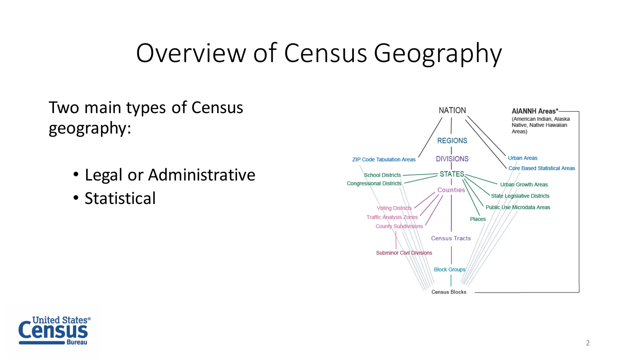
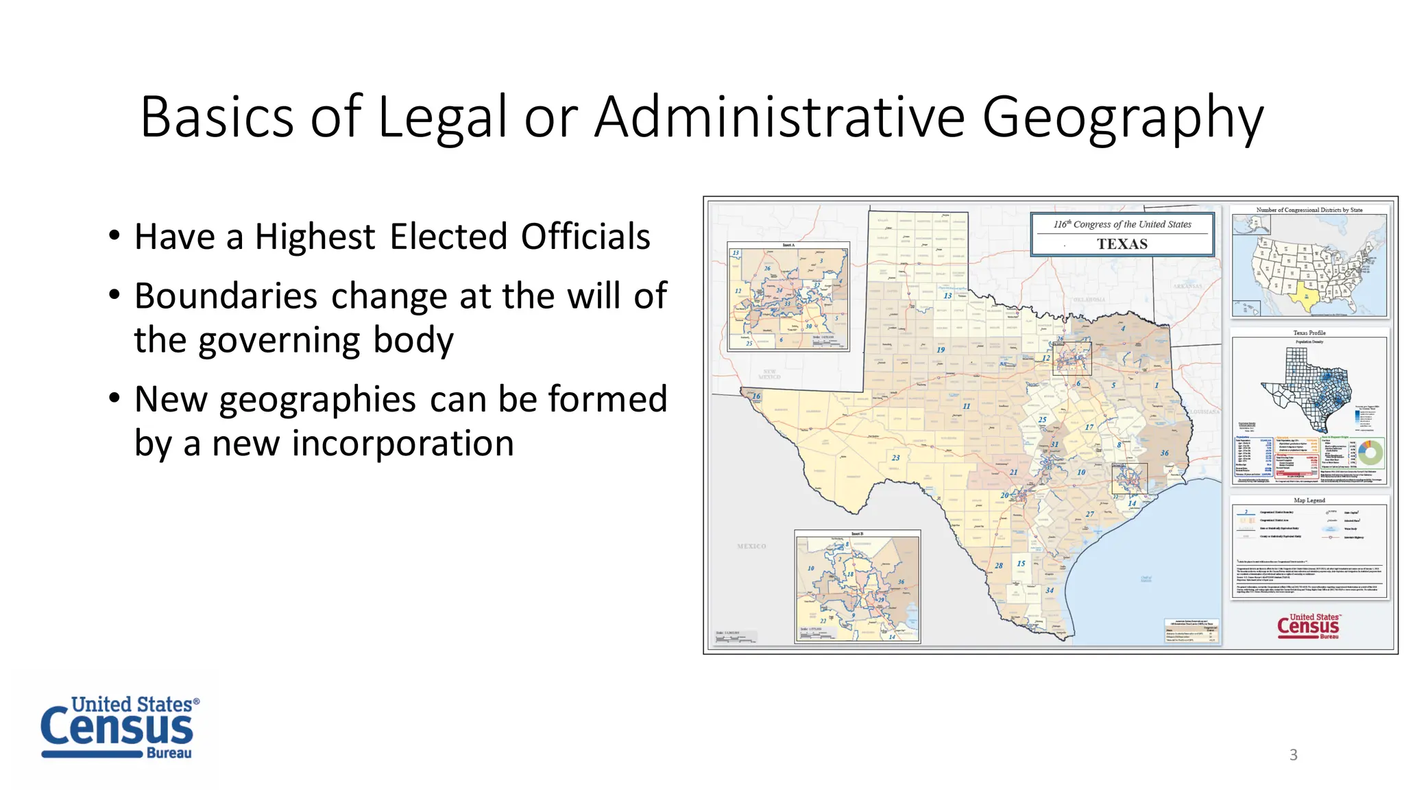
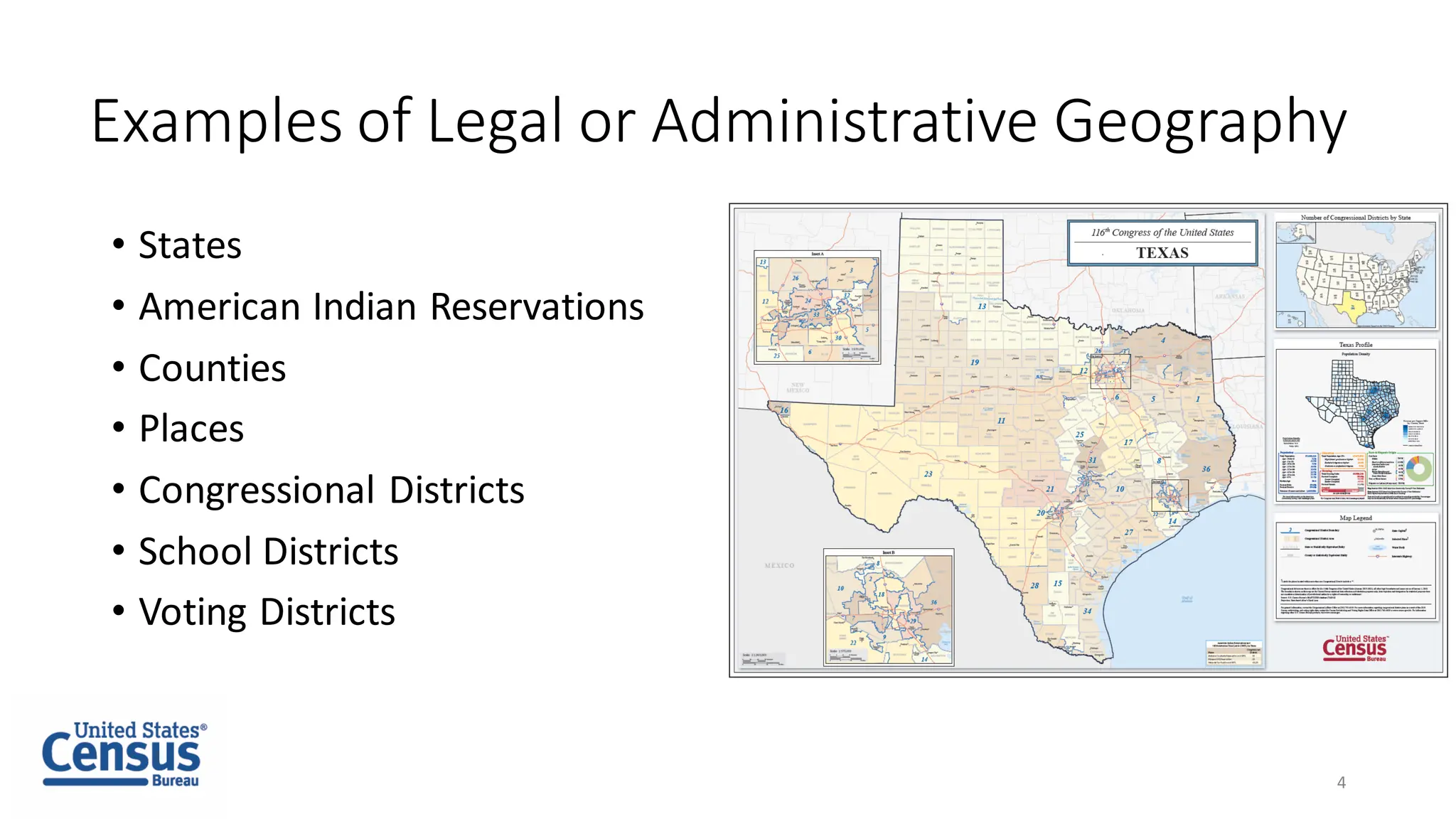
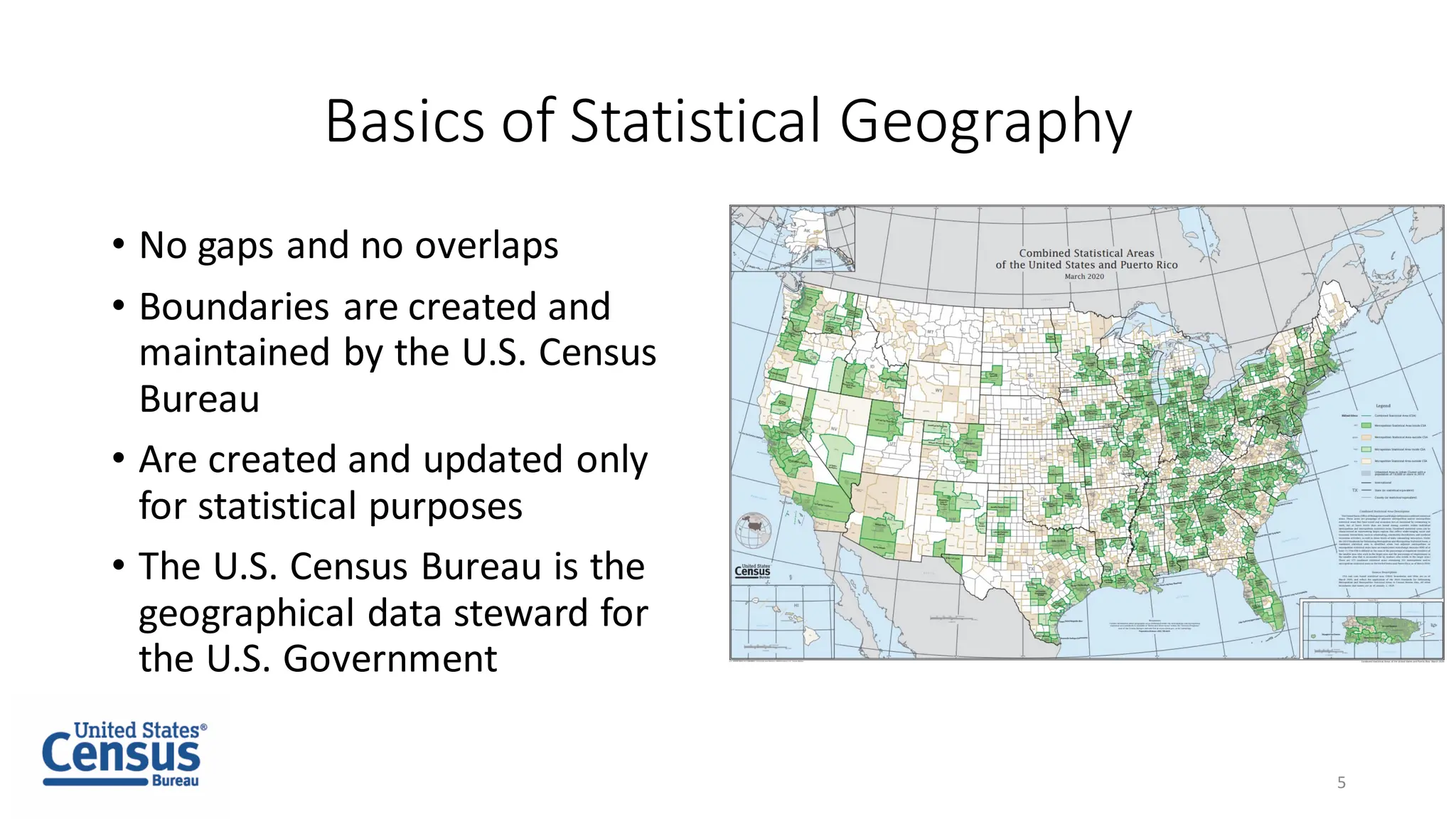
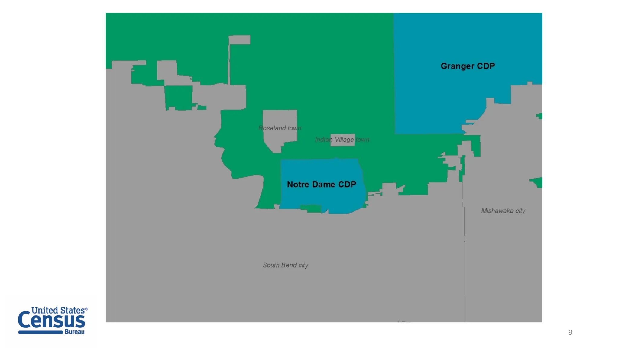
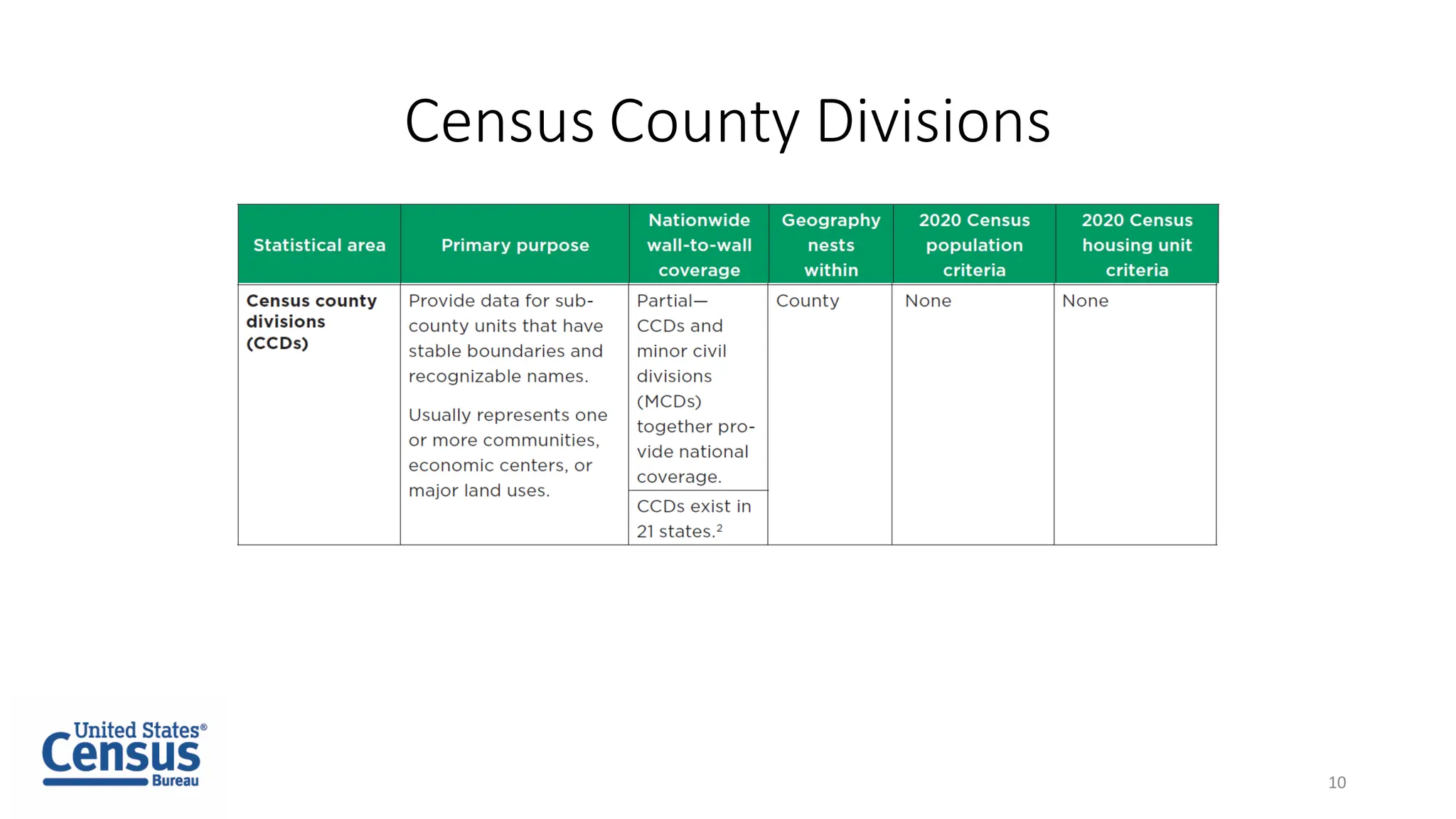
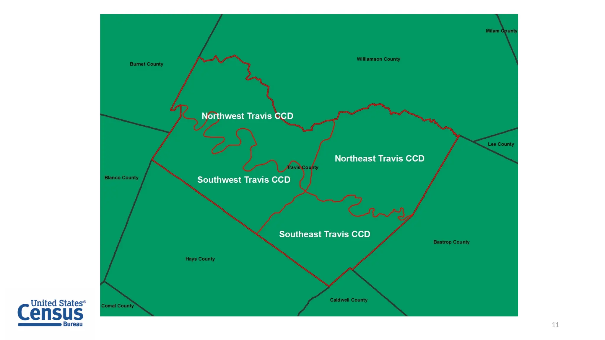
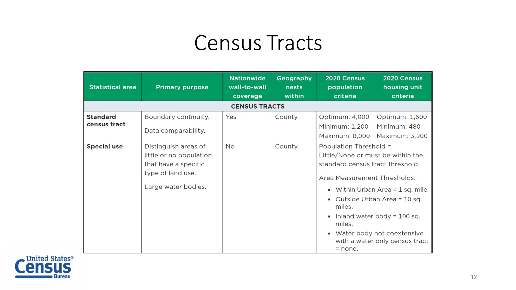
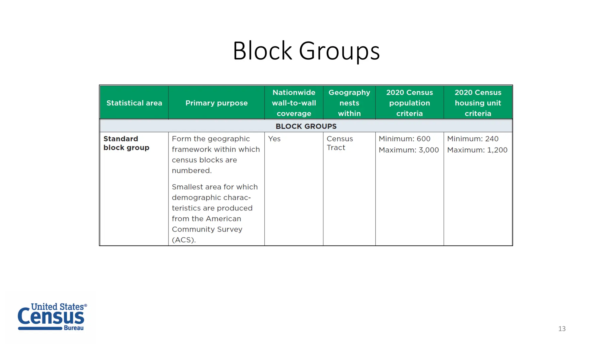
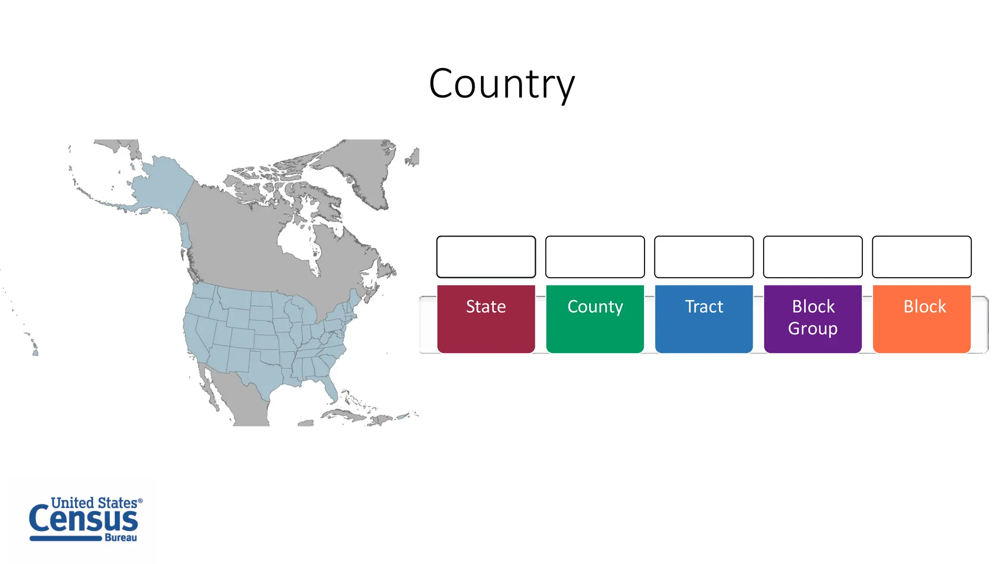
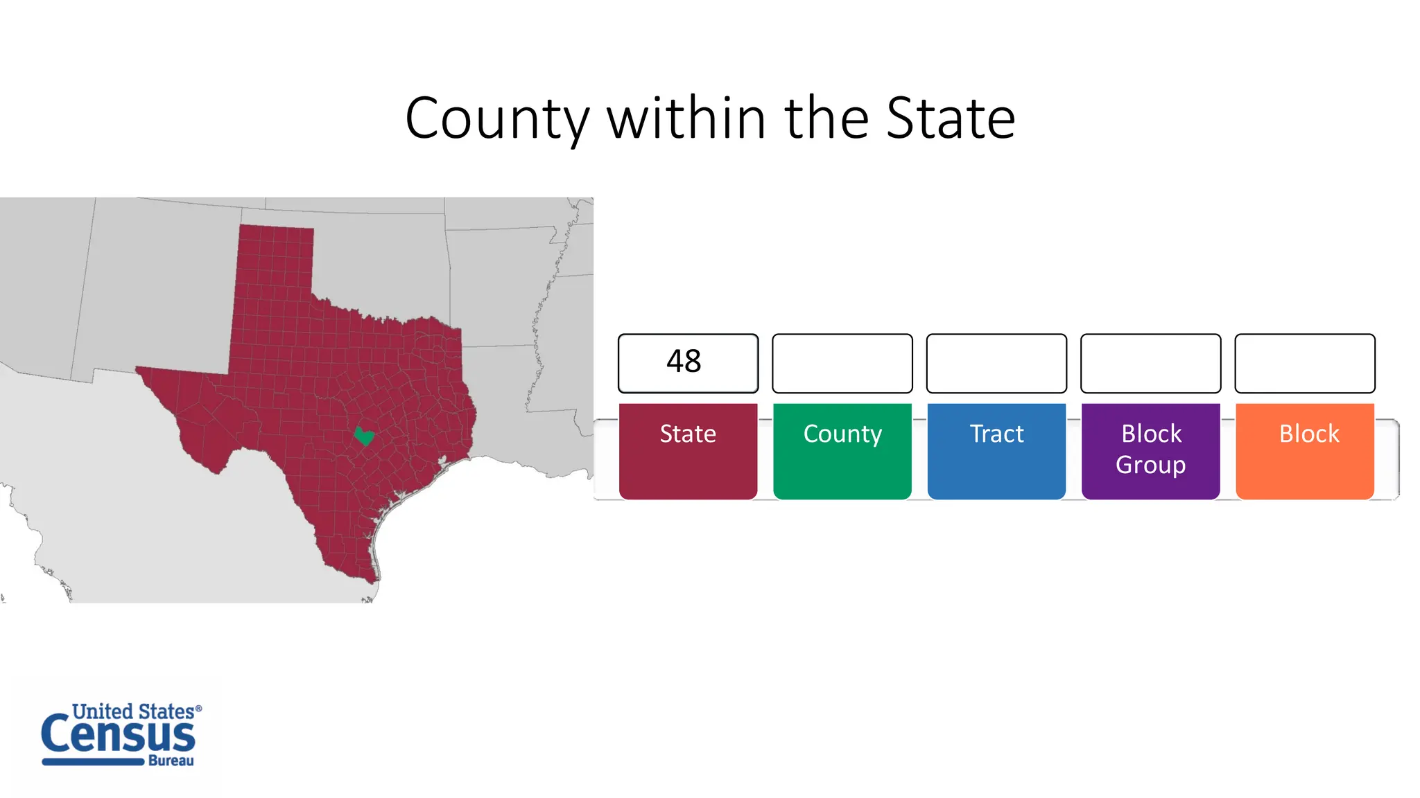
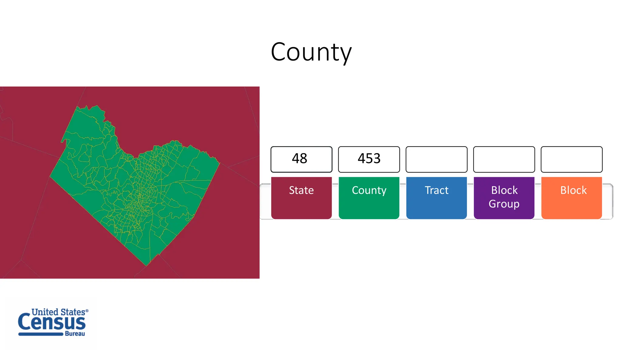
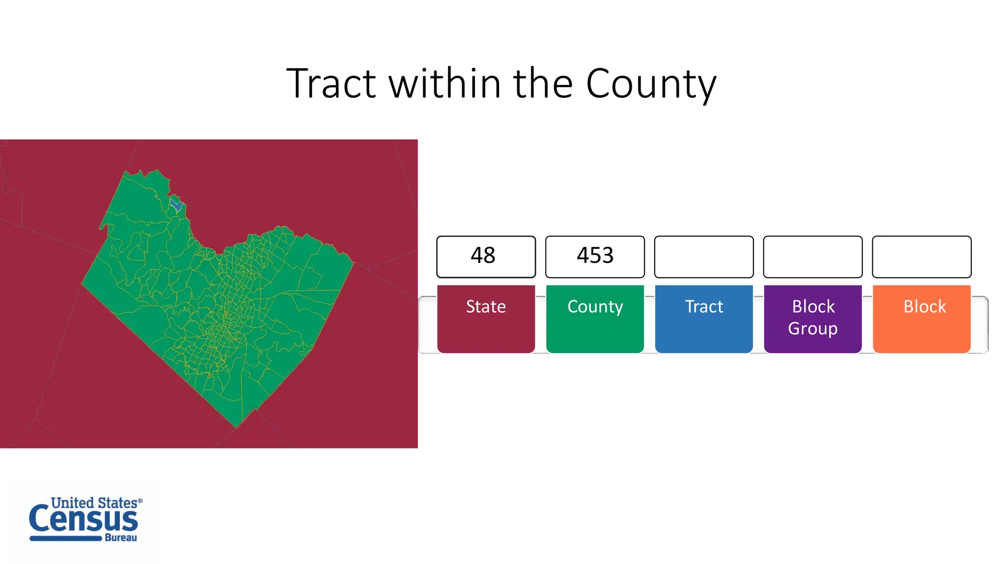
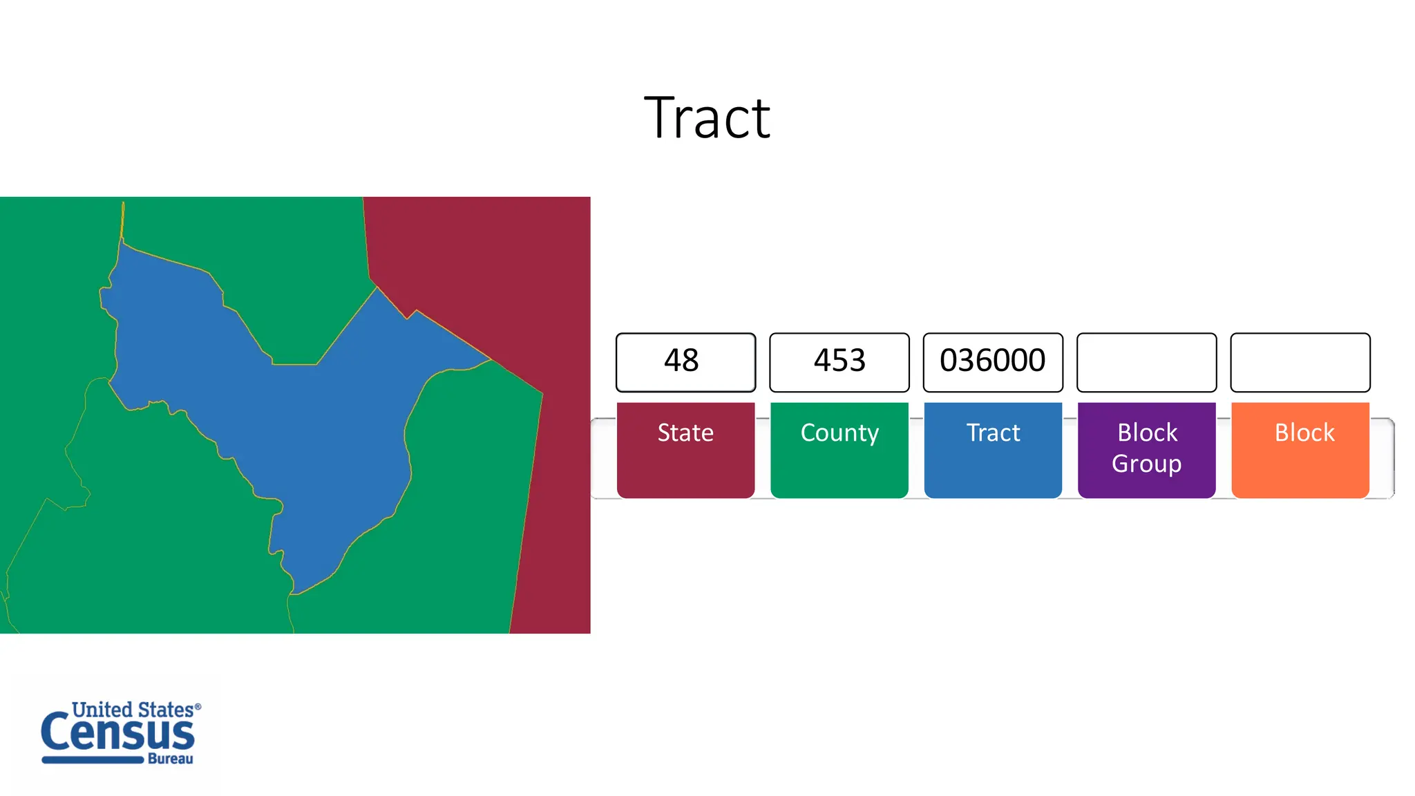
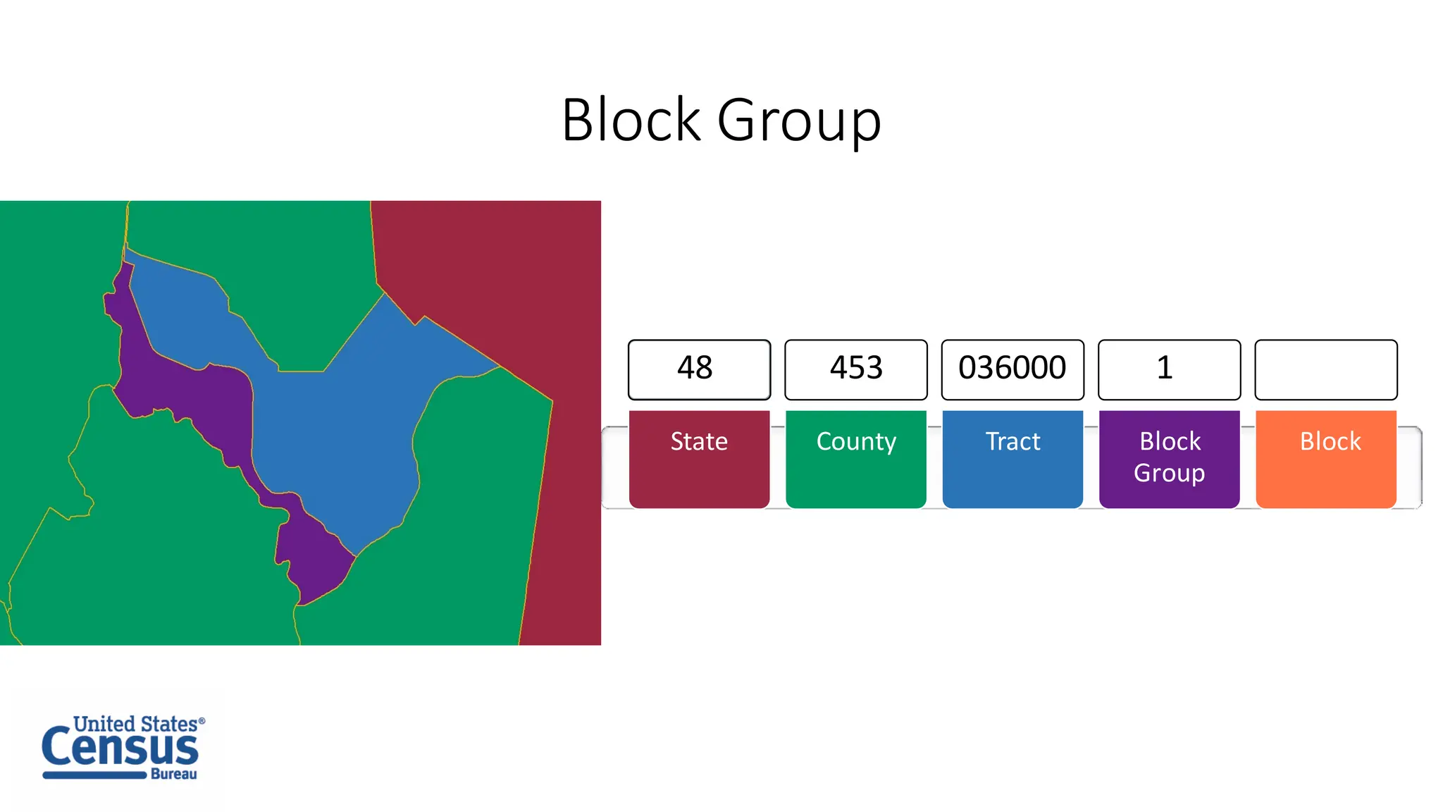
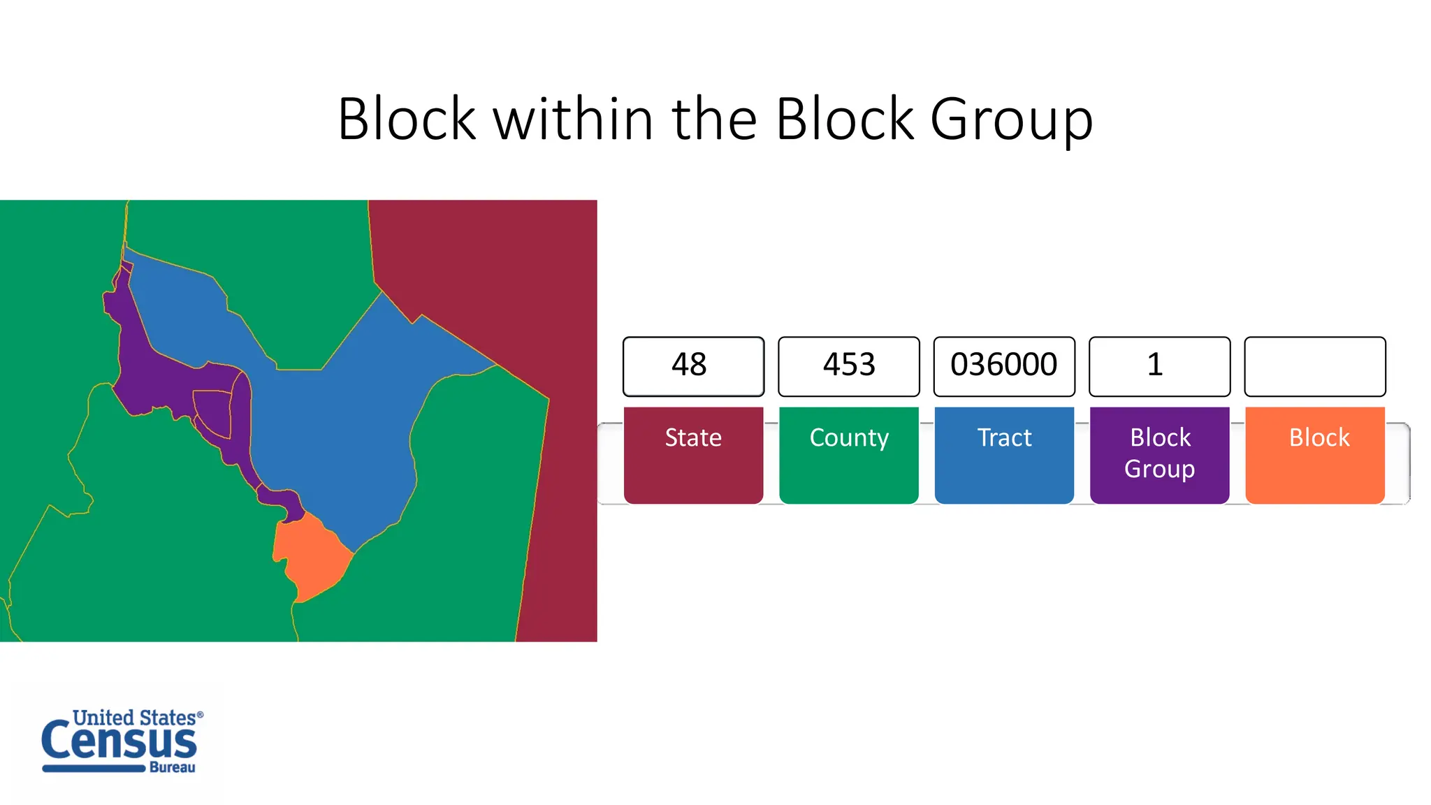
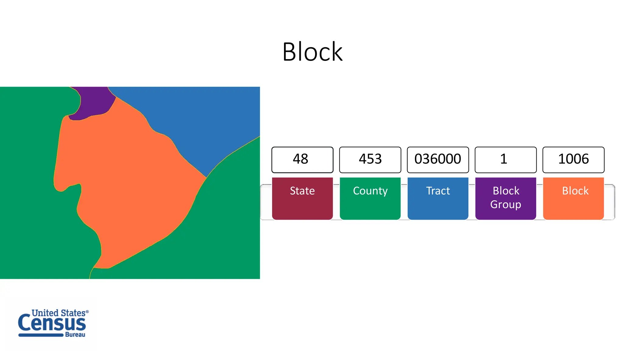
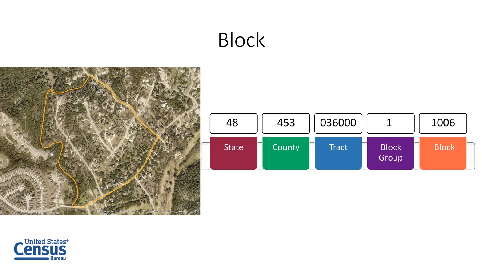
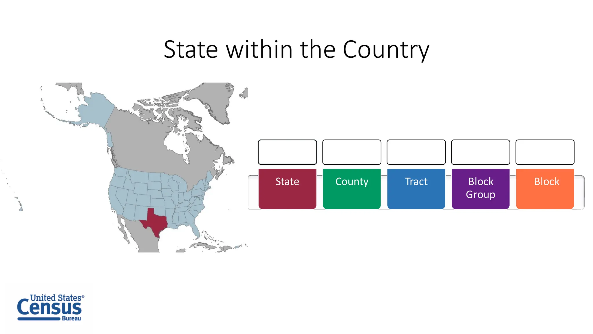
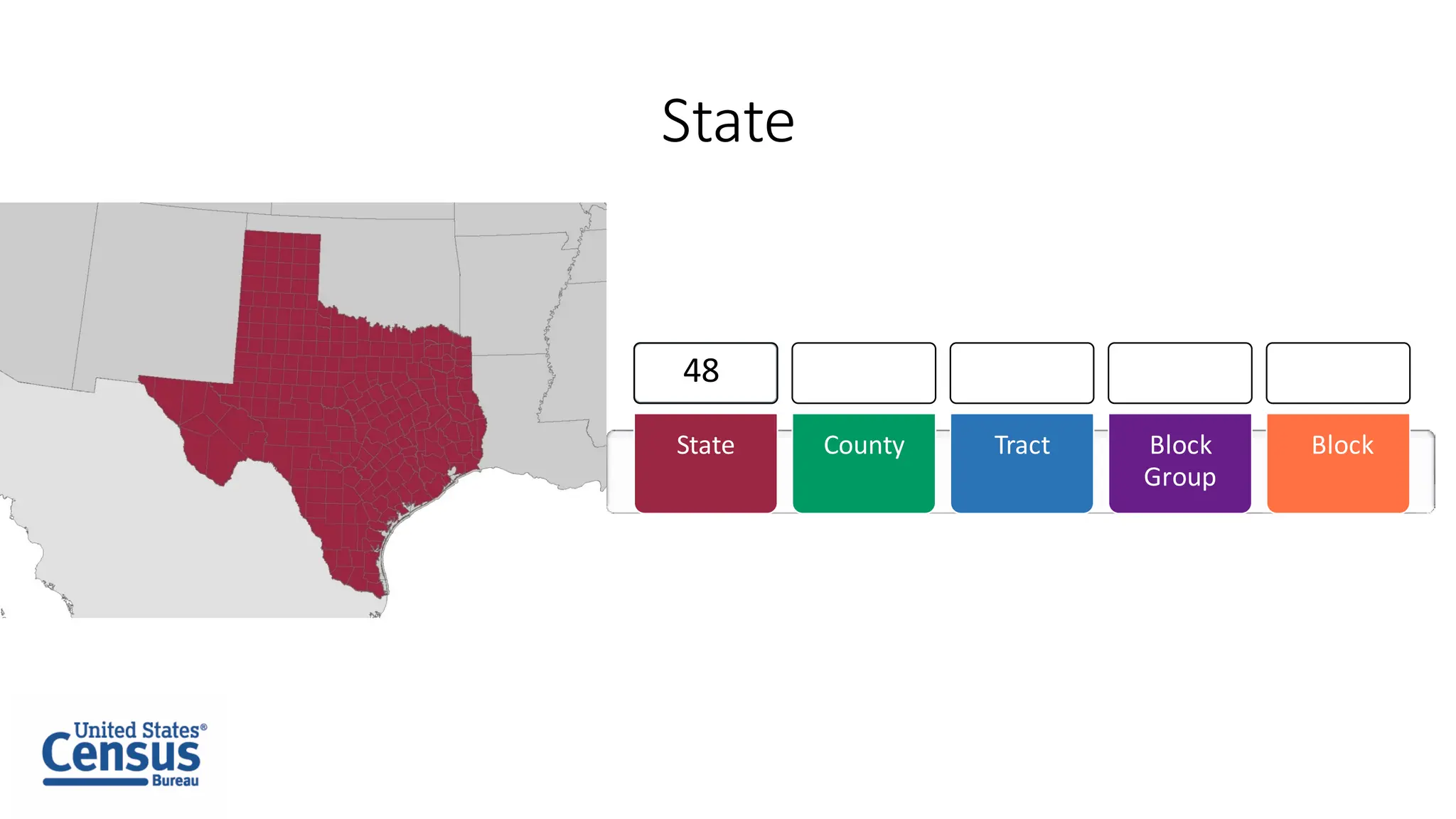
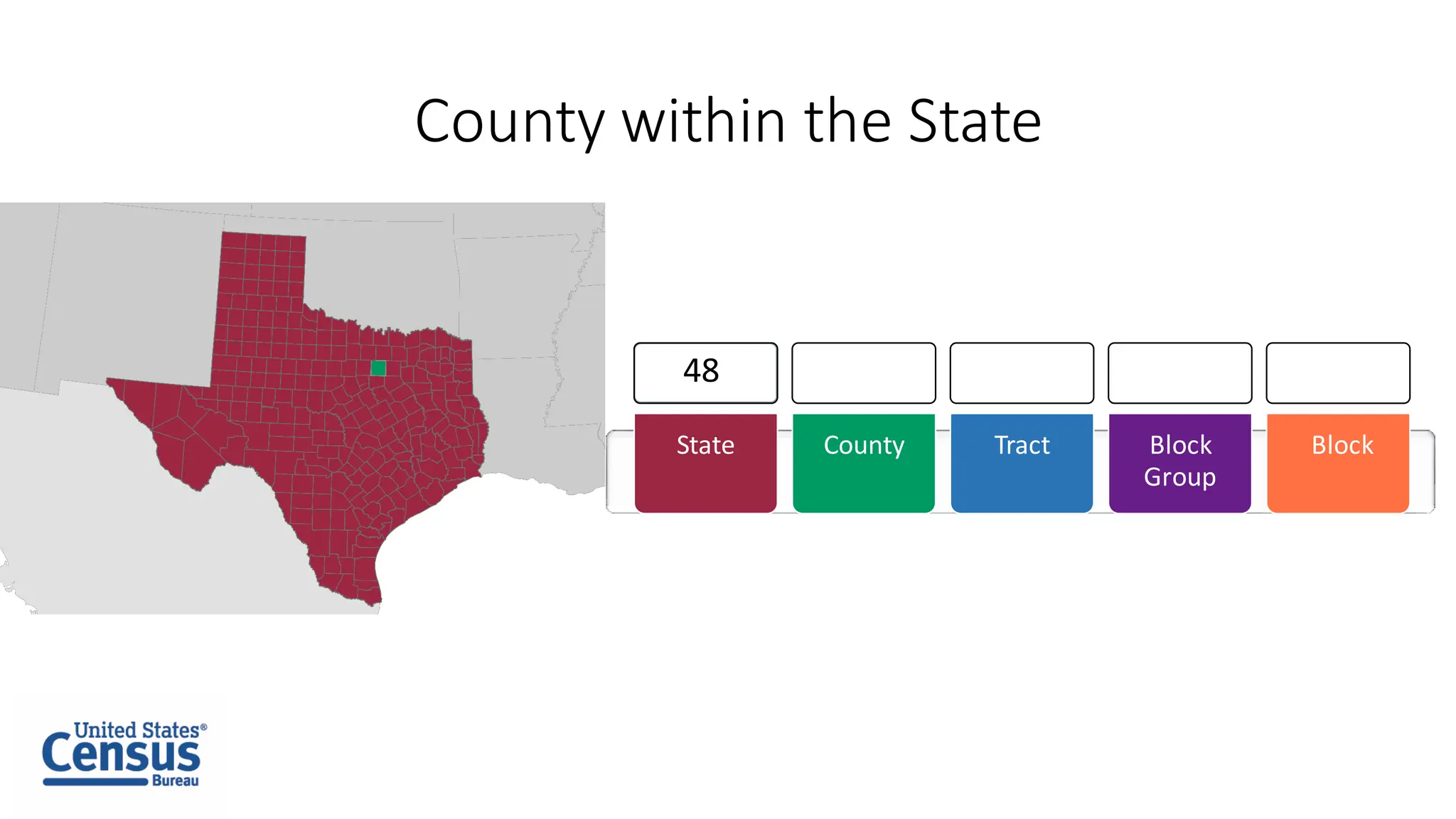
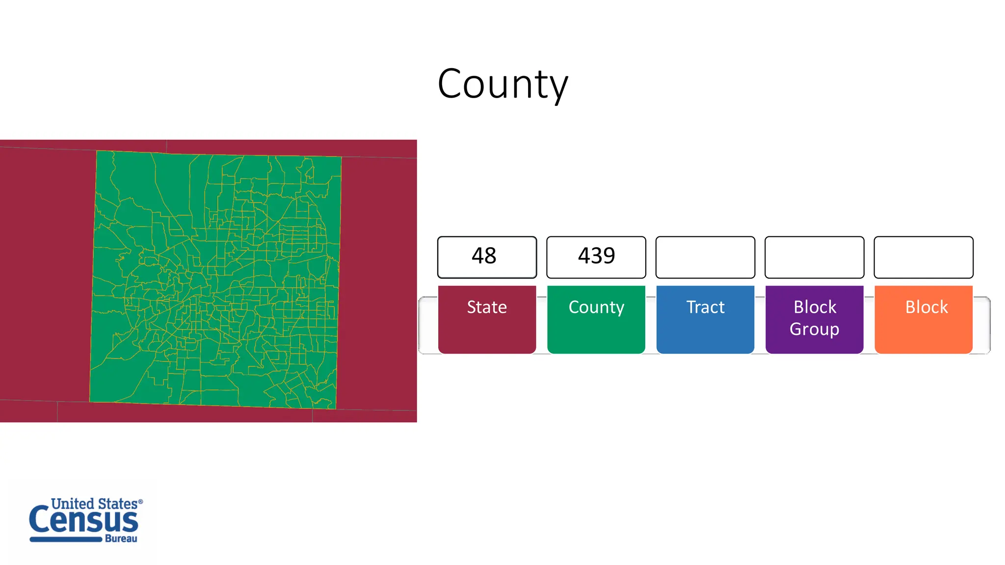
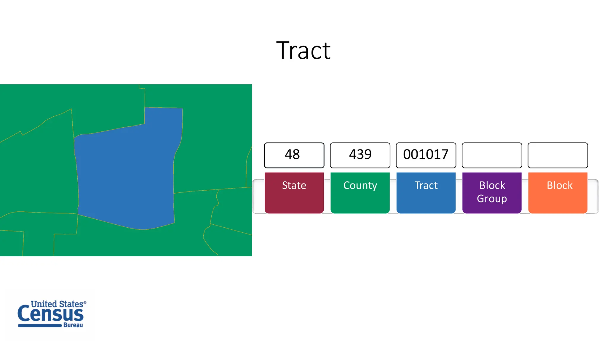
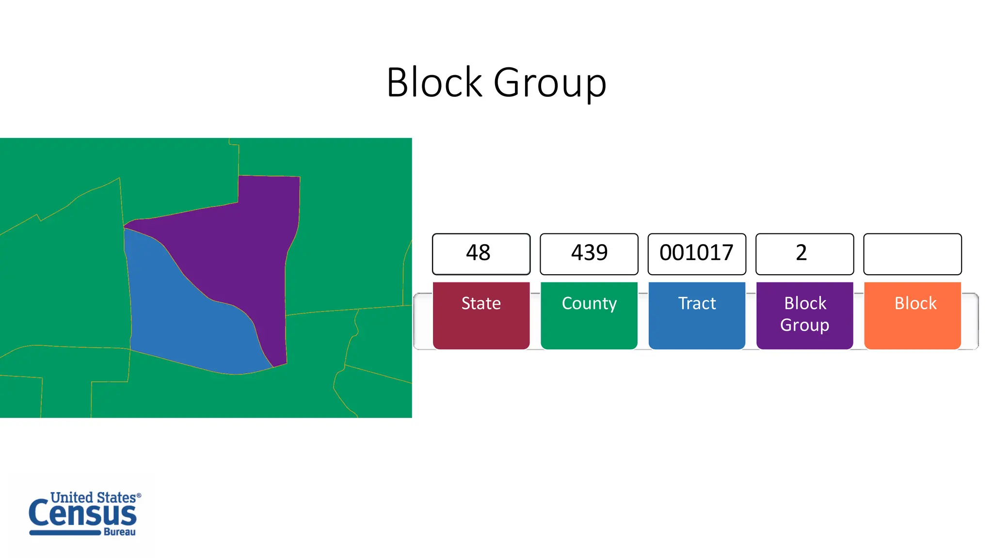
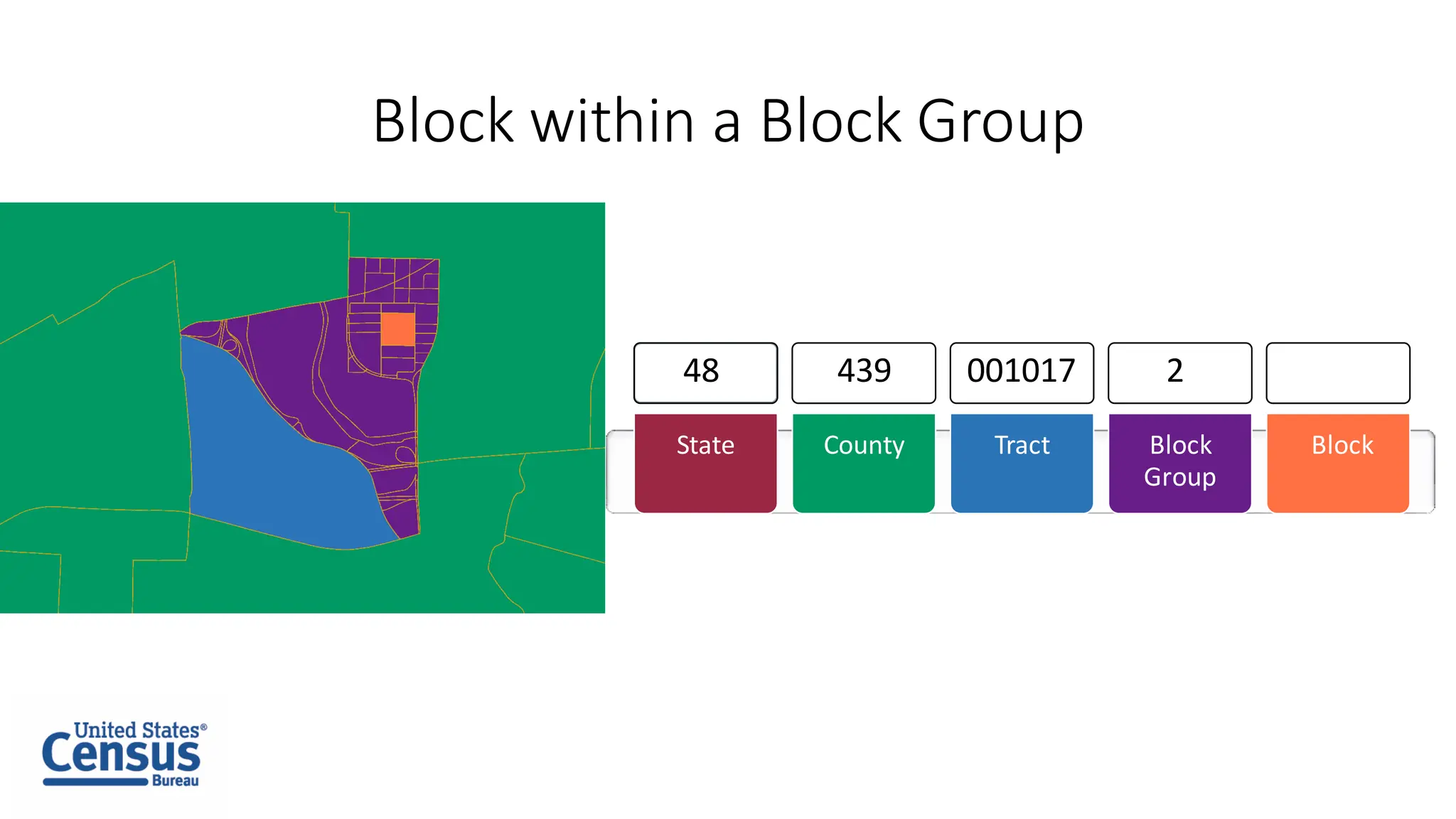
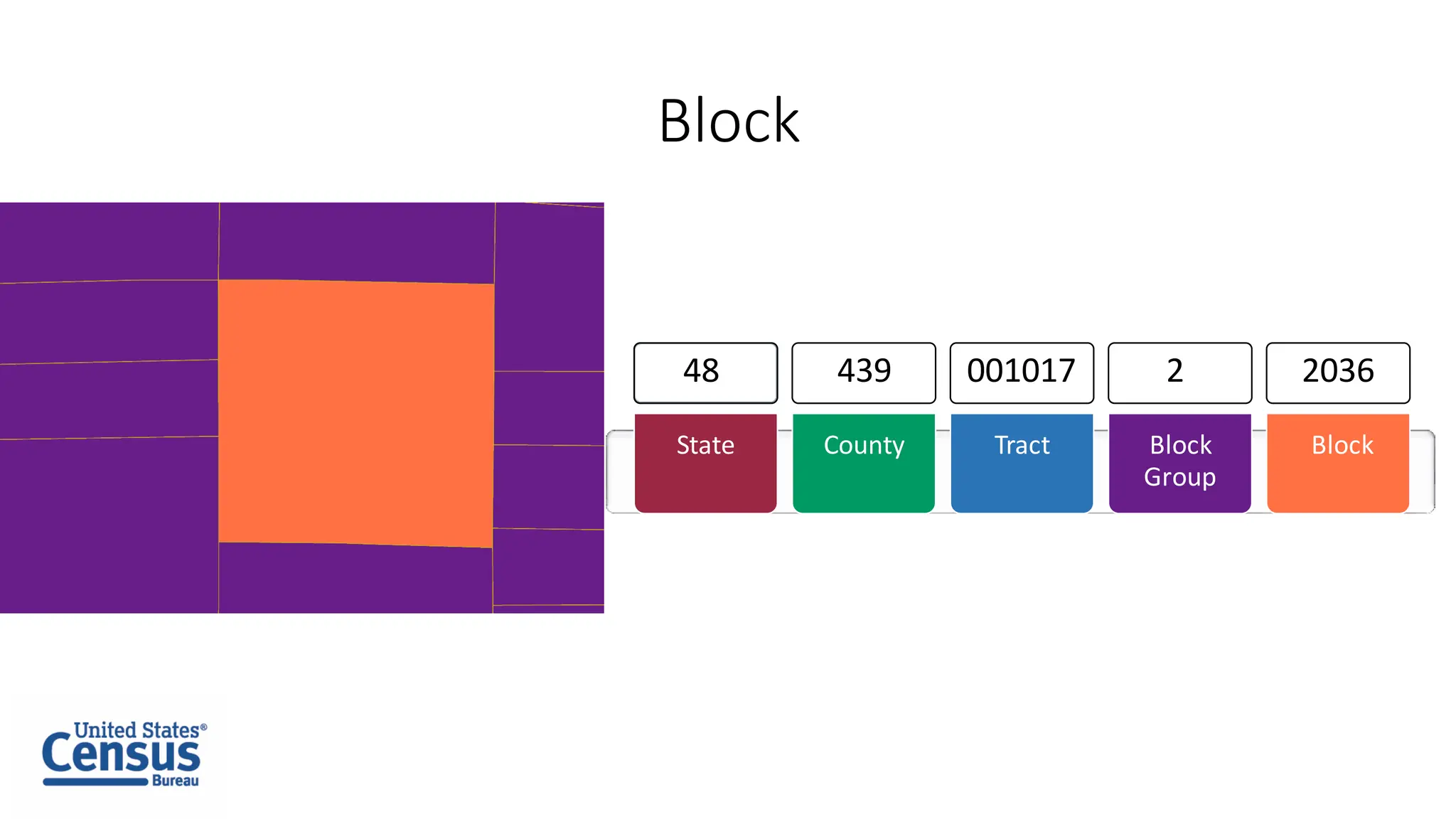
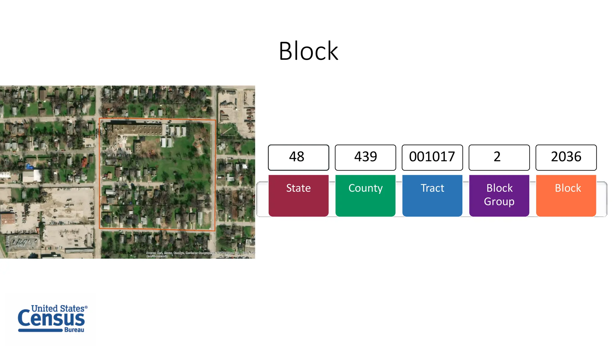
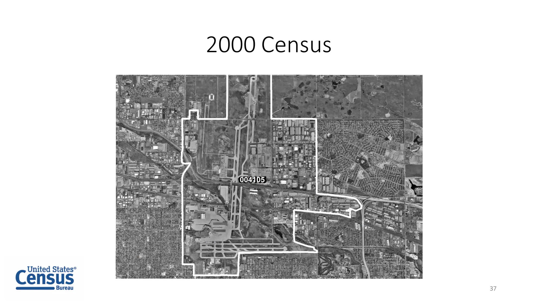
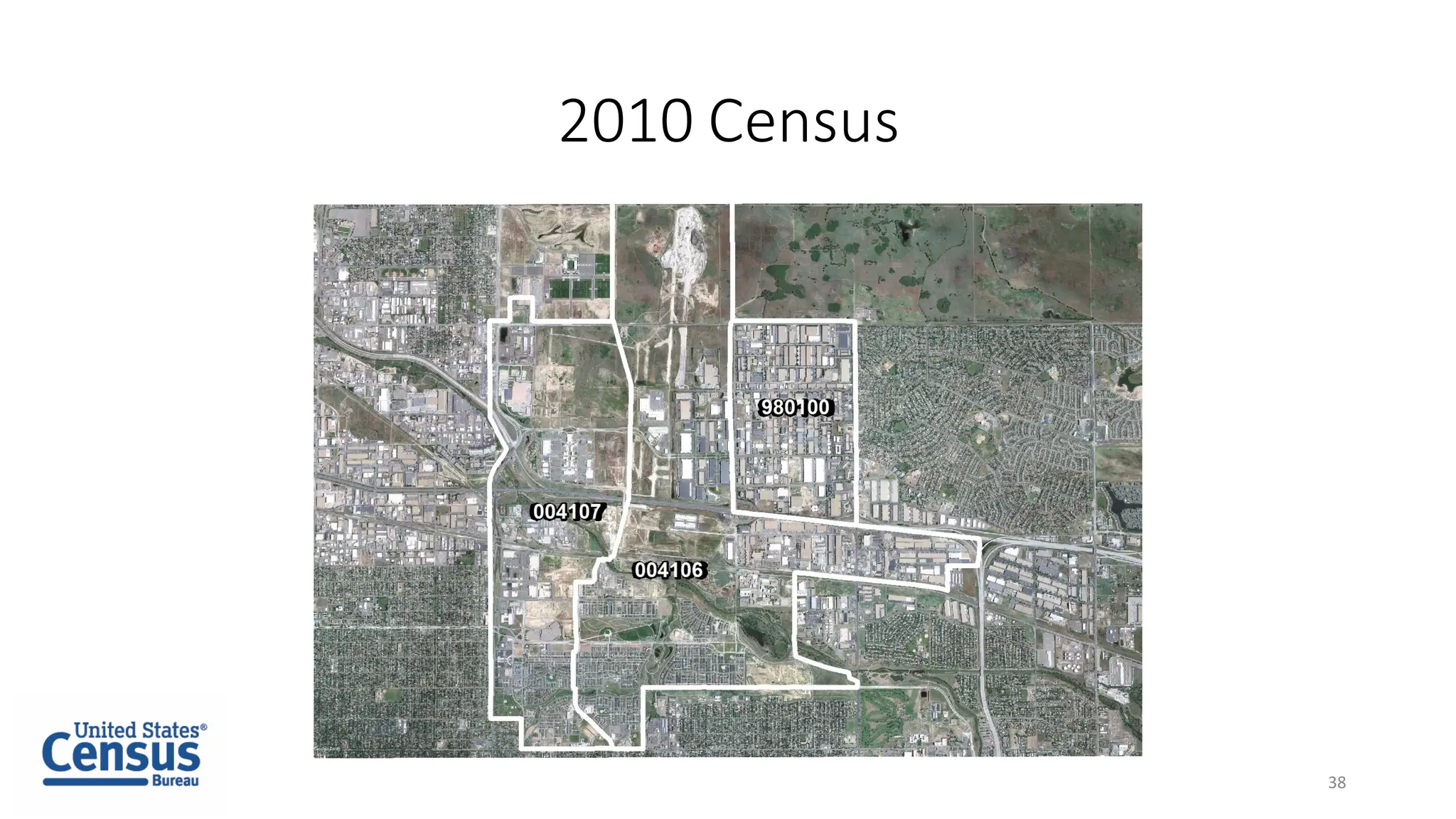
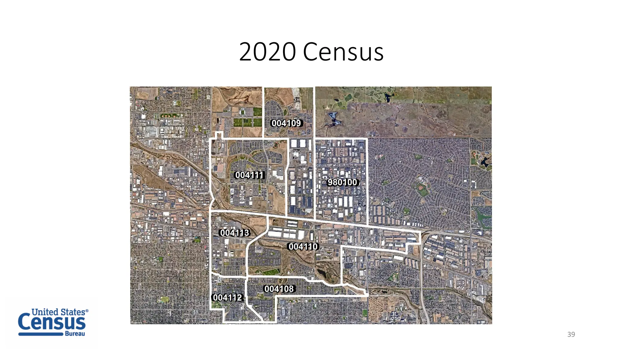
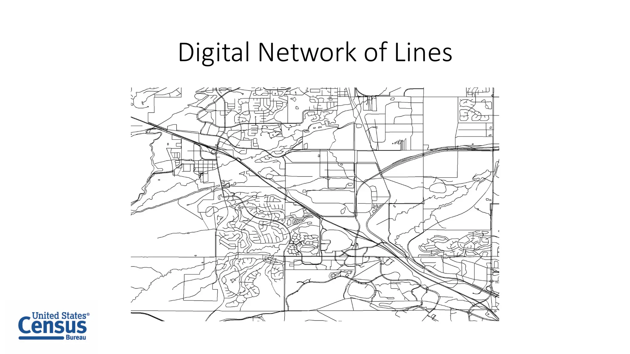
Understanding Statistical
Geography
Jim Castagneri
Lacey Loftin
1
Overview of Census Geography
Two main types of Census
geography:
• Legal or Administrative
• Statistical
2
Basics of Legal or Administrative Geography
• Have a Highest Elected Officials
• Boundaries change at the will of
the governing body
• New geographies can be formed
by a new incorporation
3
Examples of Legal or Administrative Geography
• States
• American Indian Reservations
• Counties
• Places
• Congressional Districts
• School Districts
• Voting Districts
4
Basics of Statistical Geography
• No gaps and no overlaps
• Boundaries are created and
maintained by the U.S. Census
Bureau
• Are created and updated only
for statistical purposes
• The U.S. Census Bureau is the
geographical data steward for
the U.S. Government
5
Examples of Statistical Geography
• State
• County
• Census Tract
• Census Block Group
• Census Block
• Census Designated Places(CDPs)
• Census County Divisions
6
Tribal Statistical Geographies
• Tribal Census Tracts (TCTs).
• Tribal block groups (TBGs).
• Census Designated Places (CDPs).
• Tribal Designated Statistical Areas (TDSAs).
• StateDesignatedTribalStatisticalAreas(SDTSAs).
• Oklahoma Tribal Statistical Areas (OTSAs).
• Statistical tribal subdivisions.
7
CensusDesignatedPlaces
8
9
Census County Divisions
10
11
Census Tracts
12
Block Groups
13
Country
State County Tract Block
Group
Block
State within the Country
State County Tract Block
Group
Block
State
State County Tract Block
Group
Block
48
County within the State
State County Tract Block
Group
Block
48
County
State County Tract Block
Group
Block
48 453
Tract within the County
State County Tract Block
Group
Block
48 453
Tract
State County Tract Block
Group
Block
48 453 036000
Block Group
State County Tract Block
Group
Block
48 453 036000 1
Block within the Block Group
State County Tract Block
Group
Block
48 453 036000 1
Block
State County Tract Block
Group
Block
48 453 036000 1 1006
Block
State County Tract Block
Group
Block
48 453 036000 1 1006
Country
State County Tract Block
Group
Block
State within the Country
State County Tract Block
Group
Block
State
State County Tract Block
Group
Block
48
County within the State
State County Tract Block
Group
Block
48
County
State County Tract Block
Group
Block
48 439
Tract within the County
State County Tract Block
Group
Block
48 439
Tract
State County Tract Block
Group
Block
48 439 001017
Block Group
State County Tract Block
Group
Block
48 439 001017 2
Block within a Block Group
State County Tract Block
Group
Block
48 439 001017 2
Block
State County Tract Block
Group
Block
48 439 001017 2 2036
Block
State County Tract Block
Group
Block
48 439 001017 2 2036
Tracts over Time
• First used in the 1910 census in some urban areas
• Full coverage in 1990
• Population Growth can require tract splits
• Maintain Comparability
• Numbering
36
2000 Census
37
2010 Census
38
2020 Census
39
What is TIGER?
Digital Network of Lines
Live Demonstration
42
Thank you!
james.d.castagneri@census.gov
lacey.e.loftin@census.gov
43

Understanding statistical geography