The Geographic Archaeological Information System of Rome between Intellectual Property Rights and Privacy Protection Law
•
1 like•1,383 views

Presentation by M.Stacca, M.Serlorenzi, V.Bo,I.Jovine, Sitar EAA 2014 session: Open Access and Open Data in Archaeology Istanbul, Turkey 13 September 2013

Recommended
Recommended
More Related Content
Viewers also liked
Viewers also liked (20)
Similar to The Geographic Archaeological Information System of Rome between Intellectual Property Rights and Privacy Protection Law
Similar to The Geographic Archaeological Information System of Rome between Intellectual Property Rights and Privacy Protection Law (20)
More from ariadnenetwork
More from ariadnenetwork (20)
Recently uploaded
Recently uploaded (20)
The Geographic Archaeological Information System of Rome between Intellectual Property Rights and Privacy Protection Law
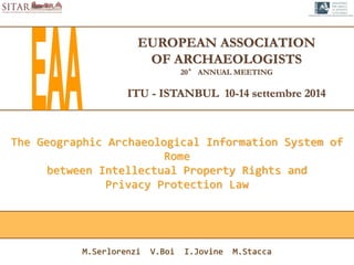
- 1. EUROPEAN ASSOCIATION OF ARCHAEOLOGISTS 20° ANNUAL MEETING ITU - ISTANBUL 10-14 settembre 2014 The Geographic Archaeological Information System of Rome between Intellectual Property Rights and Privacy Protection Law M.Serlorenzi V.Boi I.Jovine M.Stacca
- 2. The Archeological Geographic Information System of Rome ssba-rm.gis@beniculturali.it Istanbul 10-14 September EAA2014 A project of Special Superintendence for Archeological Heritage of Rome Ministry for Cultural Assets and Activities and for Tourism
- 3. STRONG POINTS • The project is published by a state agency • Is produced with public funding • Processes public data SITAR Project: the presentation of data ssba-rm.gis@beniculturali.it Istanbul 10-14 September EAA2014 PURPOSE OF THE PROJECT Producing a complete and updated database of the archaeological heritage of Rome. Certified by the Ministry of Culture. Useful for the urban planning policies.
- 4. D.Lgs. 82/2005: CAD, DIGITAL ADMINISTRATION CODE D.Lgs. 36/2006: RE-USE OF DOCUMENTS IN PUBLIC ADMINITRATION D.L. 179/2012: Decreto Sviluppo 2.0 D.Lgs. 33/2013: RE-ORGANIZATION OF REGULATION CONCERNING OBLIGATIONS OF ADVERTISEMENT, TRANSPARENCY AND PUBLICATION OF INFORMATIONS BY THE PUBLIC ADMINISTRATIONS Faro Convention (1948) ratified by Italy 27 FEBRUARY 2013 OPEN DATA FOR THE ARCHAEOLOGICAL HERITAGE PROTECTION Italian Regulatory Framework ssba-rm.gis@beniculturali.it Istanbul 10-14 September EAA2014 A Public Data IS "a data that everyone can know" "a data produced by public administrations within their institutional goals" but also
- 5. ssba-rm.gis@beniculturali.it Istanbul 10-14 September EAA2014 THE SITAR PROJECT AS A CULTURAL MEDIATOR SITAR as a mediator between information of a specialist nature and civil society
- 6. The archaeological data fall within the category of spatial data of general interest and they must be shared with organizations in charge of the management of the territory. Direttiva 2007/2/CE INSPIRE Infrastructure for Spatial Information in the European Community ssba-rm.gis@beniculturali.it Istanbul 10-14 September EAA2014
- 7. SITAR CODE OWNER AUTHORITY MANAGING OFFICIAL PROPERTIES REAL ESTATE RESEARCH METHOD START AND END OF RESEARCH SCIENTIFIC TEAM APPLICANT RESEARCHER WORK DESCRIPTION ARCHIVE REFERENCES DISTRICT MUNICIPALITY AREA ADDRESS GEO-REFERENCING CODE GEO-REFERENCING METHOD KIND OF REPRESENTATION DATA PUBLICATION LEVEL 1 The Origin of the Information ADMINISTRATIVE DATA ssba-rm.gis@beniculturali.it Istanbul 10-14 September EAA2014 The Right to Information and the Respect for Privacy 1 1 The “history” of the archaeological investigation
- 8. SITAR CODE OWNER AUTHORITY MANAGING OFFICIAL PROPERTIES REAL ESTATE RESEARCH METHOD START AND END OF RESEARCH SCIENTIFIC TEAM APPLICANT RESEARCHER WORK DESCRIPTION ARCHIVE REFERENCES DISTRICT MUNICIPALITY AREA ADDRESS GEO-REFERENCING CODE GEO-REFERENCING METHOD KIND OF REPRESENTATION DATA PUBLICATION LEVEL 1 The Origin of the Information ADMINISTRATIVE DATA ssba-rm.gis@beniculturali.it Istanbul 10-14 September EAA2014 1 1 1 1 The identity of those who produced the archaeological record The Right to Information and the Respect for Privacy
- 9. DATA PUBLICATION LEVEL 2 The Archaeological Partition SCIENTIFIC INFORMATION ssba-rm.gis@beniculturali.it Istanbul 10-14 September EAA2014 The Right of Authorship SITAR CODE RESEARCH METHOD OBJECTIVE DEFINITION SPECIFIC DEFINITION INTERPRETATION’S DEFINITION GEO-REFERENCING CODE GEO-REFERENCING METHOD KIND OF REPRESENTATION DESCRIPTION BUILDING TECHNIQUE MAXIMUM ALTITUDE MINIMUM ALTITUDE CRONOLOGY 11 Each partition is distinguished on the basis of a criterion of chronological and functional homogeneity
- 10. DATA PUBLICATION AND QUALITY OF PUBLISHED DATA ssba-rm.gis@beniculturali.it Istanbul 10-14 September EAA2014 The Ministry has established that the time to carry out this control must not exceed one year after the end of the work in the Archeological site.
- 11. DATA PUBLICATION LEVEL 3 Archaeological Unit SYNTHESIS OF ARCHAEOLOGICAL INTERPRETATION ssba-rm.gis@beniculturali.it Istanbul 10-14 September EAA2014 The archaeological units contribute to the identification of historical and topographic sets that have formed the different historical landscapes of the city and its region.
- 12. DATA PUBLICATION E RAW DATA ssba-rm.gis@beniculturali.it Istanbul 10-14 September EAA2014 The digital copy of the documents that constitute the starting information used to implement the database is attached to each record.
- 13. PUBLICATION LICENSE ssba-rm.gis@beniculturali.it Istanbul 10-14 September EAA2014 “Italian Guidelines for the enhancement of public information" Supranational interoperability and possibility of maximum reuse of the data.
- 14. PUBLICATION LICENSE ssba-rm.gis@beniculturali.it Istanbul 10-14 September EAA2014 SITAR CODE OWNER AUTHORITY MANAGING OFFICIAL PROPERTIES REAL ESTATE RESEARCH METHOD START AND END OF RESEARCH SCIENTIFIC TEAM APPLICANT RESEARCHER WORK DESCRIPTION ARCHIVE REFERENCES DISTRICT MUNICIPALITY AREA ADDRESS GEO-REFERENCING CODE GEO-REFERENCING METHOD KIND OF REPRESENTATION LEVEL 1 The Origin of the Information “To support the ARIADNE Project purposes and to publicize the valuable informative heritage of its Repositories, SSBAR will provide the shareable and already available SITAR dataset related to the s.c. ORIGINI DELL’INFORMAZIONE (in acronym OI), in other words the “Information Sources” intended as the georeferencing, administrative (with exclusion of the natural or legal personal informations different from scientific équipe persons; the real estate data; the costs of interventions), methodological, temporal informations and metadata, and short scientific references of each archaeological research, preventive digging, geophysical/geological survey, topographical study, monograph research on a single monument, etc., carried out in the territory of Cities of Rome and Fiumicino, since about 1860 up to 2014”.
- 15. The adoption of this type of license allows for derivative works to preserve information about the source of scientific data. PUBLICATION LICENSE ssba-rm.gis@beniculturali.it Istanbul 10-14 September EAA2014 LEVEL 2 The Archaeological Partition SCIENTIFIC INFORMATION The only requirement to cite the source at the time of re-use SITAR CODE RESEARCH METHOD OBJECTIVE DEFINITION SPECIFIC DEFINITION INTERPRETATION’S DEFINITION GEO-REFERENCING CODE GEO-REFERENCING METHOD KIND OF REPRESENTATION DESCRIPTION BUILDING TECHNIQUE MAXIMUM ALTITUDE MINIMUM ALTITUDE CRONOLOGY
- 16. www.facebook.com/pages/SITAR-Sistema-Informativo-Territoriale-Archeologico-di-Roma you can access the SITAR WebGIS at http://sitar.archeoroma.beniculturali.it/ http:// webgis.archeoroma.beniculturali.it/sitar/ ssba-rm.gis@beniculturali.it Istanbul 10-14 September EAA2014