Presented by Michael Dingkuhn at the CCAFS Workshop on Developing Climate-Smart Crops for a 2030 World, ILRI, Addis Ababa, Ethiopia, 6-8 December 2011.
Presentation of Andre Nassar for the "2nd Workshop on the Impact of New Technologies on the Sustainability of the Sugarcane/Bioethanol Production Cycle"
Apresentação de Marcos S. Buckeridge realizada no "2nd Workshop on the Impact of New Technologies on the Sustainability of the Sugarcane/Bioethanol Production Cycle"
Date / Data : Novr 11th - 12th 2009/
11 e 12 de novembro de 2009
Place / Local: CTBE, Campinas, Brazil
Event Website / Website do evento: http://www.bioetanol.org.br/workshop5
A spatial analysis: creating similarity domains for targeted research sites i...Joanna Hicks
This spatial analysis was commissioned by ACIAR to develop similarity domains for targeted research sites in Zimbabwe based on climate, production, market access, and population data. The objectives were to enhance adoption of farming technologies and assist funding bodies to target high-impact regions. Climate, soil, population, and other data layers were overlaid to create six similarity domains centered around existing research sites. Agricultural potential analysis showed a large yield gap between current low-input yields and simulated high-input yields across all domains, indicating room for improvement through investments and interventions.
The 2011 Utah Grasshopper and Mormon Cricket Report found that Mormon cricket infestations increased 55% from 2010 to 98,449 acres statewide, while grasshopper infestations decreased 49% to 415,000 acres. A total of 33,498 acres were treated for grasshoppers in 2011 at a cost of $319,488, with the state of Utah, Bureau of Land Management, and private landowners contributing funds. The Utah Department of Agriculture and Food also operates a cost-share program that reimburses private landowners 75% of treatment costs for grasshoppers or Mormon crickets on privately owned land.
Workshop Trade-off Analysis - CGIAR_20 Feb 2013_Group discussion_Harmonizatio...LotteKlapwijk
The document discusses different levels of analyzing land use systems from a high level analysis of tradeoffs at the system level to more detailed analyses incorporating spatial and human factors. It presents four frameworks moving from analyzing system properties to incorporating spatial detail, people, and dynamic agent-based modeling. A variety of indicators and metrics are proposed for evaluating land use systems across different contexts and scales.
The spatial aggregation of agricultural intensity. Felix TeillardJoanna Hicks
This document discusses mapping agricultural intensity in France to better target conservation policies. It develops an intensity indicator called Input Cost per hectare (IC/ha) that is computed using farm account data and estimated at a high resolution. The results show strong spatial segregation and aggregation of intensity within regions. Areas of low and high intensity form distinct clusters, indicating opportunities to better target "improvement" measures at sensitive areas and "protection" measures at high quality areas. Mapping intensity at a fine scale provides insights to move conservation policy from theory to practice.
1) The document discusses three approaches to estimate national-level activity data on forest change using total land-use area with no conversion data, total land-use area with spatially explicit data including changes between categories, and conversion data from remote sensing.
2) It describes three tiers of emission factors - Tier 1 using default IPCC values, Tier 2 using country-specific factors, and Tier 3 using high-resolution models and measurements.
3) Tables and figures show examples of analyzing deforestation and degradation drivers by continent and how they change over phases of development.
MRV in REDD+: Deforestation and forest degradation driversCIFOR-ICRAF
This presentation was given by CIFOR scientist Louis Verchot on 28 November 2012 at a joint CIFOR and GOFC-GOLD (Global Observation of Forest Cover and Land Dynamics) UNFCCC COP18 side-event in Doha, Qatar.
This document discusses emerging carbon economies and savanna fire abatement projects in northern Australia. It describes the landscape and cultural heritage of northern Australia and significant development pressures. It highlights several existing projects that aim to shift fire regimes at large scales, reintroduce traditional burning practices, and accurately measure greenhouse gas emissions from savanna fires. These projects establish partnerships between Indigenous groups, government organizations, and private funders. They have helped reduce emissions and shift the timing of fires compared to baseline periods. The document advocates for policies and an industry structure that promotes Indigenous involvement and benefits from carbon projects on their lands.
This document discusses several key issues related to the Large Scale Biosphere Atmosphere Experiment in Amazonia (LBA), including carbon cycling and controls, atmospheric chemistry interactions, aerosol-cloud interactions, land use change effects, and the role of droughts. It provides background on topics like tropical deforestation drivers over time, the focus of the LBA experiment, carbon emissions from land use change, and forest cover changes in Amazonia from 2000-2005. Graphs and figures show data on deforestation rates in Brazil, greenhouse gas emissions in Brazil, precipitation and temperature trends, and aerosol distributions and impacts on clouds and radiation in Amazonia.
Cristina Branquinho "Improving ecosystem services in drylands: microclimate m...Global Risk Forum GRFDavos
This document summarizes a study on how microclimate affects the natural regeneration of forests in dryland areas of Portugal after agricultural abandonment. The study found that the rate of regeneration of holm oak trees depends on local microclimate conditions, with regeneration being faster in areas with higher potential solar radiation and slower in areas with lower potential solar radiation. The researchers developed a predictive model for holm oak regeneration based on microclimate variables that can help improve reforestation planning efforts. Validating the model over time showed it has potential for predicting natural regeneration patterns under different climate scenarios.
The document summarizes Tony Simons' speech on trees and forests for a healthy world by 2030. It discusses the challenges of population growth, inequality, and food insecurity. It presents paradigms for balancing ecological functioning, productivity, and income stability. It looks ahead to opportunities for knowledge transfer regarding agroforestry, forest definitions, and an integrated view of trees within and outside forests.
The document discusses trends, current situations, and policy options for reducing rural poverty in the São Francisco River Basin region of Brazil. It provides an overview of population trends, poverty levels, agricultural practices, water availability, and other driving forces in the region from 1991 to present. The presentation then examines problems like persistent poverty, water conflicts, and environmental impacts. It proposes that public policy could help manage agriculture, reduce poverty, and models the impacts of potential policy options like water pricing and restrictions. Data sources, economic models, and knowledge pathways are also referenced.
This spatial analysis created six similarity domains for targeted research sites in Zimbabwe based on climate, soil type, population, market access, and agricultural potential. The domains showed relatively low average travel times to markets but noted constraints to input access could still limit yields. While current average yields are below 1.75 tons/ha, the analysis found a continued high potential yield gap across the regions. It identified spatial areas that would most benefit from extrapolating targeted farming technologies from the research locations.
Energy as Motor of Seawater Reverse Osmosis Desalination DevelopmentDegrémont
This document summarizes information about reverse osmosis desalination and trends in energy consumption. It discusses how reverse osmosis works to treat brackish water and seawater, showing typical operating pressures and recovery rates. Energy consumption in desalination depends on factors like total dissolved solids, recovery rate, temperature, and membranes used. The document then charts historical energy consumption for desalination plants from the 1970s to present, showing a gradual decline. Future reductions may come from improved energy recovery devices, membranes, and pretreatment techniques. Emerging technologies like forward osmosis also have potential to significantly reduce energy use.
David Keith_Risk assessment of Australian ecosystemsTERN Australia
This document discusses using a risk assessment framework to evaluate the risk of collapse of Australian ecosystems, similar to the Red List approach used for species. It describes the key components and processes of ecosystems and outlines criteria for assessing risks based on declines in distribution, environmental degradation, and altered biotic processes. Functional variables are selected to represent each ecosystem, and thresholds are established to evaluate the severity of any declines. Outcomes would indicate the level of risk to each ecosystem and help identify the greatest threats. The goal is to train practitioners and develop risk assessments for selected Australian ecosystems to improve environmental reporting.
Smallholders’ agriculture at the tropical forest margin in cameroon opportuni...World Agroforestry (ICRAF)
This document discusses smallholder agriculture at the tropical forest margin in Cameroon and opportunities to promote agroforestry using a landscape approach. Smallholder farmers are a major driver of deforestation as they practice slash and burn agriculture and depend on forest resources. However, fallows and agroforests provide ecosystem services like carbon storage and biodiversity conservation. A landscape approach is needed to address production, ecosystem services, biodiversity, livelihoods, policies and institutions across scales in these complex landscapes. Research is analyzing the implications of land use change on environmental services and exploring entry points for agroforestry interventions.
Which actor holds the right to the land is going to determine how the resources will be used, so it follows that changes in tenure will have an influence on the landscape. This presentation uses various methods to look at the dynamic between land tenure and land use change in the Brazilian Amazon. This presentation was given during CIFOR’s Annual Meeting 2012, which was held on 1–5 October at the headquarters in Bogor, Indonesia.
Accompanying the agrarian transition in Laos. Guillaume LestrelinJoanna Hicks
This document summarizes research on opportunities and challenges for conservation agriculture (CA) in maize production areas in Laos. The research examined CA adoption across four agro-ecological zones representing different stages of agricultural intensification. Results showed the highest CA adoption levels occurred early in the intensification process and later during land degradation. The research concluded there are two key windows for CA interventions - early commodity production and late stages of diversification in degraded lands. Proper timing and extension efforts could make CA a viable alternative for smallholders.
2012 ASPRS Track, Forest cover loss in Papua New Guinea: How much does subsis...GIS in the Rockies
Deforestation rates in Papua New Guinea (PNG) are more rapid than the Brazilian Amazon. This high rate of forest degradation and loss largely impacts scientific understanding of biodiversity in PNG. While many factors have been linked to deforestation and land degradation in PNG, the relationship between agricultural practices and deforestation have not been fully examined. The effects of agricultural expansion have been overestimated in some areas due to population growth, the negative perception of swidden agriculture (slash-and-burn), and difficulties in discerning agriculture from logged areas in aerial imagery. To examine how swidden agricultural strategies contribute to land cover changes a coastal village was selected. This village, Kamiali, has thwarted logging industry advances and maintained primary forest cover. To assess agricultural and land use changes participatory research was conducted and responses were linked to land cover change via aerial imagery.
Temporal analyses of satellite imagery revealed that cultivated area in Kamiali has increased by 9% between 1992 and 2010 despite an estimated population growth of 63%. Thus, agricultural strategies other than expansion were employed to sustain the population. Interviews supported intensification strategies, which included 1) shortened fallows, 2) an increase in crops planted per area, and 3) new cultivar and crop introductions. The intensification was supported with brightness-wetness index, a tasseled cap band subtraction analysis. Image differencing then suggested a temporal increase in crop coverage and density. These results show that subsistence agriculture has influenced land cover changes, but has not been a major contributor to deforestation rates in Kamiali.
This document discusses inter-governmental consultation on climate protection and air quality in Latin America and the Caribbean from October 31 to November 2, 2012 in Bogota, Colombia. It focuses on the impacts of biomass burning from deforestation and agricultural fires, including impacts to air quality, weather, climate, and human and ecosystem health. Potential strategies to address biomass burning impacts are also explored.
Pontillas, J. Role of UNESCO's Man and Biosphere Reserves in Climate Change A...No to mining in Palawan
The document discusses the role of UNESCO's Man and Biosphere Reserves in climate change adaptation, using the example of Palawan Biosphere Reserve in the Philippines. It provides an overview of Palawan BR, including its characteristics, natural resources, population, and zoning system called ECAN. It describes challenges like deforestation, mining, and climate impacts. Finally, it discusses how ECAN zoning and the biosphere reserve concept can help balance environmental protection and sustainable development in Palawan.
This document discusses water management and poverty in the São Francisco River Basin in Brazil. It summarizes trends in population growth, rural to urban migration, aging of the rural population, changes in market structure and agriculture. Key policy issues around water allocation, irrigation, and poverty reduction are identified. Research being conducted in the basin aims to develop hydro-economic models to understand farmer behavior under different policies and assess trade-offs between agriculture, poverty, and other sectors. The models link hydrologic and economic components to analyze impacts at various spatial scales from plot to basin level.
This document summarizes the development of agriculture in Brazil and discusses potential impacts of climate change and policy alternatives. Key points:
1) Brazilian agriculture transformed from low production to highly productive through increased yields, new technologies, and expansion into new areas.
2) Climate change may impact crop yields and suitable land for agriculture in Brazil according to models, though effects are uncertain.
3) Brazil has implemented policies like its Agricultural and Livestock Plan to promote no-till farming, integrated systems, and degraded pasture recovery to mitigate emissions.
El documento presenta información sobre datos geográficos y sistemas de información geográfica. Explica que los datos geográficos incluyen atributos y ubicaciones que pueden ser mapeados. Describe cómo los SIG han evolucionado de sistemas instalados en una sola computadora a sistemas de red con múltiples computadoras interconectadas. También destaca el desarrollo reciente de software libre para SIG y plataformas en línea de código abierto como QGIS, CartoDB y Global Forest Watch.
1) The document discusses three approaches to estimate national-level activity data on forest change using total land-use area with no conversion data, total land-use area with spatially explicit data including changes between categories, and conversion data from remote sensing.
2) It describes three tiers of emission factors - Tier 1 using default IPCC values, Tier 2 using country-specific factors, and Tier 3 using high-resolution models and measurements.
3) Tables and figures show examples of analyzing deforestation and degradation drivers by continent and how they change over phases of development.
MRV in REDD+: Deforestation and forest degradation driversCIFOR-ICRAF
This presentation was given by CIFOR scientist Louis Verchot on 28 November 2012 at a joint CIFOR and GOFC-GOLD (Global Observation of Forest Cover and Land Dynamics) UNFCCC COP18 side-event in Doha, Qatar.
This document discusses emerging carbon economies and savanna fire abatement projects in northern Australia. It describes the landscape and cultural heritage of northern Australia and significant development pressures. It highlights several existing projects that aim to shift fire regimes at large scales, reintroduce traditional burning practices, and accurately measure greenhouse gas emissions from savanna fires. These projects establish partnerships between Indigenous groups, government organizations, and private funders. They have helped reduce emissions and shift the timing of fires compared to baseline periods. The document advocates for policies and an industry structure that promotes Indigenous involvement and benefits from carbon projects on their lands.
This document discusses several key issues related to the Large Scale Biosphere Atmosphere Experiment in Amazonia (LBA), including carbon cycling and controls, atmospheric chemistry interactions, aerosol-cloud interactions, land use change effects, and the role of droughts. It provides background on topics like tropical deforestation drivers over time, the focus of the LBA experiment, carbon emissions from land use change, and forest cover changes in Amazonia from 2000-2005. Graphs and figures show data on deforestation rates in Brazil, greenhouse gas emissions in Brazil, precipitation and temperature trends, and aerosol distributions and impacts on clouds and radiation in Amazonia.
Cristina Branquinho "Improving ecosystem services in drylands: microclimate m...Global Risk Forum GRFDavos
This document summarizes a study on how microclimate affects the natural regeneration of forests in dryland areas of Portugal after agricultural abandonment. The study found that the rate of regeneration of holm oak trees depends on local microclimate conditions, with regeneration being faster in areas with higher potential solar radiation and slower in areas with lower potential solar radiation. The researchers developed a predictive model for holm oak regeneration based on microclimate variables that can help improve reforestation planning efforts. Validating the model over time showed it has potential for predicting natural regeneration patterns under different climate scenarios.
The document summarizes Tony Simons' speech on trees and forests for a healthy world by 2030. It discusses the challenges of population growth, inequality, and food insecurity. It presents paradigms for balancing ecological functioning, productivity, and income stability. It looks ahead to opportunities for knowledge transfer regarding agroforestry, forest definitions, and an integrated view of trees within and outside forests.
The document discusses trends, current situations, and policy options for reducing rural poverty in the São Francisco River Basin region of Brazil. It provides an overview of population trends, poverty levels, agricultural practices, water availability, and other driving forces in the region from 1991 to present. The presentation then examines problems like persistent poverty, water conflicts, and environmental impacts. It proposes that public policy could help manage agriculture, reduce poverty, and models the impacts of potential policy options like water pricing and restrictions. Data sources, economic models, and knowledge pathways are also referenced.
This spatial analysis created six similarity domains for targeted research sites in Zimbabwe based on climate, soil type, population, market access, and agricultural potential. The domains showed relatively low average travel times to markets but noted constraints to input access could still limit yields. While current average yields are below 1.75 tons/ha, the analysis found a continued high potential yield gap across the regions. It identified spatial areas that would most benefit from extrapolating targeted farming technologies from the research locations.
Energy as Motor of Seawater Reverse Osmosis Desalination DevelopmentDegrémont
This document summarizes information about reverse osmosis desalination and trends in energy consumption. It discusses how reverse osmosis works to treat brackish water and seawater, showing typical operating pressures and recovery rates. Energy consumption in desalination depends on factors like total dissolved solids, recovery rate, temperature, and membranes used. The document then charts historical energy consumption for desalination plants from the 1970s to present, showing a gradual decline. Future reductions may come from improved energy recovery devices, membranes, and pretreatment techniques. Emerging technologies like forward osmosis also have potential to significantly reduce energy use.
David Keith_Risk assessment of Australian ecosystemsTERN Australia
This document discusses using a risk assessment framework to evaluate the risk of collapse of Australian ecosystems, similar to the Red List approach used for species. It describes the key components and processes of ecosystems and outlines criteria for assessing risks based on declines in distribution, environmental degradation, and altered biotic processes. Functional variables are selected to represent each ecosystem, and thresholds are established to evaluate the severity of any declines. Outcomes would indicate the level of risk to each ecosystem and help identify the greatest threats. The goal is to train practitioners and develop risk assessments for selected Australian ecosystems to improve environmental reporting.
Smallholders’ agriculture at the tropical forest margin in cameroon opportuni...World Agroforestry (ICRAF)
This document discusses smallholder agriculture at the tropical forest margin in Cameroon and opportunities to promote agroforestry using a landscape approach. Smallholder farmers are a major driver of deforestation as they practice slash and burn agriculture and depend on forest resources. However, fallows and agroforests provide ecosystem services like carbon storage and biodiversity conservation. A landscape approach is needed to address production, ecosystem services, biodiversity, livelihoods, policies and institutions across scales in these complex landscapes. Research is analyzing the implications of land use change on environmental services and exploring entry points for agroforestry interventions.
Which actor holds the right to the land is going to determine how the resources will be used, so it follows that changes in tenure will have an influence on the landscape. This presentation uses various methods to look at the dynamic between land tenure and land use change in the Brazilian Amazon. This presentation was given during CIFOR’s Annual Meeting 2012, which was held on 1–5 October at the headquarters in Bogor, Indonesia.
Accompanying the agrarian transition in Laos. Guillaume LestrelinJoanna Hicks
This document summarizes research on opportunities and challenges for conservation agriculture (CA) in maize production areas in Laos. The research examined CA adoption across four agro-ecological zones representing different stages of agricultural intensification. Results showed the highest CA adoption levels occurred early in the intensification process and later during land degradation. The research concluded there are two key windows for CA interventions - early commodity production and late stages of diversification in degraded lands. Proper timing and extension efforts could make CA a viable alternative for smallholders.
2012 ASPRS Track, Forest cover loss in Papua New Guinea: How much does subsis...GIS in the Rockies
Deforestation rates in Papua New Guinea (PNG) are more rapid than the Brazilian Amazon. This high rate of forest degradation and loss largely impacts scientific understanding of biodiversity in PNG. While many factors have been linked to deforestation and land degradation in PNG, the relationship between agricultural practices and deforestation have not been fully examined. The effects of agricultural expansion have been overestimated in some areas due to population growth, the negative perception of swidden agriculture (slash-and-burn), and difficulties in discerning agriculture from logged areas in aerial imagery. To examine how swidden agricultural strategies contribute to land cover changes a coastal village was selected. This village, Kamiali, has thwarted logging industry advances and maintained primary forest cover. To assess agricultural and land use changes participatory research was conducted and responses were linked to land cover change via aerial imagery.
Temporal analyses of satellite imagery revealed that cultivated area in Kamiali has increased by 9% between 1992 and 2010 despite an estimated population growth of 63%. Thus, agricultural strategies other than expansion were employed to sustain the population. Interviews supported intensification strategies, which included 1) shortened fallows, 2) an increase in crops planted per area, and 3) new cultivar and crop introductions. The intensification was supported with brightness-wetness index, a tasseled cap band subtraction analysis. Image differencing then suggested a temporal increase in crop coverage and density. These results show that subsistence agriculture has influenced land cover changes, but has not been a major contributor to deforestation rates in Kamiali.
This document discusses inter-governmental consultation on climate protection and air quality in Latin America and the Caribbean from October 31 to November 2, 2012 in Bogota, Colombia. It focuses on the impacts of biomass burning from deforestation and agricultural fires, including impacts to air quality, weather, climate, and human and ecosystem health. Potential strategies to address biomass burning impacts are also explored.
Pontillas, J. Role of UNESCO's Man and Biosphere Reserves in Climate Change A...No to mining in Palawan
The document discusses the role of UNESCO's Man and Biosphere Reserves in climate change adaptation, using the example of Palawan Biosphere Reserve in the Philippines. It provides an overview of Palawan BR, including its characteristics, natural resources, population, and zoning system called ECAN. It describes challenges like deforestation, mining, and climate impacts. Finally, it discusses how ECAN zoning and the biosphere reserve concept can help balance environmental protection and sustainable development in Palawan.
This document discusses water management and poverty in the São Francisco River Basin in Brazil. It summarizes trends in population growth, rural to urban migration, aging of the rural population, changes in market structure and agriculture. Key policy issues around water allocation, irrigation, and poverty reduction are identified. Research being conducted in the basin aims to develop hydro-economic models to understand farmer behavior under different policies and assess trade-offs between agriculture, poverty, and other sectors. The models link hydrologic and economic components to analyze impacts at various spatial scales from plot to basin level.
This document summarizes the development of agriculture in Brazil and discusses potential impacts of climate change and policy alternatives. Key points:
1) Brazilian agriculture transformed from low production to highly productive through increased yields, new technologies, and expansion into new areas.
2) Climate change may impact crop yields and suitable land for agriculture in Brazil according to models, though effects are uncertain.
3) Brazil has implemented policies like its Agricultural and Livestock Plan to promote no-till farming, integrated systems, and degraded pasture recovery to mitigate emissions.
Similar to Spatial model of deforestation for Northeast Bolivia (20)
El documento presenta información sobre datos geográficos y sistemas de información geográfica. Explica que los datos geográficos incluyen atributos y ubicaciones que pueden ser mapeados. Describe cómo los SIG han evolucionado de sistemas instalados en una sola computadora a sistemas de red con múltiples computadoras interconectadas. También destaca el desarrollo reciente de software libre para SIG y plataformas en línea de código abierto como QGIS, CartoDB y Global Forest Watch.
Mapillary es un servicio que permite a usuarios compartir fotos geoetiquetadas del mundo exterior de manera colaborativa con el fin de representar todo el planeta. Las fotos son procesadas en servidores remotos usando técnicas de grandes datos y visión por computadora. El documento proporciona enlaces a colecciones de Mapillary que muestran varias áreas de Santa Cruz, Bolivia.
This document summarizes a spatial model of deforestation for the East Region of Cameroon developed by Eric Armijo for the Cameroon National REDD Pilot Project in November 2010. The model uses data on land use from 2000 and 2005 and known deforestation predictors like location and amount of forest conversion to map changes and simulate future deforestation risk for the East Region based on the framework of Lambin and Geist from 2006.
Este documento presenta los resultados de un análisis de vulnerabilidad al cambio climático en cuatro territorios indígenas del norte de Bolivia. Se analizan los impactos de inundaciones, incendios, sequías y calor extremo, así como las medidas de adaptación tomadas. Las inundaciones afectan principalmente a comunidades a orillas de ríos y causan pérdida de cultivos y daños a viviendas. Los incendios ocurren en la época seca y afectan bosques y cultivos. Se percibe un aumento de temperatura
Este documento presenta los resultados de un estudio sobre la dinámica de la deforestación en la Amazonia Legal de Bolivia. El estudio tuvo tres objetivos: incrementar el conocimiento sobre los procesos antrópicos en la región, incorporar un enfoque cuantitativo a la discusión sobre la deforestación, y ejemplificar las oportunidades de análisis con mapas de datos geográficos. Los resultados muestran que la mayoría de la deforestación histórica se concentró en seis municipios, y que la tasa promedio anual de deforest
Este documento presenta un resumen de los modelos espaciales de deforestación en áreas tropicales. Explica que los modelos espaciales representan procesos de conversión de bosque a no-bosque y toman en cuenta factores ambientales y sociales. También cubre temas como la cantidad y ubicación del cambio de uso de la tierra, las escalas de los modelos, y su utilización para simular escenarios futuros y apoyar la toma de decisiones sobre temas como REDD.
Worshop Alternativas de Desenvolvimento Econômico em Cenário de Mudanças Climáticas na Tríplice Fronteira MAP. Epitaciolândia – AC, Brasil, 30 nov - 1 dic 2011.
The Fundación Amigos de la Naturaleza (FAN) is a nonprofit organization dedicated to biodiversity conservation in Bolivia. As part of its climate change and conservation planning projects, FAN has used Dinamica EGO to model land use in Bolivia and Cameroon. In Bolivia, Dinamica EGO supported the development of baseline scenarios for a pilot REDD program in Northern Beni and Southern Pando, projecting deforestation. In 2010 in Cameroon, FAN provided technical training on baseline development using Dinamica EGO and conducted preliminary modeling of forest dynamics in East Province.
Este documento presenta información sobre el Programa REDD+ en Bolivia. REDD+ busca reducir las emisiones de carbono causadas por la deforestación y degradación forestal mediante la conservación de bosques, el manejo forestal sostenible y el aumento de los sumideros de carbono. El programa en Bolivia trabaja con comunidades indígenas y municipios para monitorear y reducir la deforestación ilegal, mitigar la degradación forestal y generar beneficios sociales, económicos y ambientales. El programa ofrece una valiosa experi
Este documento presenta información sobre varios proyectos y talleres relacionados con incentivos económicos para la conservación de bosques en Bolivia y Perú. Se describen proyectos como el Proyecto de Acción Climática Noel Kempff en Bolivia, que ha evitado emisiones de gases de efecto invernadero a través de la conservación de bosques, y el proyecto Bosques del Beni en Bolivia, el cual busca reducir la deforestación a través de enfoques comunitarios y de pagos por servicios ambientales. También se detalla un
This document provides updates from scholars in Bolivia, Zambia, Colombia, and Indonesia who participated in a workshop at the Woods Hole Research Center on forest carbon measurement techniques. It describes the scholars' activities since returning home, including applying image segmentation to detect deforestation in Bolivia, providing technical guidance on forest carbon projects in Zambia, modeling land use change in Indonesia, and testing algorithms for forest classification and carbon stock estimation in Colombia. The overall goal of the scholar program is to expand the reach of the research center's science by building capacity around the world.
This document provides updates from the Woods Hole Research Center on their pantropical scholars program. It includes a letter from the director discussing a side event at the COP17 climate conference where WHRC scientists merged narratives from forest community members with scientific and economic analyses of forests. It also includes reports from several scholars on their work related to deforestation, REDD, and climate change in their home countries. Project coordinators provide updates on their land cover classification and soil moisture mapping work using satellite imagery.
El documento resume la quinta reunión nacional de investigación forestal en Cochabamba, Bolivia. Se define la "Amazonía Legal" de Bolivia como la región amazónica que cubre aproximadamente 16 millones de hectáreas en tres departamentos y contiene alrededor del 75% de bosques, los cuales almacenan biomasa equivalente a 98 años de emisiones de carbono de Bolivia. La deforestación se ha concentrado en seis municipios, principalmente alrededor de centros poblados y vías, y ha variado según actividades como ganadería y
The document discusses a pantropical visiting scholars program hosted by Woods Hole Research Center that trained scholars from across the tropics in forest measurement and monitoring techniques using remote sensing and field data collection to build technical capacity for mapping and monitoring forests in their home countries; it provides updates from several scholars on projects applying skills gained from the program to monitor deforestation, map forest cover, and build resilience of forest communities to climate change in their countries.
More from Universidad Autónoma Gabriel René Moreno (15)
Generative AI Deep Dive: Advancing from Proof of Concept to ProductionAggregage
Join Maher Hanafi, VP of Engineering at Betterworks, in this new session where he'll share a practical framework to transform Gen AI prototypes into impactful products! He'll delve into the complexities of data collection and management, model selection and optimization, and ensuring security, scalability, and responsible use.
For the full video of this presentation, please visit: https://www.edge-ai-vision.com/2024/06/building-and-scaling-ai-applications-with-the-nx-ai-manager-a-presentation-from-network-optix/
Robin van Emden, Senior Director of Data Science at Network Optix, presents the “Building and Scaling AI Applications with the Nx AI Manager,” tutorial at the May 2024 Embedded Vision Summit.
In this presentation, van Emden covers the basics of scaling edge AI solutions using the Nx tool kit. He emphasizes the process of developing AI models and deploying them globally. He also showcases the conversion of AI models and the creation of effective edge AI pipelines, with a focus on pre-processing, model conversion, selecting the appropriate inference engine for the target hardware and post-processing.
van Emden shows how Nx can simplify the developer’s life and facilitate a rapid transition from concept to production-ready applications.He provides valuable insights into developing scalable and efficient edge AI solutions, with a strong focus on practical implementation.
UiPath Test Automation using UiPath Test Suite series, part 5DianaGray10
Welcome to UiPath Test Automation using UiPath Test Suite series part 5. In this session, we will cover CI/CD with devops.
Topics covered:
CI/CD with in UiPath
End-to-end overview of CI/CD pipeline with Azure devops
Speaker:
Lyndsey Byblow, Test Suite Sales Engineer @ UiPath, Inc.
Removing Uninteresting Bytes in Software FuzzingAftab Hussain
Imagine a world where software fuzzing, the process of mutating bytes in test seeds to uncover hidden and erroneous program behaviors, becomes faster and more effective. A lot depends on the initial seeds, which can significantly dictate the trajectory of a fuzzing campaign, particularly in terms of how long it takes to uncover interesting behaviour in your code. We introduce DIAR, a technique designed to speedup fuzzing campaigns by pinpointing and eliminating those uninteresting bytes in the seeds. Picture this: instead of wasting valuable resources on meaningless mutations in large, bloated seeds, DIAR removes the unnecessary bytes, streamlining the entire process.
In this work, we equipped AFL, a popular fuzzer, with DIAR and examined two critical Linux libraries -- Libxml's xmllint, a tool for parsing xml documents, and Binutil's readelf, an essential debugging and security analysis command-line tool used to display detailed information about ELF (Executable and Linkable Format). Our preliminary results show that AFL+DIAR does not only discover new paths more quickly but also achieves higher coverage overall. This work thus showcases how starting with lean and optimized seeds can lead to faster, more comprehensive fuzzing campaigns -- and DIAR helps you find such seeds.
- These are slides of the talk given at IEEE International Conference on Software Testing Verification and Validation Workshop, ICSTW 2022.
“An Outlook of the Ongoing and Future Relationship between Blockchain Technologies and Process-aware Information Systems.” Invited talk at the joint workshop on Blockchain for Information Systems (BC4IS) and Blockchain for Trusted Data Sharing (B4TDS), co-located with with the 36th International Conference on Advanced Information Systems Engineering (CAiSE), 3 June 2024, Limassol, Cyprus.
Building RAG with self-deployed Milvus vector database and Snowpark Container...Zilliz
This talk will give hands-on advice on building RAG applications with an open-source Milvus database deployed as a docker container. We will also introduce the integration of Milvus with Snowpark Container Services.
Unlocking Productivity: Leveraging the Potential of Copilot in Microsoft 365, a presentation by Christoforos Vlachos, Senior Solutions Manager – Modern Workplace, Uni Systems
Cosa hanno in comune un mattoncino Lego e la backdoor XZ?Speck&Tech
ABSTRACT: A prima vista, un mattoncino Lego e la backdoor XZ potrebbero avere in comune il fatto di essere entrambi blocchi di costruzione, o dipendenze di progetti creativi e software. La realtà è che un mattoncino Lego e il caso della backdoor XZ hanno molto di più di tutto ciò in comune.
Partecipate alla presentazione per immergervi in una storia di interoperabilità, standard e formati aperti, per poi discutere del ruolo importante che i contributori hanno in una comunità open source sostenibile.
BIO: Sostenitrice del software libero e dei formati standard e aperti. È stata un membro attivo dei progetti Fedora e openSUSE e ha co-fondato l'Associazione LibreItalia dove è stata coinvolta in diversi eventi, migrazioni e formazione relativi a LibreOffice. In precedenza ha lavorato a migrazioni e corsi di formazione su LibreOffice per diverse amministrazioni pubbliche e privati. Da gennaio 2020 lavora in SUSE come Software Release Engineer per Uyuni e SUSE Manager e quando non segue la sua passione per i computer e per Geeko coltiva la sua curiosità per l'astronomia (da cui deriva il suo nickname deneb_alpha).
Essentials of Automations: The Art of Triggers and Actions in FMESafe Software
In this second installment of our Essentials of Automations webinar series, we’ll explore the landscape of triggers and actions, guiding you through the nuances of authoring and adapting workspaces for seamless automations. Gain an understanding of the full spectrum of triggers and actions available in FME, empowering you to enhance your workspaces for efficient automation.
We’ll kick things off by showcasing the most commonly used event-based triggers, introducing you to various automation workflows like manual triggers, schedules, directory watchers, and more. Plus, see how these elements play out in real scenarios.
Whether you’re tweaking your current setup or building from the ground up, this session will arm you with the tools and insights needed to transform your FME usage into a powerhouse of productivity. Join us to discover effective strategies that simplify complex processes, enhancing your productivity and transforming your data management practices with FME. Let’s turn complexity into clarity and make your workspaces work wonders!
TrustArc Webinar - 2024 Global Privacy SurveyTrustArc
How does your privacy program stack up against your peers? What challenges are privacy teams tackling and prioritizing in 2024?
In the fifth annual Global Privacy Benchmarks Survey, we asked over 1,800 global privacy professionals and business executives to share their perspectives on the current state of privacy inside and outside of their organizations. This year’s report focused on emerging areas of importance for privacy and compliance professionals, including considerations and implications of Artificial Intelligence (AI) technologies, building brand trust, and different approaches for achieving higher privacy competence scores.
See how organizational priorities and strategic approaches to data security and privacy are evolving around the globe.
This webinar will review:
- The top 10 privacy insights from the fifth annual Global Privacy Benchmarks Survey
- The top challenges for privacy leaders, practitioners, and organizations in 2024
- Key themes to consider in developing and maintaining your privacy program
Encryption in Microsoft 365 - ExpertsLive Netherlands 2024Albert Hoitingh
In this session I delve into the encryption technology used in Microsoft 365 and Microsoft Purview. Including the concepts of Customer Key and Double Key Encryption.
Full-RAG: A modern architecture for hyper-personalizationZilliz
Mike Del Balso, CEO & Co-Founder at Tecton, presents "Full RAG," a novel approach to AI recommendation systems, aiming to push beyond the limitations of traditional models through a deep integration of contextual insights and real-time data, leveraging the Retrieval-Augmented Generation architecture. This talk will outline Full RAG's potential to significantly enhance personalization, address engineering challenges such as data management and model training, and introduce data enrichment with reranking as a key solution. Attendees will gain crucial insights into the importance of hyperpersonalization in AI, the capabilities of Full RAG for advanced personalization, and strategies for managing complex data integrations for deploying cutting-edge AI solutions.
In his public lecture, Christian Timmerer provides insights into the fascinating history of video streaming, starting from its humble beginnings before YouTube to the groundbreaking technologies that now dominate platforms like Netflix and ORF ON. Timmerer also presents provocative contributions of his own that have significantly influenced the industry. He concludes by looking at future challenges and invites the audience to join in a discussion.
Unlock the Future of Search with MongoDB Atlas_ Vector Search Unleashed.pdfMalak Abu Hammad
Discover how MongoDB Atlas and vector search technology can revolutionize your application's search capabilities. This comprehensive presentation covers:
* What is Vector Search?
* Importance and benefits of vector search
* Practical use cases across various industries
* Step-by-step implementation guide
* Live demos with code snippets
* Enhancing LLM capabilities with vector search
* Best practices and optimization strategies
Perfect for developers, AI enthusiasts, and tech leaders. Learn how to leverage MongoDB Atlas to deliver highly relevant, context-aware search results, transforming your data retrieval process. Stay ahead in tech innovation and maximize the potential of your applications.
#MongoDB #VectorSearch #AI #SemanticSearch #TechInnovation #DataScience #LLM #MachineLearning #SearchTechnology
Maruthi Prithivirajan, Head of ASEAN & IN Solution Architecture, Neo4j
Get an inside look at the latest Neo4j innovations that enable relationship-driven intelligence at scale. Learn more about the newest cloud integrations and product enhancements that make Neo4j an essential choice for developers building apps with interconnected data and generative AI.
Spatial model of deforestation for Northeast Bolivia
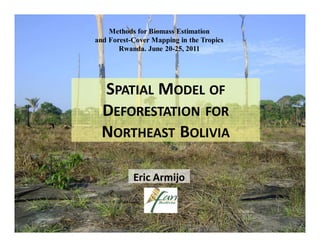
1. Methods for Biomass Estimation
and Forest-Cover Mapping in the Tropics
Rwanda. June 20-25, 2011
SPATIAL MODEL OF
DEFORESTATION FOR
NORTHEAST BOLIVIA
Eric Armijo
2. WHY SPATIAL MODELING OF DEFORESTATION?
• Better understanding of past land use
change processes
• Predictive power (future scenarios):
spatial patterns
• Support decision-making for natural
resource managers
• REDD mechanism: baseline definition
(additionality)
3. MODELING ENVIRONMENT
Dinamica EGO
Universidade Federal de Minas Gerais, Brazil
http://www.csr.ufmg.br/dinamica/
• Multiple land cover/use transitions at the same time
• Subregion support
• Many transition matrices (annual deforestation rates)
• Dynamic variables
• Highly customizable (w/ spatial patterns)
• Robust with large datasets
• Freeware, available on the web
• Tutorial & technical support available (forum)
6. Indigenous REDD Program
in the Bolivian Amazon
Size: ~ 3.8 Million Ha.
160,000 inhabitants
4 indigenous territories
Forest cover (2008):
~2.7 Million Ha. (71,9 %)
Deforestation: 9,800 Ha/yr
7. MAIN DRIVERS AND AGENTS OF DEFORESTATION
Slash-and-burn
Cattle ranching (pastures) Small-scale agriculture
~ 20 - 50 Ha. ~ 1 - 5 Ha.
Road
improvement
8. REGIONALIZATION OF THE STUDY AREA
4
1 1 Riberalta - Guayaramerín
2 Riberalta - Rurrenabaque
3 El Choro - Cobija
3 2 4 Rural (outside main road)
4
4
9. SPATIAL MODELING OF DEFORESTATION
Amount of
forest
conversion
Lambin & Geist, 2006
10. DEFORESTATION RATE
250,000
200,000 Deforestation
(Area in Ha.)
150,000
100,000
50,000
0
1991
0 2 4 6 8 10
2001 12 14
2005 16 18
2008
Area (Ha.)
antes 1991 1991-2001 2001-2005 2005-2008
Study area 83,486 45,390 46,185 29,005 204,066
Average annual
deforestation rate
(Ha/year) 4,539 11,546 9,668
11. DEFORESTATION RATE (Transition Matrix)
0.13 %
1.54 %
The transition matrix
is calculated for each
0.62 %
subregion based on
0.13 % observed (past)
0.10 %
deforestation
0.13 %
DEFORESTATION RATE
1991-2005
12. SPATIAL MODELING OF DEFORESTATION
Location of
forest
conversion
Lambin & Geist, 2006
17. MODEL VALIDATION
55%
50%
45%
40%
35%
Model fitness
Similarirty
30%
25%
Spatial resolution (m)
20%
0 200 400 600 800 1000
Is the model capturing
adequately the past
dynamics ?
Simulated deforestation: 2005-2008