This document discusses spatial data visualization and mapping for researchers. It provides examples of historic maps from the 16th century and modern OpenStreetMap. It also discusses how maps have been used historically in research, providing examples from John Snow's 1854 cholera maps in London. The document emphasizes that good design is important for maps to be effective and not misleading. It highlights recent examples of well-designed data visualizations showing fossil fuel emissions and polar bear populations. The document concludes by advertising a one-day intensive training workshop on using spatial data tools and creating data visualizations.
My Hydrospatial 21 presentation titled "Back to the Future: The Climate for Change and the Hydrographer of the Future" contained a number of slides noting supplement.
This presentation is the Rosetta link. It suggests that visionary capabilities are possible and uses components of the Rosetta mission with past capabilities.
American Astronautical Society, Astronauts and Robots: Partners in Space Exploration, May 12-13, 2015 - http://astronautical.org/event/astronauts-robots
Commercializing Space: From the Moon to MarsLarry Smarr
Panel discussion featuring Calit2 Director Larry Smarr, former FAA associate administrator and aerospace consultant Patti Grace Smith, and nonfiction author Michael Sims at the Future in Review Conference on May 21, 2014 in Laguna Beach, Calif.
Prof. Melinda Laituri, Colorado State University | Open Data for Secondary Ci...Kathmandu Living Labs
State of the Map Asia (SotM-Asia) is the annual regional conference of OpenStreetMap (OSM) organized by OSM communities in Asia. First SotM-Asia was organized in Jakarta, Indonesia in 2015, and the second was organized in Manila, Philippines in 2016. This year’s conference, third in the series, was organized in Kathmandu, Nepal on September 23 – 24, 2017 at Park Village Resort, Budhanilkantha, Kathmandu, Nepal.
We brought nearly 200 Open Mapping enthusiasts from Asia and beyond to this year’s SotM-Asia. The event provided an opportunity to share knowledge and experience among mappers; expand their network; and generate ideas to expand map coverage and effective use of OSM data in Asian continent. We chose ‘from creation to use of OSM data’ as the theme of this year’s conference, emphasizing on the effective use of OSM data. We also brought together a government panel from four different countries in this year’s SotM-Asia. We believe this event will deepen the bond and enhance collaboration among OSM communities across Asia.
More information about the conference can be found on: http://stateofthemap.asia.
Space Tech Trends in Satellite Imagery AnalysisThe Aleph
We take a broad look at what Space Tech is all about and we go in-depth with the challenges of image analysis and application of AI and Machine Learning visual and predictive models.
A brief introduction to Space Technology, what is it, how much investment is being poured, what are the hot areas and how will it evolve in the future.
Ease Leads to Exposure , Exposure Leads to AdoptionDawn Wright
Federation of Earth Science Information Partners (ESIP) ESIP 2019 Summer Meeting - Day 2 Plenary – Tacoma, WA, July 17, 2019 In thinking about my remarks this morning, it occurred to me that there is very little that I could say to an outstanding community such as yours that you haven’t already heard. I do know, however, that one of the hallmarks of your community is your wonderful ethic of sharing, of giving, and your deep understanding that the more you GIVE in this community, the more you RECEIVE, and all toward better science for everyone, and better actions to literally save our planet.
Toward this end, I want to share some remarks under a fun Star Wars theme, which I hope you’ll enjoy. These thoughts are about getting people to actually USE the resources that we’ve worked so very hard to build, and thus is in keeping with your conference theme: “Data to Action: Increasing the Use and Value of Earth Science Data and Information.”
Slide design based on the Powerpoint slide template of Joshua D. Clarke, foxgguy2001.deviantart.com, Annville, KY
INDIAN SPACE RESEARCH ORGANIZATION INSAT FAMILY ,
Asteroid / Comet flyby mission: Possible time frame- 2015
Mission to Mars :Timeframe- 2019
Human Mission : Timeframe 2020
Missions to other planets (Venus, Mercury…Vision beyond 2020)
Asteroid / Comet flyby mission: Possible time frame- 2015
Mission to Mars :Timeframe- 2019
Human Mission : Timeframe 2020
Missions to other planets (Venus, Mercury…Vision beyond 2020)
Asteroid / Comet flyby mission: Possible time frame- 2015
Mission to Mars :Timeframe- 2019
Human Mission : Timeframe 2020
Missions to other planets (Venus, Mercury…Vision beyond 2020)
Television Broadcasting
Direct To Home (DTH)
TV & Radio Networking
Tesla Club Italy Revolution 2019 - Argotec’s SmallSat for a NASA interplaneta...Tesla Club Italy
Nel 2021 avverrà uno scontro frontale fra un asteroide e una sonda NASA lanciata da SpaceX a 21 mila km/h a 10 milioni di chilometri dalla Terra. Un evento non casuale ma programmato nei minimi dettagli per difendere la Terra da un pericolo concreto. Questa missione a tratti fantascientifica avrà un testimone oculare d’eccezione tutto italiano: LICIACube. Lo SmallSat Made in Italy firmato Argotec, rilasciato poco prima dell’impatto, monitorerà tutte le fasi della missione per verificare l’efficacia della variazione orbitale dell’asteroide.
Relatore: Alessandro Balossino, Argotec R&D Project Engineer
Visualizations and Mashups in Online News ProductionAndy Sternberg
Many digital technologies are emerging as production and consumption of news shifts to online media. With the growth of citizen journalism and the increased availability and access to information, data, and analytical tools, online news has the potential to become an effective tool in restoring public trust in media. This paper examines the most promising of these developing technologies.
A Landscape Becoming: Undercutting Discourse Materialized in Modern LandscapesNicolas Laracuente
A paper I presented at the 2011 meeting of the Society for Historical Archaeology in Austin, TX as part of the Terrestrial Symposium: Bridging Landscapes: Geographic Approaches to the Archaeologies of Landscape. Thank you to Kevin Fogle, Andrew Agha, and Jakob Crockett for putting together a wonderful session. Questions, criticisms, and comments can be directed to me on twitter: @archaeologist. I take full responsibility for any mistakes presented in this narrated power point presentation
In presenting his report on the 9/11 Commission Report, Thomas Kean stated "We have failures in: Policy, Management, Capability and above in IMAGINATION". This article follows on from my previous post "Deciphering a Historic Image; To reveal enduring requirements and capabilities". So, now, let me introduce you to Fitzy, desmond, Wally and Ben.
Andrea Ballatore: Beyond GIS? The future of Cultural Geo-AnalyticsAndrea Ballatore
Abstract: Cultural geo-analytics (CGA) is an emergent area that studies the geographical dimension of the production and consumption of cultural objects, relying on digital data and spatial methods. In this talk, I will explore how, as GIS experts, we can fruitfully collaborate with researchers in cultural studies, media studies, and digital humanities to shape new interdisciplinary agendas. Given the conceptual and empirical centrality of place in CGA, I will then discuss the challenges in its representation in GIS by offering an overview of several case studies.
28 Apr 2022
Bio: Andrea Ballatore (he/him) is a Lecturer in Social and Cultural Informatics at King’s College London. From 2016 to 2021, he was employed as a Lecturer in Geographic Data Science at Birkbeck, University of London. Previously, he worked as a postdoctoral researcher at the Center for Spatial Studies at the University of California, Santa Barbara. In 2013, he completed a PhD in Computer Science at University College Dublin on geographic information retrieval and natural language processing. His current work combines cultural analytics and digital geographies, and is centred on collaborative projects with academic and corporate partners, including the Ordnance Survey and Facebook.
Extreme Citizen Science: Current Development Muki Haklay
Slides from a talk to UCL Institute of Global Prosperity soundbites event - 5th November 2015.
With a growing emphasis on civil society-led change in diverse disciplines, from International Development to Town Planning, there is an increasing demand to understand how institutions might work with the public effectively and fairly.
Extreme Citizen Science is a situated, bottom-up practice that takes into account local needs, practices and culture and works with broad networks of people to design and build new devices and knowledge creation processes that can transform the world.
In this talk, Muki will discuss the work of UCL Extreme Citizen Science group within the wider context of the developments in the field of citizen science.He will cover the work that ExCiteS has already done, currently developing and plans for the future.
https://www.igp.ucl.ac.uk/igp-events-pub/muki-haklay-extreme-citizen-science
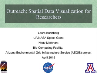
1. Laura Kurtzberg
Outreach: Spatial Data Visualization for
Researchers
Laura Kurtzberg
UA/NASA Space Grant
Nirav Merchant
Bio-Computing Facility,
Arizona Environmental Grid Infrastructure Service (AEGIS) project
April 2015
2. Maps: Information + Art
try
Piri Reis
Book of Navigation
Map of the Coast of Andalusia
with the City of Grenada
16th century
The Walters Art Museum
3. Maps: Information + Art
hi
OpenStreetMap: Map of the Coast of Andalusia - 21st Century
5. Maps for Research
hi
John Snow
On the Mode of
Communication of Cholera
London, England, 1854
Cholera Outbreaks along
Broad Street
Map 1. Published by C.F. Cheffins, Lith,
Southhampton Buildings, London,
England, 1854 in Snow, John. On the
Mode of Communication of Cholera, 2nd
Ed, John Churchill, New Burlington Street,
London, England, 1855. (yellow shading
by RRF).
6. Maps for Research
Cholera visualization
Sonia Shah and Dan McCarey: Mapping Cholera in 1832 New York City
"Mapping Cholera" is adapted from
"Pandemic: Tracking Contagions, from
Cholera to Ebola and Beyond" by Sonia
Shah, forthcoming from Sarah Crichton
Books/Farrar, Straus & Giroux in 2015.
7. Why should we care
about good design?
maps
Maps can help us make discoveries
Communicate those discoveries to
others
However, we care about making
maps well
Otherwise they won't be effective,
or they can be misleading
Good mapmaking goes hand in
hand with good science
8. Good Design
hi
Kennedy Elliott
Fossil fuel emissions,
2001-2012 mean,
grams of carbon
dioxide
http://www.washingtonpost.com/
graphics/national/carbon-
emissions-2015/
9. Good Design
hi
Designed by members of
Periscopic data
visualization firm
State of the Polar Bear
http://pbsg.npolar.no/en/dyna
mic/app
Citraro, Dino, Kim Rees, Jacob O'Brien,
Brett Johnson, Domanique Alicia, and
Andrew Winterman. 2013. State of the
Polar Bear. Portland, OR. Courtesy of
Periscopic. In “9th Iteration (2013):
Science Maps Showing Trends and
Dynamics,” Places & Spaces: Mapping
Science, edited by Katy Börner and Todd
N. Theriault. http://scimaps.org
10. The Spatial Data Bootcamp
maps
1 day intensive “Bootcamp” in May
UofA, ASU & NAU
Use iPlant to share and store geographic data
Perform spatial data analysis with NetCDF data
using open source tools
Create beautiful visualizations and share them on
the web
Peter Desmet, Bart Aelterman, Kevin Azijn (LifeWatch INBO), based on
data released by ENRAM.
A week of bird migration across Belgium/ the Netherlands in April 2013
http://enram.github.io/bird-migration-flow-visualization/viz/
11. Thank You!
hi
http://earth.nullschool.net/
Cameron Beccario: Real time wind and temperature patterns, several projections
Nirav Merchant
Susan Miller
Amit Juneja
Nathan Casler
Daniel Guaderrama
Susan Brew
Timothy Swindle
Erica Hernandez
Chandra Collins
Everyone at AzSGC