Download as PDF, PPTX


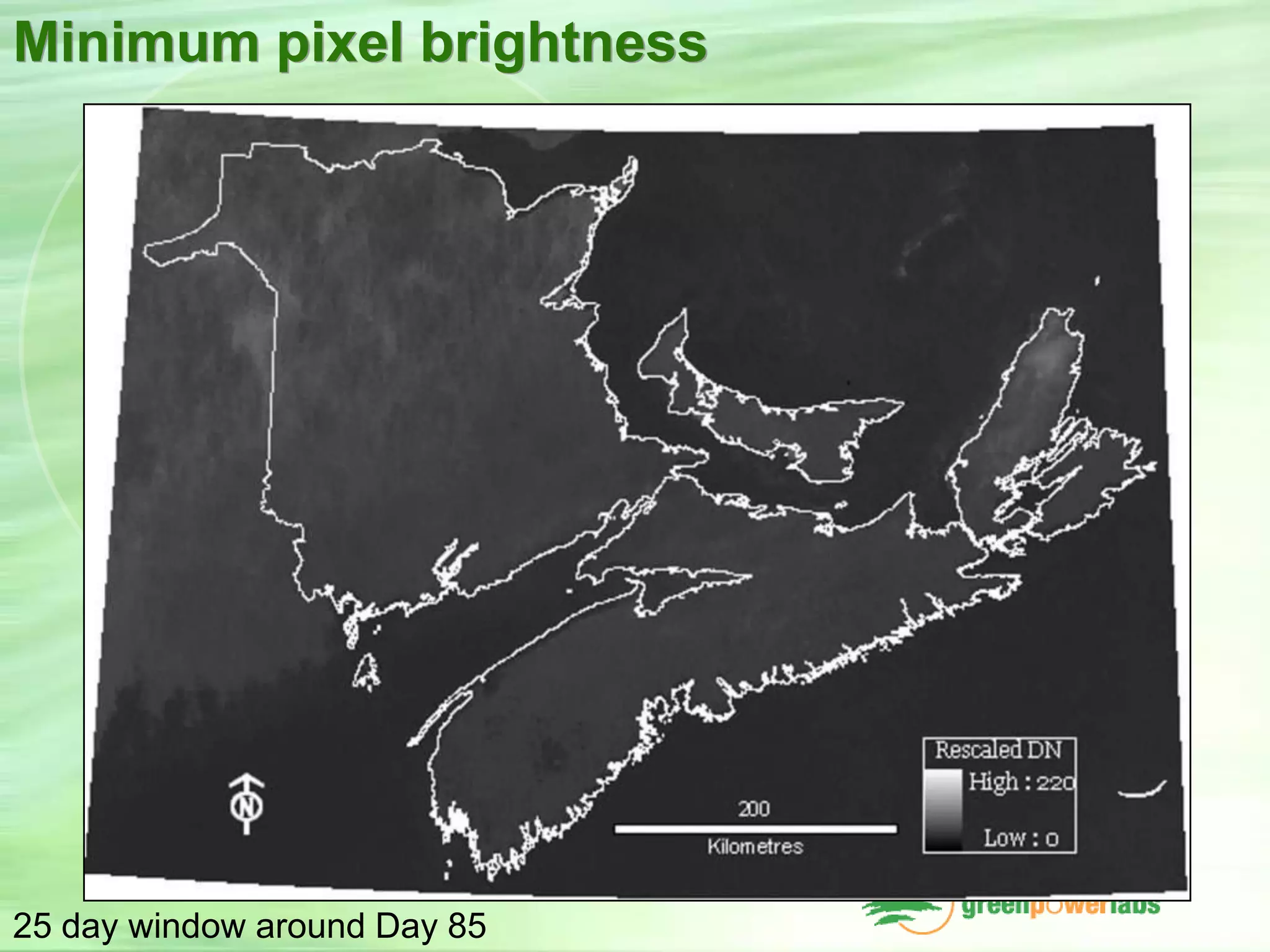

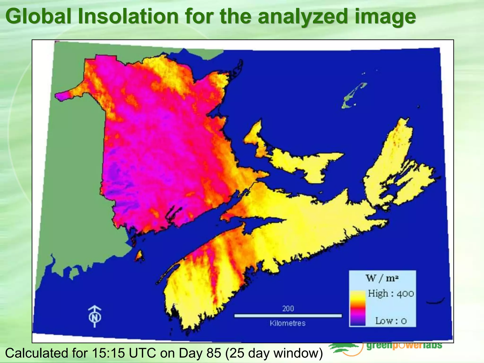
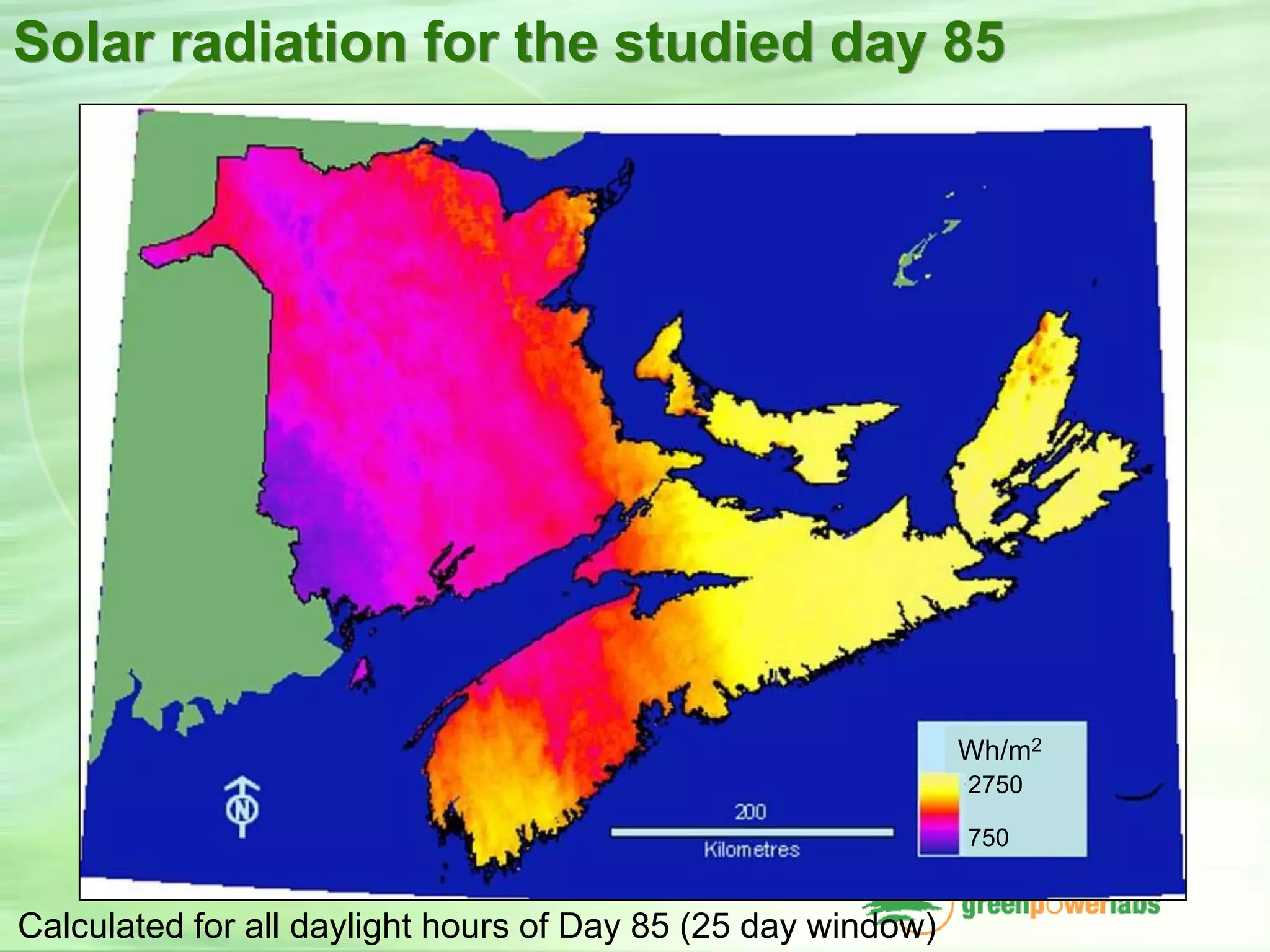
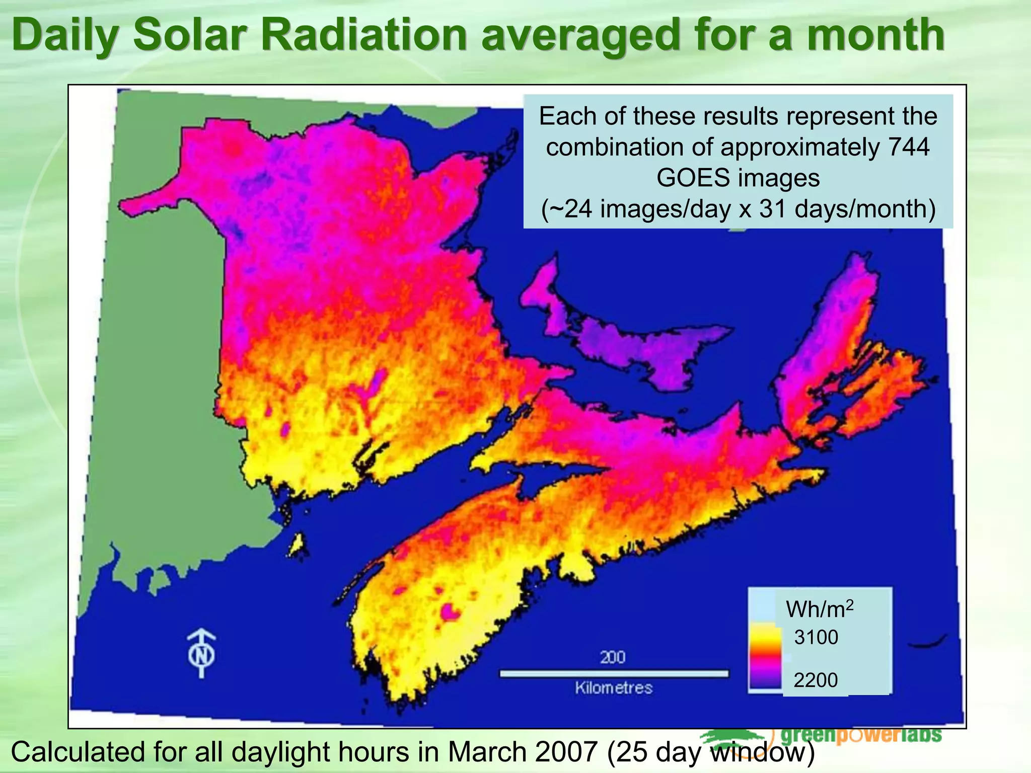
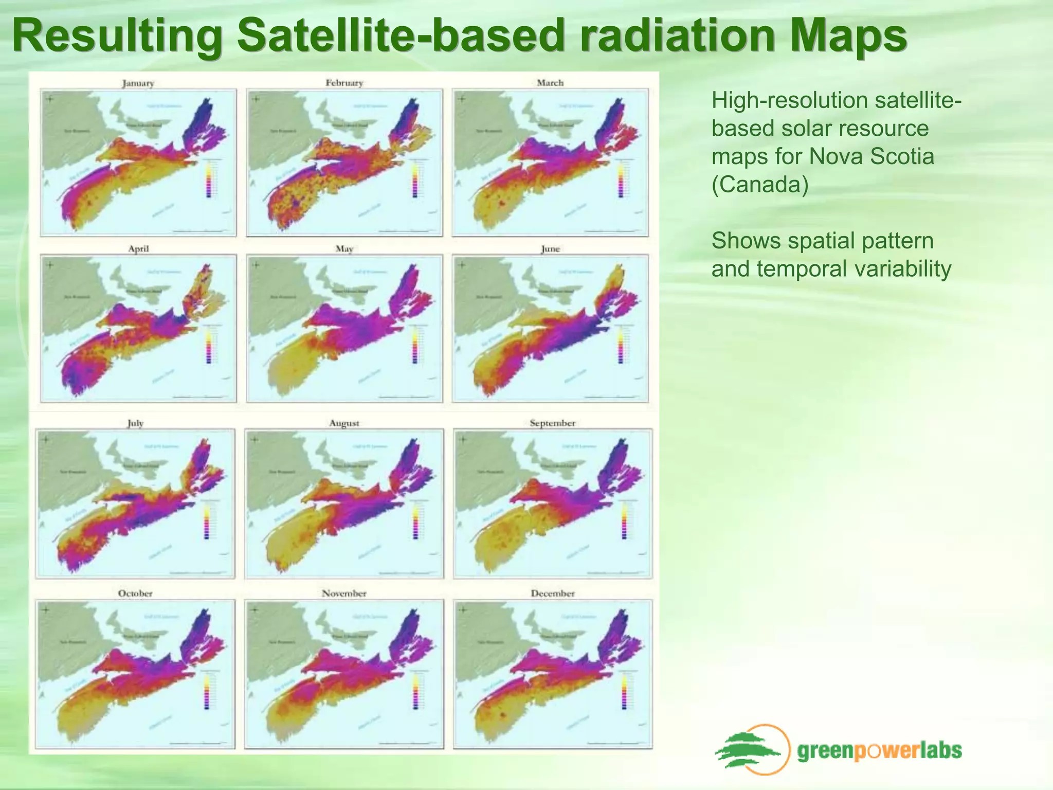
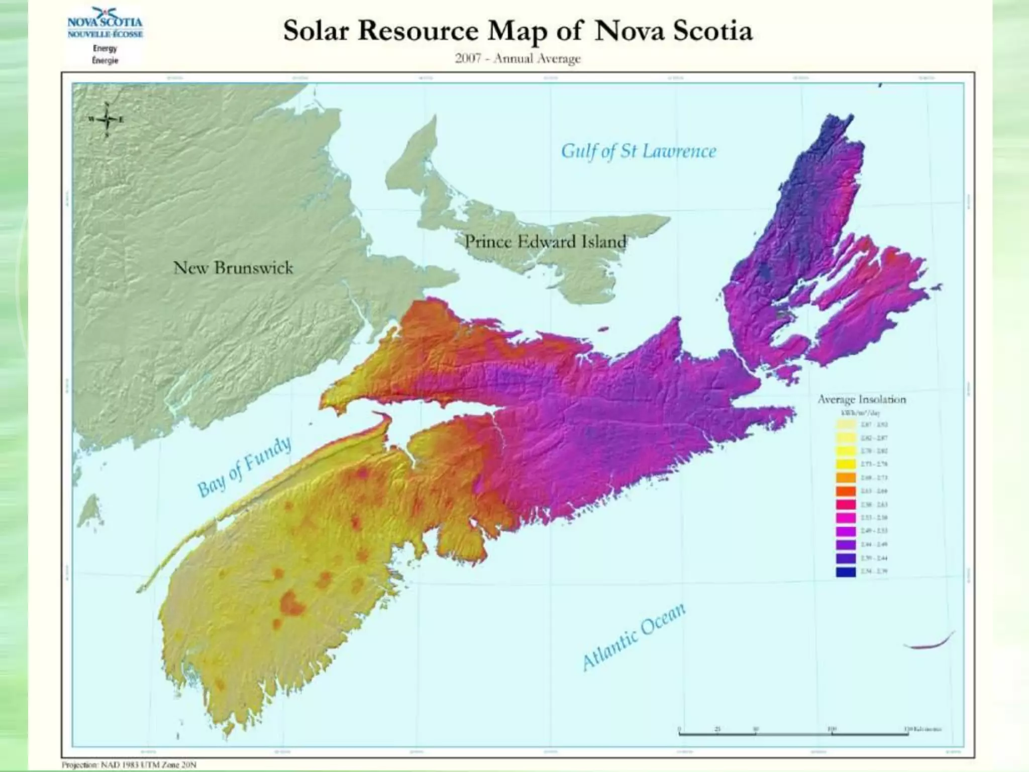
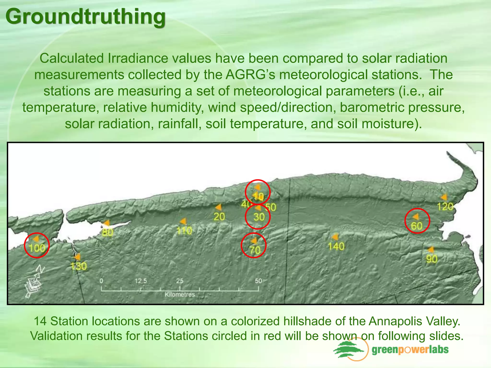
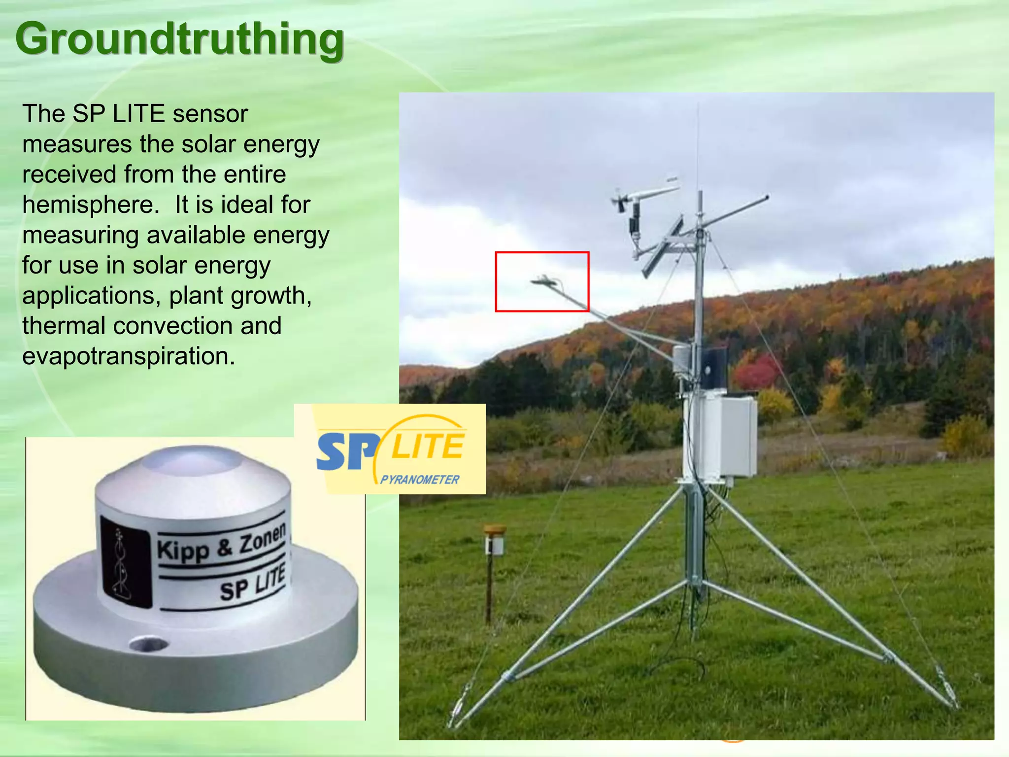
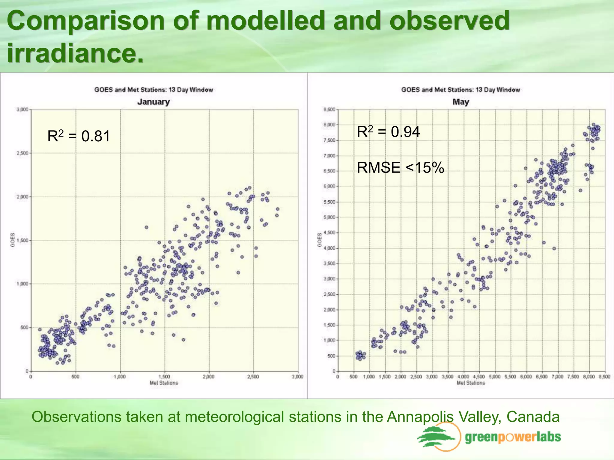
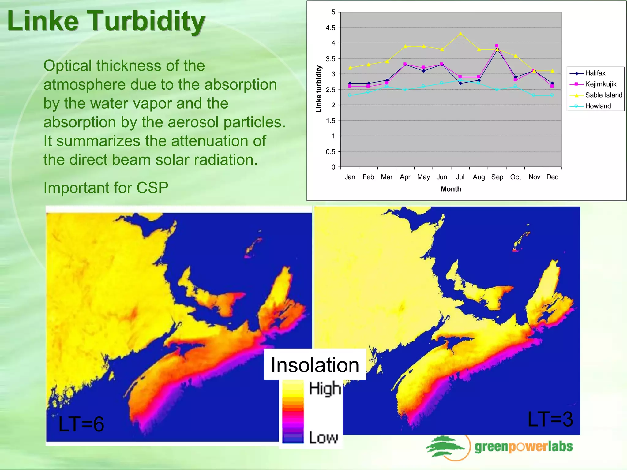
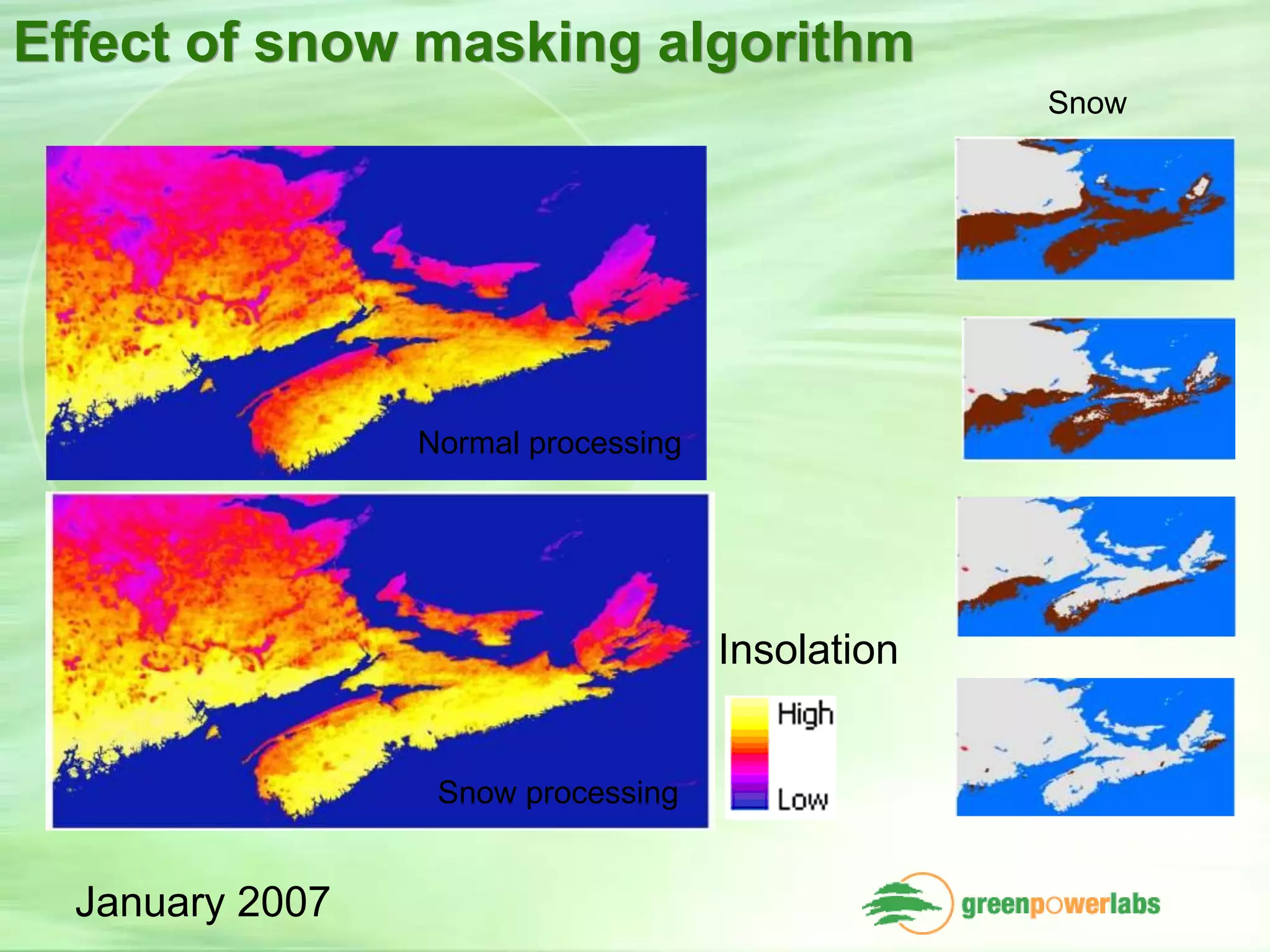
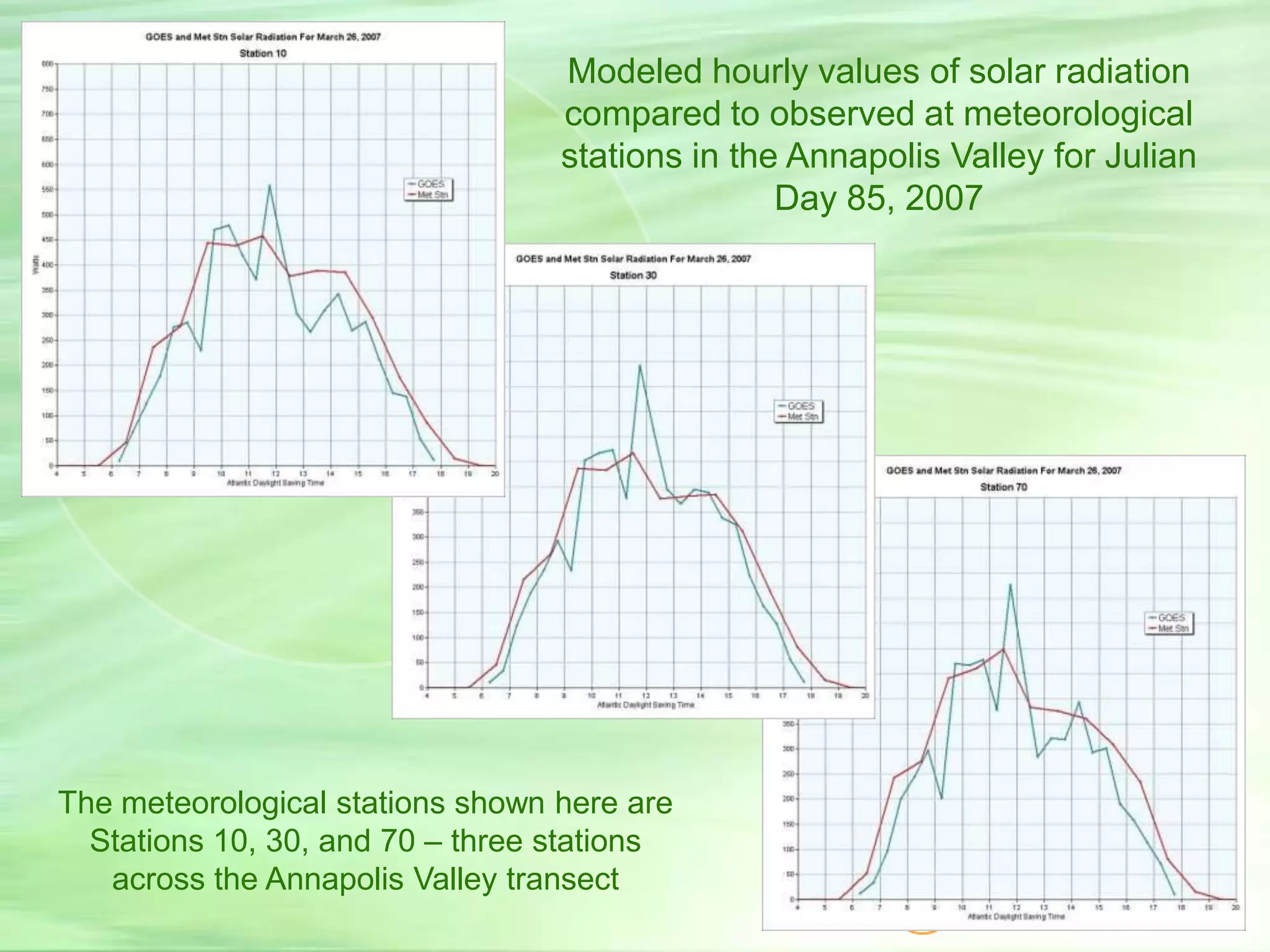
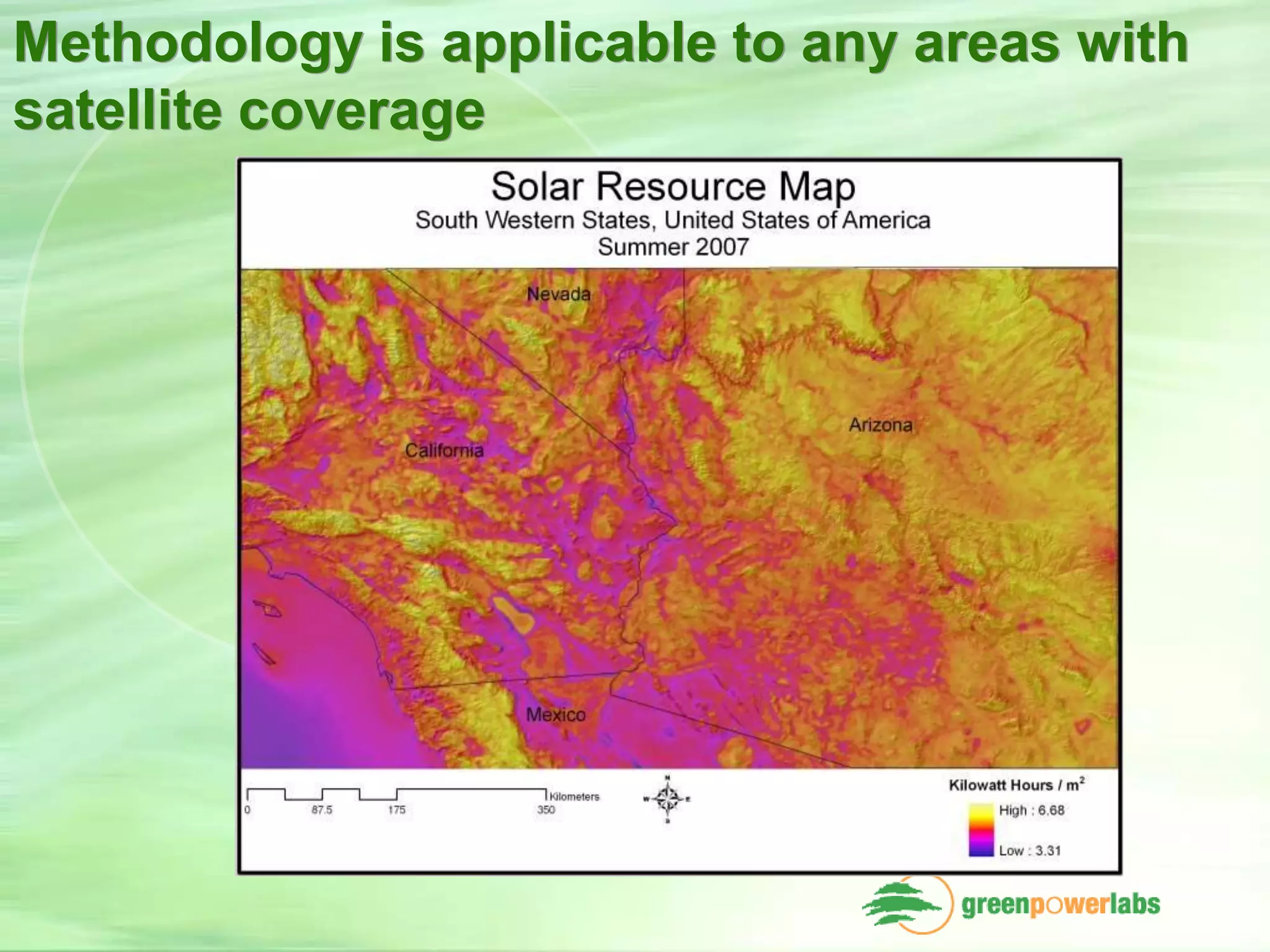

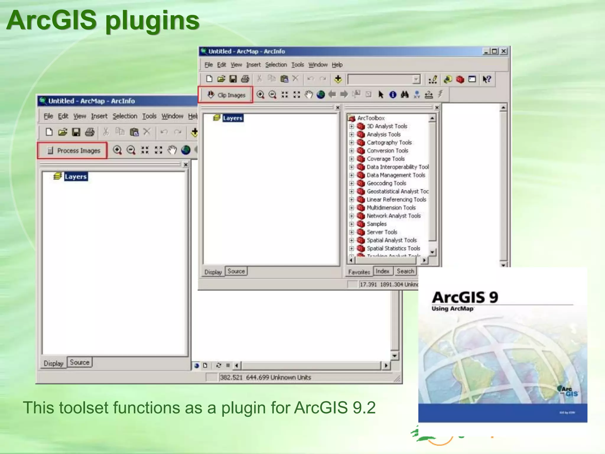


This document discusses using satellite data to monitor and map solar radiation. It describes how Green Power Labs developed software to process images from geostationary satellites like GOES into high resolution solar radiation maps for Atlantic Canada. The maps were groundtruthed against meteorological station data with a correlation of 0.94. The software tools allow automated processing of satellite images within a GIS and have applications for solar system monitoring and forecasting to support energy management and production.