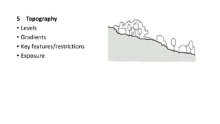
SITE ANALYSIS
• What is site analysis?
• Why do we need to analyse the site?
• How do we analyse sites in architecture?
• What next after site analysis?
What is site analysis
• Evaluating a specific location’s physical, mental and social
characteristics
• With an objective of developing an architectural solution
Why do site analysis
• Uniqueness of every site
What to look for…
1. General Zoning & Size
• Geographical location
• Site boundary
• Existing buildings / structures
• Entrance location & type
2. Neighbouring buildings
• Distances
• Heights
• Uses
• Vernacular
• Site lines
• Rights to light
• Legal restrictions
• Noise levels
03 Legal Restrictions
• Ownership
• Conservation areas
• Covenants and easements
• Rights of way
• SSSI ( Site of Special Scientific Interest)
• TPO’s (Tree preservation orders)
• Previous planning permissions and applications
04 Access
• Public routes
• Private routes
• Vehicle access
• Pedestrian access
• Existing circulation routes within
5 Topography
• Levels
• Gradients
• Key features/restrictions
• Exposure
6 Sensory : Views, Noise etc
• Private views out
• Public views in
• Noise sources
7 Climate (Sun path)
• Sun paths
• Solar gains
• Shading
8 Climate (Wind patterns)
• Prevailing direction
• Shelter
• Exposure
9 Public Transport Links
• Bus’s
• Train’s
• Taxi’s
10 Trees and vegetation
• TPO’s and protected species
• Root protection areas
• Items for removal
• Items to maintain
• Ownerships
11 Ecology
• Protected species
• Protected zones
• Impacts
12 Site restrictions
•Visibility
•Light
•Views
•Neighbours
•Pollution
•Flooding
•Land slides
13 Features
• Areas to expose/use
• Areas to improve
• Areas to hide
14 Hazards
• (Electricity lines, Drainage, Telephone lines, Sub-stations)
• Derelict Buildings
• Unfinished building works
15 Human and Cultural
• Cultural
• Psychological
• Behavioural
• Social aspect of the neighbourhood
Desktop Study
• Before the site visit, find out about:
• Geological maps – predominant soils, rocks
• Aerial photographs & maps – Google & Bing
• Restrictions … etc
What to take with you
• Notebook
• Camera
• Smart phone
• Tape measure or laser measure
• Good weather
Diagramming your findings
• The best way to present much of your findings is by diagramming
• Ensure the diagram is simple, and clear, with bold graphics.
• Emphasise on information you are communicating
• Be consistent on scale and orientation when presenting different
variables
Evaluating your site visit
• Consider all the points below and integrate brief requirements
• Street patterns
• Street section
• Scale and the hierarchy/form/space
• Land use
• Typologies
• Neighbourhood relationships, formal street variation
• Perspective relationships, views
• Edge conditions, surfaces and materials
• Natural and man made
• Movement and circulation within and around the site
• Vehicle vs. pedestrian
• Access
• Public space vs. private space
• Open space
• History
• Climate – sun angles and sun shadows
• Negative and positive spaces – we move through negative spaces and dwell in positive spaces
Presenting your site analysis
• Focus more on elements likely to influence your design
• Come up with a composite map
• Through layering, zone your site
• The site will have inspired some of your concepts
Q&A

SITE ANALYSIS.pptx

  • 1.
    SITE ANALYSIS • Whatis site analysis? • Why do we need to analyse the site? • How do we analyse sites in architecture? • What next after site analysis?
  • 2.
    What is siteanalysis • Evaluating a specific location’s physical, mental and social characteristics • With an objective of developing an architectural solution
  • 3.
    Why do siteanalysis • Uniqueness of every site
  • 4.
    What to lookfor… 1. General Zoning & Size • Geographical location • Site boundary • Existing buildings / structures • Entrance location & type
  • 5.
    2. Neighbouring buildings •Distances • Heights • Uses • Vernacular • Site lines • Rights to light • Legal restrictions • Noise levels
  • 6.
    03 Legal Restrictions •Ownership • Conservation areas • Covenants and easements • Rights of way • SSSI ( Site of Special Scientific Interest) • TPO’s (Tree preservation orders) • Previous planning permissions and applications
  • 7.
    04 Access • Publicroutes • Private routes • Vehicle access • Pedestrian access • Existing circulation routes within
  • 8.
    5 Topography • Levels •Gradients • Key features/restrictions • Exposure
  • 9.
    6 Sensory :Views, Noise etc • Private views out • Public views in • Noise sources 7 Climate (Sun path) • Sun paths • Solar gains • Shading
  • 10.
    8 Climate (Windpatterns) • Prevailing direction • Shelter • Exposure 9 Public Transport Links • Bus’s • Train’s • Taxi’s
  • 11.
    10 Trees andvegetation • TPO’s and protected species • Root protection areas • Items for removal • Items to maintain • Ownerships
  • 12.
    11 Ecology • Protectedspecies • Protected zones • Impacts 12 Site restrictions •Visibility •Light •Views •Neighbours •Pollution •Flooding •Land slides
  • 13.
    13 Features • Areasto expose/use • Areas to improve • Areas to hide 14 Hazards • (Electricity lines, Drainage, Telephone lines, Sub-stations) • Derelict Buildings • Unfinished building works
  • 14.
    15 Human andCultural • Cultural • Psychological • Behavioural • Social aspect of the neighbourhood
  • 15.
    Desktop Study • Beforethe site visit, find out about: • Geological maps – predominant soils, rocks • Aerial photographs & maps – Google & Bing • Restrictions … etc
  • 16.
    What to takewith you • Notebook • Camera • Smart phone • Tape measure or laser measure • Good weather
  • 17.
    Diagramming your findings •The best way to present much of your findings is by diagramming • Ensure the diagram is simple, and clear, with bold graphics. • Emphasise on information you are communicating • Be consistent on scale and orientation when presenting different variables
  • 19.
    Evaluating your sitevisit • Consider all the points below and integrate brief requirements • Street patterns • Street section • Scale and the hierarchy/form/space • Land use • Typologies • Neighbourhood relationships, formal street variation • Perspective relationships, views • Edge conditions, surfaces and materials • Natural and man made • Movement and circulation within and around the site • Vehicle vs. pedestrian • Access • Public space vs. private space • Open space • History • Climate – sun angles and sun shadows • Negative and positive spaces – we move through negative spaces and dwell in positive spaces
  • 20.
    Presenting your siteanalysis • Focus more on elements likely to influence your design • Come up with a composite map • Through layering, zone your site • The site will have inspired some of your concepts
  • 21.

Editor's Notes

  • #3 Solution that will address and enhance internal and external context of the said location looks at the existing conditions of a project site, along with any imminent or potential future conditions.
  • #4 Check on viability and establish parameters to implement the best design that responds to the physical and environmental features of the site. varying topography, watercourses, trees, plants, habitats, and weather patterns These should influence an architect’s design process and decision-making. …providing a very vital foundation and crucial starting point for architectural project. …forms the backbone and foundation of a successful design response for any given site. A poorly executed site analysis can lead to a sub standard design due to the designer not having all available information to respond to and develop solutions for.
  • #5 Soft data looks at site conditions that can be changed. Hard data looks at more concrete elements such as site boundaries, site areas Allows us to create a hierarchy and gives a more systematic approach to understanding our data and developing the design.
  • #6 look towards the local vernacular of the surrounding buildings Rammed earth walls can be used to represent an extension of the site and if the local soil type is right Noise levels from the road – how do you mitigate it? Earth bumps, moulds
  • #10  prominent views - buildings can address the landscape with large framed openings and pick key views and features to specifically draw attention to weather patterns, - provide a building with the best possible access to solar gains, daylight and shelter. …good positioning of openings and rooflines to provide natural light, warmth and shelter throughout the year.
  • #14 Each one of these areas is an opportunity to generate a meaningful conceptual approach and a way to devise a buildings shape, layout, form and materiality.
  • #15 Activities and patterns, density, population ethnic patterns, employment, income, values and so on. Each one of these areas is an opportunity to generate a meaningful conceptual approach and a way to devise a buildings shape, layout, form and materiality.