Download to read offline

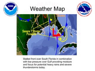
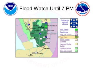
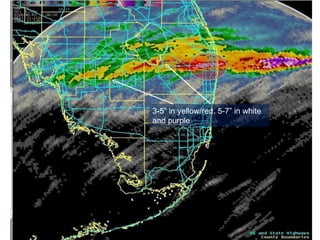
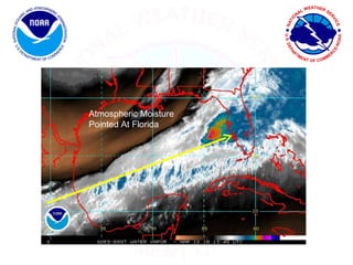
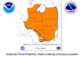
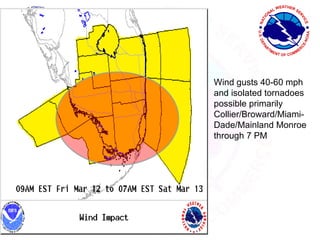
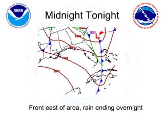


A flood watch was issued for South Florida until 7 PM on March 12, 2010 due to a stalled front and low pressure system providing moisture for heavy rain and severe thunderstorms, with 3 to 7 inches of rain expected to cause flooding of roads and potential water entry into structures. Isolated tornadoes with wind gusts up to 60 mph were also possible from Collier to Miami-Dade counties through the evening. The front was forecast to move east overnight, ending the rain and bringing drier, cooler weather for the weekend.


