
More Related Content
Viewers also liked
Viewers also liked (15)
Similar to Presentation in Ostrava Congress 2016
Similar to Presentation in Ostrava Congress 2016 (9)
Recently uploaded
Recently uploaded (20)
Presentation in Ostrava Congress 2016
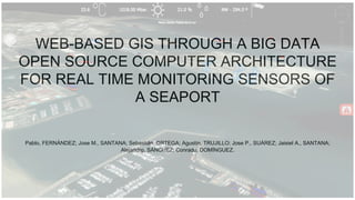
- 1. WEB-BASED GIS THROUGH A BIG DATA OPEN SOURCE COMPUTER ARCHITECTURE FOR REAL TIME MONITORING SENSORS OF A SEAPORT Pablo, FERNÁNDEZ; Jose M., SANTANA; Sebastián, ORTEGA; Agustín, TRUJILLO; Jose P., SUÁREZ; Jaisiel A., SANTANA; Alejandro, SÁNCHEZ; Conrado, DOMÍNGUEZ.
- 2. Index Introduction and Motivation SmartPort at a glance. Real-Time ships location tracking through Automatic Identification System (AIS) GIS based visualization and sensor data output via a 3D RIA. SmartPort in Action Conclusions and Future Work
- 3. Canary islands, a nice place to live and do research A warm climate all year benefits co-working/ collaboration and help new fresh ideas and creativity
- 4. Geography of Canary Islands 1583 kilometer of marine coast Heavy marine interaction with economy
- 5. Ship in Gran Canaria: Oil disaster Recent disaster in Gran Canaria, derived from a chain of bad decisions
- 6. SmartPort at a glance - 3D real time visualization and Big Data - Traffic management - Sustainability development: Tourism, fishing, industry… - Working as a control panel, decision making. Live Alerts. - Integrates all the information from several data sources.
- 7. Back-End
- 10. SmartPort. Architectures. Static Data Internet GeoJSON PostgreSQL PostGIS conversion Web App Digitizing (QGIS)
- 11. Architecture. Dynamic data: Recent values Cosmos Cygnus WebHDFS Hadoop - HDFS Sensors Orion CB FIWARE SmartPort Back End SmartPort Front End Captured Data Pub/Sub API Rest API Historic - Python connector
- 12. Big Data? 0 200 400 600 800 1000 1200 Year 2015 2016 2017 2018 GB Data volume (GB)
- 13. Big Data. The problem Time MySQL PostgreSQL Hadoop All meteo data 3,03 4,99 59,51 An element by date 1,55 2,53 74,83
- 14. Big Data. The solution
- 15. Big Data. The solution Time MySQL PostgreSQL Hadoop Optimized All meteo data 3,03 4,99 4,76 One attribute orderer by date 1,55 2,53 5,98
- 16. Front-End
- 17. 3D engine - Glob3Mobile - Open source Framework - Geospatial information in 3D - Runs on mobile and web - Real time - Multi-touch
- 18. Big Data. Data mining
- 21. Related projects ULPGC - OpenData
- 22. Conclusions and Future Work - Improve data mining - Mobile devices - Increase sensors
- 23. Thank you! Pablo Fernández Moniz pablo.fernandez.moniz@gmail.com