SlideShare a Scribd company logo
1 of 292
Pinehurst Local Historic
District Boundary Amendment
Pinehurst, North Carolina
New South Associates
This page intentionally left blank
Pinehurst Local Historic District Boundary Amendment
Pinehurst, North Carolina
Report submitted to:
Village of Pinehurst • 395 Magnolia Road • Pinehurst, North Carolina 28374
Report prepared by:
New South Associates • 6150 East Ponce de Leon Avenue • Stone Mountain, Georgia 30083
Ellen Turco – Principal Investigator
Ellen Turco – Principal Investigator and Co-Author
Martha Lauer – Historic Preservation Planner and Co-Author
January 29, 2018 • Final Report
New South Associates Technical Report 2791
This page intentionally left blank
EXECUTIVE SUMMARY
This report is a follow-up report to the 2006 Village of Pinehurst Local Historic District Report,
prepared for the Village of Pinehurst (Village) by Circa, Inc. In 2017, the Village contracted with
New South Associates (New South) to reexamine the Pinehurst Local Historic District Overlay
boundary adopted by the Village Council on September 26, 2006. Historic contexts, background
history, property types and architectural styles are fully described in the 1996 National Historic
Landmark (NHL) nomination. Circa’s 2006 local landmark report, based on field survey work
conducted in 2005 and 2006, added descriptions of additional architectural styles that were not
included in the 2006 NHL report. For purposes of brevity, discussions of history and building
types and styles are not reproduced in full here. The NHL and 2006 local landmark district
report should be treated as companion documents to this report and are included as Appendices
A and B. As a result of this reexamination, New South recommends that the existing local
historic district overlay boundary be amended into three smaller districts: Old Village Center,
Village West, and the School District. These recommended districts are associated with their
own historical contexts and physical development and acknowledge the “special character” of
different areas within the Village.
iPINEHURST LOCAL HISTORIC DISTRICT BOUNDARY AMENDMENT
This page intentionally left blank
ii
TABLE OF CONTENTS
EXECUTIVE SUMMARY.............................................................................................................. i
TABLE OF CONTENTS .............................................................................................................. iii
LIST OF FIGURES .........................................................................................................................v
I. INTRODUCTION.......................................................................................................................1
ABOUT LOCALLY DESIGNATED HISTORIC DISTRICTS IN NORTH CAROLINA..........3
PROJECT NEED..........................................................................................................................4
II. METHODS..................................................................................................................................7
III. BRIEF HISTORY OF THE DEVELOPMENT OF PINEHURST 1895-1970..........................9
PINEHURST: 1895-1948.............................................................................................................9
THE POST-WAR YEARS AND THE CHANGING OF THE GUARD: 1948-1960................10
THE FINAL DECADE OF THE TUFTS: 1960-1970 ...............................................................11
POST 1970 PINEHURST...........................................................................................................12
IV. FINDINGS AND RECOMMENDATIONS ............................................................................15
RESOURCE TYPES AND STYLES.........................................................................................15
2017 FINDINGS AND RECOMMENDATIONS......................................................................16
Special Character of the Old Village Center.........................................................................18
Special character of the Village West District.......................................................................28
Special Character of the School District...............................................................................41
RECOMMENDATIONS............................................................................................................51
REFERENCES CITED..................................................................................................................53
APPENDIX A. NRHP NOMINATION
APPENDIX B. PINEHURST HISTORIC DISTRICT REPORT
APPENDIX C. LIST OF PARCELS BY DISTRICT
iiiPINEHURST LOCAL HISTORIC DISTRICT BOUNDARY AMENDMENT
This page intentionally left blank
iv
LIST OF FIGURES
Figure 1. Map Showing National Register, National Historic Landmark, and Local Historic
xxxxxxxxxDistricts in Pinehurst.....................................................................................................2
Figure 2. Recommended Amended Local Historic District Boundaries for Old Village
Center, Village West District and the School District ................................................17
Figure 3. Old Village Center Local Historic District Boundary (Recommended).....................19
Figure 4. Plan of Pinehurst. Olmsted, Olmsted and Elliot, 1895...............................................20
Figure 5. Sanborn Fire Insurance Map of Pinehurst, 1920........................................................21
Figure 6. Old Village Center Landscape Elements....................................................................23
Figure 7. Old Village Center Architectural Styles .....................................................................24
Figure 8. Old Village Center Massing, Materials and Other Details.........................................26
Figure 9. Village West District Boundary Local Historic District Boundary
xxxxxxxxx(Recommended)..........................................................................................................29
Figure 10. Village West Historic District Landscape Elements...................................................31
Figure 11. Village West Historic District Architectural Styles ....................................................35
Figure 12. Village West Historic District Massing, Materials and Other Details........................37
Figure 13. School District Local Historic District Boundary (Recommended)...........................42
Figure 14. 1920 Sanborn Fire Insurance Map .............................................................................43
Figure 15. Small Houses on 100 Block of Woods Road..............................................................44
Figure 16. School Historic District Landscape Elements............................................................46
Figure 17. School Historic District Architectural Styles .............................................................49
Figure 18. School Historic District Massing, Materials and Other Details .................................50
vPINEHURST LOCAL HISTORIC DISTRICT BOUNDARY AMENDMENT
This page intentionally left blank
vi
I. INTRODUCTION
In February 2005, Circa. Inc. was contracted by the Village of Pinehurst (Village) to conduct
an architectural survey and historical research for the purpose of establishing, a local historic
district zoning overlay in the Village of Pinehurst (Figure 1). Prior to 2006, the Village had
completed a series of historic preservation-related projects and initiatives had been completed.
• 1973 - Pinehurst Historic District listed in National Register of Historic Places (NRHP).
• 1992 - Pinehurst Race Track listed in National Register of Historic Places
• 1995 - Old Village Center Overlay District established as part of the development of the
Pinehurst Development Ordinance.
• 1996 - National Register District expanded to include 1973 district, 1992 Race Track, and
newly surveyed areas. This project resulted in establishment of the Pinehurst National
Historic Landmark, which recognized the community’s importance at the national level.
• 2001 - Citizen-conducted survey of buildings over 50 years of age northeast of the
Pinehurst National Historic Landmark boundary, in an area known as the School District.
• 2003 - Adoption of Pinehurst Comprehensive Long-Range Village Plan, which called for
the establishment of a large local historic district zoning overlay that expanded beyond
the boundary of the 1995 Old Village Center overlay district.
• 2006 - Adoption of the Pinehurst Local Historic Preservation Ordinance by the Village
Council (March 14, 2006). This ordinance established the local Historic Preservation
Commission (HPC) and allowed for the designation of historic landmark properties
and districts, pursuant to North Carolina General Statutes, (General Statutes of North
Carolina, Chapter 160.A, Part 3C, ss.160A--400.1-400.14).
In order to determine an appropriate boundary for a local historic district, the scope of Circa’s
2005-2006 survey project was to record and evaluate previously undocumented properties
within the Old Village Center Overlay District and four additional new survey areas identified
by Village staff: Survey Area I (Linden Road, west of the Old Village Center overlay district);
Survey Area II (Campbell, Dalrymple, and Midland Roads east of the Old Village Center overlay
district); Survey Area III (northeast of the Old Village Center overlay district, along McCaskill,
1PINEHURST LOCAL HISTORIC DISTRICT BOUNDARY AMENDMENT
Figure 1. Map Showing National Register, National Historic Landmark, and Local Historic
Districts in Pinehurst
1973 Pinehurst Historic District
1992 Pinehurst Race Track
1996 Pinhurst Historic District Boundary Expaned (NHL)
2006 Pinehurst Local Historic District
Excluded Area
0 0.5 10.25 Miles
0 1 20.5 Kilometers
Source: ESRI Resource Data
2
McIntyre, Kelly, Page, and Midland Roads); and Survey Area IV (southwest of the Old Village
Center overlay district and roughly bounded by Beulah Hill and Blue Roads and the railroad
line. A total of 131 properties were recorded for the first time as part of this project.
Based on the results of the survey and the findings of historical research relating to the development
of Pinehurst, Circa, Inc. recommended a boundary for a potential local historic district. Properties
located within this boundary were constructed between 1895 and 1970 the period of significance
identified for the recommended local historic district, and were considered contributing resources
to the local historic district, unless they had undergone significant alterations that affected their
overall physical integrity. The ordinance creating the “Local Historic District Overlay” was
adopted by the Pinehurst Village Council on September 26, 2006. The Village of Pinehurst
Historic District Standards and Guidelines (Standards and Guidelines) were adopted by the
Village Council on September 26, 2006. The Standards and Guidelines were subsequently
amended on June 20, 2012; August 20, 2013, and September 11, 2013.
ABOUT LOCALLY DESIGNATED HISTORIC DISTRICTS IN NORTH CAROLINA
Under North Carolina law (GS160A-400.1-400.14), local governments are permitted to establish
historic preservation commissions, and subsequently designate locally zoned historic districts
and landmarks. Local designation allows a community to bestow honor upon historic resources,
which are found to possess historic or architectural significance at the state or local level. Local
designation requires that a property, or properties, possess historic or architectural significance
and retain overall physical integrity in order to be considered for designation. State legislation
also requires that the “land area” being designated be well defined, including a description of
elements contributing to the significance of the overall site. The designation of a local historic
district is done on the recommendation of the local government’s appointed Historic Preservation
Commission (HPC). Local HPCs only exist where they have been clearly created by their local
governing body, in the case of Pinehurst, the Village Council.
It is important not to confuse local designation programs with the National Register of Historic
Places (NRHP) or National Historic Landmark (NHL) programs, as these are federal programs.
The NRHP is the official list of the nation’s historic places worthy of preservation. NHL
properties are those special properties designated by the Secretary of the Interior as nationally
significant because they possess exceptional value or quality in illustrating or interpreting the
heritage of the United States. All properties designated NHLs are automatically included in the
NRHP.
3PINEHURST LOCAL HISTORIC DISTRICT BOUNDARY AMENDMENT
While historic districts may carry NRHP and local designations, the regulations and benefits
associated with each designation are different. NRHP designation is first and foremost an
honorary designation that offers little protection from the alteration or demolition of a designated
property. Properties listed in the NRHP, either individually or as a contributing resource in
a district, are eligible for state and federal tax credits for rehabilitation. Locally designated
properties may have more locally imposed limitations in relation to alterations, additions, and
demolitions. However, these limitations are set forth and administered by the local governing
body through its design guidelines and the interpretation of those guidelines by the appointed
preservation commission or its staff. Local designation affords a community the ability to
protect its resources. Landowners and commission members are neighbors and peers in this
process. At no point is an application to a local preservation commission acted upon in a binding
way by a state or federal agency.
PROJECT NEED
Many neighborhood preservation efforts begin with the establishment of a National Register
Historic District, which is honorary and makes available federal and state rehabilitation tax
credits. It has been typical in North Carolina for local jurisdictions to use the historic information
and boundaries identified in a National Register Historic District and/or NHL District designation
reports in the establishment of local historic districts. A review of jurisdictions indicates
that in the past, rather than identify several districts in a town, a single historic district was
formed, generally identifying all resources with historic integrity that meet the over 50-year age
requirement. For the purposes of administering federal historic preservation programs, this has
been effective. A single historic district can be challenging to administer as a local historic district,
however, as most jurisdictions with a single district are comprised of several neighborhoods
with disparate elements, including, but not limited to varying periods of significance, building
sizes, streetscapes, and landscapes. To properly protect the more fine-grained special character
of historic neighborhoods encompassed within a catch-all district, a more in-depth study and
determination of boundaries may be prepared. To this end, the Village of Pinehurst selected
New South Associates, Inc. (New South) to reexamine local overlay boundaries to determine if
the Pinehurst Local Historic District warrants being divided into smaller districts.
Pinehurst HPC charged New South with a study to determine the appropriateness of amending
the Pinehurst Local Historic District zoning map to create smaller, more cohesive local
historic districts. The HPC’s request was precipitated in part by an increase in Certificate of
Appropriateness (COA) applications for the construction of new dwellings in the vicinity of
4
the Pinehurst Elementary School.1
The Standards and Guidelines have been interpreted by
the Village legal counsel to apply to the entire area within the local historic district boundary,
leaving the HPC with no mechanism by which to deny COA applications for new construction
or additions that are not in keeping with the immediately surrounding buildings or streetscapes
of a particular section of the district. The size of the existing local historic district (597 parcels)
does not account for the nuances among the distinct physical environments contained within
it. As a result, the HPC presently has no way to deny COA applications for alterations or new
construction that are incongruous with their immediate surroundings because the proposed
work is out of scale, in terms of building height, massing and square-footage, and/or rendered
in an incompatible architectural style, or utilized incongruous building materials. The Village
retained New South to study the character of several geographical areas at the neighborhood
level. The Village staff and the HPC preliminarily identified these neighborhoods. New South
was requested to prepare a report summarizing the findings of the neighborhood analyses and to
recommend amendments to the Pinehurst Local Historic District boundary based on the special
character of discrete area, if appropriate.
1 A Certificate of Appropriateness (COA) is a permit issued by the Historic Preservation Commission through
the Village of Pinehurst indicating that proposed exterior changes to the property are not incongruous with the historic
character of the Pinehurst Local Historic District. The Village of Pinehurst Local Historic District Standards and
Guidelines, adopted by the Village Council in 2006 (amended, 2012 and 2013), is the document the HPC uses to
determine if proposed changes to a historic resource are not incongruous.
5PINEHURST LOCAL HISTORIC DISTRICT BOUNDARY AMENDMENT
This page intentionally left blank
6
II. METHODS
On October 4, 2017, New South staff met in Pinehurst with Village staff and representatives
of the HPC to refine the project parameters and develop a plan of work. All parties reviewed
maps of the various districts and the attendees delineated potential areas for neighborhood-
level analysis based on their potential for disparate physical character. General areas for study
included: the Old Village Center area, which roughly corresponded with the 1973 Pinehurst
National Register District; an area west of the Village Center containing Pinehurst’s largest
historic homes, sometimes referred to locally as “Million Dollar Hill”; the recreational area
south of the Village Center containing the golf courses and race track; the industrial and service
area north of the Village Center; and an area of modest worker housing near the Pinehurst
Elementary School. Properties in these areas had previously been documented, in some cases
multiple times, as part of previous historic architectural survey projects conducted in Pinehurst.
It was determined that sufficient historical information and photographic documentation existed
for resources within the Pinehurst Local Historic District and that documentation and evaluation
at the resource level was not necessary to complete the task at hand: an analysis and comparison
of visual character of geographical clusters of resources.2
Because the subject area has been
protected since 2006 through the HPC and its Standards and Guidelines, it is assumed that any
change that has occurred since the last survey has received approval; and therefore, the overall
integrity of the district has remains. It was also agreed that any recommended amendments to
the landmark district should, if feasible, take place within the existing boundary and not bring
new areas into the district, or remove areas that had previously been included. After discussion
and a review of maps, the attendees commenced an overview driving tour of Pinehurst.
It merits note that identifying a house by its street number can be a challenge in Pinehurst, as
property addresses have changed over the years. There are multiple instances where parcels
have been divided into smaller ones, or small parcels have been recombined into new, larger
parcels. Many residences were assigned new street address numbers as part of a 911 emergency
response project. Some property owners display their new 911-assigned numbers on their abodes,
2 Written and photographic documentation for Pinehurst’s historic buildings can be found in multiple
repositories and reports. Historic architectural survey files for individual resources and/or building groups are on
file and available to the public at the North Carolina State Historic Preservation Office in Raleigh and the Village of
Pinehurst Planning Department. Also see the resource inventory list incorporated into the 1996 National Historic
Landmark Report and Appendix A of the 2006 Local Historic District Report. The Village Planning Department also
maintains COArecords which contain photographs and descriptions of changes made to historic properties since 2006.
7PINEHURST LOCAL HISTORIC DISTRICT BOUNDARY AMENDMENT
some retain their original numbers, and still others choose to display no number at all. Presently,
Moore County maintains Pinehurst’s tax parcel data and many property records do not include a
physical street address number. For these reasons, a search for a specific house by street address
can be challenging. While this situation did not present a problem for the neighborhood-level
analysis conducted by New South staff, the authors point it out as a caution to those who may
work with district resources in the future. At this point, the county-assigned parcel identification
number is the most accurate way to identify a property and should be used by the Village for
administrative purposes. In this report, specific buildings are referred to either by the street
address, if known, or by the street only, or by the historical name of the property as identified in
the NHL report.
New South staff conducted additional in depth windshield surveys of the Pinehurst Local Historic
DistrictonNovember8and29,2017. Duringthesesurveys,photographsofrepresentativebuildings
were taken to document the geographical differences in styles, materials, building heights and
massing. A spreadsheet was created to track construction dates, contributing/non-contributing
status, and other building information for the purpose of analysis and recommendation. The
spreadsheet was subsequently translated into a GIS layer so these attributes could be visually
depicted and analyzed. Tax parcel data was downloaded from Moore County. The Village
provided New South with in-house GIS data for the NRHP and local district boundaries. GIS
data was also obtained from the State Historic Preservation Office. New South reconciled this
data in the few instances where it conflicted.
As a result of the fieldwork and subsequent analysis, New South prepared this report with
recommendations for amending the Pinehurst Local Historic District boundary into three
distinct districts: Old Village, Village West, and the School District. Each of the three districts
has a separate, defined character when viewed through the lens of managing change through
local regulation. The sections that follow provide summaries of the history of Pinehurst, types
and styles of buildings found in Pinehurst, a synopsis of the three new areas recommended for a
boundary amendment, “Special Character Essays” for each recommended area, and a summary
section presenting recommendations for the future.
8
III. BRIEF HISTORY OF THE
DEVELOPMENT OF PINEHURST 1895-1970
(Note: Since considerable research has been done on the history of Pinehurst from 1895-1948 through the National
Register and NHL designations, that portion of local history is presented here in brief. For a more detailed
account please refer to those reports, found in the Appendix.)
PINEHURST: 1895-1948
Beginning in the summer of 1895 and ending in December 1896, James Walker Tufts, a
manufacturer from Boston, Massachusetts, and head of the America Soda Foundation assembled
and purchased 5,980 acres of mostly cut timberlands in Moore County. These lands, acquired for
the sum of $7,400, would later become known as Pinehurst. In the summer of 1895, before many
of the land transactions were complete, Tufts hired the New York-based landscape architecture
firm of Olmsted, Olmsted, and Eliot to create a “diagram for location of hotel and cottages” (Hood
and Phillips 1996:76). This first step in the development of the Village of Pinehurst signified the
importance of landscape, setting, and the integration of the natural and built environments that
would define Pinehurst more than a century later.
Tufts’ initial plan was to market the Village as a health resort. His marketing letters to Boston
area physicians advertise Pinehurst as a respite from the city, offering a healthful environment for
those with consumption. Between July 1895 and February 1896, 23 buildings were constructed
in the Village, including an inn, boarding houses, cottages, and a store.
In 1897, Tufts had to scrap the health resort plan as a result of new research on consumption. At
the close of the 1897 season, Tufts banned consumptives from the property. It was at this time
that the focus of the resort village shifted to recreation, resulting in the construction of the golf
links and golf club house. In the fall of 1900, Donald James Ross came to Pinehurst and took
over the golfing operations, a position he would maintain for the next 40 years.
Pinehurst continued to grow at a rapid pace in the following decades under the guidance of James
Walker Tufts and, after his death in 1902, his son Leonard Tufts. The latter was responsible for
the majority of buildings within the Village core constructed in the 1900s and 1910s. Winter
guests would rent cottages for the season or, if coming for a shorter visit, would stay in the many
hotel rooms and boarding houses located throughout the Village.
9PINEHURST LOCAL HISTORIC DISTRICT BOUNDARY AMENDMENT
As Pinehurst continued to establish itself as an ideal winter resort, adding more golfing
opportunities, a harness track, and other recreational elements, the nature of development
in the Village changed. By the mid 1910s and throughout the 1920s properties were being
constructed by private property owners. These properties were often more substantial in scale
and rendered in architectural styles reflective of national trends. This was in contrast to earlier
cottage construction completed in Tufts’ prescribed ‘New England Village in the North Carolina
Sandhills’ style.
The stock market crash of 1929 and subsequent depression had its effect on Pinehurst. While
1931 was the only year the resort did not show a profit, building projects were considerably
slower during the 1930s and the Village paid its employees non-cash wages known as script.
This script was accepted as currency throughout the Village as well as in nearby Sanford and the
state’s capitol, Raleigh. However, in 1935, the resort installed its first grass greens (earlier greens
had been sand) and in the fall of 1936, the Professional Golfer’s Association of America (PGA)
National Championship was played on #2. This significant event further cemented Pinehurst’s
role in American golf and gave the Resort a much-needed boost in a tough financial period.
In the early 1940s, the proximity of Pinehurst to Camp (later Fort) Bragg resulted in a strong
military presence during the war years. There was the chance, although it never materialized,
that many structures in Pinehurst, particularly the hotels and inns, would be occupied by military
troops during World War II. This never came to pass and the Resort was able to operate all of
its facilities through the war.
Pinehurst celebrated its fiftieth anniversary in 1945. In 1946, Richard Sise Tufts, who had
managed the resort since his father Leonard’s death in 1930, announced a series of changes. At
the center of these modifications was the reorganization of the company’s stock in such a manner
that it would not fall out of family ownership (Tufts, July 2006 in Circa, Inc. 2006:8). First,
the company announced a profit-sharing plan for all full-time employees who had been with
the company (Pinehurst, Inc.) for five years or more. Second, the management structure of the
company was reorganized. As a result of these changes, Donald Ross resigned.
THE POST-WAR YEARS AND THE CHANGING OF THE GUARD: 1948-1960
Between 1948 and 1960 Pinehurst continued to operate as a seasonal resort. The hotels, golf
courses, and stores were open only during the season, late September through May. The
Pinehurst Outlook, the weekly news publication for the area, was filled with articles on sporting
events, social gatherings, and light articles about the activities of Villagers, almost always with
a reference to where their permanent residences were.
10
This resort lifestyle was also reflected in the building that occurred in Pinehurst during that time.
Homes were still being built by private owners, often reported in the Outlook with reference to
which architect and builder had been selected for the job. The majority of houses built during this
period were to the northeast of the Village lining Midland, Page, and Everette roads. A handful
of homes were also built during that era in an employee-housing neighborhood, primarily on
Medlin and Kelly roads.
The types of houses built during this era were much like those that had been built in Pinehurst
for the previous several decades. Stylistically, they were reflective of national trends but with
the individuality that came from being architect-designed. Many of these homes incorporated
elements of New England architecture, such as shingled exterior walls that appear in the earliest
homes of the Village, built under the direction of the Tufts.
It was during this era that the number of full-time residents increased considerably in the Village.
To serve this population, a public school was constructed during the 1950s on Kelly Road, and
plans were being made for public recreational facilities such as parks and swimming pools. The
traffic circle, constructed in the mid 1950s at the junction of Highways 15/501, NC 211 and NC
2, was completed, indicating a need to handle a larger volume of traffic in the area.
Several changes were also occurring at Pinehurst, Inc. during this era. In 1948, Donald Ross
died at Moore County Regional Hospital. While Ross had resigned his position on the board
during the reorganization of Pinehurst, Inc. a few years earlier, his presence was always felt and
his opinion respected in the Village. In 1958, Isham Sledge, long time friend of Leonard Tufts
as well as stockholder and Chief Financial Officer of Pinehurst, Inc. since the 1920s, passed
away. Sledge had openly disapproved of the 1946 plans to reorganize the company but remained
on the board of directors until his death. His death is thought to have contributed to the slow
unraveling of the company that would occur in the next decade.
THE FINAL DECADE OF THE TUFTS: 1960-1970
Several articles published in the Outlook in 1960 foreshadowed the Village’s evolution in the
next decade to a year-round community. More of the Village’s inns remained open through the
summer months and added amenities like air-conditioning and swimming pools, reflective of
a year-round interest in visiting the Resort Village. At the local level, a year-round population
had also begun to take hold. The Village announced plans to build amenities, such as a pool,
public parks, and a library. These were all amenities, minus the library, that guests of the Resort
would have access to at one of the Resort facilities. The fact that the Village was building them
indicates that they were serving the non-resort population.
11PINEHURST LOCAL HISTORIC DISTRICT BOUNDARY AMENDMENT
An article in the May 20, 1960 edition of the Outlook announced the sale of the 1,800-acre
Pinewild Estate to E.N. Richards of Raleigh. Prior to this sale, the majority of land transactions
in Pinehurst, with the exception of Tufts’ original purchase, had been smaller lots for the
construction of individual homes or estates. Richards was a known developer in Raleigh who
had moved there from Brooklyn 15 years earlier and constructed hundreds of homes around the
capital city. The Outlook article made clear that Richards’ intention was to develop the property
as a subdivision, the beginning of many large-scale developments that would change Pinehurst’s
environment.
Richard Sise Tufts resigned as head of the Pinehurst, Inc. in 1963. In the following seven years,
there were three successors: Albert Tufts, James Tufts and his son-in-law James E. Harrington.
By the late 1960s, each of these men was close to retirement, if not retired already. At the same
time, parts of the resort were in need of updating to remain competitive with similar resorts
being built on the South Carolina coast and in Florida. This compounded with changes in the
North Carolina laws on estate taxes caused the family to re-think their ownership of the resort.
The changes to the North Carolina Estate Tax would have effectively caused the family to
hold smaller portions of the resort as it passed to a surviving spouse and then the succeeding
generation. The family realized that they could hold as little as 50 percent of the company
within just a few generations (Tufts, July 2006 in Circa, Inc. 2006:10). According to descendant
Robert Tufts, the family chose to put the resort on the market for one calendar year: January
through December 1970. Correspondence held at the Tufts Archives shows that the board was
both entertaining offers for purchase while subsequently making plans to update the resort,
should an appropriate seller not be found.
POST 1970 PINEHURST
Effective December 31, 1970, the Diamondhead Corporation became owners of the Pinehurst
Resort. The $9.2 million purchase price included the Carolina Hotel, the Holly Inn, the Pinehurst
Country Club, five golf courses, the garage, racetrack and stables, service facilities, and several
thousand acres of undeveloped land surrounding the Resort. Diamondhead’s plans for making
improvements to the property made clear that their vision for the Resort was different than that
of the Tufts.
By the 1970s, demand was high for housing in Pinehurst, and homes located on the edges of
golf courses, a concept that was in practice in other fashionable resorts in the country, were
highly desirable. Diamondhead’s management chose to cut away areas in between the greens
and develop them as subdivisions for condominiums and single-family homes. This pro-
development approach was furthered by the systematic selling off of the thousands of ‘buffer’
12
acres that surrounded the Village and Resort. These lands were sold off in large tracts and
developed as sizable subdivisions. It was the result of these development choices, and the loss of
the vast open spaces, that forever changed the face of Pinehurst.
13PINEHURST LOCAL HISTORIC DISTRICT BOUNDARY AMENDMENT
This page intentionally left blank
14
IV. FINDINGS AND RECOMMENDATIONS
RESOURCE TYPES AND STYLES
The types, or categories, of historic resources found in Pinehurst were identified in the 1996 NHL
report. The 2006 local landmark designation report did not identify any additional resource
types. The categories “planned landscape” and “outbuilding” were added in 2017. Categories
of resource types found in Pinehurst are listed below.
• Single Dwelling • Religious Facility
• Multiple Dwelling • Church Related Residence
• Outbuilding • Theater
• Hotel • Music Facility
• Business • Recreation Facility
• Financial Institution • Outdoor Recreation
• Specialty Store • Animal Facility
• Restaurant • Horticulture Facility
• Club House • Park
• Post Office • Planned Landscape
Style refers to architectural fashions popular during a period of time in history. Buildings
or structures, such as houses, churches, bandstands, or funerary monuments, may possess
architectural style, although some do not and are categorized as folk or vernacular buildings.
Style is characterized by the features that make a building or structure historically identifiable.
Elements of style may include massing, building materials, and ornamentation. Styles of historic
resources in Pinehurst identified are in the 1996 NHL report and the 2006 local historic district
report. These styles are listed below.
• Queen Anne • Classical Revival
• Shingle • Late Gothic Revival
• Edwardian Cottage • Mission Revival
• English Manor Revival • Mediterranean Revival
• Georgian Revival • Bungalow/Craftsman
• Colonial Revival • Mid-Twentieth-Century Colonial Revival
• Spanish Colonial Revival • Ranch
• Tudor Revival • Contemporary
15PINEHURST LOCAL HISTORIC DISTRICT BOUNDARY AMENDMENT
2017 FINDINGS AND RECOMMENDATIONS
Based on Circa’s 2006 historic research and recommendation as summarized in the Village of
Pinehurst Local Historic District Report, the Village Council established a Historic Preservation
Commission and designated the Pinehurst Local Historic District. This was a substantial step
towards protecting the distinct character and significant history of the Village as a planned
resort, as evident in its unique architectural forms, streetscapes, and landscapes that define the
community. Furthermore, the Standards and Guidelines were adopted by the Village Council
to manage the protection of the village’s residential, commercial, and institutional structures, as
well as its landscape elements.
Because of the wide variety of resources found as a result of the recent survey work in the
existing Pinehurst Local Historic District, New South recommends that the Village of Pinehurst
amend its zoning map to subdivide the Pinehurst Local Historic District into three distinct areas:
Old Village Center Historic District, Village West Historic District, and the School Historic
District (Figure 2). This will allow the HPC to better evaluate the congruity of COA applications
based on the specific character of Pinehurst’s neighborhoods.
One of the captivating characteristics of all three recommended historic districts is the verdant
naturalistic landscape and low height profiles of the built environment. In the Old Village
Center, one experiences a compact, quaint village. The collection of late nineteenth- and early
twentieth-century cottages creates a unique character that is only experienced in the Old Village
Center. The Village West District extends the concentric and curvilinear street pattern, but
with larger size lots and more stylized historic structures from the 1910s through the 1960, set
in a suburban rhythm. Finally, the School District maintains it own gridded rhythm, populated
with scaled down versions of the structures found within the Old Village Center. The simplified
architectural styles are consistent with that of the styles found within the two, more articulated
districts.
In order to support the administration of three districts, New South developed Special Character
Essays for each neighborhood, identifying the architectural and landscape details that create
the character so worth preserving.3
The Special Character Essays that follow include detailed
descriptions of each recommended district including, setting and landscape; building scale,
form, massing, and architectural style; and finishing details such as materials, windows and
decorative features. These sections also discuss each district’s landscapes, including elements
such as streetscapes, sidewalks and walkways, parking, vegetation, and vistas.
3 Special Character Essay concept was originally developed by the Raleigh Historic Development Commission,
Inc. in its Design Guidelines for Raleigh Historic Districts and Landmarks.
16
Figure 2. Recommended Amended Local Historic District Boundaries for Old Village Center, Village
West District and the School District
Village West District
Old Town Village District
School District
Excluded Area
0 0.5 10.25 Miles
0 1 20.5 Kilometers
Source: ESRI Resource Data
17PINEHURST LOCAL HISTORIC DISTRICT BOUNDARY AMENDMENT
Concurrent with the adoption of the amended zoning map, the HPC should adopt the Special
Character Essays found in this document as an official Appendix to Pinehurst’s Standards and
Guidelines. It is also recommended that the HPC evaluate the current Standards and Guidelines
to ensure that the guidelines for evaluating each of the items in the Special Character descriptions
is sufficiently addressed.
SPECIAL CHARACTER OF THE OLD VILLAGE CENTER
The Old Village Center District roughly coincides with the boundary of the 1973 Pinehurst
Historic District, the first federally recognized historic district in Pinehurst (Figure 3). The
name “Old Village Center” was chosen for this district because this area reflects Frederick Law
Olmstead’s original compact and picturesque landscape plan and contains the oldest structures in
Pinehurst, dating from 1895. The district is the literal and figurative center of historic Pinehurst,
the location of its commercial core, which serves as the social nucleus of the village. The
district contains 215 parcels and is the only district in Pinehurst historically planned to be a self-
sufficient village of single-family residences, hotels and rooming houses, churches, a theater,
stores, an industrial/support area, and outdoor spaces for recreation and the enjoyment of nature.
Location and Layout
The Old Village Center District is roughly bounded by McCaskill Road, Spur Road, Palmetto
Road, Beulah Hill Road, McLean Road, and Graham Road in a clockwise fashion. The district
encompasses Frederick Law Olmsted’s and Warren H. Manning’s approximately 100-acre plan
for a pattern of curvilinear and concentric of streets, arranged around an oval-shaped village
green, with a “wilderness” containing a Pine Grove and Deer Park, later known as Marshall
Park, at the southern end of the village at the terminus of Carolina Vista (Figure 4). This area is
characterized by its compactness and the homogeneity of its eclectic “cottage style” collection of
wood houses. The Old Village Center District also includes the 1899 enlargement of the original
plan to accommodate the 22-acre park-like setting of the Carolina Hotel, now the Pinehurst
Resort, northwest of the village green.
Residential lots in the Old Village Center District typically range from 0.3-0.5 of an acre and are
generally rectangular in shape, being more deep than wide. Residential building setbacks are
mostly uniform and measure around 40-50 feet. The village’s commercial core, on Chinquapin
Road and Market Square, displays one-, two-story and 2.5-story, attached Colonial Revival
commercial buildings, which are positioned close to the road as is typical in historic commercial
districts. Paved perpendicular parking has been added on both sides of these streets and brick
sidewalks are in front of the commercial buildings. At the northern edge of the district is
the village’s historical service area that contained the village railroad spur, steam plant, livery
stable, laundry and other essential support functions. The service area is characterized by
its large irregularly-shaped lots with minimal vegetation and irregularly situated low brick
18
Hwy5
SpurRd
PineValleyRd
Shaw Rd SE
McKenzie Rd W
BarrettRdE
MagnoliaRd
Cherokee
Rd
Palmetto
Rd
Kelly
Rd
M
edlin
Rd
CuldeeRd
MapleRd
Market Sq
MorgantonRd
Powerhouse Rd
VjllageGreenRdE
Community Rd
M
cIntyre
Rd
McCaskill Rd
Chinquapin Rd
Azalea Rd
Carolina
Vis
Muster Branch Rd
McKenzieRdE
RitterRdW
Power Plant Rd S
Midland Rd
FergusonRd
DogwoodRd
Palmetto
Rd
Barrett Rd E Magnolia
Rd
SpurRd
Hwy5
BeulahHillRdS
Fields
Rd
M
cLean
Rd
Blue Rd
MagnoliaRd
OrangeRd
Kelly
Rd
Graham
Rd
CaddellRd
Ritter Rd E
McCaskill Rd
E
RattlesnakeTrl
Azalea
Rd
Everette Rd
VillageGreenRdW
PalmettoRd
M
cC
askillR
d
Dundee
Rd
Carolina
Vis
Cherokee Rd E
ShawRdNW
BeulahHillRdN
Quail Hill Condos
Briarwood
Pl
Inverness Rd
McKenzie Rd W
Chinquapin Rd
Azalea Rd
Hwy5
GrahamRd
Kelly
Rd
McCaskill Rd
LaurelRd
Everette
Rd
Dundee
Rd
M
cKenzie
Rd
E
Carolina
Vis
VillageLn
CuldeeRd
Palmetto
Rd
W
oods
Rd
M
cIntyre
Rd
Linden Rd
BeulahHillRdN
MagnoliaRd
Shaw
R
d
N
E
ChinquapinRd
GrahamRd
MapleRd
Shaw
Rd
SW
FergusonRd
M
cLean
Rd
Azalea Rd
McCaskill Rd E
Community Rd
Cherokee Rd
BeulahHillRdN
Shaw Rd SW
Dundee Rd
Old Village Center District
0 500 1,000 1,500250 Feet
0 200 400100 Meters
Source: ESRI Resource Data
Figure 3. Old Village Center Local Historic District Boundary (Recommended)
19PINEHURST LOCAL HISTORIC DISTRICT BOUNDARY AMENDMENT
industrial buildings. Of note are a few surviving workers’ houses on Power Plant Road. The 12-
lot residential cul-de-sac, Village Lane, west of the service area, is included in the Old Village
Center District because the parcel and building sizes are in keeping with those of the Old Village
Center, rather than the more generous ones of the adjacent Village West area.
Figure 4. Plan of Pinehurst. Olmsted, Olmsted and Elliot, 1895
PhysicaL and chronoLogicaL deveLoPment
The Old Village Center District street plan was designed by Olmsted and carried out by Warren
Manning over four decades, between 1895 the late 1920s. Olmsted prepared the first plan for
Pinehurst for the resort’s developer, James Walker Tufts, in 1895. The plan conceptualized
Pinehurst’s characteristic curvilinear and concentric system of streets that enveloped generous
amounts of green space, including the iconic Village Green. A series of small hotels, boarding
houses, and rental cottages, all owned by Tufts, were to be built along the village’s curving
streets. A large lot was set aside for the two-story Colonial Revival Holly Inn, Pinehurst’s
original hotel and one if its first completed buildings, located north of the Green. Olmstead’s
plan for the village promoted a “leisurely and tranquil experience,” appropriate for a resort town.
In 1899, Manning expanded the original plan in a sympathetic manner by adding a 22-acre lot at
the northwest end of the village for the construction of the four-story, 250-room Colonial Revival
Carolina Hotel. This expanded the land area of the village by almost 25 percent. At this time,
a straight boulevard called Carolina Vista was cut southward from the Carolina Hotel tract to
(Image Courtesy of the Tufts Archives in Pinehurst, NC)
20
the recreational pine grove at the south end of the village. Beginning in 1898, Tufts developed
golf courses on the south side of the village. Golf facilities increased in number and evolved in
character through the years, as golf course architect Donald Ross worked constantly to improve
them. In 1910, the development of the horseracing track on the east side of Beulah Hill Road was
begun (Hood and Phillips 1996). Though not depicted on early maps, the development of the
village’s industrial support area, with a railroad spur, power plant, waterworks and plant nursery,
must have coincided with the earliest construction in the village.
The 1920 Sanborn Fire Insurance map shows the Old Village Center District almost completely
built out except for individual residential lots here and there and of a cluster seven lots on Laurel
Road (Figure 5). In the early 1920s, Market Square was cut through between Dogwood and
Magnolia roads to allow for more commercial development and to add to the commercial area
already extant along Chinquapin Road. In 1924, a lot was carved out of the south end of the
Village Green oval for the construction of the Village Chapel.
Figure 5. Sanborn Fire Insurance Map of Pinehurst, 1920
21PINEHURST LOCAL HISTORIC DISTRICT BOUNDARY AMENDMENT
In the summer of 1927, surveyor Francis Deaton was engaged with street widening efforts
throughout the original village to accommodate the increased use of automobiles, which were not
a factor when the resort had first opened. This effort reduced the wide vegetative “plantations”
that Manning had placed between the walkways and roadways. Deaton also improved the
village’s system of clay path sidewalks as part of the road project. In the mid-twentieth century,
Pinehurst’s planned open spaces were repurposed for community uses. In 1964, the Given
Memorial Library was erected at the north end of the Village Green and recently a parking lot
was installed on the west side of the Green. The construction of the Pinehurst Tennis Club in
the 1970s altered the naturalistic setting of Marshall Park; however, the area continues to be used
recreationally.
LandscaPe
Pinehurst occupies a unique place in the history of American resort communities. It is
historically significant at the national level for its planned landscape. Nowhere in Pinehurst is
this landscape more evident than the Old Village Center District. The historic landscape has two
major components: the hardscape of the circulation system and the softscape of the plantings.
The district retains its character-defining original concentric and curvilinear street pattern that
radiates outward from the oval Village Green. Alongside many of the streets run planting areas
and sand and clay sidewalks, features described in Manning’s writings and found throughout
the entirety of the village. In some places the planting areas have been eroded by necessary
parallel parking spaces, but these have been sensitively added and are broken up by plantings
and surfaced with gravel (Figure 6a). Hardscaped brick sidewalks have been recently installed
in the commercial area and are replacing the historic paths in many parts of the Old Village
Center. The road beds are narrow and historically lacked curb and gutter, which contributed to
the informal resort feel of the district.
The land that James Walker Tufts acquired for his resort had been stripped of native Long-Leaf
pines, making extensive plantings necessary to achieving Manning’s vision of an evergreen
environment. During the early years of the resort’s development, more than 225,000 native
or native-appearing plants were set out in an attempt to create a park-like oasis in the North
Carolina Sandhills. The Old Village Center District is heavily planted, perhaps even more so at
this point than the original designers intended. Varieties of pines predominate, particularly on
the Village Green. Other large evergreens species such as magnolias, laurels, hollies and cedars
provide intermediate cover. Oaks and other deciduous trees contribute to the lush greenery in
the spring and summer. The understory features dogwoods, and azaleas and other low-growing
shrubs. This layering of textures and tree heights was called out by Manning’s in his writings and
remains a distinguishing quality. Although private homeowners currently show a preference for
22
Figure 6. Old Village Center Landscape Elements
A. Typical Parallel Parking
B. Example of Historic Garage and
Placement
C. Example of Fence
D. Example of Fence
A
C
B
D
grass lawns, a ground cover of pine thatch was probably most common historically. Overall, the
vegetative landscape of the Old Village Center District can be described as lush and informal,
and is generally consistent in public spaces and private homes.
23PINEHURST LOCAL HISTORIC DISTRICT BOUNDARY AMENDMENT
In keeping with the informal atmosphere of the district, historic driveway and walkways are
unpaved. Despite the small lots, many lots have semicircular driveways in front of the dwelling.
Historic garages are positioned to the rear and to one side of their associated dwellings at the
end of a straight driveway (Figure 6b). They remain visible from the public right-of-way. Low
decorative wood fences are the most common type of fencing (Figure 6c and 6d).
BuiLding tyPes
The Old Village Center District possesses multiple types of buildings, including residential
(single-family, rooming houses and grand hotels), commercial, institutional and industrial,
making it the most varied of the three districts.
styLes, massing, and materiaLs
Pinehurst’s earliest single-family cottages were born of Tufts’ vision for his resort village, so
there is cohesion to their design. These houses are not examples of any pure architectural style,
but they do combine charming details to embody Tuft’s idealistic notion of the quaint New
England village. The cottages of the Old Village Center display elements of the late-Victorian
period Queen Anne and Shingle styles, such as plain and patterned shingles; eave brackets,
exposed rafter ends, porches with turned balustrades, spindles and decorative sawnwork
(Figure 7a). Dormers are common, and are used as a primary decorative feature of the building.
The nationally popular Craftsman style of architecture affected local influence as seen in the
unenclosed eave overhangs with exposed rafter ends and triangular brackets, tapered square
Figure 7. Old Village Center Architectural Styles
A. Typical Cottage
Displaying Multiple
Decorative Elements
B. Example of Cottage
with Craftsman
Details
C. Example of Cottage
with Craftsman
Details
D. Statzell Cottage
E. Red Brick Cottage
F. H. Rackham House
A
24
DC
B
E F
25PINEHURST LOCAL HISTORIC DISTRICT BOUNDARY AMENDMENT
porch posts, and bands of windows (Figures 7b and 7c). Even the largest of the early phase
dwellings have an informal feel and are essentially overblown cottages, such as the Statzell
Cottage on Carolina Vista (Figure 7d). The two-story houses built after 1920 tend to drift away
from the informal eclecticism of the earliest cottages. These houses adhere more to established
architectural styles. Two examples are the Tudor Revival Red Brick Cottage and H.H. Rackham
House (Figures 7e and 7f).
In the Old Village Center, one, One and a half, and two-story heights are interspersed with one
another. Roof-lines are simple gables, hips, or gambrels, with roof dormers projecting from one-
and-a-half-story structures (8a). There are variations of these roof-forms, such as the clipped
gable, the cross-gable, and two- and three-gable forms (8b). A few pyramidal roofs are found
Figure 8. Old Village Center Massing, Materials and Other Details
A. Example of gambrel roofline
B. Example of clipped gable roof
C. Example of Hipped Dormer
D. Example of Shed Dormer
E. Typical Front Gable Cottage
F. Typical Front Gable Cottage
G. Example of Porch
H. Example of Combination Siding (German and
Shingle)
CB
A
26
E F
D
G H
27PINEHURST LOCAL HISTORIC DISTRICT BOUNDARY AMENDMENT
in the district. Multiple historic red tile roofs survive, as well as a few slate and wood shingle
roofs. Many roofs have been replaced with asphalt shingles. Quite prevalent on a variety of
roof forms are dormers; examples include hipped dormers, facade dormers, and elongated shed
dormers with repeated fenestration (Figure 8c and 8d). Modest side-gable cottages with simple
rooflines are also scattered throughout the district (Figures 8e and 8f). Informal sitting porches
are more common here than anywhere else in historic Pinehurst. They are almost all one-story
in height, and come in hipped-roof, shed-roof, full-facade and wrap-around forms (Figure 8g).
Materials are an important feature of the Old Village District. About half of the structures are
wood-sided, either with wood shingles, German siding, or weatherboard (Figure 8h). Only a
handful of houses feature two materials; noted were combinations of brick and half-timbering;
stucco and wood shingles; and German siding with wood shingles. When seen, the marriage of
two materials is subtle, rather than gilded with additional heavy detailing.
Windows in the district vary, including leaded casement, casement, and sash windows with
true divided lights, including 9/9, 6/6, 8/1, 6/1, 3/3, and 2/2. In addition to the common usage
of dormer windows, a few decorative windows are seen the district. Some windows have been
replaced with vinyl windows, or wood windows with simulated divided lights, which is not
characteristic of the historic district and should not be replicated.
The development of the Village Lane cul-de-sac, bounded by McCaskill Road to the north,
Caddell Road to the east, Mclean Road to the south, and Graham Road to the east, occurred from
the 1980s through 2000s. The lot sizes are around 0.3 acres and the houses are set back around
30 feet from the road. The Village Lane cul-de-sac area represents the final non-historic phase
of development within in the district; as such, it reflects its time period, but is not appropriate for
proposed new construction. The cul-de-sac layout is not a historic street pattern and the mostly
one and one-and-a-half-story houses but do not combine the appropriate building elements to
achieve congruity with the larger Old Village Center Historic District.
SPECIAL CHARACTER OF THE VILLAGE WEST DISTRICT
The Village West District is so called due to its locus of residential development that is west of
the Old Village Center, and north and west of the Carolina Inn (Figure 9). This area was platted
around 1911. The area is sometimes locally referred to as Millionaire Hill, due to the size of the
homes there. Also included in the Village West District are Midland and Campbell/Dalrymple
roads, east of the Old Village Center and west of the village’s historic traffic circle. A linear
stretch of Linden Road is also embodied within this district. It radiates out from the heart of
the district to the west, very similar in nature to the Midland Road alignment to the east. The
district also encompasses Pinehurst’s historic recreational resort facilities: Pinehurst No. 2 and
No. 4 golf courses and the Pinehurst Racetrack. The entire Village West District contains 202
parcels and is heavily residential in nature.
28
Figure 9. Village West District Boundary Local Historic District Boundary (Recommended)
Olivia Ln
Page
Rd
Linden Rd
EdinburgDr
Monticello Dr
CypressPointDr
BelAirDr
MagnoliaRd
QuailRun
NationalDr
Lake Dornoch Dr
Surry Cir N
Hwy5
SpurRd
Beaver Ln
Firestone Dr
Page
Dr
SalemDr
Morganton Rd
Midland Rd
Donald
Ross
Dr
ValleyRd
Melrose Dr
McKenzieRdE
Yadkin
Rd
Gaines St
ShortRd
OakmontCir
Craig
Rd
VardonRd
Pine Valley Rd
IdlewildRd
PinehurstTraceDr
State Hwy 211
Juniper C
reek
Blvd
Saint Andrews Dr
Muster Branch Rd
Airport Rd
Shaw Rd SEWilson Rd
McKenzie Rd W
Lake Hills Rd
M
ain
St
LodgePoleLn
BarrettRdE
Cherokee
Rd
Dawkins St
Turner Rd
Lake
Forest D
r SE
Frye Rd
Rosswood
Pl
Brookhaven
R
d
Forest Hills Ln
Palmetto
Rd
Wheeling Dr
HearthstoneRd
Bangor Ln
Kelly
Rd
M
edlin
Rd
Blake Blvd
W
oods
Rd
RocklandLn
McQueenRd
TaylorAve
SugarPineDr
LoveLn
Alston Dr
Holly Ln
Longleaf Dr E
BurningTreeRd
Ampersand Dr
SassafrasLn
Carter St
RidgewoodRd
Diam
ondhead
Dr S
DoralDr
CuldeeRd
Lake
Forest Dr
Torrey Pines Ln
Crocker St
CentralParkAve
LindenLn
Pine
M
eadow
s
R
d
HorseCreekRun
Hunt St
PitchPineLn
OvercupLn
Pinehurst St
Cabot Cir
Oak Ct
Apaloosa Pl
Augusta
W
ay
Barrett Rd W
Powerhouse
Rd
Regal Way
Gambel Ct
Trotter Dr
Longleaf Dr W
QuailHollow
Pine
Vista
Dr
Merion Cir
DeerRun
McCaskill Rd
Olmstead Blvd
Denichilo Ct
Raleigh Dr
Saville Row
LakeShoreCt
PostCt
InvernessPl
WhirlaWay
BoardBranchRd
Page
Rd
Linden Rd
Midland Rd
ShortRd
Morganton Rd
Q
uail R
un
Yadkin Rd
M
cKenzie
Rd
WLinden Rd
Palmetto
Rd
Yadkin
Rd
State
Hwy
211
M
agnolia
Rd
Burning Tree Rd
StateHwy211
BeulahHillRdS
Yadkin Rd
Midland Rd
Page
Rd
QuailHollow
CherryHillDr
Ampersand Dr
MainSt
Gaines St
Sugar Gum Ln
Stoneykirk
Dr
Brookline Dr
M
em
orial Dr
Inverrary Rd
Blue Rd
Hwy5
Cotton St
SakonnetTrl
Rassie Wicker Dr
Lake Hills Rd
MurdocksvilleRd
LostTreeRd
MonticelloDr
SaintAndrewsDr
Hearthstone
Rd
StateHwy5
USHwy15
Fields
Rd
McLean Rd
Ivey Ln
Dawkins St
Braemar Rd
ArmstrongLn
MagnoliaRd
Gray Fox Run
FryeRd
Linden Rd
Eldorado Ln
MerionCir
Moore Dr
Canter Ln
O
range
Rd
LakeForestDrSW
D
ove
R
un
KnollwoodRd
Sulky Ln
Wheeling Dr
P492
Kelly
Rd
Wicker Ln
Regional Dr
Highland
Dr
Oak Meadow Rd
Oakmont Cir
Ritter Rd E
PinyonCir
McDonaldRdW
Dogwood Ter
Gun Club Rd
LoweryLn
MaplesLn
LiveOakLn
ParsonRd
AmboyPl
D
iam
ondhead
D
r S
WoodenbridgeLn
LincolnAve
Rutledge
Ln
New Bedford Cir
AshevilleWay
ChestnutLn
FurlongPl
BelairCt
Merion
Q
uailRun
Nashua Ct
Ham
ptonsDr
Pin Oak Ct
SeminolePl
Topaz Ln
InterlachonDr
Vinson Ln
SurryCirS
Starlit Ln
McBrydeLoop
Surry Cir N
ShenecossettLn
LongleafDrE
Starlit Ct
Briarwood
Pl
InverraryCt
Stoneykirk Dr
DiamondheadDrS
Yadkin Rd
Frye Rd
Yadkin Rd
GunClubRd
InverraryRd
PageRd
Quail Hollow
Linden Rd
State Hwy 211
Hwy5
Linden Rd
LinvilleDr
Brookline Dr
Morganton Rd
Kelly
Rd
Everette
Rd
AshleyDr
Inverrary Rd
Blake Blvd
LongleafDrW
Saint Andrews Dr
Diamondhead Dr S
Yadkin Rd
StateHwy5
USHwy501
BelAirDr
Ivy Way
LincolnAve
M
em
orialDr
Lake Dornoch Dr
Donald Ross Dr
FloydWay
CanterLn
FillyPl
M
cKenzie
Rd
E
Ampersand Rd
Monticello Dr
PinehurstManor
Harlow
Rd
Walnut Creek Rd
CentralParkAve
GunClubRd
DoralDr
LakeForestDrSE
LlewellinSt
GraysonLn
Pine
Valley Rd
Cotton St
GoldthreadLn
MelroseDr
SaddleCt
GullLn
FirestoneLn
Trotter Hills Cir
Dawkins St Exd
MallardLn
CherryLn
M
cLeod
Rd
Apawam
isRd
Inverrary Rd
Linden Rd
Doral Dr
Inverrary Rd
Village West District
Excluded Area
0 0.5 10.25 Miles
0 1 20.5 Kilometers
Source: ESRI Resource Data
29PINEHURST LOCAL HISTORIC DISTRICT BOUNDARY AMENDMENT
Location, Layout, and setting
The Village West District has an irregularly shaped boundary that begins at the north parcel
corner of 85 McKenzie Road. From there, it follows the rear lot lines of the McKenzie Road
parcels to Beulah Hill Road North before it veers northwest to encompass the houses on McDonald
Road West till it reaches Linden Road. The boundary extends west enveloping houses on both
sides of Linden Road to the Pinewild Country Club. It then picks up the parcels on the east side
of McKenzie Road West and swings south, and north again, to include the irregularly shaped
parcels of the Pinehurst No. 4 golf course, the Pinehurst Race Track, and the Pinehurst No. 2
golf course. Pockets of non-historic dwellings within the golf courses along McKenzie Road
West, Doral Drive, and Ridgewood Road have been omitted from the district boundary. From
the east side of the Pinehurst No. 2, the district continues east to take in the 1956 traffic circle
and the cluster of post-1970 housing on Campbell and Dalrymple roads, and then continues
southwest along the rear parcel lines on the north side of Midland Road. The line runs down the
centerline of Cherokee Road southwest to the east lot line of 120 Palmetto Road, south along the
east lot line, and then southwest along Palmetto Road to its terminus. The boundary then cuts
west through a parking lot between the Pinehurst Country Club to the south and the Pinehurst
Tennis Club to the north. It then swings north to Beulah Hill Road, traveling north until it
meets McLean Road until Graham Road. From Graham, the boundary curves northwest to the
beginning point.
The street pattern of the Village West District is a continuation of the 1895 layout designed by
Frederick Law Olmstead, with projecting linear transportation “spokes” formed by Midland
and Linden roads leading to and from the village from the east and west, respectively. Warren
Manning’s 1911 plan created the lots west of Beulah Hill Road. While it curves gently, Beulah
Hill is a relatively straight road compared to others in Pinehurst, which is the reason it became
the village’s most utilized north-south corridor. Residential lots in the Village West District are
the largest of those found in historic Pinehurst. They typically measure one acre or more, are
square in shape, and are roughly equal in street frontage and depth. These broad lots contribute
to the estate like-feel of this district and in this aspect it differs from the compactness of the Old
Village Center. Residential building setbacks are more generous here than in the Old Village
Center, spanning between 50 and 100 feet. The recreational and resort facilities at the south end
of the village, which were built-out between the late 1890s and the 1970s, provide the physical
setting for the resort’s primary recreational activities. This area is characterized by open spaces
with manicured landscaping and few buildings.
LandscaPe
The landscape of the Village West is similar to that of the Old Village Center, although on a
larger scale. The character-defining curvilinear street pattern that originated on the west side of
Beulah Hill Road remains intact. The system of sand and clay sidewalks continues here, and is
more intact than in the Old Village Center (Figure 10a and 10b). The road beds are narrow and
30
Figure 10. Village West Historic District Landscape Elements
A B
C
D
31PINEHURST LOCAL HISTORIC DISTRICT BOUNDARY AMENDMENT
without curb and gutter. The overall feeling of this district is more formal, owing to the large
lots and broad street frontages which called out for estate-style landscaping, including grass
lawns bisected by brick walkways, neat hedges, sweeping semicircular driveways marked by
brick or stone entry piers, and front terraces accessed by wide steps (10c and 10d). While pine
straw covers some yards, clearly grass is the preference here.
Tall pine trees provide a unifying canopy for all three of Pinehurst’s historic districts (10e). The
varieties of trees and shrubs do not vary between the districts; however, in pockets of Village
West the plantings more spaced out, creating a more open feeling especially around the grandest
houses on the north side of the district. Common tree and shrub species are: magnolias, laurels,
hollies, cedars, oaks dogwoods, and azaleas.
A number of the properties have historic automobile garages. Often they were built to
accommodate more than one vehicle and mimicked the style of the adjacent dwelling (Figure
10f). Semicircular driveways of both gravel and concrete are popular. Low perimeter walls of
stone or brick enclose some front lawns.
A. Typical Sand and Clay Paths
B. Typical Sand and Clay Paths
C. Example of Driveway and Piers
D. Example of Driveway and Piers
E. Pine Trees Along Linden Road Looking East
F. Example of Well Detailed Garage
E F
32
PhysicaL and chronoLogicaL deveLoPment
Known as “America’s St. Andrews”, Pinehurst holds an extraordinary place in the history of
golf in America for two primary reasons: its role as the nursery of golf as a sport in the United
States; and its function as the model of the American golf resort (Hood and Phillips 1996:67).
The rising popularity of golf as a winter pastime of the rich drove the southward and westward
physical expansion of the Pinehurst village. After 1900, Leonard Tufts began the development
of a “golf links” on 60 acres south of south of the Village Green in 1898.
On January 1, 1901, the Carolina Hotel was officially opened. Hundreds of additional guests
could now be accommodated and Pinehurst blossomed as a golf resort. Donald Ross was
appointed the resort’s golf professional for the 1900-1901 season. Ross became a world famous
designer of golf courses and designed, expanded or reconfigured Pinehurst courses Nos. 1, 2, 3, 4
and 5 until his death in 1948. With its small, sloping greens, deep bunkers, loose, sandy soil, and
rough wiregrass, Ross described his No. 2 as “the finest test of championship golf I have ever
designed” (Hood and Phillips 1996:67). In 1922, Ross built a large two-story dormered brick
and frame cottage at 20 Midland Road in the newly subdivided area of the village. The 1922
house replaced his smaller cottage at 50 Magnolia Road in the Old Village Center district. Also
in 1922, the 1899 golf clubhouse was replaced with a Mediterranean Revival-style clubhouse
overlooking Pinehurst #2.
To stimulate private development in Pinehurst around 1911, Tufts directed Warren Manning
to lay out approximately 100 acres west and northwest of the Carolina Hotel into residential
building lots. Manning expanded Olmstead’s 1895 pattern of ringed roadways and broadened
their dimensions. The new roads west of Beulah Hill Road continued their curved layout.
Building lots were one acre or more and are generally square in shape being roughly equal in
length and depth.
This set the stage for larger, sprawling houses and the opportunity for more extensive estate-
scaled landscaping. The 1911 annexation was the first significant expansion of the original
village plan since the village’s enlargement in 1899 for the Carolina Hotel. The newly created
lots would be the first in Pinehurst to be purchased by private individuals, rather than developed
by Tufts. For this reason, the Village West architecture is more varied stylistically than its
antecedents in the Old Village Center. The houses, many of which were designed by northern
architectural firms, reflect the personal preferences of their owners and demonstrate changing
tastes in residential construction.
33PINEHURST LOCAL HISTORIC DISTRICT BOUNDARY AMENDMENT
The 1920 Sanborn Fire Insurance Maps show about 35 dwellings in the Village West District.
Two of these were constructed of brick, while the rest were frame. In the 1920s, Midland Road
was built as the first divided, two-lane road in the state, and houses were built eastward along
this landscaped boulevard. In 1956, the traffic circle at the junction of NC 2, NC 211, and US
15/501 was created at the east end of Midland Road. Its circular design mimicked the historical
layout of the village, and it immediately became the primary ornamental gateway to Pinehurst.
Grand and fashionable dwellings continue to be built in the Village West District from the 1920s
through the 1960s in nationally popular styles.
At the southernmost end of the Village West District is the approximately 60-acre Pinehurst Race
Track and associated facilities. This area, south of Morganton Road, was developed between
1910 and 1942 for thoroughbred and harness racing, livestock showing and target shooting.
In 1915, its centerpiece, two concentric sand and clay oval racetracks, were completed. The
racetracks measure 0.5 miles for the inner track, and slightly more for the outer one.
Construction of the traffic circle in 1956 intensified the building of Ranch type homes with deep
front yards along Midland Road in the 1960s, particularly on the north side. The completion
of the traffic circle also precipitated the establishment of Campbell and Dalrymple roads. The
majority of the houses on these two streets postdate 1970, with the majority erected in the 1990s.
BuiLding tyPes
The Village West contains multiple building types. Residential primary structures and
outbuildings, such as garages, are the most prevalent. There is one church, the Picturesque brick
(former) Sacred Heart Catholic Church at 35 McLean Road. At the south end of the district are
clubhouses, lodges, maintenance buildings, garages, and horse and livestock barns associated
with Pinehurst’s golf, tennis and equestrian activities.
styLe, massing, and materiaLs
The residential properties located in the Village West District post-date 1911. The buildings
are not as old as those in Old Village Center, are more commodious, and are located on broad
lots that are suburban in nature. Built by private owners and designed by architects, there is a
notable abandonment of Tuft’s New England feel found in the Old Village District, with houses
displaying a greater degree of individuality. The first houses built in Village West were larger
versions of Pinehurst’s earliest cottages. By the 1920s, dwellings became more formal. The most
prevalent architectural style is the Colonial Revival, which reflected the style Tufts chose for the
landmark hotels in the Old Village Center (Figures 11a-11c). This style conveyed formality,
wealth and permanence. Colonial Revival elements, such as porticoes and classically-inspired
door surrounds, are seen on 1920s-era dwellings as well as on Ranch houses from the 1950s
34
Figure 11. Village West Historic District Architectural Styles
A B
C
D
35PINEHURST LOCAL HISTORIC DISTRICT BOUNDARY AMENDMENT
and 1960s (Figure 11d). There are multiple examples of English Tudor Revival houses with
characteristic brick, stucco and half-timbered exteriors (Figure 11e and 11f). Some dwellings
display a pastiche of two or more styles such as Craftsman and Colonial Revival (Figure 11g).
Massing of structures in the Village West District is of larger scale than the Old Village Center.
Broad facades express interiors with high ceilings and generously sized rooms. A one-story
house here is both taller and wider than its counterpart in the Old Village Center. Symmetrical
or bi-laterally balanced houses were preferred.
Sitting porches are not common. Perhaps the residents of the Village West were busily engaged
with golf and tennis and sitting porches were not of use, or maybe they enjoyed the arcaded
communal porch at clubhouse overlooking Pinehurst No, 2. Regardless, the two most common
types of porches are decorative one-bay entryway porches or grand porticoes with plain Tuscan
columns (Figure 12a). Neither was intended for sitting. In place of the porch, elaborate front
door surrounds are often the focal point of the facade (Figure 12b).
A. Example of Colonial
Revival
B. Example of Colonial
Revival (Georgian)
C. Example of Colonial
Revival (Georgian)
D. Example of Colonial
Revival (Ranch)
E. Example of Tudor Revival
F. Example of Tudor Revival
G. Example Mixed Colonial
Revival and Craftsman
Elements
E F
G
36
Figure 12. Village West Historic District Massing, Materials and Other Details
A
B
37PINEHURST LOCAL HISTORIC DISTRICT BOUNDARY AMENDMENT
Distribution of 1, 1.5 and 2-Story Houses
in the Village West District
1 and 1.5-Story Concentration
2-Story Concentration
Village West District Boundary
Source: ESRI Resource Data
0 1,000 2,000500 Feet
0 400 800200 Meters
C
38
A. Example of 1-Bay Porch
B. Example of Entry Surround
C. Map Showing Concentrations of Lots with 1-Story,
One and a half-Story and 2-Story Houses
D. Example of Front-Gable House
E. Example of Hipped-Roof House
F. Example of Hipped-Roof House
G. Example of Gambrel-Roof House
H. Example of Dormers
D E
F
G H
39PINEHURST LOCAL HISTORIC DISTRICT BOUNDARY AMENDMENT
The historic development pattern of the heart of the Village West District, roughly bounded by
Beulah Hill, McKenzie, Ferguson and McLean roads, is primarily characterized by two-story
houses, with one-and-a-half-story houses mixed in. The edges of the district, including the
properties east of Beulah Hill Road, as well as along Linden and Ritter roads, are primarily
populated by one-story houses, interspersed with one-and-a-half-story houses. So historically,
in the heart of Village West, there was a central area of taller houses, which generally tapered
down to slightly lower houses to meet the Old Village Center Historic District at the northern
and southern sides (Figure 12c). The structures located along Midland Road comprise the most
mixed variety of building heights, with primarily one-story houses on the northwest side of the
divided boulevard, and a mixture of two- and one-and-a-half-story houses on the southeast side
of the boulevard.
Roof forms in the Village West District are primarily front gable, hip, or gambrel, a combination
that adds variety to the streetscapes (Figures 12d, 12e, 12f and 12g). There are simple variations
of these roof-forms, such as the clipped gable or a gable on hip, or gable- or gambrel-end facade
treatments; however, the rooflines remain strong and simple rather than overly complex, as
seen in current building trends. A handful of side-gable houses are seen throughout, as is
true for all districts in Pinehurst. Dormers are a common occurrence in the district, typically
hipped dormers, but also arched and shed (Figure 12h). Dormers are used on both tall one-story
buildings to capture upper level space, and on two-story buildings as an aesthetic feature. There
is still significant presence of historic slate roofs in the Village West District, however most roofs
have been replaced with modern composite shingles. A few wood shingle tile roofs are present.
Windows in the district include casement windows and sash windows such as Colonial Revival
6/6, 8/8 and 9/9 divided lights. There are subtle decorative windows on some houses, including
windows that are arched, elliptical, oriel, or Palladian. In some cases, original windows have
been replaced with vinyl windows or wood windows lacking true divided lights. These sorts of
windows are not characteristic of the historic district and should not be replicated.
Over one-half of the buildings in the West District are sided with weatherboards; wood shingles,
stucco, or brick are used throughout the district to a lesser extent. About 10 percent are sheathed
with two materials, one on the first story, and a differing one on the second. Wood shingles,
stucco, brick, and half-timbering, are used in every combination, but at a rate of only two
materials per building.
The Campbell/Dalrymple area houses located north of Midland Road date from the 1970s,
1990s, and 2000s. These dwellings should not be used as models for future construction in the
district. The lot sizes are around 0.8 acres and the houses are set back between 80 to 100 feet
from the road. They are characterized by their complex mixed hipped and gabled roof forms
that are not in keeping with the simple historic gable, gambrel, and hip forms found throughout
40
the Village West District. The Campbell/Dalrymple area represents the final non-historic phase
of development within in the district; as such, it reflects its time period, but is not appropriate for
proposed new construction within the larger Village West District.
SPECIAL CHARACTER OF THE SCHOOL DISTRICT
The School District is named after the Pinehurst Elementary School, built circa 1950, which is
on an approximately 15-acre parcel near the center of the district (Figure 13). The name “School
District” was chosen to describe a present-day institutional landmark, one that is well known
to the broad, local community. The School District is located northeast of the Old Village
Center. The district contains 180 parcels and is heavily residential with the exception of the
Pinehurst Elementary School, the Community Church at the corner of Kelly and Everette roads,
and eight post-1930 commercial buildings on the west side of the district on McIntyre Road and
Rattlesnake Trail.
Location and Layout
The School District is roughly bounded by Rattlesnake Trail, Page Road, Highway 211, and Spur
Road to the north, south, east, and west, respectively. The layout is a general, but imperfect grid,
with streets running from northeast to southwest (Rattlesnake, McIntyre, Dundee, Everette,
McFarland, and Page) and from northwest to southeast (McLeod, Short, Woods, Medlin, Kelly
and Fields). This gridded street plan and the small lot sizes impart a suburban feel to the School
District. The grid pattern is broken by the Pinehurst Elementary School parcel, which interrupts
the northwest-to-southeast path of Medlin and Woods roads. The School District is the only
historic area within the Village of Pinehurst with straight roads meeting at right angles. This
pattern is markedly different from the concentric and curvilinear streets of the Old Village
Center and Village West districts. The lots in the School District are only slightly larger on
average than those of the Old Village Center. Lots are generally rectangular being more deep
than wide.
PhysicaL and chronoLogicaL deveLoPment
The street plan of the School District evolved between the 1920s and the 1950s. It is important
to note that this area was not part of Frederick Law Olmsted and Warren Manning’s planned
resort community, except as an industrial and service area that supported the Village. The
1920 Sanborn Fire Insurance Map shows the eastern part of the School District with industrial
buildings and fewer than 10 dwellings (Figure 14). After 1920, it was slowly built-out as a
predominantly residential area of modest houses on lots of less than 0.5 acres. Many lots,
especially in the western part of the district, are 0.25 acres in size. Houses are set back roughly
50 feet from the edge of pavement.
41PINEHURST LOCAL HISTORIC DISTRICT BOUNDARY AMENDMENT
Figure 13. School District Local Historic District Boundary (Recommended)
Kelly
Rd
Everette
Rd
Inverrary Rd
Midland Rd
Yadkin Rd
Mem
orialDr
Dundee
Rd
D
alrym
ple
R
d
LaurelRd
PG
ABlvd
GunClubRd
W
oods
Rd
Palmetto
Rd
M
cIntyre
Rd
FirstVillage
Dr
HearthstoneRd
Short Rd
Page
Rd
RattlesnakeTrl
LongleafD
rE
MapleRd
Regional Dr
Aviem
ore
Dr
Azalea Rd
RedCedarLn
Brookhaven
Rd
M
cLeod
Rd
Community Rd
Fields
R
d
StateHwy211
W
oods
Rd
Dundee
Rd
Yadkin
Rd
Dundee Rd
M
cIntyre
Rd
Yadkin Rd
AviemoreDr
Midland Rd
Page
Rd
Yadkin Rd
M
em
orial Dr
Fields
Rd
Braemar Rd
OrangeRd
PGABlvd
InverraryRd
Cam
pbell Rd
WheelingDr
Kelly
Rd
N Hills Rd
M
cIntyre
Rd
M
cLeod
Rd
RattlesnakeTrl
Regional Dr
M
edlin
R
d
Everette Rd
WinchesterRd
VillageGreenRdW
PalmettoRd
Danville
Ln
LassiterLn
M
cC
askillR
d
HearthstoneRd
Dundee
Rd
Azalea Rd
Cherokee Rd E
InverraryCt
Browns Ct
Longleaf Dr E
Midland Rd
WheelingDr
PageRd
Page
Rd
RattlesnakeTrl
Yadkin Rd
Page
Rd
SpurRd
Page
Dr
Yadkin
Rd
ShortRd
Craig
Rd
Muster Branch Rd
Brookhaven
R
d
Magnolia Rd
Kelly
Rd
M
edlin
Rd
W
oods
Rd
Midland Rd
Palm
etto
Rd
Longleaf Dr E
MapleRd
Powerhouse
Rd
R
egalW
ay
VjllageGreenRdE
M
cIntyre
Rd
BoardBranchRd
RattlesnakeTrl
Aviem
ore
Ct
Village Way
DogwoodRd
ShortRd
Page
Rd
ShortRd
Palmetto
Rd
School District
0 1,000500 Feet
0 400200 Meters
Source: ESRI Resource Data
42
Figure 14. 1920 Sanborn Fire Insurance Map
The earliest dwellings in the School District date from the 1920s, a full three decades after
Leonard Tufts erected the first of “New England-style cottages” within Old Village Center
District. By 1920, four one- and two-story frame dwellings had been erected on the northwest
side of what was then the 2400 block of Dundee Road. The four houses that stand there today
(45, 55, 65, and 75 Dundee Road) correspond with the building footprints and heights depicted
on the 1920 Sanborn maps. It is plausible that these plain dwellings were built as worker housing
for the industrial and village support area. Residential construction picked up in the 1920s with
mostly one-story and one-and-a-half-story houses built along Woods, Kelly and Short roads.
43PINEHURST LOCAL HISTORIC DISTRICT BOUNDARY AMENDMENT
These houses are smaller, paired down versions of the more elaborate Shingle, Craftsman and
Colonial Revival dwellings built in the Old Village Center (Figure 15). The building of small
houses on lots of less than 0.5 acres continued through the 1950s.
Beginning in the 1950s, the number of full-time residents increased considerably in the Village.
To serve this population, a public school was built on a rectangular block bounded by Dundee
Kelly and Everett roads. Still occupied by Pinehurst Elementary School, the large block is the
district’s only true outdoor public space. This differs from the Old Village Center in which oval
parks and open spaces were intentional features of the landscape plan.
Figure 15. Small Houses on 100 Block of Woods Road
44
LandscaPe
The vegetation of the School District is not unlike that of the Old Village Center, as landscaped
by Warren Manning, although the topography is noticeably flatter. Similar to the Old Village
Center, evergreen vegetation is an essential component of the landscape and a character-defining
feature. Historic houses sit within a canopy of tall pine trees, which drop a carpet of pine
straw on the ground and filter sunlight for a dappled effect (Figure 16a and 16b). In addition to
the omnipresent pine tree, lower growing evergreens such as cedars, hollies and magnolias are
common. Yard beds are often planted with low growing evergreen shrubs such as juniper and
varieties of azalea. Some lots have been cleared for the construction of new houses and these
resemble modern suburban residential development with neat grass lawns and little thought to
fitting in with the historic landscape (Figure 16c). Despite these limited intrusions, the overall
feeling of the district is informal.
Where pedestrian facilities exist, they are clay footpaths, a feature unique to Pinehurst and
found throughout the entirety of the village (Figure 16d). There are no hardscaped sidewalks.
However, on many of the streets, particularly in the western half of the district, there are no
sidewalks at all. The road beds are narrow and lack curb and gutter, which contributes to the
district’s casual appearance.
In keeping with the informal appearance of the district, historic driveway and walkways are
unpaved. Many houses have semicircular driveways (Figure 16e). Historic garages are positioned
behind and to one side of their associated dwellings at the end of a straight driveway (Figure
16f). Straight driveways accessing attached front-loading garages are only seen on non-historic
dwellings, and are not characteristic of the historic district. Outbuildings remain visible from
the public right-of-way. Fences are common. They are functional, delineating or enclosing
private yards, but also serve a decorative purpose. Most are wood, a few are metal or have brick
piers, and many are unique (Figures 16g-16i). Notable are the very limited number of mass-
produced, prefabricated fences. No solid stone or brick walls wall were observed.
BuiLding tyPes
Residential buildings dominate in the School District. Detached automobile garages are common.
A commercial area of 12 detached, one-story, commercial buildings is located at the west end
of the district on portions of Rattlesnake Trail, McIntyre, McCaskill and Kelly roads. Surface
parking is provided on each lot. There are two institutional buildings; one is the circa 1955
Pinehurst Elementary School on Kelly Road and the second is the 1929 brick Colonial Revival
Community Church.
45PINEHURST LOCAL HISTORIC DISTRICT BOUNDARY AMENDMENT
Figure 16. School Historic District Landscape Elements
A. Typical Roadway and Tree Cover
B. Pine Straw Yard
C. Non-Historic Dwellings in School District
D. Typical Sand and Clay Path
E. Typical Semicircular Driveway
F. Typical Placement of Historic Garage
G. Example of Wood Fencing
H. Example of Wood Fencing
I. Example of Wrought Metal Fencing
A
D
B
C
46
F
H
E
G
I
47PINEHURST LOCAL HISTORIC DISTRICT BOUNDARY AMENDMENT
styLe, massing, and materiaLs
Originally constructed for permanent residents who contributed to the operation of the resort,
School District is characterized by its modest, informal housing stock with restrained architectural
detailing. Many of the houses display elements of architectural styles but are not are not fully-
expressed examples of any particular one. Style is hinted at in Craftsman-influenced exposed
rafter ends, Colonial Revival columns or an entry surround, or a Tudor-inspired façade chimney
(Figure 17a and 17b). The districts modest brick Ranch-style dwellings have minimal detail
(Figure 17c).
Although there are a few examples of two-story residences on Everette Road and on the east side
of Fields Road, almost all structures in the School District are one or one and a half stories. The
one and half-story dwellings capture additional living space in the upper level while keeping roof
heights low. Historic roof forms are relatively simple: front-gable, side-gable, gable-and-wing,
and hipped (see Figure 15; Figure 18a and 18b). The roof form of the bell-curve of the Dutch
Colonial Revival is as complex as it gets (Figure 18c). Front and side dormers are common; front
dormers are often elongated with multiple window openings (Figure 18d). Side-gable houses
with front-gabled dormers embody the Cape Cod form (18e). Non-historic houses have multi-
gabled rooflines, which are not in keeping with the historic character of the School District (see
Figure 16c). Given Pinehurst’s reputation as a community of leisure, the iconic broad Southern
sitting porch appears less frequently than one would expect. There are some small porches,
spanning only a small part of the facade and providing only enough space for one or two chairs,
but the small but stylish stoop or pent is the most common type of entry shelter.
Historic dwellings tend to have one type of exterior wall treatment. Wood is the most common
siding material, crafted into plain weatherboard siding or, reflecting the popular treatment in
the Old Village Center District, shingles. Brick exteriors are seen to a much lesser extent, on
Period Cottages and some Ranch houses. Several stuccoed house were observed in the School
district. Windows in the School District tend to be simple double-hung divided light sashes
in 6/6 and 8/8 configurations. The original windows were wood, or in a few instances, metal
casements. Some original windows have been replaced with vinyl sashes or simulated divided
light windows, which are not congruous with the historic fabric of the district. The vast majority
historic buildings have had their original roofing materials replaced with modern composite
shingles. There are some metal roofs, both historic and new, however.
48
Figure 17. School Historic District Architectural Styles
A. Example of Craftsman Rafter Ends and Colonial Revival Porch Columns
B. Example of Colonial Revival Porch Entry Surround
C. Typical Ranch House
A
C
B
49PINEHURST LOCAL HISTORIC DISTRICT BOUNDARY AMENDMENT
Figure 18. School Historic District Massing, Materials and Other Details
A. Example of Gable-and-Wing Form House
B. Example of Hipped-Roof House
C. Example of Dutch Colonial Revival Form House
D. Example of Shed Dormer
E. Example of Cape Cod Form House
A
C
E
B
D
50
RECOMMENDATIONS
As a result of this study, three visually distinct neighborhoods within the Pinehurst Local
Historic District have been identified and delineated: the Old Village Center, Village West and
the School District. While all are inextricably linked historically, each neighborhood’s visual
characteristics are unique. In order to encourage the preservation of these neighborhoods, New
South recommends that the existing local historic district overlay boundary be amended to
create three smaller districts: the Old Village Center, Village West, and the School District. An
amendment to the Pinehurst Local Historic District overlay boundary will acknowledge the
“special character” of these distinct areas and encourage the preservation of each neighborhood,
and the Village of Pinehurst as a whole.
New South recommends that the Village of Pinehurst Historic Preservation Commission take
the following actions:
• Submit this report to the North Carolina State Historic Preservation Office for its review
and comment, per North Carolina General Statute §160A-400.4 (2);
• Report and recommend to the Village Council that it amend the Village of Pinehurst
Official Zoning Map to create three historic overlay districts: the Old Village Center
Historic Overlay District, the Village West Historic Overlay District, and the School
Historic Overlay District;
• Report and recommend to the Village Council that it adopt the Special Character Essays
found in this document as an official Appendix to the Village of Pinehurst Historic
District Standards and Guidelines;
• Evaluate the current Standards and Guidelines to ensure that the guidelines are adequate
to protect the character-defining features called out in the Special Character Essays;
• Provide ongoing training opportunities to HPC members and staff in the areas of
architectural history, conducting quasi-judicial hearings, and using the Standards and
Guidelines to evaluate proposed changes in the historic districts.
51PINEHURST LOCAL HISTORIC DISTRICT BOUNDARY AMENDMENT
This page intentionally left blank
52
REFERENCES CITED
Circa, Inc.
2006 Local Historic District Report, Village of Pinehurst. Prepared for the Village of
Pinehurst, Pinehurst, North Carolina. Prepared by Circa, Inc., Raleigh, North
Carolina.
Hood, Davyd Foard and Laura A. W. Phillips
1996 National Historic Landmark Nomination for the Pinehurst Historic District in
Pinehurst, North Carolina. Form Prepared by Isinglass, Vale, North Carolina.
On file with the United States Department of Interior, National Park Service,
Washington, D.C.
53PINEHURST LOCAL HISTORIC DISTRICT BOUNDARY AMENDMENT
This page intentionally left blank
54
APPENDIX A. NRHP NOMINATION
56
This page intentionally left blank
NATIONAL IDSTORIC LANDMARK NOMINATION
NPS Form 10-900 USDI!NPS NRHP Registration Form (Rev. 8-86)
PINEHURST DISTRICT
United States Department of the Interior, National Park Service
Historic Name: PINEHURST HISTORIC DISTRICT
Other Name/Site Number:
Street & Number: Vicinity ofjunction NC 5 and NC 2
City/Town: Pinehurst
State: NC County: Moore
3. CLASSIFICATION
Ownership of Property
Private: X
Public-local: X
Public-State: X
Public-Federal: X
Number of Resources within Property
Contributing
288
_u
_3
_o
302
Code: 125
Category ofProperty
Building(s):
District: X
Site:
Structure:
Object:
Noncontributing
101 Buildings
__2 Sites
__]Jl Structures
Objects
Total
OMB No. 1024-0018
1
National Register ofHistoric Places Registration Form
Not for publication: N/A
Vicinity:..X
Zip Code: 28374
Number of Contributing Resources Previously Listed in the National Register: 160
Name of related multiple property listing: N/A
Designated a
NPJIQN,A.L LANDMARKon
19
by the-Secrerary ot tile interior,
NPS Form 10-900 USDIINPS NRHP Registration Form (Rev. 8-86) OMB No. 1024-0018
PINEHURST IDSTORIC 2
United States Department of the Interior, National Park Service National Register ofHistoric Places Registration Form
As the designated authority under the National Historic Preservation Act of 1966, as amended, I hereby certify that this
_x_ nomination __ request for determination of eligibility meets the documentation standards for registering
properties in the National Register of Historic Places and meets the procedural and professional requirements set forth
in 36 CPR Part 60. In my opinion, the property __ meets __ does not meet the National Register Criteria.
Signature of Certifying Official Date
State or Federal Agency and Bureau
In my opinion, the property __ meets __ does not meet the National Register criteria.
Signature of Commenting of Other Official
State or Federal Agency and Bureau
5. NATIONAL PARK SERVICE CERTIFICATION
I hereby certify that this property is:
Entered in the National Register "'
Determined eligible for the National Register
Determined not eligible for the National Register
Removed from the National Register
Other (explain):
Signature of Keeper
Date
Date of Action
NPS Form 10-900
PINEHURST IDSTORIC DISTRICT
United States Department of the Interior, National Park Service
Historic:
Domestic
Domestic
Domestic
Commerce/Trade
"
"
"
Social
Government
Religion
"
Recreation and Culture
"
"
"
Agriculture/Subsistence
"
Landscape
Current:
Domestic
Domestic
Domestic
Commerce/Trade
"
"
"
Social
Government
Religion
"
Recreation and Culture
"
"
"
Landscape
USDIINPS NRHP Registration Form (Rev. 8-86) OMB No. 1024-0018
Sub:
Sub:
3
National Register ofHistoric Places Registration Form
Single Dwelling
Multiple Dwelling
Hotel
Business
Financial Institution
Specialty Store
Restaurant
Club House
Post Office
Religious Facility
Church Related Residence
Theater
Music Facility
Recreation Facility
Outdoor Recreation
Animal Facility
Horticulture Facility
Park
Single Dwelling
Multiple Dwelling
Hotel
Business
Financial Institution
Specialty Store
Restaurant
Club House
Post Office
Religious Facility
Church Related Residence
Theater
Music Facility
Recreation Facility
Outdoor Recreation
Park
NPS Form 10-900 USDIINPS NRHP Registration Form (Rev. 8-86)
PINEHURST IDSTORIC DISTRICT
United States Department of the Interior, National Park Service
ARCHITECTURAL CLASSIFICATION:
MATERIALS:
Foundation:
Walls:
Roof:
Other:
Late Victorian/Queen Anne Shingle Style
Late 19th and 20th Century Revivals
Colonial Revival
Tudor Revival
Classical Revival
Late Gothic Revival
Mission Revival
Late 19th and Early 20th Century Movements
Bungalow/Craftsman
Brick
Wood/weatherboard
Wood/shingle
Wood/log
Brick
Stone
Stucco
Metal/tin
Metal/copper
Asphalt
Asbestos
Terra Cotta
Stone/slate
Metal/cast iron
Concrete
Glass
OMB No. 1024-0018
4
National Register of Historic Places Registration Form
Pinehurst Local Historic District Boundary Amendment

More Related Content

Similar to Pinehurst Local Historic District Boundary Amendment

Historical Geospatial Data for Coastal Management in Wisconsin
Historical Geospatial Data for Coastal Management in WisconsinHistorical Geospatial Data for Coastal Management in Wisconsin
Historical Geospatial Data for Coastal Management in Wisconsinveregin
 
Landscape Consequences of Natural Gas Extraction in Fayette and Lycoming Coun...
Landscape Consequences of Natural Gas Extraction in Fayette and Lycoming Coun...Landscape Consequences of Natural Gas Extraction in Fayette and Lycoming Coun...
Landscape Consequences of Natural Gas Extraction in Fayette and Lycoming Coun...Marcellus Drilling News
 
2015-07 Te Kura Whenua
2015-07 Te Kura Whenua2015-07 Te Kura Whenua
2015-07 Te Kura WhenuaFiona Coyle
 
RECOVERED Mackinaw Comp Plan Final 7.25.13_reduced
RECOVERED Mackinaw Comp Plan Final 7.25.13_reducedRECOVERED Mackinaw Comp Plan Final 7.25.13_reduced
RECOVERED Mackinaw Comp Plan Final 7.25.13_reducedJillian Goforth
 
Arctic Nautical Charting Plan
Arctic Nautical Charting PlanArctic Nautical Charting Plan
Arctic Nautical Charting Planclimate central
 
Nelway BC to Yahk Trans Canada Trail Route Assessment Report
Nelway BC to Yahk Trans Canada Trail Route Assessment ReportNelway BC to Yahk Trans Canada Trail Route Assessment Report
Nelway BC to Yahk Trans Canada Trail Route Assessment ReportTrails BC
 
Burlington_County_Data_Book 2010 Edition
Burlington_County_Data_Book 2010 EditionBurlington_County_Data_Book 2010 Edition
Burlington_County_Data_Book 2010 EditionDavid Hojsak, AICP, PP
 
Focus area Rattle Snake
Focus area Rattle SnakeFocus area Rattle Snake
Focus area Rattle SnakeTomSchroeder20
 

Similar to Pinehurst Local Historic District Boundary Amendment (20)

Historical Geospatial Data for Coastal Management in Wisconsin
Historical Geospatial Data for Coastal Management in WisconsinHistorical Geospatial Data for Coastal Management in Wisconsin
Historical Geospatial Data for Coastal Management in Wisconsin
 
Landscape Consequences of Natural Gas Extraction in Fayette and Lycoming Coun...
Landscape Consequences of Natural Gas Extraction in Fayette and Lycoming Coun...Landscape Consequences of Natural Gas Extraction in Fayette and Lycoming Coun...
Landscape Consequences of Natural Gas Extraction in Fayette and Lycoming Coun...
 
2015-07 Te Kura Whenua
2015-07 Te Kura Whenua2015-07 Te Kura Whenua
2015-07 Te Kura Whenua
 
AndrewVohs2016
AndrewVohs2016AndrewVohs2016
AndrewVohs2016
 
Healthy country-blackfellow-creek-report
Healthy country-blackfellow-creek-reportHealthy country-blackfellow-creek-report
Healthy country-blackfellow-creek-report
 
RECOVERED Mackinaw Comp Plan Final 7.25.13_reduced
RECOVERED Mackinaw Comp Plan Final 7.25.13_reducedRECOVERED Mackinaw Comp Plan Final 7.25.13_reduced
RECOVERED Mackinaw Comp Plan Final 7.25.13_reduced
 
Hearth Rpts CRM Tech
Hearth Rpts CRM TechHearth Rpts CRM Tech
Hearth Rpts CRM Tech
 
Milford Corridor Study
Milford Corridor StudyMilford Corridor Study
Milford Corridor Study
 
Civic Master Plan - Oct. 3, 2013 Draft
Civic Master Plan - Oct. 3, 2013 DraftCivic Master Plan - Oct. 3, 2013 Draft
Civic Master Plan - Oct. 3, 2013 Draft
 
bow valley private land
bow valley private landbow valley private land
bow valley private land
 
City of Beaufort Civic Master Plan - Adopted
City of Beaufort Civic Master Plan - AdoptedCity of Beaufort Civic Master Plan - Adopted
City of Beaufort Civic Master Plan - Adopted
 
Civic Master Plan - October 18, 2013 Draft
Civic Master Plan - October 18, 2013 DraftCivic Master Plan - October 18, 2013 Draft
Civic Master Plan - October 18, 2013 Draft
 
Local Historic Preservation Planning
Local Historic Preservation PlanningLocal Historic Preservation Planning
Local Historic Preservation Planning
 
Mapd 060412
Mapd 060412Mapd 060412
Mapd 060412
 
Wasatch Mountain Geologic Tour
Wasatch Mountain Geologic TourWasatch Mountain Geologic Tour
Wasatch Mountain Geologic Tour
 
Arctic Nautical Charting Plan
Arctic Nautical Charting PlanArctic Nautical Charting Plan
Arctic Nautical Charting Plan
 
Nelway BC to Yahk Trans Canada Trail Route Assessment Report
Nelway BC to Yahk Trans Canada Trail Route Assessment ReportNelway BC to Yahk Trans Canada Trail Route Assessment Report
Nelway BC to Yahk Trans Canada Trail Route Assessment Report
 
Burlington_County_Data_Book 2010 Edition
Burlington_County_Data_Book 2010 EditionBurlington_County_Data_Book 2010 Edition
Burlington_County_Data_Book 2010 Edition
 
Keene Historic Preservation
Keene Historic PreservationKeene Historic Preservation
Keene Historic Preservation
 
Focus area Rattle Snake
Focus area Rattle SnakeFocus area Rattle Snake
Focus area Rattle Snake
 

Recently uploaded

Fair Trash Reduction - West Hartford, CT
Fair Trash Reduction - West Hartford, CTFair Trash Reduction - West Hartford, CT
Fair Trash Reduction - West Hartford, CTaccounts329278
 
Regional Snapshot Atlanta Aging Trends 2024
Regional Snapshot Atlanta Aging Trends 2024Regional Snapshot Atlanta Aging Trends 2024
Regional Snapshot Atlanta Aging Trends 2024ARCResearch
 
Zechariah Boodey Farmstead Collaborative presentation - Humble Beginnings
Zechariah Boodey Farmstead Collaborative presentation -  Humble BeginningsZechariah Boodey Farmstead Collaborative presentation -  Humble Beginnings
Zechariah Boodey Farmstead Collaborative presentation - Humble Beginningsinfo695895
 
(VASUDHA) Call Girls Balaji Nagar ( 7001035870 ) HI-Fi Pune Escorts Service
(VASUDHA) Call Girls Balaji Nagar ( 7001035870 ) HI-Fi Pune Escorts Service(VASUDHA) Call Girls Balaji Nagar ( 7001035870 ) HI-Fi Pune Escorts Service
(VASUDHA) Call Girls Balaji Nagar ( 7001035870 ) HI-Fi Pune Escorts Serviceranjana rawat
 
VIP Russian Call Girls in Indore Ishita 💚😋 9256729539 🚀 Indore Escorts
VIP Russian Call Girls in Indore Ishita 💚😋  9256729539 🚀 Indore EscortsVIP Russian Call Girls in Indore Ishita 💚😋  9256729539 🚀 Indore Escorts
VIP Russian Call Girls in Indore Ishita 💚😋 9256729539 🚀 Indore Escortsaditipandeya
 
↑VVIP celebrity ( Pune ) Serampore Call Girls 8250192130 unlimited shot and a...
↑VVIP celebrity ( Pune ) Serampore Call Girls 8250192130 unlimited shot and a...↑VVIP celebrity ( Pune ) Serampore Call Girls 8250192130 unlimited shot and a...
↑VVIP celebrity ( Pune ) Serampore Call Girls 8250192130 unlimited shot and a...ranjana rawat
 
(PRIYA) Call Girls Rajgurunagar ( 7001035870 ) HI-Fi Pune Escorts Service
(PRIYA) Call Girls Rajgurunagar ( 7001035870 ) HI-Fi Pune Escorts Service(PRIYA) Call Girls Rajgurunagar ( 7001035870 ) HI-Fi Pune Escorts Service
(PRIYA) Call Girls Rajgurunagar ( 7001035870 ) HI-Fi Pune Escorts Serviceranjana rawat
 
Global debate on climate change and occupational safety and health.
Global debate on climate change and occupational safety and health.Global debate on climate change and occupational safety and health.
Global debate on climate change and occupational safety and health.Christina Parmionova
 
Precarious profits? Why firms use insecure contracts, and what would change t...
Precarious profits? Why firms use insecure contracts, and what would change t...Precarious profits? Why firms use insecure contracts, and what would change t...
Precarious profits? Why firms use insecure contracts, and what would change t...ResolutionFoundation
 
Incident Command System xxxxxxxxxxxxxxxxxxxxxxxxx
Incident Command System xxxxxxxxxxxxxxxxxxxxxxxxxIncident Command System xxxxxxxxxxxxxxxxxxxxxxxxx
Incident Command System xxxxxxxxxxxxxxxxxxxxxxxxxPeter Miles
 
CBO’s Recent Appeals for New Research on Health-Related Topics
CBO’s Recent Appeals for New Research on Health-Related TopicsCBO’s Recent Appeals for New Research on Health-Related Topics
CBO’s Recent Appeals for New Research on Health-Related TopicsCongressional Budget Office
 
Cunningham Road Call Girls Bangalore WhatsApp 8250192130 High Profile Service
Cunningham Road Call Girls Bangalore WhatsApp 8250192130 High Profile ServiceCunningham Road Call Girls Bangalore WhatsApp 8250192130 High Profile Service
Cunningham Road Call Girls Bangalore WhatsApp 8250192130 High Profile ServiceHigh Profile Call Girls
 
EDUROOT SME_ Performance upto March-2024.pptx
EDUROOT SME_ Performance upto March-2024.pptxEDUROOT SME_ Performance upto March-2024.pptx
EDUROOT SME_ Performance upto March-2024.pptxaaryamanorathofficia
 
(DIVYA) Call Girls Wakad ( 7001035870 ) HI-Fi Pune Escorts Service
(DIVYA) Call Girls Wakad ( 7001035870 ) HI-Fi Pune Escorts Service(DIVYA) Call Girls Wakad ( 7001035870 ) HI-Fi Pune Escorts Service
(DIVYA) Call Girls Wakad ( 7001035870 ) HI-Fi Pune Escorts Serviceranjana rawat
 

Recently uploaded (20)

Fair Trash Reduction - West Hartford, CT
Fair Trash Reduction - West Hartford, CTFair Trash Reduction - West Hartford, CT
Fair Trash Reduction - West Hartford, CT
 
Call Girls In Rohini ꧁❤ 🔝 9953056974🔝❤꧂ Escort ServiCe
Call Girls In  Rohini ꧁❤ 🔝 9953056974🔝❤꧂ Escort ServiCeCall Girls In  Rohini ꧁❤ 🔝 9953056974🔝❤꧂ Escort ServiCe
Call Girls In Rohini ꧁❤ 🔝 9953056974🔝❤꧂ Escort ServiCe
 
Regional Snapshot Atlanta Aging Trends 2024
Regional Snapshot Atlanta Aging Trends 2024Regional Snapshot Atlanta Aging Trends 2024
Regional Snapshot Atlanta Aging Trends 2024
 
Zechariah Boodey Farmstead Collaborative presentation - Humble Beginnings
Zechariah Boodey Farmstead Collaborative presentation -  Humble BeginningsZechariah Boodey Farmstead Collaborative presentation -  Humble Beginnings
Zechariah Boodey Farmstead Collaborative presentation - Humble Beginnings
 
Rohini Sector 37 Call Girls Delhi 9999965857 @Sabina Saikh No Advance
Rohini Sector 37 Call Girls Delhi 9999965857 @Sabina Saikh No AdvanceRohini Sector 37 Call Girls Delhi 9999965857 @Sabina Saikh No Advance
Rohini Sector 37 Call Girls Delhi 9999965857 @Sabina Saikh No Advance
 
(VASUDHA) Call Girls Balaji Nagar ( 7001035870 ) HI-Fi Pune Escorts Service
(VASUDHA) Call Girls Balaji Nagar ( 7001035870 ) HI-Fi Pune Escorts Service(VASUDHA) Call Girls Balaji Nagar ( 7001035870 ) HI-Fi Pune Escorts Service
(VASUDHA) Call Girls Balaji Nagar ( 7001035870 ) HI-Fi Pune Escorts Service
 
VIP Russian Call Girls in Indore Ishita 💚😋 9256729539 🚀 Indore Escorts
VIP Russian Call Girls in Indore Ishita 💚😋  9256729539 🚀 Indore EscortsVIP Russian Call Girls in Indore Ishita 💚😋  9256729539 🚀 Indore Escorts
VIP Russian Call Girls in Indore Ishita 💚😋 9256729539 🚀 Indore Escorts
 
↑VVIP celebrity ( Pune ) Serampore Call Girls 8250192130 unlimited shot and a...
↑VVIP celebrity ( Pune ) Serampore Call Girls 8250192130 unlimited shot and a...↑VVIP celebrity ( Pune ) Serampore Call Girls 8250192130 unlimited shot and a...
↑VVIP celebrity ( Pune ) Serampore Call Girls 8250192130 unlimited shot and a...
 
(PRIYA) Call Girls Rajgurunagar ( 7001035870 ) HI-Fi Pune Escorts Service
(PRIYA) Call Girls Rajgurunagar ( 7001035870 ) HI-Fi Pune Escorts Service(PRIYA) Call Girls Rajgurunagar ( 7001035870 ) HI-Fi Pune Escorts Service
(PRIYA) Call Girls Rajgurunagar ( 7001035870 ) HI-Fi Pune Escorts Service
 
How to Save a Place: 12 Tips To Research & Know the Threat
How to Save a Place: 12 Tips To Research & Know the ThreatHow to Save a Place: 12 Tips To Research & Know the Threat
How to Save a Place: 12 Tips To Research & Know the Threat
 
Global debate on climate change and occupational safety and health.
Global debate on climate change and occupational safety and health.Global debate on climate change and occupational safety and health.
Global debate on climate change and occupational safety and health.
 
Precarious profits? Why firms use insecure contracts, and what would change t...
Precarious profits? Why firms use insecure contracts, and what would change t...Precarious profits? Why firms use insecure contracts, and what would change t...
Precarious profits? Why firms use insecure contracts, and what would change t...
 
Russian Call Girls Service Ashiyana Colony { Lucknow Call Girls Service 95482...
Russian Call Girls Service Ashiyana Colony { Lucknow Call Girls Service 95482...Russian Call Girls Service Ashiyana Colony { Lucknow Call Girls Service 95482...
Russian Call Girls Service Ashiyana Colony { Lucknow Call Girls Service 95482...
 
Incident Command System xxxxxxxxxxxxxxxxxxxxxxxxx
Incident Command System xxxxxxxxxxxxxxxxxxxxxxxxxIncident Command System xxxxxxxxxxxxxxxxxxxxxxxxx
Incident Command System xxxxxxxxxxxxxxxxxxxxxxxxx
 
CBO’s Recent Appeals for New Research on Health-Related Topics
CBO’s Recent Appeals for New Research on Health-Related TopicsCBO’s Recent Appeals for New Research on Health-Related Topics
CBO’s Recent Appeals for New Research on Health-Related Topics
 
Cunningham Road Call Girls Bangalore WhatsApp 8250192130 High Profile Service
Cunningham Road Call Girls Bangalore WhatsApp 8250192130 High Profile ServiceCunningham Road Call Girls Bangalore WhatsApp 8250192130 High Profile Service
Cunningham Road Call Girls Bangalore WhatsApp 8250192130 High Profile Service
 
Delhi Russian Call Girls In Connaught Place ➡️9999965857 India's Finest Model...
Delhi Russian Call Girls In Connaught Place ➡️9999965857 India's Finest Model...Delhi Russian Call Girls In Connaught Place ➡️9999965857 India's Finest Model...
Delhi Russian Call Girls In Connaught Place ➡️9999965857 India's Finest Model...
 
Call Girls Service Connaught Place @9999965857 Delhi 🫦 No Advance VVIP 🍎 SER...
Call Girls Service Connaught Place @9999965857 Delhi 🫦 No Advance  VVIP 🍎 SER...Call Girls Service Connaught Place @9999965857 Delhi 🫦 No Advance  VVIP 🍎 SER...
Call Girls Service Connaught Place @9999965857 Delhi 🫦 No Advance VVIP 🍎 SER...
 
EDUROOT SME_ Performance upto March-2024.pptx
EDUROOT SME_ Performance upto March-2024.pptxEDUROOT SME_ Performance upto March-2024.pptx
EDUROOT SME_ Performance upto March-2024.pptx
 
(DIVYA) Call Girls Wakad ( 7001035870 ) HI-Fi Pune Escorts Service
(DIVYA) Call Girls Wakad ( 7001035870 ) HI-Fi Pune Escorts Service(DIVYA) Call Girls Wakad ( 7001035870 ) HI-Fi Pune Escorts Service
(DIVYA) Call Girls Wakad ( 7001035870 ) HI-Fi Pune Escorts Service
 

Pinehurst Local Historic District Boundary Amendment

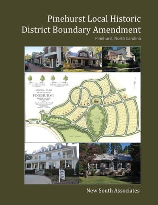
  • 1. Pinehurst Local Historic District Boundary Amendment Pinehurst, North Carolina New South Associates
  • 3. Pinehurst Local Historic District Boundary Amendment Pinehurst, North Carolina Report submitted to: Village of Pinehurst • 395 Magnolia Road • Pinehurst, North Carolina 28374 Report prepared by: New South Associates • 6150 East Ponce de Leon Avenue • Stone Mountain, Georgia 30083 Ellen Turco – Principal Investigator Ellen Turco – Principal Investigator and Co-Author Martha Lauer – Historic Preservation Planner and Co-Author January 29, 2018 • Final Report New South Associates Technical Report 2791
  • 5. EXECUTIVE SUMMARY This report is a follow-up report to the 2006 Village of Pinehurst Local Historic District Report, prepared for the Village of Pinehurst (Village) by Circa, Inc. In 2017, the Village contracted with New South Associates (New South) to reexamine the Pinehurst Local Historic District Overlay boundary adopted by the Village Council on September 26, 2006. Historic contexts, background history, property types and architectural styles are fully described in the 1996 National Historic Landmark (NHL) nomination. Circa’s 2006 local landmark report, based on field survey work conducted in 2005 and 2006, added descriptions of additional architectural styles that were not included in the 2006 NHL report. For purposes of brevity, discussions of history and building types and styles are not reproduced in full here. The NHL and 2006 local landmark district report should be treated as companion documents to this report and are included as Appendices A and B. As a result of this reexamination, New South recommends that the existing local historic district overlay boundary be amended into three smaller districts: Old Village Center, Village West, and the School District. These recommended districts are associated with their own historical contexts and physical development and acknowledge the “special character” of different areas within the Village. iPINEHURST LOCAL HISTORIC DISTRICT BOUNDARY AMENDMENT
  • 6. This page intentionally left blank ii
  • 7. TABLE OF CONTENTS EXECUTIVE SUMMARY.............................................................................................................. i TABLE OF CONTENTS .............................................................................................................. iii LIST OF FIGURES .........................................................................................................................v I. INTRODUCTION.......................................................................................................................1 ABOUT LOCALLY DESIGNATED HISTORIC DISTRICTS IN NORTH CAROLINA..........3 PROJECT NEED..........................................................................................................................4 II. METHODS..................................................................................................................................7 III. BRIEF HISTORY OF THE DEVELOPMENT OF PINEHURST 1895-1970..........................9 PINEHURST: 1895-1948.............................................................................................................9 THE POST-WAR YEARS AND THE CHANGING OF THE GUARD: 1948-1960................10 THE FINAL DECADE OF THE TUFTS: 1960-1970 ...............................................................11 POST 1970 PINEHURST...........................................................................................................12 IV. FINDINGS AND RECOMMENDATIONS ............................................................................15 RESOURCE TYPES AND STYLES.........................................................................................15 2017 FINDINGS AND RECOMMENDATIONS......................................................................16 Special Character of the Old Village Center.........................................................................18 Special character of the Village West District.......................................................................28 Special Character of the School District...............................................................................41 RECOMMENDATIONS............................................................................................................51 REFERENCES CITED..................................................................................................................53 APPENDIX A. NRHP NOMINATION APPENDIX B. PINEHURST HISTORIC DISTRICT REPORT APPENDIX C. LIST OF PARCELS BY DISTRICT iiiPINEHURST LOCAL HISTORIC DISTRICT BOUNDARY AMENDMENT
  • 8. This page intentionally left blank iv
  • 9. LIST OF FIGURES Figure 1. Map Showing National Register, National Historic Landmark, and Local Historic xxxxxxxxxDistricts in Pinehurst.....................................................................................................2 Figure 2. Recommended Amended Local Historic District Boundaries for Old Village Center, Village West District and the School District ................................................17 Figure 3. Old Village Center Local Historic District Boundary (Recommended).....................19 Figure 4. Plan of Pinehurst. Olmsted, Olmsted and Elliot, 1895...............................................20 Figure 5. Sanborn Fire Insurance Map of Pinehurst, 1920........................................................21 Figure 6. Old Village Center Landscape Elements....................................................................23 Figure 7. Old Village Center Architectural Styles .....................................................................24 Figure 8. Old Village Center Massing, Materials and Other Details.........................................26 Figure 9. Village West District Boundary Local Historic District Boundary xxxxxxxxx(Recommended)..........................................................................................................29 Figure 10. Village West Historic District Landscape Elements...................................................31 Figure 11. Village West Historic District Architectural Styles ....................................................35 Figure 12. Village West Historic District Massing, Materials and Other Details........................37 Figure 13. School District Local Historic District Boundary (Recommended)...........................42 Figure 14. 1920 Sanborn Fire Insurance Map .............................................................................43 Figure 15. Small Houses on 100 Block of Woods Road..............................................................44 Figure 16. School Historic District Landscape Elements............................................................46 Figure 17. School Historic District Architectural Styles .............................................................49 Figure 18. School Historic District Massing, Materials and Other Details .................................50 vPINEHURST LOCAL HISTORIC DISTRICT BOUNDARY AMENDMENT
  • 10. This page intentionally left blank vi
  • 11. I. INTRODUCTION In February 2005, Circa. Inc. was contracted by the Village of Pinehurst (Village) to conduct an architectural survey and historical research for the purpose of establishing, a local historic district zoning overlay in the Village of Pinehurst (Figure 1). Prior to 2006, the Village had completed a series of historic preservation-related projects and initiatives had been completed. • 1973 - Pinehurst Historic District listed in National Register of Historic Places (NRHP). • 1992 - Pinehurst Race Track listed in National Register of Historic Places • 1995 - Old Village Center Overlay District established as part of the development of the Pinehurst Development Ordinance. • 1996 - National Register District expanded to include 1973 district, 1992 Race Track, and newly surveyed areas. This project resulted in establishment of the Pinehurst National Historic Landmark, which recognized the community’s importance at the national level. • 2001 - Citizen-conducted survey of buildings over 50 years of age northeast of the Pinehurst National Historic Landmark boundary, in an area known as the School District. • 2003 - Adoption of Pinehurst Comprehensive Long-Range Village Plan, which called for the establishment of a large local historic district zoning overlay that expanded beyond the boundary of the 1995 Old Village Center overlay district. • 2006 - Adoption of the Pinehurst Local Historic Preservation Ordinance by the Village Council (March 14, 2006). This ordinance established the local Historic Preservation Commission (HPC) and allowed for the designation of historic landmark properties and districts, pursuant to North Carolina General Statutes, (General Statutes of North Carolina, Chapter 160.A, Part 3C, ss.160A--400.1-400.14). In order to determine an appropriate boundary for a local historic district, the scope of Circa’s 2005-2006 survey project was to record and evaluate previously undocumented properties within the Old Village Center Overlay District and four additional new survey areas identified by Village staff: Survey Area I (Linden Road, west of the Old Village Center overlay district); Survey Area II (Campbell, Dalrymple, and Midland Roads east of the Old Village Center overlay district); Survey Area III (northeast of the Old Village Center overlay district, along McCaskill, 1PINEHURST LOCAL HISTORIC DISTRICT BOUNDARY AMENDMENT
  • 12. Figure 1. Map Showing National Register, National Historic Landmark, and Local Historic Districts in Pinehurst 1973 Pinehurst Historic District 1992 Pinehurst Race Track 1996 Pinhurst Historic District Boundary Expaned (NHL) 2006 Pinehurst Local Historic District Excluded Area 0 0.5 10.25 Miles 0 1 20.5 Kilometers Source: ESRI Resource Data 2
  • 13. McIntyre, Kelly, Page, and Midland Roads); and Survey Area IV (southwest of the Old Village Center overlay district and roughly bounded by Beulah Hill and Blue Roads and the railroad line. A total of 131 properties were recorded for the first time as part of this project. Based on the results of the survey and the findings of historical research relating to the development of Pinehurst, Circa, Inc. recommended a boundary for a potential local historic district. Properties located within this boundary were constructed between 1895 and 1970 the period of significance identified for the recommended local historic district, and were considered contributing resources to the local historic district, unless they had undergone significant alterations that affected their overall physical integrity. The ordinance creating the “Local Historic District Overlay” was adopted by the Pinehurst Village Council on September 26, 2006. The Village of Pinehurst Historic District Standards and Guidelines (Standards and Guidelines) were adopted by the Village Council on September 26, 2006. The Standards and Guidelines were subsequently amended on June 20, 2012; August 20, 2013, and September 11, 2013. ABOUT LOCALLY DESIGNATED HISTORIC DISTRICTS IN NORTH CAROLINA Under North Carolina law (GS160A-400.1-400.14), local governments are permitted to establish historic preservation commissions, and subsequently designate locally zoned historic districts and landmarks. Local designation allows a community to bestow honor upon historic resources, which are found to possess historic or architectural significance at the state or local level. Local designation requires that a property, or properties, possess historic or architectural significance and retain overall physical integrity in order to be considered for designation. State legislation also requires that the “land area” being designated be well defined, including a description of elements contributing to the significance of the overall site. The designation of a local historic district is done on the recommendation of the local government’s appointed Historic Preservation Commission (HPC). Local HPCs only exist where they have been clearly created by their local governing body, in the case of Pinehurst, the Village Council. It is important not to confuse local designation programs with the National Register of Historic Places (NRHP) or National Historic Landmark (NHL) programs, as these are federal programs. The NRHP is the official list of the nation’s historic places worthy of preservation. NHL properties are those special properties designated by the Secretary of the Interior as nationally significant because they possess exceptional value or quality in illustrating or interpreting the heritage of the United States. All properties designated NHLs are automatically included in the NRHP. 3PINEHURST LOCAL HISTORIC DISTRICT BOUNDARY AMENDMENT
  • 14. While historic districts may carry NRHP and local designations, the regulations and benefits associated with each designation are different. NRHP designation is first and foremost an honorary designation that offers little protection from the alteration or demolition of a designated property. Properties listed in the NRHP, either individually or as a contributing resource in a district, are eligible for state and federal tax credits for rehabilitation. Locally designated properties may have more locally imposed limitations in relation to alterations, additions, and demolitions. However, these limitations are set forth and administered by the local governing body through its design guidelines and the interpretation of those guidelines by the appointed preservation commission or its staff. Local designation affords a community the ability to protect its resources. Landowners and commission members are neighbors and peers in this process. At no point is an application to a local preservation commission acted upon in a binding way by a state or federal agency. PROJECT NEED Many neighborhood preservation efforts begin with the establishment of a National Register Historic District, which is honorary and makes available federal and state rehabilitation tax credits. It has been typical in North Carolina for local jurisdictions to use the historic information and boundaries identified in a National Register Historic District and/or NHL District designation reports in the establishment of local historic districts. A review of jurisdictions indicates that in the past, rather than identify several districts in a town, a single historic district was formed, generally identifying all resources with historic integrity that meet the over 50-year age requirement. For the purposes of administering federal historic preservation programs, this has been effective. A single historic district can be challenging to administer as a local historic district, however, as most jurisdictions with a single district are comprised of several neighborhoods with disparate elements, including, but not limited to varying periods of significance, building sizes, streetscapes, and landscapes. To properly protect the more fine-grained special character of historic neighborhoods encompassed within a catch-all district, a more in-depth study and determination of boundaries may be prepared. To this end, the Village of Pinehurst selected New South Associates, Inc. (New South) to reexamine local overlay boundaries to determine if the Pinehurst Local Historic District warrants being divided into smaller districts. Pinehurst HPC charged New South with a study to determine the appropriateness of amending the Pinehurst Local Historic District zoning map to create smaller, more cohesive local historic districts. The HPC’s request was precipitated in part by an increase in Certificate of Appropriateness (COA) applications for the construction of new dwellings in the vicinity of 4
  • 15. the Pinehurst Elementary School.1 The Standards and Guidelines have been interpreted by the Village legal counsel to apply to the entire area within the local historic district boundary, leaving the HPC with no mechanism by which to deny COA applications for new construction or additions that are not in keeping with the immediately surrounding buildings or streetscapes of a particular section of the district. The size of the existing local historic district (597 parcels) does not account for the nuances among the distinct physical environments contained within it. As a result, the HPC presently has no way to deny COA applications for alterations or new construction that are incongruous with their immediate surroundings because the proposed work is out of scale, in terms of building height, massing and square-footage, and/or rendered in an incompatible architectural style, or utilized incongruous building materials. The Village retained New South to study the character of several geographical areas at the neighborhood level. The Village staff and the HPC preliminarily identified these neighborhoods. New South was requested to prepare a report summarizing the findings of the neighborhood analyses and to recommend amendments to the Pinehurst Local Historic District boundary based on the special character of discrete area, if appropriate. 1 A Certificate of Appropriateness (COA) is a permit issued by the Historic Preservation Commission through the Village of Pinehurst indicating that proposed exterior changes to the property are not incongruous with the historic character of the Pinehurst Local Historic District. The Village of Pinehurst Local Historic District Standards and Guidelines, adopted by the Village Council in 2006 (amended, 2012 and 2013), is the document the HPC uses to determine if proposed changes to a historic resource are not incongruous. 5PINEHURST LOCAL HISTORIC DISTRICT BOUNDARY AMENDMENT
  • 16. This page intentionally left blank 6
  • 17. II. METHODS On October 4, 2017, New South staff met in Pinehurst with Village staff and representatives of the HPC to refine the project parameters and develop a plan of work. All parties reviewed maps of the various districts and the attendees delineated potential areas for neighborhood- level analysis based on their potential for disparate physical character. General areas for study included: the Old Village Center area, which roughly corresponded with the 1973 Pinehurst National Register District; an area west of the Village Center containing Pinehurst’s largest historic homes, sometimes referred to locally as “Million Dollar Hill”; the recreational area south of the Village Center containing the golf courses and race track; the industrial and service area north of the Village Center; and an area of modest worker housing near the Pinehurst Elementary School. Properties in these areas had previously been documented, in some cases multiple times, as part of previous historic architectural survey projects conducted in Pinehurst. It was determined that sufficient historical information and photographic documentation existed for resources within the Pinehurst Local Historic District and that documentation and evaluation at the resource level was not necessary to complete the task at hand: an analysis and comparison of visual character of geographical clusters of resources.2 Because the subject area has been protected since 2006 through the HPC and its Standards and Guidelines, it is assumed that any change that has occurred since the last survey has received approval; and therefore, the overall integrity of the district has remains. It was also agreed that any recommended amendments to the landmark district should, if feasible, take place within the existing boundary and not bring new areas into the district, or remove areas that had previously been included. After discussion and a review of maps, the attendees commenced an overview driving tour of Pinehurst. It merits note that identifying a house by its street number can be a challenge in Pinehurst, as property addresses have changed over the years. There are multiple instances where parcels have been divided into smaller ones, or small parcels have been recombined into new, larger parcels. Many residences were assigned new street address numbers as part of a 911 emergency response project. Some property owners display their new 911-assigned numbers on their abodes, 2 Written and photographic documentation for Pinehurst’s historic buildings can be found in multiple repositories and reports. Historic architectural survey files for individual resources and/or building groups are on file and available to the public at the North Carolina State Historic Preservation Office in Raleigh and the Village of Pinehurst Planning Department. Also see the resource inventory list incorporated into the 1996 National Historic Landmark Report and Appendix A of the 2006 Local Historic District Report. The Village Planning Department also maintains COArecords which contain photographs and descriptions of changes made to historic properties since 2006. 7PINEHURST LOCAL HISTORIC DISTRICT BOUNDARY AMENDMENT
  • 18. some retain their original numbers, and still others choose to display no number at all. Presently, Moore County maintains Pinehurst’s tax parcel data and many property records do not include a physical street address number. For these reasons, a search for a specific house by street address can be challenging. While this situation did not present a problem for the neighborhood-level analysis conducted by New South staff, the authors point it out as a caution to those who may work with district resources in the future. At this point, the county-assigned parcel identification number is the most accurate way to identify a property and should be used by the Village for administrative purposes. In this report, specific buildings are referred to either by the street address, if known, or by the street only, or by the historical name of the property as identified in the NHL report. New South staff conducted additional in depth windshield surveys of the Pinehurst Local Historic DistrictonNovember8and29,2017. Duringthesesurveys,photographsofrepresentativebuildings were taken to document the geographical differences in styles, materials, building heights and massing. A spreadsheet was created to track construction dates, contributing/non-contributing status, and other building information for the purpose of analysis and recommendation. The spreadsheet was subsequently translated into a GIS layer so these attributes could be visually depicted and analyzed. Tax parcel data was downloaded from Moore County. The Village provided New South with in-house GIS data for the NRHP and local district boundaries. GIS data was also obtained from the State Historic Preservation Office. New South reconciled this data in the few instances where it conflicted. As a result of the fieldwork and subsequent analysis, New South prepared this report with recommendations for amending the Pinehurst Local Historic District boundary into three distinct districts: Old Village, Village West, and the School District. Each of the three districts has a separate, defined character when viewed through the lens of managing change through local regulation. The sections that follow provide summaries of the history of Pinehurst, types and styles of buildings found in Pinehurst, a synopsis of the three new areas recommended for a boundary amendment, “Special Character Essays” for each recommended area, and a summary section presenting recommendations for the future. 8
  • 19. III. BRIEF HISTORY OF THE DEVELOPMENT OF PINEHURST 1895-1970 (Note: Since considerable research has been done on the history of Pinehurst from 1895-1948 through the National Register and NHL designations, that portion of local history is presented here in brief. For a more detailed account please refer to those reports, found in the Appendix.) PINEHURST: 1895-1948 Beginning in the summer of 1895 and ending in December 1896, James Walker Tufts, a manufacturer from Boston, Massachusetts, and head of the America Soda Foundation assembled and purchased 5,980 acres of mostly cut timberlands in Moore County. These lands, acquired for the sum of $7,400, would later become known as Pinehurst. In the summer of 1895, before many of the land transactions were complete, Tufts hired the New York-based landscape architecture firm of Olmsted, Olmsted, and Eliot to create a “diagram for location of hotel and cottages” (Hood and Phillips 1996:76). This first step in the development of the Village of Pinehurst signified the importance of landscape, setting, and the integration of the natural and built environments that would define Pinehurst more than a century later. Tufts’ initial plan was to market the Village as a health resort. His marketing letters to Boston area physicians advertise Pinehurst as a respite from the city, offering a healthful environment for those with consumption. Between July 1895 and February 1896, 23 buildings were constructed in the Village, including an inn, boarding houses, cottages, and a store. In 1897, Tufts had to scrap the health resort plan as a result of new research on consumption. At the close of the 1897 season, Tufts banned consumptives from the property. It was at this time that the focus of the resort village shifted to recreation, resulting in the construction of the golf links and golf club house. In the fall of 1900, Donald James Ross came to Pinehurst and took over the golfing operations, a position he would maintain for the next 40 years. Pinehurst continued to grow at a rapid pace in the following decades under the guidance of James Walker Tufts and, after his death in 1902, his son Leonard Tufts. The latter was responsible for the majority of buildings within the Village core constructed in the 1900s and 1910s. Winter guests would rent cottages for the season or, if coming for a shorter visit, would stay in the many hotel rooms and boarding houses located throughout the Village. 9PINEHURST LOCAL HISTORIC DISTRICT BOUNDARY AMENDMENT
  • 20. As Pinehurst continued to establish itself as an ideal winter resort, adding more golfing opportunities, a harness track, and other recreational elements, the nature of development in the Village changed. By the mid 1910s and throughout the 1920s properties were being constructed by private property owners. These properties were often more substantial in scale and rendered in architectural styles reflective of national trends. This was in contrast to earlier cottage construction completed in Tufts’ prescribed ‘New England Village in the North Carolina Sandhills’ style. The stock market crash of 1929 and subsequent depression had its effect on Pinehurst. While 1931 was the only year the resort did not show a profit, building projects were considerably slower during the 1930s and the Village paid its employees non-cash wages known as script. This script was accepted as currency throughout the Village as well as in nearby Sanford and the state’s capitol, Raleigh. However, in 1935, the resort installed its first grass greens (earlier greens had been sand) and in the fall of 1936, the Professional Golfer’s Association of America (PGA) National Championship was played on #2. This significant event further cemented Pinehurst’s role in American golf and gave the Resort a much-needed boost in a tough financial period. In the early 1940s, the proximity of Pinehurst to Camp (later Fort) Bragg resulted in a strong military presence during the war years. There was the chance, although it never materialized, that many structures in Pinehurst, particularly the hotels and inns, would be occupied by military troops during World War II. This never came to pass and the Resort was able to operate all of its facilities through the war. Pinehurst celebrated its fiftieth anniversary in 1945. In 1946, Richard Sise Tufts, who had managed the resort since his father Leonard’s death in 1930, announced a series of changes. At the center of these modifications was the reorganization of the company’s stock in such a manner that it would not fall out of family ownership (Tufts, July 2006 in Circa, Inc. 2006:8). First, the company announced a profit-sharing plan for all full-time employees who had been with the company (Pinehurst, Inc.) for five years or more. Second, the management structure of the company was reorganized. As a result of these changes, Donald Ross resigned. THE POST-WAR YEARS AND THE CHANGING OF THE GUARD: 1948-1960 Between 1948 and 1960 Pinehurst continued to operate as a seasonal resort. The hotels, golf courses, and stores were open only during the season, late September through May. The Pinehurst Outlook, the weekly news publication for the area, was filled with articles on sporting events, social gatherings, and light articles about the activities of Villagers, almost always with a reference to where their permanent residences were. 10
  • 21. This resort lifestyle was also reflected in the building that occurred in Pinehurst during that time. Homes were still being built by private owners, often reported in the Outlook with reference to which architect and builder had been selected for the job. The majority of houses built during this period were to the northeast of the Village lining Midland, Page, and Everette roads. A handful of homes were also built during that era in an employee-housing neighborhood, primarily on Medlin and Kelly roads. The types of houses built during this era were much like those that had been built in Pinehurst for the previous several decades. Stylistically, they were reflective of national trends but with the individuality that came from being architect-designed. Many of these homes incorporated elements of New England architecture, such as shingled exterior walls that appear in the earliest homes of the Village, built under the direction of the Tufts. It was during this era that the number of full-time residents increased considerably in the Village. To serve this population, a public school was constructed during the 1950s on Kelly Road, and plans were being made for public recreational facilities such as parks and swimming pools. The traffic circle, constructed in the mid 1950s at the junction of Highways 15/501, NC 211 and NC 2, was completed, indicating a need to handle a larger volume of traffic in the area. Several changes were also occurring at Pinehurst, Inc. during this era. In 1948, Donald Ross died at Moore County Regional Hospital. While Ross had resigned his position on the board during the reorganization of Pinehurst, Inc. a few years earlier, his presence was always felt and his opinion respected in the Village. In 1958, Isham Sledge, long time friend of Leonard Tufts as well as stockholder and Chief Financial Officer of Pinehurst, Inc. since the 1920s, passed away. Sledge had openly disapproved of the 1946 plans to reorganize the company but remained on the board of directors until his death. His death is thought to have contributed to the slow unraveling of the company that would occur in the next decade. THE FINAL DECADE OF THE TUFTS: 1960-1970 Several articles published in the Outlook in 1960 foreshadowed the Village’s evolution in the next decade to a year-round community. More of the Village’s inns remained open through the summer months and added amenities like air-conditioning and swimming pools, reflective of a year-round interest in visiting the Resort Village. At the local level, a year-round population had also begun to take hold. The Village announced plans to build amenities, such as a pool, public parks, and a library. These were all amenities, minus the library, that guests of the Resort would have access to at one of the Resort facilities. The fact that the Village was building them indicates that they were serving the non-resort population. 11PINEHURST LOCAL HISTORIC DISTRICT BOUNDARY AMENDMENT
  • 22. An article in the May 20, 1960 edition of the Outlook announced the sale of the 1,800-acre Pinewild Estate to E.N. Richards of Raleigh. Prior to this sale, the majority of land transactions in Pinehurst, with the exception of Tufts’ original purchase, had been smaller lots for the construction of individual homes or estates. Richards was a known developer in Raleigh who had moved there from Brooklyn 15 years earlier and constructed hundreds of homes around the capital city. The Outlook article made clear that Richards’ intention was to develop the property as a subdivision, the beginning of many large-scale developments that would change Pinehurst’s environment. Richard Sise Tufts resigned as head of the Pinehurst, Inc. in 1963. In the following seven years, there were three successors: Albert Tufts, James Tufts and his son-in-law James E. Harrington. By the late 1960s, each of these men was close to retirement, if not retired already. At the same time, parts of the resort were in need of updating to remain competitive with similar resorts being built on the South Carolina coast and in Florida. This compounded with changes in the North Carolina laws on estate taxes caused the family to re-think their ownership of the resort. The changes to the North Carolina Estate Tax would have effectively caused the family to hold smaller portions of the resort as it passed to a surviving spouse and then the succeeding generation. The family realized that they could hold as little as 50 percent of the company within just a few generations (Tufts, July 2006 in Circa, Inc. 2006:10). According to descendant Robert Tufts, the family chose to put the resort on the market for one calendar year: January through December 1970. Correspondence held at the Tufts Archives shows that the board was both entertaining offers for purchase while subsequently making plans to update the resort, should an appropriate seller not be found. POST 1970 PINEHURST Effective December 31, 1970, the Diamondhead Corporation became owners of the Pinehurst Resort. The $9.2 million purchase price included the Carolina Hotel, the Holly Inn, the Pinehurst Country Club, five golf courses, the garage, racetrack and stables, service facilities, and several thousand acres of undeveloped land surrounding the Resort. Diamondhead’s plans for making improvements to the property made clear that their vision for the Resort was different than that of the Tufts. By the 1970s, demand was high for housing in Pinehurst, and homes located on the edges of golf courses, a concept that was in practice in other fashionable resorts in the country, were highly desirable. Diamondhead’s management chose to cut away areas in between the greens and develop them as subdivisions for condominiums and single-family homes. This pro- development approach was furthered by the systematic selling off of the thousands of ‘buffer’ 12
  • 23. acres that surrounded the Village and Resort. These lands were sold off in large tracts and developed as sizable subdivisions. It was the result of these development choices, and the loss of the vast open spaces, that forever changed the face of Pinehurst. 13PINEHURST LOCAL HISTORIC DISTRICT BOUNDARY AMENDMENT
  • 24. This page intentionally left blank 14
  • 25. IV. FINDINGS AND RECOMMENDATIONS RESOURCE TYPES AND STYLES The types, or categories, of historic resources found in Pinehurst were identified in the 1996 NHL report. The 2006 local landmark designation report did not identify any additional resource types. The categories “planned landscape” and “outbuilding” were added in 2017. Categories of resource types found in Pinehurst are listed below. • Single Dwelling • Religious Facility • Multiple Dwelling • Church Related Residence • Outbuilding • Theater • Hotel • Music Facility • Business • Recreation Facility • Financial Institution • Outdoor Recreation • Specialty Store • Animal Facility • Restaurant • Horticulture Facility • Club House • Park • Post Office • Planned Landscape Style refers to architectural fashions popular during a period of time in history. Buildings or structures, such as houses, churches, bandstands, or funerary monuments, may possess architectural style, although some do not and are categorized as folk or vernacular buildings. Style is characterized by the features that make a building or structure historically identifiable. Elements of style may include massing, building materials, and ornamentation. Styles of historic resources in Pinehurst identified are in the 1996 NHL report and the 2006 local historic district report. These styles are listed below. • Queen Anne • Classical Revival • Shingle • Late Gothic Revival • Edwardian Cottage • Mission Revival • English Manor Revival • Mediterranean Revival • Georgian Revival • Bungalow/Craftsman • Colonial Revival • Mid-Twentieth-Century Colonial Revival • Spanish Colonial Revival • Ranch • Tudor Revival • Contemporary 15PINEHURST LOCAL HISTORIC DISTRICT BOUNDARY AMENDMENT
  • 26. 2017 FINDINGS AND RECOMMENDATIONS Based on Circa’s 2006 historic research and recommendation as summarized in the Village of Pinehurst Local Historic District Report, the Village Council established a Historic Preservation Commission and designated the Pinehurst Local Historic District. This was a substantial step towards protecting the distinct character and significant history of the Village as a planned resort, as evident in its unique architectural forms, streetscapes, and landscapes that define the community. Furthermore, the Standards and Guidelines were adopted by the Village Council to manage the protection of the village’s residential, commercial, and institutional structures, as well as its landscape elements. Because of the wide variety of resources found as a result of the recent survey work in the existing Pinehurst Local Historic District, New South recommends that the Village of Pinehurst amend its zoning map to subdivide the Pinehurst Local Historic District into three distinct areas: Old Village Center Historic District, Village West Historic District, and the School Historic District (Figure 2). This will allow the HPC to better evaluate the congruity of COA applications based on the specific character of Pinehurst’s neighborhoods. One of the captivating characteristics of all three recommended historic districts is the verdant naturalistic landscape and low height profiles of the built environment. In the Old Village Center, one experiences a compact, quaint village. The collection of late nineteenth- and early twentieth-century cottages creates a unique character that is only experienced in the Old Village Center. The Village West District extends the concentric and curvilinear street pattern, but with larger size lots and more stylized historic structures from the 1910s through the 1960, set in a suburban rhythm. Finally, the School District maintains it own gridded rhythm, populated with scaled down versions of the structures found within the Old Village Center. The simplified architectural styles are consistent with that of the styles found within the two, more articulated districts. In order to support the administration of three districts, New South developed Special Character Essays for each neighborhood, identifying the architectural and landscape details that create the character so worth preserving.3 The Special Character Essays that follow include detailed descriptions of each recommended district including, setting and landscape; building scale, form, massing, and architectural style; and finishing details such as materials, windows and decorative features. These sections also discuss each district’s landscapes, including elements such as streetscapes, sidewalks and walkways, parking, vegetation, and vistas. 3 Special Character Essay concept was originally developed by the Raleigh Historic Development Commission, Inc. in its Design Guidelines for Raleigh Historic Districts and Landmarks. 16
  • 27. Figure 2. Recommended Amended Local Historic District Boundaries for Old Village Center, Village West District and the School District Village West District Old Town Village District School District Excluded Area 0 0.5 10.25 Miles 0 1 20.5 Kilometers Source: ESRI Resource Data 17PINEHURST LOCAL HISTORIC DISTRICT BOUNDARY AMENDMENT
  • 28. Concurrent with the adoption of the amended zoning map, the HPC should adopt the Special Character Essays found in this document as an official Appendix to Pinehurst’s Standards and Guidelines. It is also recommended that the HPC evaluate the current Standards and Guidelines to ensure that the guidelines for evaluating each of the items in the Special Character descriptions is sufficiently addressed. SPECIAL CHARACTER OF THE OLD VILLAGE CENTER The Old Village Center District roughly coincides with the boundary of the 1973 Pinehurst Historic District, the first federally recognized historic district in Pinehurst (Figure 3). The name “Old Village Center” was chosen for this district because this area reflects Frederick Law Olmstead’s original compact and picturesque landscape plan and contains the oldest structures in Pinehurst, dating from 1895. The district is the literal and figurative center of historic Pinehurst, the location of its commercial core, which serves as the social nucleus of the village. The district contains 215 parcels and is the only district in Pinehurst historically planned to be a self- sufficient village of single-family residences, hotels and rooming houses, churches, a theater, stores, an industrial/support area, and outdoor spaces for recreation and the enjoyment of nature. Location and Layout The Old Village Center District is roughly bounded by McCaskill Road, Spur Road, Palmetto Road, Beulah Hill Road, McLean Road, and Graham Road in a clockwise fashion. The district encompasses Frederick Law Olmsted’s and Warren H. Manning’s approximately 100-acre plan for a pattern of curvilinear and concentric of streets, arranged around an oval-shaped village green, with a “wilderness” containing a Pine Grove and Deer Park, later known as Marshall Park, at the southern end of the village at the terminus of Carolina Vista (Figure 4). This area is characterized by its compactness and the homogeneity of its eclectic “cottage style” collection of wood houses. The Old Village Center District also includes the 1899 enlargement of the original plan to accommodate the 22-acre park-like setting of the Carolina Hotel, now the Pinehurst Resort, northwest of the village green. Residential lots in the Old Village Center District typically range from 0.3-0.5 of an acre and are generally rectangular in shape, being more deep than wide. Residential building setbacks are mostly uniform and measure around 40-50 feet. The village’s commercial core, on Chinquapin Road and Market Square, displays one-, two-story and 2.5-story, attached Colonial Revival commercial buildings, which are positioned close to the road as is typical in historic commercial districts. Paved perpendicular parking has been added on both sides of these streets and brick sidewalks are in front of the commercial buildings. At the northern edge of the district is the village’s historical service area that contained the village railroad spur, steam plant, livery stable, laundry and other essential support functions. The service area is characterized by its large irregularly-shaped lots with minimal vegetation and irregularly situated low brick 18
  • 29. Hwy5 SpurRd PineValleyRd Shaw Rd SE McKenzie Rd W BarrettRdE MagnoliaRd Cherokee Rd Palmetto Rd Kelly Rd M edlin Rd CuldeeRd MapleRd Market Sq MorgantonRd Powerhouse Rd VjllageGreenRdE Community Rd M cIntyre Rd McCaskill Rd Chinquapin Rd Azalea Rd Carolina Vis Muster Branch Rd McKenzieRdE RitterRdW Power Plant Rd S Midland Rd FergusonRd DogwoodRd Palmetto Rd Barrett Rd E Magnolia Rd SpurRd Hwy5 BeulahHillRdS Fields Rd M cLean Rd Blue Rd MagnoliaRd OrangeRd Kelly Rd Graham Rd CaddellRd Ritter Rd E McCaskill Rd E RattlesnakeTrl Azalea Rd Everette Rd VillageGreenRdW PalmettoRd M cC askillR d Dundee Rd Carolina Vis Cherokee Rd E ShawRdNW BeulahHillRdN Quail Hill Condos Briarwood Pl Inverness Rd McKenzie Rd W Chinquapin Rd Azalea Rd Hwy5 GrahamRd Kelly Rd McCaskill Rd LaurelRd Everette Rd Dundee Rd M cKenzie Rd E Carolina Vis VillageLn CuldeeRd Palmetto Rd W oods Rd M cIntyre Rd Linden Rd BeulahHillRdN MagnoliaRd Shaw R d N E ChinquapinRd GrahamRd MapleRd Shaw Rd SW FergusonRd M cLean Rd Azalea Rd McCaskill Rd E Community Rd Cherokee Rd BeulahHillRdN Shaw Rd SW Dundee Rd Old Village Center District 0 500 1,000 1,500250 Feet 0 200 400100 Meters Source: ESRI Resource Data Figure 3. Old Village Center Local Historic District Boundary (Recommended) 19PINEHURST LOCAL HISTORIC DISTRICT BOUNDARY AMENDMENT
  • 30. industrial buildings. Of note are a few surviving workers’ houses on Power Plant Road. The 12- lot residential cul-de-sac, Village Lane, west of the service area, is included in the Old Village Center District because the parcel and building sizes are in keeping with those of the Old Village Center, rather than the more generous ones of the adjacent Village West area. Figure 4. Plan of Pinehurst. Olmsted, Olmsted and Elliot, 1895 PhysicaL and chronoLogicaL deveLoPment The Old Village Center District street plan was designed by Olmsted and carried out by Warren Manning over four decades, between 1895 the late 1920s. Olmsted prepared the first plan for Pinehurst for the resort’s developer, James Walker Tufts, in 1895. The plan conceptualized Pinehurst’s characteristic curvilinear and concentric system of streets that enveloped generous amounts of green space, including the iconic Village Green. A series of small hotels, boarding houses, and rental cottages, all owned by Tufts, were to be built along the village’s curving streets. A large lot was set aside for the two-story Colonial Revival Holly Inn, Pinehurst’s original hotel and one if its first completed buildings, located north of the Green. Olmstead’s plan for the village promoted a “leisurely and tranquil experience,” appropriate for a resort town. In 1899, Manning expanded the original plan in a sympathetic manner by adding a 22-acre lot at the northwest end of the village for the construction of the four-story, 250-room Colonial Revival Carolina Hotel. This expanded the land area of the village by almost 25 percent. At this time, a straight boulevard called Carolina Vista was cut southward from the Carolina Hotel tract to (Image Courtesy of the Tufts Archives in Pinehurst, NC) 20
  • 31. the recreational pine grove at the south end of the village. Beginning in 1898, Tufts developed golf courses on the south side of the village. Golf facilities increased in number and evolved in character through the years, as golf course architect Donald Ross worked constantly to improve them. In 1910, the development of the horseracing track on the east side of Beulah Hill Road was begun (Hood and Phillips 1996). Though not depicted on early maps, the development of the village’s industrial support area, with a railroad spur, power plant, waterworks and plant nursery, must have coincided with the earliest construction in the village. The 1920 Sanborn Fire Insurance map shows the Old Village Center District almost completely built out except for individual residential lots here and there and of a cluster seven lots on Laurel Road (Figure 5). In the early 1920s, Market Square was cut through between Dogwood and Magnolia roads to allow for more commercial development and to add to the commercial area already extant along Chinquapin Road. In 1924, a lot was carved out of the south end of the Village Green oval for the construction of the Village Chapel. Figure 5. Sanborn Fire Insurance Map of Pinehurst, 1920 21PINEHURST LOCAL HISTORIC DISTRICT BOUNDARY AMENDMENT
  • 32. In the summer of 1927, surveyor Francis Deaton was engaged with street widening efforts throughout the original village to accommodate the increased use of automobiles, which were not a factor when the resort had first opened. This effort reduced the wide vegetative “plantations” that Manning had placed between the walkways and roadways. Deaton also improved the village’s system of clay path sidewalks as part of the road project. In the mid-twentieth century, Pinehurst’s planned open spaces were repurposed for community uses. In 1964, the Given Memorial Library was erected at the north end of the Village Green and recently a parking lot was installed on the west side of the Green. The construction of the Pinehurst Tennis Club in the 1970s altered the naturalistic setting of Marshall Park; however, the area continues to be used recreationally. LandscaPe Pinehurst occupies a unique place in the history of American resort communities. It is historically significant at the national level for its planned landscape. Nowhere in Pinehurst is this landscape more evident than the Old Village Center District. The historic landscape has two major components: the hardscape of the circulation system and the softscape of the plantings. The district retains its character-defining original concentric and curvilinear street pattern that radiates outward from the oval Village Green. Alongside many of the streets run planting areas and sand and clay sidewalks, features described in Manning’s writings and found throughout the entirety of the village. In some places the planting areas have been eroded by necessary parallel parking spaces, but these have been sensitively added and are broken up by plantings and surfaced with gravel (Figure 6a). Hardscaped brick sidewalks have been recently installed in the commercial area and are replacing the historic paths in many parts of the Old Village Center. The road beds are narrow and historically lacked curb and gutter, which contributed to the informal resort feel of the district. The land that James Walker Tufts acquired for his resort had been stripped of native Long-Leaf pines, making extensive plantings necessary to achieving Manning’s vision of an evergreen environment. During the early years of the resort’s development, more than 225,000 native or native-appearing plants were set out in an attempt to create a park-like oasis in the North Carolina Sandhills. The Old Village Center District is heavily planted, perhaps even more so at this point than the original designers intended. Varieties of pines predominate, particularly on the Village Green. Other large evergreens species such as magnolias, laurels, hollies and cedars provide intermediate cover. Oaks and other deciduous trees contribute to the lush greenery in the spring and summer. The understory features dogwoods, and azaleas and other low-growing shrubs. This layering of textures and tree heights was called out by Manning’s in his writings and remains a distinguishing quality. Although private homeowners currently show a preference for 22
  • 33. Figure 6. Old Village Center Landscape Elements A. Typical Parallel Parking B. Example of Historic Garage and Placement C. Example of Fence D. Example of Fence A C B D grass lawns, a ground cover of pine thatch was probably most common historically. Overall, the vegetative landscape of the Old Village Center District can be described as lush and informal, and is generally consistent in public spaces and private homes. 23PINEHURST LOCAL HISTORIC DISTRICT BOUNDARY AMENDMENT
  • 34. In keeping with the informal atmosphere of the district, historic driveway and walkways are unpaved. Despite the small lots, many lots have semicircular driveways in front of the dwelling. Historic garages are positioned to the rear and to one side of their associated dwellings at the end of a straight driveway (Figure 6b). They remain visible from the public right-of-way. Low decorative wood fences are the most common type of fencing (Figure 6c and 6d). BuiLding tyPes The Old Village Center District possesses multiple types of buildings, including residential (single-family, rooming houses and grand hotels), commercial, institutional and industrial, making it the most varied of the three districts. styLes, massing, and materiaLs Pinehurst’s earliest single-family cottages were born of Tufts’ vision for his resort village, so there is cohesion to their design. These houses are not examples of any pure architectural style, but they do combine charming details to embody Tuft’s idealistic notion of the quaint New England village. The cottages of the Old Village Center display elements of the late-Victorian period Queen Anne and Shingle styles, such as plain and patterned shingles; eave brackets, exposed rafter ends, porches with turned balustrades, spindles and decorative sawnwork (Figure 7a). Dormers are common, and are used as a primary decorative feature of the building. The nationally popular Craftsman style of architecture affected local influence as seen in the unenclosed eave overhangs with exposed rafter ends and triangular brackets, tapered square Figure 7. Old Village Center Architectural Styles A. Typical Cottage Displaying Multiple Decorative Elements B. Example of Cottage with Craftsman Details C. Example of Cottage with Craftsman Details D. Statzell Cottage E. Red Brick Cottage F. H. Rackham House A 24
  • 35. DC B E F 25PINEHURST LOCAL HISTORIC DISTRICT BOUNDARY AMENDMENT
  • 36. porch posts, and bands of windows (Figures 7b and 7c). Even the largest of the early phase dwellings have an informal feel and are essentially overblown cottages, such as the Statzell Cottage on Carolina Vista (Figure 7d). The two-story houses built after 1920 tend to drift away from the informal eclecticism of the earliest cottages. These houses adhere more to established architectural styles. Two examples are the Tudor Revival Red Brick Cottage and H.H. Rackham House (Figures 7e and 7f). In the Old Village Center, one, One and a half, and two-story heights are interspersed with one another. Roof-lines are simple gables, hips, or gambrels, with roof dormers projecting from one- and-a-half-story structures (8a). There are variations of these roof-forms, such as the clipped gable, the cross-gable, and two- and three-gable forms (8b). A few pyramidal roofs are found Figure 8. Old Village Center Massing, Materials and Other Details A. Example of gambrel roofline B. Example of clipped gable roof C. Example of Hipped Dormer D. Example of Shed Dormer E. Typical Front Gable Cottage F. Typical Front Gable Cottage G. Example of Porch H. Example of Combination Siding (German and Shingle) CB A 26
  • 37. E F D G H 27PINEHURST LOCAL HISTORIC DISTRICT BOUNDARY AMENDMENT
  • 38. in the district. Multiple historic red tile roofs survive, as well as a few slate and wood shingle roofs. Many roofs have been replaced with asphalt shingles. Quite prevalent on a variety of roof forms are dormers; examples include hipped dormers, facade dormers, and elongated shed dormers with repeated fenestration (Figure 8c and 8d). Modest side-gable cottages with simple rooflines are also scattered throughout the district (Figures 8e and 8f). Informal sitting porches are more common here than anywhere else in historic Pinehurst. They are almost all one-story in height, and come in hipped-roof, shed-roof, full-facade and wrap-around forms (Figure 8g). Materials are an important feature of the Old Village District. About half of the structures are wood-sided, either with wood shingles, German siding, or weatherboard (Figure 8h). Only a handful of houses feature two materials; noted were combinations of brick and half-timbering; stucco and wood shingles; and German siding with wood shingles. When seen, the marriage of two materials is subtle, rather than gilded with additional heavy detailing. Windows in the district vary, including leaded casement, casement, and sash windows with true divided lights, including 9/9, 6/6, 8/1, 6/1, 3/3, and 2/2. In addition to the common usage of dormer windows, a few decorative windows are seen the district. Some windows have been replaced with vinyl windows, or wood windows with simulated divided lights, which is not characteristic of the historic district and should not be replicated. The development of the Village Lane cul-de-sac, bounded by McCaskill Road to the north, Caddell Road to the east, Mclean Road to the south, and Graham Road to the east, occurred from the 1980s through 2000s. The lot sizes are around 0.3 acres and the houses are set back around 30 feet from the road. The Village Lane cul-de-sac area represents the final non-historic phase of development within in the district; as such, it reflects its time period, but is not appropriate for proposed new construction. The cul-de-sac layout is not a historic street pattern and the mostly one and one-and-a-half-story houses but do not combine the appropriate building elements to achieve congruity with the larger Old Village Center Historic District. SPECIAL CHARACTER OF THE VILLAGE WEST DISTRICT The Village West District is so called due to its locus of residential development that is west of the Old Village Center, and north and west of the Carolina Inn (Figure 9). This area was platted around 1911. The area is sometimes locally referred to as Millionaire Hill, due to the size of the homes there. Also included in the Village West District are Midland and Campbell/Dalrymple roads, east of the Old Village Center and west of the village’s historic traffic circle. A linear stretch of Linden Road is also embodied within this district. It radiates out from the heart of the district to the west, very similar in nature to the Midland Road alignment to the east. The district also encompasses Pinehurst’s historic recreational resort facilities: Pinehurst No. 2 and No. 4 golf courses and the Pinehurst Racetrack. The entire Village West District contains 202 parcels and is heavily residential in nature. 28
  • 39. Figure 9. Village West District Boundary Local Historic District Boundary (Recommended) Olivia Ln Page Rd Linden Rd EdinburgDr Monticello Dr CypressPointDr BelAirDr MagnoliaRd QuailRun NationalDr Lake Dornoch Dr Surry Cir N Hwy5 SpurRd Beaver Ln Firestone Dr Page Dr SalemDr Morganton Rd Midland Rd Donald Ross Dr ValleyRd Melrose Dr McKenzieRdE Yadkin Rd Gaines St ShortRd OakmontCir Craig Rd VardonRd Pine Valley Rd IdlewildRd PinehurstTraceDr State Hwy 211 Juniper C reek Blvd Saint Andrews Dr Muster Branch Rd Airport Rd Shaw Rd SEWilson Rd McKenzie Rd W Lake Hills Rd M ain St LodgePoleLn BarrettRdE Cherokee Rd Dawkins St Turner Rd Lake Forest D r SE Frye Rd Rosswood Pl Brookhaven R d Forest Hills Ln Palmetto Rd Wheeling Dr HearthstoneRd Bangor Ln Kelly Rd M edlin Rd Blake Blvd W oods Rd RocklandLn McQueenRd TaylorAve SugarPineDr LoveLn Alston Dr Holly Ln Longleaf Dr E BurningTreeRd Ampersand Dr SassafrasLn Carter St RidgewoodRd Diam ondhead Dr S DoralDr CuldeeRd Lake Forest Dr Torrey Pines Ln Crocker St CentralParkAve LindenLn Pine M eadow s R d HorseCreekRun Hunt St PitchPineLn OvercupLn Pinehurst St Cabot Cir Oak Ct Apaloosa Pl Augusta W ay Barrett Rd W Powerhouse Rd Regal Way Gambel Ct Trotter Dr Longleaf Dr W QuailHollow Pine Vista Dr Merion Cir DeerRun McCaskill Rd Olmstead Blvd Denichilo Ct Raleigh Dr Saville Row LakeShoreCt PostCt InvernessPl WhirlaWay BoardBranchRd Page Rd Linden Rd Midland Rd ShortRd Morganton Rd Q uail R un Yadkin Rd M cKenzie Rd WLinden Rd Palmetto Rd Yadkin Rd State Hwy 211 M agnolia Rd Burning Tree Rd StateHwy211 BeulahHillRdS Yadkin Rd Midland Rd Page Rd QuailHollow CherryHillDr Ampersand Dr MainSt Gaines St Sugar Gum Ln Stoneykirk Dr Brookline Dr M em orial Dr Inverrary Rd Blue Rd Hwy5 Cotton St SakonnetTrl Rassie Wicker Dr Lake Hills Rd MurdocksvilleRd LostTreeRd MonticelloDr SaintAndrewsDr Hearthstone Rd StateHwy5 USHwy15 Fields Rd McLean Rd Ivey Ln Dawkins St Braemar Rd ArmstrongLn MagnoliaRd Gray Fox Run FryeRd Linden Rd Eldorado Ln MerionCir Moore Dr Canter Ln O range Rd LakeForestDrSW D ove R un KnollwoodRd Sulky Ln Wheeling Dr P492 Kelly Rd Wicker Ln Regional Dr Highland Dr Oak Meadow Rd Oakmont Cir Ritter Rd E PinyonCir McDonaldRdW Dogwood Ter Gun Club Rd LoweryLn MaplesLn LiveOakLn ParsonRd AmboyPl D iam ondhead D r S WoodenbridgeLn LincolnAve Rutledge Ln New Bedford Cir AshevilleWay ChestnutLn FurlongPl BelairCt Merion Q uailRun Nashua Ct Ham ptonsDr Pin Oak Ct SeminolePl Topaz Ln InterlachonDr Vinson Ln SurryCirS Starlit Ln McBrydeLoop Surry Cir N ShenecossettLn LongleafDrE Starlit Ct Briarwood Pl InverraryCt Stoneykirk Dr DiamondheadDrS Yadkin Rd Frye Rd Yadkin Rd GunClubRd InverraryRd PageRd Quail Hollow Linden Rd State Hwy 211 Hwy5 Linden Rd LinvilleDr Brookline Dr Morganton Rd Kelly Rd Everette Rd AshleyDr Inverrary Rd Blake Blvd LongleafDrW Saint Andrews Dr Diamondhead Dr S Yadkin Rd StateHwy5 USHwy501 BelAirDr Ivy Way LincolnAve M em orialDr Lake Dornoch Dr Donald Ross Dr FloydWay CanterLn FillyPl M cKenzie Rd E Ampersand Rd Monticello Dr PinehurstManor Harlow Rd Walnut Creek Rd CentralParkAve GunClubRd DoralDr LakeForestDrSE LlewellinSt GraysonLn Pine Valley Rd Cotton St GoldthreadLn MelroseDr SaddleCt GullLn FirestoneLn Trotter Hills Cir Dawkins St Exd MallardLn CherryLn M cLeod Rd Apawam isRd Inverrary Rd Linden Rd Doral Dr Inverrary Rd Village West District Excluded Area 0 0.5 10.25 Miles 0 1 20.5 Kilometers Source: ESRI Resource Data 29PINEHURST LOCAL HISTORIC DISTRICT BOUNDARY AMENDMENT
  • 40. Location, Layout, and setting The Village West District has an irregularly shaped boundary that begins at the north parcel corner of 85 McKenzie Road. From there, it follows the rear lot lines of the McKenzie Road parcels to Beulah Hill Road North before it veers northwest to encompass the houses on McDonald Road West till it reaches Linden Road. The boundary extends west enveloping houses on both sides of Linden Road to the Pinewild Country Club. It then picks up the parcels on the east side of McKenzie Road West and swings south, and north again, to include the irregularly shaped parcels of the Pinehurst No. 4 golf course, the Pinehurst Race Track, and the Pinehurst No. 2 golf course. Pockets of non-historic dwellings within the golf courses along McKenzie Road West, Doral Drive, and Ridgewood Road have been omitted from the district boundary. From the east side of the Pinehurst No. 2, the district continues east to take in the 1956 traffic circle and the cluster of post-1970 housing on Campbell and Dalrymple roads, and then continues southwest along the rear parcel lines on the north side of Midland Road. The line runs down the centerline of Cherokee Road southwest to the east lot line of 120 Palmetto Road, south along the east lot line, and then southwest along Palmetto Road to its terminus. The boundary then cuts west through a parking lot between the Pinehurst Country Club to the south and the Pinehurst Tennis Club to the north. It then swings north to Beulah Hill Road, traveling north until it meets McLean Road until Graham Road. From Graham, the boundary curves northwest to the beginning point. The street pattern of the Village West District is a continuation of the 1895 layout designed by Frederick Law Olmstead, with projecting linear transportation “spokes” formed by Midland and Linden roads leading to and from the village from the east and west, respectively. Warren Manning’s 1911 plan created the lots west of Beulah Hill Road. While it curves gently, Beulah Hill is a relatively straight road compared to others in Pinehurst, which is the reason it became the village’s most utilized north-south corridor. Residential lots in the Village West District are the largest of those found in historic Pinehurst. They typically measure one acre or more, are square in shape, and are roughly equal in street frontage and depth. These broad lots contribute to the estate like-feel of this district and in this aspect it differs from the compactness of the Old Village Center. Residential building setbacks are more generous here than in the Old Village Center, spanning between 50 and 100 feet. The recreational and resort facilities at the south end of the village, which were built-out between the late 1890s and the 1970s, provide the physical setting for the resort’s primary recreational activities. This area is characterized by open spaces with manicured landscaping and few buildings. LandscaPe The landscape of the Village West is similar to that of the Old Village Center, although on a larger scale. The character-defining curvilinear street pattern that originated on the west side of Beulah Hill Road remains intact. The system of sand and clay sidewalks continues here, and is more intact than in the Old Village Center (Figure 10a and 10b). The road beds are narrow and 30
  • 41. Figure 10. Village West Historic District Landscape Elements A B C D 31PINEHURST LOCAL HISTORIC DISTRICT BOUNDARY AMENDMENT
  • 42. without curb and gutter. The overall feeling of this district is more formal, owing to the large lots and broad street frontages which called out for estate-style landscaping, including grass lawns bisected by brick walkways, neat hedges, sweeping semicircular driveways marked by brick or stone entry piers, and front terraces accessed by wide steps (10c and 10d). While pine straw covers some yards, clearly grass is the preference here. Tall pine trees provide a unifying canopy for all three of Pinehurst’s historic districts (10e). The varieties of trees and shrubs do not vary between the districts; however, in pockets of Village West the plantings more spaced out, creating a more open feeling especially around the grandest houses on the north side of the district. Common tree and shrub species are: magnolias, laurels, hollies, cedars, oaks dogwoods, and azaleas. A number of the properties have historic automobile garages. Often they were built to accommodate more than one vehicle and mimicked the style of the adjacent dwelling (Figure 10f). Semicircular driveways of both gravel and concrete are popular. Low perimeter walls of stone or brick enclose some front lawns. A. Typical Sand and Clay Paths B. Typical Sand and Clay Paths C. Example of Driveway and Piers D. Example of Driveway and Piers E. Pine Trees Along Linden Road Looking East F. Example of Well Detailed Garage E F 32
  • 43. PhysicaL and chronoLogicaL deveLoPment Known as “America’s St. Andrews”, Pinehurst holds an extraordinary place in the history of golf in America for two primary reasons: its role as the nursery of golf as a sport in the United States; and its function as the model of the American golf resort (Hood and Phillips 1996:67). The rising popularity of golf as a winter pastime of the rich drove the southward and westward physical expansion of the Pinehurst village. After 1900, Leonard Tufts began the development of a “golf links” on 60 acres south of south of the Village Green in 1898. On January 1, 1901, the Carolina Hotel was officially opened. Hundreds of additional guests could now be accommodated and Pinehurst blossomed as a golf resort. Donald Ross was appointed the resort’s golf professional for the 1900-1901 season. Ross became a world famous designer of golf courses and designed, expanded or reconfigured Pinehurst courses Nos. 1, 2, 3, 4 and 5 until his death in 1948. With its small, sloping greens, deep bunkers, loose, sandy soil, and rough wiregrass, Ross described his No. 2 as “the finest test of championship golf I have ever designed” (Hood and Phillips 1996:67). In 1922, Ross built a large two-story dormered brick and frame cottage at 20 Midland Road in the newly subdivided area of the village. The 1922 house replaced his smaller cottage at 50 Magnolia Road in the Old Village Center district. Also in 1922, the 1899 golf clubhouse was replaced with a Mediterranean Revival-style clubhouse overlooking Pinehurst #2. To stimulate private development in Pinehurst around 1911, Tufts directed Warren Manning to lay out approximately 100 acres west and northwest of the Carolina Hotel into residential building lots. Manning expanded Olmstead’s 1895 pattern of ringed roadways and broadened their dimensions. The new roads west of Beulah Hill Road continued their curved layout. Building lots were one acre or more and are generally square in shape being roughly equal in length and depth. This set the stage for larger, sprawling houses and the opportunity for more extensive estate- scaled landscaping. The 1911 annexation was the first significant expansion of the original village plan since the village’s enlargement in 1899 for the Carolina Hotel. The newly created lots would be the first in Pinehurst to be purchased by private individuals, rather than developed by Tufts. For this reason, the Village West architecture is more varied stylistically than its antecedents in the Old Village Center. The houses, many of which were designed by northern architectural firms, reflect the personal preferences of their owners and demonstrate changing tastes in residential construction. 33PINEHURST LOCAL HISTORIC DISTRICT BOUNDARY AMENDMENT
  • 44. The 1920 Sanborn Fire Insurance Maps show about 35 dwellings in the Village West District. Two of these were constructed of brick, while the rest were frame. In the 1920s, Midland Road was built as the first divided, two-lane road in the state, and houses were built eastward along this landscaped boulevard. In 1956, the traffic circle at the junction of NC 2, NC 211, and US 15/501 was created at the east end of Midland Road. Its circular design mimicked the historical layout of the village, and it immediately became the primary ornamental gateway to Pinehurst. Grand and fashionable dwellings continue to be built in the Village West District from the 1920s through the 1960s in nationally popular styles. At the southernmost end of the Village West District is the approximately 60-acre Pinehurst Race Track and associated facilities. This area, south of Morganton Road, was developed between 1910 and 1942 for thoroughbred and harness racing, livestock showing and target shooting. In 1915, its centerpiece, two concentric sand and clay oval racetracks, were completed. The racetracks measure 0.5 miles for the inner track, and slightly more for the outer one. Construction of the traffic circle in 1956 intensified the building of Ranch type homes with deep front yards along Midland Road in the 1960s, particularly on the north side. The completion of the traffic circle also precipitated the establishment of Campbell and Dalrymple roads. The majority of the houses on these two streets postdate 1970, with the majority erected in the 1990s. BuiLding tyPes The Village West contains multiple building types. Residential primary structures and outbuildings, such as garages, are the most prevalent. There is one church, the Picturesque brick (former) Sacred Heart Catholic Church at 35 McLean Road. At the south end of the district are clubhouses, lodges, maintenance buildings, garages, and horse and livestock barns associated with Pinehurst’s golf, tennis and equestrian activities. styLe, massing, and materiaLs The residential properties located in the Village West District post-date 1911. The buildings are not as old as those in Old Village Center, are more commodious, and are located on broad lots that are suburban in nature. Built by private owners and designed by architects, there is a notable abandonment of Tuft’s New England feel found in the Old Village District, with houses displaying a greater degree of individuality. The first houses built in Village West were larger versions of Pinehurst’s earliest cottages. By the 1920s, dwellings became more formal. The most prevalent architectural style is the Colonial Revival, which reflected the style Tufts chose for the landmark hotels in the Old Village Center (Figures 11a-11c). This style conveyed formality, wealth and permanence. Colonial Revival elements, such as porticoes and classically-inspired door surrounds, are seen on 1920s-era dwellings as well as on Ranch houses from the 1950s 34
  • 45. Figure 11. Village West Historic District Architectural Styles A B C D 35PINEHURST LOCAL HISTORIC DISTRICT BOUNDARY AMENDMENT
  • 46. and 1960s (Figure 11d). There are multiple examples of English Tudor Revival houses with characteristic brick, stucco and half-timbered exteriors (Figure 11e and 11f). Some dwellings display a pastiche of two or more styles such as Craftsman and Colonial Revival (Figure 11g). Massing of structures in the Village West District is of larger scale than the Old Village Center. Broad facades express interiors with high ceilings and generously sized rooms. A one-story house here is both taller and wider than its counterpart in the Old Village Center. Symmetrical or bi-laterally balanced houses were preferred. Sitting porches are not common. Perhaps the residents of the Village West were busily engaged with golf and tennis and sitting porches were not of use, or maybe they enjoyed the arcaded communal porch at clubhouse overlooking Pinehurst No, 2. Regardless, the two most common types of porches are decorative one-bay entryway porches or grand porticoes with plain Tuscan columns (Figure 12a). Neither was intended for sitting. In place of the porch, elaborate front door surrounds are often the focal point of the facade (Figure 12b). A. Example of Colonial Revival B. Example of Colonial Revival (Georgian) C. Example of Colonial Revival (Georgian) D. Example of Colonial Revival (Ranch) E. Example of Tudor Revival F. Example of Tudor Revival G. Example Mixed Colonial Revival and Craftsman Elements E F G 36
  • 47. Figure 12. Village West Historic District Massing, Materials and Other Details A B 37PINEHURST LOCAL HISTORIC DISTRICT BOUNDARY AMENDMENT
  • 48. Distribution of 1, 1.5 and 2-Story Houses in the Village West District 1 and 1.5-Story Concentration 2-Story Concentration Village West District Boundary Source: ESRI Resource Data 0 1,000 2,000500 Feet 0 400 800200 Meters C 38
  • 49. A. Example of 1-Bay Porch B. Example of Entry Surround C. Map Showing Concentrations of Lots with 1-Story, One and a half-Story and 2-Story Houses D. Example of Front-Gable House E. Example of Hipped-Roof House F. Example of Hipped-Roof House G. Example of Gambrel-Roof House H. Example of Dormers D E F G H 39PINEHURST LOCAL HISTORIC DISTRICT BOUNDARY AMENDMENT
  • 50. The historic development pattern of the heart of the Village West District, roughly bounded by Beulah Hill, McKenzie, Ferguson and McLean roads, is primarily characterized by two-story houses, with one-and-a-half-story houses mixed in. The edges of the district, including the properties east of Beulah Hill Road, as well as along Linden and Ritter roads, are primarily populated by one-story houses, interspersed with one-and-a-half-story houses. So historically, in the heart of Village West, there was a central area of taller houses, which generally tapered down to slightly lower houses to meet the Old Village Center Historic District at the northern and southern sides (Figure 12c). The structures located along Midland Road comprise the most mixed variety of building heights, with primarily one-story houses on the northwest side of the divided boulevard, and a mixture of two- and one-and-a-half-story houses on the southeast side of the boulevard. Roof forms in the Village West District are primarily front gable, hip, or gambrel, a combination that adds variety to the streetscapes (Figures 12d, 12e, 12f and 12g). There are simple variations of these roof-forms, such as the clipped gable or a gable on hip, or gable- or gambrel-end facade treatments; however, the rooflines remain strong and simple rather than overly complex, as seen in current building trends. A handful of side-gable houses are seen throughout, as is true for all districts in Pinehurst. Dormers are a common occurrence in the district, typically hipped dormers, but also arched and shed (Figure 12h). Dormers are used on both tall one-story buildings to capture upper level space, and on two-story buildings as an aesthetic feature. There is still significant presence of historic slate roofs in the Village West District, however most roofs have been replaced with modern composite shingles. A few wood shingle tile roofs are present. Windows in the district include casement windows and sash windows such as Colonial Revival 6/6, 8/8 and 9/9 divided lights. There are subtle decorative windows on some houses, including windows that are arched, elliptical, oriel, or Palladian. In some cases, original windows have been replaced with vinyl windows or wood windows lacking true divided lights. These sorts of windows are not characteristic of the historic district and should not be replicated. Over one-half of the buildings in the West District are sided with weatherboards; wood shingles, stucco, or brick are used throughout the district to a lesser extent. About 10 percent are sheathed with two materials, one on the first story, and a differing one on the second. Wood shingles, stucco, brick, and half-timbering, are used in every combination, but at a rate of only two materials per building. The Campbell/Dalrymple area houses located north of Midland Road date from the 1970s, 1990s, and 2000s. These dwellings should not be used as models for future construction in the district. The lot sizes are around 0.8 acres and the houses are set back between 80 to 100 feet from the road. They are characterized by their complex mixed hipped and gabled roof forms that are not in keeping with the simple historic gable, gambrel, and hip forms found throughout 40
  • 51. the Village West District. The Campbell/Dalrymple area represents the final non-historic phase of development within in the district; as such, it reflects its time period, but is not appropriate for proposed new construction within the larger Village West District. SPECIAL CHARACTER OF THE SCHOOL DISTRICT The School District is named after the Pinehurst Elementary School, built circa 1950, which is on an approximately 15-acre parcel near the center of the district (Figure 13). The name “School District” was chosen to describe a present-day institutional landmark, one that is well known to the broad, local community. The School District is located northeast of the Old Village Center. The district contains 180 parcels and is heavily residential with the exception of the Pinehurst Elementary School, the Community Church at the corner of Kelly and Everette roads, and eight post-1930 commercial buildings on the west side of the district on McIntyre Road and Rattlesnake Trail. Location and Layout The School District is roughly bounded by Rattlesnake Trail, Page Road, Highway 211, and Spur Road to the north, south, east, and west, respectively. The layout is a general, but imperfect grid, with streets running from northeast to southwest (Rattlesnake, McIntyre, Dundee, Everette, McFarland, and Page) and from northwest to southeast (McLeod, Short, Woods, Medlin, Kelly and Fields). This gridded street plan and the small lot sizes impart a suburban feel to the School District. The grid pattern is broken by the Pinehurst Elementary School parcel, which interrupts the northwest-to-southeast path of Medlin and Woods roads. The School District is the only historic area within the Village of Pinehurst with straight roads meeting at right angles. This pattern is markedly different from the concentric and curvilinear streets of the Old Village Center and Village West districts. The lots in the School District are only slightly larger on average than those of the Old Village Center. Lots are generally rectangular being more deep than wide. PhysicaL and chronoLogicaL deveLoPment The street plan of the School District evolved between the 1920s and the 1950s. It is important to note that this area was not part of Frederick Law Olmsted and Warren Manning’s planned resort community, except as an industrial and service area that supported the Village. The 1920 Sanborn Fire Insurance Map shows the eastern part of the School District with industrial buildings and fewer than 10 dwellings (Figure 14). After 1920, it was slowly built-out as a predominantly residential area of modest houses on lots of less than 0.5 acres. Many lots, especially in the western part of the district, are 0.25 acres in size. Houses are set back roughly 50 feet from the edge of pavement. 41PINEHURST LOCAL HISTORIC DISTRICT BOUNDARY AMENDMENT
  • 52. Figure 13. School District Local Historic District Boundary (Recommended) Kelly Rd Everette Rd Inverrary Rd Midland Rd Yadkin Rd Mem orialDr Dundee Rd D alrym ple R d LaurelRd PG ABlvd GunClubRd W oods Rd Palmetto Rd M cIntyre Rd FirstVillage Dr HearthstoneRd Short Rd Page Rd RattlesnakeTrl LongleafD rE MapleRd Regional Dr Aviem ore Dr Azalea Rd RedCedarLn Brookhaven Rd M cLeod Rd Community Rd Fields R d StateHwy211 W oods Rd Dundee Rd Yadkin Rd Dundee Rd M cIntyre Rd Yadkin Rd AviemoreDr Midland Rd Page Rd Yadkin Rd M em orial Dr Fields Rd Braemar Rd OrangeRd PGABlvd InverraryRd Cam pbell Rd WheelingDr Kelly Rd N Hills Rd M cIntyre Rd M cLeod Rd RattlesnakeTrl Regional Dr M edlin R d Everette Rd WinchesterRd VillageGreenRdW PalmettoRd Danville Ln LassiterLn M cC askillR d HearthstoneRd Dundee Rd Azalea Rd Cherokee Rd E InverraryCt Browns Ct Longleaf Dr E Midland Rd WheelingDr PageRd Page Rd RattlesnakeTrl Yadkin Rd Page Rd SpurRd Page Dr Yadkin Rd ShortRd Craig Rd Muster Branch Rd Brookhaven R d Magnolia Rd Kelly Rd M edlin Rd W oods Rd Midland Rd Palm etto Rd Longleaf Dr E MapleRd Powerhouse Rd R egalW ay VjllageGreenRdE M cIntyre Rd BoardBranchRd RattlesnakeTrl Aviem ore Ct Village Way DogwoodRd ShortRd Page Rd ShortRd Palmetto Rd School District 0 1,000500 Feet 0 400200 Meters Source: ESRI Resource Data 42
  • 53. Figure 14. 1920 Sanborn Fire Insurance Map The earliest dwellings in the School District date from the 1920s, a full three decades after Leonard Tufts erected the first of “New England-style cottages” within Old Village Center District. By 1920, four one- and two-story frame dwellings had been erected on the northwest side of what was then the 2400 block of Dundee Road. The four houses that stand there today (45, 55, 65, and 75 Dundee Road) correspond with the building footprints and heights depicted on the 1920 Sanborn maps. It is plausible that these plain dwellings were built as worker housing for the industrial and village support area. Residential construction picked up in the 1920s with mostly one-story and one-and-a-half-story houses built along Woods, Kelly and Short roads. 43PINEHURST LOCAL HISTORIC DISTRICT BOUNDARY AMENDMENT
  • 54. These houses are smaller, paired down versions of the more elaborate Shingle, Craftsman and Colonial Revival dwellings built in the Old Village Center (Figure 15). The building of small houses on lots of less than 0.5 acres continued through the 1950s. Beginning in the 1950s, the number of full-time residents increased considerably in the Village. To serve this population, a public school was built on a rectangular block bounded by Dundee Kelly and Everett roads. Still occupied by Pinehurst Elementary School, the large block is the district’s only true outdoor public space. This differs from the Old Village Center in which oval parks and open spaces were intentional features of the landscape plan. Figure 15. Small Houses on 100 Block of Woods Road 44
  • 55. LandscaPe The vegetation of the School District is not unlike that of the Old Village Center, as landscaped by Warren Manning, although the topography is noticeably flatter. Similar to the Old Village Center, evergreen vegetation is an essential component of the landscape and a character-defining feature. Historic houses sit within a canopy of tall pine trees, which drop a carpet of pine straw on the ground and filter sunlight for a dappled effect (Figure 16a and 16b). In addition to the omnipresent pine tree, lower growing evergreens such as cedars, hollies and magnolias are common. Yard beds are often planted with low growing evergreen shrubs such as juniper and varieties of azalea. Some lots have been cleared for the construction of new houses and these resemble modern suburban residential development with neat grass lawns and little thought to fitting in with the historic landscape (Figure 16c). Despite these limited intrusions, the overall feeling of the district is informal. Where pedestrian facilities exist, they are clay footpaths, a feature unique to Pinehurst and found throughout the entirety of the village (Figure 16d). There are no hardscaped sidewalks. However, on many of the streets, particularly in the western half of the district, there are no sidewalks at all. The road beds are narrow and lack curb and gutter, which contributes to the district’s casual appearance. In keeping with the informal appearance of the district, historic driveway and walkways are unpaved. Many houses have semicircular driveways (Figure 16e). Historic garages are positioned behind and to one side of their associated dwellings at the end of a straight driveway (Figure 16f). Straight driveways accessing attached front-loading garages are only seen on non-historic dwellings, and are not characteristic of the historic district. Outbuildings remain visible from the public right-of-way. Fences are common. They are functional, delineating or enclosing private yards, but also serve a decorative purpose. Most are wood, a few are metal or have brick piers, and many are unique (Figures 16g-16i). Notable are the very limited number of mass- produced, prefabricated fences. No solid stone or brick walls wall were observed. BuiLding tyPes Residential buildings dominate in the School District. Detached automobile garages are common. A commercial area of 12 detached, one-story, commercial buildings is located at the west end of the district on portions of Rattlesnake Trail, McIntyre, McCaskill and Kelly roads. Surface parking is provided on each lot. There are two institutional buildings; one is the circa 1955 Pinehurst Elementary School on Kelly Road and the second is the 1929 brick Colonial Revival Community Church. 45PINEHURST LOCAL HISTORIC DISTRICT BOUNDARY AMENDMENT
  • 56. Figure 16. School Historic District Landscape Elements A. Typical Roadway and Tree Cover B. Pine Straw Yard C. Non-Historic Dwellings in School District D. Typical Sand and Clay Path E. Typical Semicircular Driveway F. Typical Placement of Historic Garage G. Example of Wood Fencing H. Example of Wood Fencing I. Example of Wrought Metal Fencing A D B C 46
  • 57. F H E G I 47PINEHURST LOCAL HISTORIC DISTRICT BOUNDARY AMENDMENT
  • 58. styLe, massing, and materiaLs Originally constructed for permanent residents who contributed to the operation of the resort, School District is characterized by its modest, informal housing stock with restrained architectural detailing. Many of the houses display elements of architectural styles but are not are not fully- expressed examples of any particular one. Style is hinted at in Craftsman-influenced exposed rafter ends, Colonial Revival columns or an entry surround, or a Tudor-inspired façade chimney (Figure 17a and 17b). The districts modest brick Ranch-style dwellings have minimal detail (Figure 17c). Although there are a few examples of two-story residences on Everette Road and on the east side of Fields Road, almost all structures in the School District are one or one and a half stories. The one and half-story dwellings capture additional living space in the upper level while keeping roof heights low. Historic roof forms are relatively simple: front-gable, side-gable, gable-and-wing, and hipped (see Figure 15; Figure 18a and 18b). The roof form of the bell-curve of the Dutch Colonial Revival is as complex as it gets (Figure 18c). Front and side dormers are common; front dormers are often elongated with multiple window openings (Figure 18d). Side-gable houses with front-gabled dormers embody the Cape Cod form (18e). Non-historic houses have multi- gabled rooflines, which are not in keeping with the historic character of the School District (see Figure 16c). Given Pinehurst’s reputation as a community of leisure, the iconic broad Southern sitting porch appears less frequently than one would expect. There are some small porches, spanning only a small part of the facade and providing only enough space for one or two chairs, but the small but stylish stoop or pent is the most common type of entry shelter. Historic dwellings tend to have one type of exterior wall treatment. Wood is the most common siding material, crafted into plain weatherboard siding or, reflecting the popular treatment in the Old Village Center District, shingles. Brick exteriors are seen to a much lesser extent, on Period Cottages and some Ranch houses. Several stuccoed house were observed in the School district. Windows in the School District tend to be simple double-hung divided light sashes in 6/6 and 8/8 configurations. The original windows were wood, or in a few instances, metal casements. Some original windows have been replaced with vinyl sashes or simulated divided light windows, which are not congruous with the historic fabric of the district. The vast majority historic buildings have had their original roofing materials replaced with modern composite shingles. There are some metal roofs, both historic and new, however. 48
  • 59. Figure 17. School Historic District Architectural Styles A. Example of Craftsman Rafter Ends and Colonial Revival Porch Columns B. Example of Colonial Revival Porch Entry Surround C. Typical Ranch House A C B 49PINEHURST LOCAL HISTORIC DISTRICT BOUNDARY AMENDMENT
  • 60. Figure 18. School Historic District Massing, Materials and Other Details A. Example of Gable-and-Wing Form House B. Example of Hipped-Roof House C. Example of Dutch Colonial Revival Form House D. Example of Shed Dormer E. Example of Cape Cod Form House A C E B D 50
  • 61. RECOMMENDATIONS As a result of this study, three visually distinct neighborhoods within the Pinehurst Local Historic District have been identified and delineated: the Old Village Center, Village West and the School District. While all are inextricably linked historically, each neighborhood’s visual characteristics are unique. In order to encourage the preservation of these neighborhoods, New South recommends that the existing local historic district overlay boundary be amended to create three smaller districts: the Old Village Center, Village West, and the School District. An amendment to the Pinehurst Local Historic District overlay boundary will acknowledge the “special character” of these distinct areas and encourage the preservation of each neighborhood, and the Village of Pinehurst as a whole. New South recommends that the Village of Pinehurst Historic Preservation Commission take the following actions: • Submit this report to the North Carolina State Historic Preservation Office for its review and comment, per North Carolina General Statute §160A-400.4 (2); • Report and recommend to the Village Council that it amend the Village of Pinehurst Official Zoning Map to create three historic overlay districts: the Old Village Center Historic Overlay District, the Village West Historic Overlay District, and the School Historic Overlay District; • Report and recommend to the Village Council that it adopt the Special Character Essays found in this document as an official Appendix to the Village of Pinehurst Historic District Standards and Guidelines; • Evaluate the current Standards and Guidelines to ensure that the guidelines are adequate to protect the character-defining features called out in the Special Character Essays; • Provide ongoing training opportunities to HPC members and staff in the areas of architectural history, conducting quasi-judicial hearings, and using the Standards and Guidelines to evaluate proposed changes in the historic districts. 51PINEHURST LOCAL HISTORIC DISTRICT BOUNDARY AMENDMENT
  • 62. This page intentionally left blank 52
  • 63. REFERENCES CITED Circa, Inc. 2006 Local Historic District Report, Village of Pinehurst. Prepared for the Village of Pinehurst, Pinehurst, North Carolina. Prepared by Circa, Inc., Raleigh, North Carolina. Hood, Davyd Foard and Laura A. W. Phillips 1996 National Historic Landmark Nomination for the Pinehurst Historic District in Pinehurst, North Carolina. Form Prepared by Isinglass, Vale, North Carolina. On file with the United States Department of Interior, National Park Service, Washington, D.C. 53PINEHURST LOCAL HISTORIC DISTRICT BOUNDARY AMENDMENT
  • 64. This page intentionally left blank 54
  • 65. APPENDIX A. NRHP NOMINATION
  • 67. NATIONAL IDSTORIC LANDMARK NOMINATION NPS Form 10-900 USDI!NPS NRHP Registration Form (Rev. 8-86) PINEHURST DISTRICT United States Department of the Interior, National Park Service Historic Name: PINEHURST HISTORIC DISTRICT Other Name/Site Number: Street & Number: Vicinity ofjunction NC 5 and NC 2 City/Town: Pinehurst State: NC County: Moore 3. CLASSIFICATION Ownership of Property Private: X Public-local: X Public-State: X Public-Federal: X Number of Resources within Property Contributing 288 _u _3 _o 302 Code: 125 Category ofProperty Building(s): District: X Site: Structure: Object: Noncontributing 101 Buildings __2 Sites __]Jl Structures Objects Total OMB No. 1024-0018 1 National Register ofHistoric Places Registration Form Not for publication: N/A Vicinity:..X Zip Code: 28374 Number of Contributing Resources Previously Listed in the National Register: 160 Name of related multiple property listing: N/A Designated a NPJIQN,A.L LANDMARKon 19 by the-Secrerary ot tile interior,
  • 68. NPS Form 10-900 USDIINPS NRHP Registration Form (Rev. 8-86) OMB No. 1024-0018 PINEHURST IDSTORIC 2 United States Department of the Interior, National Park Service National Register ofHistoric Places Registration Form As the designated authority under the National Historic Preservation Act of 1966, as amended, I hereby certify that this _x_ nomination __ request for determination of eligibility meets the documentation standards for registering properties in the National Register of Historic Places and meets the procedural and professional requirements set forth in 36 CPR Part 60. In my opinion, the property __ meets __ does not meet the National Register Criteria. Signature of Certifying Official Date State or Federal Agency and Bureau In my opinion, the property __ meets __ does not meet the National Register criteria. Signature of Commenting of Other Official State or Federal Agency and Bureau 5. NATIONAL PARK SERVICE CERTIFICATION I hereby certify that this property is: Entered in the National Register "' Determined eligible for the National Register Determined not eligible for the National Register Removed from the National Register Other (explain): Signature of Keeper Date Date of Action
  • 69. NPS Form 10-900 PINEHURST IDSTORIC DISTRICT United States Department of the Interior, National Park Service Historic: Domestic Domestic Domestic Commerce/Trade " " " Social Government Religion " Recreation and Culture " " " Agriculture/Subsistence " Landscape Current: Domestic Domestic Domestic Commerce/Trade " " " Social Government Religion " Recreation and Culture " " " Landscape USDIINPS NRHP Registration Form (Rev. 8-86) OMB No. 1024-0018 Sub: Sub: 3 National Register ofHistoric Places Registration Form Single Dwelling Multiple Dwelling Hotel Business Financial Institution Specialty Store Restaurant Club House Post Office Religious Facility Church Related Residence Theater Music Facility Recreation Facility Outdoor Recreation Animal Facility Horticulture Facility Park Single Dwelling Multiple Dwelling Hotel Business Financial Institution Specialty Store Restaurant Club House Post Office Religious Facility Church Related Residence Theater Music Facility Recreation Facility Outdoor Recreation Park
  • 70. NPS Form 10-900 USDIINPS NRHP Registration Form (Rev. 8-86) PINEHURST IDSTORIC DISTRICT United States Department of the Interior, National Park Service ARCHITECTURAL CLASSIFICATION: MATERIALS: Foundation: Walls: Roof: Other: Late Victorian/Queen Anne Shingle Style Late 19th and 20th Century Revivals Colonial Revival Tudor Revival Classical Revival Late Gothic Revival Mission Revival Late 19th and Early 20th Century Movements Bungalow/Craftsman Brick Wood/weatherboard Wood/shingle Wood/log Brick Stone Stucco Metal/tin Metal/copper Asphalt Asbestos Terra Cotta Stone/slate Metal/cast iron Concrete Glass OMB No. 1024-0018 4 National Register of Historic Places Registration Form