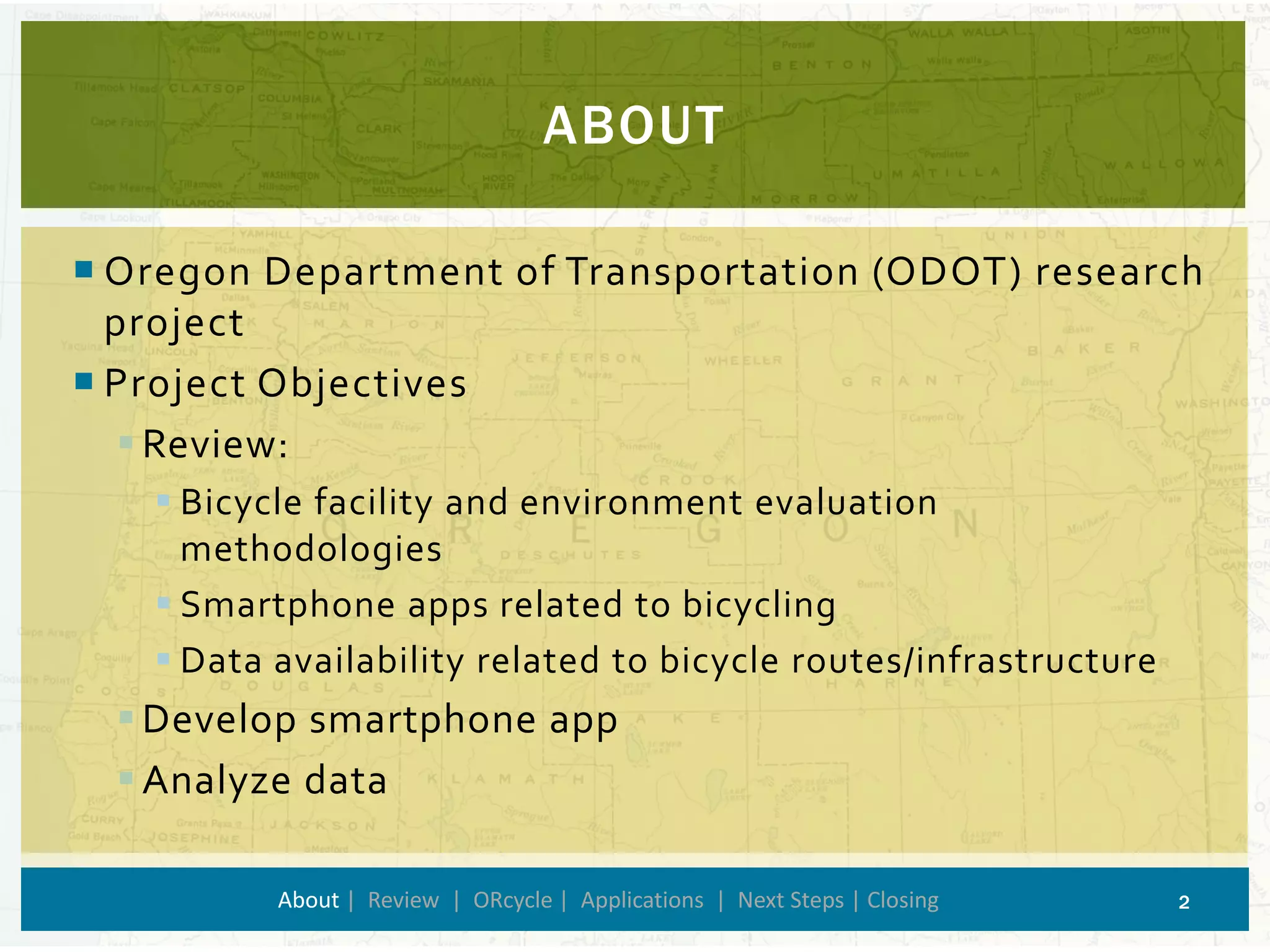
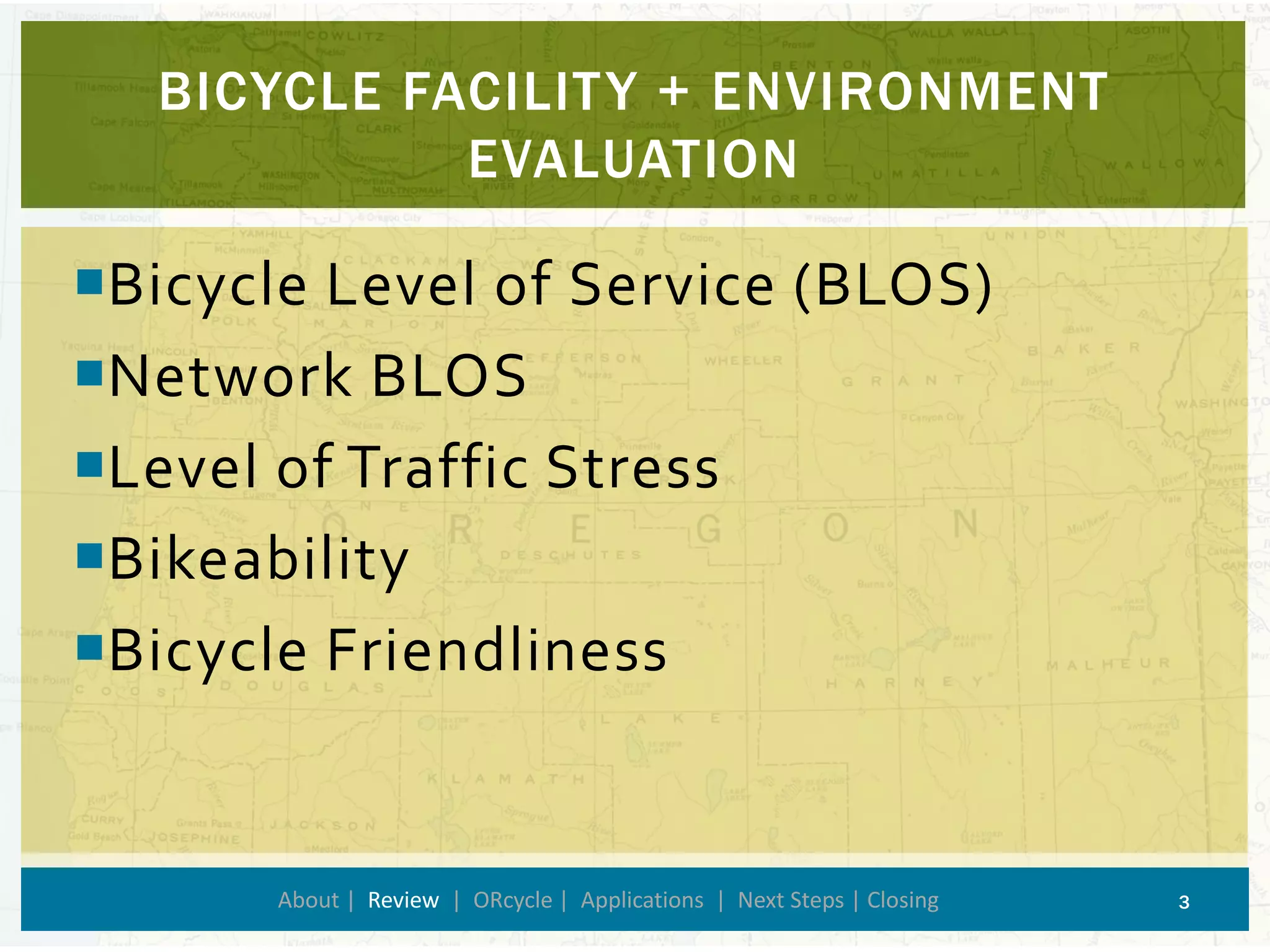
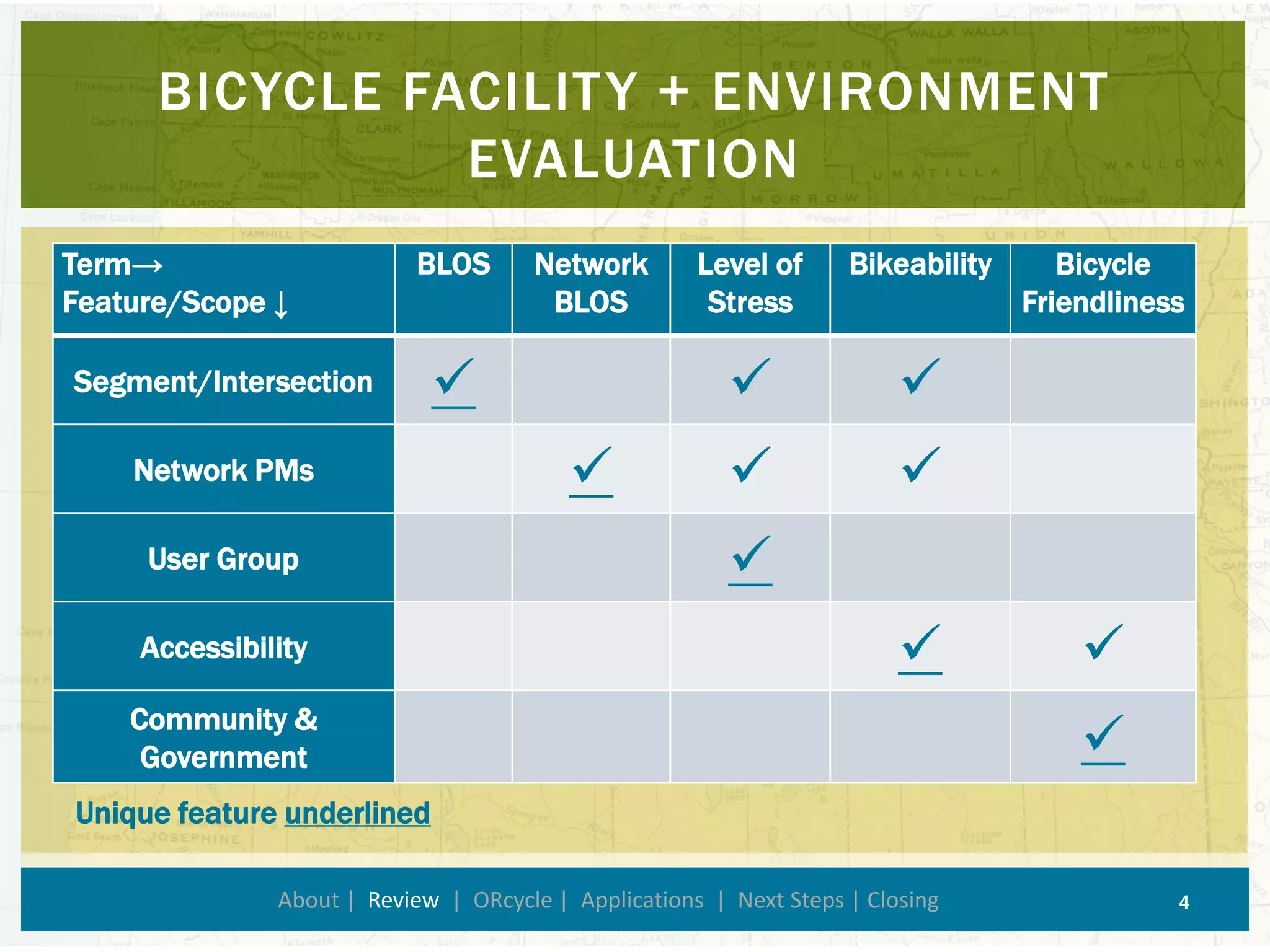
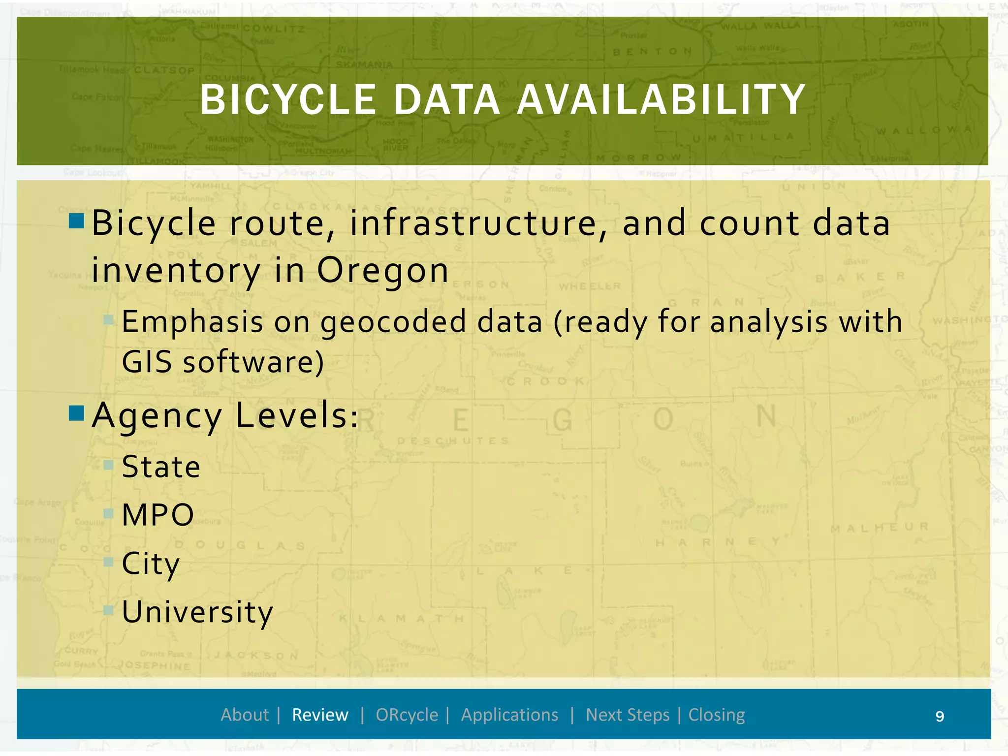
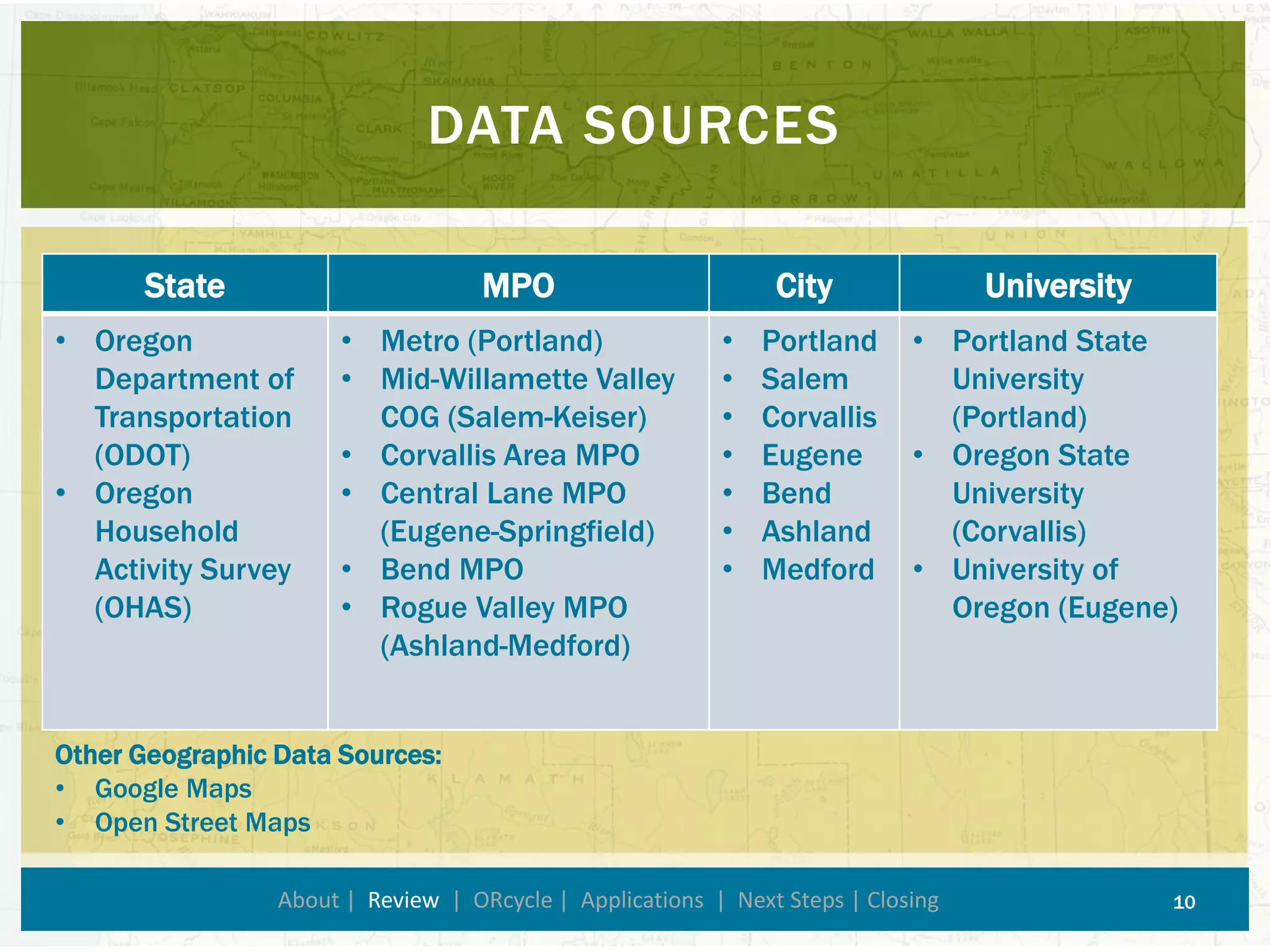
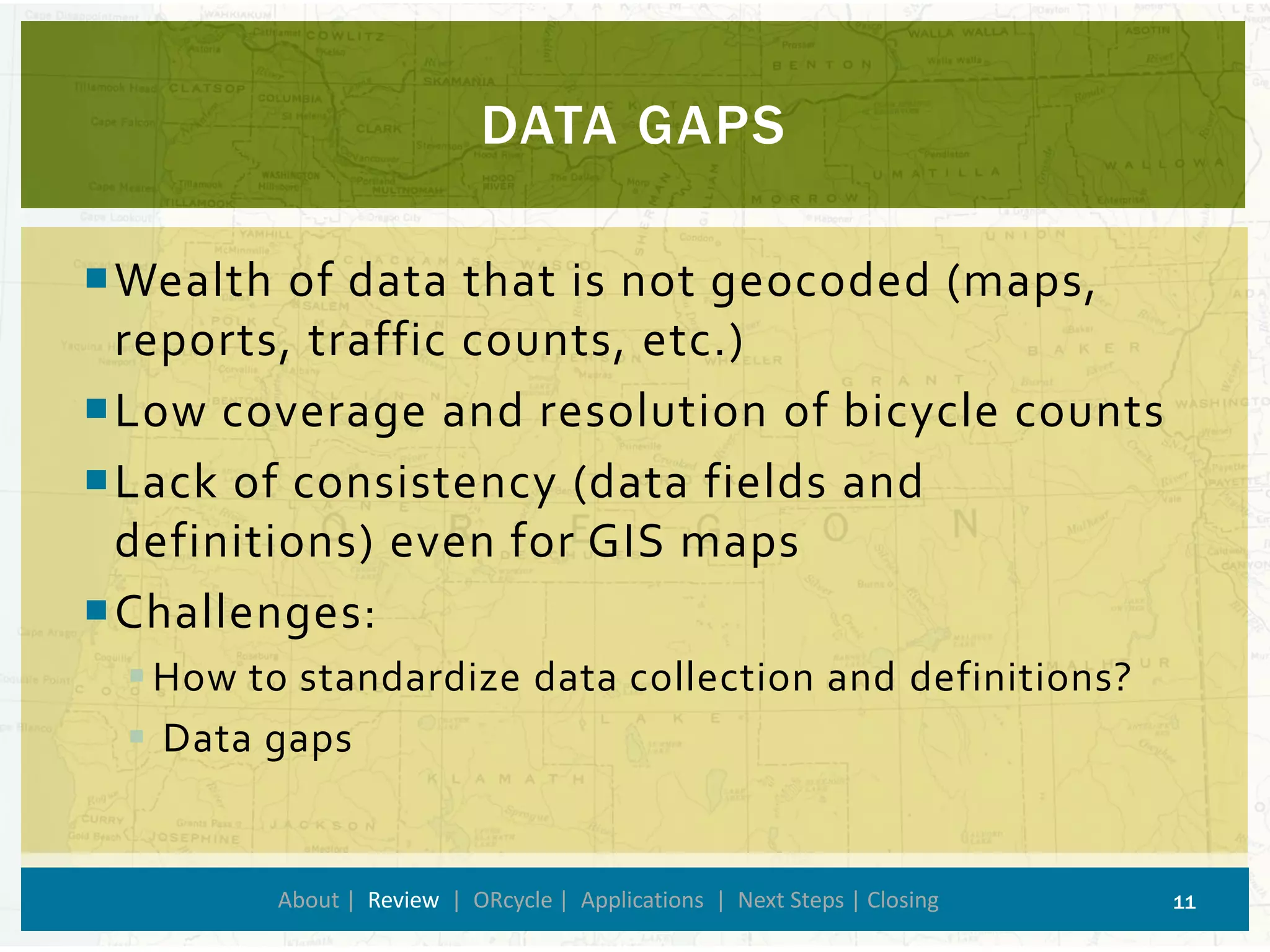
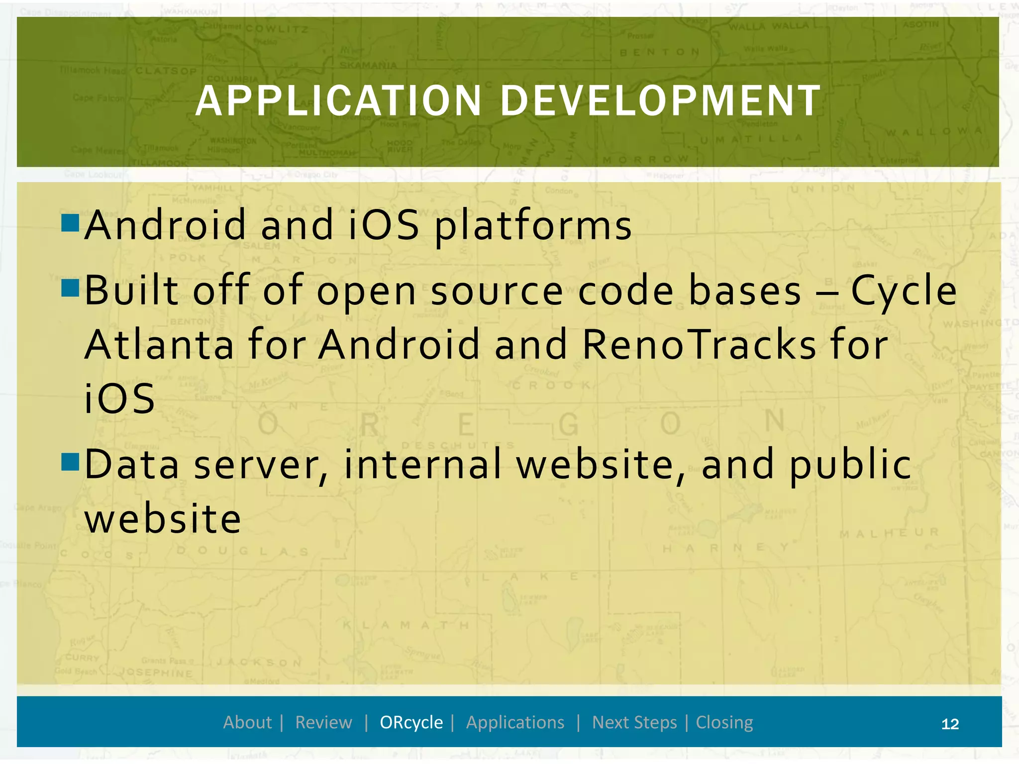
Bryan Blanc 
Dr. Miguel Figliozzi 
Transportation, Technology, and People Lab 
Portland State University - 
Department of Civil and Environmental Engineering 
UTILIZING SMARTPHONE DATA TO IMPROVE BICYCLE LEVEL OF SERVICE ESTIMATION 
1
Oregon Department of Transportation (ODOT) research project 
Project Objectives 
Review: 
Bicycle facility and environment evaluation methodologies 
Smartphone apps related to bicycling 
Data availability related to bicycle routes/infrastructure 
Develop smartphone app 
Analyze data 
ABOUT 
About| Review | ORcycle| Applications | Next Steps | Closing 2
Bicycle Level of Service (BLOS) 
Network BLOS 
Level of Traffic Stress 
Bikeability 
Bicycle Friendliness 
BICYCLE FACILITY + ENVIRONMENT EVALUATION 
About | Review| ORcycle| Applications | Next Steps | Closing 3
BICYCLE FACILITY + ENVIRONMENT EVALUATION 
About | Review| ORcycle| Applications | Next Steps | Closing 4 
Term→ 
Feature/Scope ↓ 
BLOS 
Network BLOS 
Level of Stress 
Bikeability 
Bicycle Friendliness 
Segment/Intersection 
 
 
 
Network PMs 
 
 
 
User Group 
 
Accessibility 
 
 
Community & Government 
 
Unique feature underlined
SMARTPHONE APPS 
About | Review| ORcycle| Applications | Next Steps | Closing 5 
Infrastructure Crowdsourcing Apps 
Transportation Planning Apps and Recreational Apps
BICYCLE PLANNING APPS 
About | Review| ORcycle| Applications | Next Steps | Closing 6 
CycleTracks 
(San Francisco, CA) 
Cycle Atlanta 
(Atlanta, GA) 
Mon RésoVélo 
(Montréal, QC) 
Ride Tracking 
Issue/Amenity reporting 
GHG, calories, reporting 
User interface improvements
INFRASTRUCTURE CROWDSOURCING APPS 
About | Review| ORcycle| Applications | Next Steps | Closing 7 
Citizens Connect 
(Boston, MA) 
PDX Reporter 
(Portland, OR) 
iBikeEugene 
(Eugene, OR) 
Infrastructure Reporting 
Open Source 
Bicycle Specific
RECREATIONAL APPS 
About | Review| ORcycle| Applications | Next Steps | Closing 8 
Recreational applications track bicycle rides, but are skewed towards recreational users 
Data asked 
Information provided 
Use of incentives 
Sample bias 
Strava
BICYCLE DATA AVAILABILITY 
About | Review| ORcycle| Applications | Next Steps | Closing 9 
Bicycle route, infrastructure, and count data inventory in Oregon 
Emphasis on geocoded data (ready for analysis with GIS software) 
Agency Levels: 
State 
MPO 
City 
University
DATA SOURCES 
About | Review| ORcycle| Applications | Next Steps | Closing 10 
State 
MPO 
City 
University 
•OregonDepartment of Transportation (ODOT) 
•OregonHousehold Activity Survey (OHAS) 
•Metro (Portland) 
•Mid-Willamette Valley COG (Salem-Keiser) 
•Corvallis Area MPO 
•Central Lane MPO(Eugene-Springfield) 
•Bend MPO 
•Rogue Valley MPO (Ashland-Medford) 
•Portland 
•Salem 
•Corvallis 
•Eugene 
•Bend 
•Ashland 
•Medford 
•Portland State University (Portland) 
•Oregon State University (Corvallis) 
•University of Oregon (Eugene) 
Other Geographic Data Sources: 
•Google Maps 
•Open Street Maps
DATA GAPS 
About | Review| ORcycle| Applications | Next Steps | Closing 11 
Wealth of data that is not geocoded (maps, reports, traffic counts, etc.) 
Low coverage and resolution of bicycle counts 
Lack of consistency (data fields and definitions) even for GIS maps 
Challenges: 
How to standardize data collection and definitions? 
Data gaps
APPLICATION DEVELOPMENT 
About | Review | ORcycle| Applications | Next Steps | Closing 12 
Android and iOS platforms 
Built off of open source code bases –Cycle Atlanta for Android and RenoTracks for iOS 
Data server, internal website, and public website
ADDED FEATURES: 
About | Review | ORcycle| Applications | Next Steps | Closing 13 
Updated and re-branded user interface 
Added many survey questions 
User group questions 
Post-trip questions 
Location specific safety questions 
Additional notification features to optimize information received from user
ORcycle 
About | Review | ORcycle| Applications | Next Steps | Closing 14 
iOS 
Android
Improve bicycle facility evaluation and prioritization procedures 
Understand differential preferences of rural and urban cyclists in Oregon 
Increase bicycle infrastructure data coverage and resolution 
What might this look like? 
APPLYING THE DATA 
About | Review | ORcycle| Applications| Next Steps | Closing 15
VISUALIZING ROUTE PREFERENCES 
About | Review | ORcycle| Applications| Next Steps | Closing 16 
Screenshot of Strava Heat Map in Portland, OR Area (http://labs.strava.com/heatmap/#11/-122.70862/45.49892/blue/bike)
BLOS + LTS CALIBRATION 
About | Review | ORcycle| Applications| Next Steps | Closing 17 
High LTS Map of Bike Routes in San Francisco, CA 
http://sf.streetsblog.org/wp-content/uploads/2013/04/stress.jpg
Fine-tuning the apps 
Public release and promotion 
Improving public website with mapping capabilities 
Analyzing data 
NEXT STEPS 
About | Review | ORcycle| Applications | Next Steps | Closing 18
Reaching users 
Sample biases 
User burden 
Future app improvements 
Long term data management 
CHALLENGES 
About | Review | ORcycle| Applications | Next Steps | Closing 19
Robin Murray and BikramMaharjan–ORcycleTeam 
Dr. Miguel Figliozzi–Principal Investigator + My Adviser 
Members of the Technical Advisory Committee –Project Direction 
PSU Transportation Graduate Students –Beta Testing 
Oregon Department of Transportation –Project Funding 
FHWA Eisenhower Graduate Transportation Fellowship – Additional Funding 
ACKNOWLEDGEMENTS 
About | Review | ORcycle| Applications | Next Steps | Closing 20
Please test our application –Beta version now available on the iTunes App Store and the Google Play Store 
More info here: http://www.pdx.edu/transportation-lab/orcycle 
Questions? Contact bblanc@pdx.edu. 
THANK YOU 
About | Review | ORcycle| Applications | Next Steps | Closing 21 
ORcycle

ORcycle Project Presentation October 2014

  • 1.
    Bryan Blanc Dr.Miguel Figliozzi Transportation, Technology, and People Lab Portland State University - Department of Civil and Environmental Engineering UTILIZING SMARTPHONE DATA TO IMPROVE BICYCLE LEVEL OF SERVICE ESTIMATION 1
  • 2.
    Oregon Department ofTransportation (ODOT) research project Project Objectives Review: Bicycle facility and environment evaluation methodologies Smartphone apps related to bicycling Data availability related to bicycle routes/infrastructure Develop smartphone app Analyze data ABOUT About| Review | ORcycle| Applications | Next Steps | Closing 2
  • 3.
    Bicycle Level ofService (BLOS) Network BLOS Level of Traffic Stress Bikeability Bicycle Friendliness BICYCLE FACILITY + ENVIRONMENT EVALUATION About | Review| ORcycle| Applications | Next Steps | Closing 3
  • 4.
    BICYCLE FACILITY +ENVIRONMENT EVALUATION About | Review| ORcycle| Applications | Next Steps | Closing 4 Term→ Feature/Scope ↓ BLOS Network BLOS Level of Stress Bikeability Bicycle Friendliness Segment/Intersection    Network PMs    User Group  Accessibility   Community & Government  Unique feature underlined
  • 5.
    SMARTPHONE APPS About| Review| ORcycle| Applications | Next Steps | Closing 5 Infrastructure Crowdsourcing Apps Transportation Planning Apps and Recreational Apps
  • 6.
    BICYCLE PLANNING APPS About | Review| ORcycle| Applications | Next Steps | Closing 6 CycleTracks (San Francisco, CA) Cycle Atlanta (Atlanta, GA) Mon RésoVélo (Montréal, QC) Ride Tracking Issue/Amenity reporting GHG, calories, reporting User interface improvements
  • 7.
    INFRASTRUCTURE CROWDSOURCING APPS About | Review| ORcycle| Applications | Next Steps | Closing 7 Citizens Connect (Boston, MA) PDX Reporter (Portland, OR) iBikeEugene (Eugene, OR) Infrastructure Reporting Open Source Bicycle Specific
  • 8.
    RECREATIONAL APPS About| Review| ORcycle| Applications | Next Steps | Closing 8 Recreational applications track bicycle rides, but are skewed towards recreational users Data asked Information provided Use of incentives Sample bias Strava
  • 9.
    BICYCLE DATA AVAILABILITY About | Review| ORcycle| Applications | Next Steps | Closing 9 Bicycle route, infrastructure, and count data inventory in Oregon Emphasis on geocoded data (ready for analysis with GIS software) Agency Levels: State MPO City University
  • 10.
    DATA SOURCES About| Review| ORcycle| Applications | Next Steps | Closing 10 State MPO City University •OregonDepartment of Transportation (ODOT) •OregonHousehold Activity Survey (OHAS) •Metro (Portland) •Mid-Willamette Valley COG (Salem-Keiser) •Corvallis Area MPO •Central Lane MPO(Eugene-Springfield) •Bend MPO •Rogue Valley MPO (Ashland-Medford) •Portland •Salem •Corvallis •Eugene •Bend •Ashland •Medford •Portland State University (Portland) •Oregon State University (Corvallis) •University of Oregon (Eugene) Other Geographic Data Sources: •Google Maps •Open Street Maps
  • 11.
    DATA GAPS About| Review| ORcycle| Applications | Next Steps | Closing 11 Wealth of data that is not geocoded (maps, reports, traffic counts, etc.) Low coverage and resolution of bicycle counts Lack of consistency (data fields and definitions) even for GIS maps Challenges: How to standardize data collection and definitions? Data gaps
  • 12.
    APPLICATION DEVELOPMENT About| Review | ORcycle| Applications | Next Steps | Closing 12 Android and iOS platforms Built off of open source code bases –Cycle Atlanta for Android and RenoTracks for iOS Data server, internal website, and public website
  • 13.
    ADDED FEATURES: About| Review | ORcycle| Applications | Next Steps | Closing 13 Updated and re-branded user interface Added many survey questions User group questions Post-trip questions Location specific safety questions Additional notification features to optimize information received from user
  • 14.
    ORcycle About |Review | ORcycle| Applications | Next Steps | Closing 14 iOS Android
  • 15.
    Improve bicycle facilityevaluation and prioritization procedures Understand differential preferences of rural and urban cyclists in Oregon Increase bicycle infrastructure data coverage and resolution What might this look like? APPLYING THE DATA About | Review | ORcycle| Applications| Next Steps | Closing 15
  • 16.
    VISUALIZING ROUTE PREFERENCES About | Review | ORcycle| Applications| Next Steps | Closing 16 Screenshot of Strava Heat Map in Portland, OR Area (http://labs.strava.com/heatmap/#11/-122.70862/45.49892/blue/bike)
  • 17.
    BLOS + LTSCALIBRATION About | Review | ORcycle| Applications| Next Steps | Closing 17 High LTS Map of Bike Routes in San Francisco, CA http://sf.streetsblog.org/wp-content/uploads/2013/04/stress.jpg
  • 18.
    Fine-tuning the apps Public release and promotion Improving public website with mapping capabilities Analyzing data NEXT STEPS About | Review | ORcycle| Applications | Next Steps | Closing 18
  • 19.
    Reaching users Samplebiases User burden Future app improvements Long term data management CHALLENGES About | Review | ORcycle| Applications | Next Steps | Closing 19
  • 20.
    Robin Murray andBikramMaharjan–ORcycleTeam Dr. Miguel Figliozzi–Principal Investigator + My Adviser Members of the Technical Advisory Committee –Project Direction PSU Transportation Graduate Students –Beta Testing Oregon Department of Transportation –Project Funding FHWA Eisenhower Graduate Transportation Fellowship – Additional Funding ACKNOWLEDGEMENTS About | Review | ORcycle| Applications | Next Steps | Closing 20
  • 21.
    Please test ourapplication –Beta version now available on the iTunes App Store and the Google Play Store More info here: http://www.pdx.edu/transportation-lab/orcycle Questions? Contact bblanc@pdx.edu. THANK YOU About | Review | ORcycle| Applications | Next Steps | Closing 21 ORcycle