SlideShare a Scribd company logo
1 of 237
Download to read offline
Regional Bicycle Plan
NFR MPO
FELSBURG
H O L T &
ULLE V I G
NORTHNORTH
LARIMER COUNTY
BOULDER COUNTYBOULDER COUNTY
LARIMER COUNTYLARIMER COUNTY
WELD COUNTYWELD COUNTY
LARIMERCOUNTYLARIMERCOUNTY
WELDCOUNTYWELDCOUNTY
TYY
10
12
3
4
5
6
7
8
9
11
12
Little Tho
m
pson
R
iver
Big Thomp
son
Rive
r
Sou
th
Pla
tte R
ive
r
PoudrreRiver
GWRR
BNSF
BNSF
LaSalle
Evans
Greeley
Severance
Windsor
Timnath
Fort
Collins
Loveland
Berthoud
Johnstown
Milliken
Eaton
Garden
City
25
287
287
25
34
34
257
14
392
60
56
60
402
1
85
85
BUS
34
MARCH 7, 2013
Prepared for:
North Front Range MPO
419 Canyon Avenue, Suite 300
Fort Collins, CO 80521
Prepared by:
Felsburg Holt & Ullevig
6300 South Syracuse Way, Suite 600
Centennial, CO 80111
303.721.1440
March 7, 2013
FHU Reference No. 10 045 07
i
ACKNOWLEDGEMENTS
Bicycle Technical Advisory Committee (TAC) Members
Betsy Jacobsen – CDOT Division of Transportation Development
Cameron Parrott – City of Evans
Clint Dudley – Town of LaSalle
Don Cadwallader – Town of Eaton
Eric Drummond – Colorado State Trails
Eric Grey – Colorado State Parks
Janet Meisel Burns – City of Loveland
Jeff Wiggins – City of Cheyenne
Jeffrey Boring – Larimer County
John Franklin – Town of Johnstown
Justin Stone – City of Loveland
Karen Schneiders – CDOT Region 4
Larry Butterfield – Colorado State Parks
Martina Wilkinson – Larimer County
Matt Blakely – Town of Timnath
Molly North – City of Fort Collins
Nancy Matchette – Colorado State Trails
Phillip Waggoner – Town of Milliken
Sarah Boyd – City of Greeley
Tim Katers – Town of Berthoud
Tom Morrissey – Colorado State Trails
Wade Willis – Town of Windsor
Wesley Hood – City of Greeley
NFRMPO Public Engagement Support Intern Team
Ariel Mikolitch, Colorado State University
Rachel Childs, Colorado State University
University GIS Team
Aaron Yuhas, Colorado State University
Jared Pappert Stockton, Colorado State University
Joshua Reyling, University of Northern Colorado
Ken Bucko, Colorado State University
ii
TABLE OF CONTENTS
Page
ACKNOWLEDGEMENTS ..................................................................................................................................... i
1. INTRODUCTION ................................................................................................................................... 1
Purpose of Regional Bicycle Plan...................................................................................................................1
Benefits of Investing in Bicycle Infrastructure...............................................................................................1
2. BICYCLE INVENTORY ............................................................................................................................ 3
Regional Context ...........................................................................................................................................3
Documents and Programs.............................................................................................................................4
Bicycle Infrastructure ..................................................................................................................................10
Standards and Policies.................................................................................................................................17
Data and Analysis ........................................................................................................................................21
3. PUBLIC AND STAKEHOLDER OUTREACH ..............................................................................................39
Bike Technical Advisory Committee............................................................................................................39
Project Webpage.........................................................................................................................................40
Work Sessions..............................................................................................................................................40
Employer Survey Results .............................................................................................................................41
Community Charrettes................................................................................................................................44
Household Survey Results ...........................................................................................................................44
4. REGIONAL BICYCLE SYSTEM ENHANCEMENT.......................................................................................50
Corridor Identification Process....................................................................................................................50
Regional Bicycle Corridors...........................................................................................................................51
Other Regional Improvements and Programs.............................................................................................96
5. IMPLEMENTATION PLAN.....................................................................................................................98
Funding........................................................................................................................................................98
Regional Collaboration ................................................................................................................................99
Bicycle Project Scoring Guide....................................................................................................................100
Bicycle Planning and Design Resources.....................................................................................................100
Integration with other Regional Planning Processes ................................................................................102
iii
LIST OF FIGURES
Page
Figure 2.1 NFRMPO Planning Area....................................................................................................................3
Figure 2.2 Existing Bicycle Facilities and Routes .............................................................................................11
Figure 2.3 Centerline Miles of On Street Bike Lanes and Bike Routes............................................................12
Figure 2.4 Centerline Miles of Off Street Shared Use Paths ...........................................................................13
Figure 2.5 Bike Boardings on Buses in 2010....................................................................................................14
Figure 2.6 Transfort Monthly Bike Boardings on Buses (2011).......................................................................15
Figure 2.7. Bike Shops ......................................................................................................................................16
Figure 2.8 Monthly Bicycle Counts on Southbound 13th Street in Boulder ...................................................22
Figure 2.9 Annual Bicycle Crash Data..............................................................................................................23
Figure 2.10 Annual Bicycle Theft Data ..............................................................................................................23
Figure 2.11 Household Density .........................................................................................................................25
Figure 2.12 Business Locations..........................................................................................................................26
Figure 2.13 School Access to Bike Routes .........................................................................................................27
Figure 2.14 Enrolled Student Residence within 2 Miles of University of Northern Colorado ..........................28
Figure 2.15 Enrolled Student Residence within 2 Miles of Colorado State University .....................................29
Figure 2.16 Enrolled Student Residence within 2 Miles of AIMS Community College .....................................30
Figure 2.17 Low Income Access to Bicycle Facilities .........................................................................................33
Figure 2.18 Minority Access to Bicycle Facilities...............................................................................................34
Figure 2.19 Senior Access to Bicycle Facilities...................................................................................................35
Figure 2.20 Rail Corridor Potential....................................................................................................................36
Figure 2.21 Trail and Roadway Crossings..........................................................................................................37
Figure 2.22 Ditch Ownership.............................................................................................................................38
Figure 3.1 Project Webpage............................................................................................................................40
Figure 3.2 Questions Asked During Regional Bicycle Work Sessions..............................................................41
Figure 3.3 Does your organization provide bike parking that is located near the entrance? (Short term)....42
Figure 3.4 Does your organization have showers that a cyclist could use after their commute?..................42
Figure 3.5 Does your organization provide an incentive (i.e. gift cards) for employees to bicycle to your
office?.............................................................................................................................................42
Figure 3.6 Does your company or employees participate in “Bike to Work Day” in June? ............................43
Figure 3.7 Is your organization situated on a road that is equipped with bicycle lanes?...............................43
Figure 3.8 Is your organization situated in a location that is near a multi use trail (not on roadway)?.........43
Figure 3.9 Frequency of Bicycle Use................................................................................................................46
Figure 3.10 Percentage of All Respondents Who Rode Their Bicycle in the Last Six Months...........................46
Figure 3.11 When you ride a bike for the work or school commute, what distance do you usually travel? ...47
Figure 3.12 How long is your usual bike ride for the work or school commute? .............................................47
Figure 3.13 Percent of non riders who would like to be able to ride their bike more than they currently
(and by place of residence). ...........................................................................................................48
iv
LIST OF FIGURES (cont.)
Figure 3.14 To what extent, if any, do each of the following bicycling challenges on the road concern
you?................................................................................................................................................49
Figure 4.1 Regional Bicycle Corridors..............................................................................................................52
Figure 4.2 Corridor #1 – South Platte / American Discovery ..........................................................................53
Figure 4.3 Corridor #2 – Little Thompson River ..............................................................................................57
Figure 4.4 Corridor #3 – Big Thompson River .................................................................................................61
Figure 4.5 Corridor #4 – Great Western / Johnstown / Loveland...................................................................65
Figure 4.6 Corridor #5 – North Loveland / Windsor........................................................................................69
Figure 4.7 Corridor #6 – Poudre River Trail.....................................................................................................73
Figure 4.8 Corridor #7 – Front Range Trail (West) ..........................................................................................76
Figure 4.9 Corridor #8 – BNSF Fort Collins / Berthoud....................................................................................80
Figure 4.10 Corridor #9 – Johnstown / Timnath ...............................................................................................83
Figure 4.11 Corridor #10 – Greeley / LaSalle.....................................................................................................86
Figure 4.12 Corridor #11 – US 34 ......................................................................................................................89
Figure 4.13 Corridor #12 – Carter Lake / Horsetooth Foothills.........................................................................92
v
LIST OF TABLES
Page
Table 2.1 Bike Amenities at Municipal Buildings ...........................................................................................15
Table 2.2 Bicycle Facilities Standards.............................................................................................................18
Table 2.3 Bicycle Related Regulations............................................................................................................19
Table 2.4 Bicycle Accommodation Requirements .........................................................................................20
Table 2.5 Travel Mode for Commuting (2010 Household Survey) ................................................................24
Table 2.6 Safe Routes to Schools Grant Recipients (2004 – 2011) ................................................................31
Table 3.1 Length of Residency .......................................................................................................................45
Table 3.2 Housing Tenure ..............................................................................................................................45
Table 3.3 Respondent Gender .......................................................................................................................45
Table 3.4 Respondent Age .............................................................................................................................45
Table 3.5 Respondent Ethnicity .....................................................................................................................46
Table 3.6 Reason for Having Not Ridden a Bicycle in the Past Six Months....................................................47
Table 3.7 Reason Respondent Would Be More Inclined to Bicycle More .....................................................48
Table 4.1 Corridor #1 – South Platte / American Discovery ..........................................................................54
Table 4.2 Corridor #2 – Little Thompson River ..............................................................................................58
Table 4.3 Corridor #3 – Big Thompson River .................................................................................................62
Table 4.4 Corridor #4 – Great Western / Johnstown / Loveland...................................................................66
Table 4.5 Corridor #5 – North Loveland / Windsor........................................................................................70
Table 4.6 Corridor #6 – Poudre River Trail.....................................................................................................74
Table 4.7 Corridor #7 – Front Range Trail (West) ..........................................................................................77
Table 4.8 Corridor #8 – BNSF Fort Collins / Berthoud....................................................................................81
Table 4.9 Corridor #9 – Johnstown / Timnath ...............................................................................................84
Table 4.10 Corridor #10 – Greeley / LaSalle.....................................................................................................87
Table 4.11 Corridor #11 – US 34 ......................................................................................................................90
Table 4.12 Corridor #12 – Carter Lake / Horsetooth Foothills.........................................................................93
LIST OF APPENDICES
APPENDIX A CITATIONS
APPENDIX B CDOT.BICYCLE.AND.PEDESTRIAN.POLICY.DIRECTIVE.
APPENDIX C COMMUNITY INPUT
APPENDIX D COMPILATION OF LOCAL AGENCY PROPOSED BIKE FACILITIES
APPENDIX E REGIONAL BICYCLE CORRIDOR EVALUATION MATRIX
APPENDIX F EVALUATION CRITERIA FROM
APPENDIX G PRESENATIONS ON RAILROAD AND DITCH COORDINATION
1
1. INTRODUCTION
Accommodation of bicyclists for both transportation and recreation has seen increasing emphasis in Colorado
and throughout the country. The Colorado Department of Transportation (CDOT) issued a Policy Directive (Bike
and Pedestrian Policy 1602) in 2009 and subsequent State Statute 43 1 120 which makes it clear that the
Colorado Transportation Commission intends for CDOT to promote mode choice and provide for the needs of
bicyclists and pedestrians. Through this policy the Transportation
Commission has directed the safe and reliable accommodation of
bicyclists and pedestrians in all of CDOT’s planning, design, and
operation of transportation facilities. Recognizing the state’s
commitment to integrate bicycle and pedestrian accommodation,
this Regional Bicycle Plan for the North Front Range Metropolitan
Planning Organization (NFRMPO) serves as the bicycle planning
component of the Regional Transportation Plan (RTP).
In support of Policy 1602 (and the related Procedural Directive), CDOT adopted the Statewide Bicycle and
Pedestrian Plan in October 2012. The Statewide Plan establishes goals, investment decision criteria, and
performance measures to facilitate project and program funding allocation. This Regional Bicycle Plan is
intended to work in concert with the Statewide Plan, identifying evaluation criteria that are specific to the
NFRMPO and identifying a regional bicycle corridor network; both of which further CDOT’s bicycle and
pedestrian initiatives.
Purpose of Regional Bicycle Plan
The primary purposes of the NFRMPO Regional Bicycle Plan are to:
Provide a consolidated summary of the existing bicycle infrastructure, data, and design standards
throughout the region;
Identify opportunities to connect and enhance the local and regional bicycle systems;
Identify Regional Bicycle Corridors and outline implementation steps
Provide the MPO’s 15 member governments with tools to support their local bicycle planning and
accommodation initiatives;
Position the NFRMPO to pursue state and federal (and other) funding opportunities; and
Fulfill the federal requirement to address bicycle planning as a component of the Regional
Transportation Plan.
Benefits of Investing in Bicycle Infrastructure
A variety of direct and indirect benefits can be realized as a result of investing in bicycle infrastructure. A recent
University of Massachusetts study shows that bike only projects and roadway projects incorporating bike
facilities both create more jobs than a road only project (38% and 13% respectively)1
. Additional studies point to
varying increases in property values near trails,2
while other case studies point to increased visitors and tax
1
Pedestrian and Bicycle Infrastructure: A National Study of Employment Impacts, Political Economy Research Institute,
University of Massachusetts Amherst, June 2011.
2
Bicycling and Walking in Colorado: Economic Impact and Household Survey Results; CDOT Bicycle/Pedestrian Program,
The Center for Research on Economic and Social Policy of the University of Colorado at Denver, April 2000.
“For us, the real measure of success is
when complete streets
[accommodation of all modes] and
integrated roadway design is part of
how we do business in this country.”
– Polly Trottenberg, Assistant Secretary
of Transportation Policy at the USDOT
2
revenues from tourism. In Colorado, nearly 10% of households took a bicycle related vacation, while 40% of
vacationers engaged in bicycling would have altered their plans if bicycling facilities were not provided.3
Additional economic impacts include savings from reduced gas consumption, additional retail sales, the
attraction of charitable events, and reduced economic costs of mortality.4,5
Retail related to biking contributed
$200 million to Colorado in 2000, with bike related impacts on the state totaling over a billion dollars annually.3
Bicycle tours and races can also have a significant impact on the economy; the inaugural USA Pro Cycling
Challenge in 2011 attracted more than a million spectators, resulting in an estimated $83.5 million in economic
impact in Colorado. Northern Colorado will host the sixth stage of the 2013 USA Pro Cycling Challenge, which
will start in Loveland, wind through Windsor and Estes Park, and finish in Fort Collins.
Research also concludes that added bicycle infrastructure increases safety for all modes.6
Bike lanes have been
credited with increasing the number of bicyclists traveling in the right direction, reducing the number of
bicyclists on sidewalks, increasing stop sign compliance, and providing an increased buffer between automobiles
and pedestrians.7
And with a greater number of people bicycling, drivers become more aware of non motorized
users, creating a safer environment for all. A recent FHWA study5
that tracked four locations where significant
bike investments were made concluded that despite significant increases in trips made by bikes following the
investments, fatal crashes over the study period remained steady or decreased.
Increased bicycling due to added infrastructure can also provide health related benefits. Employees who
participate in physical activity take fewer sick days, have lower healthcare costs, and even have an increase in
productivity.8
Increased physical activity can reduce the risk of various chronic diseases, prevent weight gain and obesity, and
increase life expectancy. Bicycling for recreational or transportation purposes can help to fulfill recommended
daily physical activity. Many research studies have linked the presence of bicycling and walking infrastructure
with increased physical activity and improved health. The Center for Disease Control (CDC) provides a series of
recommendations for bringing public health considerations into transportation issues . One of the primary
recommendations is to promote active transportation by providing safe and convenient walking and bicycling
facilities.
It’s important to note that many investments in bicycle infrastructure are also paired with programmatic
investments such as education and awareness programs. Almost all resources referenced note that such non
infrastructure investments help to better maximize the benefits of bicycle infrastructure investments.
3
Property Value/Desirability Effects of Bike Paths Adjacent to Residential Areas; Center for Applied Demography & Survey
Research, November 2006.
4
The Economic Benefits of Bicycle Infrastructure Investments, League of American Bicyclists, June 2009.
5
Report to the U.S. Congress on the Outcomes of the Nonmotorized Transportation Pilot Program SAFETEA LU Section
1807, Federal Highway Administration, April 2012.
6
Evidence on Why Bike Friendly Cities are Safer for All Users, Cambridge Journals Online, April 2011.
7
Bicycle Lanes Versus Wide Curb Lanes: Operational and Safety Findings and Countermeasures Recommendations,
Federal Highway Administration, October 1999.
8
Realizing the Benefits of Accelerated Investment in Cycling, British Columbia Cycling Coalition, January 2011.
3
2. BICYCLE INVENTORY
Regional Context
The NFRMPO is a governmental agency responsible for long range transportation planning activities throughout
northern Colorado. The NFRMPO, as shown on Figure 2.1, has 15 members that include Fort Collins, Greeley,
Loveland, Timnath, Berthoud, Windsor, Johnstown, Milliken, Evans, Garden City, LaSalle, Severance, Eaton and
Weld and Larimer Counties. CDOT and the State Air Quality Control Commission (AQCC) are also members. The
NFRMPO works on a regional scale that covers approximately 600 square miles from Wellington to the north,
Denver/Boulder metro to the south, the foothills of the Rockies to the west, and incorporated Greeley to the
east.
Figure 2.1 NFRMPO Planning Area
Northern Colorado is the fastest growing region
in Colorado. Their cities are recognized nationally
as one of the top places to live
(http://cbs4denver.com/business/fort.collins.
best.2.771171.html). The growth of the region is
highlighted by the growth of its three largest
cities (Loveland, Greeley, and Fort Collins) into
one large metropolitan region with the Town of
Windsor at its epicenter.
The region’s transportation system is relatively
young when compared with more established
regions in the U.S. A handful of state and federal
highways carry commuters daily between the
MPO communities and the Denver Metro
Region. Single occupancy vehicles (SOV)
dominate the regional modal split. Congestion
projections are stark based on the forecasted
doubling of population in the next 30 40 years,
existing infrastructure deficiencies, and current
modal split. Further, Northern Colorado was designated by EPA as a Non Attainment area for 8 hour ozone in
2007.
History of TDM and Bicycle Planning in Northern Colorado
In 1996, the NFRMPO began implementation of the SmartTrips program for Northern Colorado with allocated
staff in the NFRMPO and the communities of Fort Collins, Greeley, and Loveland. The program was part of a
package of strategies developed to reach the goals established in the long range RTP.
By July of 2000, the SMARTTrips program was staffed by 12 employees responsible for management, outreach
and operations amongst the three cities and NFRMPO at the budget of $1,426,999 (SmartTrips 2001 2006
Strategic Operations Plan). The SmartTrips 2001 2006 Strategic Operations Plan recommended the development
of one program as opposed to separate local and regional programs to reduce the confusion in roles and
4
responsibilities that had developed as a result of having multiple programs. Unfortunately, this led to the
eventual dissolution of all three local programs along with their staff. The NFRMPO retained the administration
for the carpool (CarGo) and vanpooling (VanGo) programs.
As of January 2012, the SmartTrips program is staffed by two full time operations and business outreach staff
members with limited administrative and accounting support. With extremely limited resources, SmartTrips
focuses strictly on the operation of the VanGo program (about 85 vans that travel between Northern Colorado
and Denver/Boulder on the regionally significant corridors of I 25, US 287, and US 34) and the maintenance of
the well visited trip matching website (www.smarttrips.org). Best practices and municipal bicycle maps are
presented on the website.
Documents and Programs
Many of NFRMPO member communities have adopted bicycle plans, either as a stand alone document, an
element of their transportation plan, or in the form of a trails plan. The communities’ bicycle planning efforts
vary in degree of complexity and level of recommendations provided. Additionally, several communities in the
region provide bicycle education and outreach programs to encourage bicycle travel and promote safe
interaction between bicyclists and motorists. The following sections summarize, by community, the bicycle
planning efforts, bicycle facility mapping, and bicycle education and outreach programs in the community. In
many cases, hyperlinks to more detailed information have been provided.
Berthoud
Bicycle Planning Efforts
The Town of Berthoud currently does not have a bicycle plan, nor does their Transportation
Plan include a bicycle element. They anticipate updating their Transportation Plan in 2013 and
may include a bicycle element. The Town’s Parks, Open Space and Recreation (PORT) Plan is
currently in draft form and includes a full trails element. The plan is currently on hold and has
not been adopted by the Town Board.
Online Mapping
Some bicycle trails/routes in Berthoud are displayed by Google Maps .
Bicycle Education and Outreach Programs
The Berthoud Police Department holds a bike safety program/bike rodeo on an annual basis.
Eaton
Bicycle Planning Efforts
The Town of Eaton does not have a bicycle plan or a bicycle element of a
transportation plan. The Town completed a Recreation and Trails Master Plan in 2004
and has developed a trail system map which depicts existing and future trails in the
community. A citizens committee has recently been formed to look at trail needs to facilitate the movement of
children around town. The Town has recently initiated the development of a Transportation Master Plan, which
will include a bicycle component.
5
Online Mapping
No online mapping of bicycle facilities exists.
Bicycle Education and Outreach Programs
Eaton does not currently have any bicycle education or outreach programs.
Evans
Bicycle Planning Efforts
The City of Evans’ 2004 Open Space and Trails Master Plan is the primary bicycle
planning document for the City. The 2004 City of Evans Transportation Plan
references the Trails Plan and the City’s desire to provide additional trails throughout the City. The City is
primarily focused on providing off street shared use trails. Evans does not have a separate bicycle plan at this
time.
Online Mapping
No online map of current bicycle routes exists independently. However, the 2004 Transportation Plan shows the
Riverside Park Trail as well as sidewalks which are eight feet wide or greater, which are considered by the City to
be shared use trails.
Bicycle Education and Outreach Programs
Evans does not currently have any bicycle education and outreach programs.
Fort Collins
Bicycle Planning Efforts
The City of Fort Collins produced a Bicycle Plan in 1995 and updated it in 2008.
This plan covers dedicated bike facilities and multi use trails. The City’s Transportation Master Plan (2011)
references the bike plan and provides steps towards implementation. Fort Collins also produced a Bicycle Safety
Education Plan in 2011. The 2008 Bicycle Plan and 2011 Bicycle Safety Education Plan will be updated and
combined in 2013.
Online Mapping
Fort Collins maintains an online interactive mapping tool that includes a bikeways layer . This tool includes
current and proposed bike lanes, bike routes, and multi use trails and also denotes where bicycles are not
allowed. The downtown dismount zone can also be viewed on the City’s website . For a printable copy of
bicycle routes, a PDF version of the official bicycle map is available from the City’s website . Another map
illustrating the City’s recreational trails is also available on the website .
Google Maps also provides an extensive mapping of bike routes in Fort Collins .
Bicycle Education and Outreach Programs
The City of Fort Collins’ FC Bikes program promotes cycling as a safe and attractive means of transportation in
Fort Collins. FC Bikes works to build the cohesiveness of the bicycle community and also educates residents on
bicycle safety and awareness while encouraging the Fort Collins community to use bicycles as a preferred
method for getting around. The FC Bikes program has a webpage on the City’s website .
6
The City’s Bicycle Safety Education Plan was created in 2011 as part of its bicycle safety outreach. Fort Collins
also publishes a bicycle riding guide that contains stories about bike style, fundamentals of cycling, and a
calendar of bike events.
Garden City
The community does not currently have a bicycle plan, map or
programs in place. Any future efforts will be incorporated into this document when appropriate.
Greeley
Bicycle Planning Efforts
The City of Greeley does not have a dedicated bicycle plan, but its 2011 2035
Comprehensive Transportation Plan provides direction for bicycle planning in the City
through the plan’s Bicycle Vision Plan element. The City also has a Parks and Trails
Master Plan (2002) and a supplemental Conceptual Trails Plan (2002).
Online Mapping
The City of Greeley has recently launched www.greeleybikes.com to provide a PDF map that outlines bicycle
and pedestrian routes in the City . Google Maps also illustrates some of the City’s bicycle routes .
Bicycle Education and Outreach Programs
The City of Greeley has recently initiated an internal bicycle advisory group and has purchased the
www.greeleybikes.com that provides links to bicycle education websites.
Johnstown
Bicycle Planning Efforts
The Town of Johnstown does not have a dedicated bicycle plan, but its 2008
Transportation Master Plan addresses bicycling by referencing the
Johnstown/Milliken Parks, Trails, Recreation and Open Space Master Plan (2003).
The joint Johnstown/Milliken trails plan serves as the primary bike planning document for the area.
Online Mapping
No online map of current bicycle routes exists independently. However, the 2008 Transportation Plan and joint
Johnstown/Milliken trails plan do map current and proposed trails for the area. Google Maps also illustrates a
limited amount of trails in the western part of Johnstown .
Bicycle Education and Outreach Programs
Johnstown does not currently have any bicycle education and outreach programs, as it is the responsibility of
the Thompson Rivers Park and Recreational District to conduct recreational outreach programs. Currently the
District does not have any dedicated bicycle programs.
7
Larimer County
Bicycle Planning Efforts
Larimer County Transportation Master Plan (2006) includes a short section on
bicycling, but the County does not have a dedicated bicycle plan. Its Open Lands
Master Plan (2001) provides some additional guidance on regional trails. Larimer
County is currently updating their transportation plan and Open Lands plans.
Online Mapping
Larimer County does not provide any online maps specifically for bicycling. However, PDF maps of open space
trails can be obtained from the Department of Natural Resources webpage . A regional view of trails is also
available within the Open Lands Master Plan appendix “Master Plan Maps & Inventory”. Google Maps displays
some bike routes outside of municipalities, but a majority of the routes are within Fort Collins and Loveland .
Bicycle Education and Outreach Programs
Larimer County does not currently have any programmed bicycle education and outreach programs, but does
provide such services on demand.
LaSalle
Bicycle Planning Efforts
The Town of LaSalle does not have a dedicated bicycle plan, but its 2010 Transportation
Master Plan provides a bike and pedestrian planning element that includes proposed bike
lanes and shared use trails. The Town also has a Parks Plan that lists trails in the community.
Online Mapping
LaSalle does not currently have any bike facilities, and therefore does not have an online map. A map of
proposed bike lanes and shared use trails is available within the Town’s transportation plan.
Bicycle Education and Outreach Programs
In 2011 the Town of LaSalle’s Recreation Department started community bike rides, which included a brief
education component at the start of each ride.
Loveland
Bicycle Planning Efforts
The City of Loveland currently has a draft Bike and Pedestrian Plan was adopted on May
1, 2012 and incorporated into the 2035 Transportation Plan which was approved on
December, 18 2012. The Parks and Recreation Master Plan (2001) includes
recreational trails.
Online Mapping
Loveland provides a PDF map on its website for the existing bike network and its recreational trail network
. Google Maps displays a mostly complete bike network for Loveland .
8
Bicycle Education and Outreach Programs
The City of Loveland provides a variety of education and outreach programs. The City is a collaborative partner
in the Bicycle and Pedestrian Education Coalition (BPEC) in providing bicycle education and outreach programs,
while maintaining a Safe Routes to School (SRTS) program that involves many of the area’s schools. The City also
operates programs such as Helmet Blitzes and Strap n Snap for 3rd
graders, while providing outreach at a variety
of local events.
Milliken
Bicycle Planning Efforts
The Town of Milliken does not have a dedicated bicycle plan, but its Transportation
Master Plan (2008) includes a bicycle element. The joint Johnstown/Milliken Parks,
Trails, Recreation and Open Space Master Plan (2001) serves as the primary bike planning document for the
area.
Online Mapping
No online map of current bicycle routes exists independently. However, the transportation plan and joint
Johnstown/Milliken trails plan do map current and proposed trails for the area.
Bicycle Education and Outreach Programs
Milliken does not have any structured education and outreach programs, but the Town occasionally hosts a bike
rodeo.
Severance
Bicycle Planning Efforts
The Town of Severance’s Transportation Plan (2008) includes a brief section that
notes plans for trails and bicycle facilities.
Online Mapping
Google Maps does display a regional trail that connects Severance, but no other facilities are displayed .
Bicycle Education and Outreach Programs
The community does not currently have bicycle programs in place. Any future efforts will be incorporated into
this document when appropriate.
Timnath
Bicycle Planning Efforts
The Town of Timnath’s Trails Plan (2005) serves as the primary bicycle planning document,
incorporating both bike routes and lanes along with regional trails and pathways. The Town’s
Transportation Plan (2005) and Comprehensive Plan (2007) also speak to providing improved
bike access in the town. There is no dedicated bicycle plan.
Online Mapping
The Town’s Trails Plan provides a map with proposed bike facilities. Google Maps also documents some bike
access within the town, but this access is primarily routes providing connection from Fort Collins .
9
Bicycle Education and Outreach Programs
Timnath does not currently have any bicycle education and outreach programs.
Weld County
Bicycle Planning Efforts
Weld County does not have any dedicated bicycle planning efforts, instead
opting to leave bicycle planning to its municipalities and providing support.
However, the Weld County 2035 Transportation Plan (2011) provides some
goals related to bicycle accommodation, primarily about supporting
municipalities. The bike element also notes the County’s assistance to the
Weld Trails Coordination Committee (WTCC) whose purpose is to help provide
regional trail connectivity.
Online Mapping
The County does not provide online mapping, but the WTCC provides a regional trails inventory map on its
website . The County’s transportation plan includes a small version of this map, along with a national and
state trails map. Google Maps displays bike routes of some of the county’s municipalities, along with some of
the regional trails between communities .
Bicycle Education and Outreach Programs
Weld County does not currently have any programmed bicycle education and outreach programs. The WTCC
would likely be the primary entity to provide such programs in the county, but no such programs are explicitly
advertised.
Windsor
Bicycle Planning Efforts
The Town of Windsor does not have a dedicated bicycle plan or a bike element within
its Transportation Study (1999). However, Windsor’s Comprehensive Plan (2006) speaks
to providing bicycle access within the Town. Furthermore, the Town’s Parks, Recreation,
Trails and Open Lands Master Plan – 2007 Update provides guidance and planning for
trails.
Online Mapping
A PDF map of Windsor’s current and proposed trail system is available on its website . Google Maps also
illustrates some of the trails within and around Windsor .
Bicycle Education and Outreach Programs
The Town of Windsor’s Police Department runs a bicycle rodeo, while the Recreational Department hosts a bike
to work day.
10
Bicycle Infrastructure
Communities in the NFRMPO have a variety of bicycle facilities ranging from shared used paths to bike lanes to
bike box treatments at intersections. The following sections provide an overview of the bicycle facilities that
currently exist in the region.
Definitions
For consistency and clarification, the following definitions are provided for different types of bicycle facilities.9
Bicycle Boulevard – A street segment, or series of contiguous street segments, that has been modified to
accommodate through bicycle traffic and minimize through motor traffic.
Bicycle Route – A roadway or bikeway designated by the jurisdiction having authority, either with a unique
route designation or with BIKE ROUTE signs, along which bicycle guide signs may provide directional and
distance information.
Bikeways – A generic term for any road, street, path or way which in some
manner is specifically designated for bicycle travel, regardless of whether such
facilities are designated for the exclusive use of bicycles or are to be shared with
other transportation modes.
Bike Box – A designated area at the head of a traffic lane at a signalized
intersection that provides bicyclists with a safe and visible way to get ahead
of queuing traffic during the red signal phase.
Bike Lane – A portion of a roadway which has been designated by striping,
signing and pavement markings for the preferential or exclusive use of bicyclists.
Shared Use Path – A bikeway physically separated from motorized
vehicular traffic by an open space or barrier and either within the highway
right of way or within an independent right of way. Shared use paths may also
be used by pedestrians, skaters, wheelchair users, joggers and other non
motorized users.
Shared Lane – A lane of a traveled way that is open to bicycle travel and
vehicular use.
Shared Lane Marking (“sharrows”) – A pavement marking symbol that
indicates an appropriate bicycle positioning in a shared lane.
Sidepath – A shared use path located immediately adjacent and parallel to a roadway.
9
Sources: AASHTO Guide for the Development of Bicycle Facilities, 2012 and February 2010 Draft; NACTO Urban Bikeway
Design Guide.
A Bike Box in Fort Collins
A Bike Lane in Fort Collins
A “Sharrow” in Fort Collins
11
Existing Bicycle Facilities
As shown on Figure 2.2, the existing bicycle facilities in the NFRMPO region are predominantly located in the
three larger cities of Fort Collins, Loveland, and Greeley. There is also considerable bicycle infrastructure in the
Windsor area. The foundation of a regional trail system along the Poudre River is discernible on Figure 2.2.
Figure 2.2 Existing Bicycle Facilities and Routes
Map created by NFRMPO
12
Bike Lanes and Bike Routes
On street bike lanes help to define an area of the street that is for the exclusive use of bicyclists and can
decrease the stress level of bicyclists riding in traffic. Bike lanes encourage bicyclists to ride in the correct
direction of travel and alert motorists of the potential presence of bicyclists. Many bicyclists prefer to ride the
most direct route to their destination, which is frequently along a street; bike lanes help to specify streets within
a community where bicycling is preferred.
Bike routes follow roadways without bike lanes. These roadways are properly signed “Bike Route” to provide
wayfinding support to the bicyclist while notifying the motorist the roadway is shared with bicyclist.
Nine of the municipalities in the MPO currently have signed routes and striped on street bike lanes. In total,
there are over 421 centerline miles of bike routes and bike lanes in the region. As shown on Figure 2.3, Fort
Collins and Loveland provide the highest mileage of bike lanes through their communities, with 142 miles of bike
lanes in Fort Collins and 83 miles in Loveland. To a lesser extent, Berthoud, Greeley, Johnstown, Windsor, and
areas unincorporated Larimer and Weld Counties also have designated bike lanes on their roads,
Figure 2.3 Centerline Miles of On Street Bike Lanes and Bike Routes
Off Street Bike Facilities
Shared use paths provide valuable benefits to a community including transportation connections and
recreational opportunities. Many cyclists, especially families with small children and those who may not be
comfortable riding alongside motor vehicles, prefer to ride on shared use paths.
In total, there are over 208 centerline miles of shared use paths in the North Front Range MPO, distributed
between nine of the municipalities and areas of unincorporated Larimer and Weld Counties, as shown on
Figure 2.4.
0
20
40
60
80
100
120
140
160
180
Bike Route Miles
Bike Lane Miles
13
Figure 2.4 Centerline Miles of Off Street Shared Use Paths
Shoulders
The AASHTO Guide for the Development of Bicycle Facilities (2012) notes that “adding or improving paved
shoulders can greatly improve bicyclist accommodation on roadways with higher speeds or traffic volumes, as
well as benefit motorists.” According to AASTHO (as well as the CDOT Roadway Design Guide), the minimum
paved shoulder width to accommodate bicycle travel is four feet. CDOT has a Policy Directive which states that
shoulder improvements shall be incorporated on all state highways when upgrades are being made (note:
bicycle use is prohibited on I 25 in urban areas, including throughout the NFRMPO region). While many
roadways in the NFRMPO have shoulders adequate for bicycle use, a comprehensive database of shoulder
widths in the region is not currently available.
Other Bicycle Facilities
In addition to bike lanes and shared used paths, the Fort Collins and Greeley bicycle networks include short
segments of share lane markings (“sharrows”). In Fort Collins, the half mile stretch of Mountain Avenue
between Mason Street and Riverside Drive is marked with sharrows. Greeley’s network includes sharrows at
four locations, covering a total of approximately 1.2 miles:
16th
Street between 4th
Avenue and 6th
Avenue
20th
Street between 7th
Avenue and 12th
Avenue
24th
Street between Balsam Avenue and Bearwood Avenue
71st
Avenue between Grizzly Drive and C Street
0
10
20
30
40
50
60
70
14
Fort Collins also has one bike box near the Colorado State University Campus at the intersection of Shields Street
and Plum Street on the side Street (Plum) approach.
Signing and Signal Equipment
Fort Collins and Loveland both have bike detectors at some signalized intersections under their jurisdiction. Fort
Collins uses a video detection system capable of detecting bikes at 84 out of 178 (47%) of their signalized
intersections (2012). Loveland uses both video and loop detection systems. Around 40 50% of Loveland’s traffic
signals are equipped with bike detection systems; however, their downtown signals are pre timed with no
detection.
Bicycle Amenities
Buses and Vanpools Equipped with Bike Carriers
Three fixed route transit systems operate in the MPO: Transfort in Fort Collins, Greeley Evans Transit (GET), and
City of Loveland Transit (COLT). All fixed route buses in each system are equipped with bicycle racks; GET and
COLT buses have a capacity of two bikes per bus and Transfort buses have a capacity of three bikes per bus.
Figure 2.5 shows the number of bike boardings on buses for the three transit providers in 2010. In total, there
were over 121,000 bike boardings on buses in the region. Figure 2.6 shows Transfort’s seasonal variation of
bicycle boardings on buses. The NFRMPO currently operates 85 active VanGo vanpooling routes. Twenty one of
the 85 vans (25 percent) are equipped with bike racks.
Figure 2.5 Bike Boardings on Buses in 2010
0
20,000
40,000
60,000
80,000
100,000
120,000
Transfort GET COLT
15
Figure 2.6 Transfort Monthly Bike Boardings on Buses (2011)
Bike Storage and/or Showers at Municipal Buildings
As shown in Table 2.1, five of the communities in the NFRMPO provide bicycle amenities at their municipal
buildings to encourage employees and visitors to bike to the facilities. Fort Collin’s facility at 215 N. Mason is a
LEED certified building that provides secure indoor bicycle storage.
Table 2.1 Bike Amenities at Municipal Buildings
Community Bike Racks
Bike Lockers/
Secure Storage
Bike Fleet Showers
Berthoud
Eaton
Evans
Fort Collins
Garden City
Greeley
Johnstown
Larimer County
LaSalle
Loveland
Milliken
Severance
Timnath
Weld County
Windsor
16
Privately Owned Bicycle Shops
In 2012, the NFRMPO region supported 40 privately owned bicycle shops, as shown on Figure 2.7. These
businesses are documented in this regional plan because they support for bicycle commuters and serve as a
source of education/information dissemination for area bicyclists.
The businesses predominantly reside in Larimer County in the cities of Fort Collins and Loveland. Weld County
has 6 bike shops between Greeley, Windsor, and Johnstown.
Figure 2.7. Bike Shops
Map created by NFRMPO
17
Standards and Policies
Bicycle Facilities Standards
Bicycle facility design standards have been established on a nation level by the American Association of State
Highway and Transportation Officials (AASHTO Guide for the Development of Bicycle Facilities, 2012) and the
National Association of City Transportation Officials (NACTO Urban Bikeway Design Guide, 2011). CDOT recently
completed the bicycle and pedestrian chapter (Chapter 14) of the CDOT Roadway Design Guide, which
documents standards and best practices for designing facilities for bicyclists and pedestrians. Several of the
counties and municipalities in the NFRMPO have also developed standards, with some based on national and
state resources, and others geared towards local conditions. Larger municipalities often communicate design
standards through bike plans and roadway design guidelines, while smaller communities rely on design
standards in municipal code or construction design standards documents. Table 2.2 compares which typical
bicycle facility standards have been documented at the national, state, and local levels.
18
Table 2.2 Bicycle Facilities Standards
Design
Element
AASHTO
NACTO
CDOT
Berthoud
Eaton
Evans
FortCollins
GardenCity
Greeley
Johnstown
LarimerCounty
LaSalle
Loveland
Milliken
Severance
Timnath
WeldCounty
Windsor
Shoulders
Curb lanes
Bike lanes
Left side bike lanes
Buffered bike lanes
Contra flow bike lanes
Bike boulevards
Shared use paths
Bike boxes
Signal timing
Bike detectors
Bike signals
On street parking
Railroad crossings
Barriers
Lighting for bikes
Surface type
Striping
Painted symbols
(e.g., sharrows)
Signage
Slopes
Design speeds
Bike parking
National or State Resource / Local Entity
= defines elements and recommends or requires following of standards
= defines element, but does not set any standards
Bicycle Related Regulations
Many of the NFRMPO communities have regulations or ordinances that pertain to bicycle use. Table 2.3 shows
the communities which have regulations related to the use of bike facilities, snow removal on bicycle facilities,
and bicycle registration programs. Each item is described in more detail in the subsequent sections.
19
Table 2.3 Bicycle Related Regulations
Community
Regulations on Bike
Facility Usage
Snow Removal
Policy (for Bike
Facilities)
Bicycle Registration
Program
Berthoud
Eaton
Evans
Fort Collins
Garden City
Greeley
Johnstown
Larimer County
LaSalle
Loveland
Milliken
Severance
Timnath
Weld County
Windsor
Regulations on Bicycle Facility Use
Eight of the 15 communities have regulations about what type of users are allowed on sidewalks or bicycle
facilities. Greeley and Windsor both allow bicyclists to use sidewalks, while in Berthoud and Milliken bicycles are
prohibited from using sidewalks. In Fort Collins, bicycles are allowed on sidewalks except in the “Downtown
Dismount Zone.” Likewise, Johnstown allows bicycles on sidewalks except in restricted areas like downtown
and Loveland allows bicycles on sidewalks except in zoning districts E and DE. Evans allows bicycles on sidewalks
that are eight feet or wider.
Berthoud, Evans, Johnstown allow motorized bicycles on bike facilities, while Greeley and Milliken prohibit
motorized bikes on trails. Fort Collins allows motorized bicycles on bike lanes, but not on recreational trails.
Snow Removal Policies
Many Coloradoans enjoy riding their bikes year round, as demonstrated in the bicycle count section of this
report. Four of the NFRMPO communities have policies related to the removal of snow from bicycle facilities.
Berthoud’s Parks Department plows the paved bike trails in the community. Fort Collins’ 2008 Bike Plan includes
the designation of priority commuter routes which maintained to minimize surface hazards including snow.
Johnstown plows their bicycle and pedestrian paths. And Loveland plows their bike lanes and shoulders at the
same time as other travel lanes. Loveland’s Parks Department plows the trail system within 24 48 hours after a
storm.
Bicycle Registration Programs
Hundreds of bicycles are stolen each year, as documented in bicycle theft section in this report. Several
communities in the NFRMPO have bicycle registration programs that help the local police departments to
recover stolen bicycles and return them to their rightful owner. Fort Collins’ bicycle registration program is free
20
and can be completed online through the FCBikes program. Bicycle registration is not required in Eaton, LaSalle
and Milliken, but can be done through the local Police Departments. Greeley has a bicycle ordinance which
requires an annual fee for bicycle registration.
Bicycle Accommodation Requirements
As shown on Table 2.4, CDOT and six of the NFRMPO communities have requirements for bicycle
accommodation to be included in roadway expansion and/or resurfacing projects. Ten of the communities
require bicycle accommodation as an element of new development or redevelopment. A brief description of the
requirements by community follows.
The National Complete Streets Coalition defines completes streets as the simple idea that “our streets should
work for everyone, of all ages and abilities, regardless of how they travel.” Their Complete Streets Policy Analysis
document ( ) outlines elements of complete streets policies and defines a methodology for evaluating the
strength of complete streets policies based on each of ten elements. Using this document as a guide, three
agencies in the NFRMPO (CDOT, Fort Collins, and Loveland) have complete street policies in place that are
comprehensive and clear in intent. Several other communities, as noted by the partial circle in Table 2.4, have
some elements of a complete streets policy in place.
Table 2.4 Bicycle Accommodation Requirements
Community
Bicycle Accommodation
Requirements for
Roadway Expansion/
Resurfacing
Bicycle Accommodation
Requirements for New
Development/
Redevelopment
Complete Streets Policy
CDOT
Berthoud
Eaton
Evans
Fort Collins
Garden City
Greeley
Johnstown
Larimer County
LaSalle
Loveland
Milliken
Severance
Timnath
Weld County
Windsor
= Policy/requirement in place
= Some elements of Complete Streets Policy in place
21
The Colorado Transportation Commission’s Bike and Pedestrian Policy Directive 1602.0 (dated October
22, 2009) and subsequent State Statute 43 1 120 support the development of fully integrated active
transportation networks. CDOT’s Policy Directive states that “the needs of bicyclists and pedestrians
shall be included in the planning, design, and operation of transportation facilities, as a matter of
routine.” As such, bicycle and pedestrian accommodation needs to be incorporated into all CDOT
transportation projects.
Berthoud is currently working on updating their development code, and it will likely require developers
to implement the proposed trails in the PORT Plan. The Town requires bike parking depending on size of
parking lot.
The typical cross sections in Evans’ Transportation Plan do not include bike lanes, but they do include 8
foot (or greater) shared use paths. These cross sections are treated as standards for development and
road expansion projects.
Fort Collins uses the Larimer County Urban Area Street Standards document as a guiding document for
providing bicycle facilities through the development review process and for roadway expansion projects.
The City has specific policies for on street bike parking.
Greeley requires the developers construct bike lanes on collectors streets and higher classification. The
City has been active in constructing road diets with bike lanes.
Many of Johnstown’s typical cross sections include bike lanes, and they are treated as standards in
development review process. Bicycle facilities are added as a part of roadway expansion projects if the
facility has been identified as a planned route.
Outside of growth management areas (GMAs), Larimer County holds developers to the rural area road
standards (RARS), which includes shoulders. For reconstruction projects, the County adheres to
standards (including shoulders) to the extent practicable. For resurfacing projects, the County tries to
widen the paved width as much as easily possible (typically 1 2 feet of additional shoulder width).
Loveland requires bicycle facilities in accordance with the Larimer County urban area street standards
(LCUASS) and Site Development Standards. Bike parking is required for multi family and all other non
residential development per the planning standards for new development.
Many of Milliken’s typical cross sections include bike lanes, and they are treated as standards in
development review process.
Timnath requires bicycle facilities in accordance with LCUASS and parking requirements in the Town’s
Land Use Code for development.
Many of Windsor’s typical cross sections include bike lanes, and they are treated as standards in
development review process.
Data and Analysis
Bicycle Counts
Fort Collins and Loveland are the only communities in the NFRMPO that have completed bicycle counts. Fort
Collins has counted bicycle volumes at over 40 intersections throughout the City during the morning, noon, and
afternoon peak hours. Loveland rented a bike counter from CDOT in October 2010; they used the counter to
collect nearly a month of bicycle and pedestrian counts on the recreational trail underpass of Eisenhower
Boulevard (US 34) between Cheyenne Avenue and Denver Avenue. Available counts from Fort Collins and
Loveland are included in Appendix B.
22
A permanent loop counter has been installed in downtown Boulder on the bike lanes on 13th
Street
approximately one block south of Pearl Street. Since Boulder’s climate is similar to that in the NFRMPO, these
data are useful to understand the variation in bicycle activity that can be expected over the course of a year. The
monthly bicycle count data for southbound 13th
Street, which has been compiled by the University of Colorado,
is presented in Figure 2.8. From this count summary, April and May represent approximately average bicycle use
over the twelve month period. June through September represent a considerable peak in bicycle activity. Bicycle
activity during the winter months is in the range of 20 percent of the peak summer activity.
Figure 2.8 Monthly Bicycle Counts on Southbound 13th Street in Boulder
Reported Bicycle Crashes
Fort Collins, Greeley, Loveland, and Windsor each track bicycle related crashes, as shown on Figure 2.9. Larimer
and Weld Counties also track bicycle crashes, but the data are not presented in the graph because they include
some crashes in incorporated areas of the Counties as well as areas of the County outside of the NFRMPO
boundary. Typically, the reported bicycle crashes involve a motor vehicle and a bicyclist, rather than crashes
between two bicyclists or a single bicycle crash. The crash data, particularly in Fort Collins, show an upward
trend in the number of bicycle crashes over time, which is likely to a large extent a result of increased population
and increased bicycling in the City.
0
2,000
4,000
6,000
8,000
10,000
12,000
14,000
16,000
18,000
Oct10
Nov10
Dec10
Jan11
Feb11
Mar11
Apr11
May11
Jun11
Jul11
Aug11
Sep11
23
Figure 2.9 Annual Bicycle Crash Data
Bicycle Theft
Bicycle theft data for six of the MPO communities are shown in Figure 2.10. Again, Larimer County also tracks
bicycle thefts, but the data are not presented in the graph because they include some crashes in incorporated
areas of the County (such as Fort Collins) as well as areas of the County outside of the NFRMPO boundary.
Between 2006 and 2010, bicycle theft in Fort Collins has increased over 35 percent.
Figure 2.10 Annual Bicycle Theft Data
0
20
40
60
80
100
120
140
160
FortCollins
Greeley
Loveland
Windsor
0
100
200
300
400
500
600
700
800
2005 2006 2007 2008 2009 2010 2011
Berthoud
Eaton
FortCollins
Greeley
Loveland
Windsor
24
Bike Participation by Community
The 2010 NFRMPO Household Survey provides insight into the travel modes used to travel to and from work, as
shown in Table 2.5. Region wide, 6.3 percent of survey respondents reported bicycling to work. Of the three
large cities in the region, Fort Collins respondents indicated the highest rate of bicycle use for commuting at
over 13 percent.
Table 2.5 Travel Mode for Commuting (2010 Household Survey)
Fort Collins
Greeley
Evans
Loveland Larimer Weld Region wide
Walk 3.60% 5.00% 1.70% 3.20% 1.70% 3.40%
Bike 13.30% 4.10% 1.00% 0.60% 1.00% 6.30%
Driver 76.80% 82.20% 89.80% 93.80% 90.90% 84.50%
Passenger 4.40% 8.00% 5.90% 2.30% 6.20% 4.80%
Local bus 0.70% 0.60% 1.40% 0.00% 0.00% 0.50%
Express bus 0.00% 0.10% 0.00% 0.00% 0.00% 0.00%
Other 1.20% 0.00% 0.20% 0.20% 0.20% 0.60%
Total 100.00% 100.00% 100.00% 100.00% 100.00% 100.00%
Household Density
Figure 2.11 below depicts the density of households across the NFRMPO region as compared with the regional
bicycle system as of the writing of this plan. A simple review of the map demonstrates where existing bicycle
infrastructure is paired with the densities of households. The cities with larger populations have an observably
larger investment in bicycle infrastructure likely indicating:
1. An increased public demand for bicycle trails and bike lanes
2. Subsequent policies to add infrastructure with new development
3. Diverse or dedicated funding sources for bicycle infrastructure
Conversely, the smaller population towns in the NFRMPO region have a lower density and their current
investment is smaller.
25
Figure 2.11 Household Density
Map created by NFRMPO
26
Business Locations
There are over 11,000 businesses in the NFRMPO, as shown on Figure 2.12, and approximately 176,600
employees. Approximately 84 percent of businesses are located within a ¼ mile of an existing bike route, and
over 85 percent of employees work within a ¼ mile of an existing bike route.
Figure 2.12 Business Locations
Map created by NFRMPO
27
Student Access to Bicycle Facilities
There are 266 schools in the NFRMPO region. Of those schools, 86 percent (229 schools) are within a ¼ mile of
an existing bike route. The remaining 37 schools have no existing bike routes within a ¼ mile distance (shown in
red on Figure 2.13).
Figure 2.13 School Access to Bike Routes
Map created by NFRMPO
28
Figures 2.14, 2.15, and 2.16 represent the frequency of students living within a two mile bicycle commute to
each college campus (except Front Range Community College due to data restrictions) in the NFRMPO region.
At the University of Northern Colorado and Colorado State University in 2012, 65% (5,087) and 70% (11,664) of
the students lived within two miles of campus respectively. AIMS Community College had 31% (1,651) at their
Greeley Campus and 5% (286) at their Loveland Campus in 2012.
Figure 2.14 Enrolled Student Residence within 2 Miles of University of Northern Colorado
Map created by NFRMPO
29
Figure 2.15 Enrolled Student Residence within 2 Miles of Colorado State University
Map created by NFRMPO
30
Figure 2.16 Enrolled Student Residence within 2 Miles of AIMS Community College
Map created by NFRMPO
31
Safe Routes to Schools
Colorado’s Safe Routes to Schools (SRTS) program and grants are administered by the Colorado Department of
Transportation. As shown on Table 2.6, many schools within the NFRMPO region have benefited from SRTS
funding over the last eight years.
Table 2.6 Safe Routes to Schools Grant Recipients (2004 – 2011)
Year City Project Summary Schools
2006 Fort Collins Sidewalk improvements Dunn Elementary School
2006 Evans New and improved walkways Chappelow Magnet School
2006 Evans Sidewalk/crosswalk improvements John Evans Middle School
2007 Fort Collins Audit, Bike and Walk across Colorado, School
Award
Bacon Elementary School
Beattie Elementary School
Laurel Elementary School
Lopez Elementary School
Werner Elementary School
2008 Loveland T n T Tuesdays Centennial Elementary School
Garfield Elementary School
Winona Elementary School
2008 Loveland Improve flashing school zone signals Centennial Elementary School
Garfield Elementary School
Winona Elementary School
2009 Fort Collins Poudre School District Safe Routes to School Bennett Elementary School
Dunn Elementary School
Lesher Junior High School
McGraw Elementary School
Tavelli Elementary School
2009 Loveland T n T Tuesdays Education Program Programmatic
2009 Milliken Sidewalk and signage improvements Milliken Elementary School
Milliken Middle School
2010 Fort Collins Fort Collins Safe Routes to School Bauder Elementary School
Blevins Middle School
Boltz Middle School
Harris Elementary School
Irish Elementary School
Johnson Elementary School
Kinard Middle School
Krus Elementary School
Lab Elementary School
Linton Elementary School
Moore Elementary School
O'Dea Elementary School
32
Year City Project Summary Schools
Olander Elementary School
Preston Middle School
Putnam Elementary School
Riffenburgh Elementary School
Shepardson Elementary School
Traut Elementary School
Webber Middle School
Zach Elementary School
2010 Loveland Loveland T n T Tuesdays BF Kitchen
Bill Reed Middle School
Centennial Elementary School
Sarah Milner Elementary School
Truscott Elementary School
Van Buren Elementary School
Winona Elementary School
2011 Fort Collins New bike racks, education and
encouragement activities
Bacon Elementary School
Bauder Elementary School
Bennett Elementary School
Dunn Elementary School
Zach Elementary School
2011 Fort Collins Community wide effort to encourage biking
and walking to school
Programmatic
2011 Loveland New sidewalk and curb extensions Truscott Elementary School
2011 Loveland T n T Tuesdays BF Kitchen
Centennial Elementary School
Cottonwood Plains Elementary School
Laurene Edmondson Elementary School
Namaqua Elementary School
Ponderosa Elementary School
33
Access to Bicycle Facilities
Low Income Population Access to Bicycle Facilities
The highest concentrations of low income residents are depicted in Figure 2.17 below. The analysis is somewhat
limited due to the granularity of the data (2010 US Census Tracts instead of Census Blocks), but the highest
concentrations center around the urban downtowns of Fort Collins and Greeley. Certainly, these concentrations
are influenced by large universities in both of these downtown areas, yet, these areas represent some of the
larger concentrations of bicycle infrastructure in the NFRMPO Region.
Figure 2.17 Low Income Access to Bicycle Facilities
Map created by NFRMPO
34
Minority Population Access to Bicycle Facilities
Figure 2.18 depicts the concentration of Hispanics (largest recognized minority population) in Northern Colorado
by 2010 US Census Block. The map demonstrates significant Census Blocks of Hispanics throughout each of our
NFRMPO communities. A significant number of high percentage blocks exist in rural Weld and Larimer County
where existing bicycle infrastructure and connections to the larger cities do not currently exist.
Figure 2.18 Minority Access to Bicycle Facilities
Map created by NFRMPO
35
Senior Access to Bicycle Facilities
Seniors are increasingly recognized users of bicycle infrastructure across the country for transportation and
fitness. Figure 2.19 depicts the concentration of Seniors Over 65 across Northern Colorado. The map clearly
shows a broad distribution of Seniors across our member governments likely indicating the popularity of
Northern Colorado for retirees and increased demand for bicycle infrastructure from the “Baby Boomer”
generation now reaching retirement age.
Figure 2.19 Senior Access to Bicycle Facilities
Map created by NFRMPO
36
Rail Corridor Potential
Historically, Northern Colorado, like much of the West, created railroad connections between all NFRMPO
communities to facilitate the movement of people, agricultural goods, and natural resources (see Figure 2.20).
Rail corridors provide an option for trail development as they connect neighboring communities and have few
property owners. Two types of trail development along trails exist with regional example in “()”:
1. Rails to Trails (Great Western Trail in Weld County) – Use of abandoned rail corridor to develop a trail
2. Rails with Trails (Mason Trail in Fort Collins)—Trail adjacent to or within an active railroad corridor
(often with fencing between the pathway and the railway) with a maintenance and liability agreement
Figure 2.20 Rail Corridor Potential
Map created by NFRMPO
37
Bike Routes and Roadway Crossings
Figure 2.21 below depicts the number of direct access points from a roadway crossing to the existing shared use
trails in the NFRMPO Region. The map measures the number of access points, from zero (0) to four (4), for
bicyclists to access a trail/route from a roadway crossing.
Figure 2.21 Trail and Roadway Crossings
Map created by NFRMPO
38
Ditch Ownership
The NFRMPO region has a diverse network of ditches connecting with all NFRMPO governments. Figure 2.22
below depicts those ditches by ownership. Ditches are frequently referenced in local plans as desired bike trail
infrastructure in our region because they have a limited number of owners while connecting neighborhoods and
communities. Ditch trails typically require a Master Agreement between the ditch company and managing
agency to provide infrastructure improvements, maintenance, and liability coverage.
Figure 2.22 Ditch Ownership
Map created by NFRMPO
39
3. PUBLIC AND STAKEHOLDER OUTREACH
The NFRMPO recognizes the value of public input to define and implement effective transportation, congestion
and air quality solutions. The organization is guided by the Public Involvement Plan (PIP) that outlines the
importance of, and establishes specific guidelines for, involving community members, organizations,
governments, transportation professionals and other entities in NFRMPO projects, plans and programs.
The Regional Bicycle Plan included the following public engagement strategies to encapsulate existing conditions
for bicycle system users along with desired improvements for commuting, recreation, and community
connections:
Bicycle Technical Advisory Committee convened with local government and State of Colorado staff to
guide and inform the planning process.
Project Webpage created for posting documents, meeting minutes, and related project news
Work Session with each member government council/board to discuss existing bicycle infrastructure
and desired improvements to the regional system.
Phone Survey of the businesses over 100 employees in the NFRMPO region
Mailed Survey to residents geographically proportional to their population size with a sample size of
1600
Citizen Meetings (Charettes) to conduct mapping exercise to capture desired routes and destinations
from their community by bicycle.
Corridor Vetting with local governments boards, councils and committees regarding their feedback
about the Regional Bicycle Corridor to guide plan introduction to the NFRMPO Planning Council and
Technical Advisory Committee.
Bike Technical Advisory Committee
The NFRMPO convened the Bicycle Technical Advisory Committee (Bike TAC) to guide and inform the Regional
Bicycle Plan. Specifically, the group provided technical data (Inventory), local coordination (meeting scheduling
/charettes), strategic recommendations (Regional Bicycle Corridors), and final plan editing.
The Bike TAC convened on the following dates during the planning process:
Tuesday, March 6, 2012 – 10am 12pm –Loveland Fire Station #6
Tuesday, May 8, 2012 – 10am 12pm–Loveland Fire Station #6
Tuesday, August 7, 2012 – 10am 12pm – Loveland Chamber of Commerce
Tuesday, October 30, 2012 – 10am 12pm– Loveland Chamber of Commerce
Tuesday, December 4, 2012 – 10am 12pm– Loveland Chamber of Commerce
40
Project Webpage
NFRMPO staff created a project webpage housed within the NFRMPO’s website located at
http://www.nfrmpo.org/Projects/BikePlan.aspx. The visitor could access the webpage from the organization’s
home page as a highlighted project.
The webpage provided project contacts, Bike TAC meeting minutes, calendar of meetings, related bicycle news
from local and national sources, maps and plan drafts. For those unable to participate one of the schedule
charrettes, on online survey option was provided on the project webpage.
Figure 3.1 Project Webpage
Work Sessions
During the first quarter of 2012, NFRMPO staff conducted work sessions with member government councils,
boards, and commissions. NFRMPO staff sought guidance for the planning effort with respects to desired local
and regional bicycle infrastructure improvement along with a level of comfort with the parameters and public
involvement propose for the planning effort. NFRMPO staff asked the following questions and recorded
collective responses (see Appendix C):
41
Figure 3.2 Questions Asked During Regional Bicycle Work Sessions
1. How can the Regional Bicycle Plan serve your community?
2. Possible:
a. Destinations by bicycle (inside/outside your community)?
b. Bike routes to investigate:
i. on system/bike lanes?
ii. off system/bike trails?
3. What is your level of comfort depicting future improvements in the plan?
4. What are your expectations for public involvement in for this plan?
The NFRMPO conducted the following work sessions:
Eaton January 19, 2012
Loveland TAB February 6, 2012
Evans February 7, 2012
Milliken February 8, 2012
Johnstown February 13, 2012
Berthoud February 21, 2012
LaSalle February 28, 2012
Loveland March 13, 2012
Windsor March 19, 2012
Greeley CTAB March 26, 2012
Timnath March 27, 2012
Thompson Rivers Parks & Recreation District April 2, 2012
Bicycle & Pedestrian Education Coalition April 3, 2012
Fort Collins BAC April 9, 2012
Employer Survey Results
Between October 2011 and March 2012, NFRMPO Customer & Business Relations Representative, Jeff McVay,
conducted a phone survey of employers to determine their level of support for bicycle commuting by their
employees.
Mr. McVay contacted the 291 businesses in the NFRMPO region with 100 employees or more (Data Source:
Reference USA). He worked with each company to identify the appropriate employee that could answer
questions about transportation, facility infrastructure, and human resources. These contacts were recorded for
future survey work with area businesses.
He successfully captured 282 responses (97% success rate). The question and response frequency are show
below:
42
Figure 3.3 Does your organization provide bike parking that is located near the
entrance? (Short term)
Figure 3.4 Does your organization have showers that a cyclist could use after their
commute?
Figure 3.5 Does your organization provide an incentive (i.e. gift cards) for employees to
bicycle to your office?
164
58%
118
42% Yes
No
10
4%
272
96%
Yes
No
15
5%
267
95%
Yes
No
43
Figure 3.6 Does your company or employees participate in “Bike to Work Day” in June?
Figure 3.7 Is your organization situated on a road that is equipped with bicycle lanes?
Figure 3.8 Is your organization situated in a location that is near a multi use trail (not on
roadway)?
195
69%
87
31% Yes
No
230
82%
52
18%
Yes
No
64
23%
218
77%
Yes
No
44
Community Charrettes
The NFRMPO scheduled a series of facilitated exercises (charrettes) to capture citizen input. Specifically, the
charrette consisted of a mapping exercise where the participant provided their ideas for future bicycle routes
and corresponding destinations. The charrettes provide everyone who participates to be a contributing author
to the plan while providing immediate guidance for the planning effort.
NFRMPO staff strategically targeted a large community event in each host community to maximize the
opportunity to collect completed mapping exercises. NFRMPO staff actively recruited event visitors to a 10’ x
10’ tented booth where they were introduced to the planning effort and shown a map of where bicycle
infrastructure exists today.
The visitor received a map of their home community with a 2 mile perimeter drawn around their town/city
boundary. NFRMPO staff instructed the visitor to draw 1) Destinations they or their family would like to
frequent by bicycle and 2) what routes they would like to see bicycle infrastructure. A summary of the
completed mapping exercise can be found in Appendix C.
The NFRMPO scheduled the following charrettes in NFRMPO member communities willing to have a public
engagement event conducted in their community:
Loveland Bike Plan Open House March 15, 2012
Fort Collins 9Health Fair April 20, 2012
Evans Planning Commission April 24, 2012
Johnstown/Milliken 9Health Fair April 28, 2012
Johnstown/Milliken Glenn A. Jones Library May 31, 2012
Berthoud Berthoud Day June 2, 2012
Evans Parks & Recreation June 6, 2012
Windsor All Town BBQ June 7, 2012
Loveland/ Fort Collins BPEC Ride June 8, 2012
Eaton Sertoma Club June 26, 2012
Eaton Eaton Days July 14, 2012
LaSalle LaSalle Day July 14, 2012
Severance Severance Day August 18, 2012
Household Survey Results
The NFRMPO subcontracted the National Research Center (Boulder, CO) to conduct a statistically valid survey of
Northern Colorado residents. A randomly selected sample of 1,600 residential addresses within the North Front
Range was mailed the NFRMPO Bicycle Survey in April 2012. The sample was stratified by areas corresponding to
the 13 cities and towns to be included in the Regional Bicycle Plan: Berthoud, Eaton, Evans, Fort Collins, Garden
City, Greeley, Johnstown, La Salle, Loveland, Milliken, Severance, Timnath and Windsor. A total of 1,521 surveys
were successfully delivered to occupied households. A total of 228 surveys and mapping exercises were
completed, for a response rate of 15%. The 95 percent confidence level for this survey is generally no greater
than plus or minus seven percentage points around any given percent reported for the entire sample (228).
45
A select listing of frequencies and cross tabulations are provided below. The complete survey results can be
found on the project website: http://www.nfrmpo.org/Projects/BikePlan.aspx. A summary of the completed
mapping exercise can be found in Appendix C.
Table 3.1 Length of Residency
How many years have you lived in this region? Percent of respondents
Less than 5 years 27%
5 to 9 years 22%
10 to 14 years 12%
15 to 19 years 6%
20 or more years 33%
Average years in the region 16.2
Table 3.2 Housing Tenure
Do you rent or own your home? Percent of respondents
Rent 38%
Own 62%
Table 3.3 Respondent Gender
What is your gender? Percent of respondents
Male 50%
Female 50%
Table 3.4 Respondent Age
In which category is your age? Percent of respondents
18 24 years 10%
25 34 years 29%
35 44 years 15%
45 54 years 19%
55 64 years 14%
65 74 years 9%
75 years or older 4%
46
Table 3.5 Respondent Ethnicity
Are you Spanish, Hispanic or Latino? Percent of respondents
Yes 7%
No 93%
Figure 3.9 Frequency of Bicycle Use
Figure 3.10 Percentage of All Respondents Who Rode Their Bicycle in the Last Six Months
74%
62%
60%
52%
52%
39%
36%
4%
11%
24%
20%
16%
19%
20%
5%
6%
11%
17%
11%
17%
23%
17%
21%
6%
11%
22%
25%
21%
Getting to and/or from school
Getting to and/or from work
Mountain biking for recreation or exercise
Shopping/running errands
Other general transportation
Bicycling for exercise (street bike)
Bicycling for recreation (street bike)
Never 1 to 11 times per year 1 to 4 times per month At least once per week
77%
42%
65%
67%
Fort Collins
Greeley
Other
Loveland
Percent of respondents who rode their bicycle
in the last six months by place of residence
47
Figure 3.11 When you ride a bike for the work or school commute, what distance do you
usually travel?
Figure 3.12 How long is your usual bike ride for the work or school commute?
The following questions below were asked only of those respondents who reported not riding a bike in the last six
months.
Table 3.6 Reason for Having Not Ridden a Bicycle in the Past Six Months
Why haven't you ridden a bicycle in the last six months? Percent of respondents
I don't own a bike 57%
I'm not interested in riding a bike 22%
I am unable to ride a bike (health conditions, etc.) 18%
I'm too busy; I don't have time 17%
It is unsafe to ride a bicycle 16%
Distances to destinations are too far 5%
I don't know how 4%
No adequate facilities exist 4%
Other 9%
33%
44%
12% 9%
1%
Less than 2 miles 2 to 5 miles 6 to 10 miles 11 to 20 miles More than 20
miles
37%
44%
16%
3%
Less than 15
minutes
15 to 29
minutes
30 to 59
minutes
1 or more
hours
48
Figure 3.13 Percent of non riders who would like to be able to ride their bike more than
they currently (and by place of residence).
Table 3.7 Reason Respondent Would Be More Inclined to Bicycle More
I would ride my bike more if: Percent of respondents
There were more well marked greenways and off road paths 50%
Motorists drove slower & respected cyclists 34%
There were wider roads for riding or roads had paved shoulders 34%
There were more on road facilities such as bike lanes 31%
I felt safer 27%
Street/road conditions were better, such as smooth pavement & less debris 22%
I felt more confident on my bike 13%
I knew how to ride a bicycle 0%
Other 49%
Yes
57%
No
43%
50%
58%
69%
80%
Fort Collins
Greeley
Other
Loveland
49
Figure 3.14 To what extent, if any, do each of the following bicycling challenges on the
road concern you?
20%
10%
25%
25%
28%
24%
33%
47%
54%
50%
12%
24%
20%
29%
28%
33%
25%
27%
25%
33%
32%
35%
44%
53%
55%
56%
59%
75%
79%
83%
Lack of climbing lanes on the uphill side
Lack of directional signage
Blind curves
Pinch points such as bridges or tunnels
Traffic lights do not detect cyclists
Debris or dangerous grates in bike lane/ roadway
High speeds (45+ mph)
Narrow pavement
Motorists not aware of cyclists
Lack of dedicated bike lane or shoulder
Great extent Moderate extent
50
4. REGIONAL BICYCLE SYSTEM ENHANCEMENT
Corridor Identification Process
One of the primary objectives of this Regional Bicycle Plan was to identify regional bicycle corridors that could
serve as the spine for bicycle travel between and through the local communities. Through a collaborative
process with the Bike TAC, and building upon input from the public and stakeholders throughout the region, a
process was developed for identifying Regional Bicycle Corridors.
Gap Assessment
The three larger communities (Fort Collins, Loveland, and Greeley), as well as several of the smaller communities
in the MPO, have considerable bicycling networks in place. Many more bicycle facilities are being planned within
the communities (refer to Appendix D for a compilation of future bicycle facilities that have been identified by
one or more local agency). Even with these planned bicycle facilities, the regional network lacks connections
between communities. With a focus on regional connections, the existing and planned bicycle facilities maps
were used to identify gaps in the bicycle network. These gaps, paired with information about desired travel
patterns obtained through the public outreach program, were valuable in identifying non corridor specific desire
routes segments for regional bicycle travel.
Regional Corridor Selection Criteria
A series of selection criteria were established to facilitate locating potential regional bike corridors:
Consistent with Local/State Planning – Proposed bike routes that have been identified in local
plans were used as a starting point, with preference for routes in which the jurisdiction has a policy to
accommodate bikes (e.g., a complete streets policy).
Supports Tourism and Local/Regional Economy – Major employment centers and the
likelihood of commuters using routes were considered as well as schools and the potential for student
use; routes used for race events and/or group riders that enhance tourism were also identified.
Connects Multiple Jurisdictions – Connections between communities that would create a network
of bicycle routes were identified.
Improves Bicycle LOS – Consideration was given to travel sheds with poor bicycle level of service
(LOS) and where significant improvement in bike LOS would result from implementation.
Provides Multimodal Connections – Existing and future transit service and stop locations were
identified and potential bike route connections to transit and park and ride locations were considered,
with a focus on connecting to regional transit service.
Connects to Regional Trails/Trailheads – Existing and future regional trails were identified to
assess the potential connections to these trails.
Obstacles to Implementation – Known obstacles in the vicinity of each potential route were
identified, including number of property owners along a trail corridor, right of way (public, private,
railroad, ditch, etc.), wildlife habitat and/or environmentally sensitive lands. Routes were selected to
minimize potential obstacles (e.g., stream crossings, railroad crossings, interstate crossing, etc.).
Public Input – Input from the extensive public outreach process, including the survey results, was
used to identify routes with a strong public demand for a bicycle connection.
51
Regional Bicycle Corridors
Using the criteria described above, and through a collaborative process with the Bike TAC and the local agency
councils and boards, a recommended regional bicycle network has been established. Twelve Regional Bicycle
Corridors comprise the recommended network, as shown on Figure 4.1. Separate maps (Figures 4.2– 4.13) and
corresponding tables (Tables 4.1 – 4.12) for each of the 12 corridors provide pertinent information about each
corridor (i.e., existing bicycle facilities along or connecting to the corridor, key local connections, school
locations, number of parcels along the corridor, and miles of corridor on street versus off street). Each corridor
has been divided into segments and the segments are described as:
Existing – this segment of the Regional Bicycle Corridor exists
Planned – this segment of the Regional Bicycle Corridor does not exist, but it has been identified in one
or more local planning document
Future – this segment of the Regional Bicycle Corridor does not exist, nor has it been identified in a
local planning document; it is a new recommendation to complete a needed regional connection
The corridor map is supported with a narrative description each segment in tabular format. The tables include:
Overview Narrative – A narrative vision of the entire corridor
Planning References – A list of plan citations referencing this corridor along with a code (letter) for
use in referencing each corridor segment
Segment ID – The identification of the segment to correspond with the corridor map
Jurisdiction – The name of the jurisdiction where the segment starts and ends
Description – A narrative overview of the segment with acknowledgement of local planning, future
projects, and opportunities
Plan – Code referencing the plan citation for the segment
Parks/Natural Areas – The name of a destination within proximity segment
Transit Connections – The number of transit stops with a ½ mile of the segment
Local Connection – Future infrastructure necessary for municipality/county to access the corridor
segment
Significant Infrastructure – Like infrastructure needed for the segment to be built (bridge,
underpass, signalization)
Temporary Alignment – Short term trail alignment that could “bridge the gap” until the permanent
infrastructure can be built
Alternative Alignment – Segment alignment that may prove more feasible over time that visualized
alignment proposed in plan.
A corridor selection criteria matrix, which documents key attributes of each corridor with respect to the eight
evaluation criteria, is included in Appendix E.
RegionalBicyclePlan
NFRMPO
Figure4.1RegionalBicycleCorridors
FELSBURG
HOLT&
ULLEVIG
NFRMPORegionalBikePlan10-045-0702/14/13
LARIMERCOUNTY
BOULDERCOUNTYBOULDERCOUNTY
LARIMERCOUNTYLARIMERCOUNTY
WELDCOUNTYWELDCOUNTY
LARIMERCOUNTY LARIMERCOUNTY
WELDCOUNTY WELDCOUNTY
LEGEND
NORTH
SouthPlatte/
AmericanDiscovery
LittleThompsonRiver
BigThompsonRiver
GreatWestern/
Johnstown/Loveland
NorthLoveland/Windsor
PoudreRiverTrail
FrontRangeTrail(West)
BNSFFortColllins/
Berthoud
Johnstown/Timnath
Greeley/LaSalle
ExistingBikeLane
ExistingSharedUseTrail
ExistingBikeRoute
CountyLine
NFRMPOBoundary
Parks/OpenSpace
Park-n-Ride
10
US3411
CarterLake/Horsetooth
FoothillsCorridor
12
1
2
3
4
5
6
7
8
9
TheNorthFrontRangeMetropolitanPlanningOrganization(NFRMPO)RegionalBicyclePlanisthecollaborativeeffortsofallparticipatingjurisdictions,
agencies,andcommunityorganizationstocreateaninventorymapofexistingandplanned(future)trailswithinandconnectingtotheNFRMPOregion.
AllmapsproducedfortheRegionalBicyclePlanareintendedtobeusedprimarilyforthecoordinationoftrailconstructionforregionalconnectivity
betweenjurisdictions.Alignmentoftrailsandcorridorsareconceptualandmayormaynotbeonrailroad,ditchorpublicrights-of-way.
Alltrailrepresentationsareforplanningpurposesonly.Pleasecontactthelocal,county,orstatejurisdictionforspecifictrailplanninginformation.
TYY
10
12
3
4
5
6
7
8
9
11
12
LittleTho
m
pson
R
iver
BigThomp
son
Rive
r
Sou
th
Pla
tteR
ive
r
Poudrr e River
GWRR
BNSF
BNSF
Horsetooth
Reservoir
Carter
Lake
Reservoir
LaSalle
Evans
Greeley
Severance
Windsor
Timnath
Fort
Collins
Loveland
Berthoud
Johnstown
Milliken
Eaton
Garden
City
25
287
287
25
34
34
257
14
392
60
56
60
402
1
85
85
BUS
34
RegionalBicyclePlan
NFRMPO
Figure4.2Corridor#1
SouthPlatte/AmericanDiscovery
FELSBURG
HOLT&
ULLEVIG
NFRMPORegionalBikePlan10-045-0702/14/13
3
10
6
11
LEGEND
NORTH
ExistingCorridorAlignment
EnvisionedCorridorAlignment
AlternativeAlignment
TemporaryAlignment
SignificantInfrastructure
Required
KeyLocalConnections
ExistingBikeLane
ExistingSharedUseTrail
ExistingBikeRoute
CountyLine
NFRMPOBoundary
Parks/OpenSpace
Schools
TheNorthFrontRangeMetropolitanPlanningOrganization(NFRMPO)RegionalBicyclePlanisthe
collaborativeeffortsofallparticipatingjurisdictions,agencies,andcommunityorganizationstocreatean
inventorymapofexistingandplanned(future)trailswithinandconnectingtotheNFRMPOregion.
AllmapsproducedfortheRegionalBicyclePlanareintendedtobeusedprimarilyforthecoordinationoftrail
constructionforregionalconnectivitybetweenjurisdictions.Alignmentoftrailsandcorridorsareconceptual
andmayormaynotbeonrailroad,ditchorpublicrights-of-way.
Alltrailrepresentationsareforplanningpurposesonly.Pleasecontactthelocal,county,orstatejurisdiction
forspecifictrailplanninginformation.
CR21
CR31
CR394
CR2750
UPRR
CR54
CR50
8thAve.
CR35
1
Sout
hPlatte
River
LaSalle
Evans
Greeley
Milliken
Garden
City
TotalCorridorLength(miles)22
MilesinLarimerCounty0
MilesinWeldCounty22
MilesOn-Street0
MilesOff-Street22
NumberofParcels121
Schoolswithin1/2mile0
CORRIDORDATA
34
85
BUS
34
60
60
85
34
SEGMENTD
EXISTING
SEGMENTA
PLANNED
SEGMENTB
PLANNED
SEGMENTC
PLANNED
SEGMENTE
PLANNED
54
Table4.1Corridor#1–SouthPlatte/AmericanDiscovery
TheSouthPlatteRiverflowsthroughthesoutheastportionoftheNFRMPOregion.Thecorridornotonly
representsafutureconnectionbetweenNFRMPOcommunities,butastatewide(ColoradoFrontRange
Trail)andnationallyrecognizedcorridor(AmericanDiscoveryTrail).Thecorridoriswidelyreferencedby
ourmembergovernmentsasasharedusetrailalongtherivercorridorultimatelyconnectingwiththe
PoudreRiverTrail(Corridor#6)eastofGreeley,Colorado.
ENTITYPLANREFEFERNCECODE
EvansFelsburg,Holt&Ullevig.March2004.CityofEvansTransportationPlan.E
ColoradoStateParksColoradoStateParksOnline.2007.ColoradoFrontRangeTrail.C
LaSalleFelsburg,Holt&Ullevig.August2010.LaSalleTransportationPlan.L
MillikenFelsburg,Holt&Ullevig.November2008.TownofMillikenTransportationMaster
Plan.
M
AmericanDiscoverTrailSocietyAmericanDiscoveryTrailSociety.“AmericanDiscoveryTrail:Colorado.”A
ThompsonRiversParkDistrictTetraTechRMC.2003.JohnstownMillikenParks,Trails,Recreation&OpenSpace
MasterPlan
T
WeldCountyWeldCountyPublicWorksDepartment.2011.WeldCounty2035Transportation
Plan.
WC
GreeleyEDAW.2002.CityofGreeleyConceptualTrailsPlan.G
Segment1APLANNEDJURISDICTIONSTARTJURISDICTIONENDDESCRIPTIONPLAN
MillikenMilliken
ThesouthernmostsegmentofthiscorridorrunsfromtheNFRMPOboundarytothethroughthesouthern
portionsofMilliken.TheTownofMillikenistheleadagencyinthedesignofthiscorridor(SouthPlatte
CorridorMasterPlan–MillikentoPlatteville)segmentwithGreaterOutdoorColorado(GOCO)funds.
C
T
M
A
WC
PARKS/NATURALAREASTRANSITCONNECTIONS
WildCatMounds
AncientBurialGround
FortSt.VrainHistoricSite
N/A
CR21/WildCatMoundsConnectionneededfromCR21inSouthMillikentoWildCatMoundsandtheSouthPlatteCorridor
Segment1BPLANNEDJURISDICTIONSTARTJURISDICTIONENDDESCRIPTIONPLAN
MillikenEvans
ThissegmentrunsfromtheTownofMilliken’seasterncitylimitstothewesterncitylimitsoftheCityofEvans
throughWeldCounty.TheTownofMillikenistheleadagencyinthedesignofthiscorridor(SouthPlatte
CorridorMasterPlan–MillikentoPlatteville)segmentwithGreaterOutdoorColorado(GOCO)funds.The
JohnstownMillikenParks,Trails,Recreation&OpenSpaceMasterPlanrecognizessharedusetrailalongthis
segment.
C
E
T
M
A
WC
PARKS/NATURALAREASTRANSITCONNECTIONS
DentMoundwithMammoth
RemainsN/A
EnhancedBridgeCrossing–Hwy60TheHwy60crossingwillrequireanaccesspointtotheSouthPlatteCorridorandbikelaneswhenthebridgeismaintained/enhanced.
55
Table4.1Corridor#1–SouthPlatte/AmericanDiscovery(cont.)
Segment1CPLANNEDJURISDICTIONSTARTJURISDICTIONENDDESCRIPTIONPLAN
EvansEvans
ThissegmentrunsfromWCR31toUS85inEvans.ThesegmentintersectswiththeBigThompsonCorridor
(#3)andtheGreeleytoLaSalleCorridor(#10).TheJohnstownMillikenParks,Trails,Recreation&OpenSpace
MasterPlanrecognizessharedusetrailalongthissegment.TheTownofLaSallewouldliketheUnionPacific
recognizedasanalternativealignmentasacandidateforafuturerailbankorsharedusetrailtoparallelthe
railline.
C
E
A
WC
L
PARKS/NATURALAREASTRANSITCONNECTIONS
BigThompsonRiverN/A
WCR35NorthsideExtensionofsharedusetrailsouthtoaccesstheSouthPlatteCorridorfromWCR35(35th
Avenue)inEvans
WCR35SouthsideBikelanesorsharedusetrailfromEvansGMAonWCR35northtotheSouthPlatteCorridor
DowntownEvansBikelanesorsharedusetrailtoconnectfromDowntownEvanstoSouthPlatteCorridor
LaSalletoEvansBikelanesandsharedusetrailfromLaSalleandEvanstoSouthPlattCorridor
UnionPacificAlignmentwouldparallelUnionPacificfromDowntownLaSallewestwardandreturntheSouthPlatteRiverconnectingwithSegment1B
CR394
Signedbikerouteorbikelaneswithroadwaymaintenance/improvementcouldprovidetemporaryalignmentuntilpermanentsharedusetrail
constructed
Segment1DEXISTINGJURISDICTIONSTARTJURISDICTIONENDDESCRIPTIONPLAN
EvansEvans
TheCityofEvanshasconstructedasharedusetrailfromUS85toRiversideParkalongthenorthsideofthe
SouthPlatteRiver.C
E
A
WC
G
L
PARKS/NATURALAREASTRANSITCONNECTIONS
RiversidePark3
DowntownEvansBikelanesorsharedusetrailtoconnectfromDowntownEvanstoSouthPlatteCorridorseparatedfromHighway85
Pedestrian/BicycleBridgeNonmotoristinfrastructuredesiredtocrossSouthPlatteandseparatedfromHighway85
Pedestrian/BicycleBridgeEvansTownDitchprovidestwoaccesspointstoSouthPlatteCorridorfromEvansuntilapermanentsharedusetrailisconstructed.
56
Table4.1Corridor#1–SouthPlatte/AmericanDiscovery(cont.)
Segment1EPLANNEDJURISDICTIONSTARTJURISDICTIONENDDESCRIPTIONPLAN
EvansWeldCounty
ThenorthernmostsegmentrunsfromtheeasternCitylimitsofEvanstotheconfluenceofthePoudreand
SouthPlatteRivers.TheCityofGreeleyrecognizesthissegmentasafuturesharedusetrailwithintheirGMA.
ThesegmentintersectswiththeUS34Corridor(#11)atUS34Bypass.
C
E
A
G
WC
PARKS/NATURALAREASTRANSITCONNECTIONS
N/A1
34CrossingInfrastructurerequiredwhereSouthPlatteCorridorcrossesUS34Businessand/orBypass.
KerseyBikelanesorsharedusetrailconnectiontoKerseyparalleltoUS34toprovideaccesstoGreeleyandEvans.
PoudreCorridorConnectionsInfrastructurerequiredtoconnectSouthPlatteRivertoPoudreRiverCorridordependentonfuturetrailalignmentsforbothcorridors.
RegionalBicyclePlan
NFRMPO
Figure4.3Corridor#2
LittleThompsonRiver
FELSBURG
HOLT&
ULLEVIG
NFRMPORegionalBikePlan10-045-0702/14/13
LARIMERCOUNTYLARIMERCOUNTY
WELDCOUNTYWELDCOUNTY
LARIMERCOUNTYLARIMERCOUNTY
BOULDERCOUNTYBOULDERCOUNTY
3
8
9
CR21
CR13
CR7
CR17
CR4
GW
RR
GWRR
CountyLineRoad
Big
Thomps
onRiver
2
7
12
7
LittleThompsonRi
v
er
BNSF
DryCreek
HomeSupplyDitch
Berthoud
Johnstown
Milliken
Berthoud
25
287
60
56
257
LEGEND
NORTH
ExistingCorridorAlignment
EnvisionedCorridorAlignment
AlternativeAlignment
TemporaryAlignment
SignificantInfrastructure
Required
KeyLocalConnections
ExistingBikeLane
ExistingSharedUseTrail
ExistingBikeRoute
CountyLine
NFRMPOBoundary
Parks/OpenSpace
Schools
TheNorthFrontRangeMetropolitanPlanningOrganization(NFRMPO)RegionalBicyclePlanisthe
collaborativeeffortsofallparticipatingjurisdictions,agencies,andcommunityorganizationstocreatean
inventorymapofexistingandplanned(future)trailswithinandconnectingtotheNFRMPOregion.
AllmapsproducedfortheRegionalBicyclePlanareintendedtobeusedprimarilyforthecoordinationoftrail
constructionforregionalconnectivitybetweenjurisdictions.Alignmentoftrailsandcorridorsareconceptual
andmayormaynotbeonrailroad,ditchorpublicrights-of-way.
Alltrailrepresentationsareforplanningpurposesonly.Pleasecontactthelocal,county,orstatejurisdiction
forspecifictrailplanninginformation.
TotalCorridorLength(miles)25.5
MilesinLarimerCounty10.5
MilesinWeldCounty15
MilesOn-Street2
MilesOff-Street23.5
NumberofParcels131
Schoolswithin1/2mile3
CORRIDORDATA
SEGMENTE
PLANNED
SEGMENTC
PLANNED
SEGMENTB
PLANNED
SEGMENTA
PLANNED
SEGMENTD
PLANNED
NFRMPO Regional Bicycle Plan

More Related Content

Viewers also liked

Suzuki marketing
Suzuki marketingSuzuki marketing
Suzuki marketingIffat Qamar
 
Shaft driven bicycle(chainless)
Shaft driven bicycle(chainless)Shaft driven bicycle(chainless)
Shaft driven bicycle(chainless)venkatwhite
 
Busness plan, bicycle retailing
Busness plan, bicycle retailingBusness plan, bicycle retailing
Busness plan, bicycle retailingMustahid Ali
 
El lince ibérico
El lince ibéricoEl lince ibérico
El lince ibéricopernutote
 
Cartilla evaluacion proyectos_tte_urbano_colombia
Cartilla evaluacion proyectos_tte_urbano_colombiaCartilla evaluacion proyectos_tte_urbano_colombia
Cartilla evaluacion proyectos_tte_urbano_colombiaMiguel Sanchez
 
Managing Global Research: Risk, Relationships & Evaluating Outcomes
Managing Global Research: Risk, Relationships & Evaluating OutcomesManaging Global Research: Risk, Relationships & Evaluating Outcomes
Managing Global Research: Risk, Relationships & Evaluating OutcomesSandy Justice
 

Viewers also liked (15)

Suzuki marketing
Suzuki marketingSuzuki marketing
Suzuki marketing
 
Shaft driven bicycle(chainless)
Shaft driven bicycle(chainless)Shaft driven bicycle(chainless)
Shaft driven bicycle(chainless)
 
Hero Cycle Strategy
Hero Cycle StrategyHero Cycle Strategy
Hero Cycle Strategy
 
Stp
StpStp
Stp
 
Bike To Work Presentation
Bike To Work PresentationBike To Work Presentation
Bike To Work Presentation
 
Electric bikes
Electric bikesElectric bikes
Electric bikes
 
Busness plan, bicycle retailing
Busness plan, bicycle retailingBusness plan, bicycle retailing
Busness plan, bicycle retailing
 
Bicycle
BicycleBicycle
Bicycle
 
Bicycle powerpoint
Bicycle powerpointBicycle powerpoint
Bicycle powerpoint
 
Credit Card
Credit Card Credit Card
Credit Card
 
Frontispicios
FrontispiciosFrontispicios
Frontispicios
 
Nanotecnologia Futuro
Nanotecnologia FuturoNanotecnologia Futuro
Nanotecnologia Futuro
 
El lince ibérico
El lince ibéricoEl lince ibérico
El lince ibérico
 
Cartilla evaluacion proyectos_tte_urbano_colombia
Cartilla evaluacion proyectos_tte_urbano_colombiaCartilla evaluacion proyectos_tte_urbano_colombia
Cartilla evaluacion proyectos_tte_urbano_colombia
 
Managing Global Research: Risk, Relationships & Evaluating Outcomes
Managing Global Research: Risk, Relationships & Evaluating OutcomesManaging Global Research: Risk, Relationships & Evaluating Outcomes
Managing Global Research: Risk, Relationships & Evaluating Outcomes
 

Similar to NFRMPO Regional Bicycle Plan

Emeryville Pedestrian and Bicycle Plan
Emeryville Pedestrian and Bicycle PlanEmeryville Pedestrian and Bicycle Plan
Emeryville Pedestrian and Bicycle PlanE'ville Eye
 
Emeryville pbp plan
Emeryville pbp planEmeryville pbp plan
Emeryville pbp planE'ville Eye
 
9900800-050-061-PPT-01-Rev0 (Deep Cove)
9900800-050-061-PPT-01-Rev0 (Deep Cove)9900800-050-061-PPT-01-Rev0 (Deep Cove)
9900800-050-061-PPT-01-Rev0 (Deep Cove)Floris van Weelderen
 
11.1 polk county calles completas manual
11.1 polk county calles completas manual11.1 polk county calles completas manual
11.1 polk county calles completas manualSierra Francisco Justo
 
11.1 polk county calles completas manual
11.1 polk county calles completas manual11.1 polk county calles completas manual
11.1 polk county calles completas manualSierra Francisco Justo
 
11.1 polk county calles completas manual
11.1 polk county calles completas manual11.1 polk county calles completas manual
11.1 polk county calles completas manualSierra Francisco Justo
 
11.1 polk county calles completas manual
11.1 polk county calles completas manual11.1 polk county calles completas manual
11.1 polk county calles completas manualSierra Francisco Justo
 
Spokes EKent AGM 2016
Spokes EKent AGM 2016Spokes EKent AGM 2016
Spokes EKent AGM 2016earlystart
 
Joe froese portfolio
Joe froese portfolioJoe froese portfolio
Joe froese portfolioJoe Froese
 
County of Los Angeles Park Design Guidelines
County of Los Angeles Park Design GuidelinesCounty of Los Angeles Park Design Guidelines
County of Los Angeles Park Design GuidelinesPerla Arquieta
 
05 ottawa facility selection decision support tool issued
05   ottawa facility selection decision support tool issued05   ottawa facility selection decision support tool issued
05 ottawa facility selection decision support tool issuedEstefanie Moreira
 
TRAFFIC VOLUME STUDY AND DESIGN OF ROUNDABOUT AT PATHANAMTHITTA
TRAFFIC VOLUME STUDY AND DESIGN OF ROUNDABOUT AT PATHANAMTHITTATRAFFIC VOLUME STUDY AND DESIGN OF ROUNDABOUT AT PATHANAMTHITTA
TRAFFIC VOLUME STUDY AND DESIGN OF ROUNDABOUT AT PATHANAMTHITTAIRJET Journal
 
Permanent Solution
Permanent SolutionPermanent Solution
Permanent SolutionRyan Degnim
 

Similar to NFRMPO Regional Bicycle Plan (20)

Emeryville Pedestrian and Bicycle Plan
Emeryville Pedestrian and Bicycle PlanEmeryville Pedestrian and Bicycle Plan
Emeryville Pedestrian and Bicycle Plan
 
Emeryville pbp plan
Emeryville pbp planEmeryville pbp plan
Emeryville pbp plan
 
Civic Master Plan - October 18, 2013 Draft
Civic Master Plan - October 18, 2013 DraftCivic Master Plan - October 18, 2013 Draft
Civic Master Plan - October 18, 2013 Draft
 
9900800-050-061-PPT-01-Rev0 (Deep Cove)
9900800-050-061-PPT-01-Rev0 (Deep Cove)9900800-050-061-PPT-01-Rev0 (Deep Cove)
9900800-050-061-PPT-01-Rev0 (Deep Cove)
 
Civic Master Plan - Nov. 4, 2013 Version
Civic Master Plan - Nov. 4, 2013 VersionCivic Master Plan - Nov. 4, 2013 Version
Civic Master Plan - Nov. 4, 2013 Version
 
City of Beaufort Civic Master Plan - Adopted
City of Beaufort Civic Master Plan - AdoptedCity of Beaufort Civic Master Plan - Adopted
City of Beaufort Civic Master Plan - Adopted
 
Civic Master Plan - Oct. 3, 2013 Draft
Civic Master Plan - Oct. 3, 2013 DraftCivic Master Plan - Oct. 3, 2013 Draft
Civic Master Plan - Oct. 3, 2013 Draft
 
11.1 polk county calles completas manual
11.1 polk county calles completas manual11.1 polk county calles completas manual
11.1 polk county calles completas manual
 
11.1 polk county calles completas manual
11.1 polk county calles completas manual11.1 polk county calles completas manual
11.1 polk county calles completas manual
 
11.1 polk county calles completas manual
11.1 polk county calles completas manual11.1 polk county calles completas manual
11.1 polk county calles completas manual
 
11.1 polk county calles completas manual
11.1 polk county calles completas manual11.1 polk county calles completas manual
11.1 polk county calles completas manual
 
Spokes EKent AGM 2016
Spokes EKent AGM 2016Spokes EKent AGM 2016
Spokes EKent AGM 2016
 
Joe froese portfolio
Joe froese portfolioJoe froese portfolio
Joe froese portfolio
 
Civic Master Plan Draft - August 5, 2013
Civic Master Plan Draft - August 5, 2013Civic Master Plan Draft - August 5, 2013
Civic Master Plan Draft - August 5, 2013
 
County of Los Angeles Park Design Guidelines
County of Los Angeles Park Design GuidelinesCounty of Los Angeles Park Design Guidelines
County of Los Angeles Park Design Guidelines
 
05 ottawa facility selection decision support tool issued
05   ottawa facility selection decision support tool issued05   ottawa facility selection decision support tool issued
05 ottawa facility selection decision support tool issued
 
TRAFFIC VOLUME STUDY AND DESIGN OF ROUNDABOUT AT PATHANAMTHITTA
TRAFFIC VOLUME STUDY AND DESIGN OF ROUNDABOUT AT PATHANAMTHITTATRAFFIC VOLUME STUDY AND DESIGN OF ROUNDABOUT AT PATHANAMTHITTA
TRAFFIC VOLUME STUDY AND DESIGN OF ROUNDABOUT AT PATHANAMTHITTA
 
shs2006
shs2006shs2006
shs2006
 
Permanent Solution
Permanent SolutionPermanent Solution
Permanent Solution
 
Milford Corridor Study
Milford Corridor StudyMilford Corridor Study
Milford Corridor Study
 

NFRMPO Regional Bicycle Plan

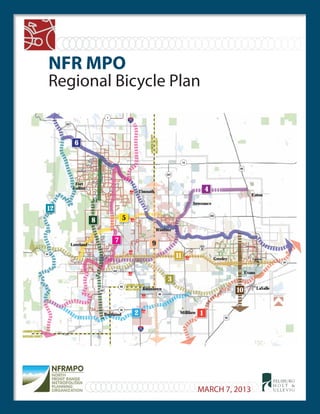
  • 1. Regional Bicycle Plan NFR MPO FELSBURG H O L T & ULLE V I G NORTHNORTH LARIMER COUNTY BOULDER COUNTYBOULDER COUNTY LARIMER COUNTYLARIMER COUNTY WELD COUNTYWELD COUNTY LARIMERCOUNTYLARIMERCOUNTY WELDCOUNTYWELDCOUNTY TYY 10 12 3 4 5 6 7 8 9 11 12 Little Tho m pson R iver Big Thomp son Rive r Sou th Pla tte R ive r PoudrreRiver GWRR BNSF BNSF LaSalle Evans Greeley Severance Windsor Timnath Fort Collins Loveland Berthoud Johnstown Milliken Eaton Garden City 25 287 287 25 34 34 257 14 392 60 56 60 402 1 85 85 BUS 34 MARCH 7, 2013
  • 2.
  • 3. Prepared for: North Front Range MPO 419 Canyon Avenue, Suite 300 Fort Collins, CO 80521 Prepared by: Felsburg Holt & Ullevig 6300 South Syracuse Way, Suite 600 Centennial, CO 80111 303.721.1440 March 7, 2013 FHU Reference No. 10 045 07
  • 4. i ACKNOWLEDGEMENTS Bicycle Technical Advisory Committee (TAC) Members Betsy Jacobsen – CDOT Division of Transportation Development Cameron Parrott – City of Evans Clint Dudley – Town of LaSalle Don Cadwallader – Town of Eaton Eric Drummond – Colorado State Trails Eric Grey – Colorado State Parks Janet Meisel Burns – City of Loveland Jeff Wiggins – City of Cheyenne Jeffrey Boring – Larimer County John Franklin – Town of Johnstown Justin Stone – City of Loveland Karen Schneiders – CDOT Region 4 Larry Butterfield – Colorado State Parks Martina Wilkinson – Larimer County Matt Blakely – Town of Timnath Molly North – City of Fort Collins Nancy Matchette – Colorado State Trails Phillip Waggoner – Town of Milliken Sarah Boyd – City of Greeley Tim Katers – Town of Berthoud Tom Morrissey – Colorado State Trails Wade Willis – Town of Windsor Wesley Hood – City of Greeley NFRMPO Public Engagement Support Intern Team Ariel Mikolitch, Colorado State University Rachel Childs, Colorado State University University GIS Team Aaron Yuhas, Colorado State University Jared Pappert Stockton, Colorado State University Joshua Reyling, University of Northern Colorado Ken Bucko, Colorado State University
  • 5. ii TABLE OF CONTENTS Page ACKNOWLEDGEMENTS ..................................................................................................................................... i 1. INTRODUCTION ................................................................................................................................... 1 Purpose of Regional Bicycle Plan...................................................................................................................1 Benefits of Investing in Bicycle Infrastructure...............................................................................................1 2. BICYCLE INVENTORY ............................................................................................................................ 3 Regional Context ...........................................................................................................................................3 Documents and Programs.............................................................................................................................4 Bicycle Infrastructure ..................................................................................................................................10 Standards and Policies.................................................................................................................................17 Data and Analysis ........................................................................................................................................21 3. PUBLIC AND STAKEHOLDER OUTREACH ..............................................................................................39 Bike Technical Advisory Committee............................................................................................................39 Project Webpage.........................................................................................................................................40 Work Sessions..............................................................................................................................................40 Employer Survey Results .............................................................................................................................41 Community Charrettes................................................................................................................................44 Household Survey Results ...........................................................................................................................44 4. REGIONAL BICYCLE SYSTEM ENHANCEMENT.......................................................................................50 Corridor Identification Process....................................................................................................................50 Regional Bicycle Corridors...........................................................................................................................51 Other Regional Improvements and Programs.............................................................................................96 5. IMPLEMENTATION PLAN.....................................................................................................................98 Funding........................................................................................................................................................98 Regional Collaboration ................................................................................................................................99 Bicycle Project Scoring Guide....................................................................................................................100 Bicycle Planning and Design Resources.....................................................................................................100 Integration with other Regional Planning Processes ................................................................................102
  • 6. iii LIST OF FIGURES Page Figure 2.1 NFRMPO Planning Area....................................................................................................................3 Figure 2.2 Existing Bicycle Facilities and Routes .............................................................................................11 Figure 2.3 Centerline Miles of On Street Bike Lanes and Bike Routes............................................................12 Figure 2.4 Centerline Miles of Off Street Shared Use Paths ...........................................................................13 Figure 2.5 Bike Boardings on Buses in 2010....................................................................................................14 Figure 2.6 Transfort Monthly Bike Boardings on Buses (2011).......................................................................15 Figure 2.7. Bike Shops ......................................................................................................................................16 Figure 2.8 Monthly Bicycle Counts on Southbound 13th Street in Boulder ...................................................22 Figure 2.9 Annual Bicycle Crash Data..............................................................................................................23 Figure 2.10 Annual Bicycle Theft Data ..............................................................................................................23 Figure 2.11 Household Density .........................................................................................................................25 Figure 2.12 Business Locations..........................................................................................................................26 Figure 2.13 School Access to Bike Routes .........................................................................................................27 Figure 2.14 Enrolled Student Residence within 2 Miles of University of Northern Colorado ..........................28 Figure 2.15 Enrolled Student Residence within 2 Miles of Colorado State University .....................................29 Figure 2.16 Enrolled Student Residence within 2 Miles of AIMS Community College .....................................30 Figure 2.17 Low Income Access to Bicycle Facilities .........................................................................................33 Figure 2.18 Minority Access to Bicycle Facilities...............................................................................................34 Figure 2.19 Senior Access to Bicycle Facilities...................................................................................................35 Figure 2.20 Rail Corridor Potential....................................................................................................................36 Figure 2.21 Trail and Roadway Crossings..........................................................................................................37 Figure 2.22 Ditch Ownership.............................................................................................................................38 Figure 3.1 Project Webpage............................................................................................................................40 Figure 3.2 Questions Asked During Regional Bicycle Work Sessions..............................................................41 Figure 3.3 Does your organization provide bike parking that is located near the entrance? (Short term)....42 Figure 3.4 Does your organization have showers that a cyclist could use after their commute?..................42 Figure 3.5 Does your organization provide an incentive (i.e. gift cards) for employees to bicycle to your office?.............................................................................................................................................42 Figure 3.6 Does your company or employees participate in “Bike to Work Day” in June? ............................43 Figure 3.7 Is your organization situated on a road that is equipped with bicycle lanes?...............................43 Figure 3.8 Is your organization situated in a location that is near a multi use trail (not on roadway)?.........43 Figure 3.9 Frequency of Bicycle Use................................................................................................................46 Figure 3.10 Percentage of All Respondents Who Rode Their Bicycle in the Last Six Months...........................46 Figure 3.11 When you ride a bike for the work or school commute, what distance do you usually travel? ...47 Figure 3.12 How long is your usual bike ride for the work or school commute? .............................................47 Figure 3.13 Percent of non riders who would like to be able to ride their bike more than they currently (and by place of residence). ...........................................................................................................48
  • 7. iv LIST OF FIGURES (cont.) Figure 3.14 To what extent, if any, do each of the following bicycling challenges on the road concern you?................................................................................................................................................49 Figure 4.1 Regional Bicycle Corridors..............................................................................................................52 Figure 4.2 Corridor #1 – South Platte / American Discovery ..........................................................................53 Figure 4.3 Corridor #2 – Little Thompson River ..............................................................................................57 Figure 4.4 Corridor #3 – Big Thompson River .................................................................................................61 Figure 4.5 Corridor #4 – Great Western / Johnstown / Loveland...................................................................65 Figure 4.6 Corridor #5 – North Loveland / Windsor........................................................................................69 Figure 4.7 Corridor #6 – Poudre River Trail.....................................................................................................73 Figure 4.8 Corridor #7 – Front Range Trail (West) ..........................................................................................76 Figure 4.9 Corridor #8 – BNSF Fort Collins / Berthoud....................................................................................80 Figure 4.10 Corridor #9 – Johnstown / Timnath ...............................................................................................83 Figure 4.11 Corridor #10 – Greeley / LaSalle.....................................................................................................86 Figure 4.12 Corridor #11 – US 34 ......................................................................................................................89 Figure 4.13 Corridor #12 – Carter Lake / Horsetooth Foothills.........................................................................92
  • 8. v LIST OF TABLES Page Table 2.1 Bike Amenities at Municipal Buildings ...........................................................................................15 Table 2.2 Bicycle Facilities Standards.............................................................................................................18 Table 2.3 Bicycle Related Regulations............................................................................................................19 Table 2.4 Bicycle Accommodation Requirements .........................................................................................20 Table 2.5 Travel Mode for Commuting (2010 Household Survey) ................................................................24 Table 2.6 Safe Routes to Schools Grant Recipients (2004 – 2011) ................................................................31 Table 3.1 Length of Residency .......................................................................................................................45 Table 3.2 Housing Tenure ..............................................................................................................................45 Table 3.3 Respondent Gender .......................................................................................................................45 Table 3.4 Respondent Age .............................................................................................................................45 Table 3.5 Respondent Ethnicity .....................................................................................................................46 Table 3.6 Reason for Having Not Ridden a Bicycle in the Past Six Months....................................................47 Table 3.7 Reason Respondent Would Be More Inclined to Bicycle More .....................................................48 Table 4.1 Corridor #1 – South Platte / American Discovery ..........................................................................54 Table 4.2 Corridor #2 – Little Thompson River ..............................................................................................58 Table 4.3 Corridor #3 – Big Thompson River .................................................................................................62 Table 4.4 Corridor #4 – Great Western / Johnstown / Loveland...................................................................66 Table 4.5 Corridor #5 – North Loveland / Windsor........................................................................................70 Table 4.6 Corridor #6 – Poudre River Trail.....................................................................................................74 Table 4.7 Corridor #7 – Front Range Trail (West) ..........................................................................................77 Table 4.8 Corridor #8 – BNSF Fort Collins / Berthoud....................................................................................81 Table 4.9 Corridor #9 – Johnstown / Timnath ...............................................................................................84 Table 4.10 Corridor #10 – Greeley / LaSalle.....................................................................................................87 Table 4.11 Corridor #11 – US 34 ......................................................................................................................90 Table 4.12 Corridor #12 – Carter Lake / Horsetooth Foothills.........................................................................93 LIST OF APPENDICES APPENDIX A CITATIONS APPENDIX B CDOT.BICYCLE.AND.PEDESTRIAN.POLICY.DIRECTIVE. APPENDIX C COMMUNITY INPUT APPENDIX D COMPILATION OF LOCAL AGENCY PROPOSED BIKE FACILITIES APPENDIX E REGIONAL BICYCLE CORRIDOR EVALUATION MATRIX APPENDIX F EVALUATION CRITERIA FROM APPENDIX G PRESENATIONS ON RAILROAD AND DITCH COORDINATION
  • 9. 1 1. INTRODUCTION Accommodation of bicyclists for both transportation and recreation has seen increasing emphasis in Colorado and throughout the country. The Colorado Department of Transportation (CDOT) issued a Policy Directive (Bike and Pedestrian Policy 1602) in 2009 and subsequent State Statute 43 1 120 which makes it clear that the Colorado Transportation Commission intends for CDOT to promote mode choice and provide for the needs of bicyclists and pedestrians. Through this policy the Transportation Commission has directed the safe and reliable accommodation of bicyclists and pedestrians in all of CDOT’s planning, design, and operation of transportation facilities. Recognizing the state’s commitment to integrate bicycle and pedestrian accommodation, this Regional Bicycle Plan for the North Front Range Metropolitan Planning Organization (NFRMPO) serves as the bicycle planning component of the Regional Transportation Plan (RTP). In support of Policy 1602 (and the related Procedural Directive), CDOT adopted the Statewide Bicycle and Pedestrian Plan in October 2012. The Statewide Plan establishes goals, investment decision criteria, and performance measures to facilitate project and program funding allocation. This Regional Bicycle Plan is intended to work in concert with the Statewide Plan, identifying evaluation criteria that are specific to the NFRMPO and identifying a regional bicycle corridor network; both of which further CDOT’s bicycle and pedestrian initiatives. Purpose of Regional Bicycle Plan The primary purposes of the NFRMPO Regional Bicycle Plan are to: Provide a consolidated summary of the existing bicycle infrastructure, data, and design standards throughout the region; Identify opportunities to connect and enhance the local and regional bicycle systems; Identify Regional Bicycle Corridors and outline implementation steps Provide the MPO’s 15 member governments with tools to support their local bicycle planning and accommodation initiatives; Position the NFRMPO to pursue state and federal (and other) funding opportunities; and Fulfill the federal requirement to address bicycle planning as a component of the Regional Transportation Plan. Benefits of Investing in Bicycle Infrastructure A variety of direct and indirect benefits can be realized as a result of investing in bicycle infrastructure. A recent University of Massachusetts study shows that bike only projects and roadway projects incorporating bike facilities both create more jobs than a road only project (38% and 13% respectively)1 . Additional studies point to varying increases in property values near trails,2 while other case studies point to increased visitors and tax 1 Pedestrian and Bicycle Infrastructure: A National Study of Employment Impacts, Political Economy Research Institute, University of Massachusetts Amherst, June 2011. 2 Bicycling and Walking in Colorado: Economic Impact and Household Survey Results; CDOT Bicycle/Pedestrian Program, The Center for Research on Economic and Social Policy of the University of Colorado at Denver, April 2000. “For us, the real measure of success is when complete streets [accommodation of all modes] and integrated roadway design is part of how we do business in this country.” – Polly Trottenberg, Assistant Secretary of Transportation Policy at the USDOT
  • 10. 2 revenues from tourism. In Colorado, nearly 10% of households took a bicycle related vacation, while 40% of vacationers engaged in bicycling would have altered their plans if bicycling facilities were not provided.3 Additional economic impacts include savings from reduced gas consumption, additional retail sales, the attraction of charitable events, and reduced economic costs of mortality.4,5 Retail related to biking contributed $200 million to Colorado in 2000, with bike related impacts on the state totaling over a billion dollars annually.3 Bicycle tours and races can also have a significant impact on the economy; the inaugural USA Pro Cycling Challenge in 2011 attracted more than a million spectators, resulting in an estimated $83.5 million in economic impact in Colorado. Northern Colorado will host the sixth stage of the 2013 USA Pro Cycling Challenge, which will start in Loveland, wind through Windsor and Estes Park, and finish in Fort Collins. Research also concludes that added bicycle infrastructure increases safety for all modes.6 Bike lanes have been credited with increasing the number of bicyclists traveling in the right direction, reducing the number of bicyclists on sidewalks, increasing stop sign compliance, and providing an increased buffer between automobiles and pedestrians.7 And with a greater number of people bicycling, drivers become more aware of non motorized users, creating a safer environment for all. A recent FHWA study5 that tracked four locations where significant bike investments were made concluded that despite significant increases in trips made by bikes following the investments, fatal crashes over the study period remained steady or decreased. Increased bicycling due to added infrastructure can also provide health related benefits. Employees who participate in physical activity take fewer sick days, have lower healthcare costs, and even have an increase in productivity.8 Increased physical activity can reduce the risk of various chronic diseases, prevent weight gain and obesity, and increase life expectancy. Bicycling for recreational or transportation purposes can help to fulfill recommended daily physical activity. Many research studies have linked the presence of bicycling and walking infrastructure with increased physical activity and improved health. The Center for Disease Control (CDC) provides a series of recommendations for bringing public health considerations into transportation issues . One of the primary recommendations is to promote active transportation by providing safe and convenient walking and bicycling facilities. It’s important to note that many investments in bicycle infrastructure are also paired with programmatic investments such as education and awareness programs. Almost all resources referenced note that such non infrastructure investments help to better maximize the benefits of bicycle infrastructure investments. 3 Property Value/Desirability Effects of Bike Paths Adjacent to Residential Areas; Center for Applied Demography & Survey Research, November 2006. 4 The Economic Benefits of Bicycle Infrastructure Investments, League of American Bicyclists, June 2009. 5 Report to the U.S. Congress on the Outcomes of the Nonmotorized Transportation Pilot Program SAFETEA LU Section 1807, Federal Highway Administration, April 2012. 6 Evidence on Why Bike Friendly Cities are Safer for All Users, Cambridge Journals Online, April 2011. 7 Bicycle Lanes Versus Wide Curb Lanes: Operational and Safety Findings and Countermeasures Recommendations, Federal Highway Administration, October 1999. 8 Realizing the Benefits of Accelerated Investment in Cycling, British Columbia Cycling Coalition, January 2011.
  • 11. 3 2. BICYCLE INVENTORY Regional Context The NFRMPO is a governmental agency responsible for long range transportation planning activities throughout northern Colorado. The NFRMPO, as shown on Figure 2.1, has 15 members that include Fort Collins, Greeley, Loveland, Timnath, Berthoud, Windsor, Johnstown, Milliken, Evans, Garden City, LaSalle, Severance, Eaton and Weld and Larimer Counties. CDOT and the State Air Quality Control Commission (AQCC) are also members. The NFRMPO works on a regional scale that covers approximately 600 square miles from Wellington to the north, Denver/Boulder metro to the south, the foothills of the Rockies to the west, and incorporated Greeley to the east. Figure 2.1 NFRMPO Planning Area Northern Colorado is the fastest growing region in Colorado. Their cities are recognized nationally as one of the top places to live (http://cbs4denver.com/business/fort.collins. best.2.771171.html). The growth of the region is highlighted by the growth of its three largest cities (Loveland, Greeley, and Fort Collins) into one large metropolitan region with the Town of Windsor at its epicenter. The region’s transportation system is relatively young when compared with more established regions in the U.S. A handful of state and federal highways carry commuters daily between the MPO communities and the Denver Metro Region. Single occupancy vehicles (SOV) dominate the regional modal split. Congestion projections are stark based on the forecasted doubling of population in the next 30 40 years, existing infrastructure deficiencies, and current modal split. Further, Northern Colorado was designated by EPA as a Non Attainment area for 8 hour ozone in 2007. History of TDM and Bicycle Planning in Northern Colorado In 1996, the NFRMPO began implementation of the SmartTrips program for Northern Colorado with allocated staff in the NFRMPO and the communities of Fort Collins, Greeley, and Loveland. The program was part of a package of strategies developed to reach the goals established in the long range RTP. By July of 2000, the SMARTTrips program was staffed by 12 employees responsible for management, outreach and operations amongst the three cities and NFRMPO at the budget of $1,426,999 (SmartTrips 2001 2006 Strategic Operations Plan). The SmartTrips 2001 2006 Strategic Operations Plan recommended the development of one program as opposed to separate local and regional programs to reduce the confusion in roles and
  • 12. 4 responsibilities that had developed as a result of having multiple programs. Unfortunately, this led to the eventual dissolution of all three local programs along with their staff. The NFRMPO retained the administration for the carpool (CarGo) and vanpooling (VanGo) programs. As of January 2012, the SmartTrips program is staffed by two full time operations and business outreach staff members with limited administrative and accounting support. With extremely limited resources, SmartTrips focuses strictly on the operation of the VanGo program (about 85 vans that travel between Northern Colorado and Denver/Boulder on the regionally significant corridors of I 25, US 287, and US 34) and the maintenance of the well visited trip matching website (www.smarttrips.org). Best practices and municipal bicycle maps are presented on the website. Documents and Programs Many of NFRMPO member communities have adopted bicycle plans, either as a stand alone document, an element of their transportation plan, or in the form of a trails plan. The communities’ bicycle planning efforts vary in degree of complexity and level of recommendations provided. Additionally, several communities in the region provide bicycle education and outreach programs to encourage bicycle travel and promote safe interaction between bicyclists and motorists. The following sections summarize, by community, the bicycle planning efforts, bicycle facility mapping, and bicycle education and outreach programs in the community. In many cases, hyperlinks to more detailed information have been provided. Berthoud Bicycle Planning Efforts The Town of Berthoud currently does not have a bicycle plan, nor does their Transportation Plan include a bicycle element. They anticipate updating their Transportation Plan in 2013 and may include a bicycle element. The Town’s Parks, Open Space and Recreation (PORT) Plan is currently in draft form and includes a full trails element. The plan is currently on hold and has not been adopted by the Town Board. Online Mapping Some bicycle trails/routes in Berthoud are displayed by Google Maps . Bicycle Education and Outreach Programs The Berthoud Police Department holds a bike safety program/bike rodeo on an annual basis. Eaton Bicycle Planning Efforts The Town of Eaton does not have a bicycle plan or a bicycle element of a transportation plan. The Town completed a Recreation and Trails Master Plan in 2004 and has developed a trail system map which depicts existing and future trails in the community. A citizens committee has recently been formed to look at trail needs to facilitate the movement of children around town. The Town has recently initiated the development of a Transportation Master Plan, which will include a bicycle component.
  • 13. 5 Online Mapping No online mapping of bicycle facilities exists. Bicycle Education and Outreach Programs Eaton does not currently have any bicycle education or outreach programs. Evans Bicycle Planning Efforts The City of Evans’ 2004 Open Space and Trails Master Plan is the primary bicycle planning document for the City. The 2004 City of Evans Transportation Plan references the Trails Plan and the City’s desire to provide additional trails throughout the City. The City is primarily focused on providing off street shared use trails. Evans does not have a separate bicycle plan at this time. Online Mapping No online map of current bicycle routes exists independently. However, the 2004 Transportation Plan shows the Riverside Park Trail as well as sidewalks which are eight feet wide or greater, which are considered by the City to be shared use trails. Bicycle Education and Outreach Programs Evans does not currently have any bicycle education and outreach programs. Fort Collins Bicycle Planning Efforts The City of Fort Collins produced a Bicycle Plan in 1995 and updated it in 2008. This plan covers dedicated bike facilities and multi use trails. The City’s Transportation Master Plan (2011) references the bike plan and provides steps towards implementation. Fort Collins also produced a Bicycle Safety Education Plan in 2011. The 2008 Bicycle Plan and 2011 Bicycle Safety Education Plan will be updated and combined in 2013. Online Mapping Fort Collins maintains an online interactive mapping tool that includes a bikeways layer . This tool includes current and proposed bike lanes, bike routes, and multi use trails and also denotes where bicycles are not allowed. The downtown dismount zone can also be viewed on the City’s website . For a printable copy of bicycle routes, a PDF version of the official bicycle map is available from the City’s website . Another map illustrating the City’s recreational trails is also available on the website . Google Maps also provides an extensive mapping of bike routes in Fort Collins . Bicycle Education and Outreach Programs The City of Fort Collins’ FC Bikes program promotes cycling as a safe and attractive means of transportation in Fort Collins. FC Bikes works to build the cohesiveness of the bicycle community and also educates residents on bicycle safety and awareness while encouraging the Fort Collins community to use bicycles as a preferred method for getting around. The FC Bikes program has a webpage on the City’s website .
  • 14. 6 The City’s Bicycle Safety Education Plan was created in 2011 as part of its bicycle safety outreach. Fort Collins also publishes a bicycle riding guide that contains stories about bike style, fundamentals of cycling, and a calendar of bike events. Garden City The community does not currently have a bicycle plan, map or programs in place. Any future efforts will be incorporated into this document when appropriate. Greeley Bicycle Planning Efforts The City of Greeley does not have a dedicated bicycle plan, but its 2011 2035 Comprehensive Transportation Plan provides direction for bicycle planning in the City through the plan’s Bicycle Vision Plan element. The City also has a Parks and Trails Master Plan (2002) and a supplemental Conceptual Trails Plan (2002). Online Mapping The City of Greeley has recently launched www.greeleybikes.com to provide a PDF map that outlines bicycle and pedestrian routes in the City . Google Maps also illustrates some of the City’s bicycle routes . Bicycle Education and Outreach Programs The City of Greeley has recently initiated an internal bicycle advisory group and has purchased the www.greeleybikes.com that provides links to bicycle education websites. Johnstown Bicycle Planning Efforts The Town of Johnstown does not have a dedicated bicycle plan, but its 2008 Transportation Master Plan addresses bicycling by referencing the Johnstown/Milliken Parks, Trails, Recreation and Open Space Master Plan (2003). The joint Johnstown/Milliken trails plan serves as the primary bike planning document for the area. Online Mapping No online map of current bicycle routes exists independently. However, the 2008 Transportation Plan and joint Johnstown/Milliken trails plan do map current and proposed trails for the area. Google Maps also illustrates a limited amount of trails in the western part of Johnstown . Bicycle Education and Outreach Programs Johnstown does not currently have any bicycle education and outreach programs, as it is the responsibility of the Thompson Rivers Park and Recreational District to conduct recreational outreach programs. Currently the District does not have any dedicated bicycle programs.
  • 15. 7 Larimer County Bicycle Planning Efforts Larimer County Transportation Master Plan (2006) includes a short section on bicycling, but the County does not have a dedicated bicycle plan. Its Open Lands Master Plan (2001) provides some additional guidance on regional trails. Larimer County is currently updating their transportation plan and Open Lands plans. Online Mapping Larimer County does not provide any online maps specifically for bicycling. However, PDF maps of open space trails can be obtained from the Department of Natural Resources webpage . A regional view of trails is also available within the Open Lands Master Plan appendix “Master Plan Maps & Inventory”. Google Maps displays some bike routes outside of municipalities, but a majority of the routes are within Fort Collins and Loveland . Bicycle Education and Outreach Programs Larimer County does not currently have any programmed bicycle education and outreach programs, but does provide such services on demand. LaSalle Bicycle Planning Efforts The Town of LaSalle does not have a dedicated bicycle plan, but its 2010 Transportation Master Plan provides a bike and pedestrian planning element that includes proposed bike lanes and shared use trails. The Town also has a Parks Plan that lists trails in the community. Online Mapping LaSalle does not currently have any bike facilities, and therefore does not have an online map. A map of proposed bike lanes and shared use trails is available within the Town’s transportation plan. Bicycle Education and Outreach Programs In 2011 the Town of LaSalle’s Recreation Department started community bike rides, which included a brief education component at the start of each ride. Loveland Bicycle Planning Efforts The City of Loveland currently has a draft Bike and Pedestrian Plan was adopted on May 1, 2012 and incorporated into the 2035 Transportation Plan which was approved on December, 18 2012. The Parks and Recreation Master Plan (2001) includes recreational trails. Online Mapping Loveland provides a PDF map on its website for the existing bike network and its recreational trail network . Google Maps displays a mostly complete bike network for Loveland .
  • 16. 8 Bicycle Education and Outreach Programs The City of Loveland provides a variety of education and outreach programs. The City is a collaborative partner in the Bicycle and Pedestrian Education Coalition (BPEC) in providing bicycle education and outreach programs, while maintaining a Safe Routes to School (SRTS) program that involves many of the area’s schools. The City also operates programs such as Helmet Blitzes and Strap n Snap for 3rd graders, while providing outreach at a variety of local events. Milliken Bicycle Planning Efforts The Town of Milliken does not have a dedicated bicycle plan, but its Transportation Master Plan (2008) includes a bicycle element. The joint Johnstown/Milliken Parks, Trails, Recreation and Open Space Master Plan (2001) serves as the primary bike planning document for the area. Online Mapping No online map of current bicycle routes exists independently. However, the transportation plan and joint Johnstown/Milliken trails plan do map current and proposed trails for the area. Bicycle Education and Outreach Programs Milliken does not have any structured education and outreach programs, but the Town occasionally hosts a bike rodeo. Severance Bicycle Planning Efforts The Town of Severance’s Transportation Plan (2008) includes a brief section that notes plans for trails and bicycle facilities. Online Mapping Google Maps does display a regional trail that connects Severance, but no other facilities are displayed . Bicycle Education and Outreach Programs The community does not currently have bicycle programs in place. Any future efforts will be incorporated into this document when appropriate. Timnath Bicycle Planning Efforts The Town of Timnath’s Trails Plan (2005) serves as the primary bicycle planning document, incorporating both bike routes and lanes along with regional trails and pathways. The Town’s Transportation Plan (2005) and Comprehensive Plan (2007) also speak to providing improved bike access in the town. There is no dedicated bicycle plan. Online Mapping The Town’s Trails Plan provides a map with proposed bike facilities. Google Maps also documents some bike access within the town, but this access is primarily routes providing connection from Fort Collins .
  • 17. 9 Bicycle Education and Outreach Programs Timnath does not currently have any bicycle education and outreach programs. Weld County Bicycle Planning Efforts Weld County does not have any dedicated bicycle planning efforts, instead opting to leave bicycle planning to its municipalities and providing support. However, the Weld County 2035 Transportation Plan (2011) provides some goals related to bicycle accommodation, primarily about supporting municipalities. The bike element also notes the County’s assistance to the Weld Trails Coordination Committee (WTCC) whose purpose is to help provide regional trail connectivity. Online Mapping The County does not provide online mapping, but the WTCC provides a regional trails inventory map on its website . The County’s transportation plan includes a small version of this map, along with a national and state trails map. Google Maps displays bike routes of some of the county’s municipalities, along with some of the regional trails between communities . Bicycle Education and Outreach Programs Weld County does not currently have any programmed bicycle education and outreach programs. The WTCC would likely be the primary entity to provide such programs in the county, but no such programs are explicitly advertised. Windsor Bicycle Planning Efforts The Town of Windsor does not have a dedicated bicycle plan or a bike element within its Transportation Study (1999). However, Windsor’s Comprehensive Plan (2006) speaks to providing bicycle access within the Town. Furthermore, the Town’s Parks, Recreation, Trails and Open Lands Master Plan – 2007 Update provides guidance and planning for trails. Online Mapping A PDF map of Windsor’s current and proposed trail system is available on its website . Google Maps also illustrates some of the trails within and around Windsor . Bicycle Education and Outreach Programs The Town of Windsor’s Police Department runs a bicycle rodeo, while the Recreational Department hosts a bike to work day.
  • 18. 10 Bicycle Infrastructure Communities in the NFRMPO have a variety of bicycle facilities ranging from shared used paths to bike lanes to bike box treatments at intersections. The following sections provide an overview of the bicycle facilities that currently exist in the region. Definitions For consistency and clarification, the following definitions are provided for different types of bicycle facilities.9 Bicycle Boulevard – A street segment, or series of contiguous street segments, that has been modified to accommodate through bicycle traffic and minimize through motor traffic. Bicycle Route – A roadway or bikeway designated by the jurisdiction having authority, either with a unique route designation or with BIKE ROUTE signs, along which bicycle guide signs may provide directional and distance information. Bikeways – A generic term for any road, street, path or way which in some manner is specifically designated for bicycle travel, regardless of whether such facilities are designated for the exclusive use of bicycles or are to be shared with other transportation modes. Bike Box – A designated area at the head of a traffic lane at a signalized intersection that provides bicyclists with a safe and visible way to get ahead of queuing traffic during the red signal phase. Bike Lane – A portion of a roadway which has been designated by striping, signing and pavement markings for the preferential or exclusive use of bicyclists. Shared Use Path – A bikeway physically separated from motorized vehicular traffic by an open space or barrier and either within the highway right of way or within an independent right of way. Shared use paths may also be used by pedestrians, skaters, wheelchair users, joggers and other non motorized users. Shared Lane – A lane of a traveled way that is open to bicycle travel and vehicular use. Shared Lane Marking (“sharrows”) – A pavement marking symbol that indicates an appropriate bicycle positioning in a shared lane. Sidepath – A shared use path located immediately adjacent and parallel to a roadway. 9 Sources: AASHTO Guide for the Development of Bicycle Facilities, 2012 and February 2010 Draft; NACTO Urban Bikeway Design Guide. A Bike Box in Fort Collins A Bike Lane in Fort Collins A “Sharrow” in Fort Collins
  • 19. 11 Existing Bicycle Facilities As shown on Figure 2.2, the existing bicycle facilities in the NFRMPO region are predominantly located in the three larger cities of Fort Collins, Loveland, and Greeley. There is also considerable bicycle infrastructure in the Windsor area. The foundation of a regional trail system along the Poudre River is discernible on Figure 2.2. Figure 2.2 Existing Bicycle Facilities and Routes Map created by NFRMPO
  • 20. 12 Bike Lanes and Bike Routes On street bike lanes help to define an area of the street that is for the exclusive use of bicyclists and can decrease the stress level of bicyclists riding in traffic. Bike lanes encourage bicyclists to ride in the correct direction of travel and alert motorists of the potential presence of bicyclists. Many bicyclists prefer to ride the most direct route to their destination, which is frequently along a street; bike lanes help to specify streets within a community where bicycling is preferred. Bike routes follow roadways without bike lanes. These roadways are properly signed “Bike Route” to provide wayfinding support to the bicyclist while notifying the motorist the roadway is shared with bicyclist. Nine of the municipalities in the MPO currently have signed routes and striped on street bike lanes. In total, there are over 421 centerline miles of bike routes and bike lanes in the region. As shown on Figure 2.3, Fort Collins and Loveland provide the highest mileage of bike lanes through their communities, with 142 miles of bike lanes in Fort Collins and 83 miles in Loveland. To a lesser extent, Berthoud, Greeley, Johnstown, Windsor, and areas unincorporated Larimer and Weld Counties also have designated bike lanes on their roads, Figure 2.3 Centerline Miles of On Street Bike Lanes and Bike Routes Off Street Bike Facilities Shared use paths provide valuable benefits to a community including transportation connections and recreational opportunities. Many cyclists, especially families with small children and those who may not be comfortable riding alongside motor vehicles, prefer to ride on shared use paths. In total, there are over 208 centerline miles of shared use paths in the North Front Range MPO, distributed between nine of the municipalities and areas of unincorporated Larimer and Weld Counties, as shown on Figure 2.4. 0 20 40 60 80 100 120 140 160 180 Bike Route Miles Bike Lane Miles
  • 21. 13 Figure 2.4 Centerline Miles of Off Street Shared Use Paths Shoulders The AASHTO Guide for the Development of Bicycle Facilities (2012) notes that “adding or improving paved shoulders can greatly improve bicyclist accommodation on roadways with higher speeds or traffic volumes, as well as benefit motorists.” According to AASTHO (as well as the CDOT Roadway Design Guide), the minimum paved shoulder width to accommodate bicycle travel is four feet. CDOT has a Policy Directive which states that shoulder improvements shall be incorporated on all state highways when upgrades are being made (note: bicycle use is prohibited on I 25 in urban areas, including throughout the NFRMPO region). While many roadways in the NFRMPO have shoulders adequate for bicycle use, a comprehensive database of shoulder widths in the region is not currently available. Other Bicycle Facilities In addition to bike lanes and shared used paths, the Fort Collins and Greeley bicycle networks include short segments of share lane markings (“sharrows”). In Fort Collins, the half mile stretch of Mountain Avenue between Mason Street and Riverside Drive is marked with sharrows. Greeley’s network includes sharrows at four locations, covering a total of approximately 1.2 miles: 16th Street between 4th Avenue and 6th Avenue 20th Street between 7th Avenue and 12th Avenue 24th Street between Balsam Avenue and Bearwood Avenue 71st Avenue between Grizzly Drive and C Street 0 10 20 30 40 50 60 70
  • 22. 14 Fort Collins also has one bike box near the Colorado State University Campus at the intersection of Shields Street and Plum Street on the side Street (Plum) approach. Signing and Signal Equipment Fort Collins and Loveland both have bike detectors at some signalized intersections under their jurisdiction. Fort Collins uses a video detection system capable of detecting bikes at 84 out of 178 (47%) of their signalized intersections (2012). Loveland uses both video and loop detection systems. Around 40 50% of Loveland’s traffic signals are equipped with bike detection systems; however, their downtown signals are pre timed with no detection. Bicycle Amenities Buses and Vanpools Equipped with Bike Carriers Three fixed route transit systems operate in the MPO: Transfort in Fort Collins, Greeley Evans Transit (GET), and City of Loveland Transit (COLT). All fixed route buses in each system are equipped with bicycle racks; GET and COLT buses have a capacity of two bikes per bus and Transfort buses have a capacity of three bikes per bus. Figure 2.5 shows the number of bike boardings on buses for the three transit providers in 2010. In total, there were over 121,000 bike boardings on buses in the region. Figure 2.6 shows Transfort’s seasonal variation of bicycle boardings on buses. The NFRMPO currently operates 85 active VanGo vanpooling routes. Twenty one of the 85 vans (25 percent) are equipped with bike racks. Figure 2.5 Bike Boardings on Buses in 2010 0 20,000 40,000 60,000 80,000 100,000 120,000 Transfort GET COLT
  • 23. 15 Figure 2.6 Transfort Monthly Bike Boardings on Buses (2011) Bike Storage and/or Showers at Municipal Buildings As shown in Table 2.1, five of the communities in the NFRMPO provide bicycle amenities at their municipal buildings to encourage employees and visitors to bike to the facilities. Fort Collin’s facility at 215 N. Mason is a LEED certified building that provides secure indoor bicycle storage. Table 2.1 Bike Amenities at Municipal Buildings Community Bike Racks Bike Lockers/ Secure Storage Bike Fleet Showers Berthoud Eaton Evans Fort Collins Garden City Greeley Johnstown Larimer County LaSalle Loveland Milliken Severance Timnath Weld County Windsor
  • 24. 16 Privately Owned Bicycle Shops In 2012, the NFRMPO region supported 40 privately owned bicycle shops, as shown on Figure 2.7. These businesses are documented in this regional plan because they support for bicycle commuters and serve as a source of education/information dissemination for area bicyclists. The businesses predominantly reside in Larimer County in the cities of Fort Collins and Loveland. Weld County has 6 bike shops between Greeley, Windsor, and Johnstown. Figure 2.7. Bike Shops Map created by NFRMPO
  • 25. 17 Standards and Policies Bicycle Facilities Standards Bicycle facility design standards have been established on a nation level by the American Association of State Highway and Transportation Officials (AASHTO Guide for the Development of Bicycle Facilities, 2012) and the National Association of City Transportation Officials (NACTO Urban Bikeway Design Guide, 2011). CDOT recently completed the bicycle and pedestrian chapter (Chapter 14) of the CDOT Roadway Design Guide, which documents standards and best practices for designing facilities for bicyclists and pedestrians. Several of the counties and municipalities in the NFRMPO have also developed standards, with some based on national and state resources, and others geared towards local conditions. Larger municipalities often communicate design standards through bike plans and roadway design guidelines, while smaller communities rely on design standards in municipal code or construction design standards documents. Table 2.2 compares which typical bicycle facility standards have been documented at the national, state, and local levels.
  • 26. 18 Table 2.2 Bicycle Facilities Standards Design Element AASHTO NACTO CDOT Berthoud Eaton Evans FortCollins GardenCity Greeley Johnstown LarimerCounty LaSalle Loveland Milliken Severance Timnath WeldCounty Windsor Shoulders Curb lanes Bike lanes Left side bike lanes Buffered bike lanes Contra flow bike lanes Bike boulevards Shared use paths Bike boxes Signal timing Bike detectors Bike signals On street parking Railroad crossings Barriers Lighting for bikes Surface type Striping Painted symbols (e.g., sharrows) Signage Slopes Design speeds Bike parking National or State Resource / Local Entity = defines elements and recommends or requires following of standards = defines element, but does not set any standards Bicycle Related Regulations Many of the NFRMPO communities have regulations or ordinances that pertain to bicycle use. Table 2.3 shows the communities which have regulations related to the use of bike facilities, snow removal on bicycle facilities, and bicycle registration programs. Each item is described in more detail in the subsequent sections.
  • 27. 19 Table 2.3 Bicycle Related Regulations Community Regulations on Bike Facility Usage Snow Removal Policy (for Bike Facilities) Bicycle Registration Program Berthoud Eaton Evans Fort Collins Garden City Greeley Johnstown Larimer County LaSalle Loveland Milliken Severance Timnath Weld County Windsor Regulations on Bicycle Facility Use Eight of the 15 communities have regulations about what type of users are allowed on sidewalks or bicycle facilities. Greeley and Windsor both allow bicyclists to use sidewalks, while in Berthoud and Milliken bicycles are prohibited from using sidewalks. In Fort Collins, bicycles are allowed on sidewalks except in the “Downtown Dismount Zone.” Likewise, Johnstown allows bicycles on sidewalks except in restricted areas like downtown and Loveland allows bicycles on sidewalks except in zoning districts E and DE. Evans allows bicycles on sidewalks that are eight feet or wider. Berthoud, Evans, Johnstown allow motorized bicycles on bike facilities, while Greeley and Milliken prohibit motorized bikes on trails. Fort Collins allows motorized bicycles on bike lanes, but not on recreational trails. Snow Removal Policies Many Coloradoans enjoy riding their bikes year round, as demonstrated in the bicycle count section of this report. Four of the NFRMPO communities have policies related to the removal of snow from bicycle facilities. Berthoud’s Parks Department plows the paved bike trails in the community. Fort Collins’ 2008 Bike Plan includes the designation of priority commuter routes which maintained to minimize surface hazards including snow. Johnstown plows their bicycle and pedestrian paths. And Loveland plows their bike lanes and shoulders at the same time as other travel lanes. Loveland’s Parks Department plows the trail system within 24 48 hours after a storm. Bicycle Registration Programs Hundreds of bicycles are stolen each year, as documented in bicycle theft section in this report. Several communities in the NFRMPO have bicycle registration programs that help the local police departments to recover stolen bicycles and return them to their rightful owner. Fort Collins’ bicycle registration program is free
  • 28. 20 and can be completed online through the FCBikes program. Bicycle registration is not required in Eaton, LaSalle and Milliken, but can be done through the local Police Departments. Greeley has a bicycle ordinance which requires an annual fee for bicycle registration. Bicycle Accommodation Requirements As shown on Table 2.4, CDOT and six of the NFRMPO communities have requirements for bicycle accommodation to be included in roadway expansion and/or resurfacing projects. Ten of the communities require bicycle accommodation as an element of new development or redevelopment. A brief description of the requirements by community follows. The National Complete Streets Coalition defines completes streets as the simple idea that “our streets should work for everyone, of all ages and abilities, regardless of how they travel.” Their Complete Streets Policy Analysis document ( ) outlines elements of complete streets policies and defines a methodology for evaluating the strength of complete streets policies based on each of ten elements. Using this document as a guide, three agencies in the NFRMPO (CDOT, Fort Collins, and Loveland) have complete street policies in place that are comprehensive and clear in intent. Several other communities, as noted by the partial circle in Table 2.4, have some elements of a complete streets policy in place. Table 2.4 Bicycle Accommodation Requirements Community Bicycle Accommodation Requirements for Roadway Expansion/ Resurfacing Bicycle Accommodation Requirements for New Development/ Redevelopment Complete Streets Policy CDOT Berthoud Eaton Evans Fort Collins Garden City Greeley Johnstown Larimer County LaSalle Loveland Milliken Severance Timnath Weld County Windsor = Policy/requirement in place = Some elements of Complete Streets Policy in place
  • 29. 21 The Colorado Transportation Commission’s Bike and Pedestrian Policy Directive 1602.0 (dated October 22, 2009) and subsequent State Statute 43 1 120 support the development of fully integrated active transportation networks. CDOT’s Policy Directive states that “the needs of bicyclists and pedestrians shall be included in the planning, design, and operation of transportation facilities, as a matter of routine.” As such, bicycle and pedestrian accommodation needs to be incorporated into all CDOT transportation projects. Berthoud is currently working on updating their development code, and it will likely require developers to implement the proposed trails in the PORT Plan. The Town requires bike parking depending on size of parking lot. The typical cross sections in Evans’ Transportation Plan do not include bike lanes, but they do include 8 foot (or greater) shared use paths. These cross sections are treated as standards for development and road expansion projects. Fort Collins uses the Larimer County Urban Area Street Standards document as a guiding document for providing bicycle facilities through the development review process and for roadway expansion projects. The City has specific policies for on street bike parking. Greeley requires the developers construct bike lanes on collectors streets and higher classification. The City has been active in constructing road diets with bike lanes. Many of Johnstown’s typical cross sections include bike lanes, and they are treated as standards in development review process. Bicycle facilities are added as a part of roadway expansion projects if the facility has been identified as a planned route. Outside of growth management areas (GMAs), Larimer County holds developers to the rural area road standards (RARS), which includes shoulders. For reconstruction projects, the County adheres to standards (including shoulders) to the extent practicable. For resurfacing projects, the County tries to widen the paved width as much as easily possible (typically 1 2 feet of additional shoulder width). Loveland requires bicycle facilities in accordance with the Larimer County urban area street standards (LCUASS) and Site Development Standards. Bike parking is required for multi family and all other non residential development per the planning standards for new development. Many of Milliken’s typical cross sections include bike lanes, and they are treated as standards in development review process. Timnath requires bicycle facilities in accordance with LCUASS and parking requirements in the Town’s Land Use Code for development. Many of Windsor’s typical cross sections include bike lanes, and they are treated as standards in development review process. Data and Analysis Bicycle Counts Fort Collins and Loveland are the only communities in the NFRMPO that have completed bicycle counts. Fort Collins has counted bicycle volumes at over 40 intersections throughout the City during the morning, noon, and afternoon peak hours. Loveland rented a bike counter from CDOT in October 2010; they used the counter to collect nearly a month of bicycle and pedestrian counts on the recreational trail underpass of Eisenhower Boulevard (US 34) between Cheyenne Avenue and Denver Avenue. Available counts from Fort Collins and Loveland are included in Appendix B.
  • 30. 22 A permanent loop counter has been installed in downtown Boulder on the bike lanes on 13th Street approximately one block south of Pearl Street. Since Boulder’s climate is similar to that in the NFRMPO, these data are useful to understand the variation in bicycle activity that can be expected over the course of a year. The monthly bicycle count data for southbound 13th Street, which has been compiled by the University of Colorado, is presented in Figure 2.8. From this count summary, April and May represent approximately average bicycle use over the twelve month period. June through September represent a considerable peak in bicycle activity. Bicycle activity during the winter months is in the range of 20 percent of the peak summer activity. Figure 2.8 Monthly Bicycle Counts on Southbound 13th Street in Boulder Reported Bicycle Crashes Fort Collins, Greeley, Loveland, and Windsor each track bicycle related crashes, as shown on Figure 2.9. Larimer and Weld Counties also track bicycle crashes, but the data are not presented in the graph because they include some crashes in incorporated areas of the Counties as well as areas of the County outside of the NFRMPO boundary. Typically, the reported bicycle crashes involve a motor vehicle and a bicyclist, rather than crashes between two bicyclists or a single bicycle crash. The crash data, particularly in Fort Collins, show an upward trend in the number of bicycle crashes over time, which is likely to a large extent a result of increased population and increased bicycling in the City. 0 2,000 4,000 6,000 8,000 10,000 12,000 14,000 16,000 18,000 Oct10 Nov10 Dec10 Jan11 Feb11 Mar11 Apr11 May11 Jun11 Jul11 Aug11 Sep11
  • 31. 23 Figure 2.9 Annual Bicycle Crash Data Bicycle Theft Bicycle theft data for six of the MPO communities are shown in Figure 2.10. Again, Larimer County also tracks bicycle thefts, but the data are not presented in the graph because they include some crashes in incorporated areas of the County (such as Fort Collins) as well as areas of the County outside of the NFRMPO boundary. Between 2006 and 2010, bicycle theft in Fort Collins has increased over 35 percent. Figure 2.10 Annual Bicycle Theft Data 0 20 40 60 80 100 120 140 160 FortCollins Greeley Loveland Windsor 0 100 200 300 400 500 600 700 800 2005 2006 2007 2008 2009 2010 2011 Berthoud Eaton FortCollins Greeley Loveland Windsor
  • 32. 24 Bike Participation by Community The 2010 NFRMPO Household Survey provides insight into the travel modes used to travel to and from work, as shown in Table 2.5. Region wide, 6.3 percent of survey respondents reported bicycling to work. Of the three large cities in the region, Fort Collins respondents indicated the highest rate of bicycle use for commuting at over 13 percent. Table 2.5 Travel Mode for Commuting (2010 Household Survey) Fort Collins Greeley Evans Loveland Larimer Weld Region wide Walk 3.60% 5.00% 1.70% 3.20% 1.70% 3.40% Bike 13.30% 4.10% 1.00% 0.60% 1.00% 6.30% Driver 76.80% 82.20% 89.80% 93.80% 90.90% 84.50% Passenger 4.40% 8.00% 5.90% 2.30% 6.20% 4.80% Local bus 0.70% 0.60% 1.40% 0.00% 0.00% 0.50% Express bus 0.00% 0.10% 0.00% 0.00% 0.00% 0.00% Other 1.20% 0.00% 0.20% 0.20% 0.20% 0.60% Total 100.00% 100.00% 100.00% 100.00% 100.00% 100.00% Household Density Figure 2.11 below depicts the density of households across the NFRMPO region as compared with the regional bicycle system as of the writing of this plan. A simple review of the map demonstrates where existing bicycle infrastructure is paired with the densities of households. The cities with larger populations have an observably larger investment in bicycle infrastructure likely indicating: 1. An increased public demand for bicycle trails and bike lanes 2. Subsequent policies to add infrastructure with new development 3. Diverse or dedicated funding sources for bicycle infrastructure Conversely, the smaller population towns in the NFRMPO region have a lower density and their current investment is smaller.
  • 33. 25 Figure 2.11 Household Density Map created by NFRMPO
  • 34. 26 Business Locations There are over 11,000 businesses in the NFRMPO, as shown on Figure 2.12, and approximately 176,600 employees. Approximately 84 percent of businesses are located within a ¼ mile of an existing bike route, and over 85 percent of employees work within a ¼ mile of an existing bike route. Figure 2.12 Business Locations Map created by NFRMPO
  • 35. 27 Student Access to Bicycle Facilities There are 266 schools in the NFRMPO region. Of those schools, 86 percent (229 schools) are within a ¼ mile of an existing bike route. The remaining 37 schools have no existing bike routes within a ¼ mile distance (shown in red on Figure 2.13). Figure 2.13 School Access to Bike Routes Map created by NFRMPO
  • 36. 28 Figures 2.14, 2.15, and 2.16 represent the frequency of students living within a two mile bicycle commute to each college campus (except Front Range Community College due to data restrictions) in the NFRMPO region. At the University of Northern Colorado and Colorado State University in 2012, 65% (5,087) and 70% (11,664) of the students lived within two miles of campus respectively. AIMS Community College had 31% (1,651) at their Greeley Campus and 5% (286) at their Loveland Campus in 2012. Figure 2.14 Enrolled Student Residence within 2 Miles of University of Northern Colorado Map created by NFRMPO
  • 37. 29 Figure 2.15 Enrolled Student Residence within 2 Miles of Colorado State University Map created by NFRMPO
  • 38. 30 Figure 2.16 Enrolled Student Residence within 2 Miles of AIMS Community College Map created by NFRMPO
  • 39. 31 Safe Routes to Schools Colorado’s Safe Routes to Schools (SRTS) program and grants are administered by the Colorado Department of Transportation. As shown on Table 2.6, many schools within the NFRMPO region have benefited from SRTS funding over the last eight years. Table 2.6 Safe Routes to Schools Grant Recipients (2004 – 2011) Year City Project Summary Schools 2006 Fort Collins Sidewalk improvements Dunn Elementary School 2006 Evans New and improved walkways Chappelow Magnet School 2006 Evans Sidewalk/crosswalk improvements John Evans Middle School 2007 Fort Collins Audit, Bike and Walk across Colorado, School Award Bacon Elementary School Beattie Elementary School Laurel Elementary School Lopez Elementary School Werner Elementary School 2008 Loveland T n T Tuesdays Centennial Elementary School Garfield Elementary School Winona Elementary School 2008 Loveland Improve flashing school zone signals Centennial Elementary School Garfield Elementary School Winona Elementary School 2009 Fort Collins Poudre School District Safe Routes to School Bennett Elementary School Dunn Elementary School Lesher Junior High School McGraw Elementary School Tavelli Elementary School 2009 Loveland T n T Tuesdays Education Program Programmatic 2009 Milliken Sidewalk and signage improvements Milliken Elementary School Milliken Middle School 2010 Fort Collins Fort Collins Safe Routes to School Bauder Elementary School Blevins Middle School Boltz Middle School Harris Elementary School Irish Elementary School Johnson Elementary School Kinard Middle School Krus Elementary School Lab Elementary School Linton Elementary School Moore Elementary School O'Dea Elementary School
  • 40. 32 Year City Project Summary Schools Olander Elementary School Preston Middle School Putnam Elementary School Riffenburgh Elementary School Shepardson Elementary School Traut Elementary School Webber Middle School Zach Elementary School 2010 Loveland Loveland T n T Tuesdays BF Kitchen Bill Reed Middle School Centennial Elementary School Sarah Milner Elementary School Truscott Elementary School Van Buren Elementary School Winona Elementary School 2011 Fort Collins New bike racks, education and encouragement activities Bacon Elementary School Bauder Elementary School Bennett Elementary School Dunn Elementary School Zach Elementary School 2011 Fort Collins Community wide effort to encourage biking and walking to school Programmatic 2011 Loveland New sidewalk and curb extensions Truscott Elementary School 2011 Loveland T n T Tuesdays BF Kitchen Centennial Elementary School Cottonwood Plains Elementary School Laurene Edmondson Elementary School Namaqua Elementary School Ponderosa Elementary School
  • 41. 33 Access to Bicycle Facilities Low Income Population Access to Bicycle Facilities The highest concentrations of low income residents are depicted in Figure 2.17 below. The analysis is somewhat limited due to the granularity of the data (2010 US Census Tracts instead of Census Blocks), but the highest concentrations center around the urban downtowns of Fort Collins and Greeley. Certainly, these concentrations are influenced by large universities in both of these downtown areas, yet, these areas represent some of the larger concentrations of bicycle infrastructure in the NFRMPO Region. Figure 2.17 Low Income Access to Bicycle Facilities Map created by NFRMPO
  • 42. 34 Minority Population Access to Bicycle Facilities Figure 2.18 depicts the concentration of Hispanics (largest recognized minority population) in Northern Colorado by 2010 US Census Block. The map demonstrates significant Census Blocks of Hispanics throughout each of our NFRMPO communities. A significant number of high percentage blocks exist in rural Weld and Larimer County where existing bicycle infrastructure and connections to the larger cities do not currently exist. Figure 2.18 Minority Access to Bicycle Facilities Map created by NFRMPO
  • 43. 35 Senior Access to Bicycle Facilities Seniors are increasingly recognized users of bicycle infrastructure across the country for transportation and fitness. Figure 2.19 depicts the concentration of Seniors Over 65 across Northern Colorado. The map clearly shows a broad distribution of Seniors across our member governments likely indicating the popularity of Northern Colorado for retirees and increased demand for bicycle infrastructure from the “Baby Boomer” generation now reaching retirement age. Figure 2.19 Senior Access to Bicycle Facilities Map created by NFRMPO
  • 44. 36 Rail Corridor Potential Historically, Northern Colorado, like much of the West, created railroad connections between all NFRMPO communities to facilitate the movement of people, agricultural goods, and natural resources (see Figure 2.20). Rail corridors provide an option for trail development as they connect neighboring communities and have few property owners. Two types of trail development along trails exist with regional example in “()”: 1. Rails to Trails (Great Western Trail in Weld County) – Use of abandoned rail corridor to develop a trail 2. Rails with Trails (Mason Trail in Fort Collins)—Trail adjacent to or within an active railroad corridor (often with fencing between the pathway and the railway) with a maintenance and liability agreement Figure 2.20 Rail Corridor Potential Map created by NFRMPO
  • 45. 37 Bike Routes and Roadway Crossings Figure 2.21 below depicts the number of direct access points from a roadway crossing to the existing shared use trails in the NFRMPO Region. The map measures the number of access points, from zero (0) to four (4), for bicyclists to access a trail/route from a roadway crossing. Figure 2.21 Trail and Roadway Crossings Map created by NFRMPO
  • 46. 38 Ditch Ownership The NFRMPO region has a diverse network of ditches connecting with all NFRMPO governments. Figure 2.22 below depicts those ditches by ownership. Ditches are frequently referenced in local plans as desired bike trail infrastructure in our region because they have a limited number of owners while connecting neighborhoods and communities. Ditch trails typically require a Master Agreement between the ditch company and managing agency to provide infrastructure improvements, maintenance, and liability coverage. Figure 2.22 Ditch Ownership Map created by NFRMPO
  • 47. 39 3. PUBLIC AND STAKEHOLDER OUTREACH The NFRMPO recognizes the value of public input to define and implement effective transportation, congestion and air quality solutions. The organization is guided by the Public Involvement Plan (PIP) that outlines the importance of, and establishes specific guidelines for, involving community members, organizations, governments, transportation professionals and other entities in NFRMPO projects, plans and programs. The Regional Bicycle Plan included the following public engagement strategies to encapsulate existing conditions for bicycle system users along with desired improvements for commuting, recreation, and community connections: Bicycle Technical Advisory Committee convened with local government and State of Colorado staff to guide and inform the planning process. Project Webpage created for posting documents, meeting minutes, and related project news Work Session with each member government council/board to discuss existing bicycle infrastructure and desired improvements to the regional system. Phone Survey of the businesses over 100 employees in the NFRMPO region Mailed Survey to residents geographically proportional to their population size with a sample size of 1600 Citizen Meetings (Charettes) to conduct mapping exercise to capture desired routes and destinations from their community by bicycle. Corridor Vetting with local governments boards, councils and committees regarding their feedback about the Regional Bicycle Corridor to guide plan introduction to the NFRMPO Planning Council and Technical Advisory Committee. Bike Technical Advisory Committee The NFRMPO convened the Bicycle Technical Advisory Committee (Bike TAC) to guide and inform the Regional Bicycle Plan. Specifically, the group provided technical data (Inventory), local coordination (meeting scheduling /charettes), strategic recommendations (Regional Bicycle Corridors), and final plan editing. The Bike TAC convened on the following dates during the planning process: Tuesday, March 6, 2012 – 10am 12pm –Loveland Fire Station #6 Tuesday, May 8, 2012 – 10am 12pm–Loveland Fire Station #6 Tuesday, August 7, 2012 – 10am 12pm – Loveland Chamber of Commerce Tuesday, October 30, 2012 – 10am 12pm– Loveland Chamber of Commerce Tuesday, December 4, 2012 – 10am 12pm– Loveland Chamber of Commerce
  • 48. 40 Project Webpage NFRMPO staff created a project webpage housed within the NFRMPO’s website located at http://www.nfrmpo.org/Projects/BikePlan.aspx. The visitor could access the webpage from the organization’s home page as a highlighted project. The webpage provided project contacts, Bike TAC meeting minutes, calendar of meetings, related bicycle news from local and national sources, maps and plan drafts. For those unable to participate one of the schedule charrettes, on online survey option was provided on the project webpage. Figure 3.1 Project Webpage Work Sessions During the first quarter of 2012, NFRMPO staff conducted work sessions with member government councils, boards, and commissions. NFRMPO staff sought guidance for the planning effort with respects to desired local and regional bicycle infrastructure improvement along with a level of comfort with the parameters and public involvement propose for the planning effort. NFRMPO staff asked the following questions and recorded collective responses (see Appendix C):
  • 49. 41 Figure 3.2 Questions Asked During Regional Bicycle Work Sessions 1. How can the Regional Bicycle Plan serve your community? 2. Possible: a. Destinations by bicycle (inside/outside your community)? b. Bike routes to investigate: i. on system/bike lanes? ii. off system/bike trails? 3. What is your level of comfort depicting future improvements in the plan? 4. What are your expectations for public involvement in for this plan? The NFRMPO conducted the following work sessions: Eaton January 19, 2012 Loveland TAB February 6, 2012 Evans February 7, 2012 Milliken February 8, 2012 Johnstown February 13, 2012 Berthoud February 21, 2012 LaSalle February 28, 2012 Loveland March 13, 2012 Windsor March 19, 2012 Greeley CTAB March 26, 2012 Timnath March 27, 2012 Thompson Rivers Parks & Recreation District April 2, 2012 Bicycle & Pedestrian Education Coalition April 3, 2012 Fort Collins BAC April 9, 2012 Employer Survey Results Between October 2011 and March 2012, NFRMPO Customer & Business Relations Representative, Jeff McVay, conducted a phone survey of employers to determine their level of support for bicycle commuting by their employees. Mr. McVay contacted the 291 businesses in the NFRMPO region with 100 employees or more (Data Source: Reference USA). He worked with each company to identify the appropriate employee that could answer questions about transportation, facility infrastructure, and human resources. These contacts were recorded for future survey work with area businesses. He successfully captured 282 responses (97% success rate). The question and response frequency are show below:
  • 50. 42 Figure 3.3 Does your organization provide bike parking that is located near the entrance? (Short term) Figure 3.4 Does your organization have showers that a cyclist could use after their commute? Figure 3.5 Does your organization provide an incentive (i.e. gift cards) for employees to bicycle to your office? 164 58% 118 42% Yes No 10 4% 272 96% Yes No 15 5% 267 95% Yes No
  • 51. 43 Figure 3.6 Does your company or employees participate in “Bike to Work Day” in June? Figure 3.7 Is your organization situated on a road that is equipped with bicycle lanes? Figure 3.8 Is your organization situated in a location that is near a multi use trail (not on roadway)? 195 69% 87 31% Yes No 230 82% 52 18% Yes No 64 23% 218 77% Yes No
  • 52. 44 Community Charrettes The NFRMPO scheduled a series of facilitated exercises (charrettes) to capture citizen input. Specifically, the charrette consisted of a mapping exercise where the participant provided their ideas for future bicycle routes and corresponding destinations. The charrettes provide everyone who participates to be a contributing author to the plan while providing immediate guidance for the planning effort. NFRMPO staff strategically targeted a large community event in each host community to maximize the opportunity to collect completed mapping exercises. NFRMPO staff actively recruited event visitors to a 10’ x 10’ tented booth where they were introduced to the planning effort and shown a map of where bicycle infrastructure exists today. The visitor received a map of their home community with a 2 mile perimeter drawn around their town/city boundary. NFRMPO staff instructed the visitor to draw 1) Destinations they or their family would like to frequent by bicycle and 2) what routes they would like to see bicycle infrastructure. A summary of the completed mapping exercise can be found in Appendix C. The NFRMPO scheduled the following charrettes in NFRMPO member communities willing to have a public engagement event conducted in their community: Loveland Bike Plan Open House March 15, 2012 Fort Collins 9Health Fair April 20, 2012 Evans Planning Commission April 24, 2012 Johnstown/Milliken 9Health Fair April 28, 2012 Johnstown/Milliken Glenn A. Jones Library May 31, 2012 Berthoud Berthoud Day June 2, 2012 Evans Parks & Recreation June 6, 2012 Windsor All Town BBQ June 7, 2012 Loveland/ Fort Collins BPEC Ride June 8, 2012 Eaton Sertoma Club June 26, 2012 Eaton Eaton Days July 14, 2012 LaSalle LaSalle Day July 14, 2012 Severance Severance Day August 18, 2012 Household Survey Results The NFRMPO subcontracted the National Research Center (Boulder, CO) to conduct a statistically valid survey of Northern Colorado residents. A randomly selected sample of 1,600 residential addresses within the North Front Range was mailed the NFRMPO Bicycle Survey in April 2012. The sample was stratified by areas corresponding to the 13 cities and towns to be included in the Regional Bicycle Plan: Berthoud, Eaton, Evans, Fort Collins, Garden City, Greeley, Johnstown, La Salle, Loveland, Milliken, Severance, Timnath and Windsor. A total of 1,521 surveys were successfully delivered to occupied households. A total of 228 surveys and mapping exercises were completed, for a response rate of 15%. The 95 percent confidence level for this survey is generally no greater than plus or minus seven percentage points around any given percent reported for the entire sample (228).
  • 53. 45 A select listing of frequencies and cross tabulations are provided below. The complete survey results can be found on the project website: http://www.nfrmpo.org/Projects/BikePlan.aspx. A summary of the completed mapping exercise can be found in Appendix C. Table 3.1 Length of Residency How many years have you lived in this region? Percent of respondents Less than 5 years 27% 5 to 9 years 22% 10 to 14 years 12% 15 to 19 years 6% 20 or more years 33% Average years in the region 16.2 Table 3.2 Housing Tenure Do you rent or own your home? Percent of respondents Rent 38% Own 62% Table 3.3 Respondent Gender What is your gender? Percent of respondents Male 50% Female 50% Table 3.4 Respondent Age In which category is your age? Percent of respondents 18 24 years 10% 25 34 years 29% 35 44 years 15% 45 54 years 19% 55 64 years 14% 65 74 years 9% 75 years or older 4%
  • 54. 46 Table 3.5 Respondent Ethnicity Are you Spanish, Hispanic or Latino? Percent of respondents Yes 7% No 93% Figure 3.9 Frequency of Bicycle Use Figure 3.10 Percentage of All Respondents Who Rode Their Bicycle in the Last Six Months 74% 62% 60% 52% 52% 39% 36% 4% 11% 24% 20% 16% 19% 20% 5% 6% 11% 17% 11% 17% 23% 17% 21% 6% 11% 22% 25% 21% Getting to and/or from school Getting to and/or from work Mountain biking for recreation or exercise Shopping/running errands Other general transportation Bicycling for exercise (street bike) Bicycling for recreation (street bike) Never 1 to 11 times per year 1 to 4 times per month At least once per week 77% 42% 65% 67% Fort Collins Greeley Other Loveland Percent of respondents who rode their bicycle in the last six months by place of residence
  • 55. 47 Figure 3.11 When you ride a bike for the work or school commute, what distance do you usually travel? Figure 3.12 How long is your usual bike ride for the work or school commute? The following questions below were asked only of those respondents who reported not riding a bike in the last six months. Table 3.6 Reason for Having Not Ridden a Bicycle in the Past Six Months Why haven't you ridden a bicycle in the last six months? Percent of respondents I don't own a bike 57% I'm not interested in riding a bike 22% I am unable to ride a bike (health conditions, etc.) 18% I'm too busy; I don't have time 17% It is unsafe to ride a bicycle 16% Distances to destinations are too far 5% I don't know how 4% No adequate facilities exist 4% Other 9% 33% 44% 12% 9% 1% Less than 2 miles 2 to 5 miles 6 to 10 miles 11 to 20 miles More than 20 miles 37% 44% 16% 3% Less than 15 minutes 15 to 29 minutes 30 to 59 minutes 1 or more hours
  • 56. 48 Figure 3.13 Percent of non riders who would like to be able to ride their bike more than they currently (and by place of residence). Table 3.7 Reason Respondent Would Be More Inclined to Bicycle More I would ride my bike more if: Percent of respondents There were more well marked greenways and off road paths 50% Motorists drove slower & respected cyclists 34% There were wider roads for riding or roads had paved shoulders 34% There were more on road facilities such as bike lanes 31% I felt safer 27% Street/road conditions were better, such as smooth pavement & less debris 22% I felt more confident on my bike 13% I knew how to ride a bicycle 0% Other 49% Yes 57% No 43% 50% 58% 69% 80% Fort Collins Greeley Other Loveland
  • 57. 49 Figure 3.14 To what extent, if any, do each of the following bicycling challenges on the road concern you? 20% 10% 25% 25% 28% 24% 33% 47% 54% 50% 12% 24% 20% 29% 28% 33% 25% 27% 25% 33% 32% 35% 44% 53% 55% 56% 59% 75% 79% 83% Lack of climbing lanes on the uphill side Lack of directional signage Blind curves Pinch points such as bridges or tunnels Traffic lights do not detect cyclists Debris or dangerous grates in bike lane/ roadway High speeds (45+ mph) Narrow pavement Motorists not aware of cyclists Lack of dedicated bike lane or shoulder Great extent Moderate extent
  • 58. 50 4. REGIONAL BICYCLE SYSTEM ENHANCEMENT Corridor Identification Process One of the primary objectives of this Regional Bicycle Plan was to identify regional bicycle corridors that could serve as the spine for bicycle travel between and through the local communities. Through a collaborative process with the Bike TAC, and building upon input from the public and stakeholders throughout the region, a process was developed for identifying Regional Bicycle Corridors. Gap Assessment The three larger communities (Fort Collins, Loveland, and Greeley), as well as several of the smaller communities in the MPO, have considerable bicycling networks in place. Many more bicycle facilities are being planned within the communities (refer to Appendix D for a compilation of future bicycle facilities that have been identified by one or more local agency). Even with these planned bicycle facilities, the regional network lacks connections between communities. With a focus on regional connections, the existing and planned bicycle facilities maps were used to identify gaps in the bicycle network. These gaps, paired with information about desired travel patterns obtained through the public outreach program, were valuable in identifying non corridor specific desire routes segments for regional bicycle travel. Regional Corridor Selection Criteria A series of selection criteria were established to facilitate locating potential regional bike corridors: Consistent with Local/State Planning – Proposed bike routes that have been identified in local plans were used as a starting point, with preference for routes in which the jurisdiction has a policy to accommodate bikes (e.g., a complete streets policy). Supports Tourism and Local/Regional Economy – Major employment centers and the likelihood of commuters using routes were considered as well as schools and the potential for student use; routes used for race events and/or group riders that enhance tourism were also identified. Connects Multiple Jurisdictions – Connections between communities that would create a network of bicycle routes were identified. Improves Bicycle LOS – Consideration was given to travel sheds with poor bicycle level of service (LOS) and where significant improvement in bike LOS would result from implementation. Provides Multimodal Connections – Existing and future transit service and stop locations were identified and potential bike route connections to transit and park and ride locations were considered, with a focus on connecting to regional transit service. Connects to Regional Trails/Trailheads – Existing and future regional trails were identified to assess the potential connections to these trails. Obstacles to Implementation – Known obstacles in the vicinity of each potential route were identified, including number of property owners along a trail corridor, right of way (public, private, railroad, ditch, etc.), wildlife habitat and/or environmentally sensitive lands. Routes were selected to minimize potential obstacles (e.g., stream crossings, railroad crossings, interstate crossing, etc.). Public Input – Input from the extensive public outreach process, including the survey results, was used to identify routes with a strong public demand for a bicycle connection.
  • 59. 51 Regional Bicycle Corridors Using the criteria described above, and through a collaborative process with the Bike TAC and the local agency councils and boards, a recommended regional bicycle network has been established. Twelve Regional Bicycle Corridors comprise the recommended network, as shown on Figure 4.1. Separate maps (Figures 4.2– 4.13) and corresponding tables (Tables 4.1 – 4.12) for each of the 12 corridors provide pertinent information about each corridor (i.e., existing bicycle facilities along or connecting to the corridor, key local connections, school locations, number of parcels along the corridor, and miles of corridor on street versus off street). Each corridor has been divided into segments and the segments are described as: Existing – this segment of the Regional Bicycle Corridor exists Planned – this segment of the Regional Bicycle Corridor does not exist, but it has been identified in one or more local planning document Future – this segment of the Regional Bicycle Corridor does not exist, nor has it been identified in a local planning document; it is a new recommendation to complete a needed regional connection The corridor map is supported with a narrative description each segment in tabular format. The tables include: Overview Narrative – A narrative vision of the entire corridor Planning References – A list of plan citations referencing this corridor along with a code (letter) for use in referencing each corridor segment Segment ID – The identification of the segment to correspond with the corridor map Jurisdiction – The name of the jurisdiction where the segment starts and ends Description – A narrative overview of the segment with acknowledgement of local planning, future projects, and opportunities Plan – Code referencing the plan citation for the segment Parks/Natural Areas – The name of a destination within proximity segment Transit Connections – The number of transit stops with a ½ mile of the segment Local Connection – Future infrastructure necessary for municipality/county to access the corridor segment Significant Infrastructure – Like infrastructure needed for the segment to be built (bridge, underpass, signalization) Temporary Alignment – Short term trail alignment that could “bridge the gap” until the permanent infrastructure can be built Alternative Alignment – Segment alignment that may prove more feasible over time that visualized alignment proposed in plan. A corridor selection criteria matrix, which documents key attributes of each corridor with respect to the eight evaluation criteria, is included in Appendix E.
  • 60. RegionalBicyclePlan NFRMPO Figure4.1RegionalBicycleCorridors FELSBURG HOLT& ULLEVIG NFRMPORegionalBikePlan10-045-0702/14/13 LARIMERCOUNTY BOULDERCOUNTYBOULDERCOUNTY LARIMERCOUNTYLARIMERCOUNTY WELDCOUNTYWELDCOUNTY LARIMERCOUNTY LARIMERCOUNTY WELDCOUNTY WELDCOUNTY LEGEND NORTH SouthPlatte/ AmericanDiscovery LittleThompsonRiver BigThompsonRiver GreatWestern/ Johnstown/Loveland NorthLoveland/Windsor PoudreRiverTrail FrontRangeTrail(West) BNSFFortColllins/ Berthoud Johnstown/Timnath Greeley/LaSalle ExistingBikeLane ExistingSharedUseTrail ExistingBikeRoute CountyLine NFRMPOBoundary Parks/OpenSpace Park-n-Ride 10 US3411 CarterLake/Horsetooth FoothillsCorridor 12 1 2 3 4 5 6 7 8 9 TheNorthFrontRangeMetropolitanPlanningOrganization(NFRMPO)RegionalBicyclePlanisthecollaborativeeffortsofallparticipatingjurisdictions, agencies,andcommunityorganizationstocreateaninventorymapofexistingandplanned(future)trailswithinandconnectingtotheNFRMPOregion. AllmapsproducedfortheRegionalBicyclePlanareintendedtobeusedprimarilyforthecoordinationoftrailconstructionforregionalconnectivity betweenjurisdictions.Alignmentoftrailsandcorridorsareconceptualandmayormaynotbeonrailroad,ditchorpublicrights-of-way. Alltrailrepresentationsareforplanningpurposesonly.Pleasecontactthelocal,county,orstatejurisdictionforspecifictrailplanninginformation. TYY 10 12 3 4 5 6 7 8 9 11 12 LittleTho m pson R iver BigThomp son Rive r Sou th Pla tteR ive r Poudrr e River GWRR BNSF BNSF Horsetooth Reservoir Carter Lake Reservoir LaSalle Evans Greeley Severance Windsor Timnath Fort Collins Loveland Berthoud Johnstown Milliken Eaton Garden City 25 287 287 25 34 34 257 14 392 60 56 60 402 1 85 85 BUS 34
  • 61. RegionalBicyclePlan NFRMPO Figure4.2Corridor#1 SouthPlatte/AmericanDiscovery FELSBURG HOLT& ULLEVIG NFRMPORegionalBikePlan10-045-0702/14/13 3 10 6 11 LEGEND NORTH ExistingCorridorAlignment EnvisionedCorridorAlignment AlternativeAlignment TemporaryAlignment SignificantInfrastructure Required KeyLocalConnections ExistingBikeLane ExistingSharedUseTrail ExistingBikeRoute CountyLine NFRMPOBoundary Parks/OpenSpace Schools TheNorthFrontRangeMetropolitanPlanningOrganization(NFRMPO)RegionalBicyclePlanisthe collaborativeeffortsofallparticipatingjurisdictions,agencies,andcommunityorganizationstocreatean inventorymapofexistingandplanned(future)trailswithinandconnectingtotheNFRMPOregion. AllmapsproducedfortheRegionalBicyclePlanareintendedtobeusedprimarilyforthecoordinationoftrail constructionforregionalconnectivitybetweenjurisdictions.Alignmentoftrailsandcorridorsareconceptual andmayormaynotbeonrailroad,ditchorpublicrights-of-way. Alltrailrepresentationsareforplanningpurposesonly.Pleasecontactthelocal,county,orstatejurisdiction forspecifictrailplanninginformation. CR21 CR31 CR394 CR2750 UPRR CR54 CR50 8thAve. CR35 1 Sout hPlatte River LaSalle Evans Greeley Milliken Garden City TotalCorridorLength(miles)22 MilesinLarimerCounty0 MilesinWeldCounty22 MilesOn-Street0 MilesOff-Street22 NumberofParcels121 Schoolswithin1/2mile0 CORRIDORDATA 34 85 BUS 34 60 60 85 34 SEGMENTD EXISTING SEGMENTA PLANNED SEGMENTB PLANNED SEGMENTC PLANNED SEGMENTE PLANNED
  • 62. 54 Table4.1Corridor#1–SouthPlatte/AmericanDiscovery TheSouthPlatteRiverflowsthroughthesoutheastportionoftheNFRMPOregion.Thecorridornotonly representsafutureconnectionbetweenNFRMPOcommunities,butastatewide(ColoradoFrontRange Trail)andnationallyrecognizedcorridor(AmericanDiscoveryTrail).Thecorridoriswidelyreferencedby ourmembergovernmentsasasharedusetrailalongtherivercorridorultimatelyconnectingwiththe PoudreRiverTrail(Corridor#6)eastofGreeley,Colorado. ENTITYPLANREFEFERNCECODE EvansFelsburg,Holt&Ullevig.March2004.CityofEvansTransportationPlan.E ColoradoStateParksColoradoStateParksOnline.2007.ColoradoFrontRangeTrail.C LaSalleFelsburg,Holt&Ullevig.August2010.LaSalleTransportationPlan.L MillikenFelsburg,Holt&Ullevig.November2008.TownofMillikenTransportationMaster Plan. M AmericanDiscoverTrailSocietyAmericanDiscoveryTrailSociety.“AmericanDiscoveryTrail:Colorado.”A ThompsonRiversParkDistrictTetraTechRMC.2003.JohnstownMillikenParks,Trails,Recreation&OpenSpace MasterPlan T WeldCountyWeldCountyPublicWorksDepartment.2011.WeldCounty2035Transportation Plan. WC GreeleyEDAW.2002.CityofGreeleyConceptualTrailsPlan.G Segment1APLANNEDJURISDICTIONSTARTJURISDICTIONENDDESCRIPTIONPLAN MillikenMilliken ThesouthernmostsegmentofthiscorridorrunsfromtheNFRMPOboundarytothethroughthesouthern portionsofMilliken.TheTownofMillikenistheleadagencyinthedesignofthiscorridor(SouthPlatte CorridorMasterPlan–MillikentoPlatteville)segmentwithGreaterOutdoorColorado(GOCO)funds. C T M A WC PARKS/NATURALAREASTRANSITCONNECTIONS WildCatMounds AncientBurialGround FortSt.VrainHistoricSite N/A CR21/WildCatMoundsConnectionneededfromCR21inSouthMillikentoWildCatMoundsandtheSouthPlatteCorridor Segment1BPLANNEDJURISDICTIONSTARTJURISDICTIONENDDESCRIPTIONPLAN MillikenEvans ThissegmentrunsfromtheTownofMilliken’seasterncitylimitstothewesterncitylimitsoftheCityofEvans throughWeldCounty.TheTownofMillikenistheleadagencyinthedesignofthiscorridor(SouthPlatte CorridorMasterPlan–MillikentoPlatteville)segmentwithGreaterOutdoorColorado(GOCO)funds.The JohnstownMillikenParks,Trails,Recreation&OpenSpaceMasterPlanrecognizessharedusetrailalongthis segment. C E T M A WC PARKS/NATURALAREASTRANSITCONNECTIONS DentMoundwithMammoth RemainsN/A EnhancedBridgeCrossing–Hwy60TheHwy60crossingwillrequireanaccesspointtotheSouthPlatteCorridorandbikelaneswhenthebridgeismaintained/enhanced.
  • 63. 55 Table4.1Corridor#1–SouthPlatte/AmericanDiscovery(cont.) Segment1CPLANNEDJURISDICTIONSTARTJURISDICTIONENDDESCRIPTIONPLAN EvansEvans ThissegmentrunsfromWCR31toUS85inEvans.ThesegmentintersectswiththeBigThompsonCorridor (#3)andtheGreeleytoLaSalleCorridor(#10).TheJohnstownMillikenParks,Trails,Recreation&OpenSpace MasterPlanrecognizessharedusetrailalongthissegment.TheTownofLaSallewouldliketheUnionPacific recognizedasanalternativealignmentasacandidateforafuturerailbankorsharedusetrailtoparallelthe railline. C E A WC L PARKS/NATURALAREASTRANSITCONNECTIONS BigThompsonRiverN/A WCR35NorthsideExtensionofsharedusetrailsouthtoaccesstheSouthPlatteCorridorfromWCR35(35th Avenue)inEvans WCR35SouthsideBikelanesorsharedusetrailfromEvansGMAonWCR35northtotheSouthPlatteCorridor DowntownEvansBikelanesorsharedusetrailtoconnectfromDowntownEvanstoSouthPlatteCorridor LaSalletoEvansBikelanesandsharedusetrailfromLaSalleandEvanstoSouthPlattCorridor UnionPacificAlignmentwouldparallelUnionPacificfromDowntownLaSallewestwardandreturntheSouthPlatteRiverconnectingwithSegment1B CR394 Signedbikerouteorbikelaneswithroadwaymaintenance/improvementcouldprovidetemporaryalignmentuntilpermanentsharedusetrail constructed Segment1DEXISTINGJURISDICTIONSTARTJURISDICTIONENDDESCRIPTIONPLAN EvansEvans TheCityofEvanshasconstructedasharedusetrailfromUS85toRiversideParkalongthenorthsideofthe SouthPlatteRiver.C E A WC G L PARKS/NATURALAREASTRANSITCONNECTIONS RiversidePark3 DowntownEvansBikelanesorsharedusetrailtoconnectfromDowntownEvanstoSouthPlatteCorridorseparatedfromHighway85 Pedestrian/BicycleBridgeNonmotoristinfrastructuredesiredtocrossSouthPlatteandseparatedfromHighway85 Pedestrian/BicycleBridgeEvansTownDitchprovidestwoaccesspointstoSouthPlatteCorridorfromEvansuntilapermanentsharedusetrailisconstructed.
  • 65. RegionalBicyclePlan NFRMPO Figure4.3Corridor#2 LittleThompsonRiver FELSBURG HOLT& ULLEVIG NFRMPORegionalBikePlan10-045-0702/14/13 LARIMERCOUNTYLARIMERCOUNTY WELDCOUNTYWELDCOUNTY LARIMERCOUNTYLARIMERCOUNTY BOULDERCOUNTYBOULDERCOUNTY 3 8 9 CR21 CR13 CR7 CR17 CR4 GW RR GWRR CountyLineRoad Big Thomps onRiver 2 7 12 7 LittleThompsonRi v er BNSF DryCreek HomeSupplyDitch Berthoud Johnstown Milliken Berthoud 25 287 60 56 257 LEGEND NORTH ExistingCorridorAlignment EnvisionedCorridorAlignment AlternativeAlignment TemporaryAlignment SignificantInfrastructure Required KeyLocalConnections ExistingBikeLane ExistingSharedUseTrail ExistingBikeRoute CountyLine NFRMPOBoundary Parks/OpenSpace Schools TheNorthFrontRangeMetropolitanPlanningOrganization(NFRMPO)RegionalBicyclePlanisthe collaborativeeffortsofallparticipatingjurisdictions,agencies,andcommunityorganizationstocreatean inventorymapofexistingandplanned(future)trailswithinandconnectingtotheNFRMPOregion. AllmapsproducedfortheRegionalBicyclePlanareintendedtobeusedprimarilyforthecoordinationoftrail constructionforregionalconnectivitybetweenjurisdictions.Alignmentoftrailsandcorridorsareconceptual andmayormaynotbeonrailroad,ditchorpublicrights-of-way. Alltrailrepresentationsareforplanningpurposesonly.Pleasecontactthelocal,county,orstatejurisdiction forspecifictrailplanninginformation. TotalCorridorLength(miles)25.5 MilesinLarimerCounty10.5 MilesinWeldCounty15 MilesOn-Street2 MilesOff-Street23.5 NumberofParcels131 Schoolswithin1/2mile3 CORRIDORDATA SEGMENTE PLANNED SEGMENTC PLANNED SEGMENTB PLANNED SEGMENTA PLANNED SEGMENTD PLANNED