
Recommended
More Related Content
More from GISRUK conference
More from GISRUK conference (20)
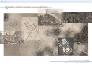
1A_2_Modelling the evolution of metropolitan London using historical GIS
- 1. Modeling the evolution of metropolitan London using historical GIS Kiril Stanilov, March 2010 CASA funded by EC’s FP7 Marie Curie Fellowship
- 2. study area Greater London Kiril Stanilov, March 2010 CASA
- 3. data Ordnance Survey County Series 1:2,500 1875 Kiril Stanilov, March 2010 CASA
- 4. data Ordnance Survey County Series 1:2,500 1 : 10,000 1875 Kiril Stanilov, March 2010 CASA
- 5. data Ordnance Survey County Series 1:2,500 1 : 2,500 1 : 10,000 1875 Kiril Stanilov, March 2010 CASA
- 6. data Ordnance Survey County Series 1:2,500 1 : 2,500 1 : 10,000 1875 Kiril Stanilov, March 2010 CASA
- 7. data Ordnance Survey County Series 1:2,500 1 : 2,500 1 : 10,000 1875 Kiril Stanilov, March 2010 CASA
- 8. data Ordnance Survey County Series 1:2,500 1 : 2,500 1 : 10,000 1875 Kiril Stanilov, March 2010 CASA
- 9. data Ordnance Survey County Series 1:2,500 1 : 2,500 1 : 10,000 1875 Kiril Stanilov, March 2010 CASA
- 10. data Ordnance Survey County Series 1:2,500 1 : 2,500 1 : 10,000 1875 Kiril Stanilov, March 2010 CASA
- 11. data Ordnance Survey County Series 1:2,500 1 : 2,500 1 : 10,000 1875 Kiril Stanilov, March 2010 CASA
- 12. data Ordnance Survey County Series 1:2500 2005 1985 1960 1935 1915 1895 1875 Kiril Stanilov, March 2010 CASA
- 13. Land use classification Kiril Stanilov, March 2010 CASA
- 14. 1875-2005 residential development terraced housing semi -detached housing detached housing multi-family housing Kiril Stanilov, March 2010 CASA
- 15. 1875 spatial structure 1875 development industrial uses Kiril Stanilov, March 2010 CASA
- 16. 1895 spatial structure 1875 development 1875-95 development industrial uses Kiril Stanilov, March 2010 CASA
- 17. 1915 spatial structure 1875 development 1875-95 development 1895-15 development industrial uses Kiril Stanilov, March 2010 CASA
- 18. 1935 spatial structure 1875 development 1875-95 development 1895-15 development 1915-35 development industrial uses Kiril Stanilov, March 2010 CASA
- 19. 1960 spatial structure 1875 development 1875-95 development 1895-15 development 1915-35 development 1935-60 development industrial uses Kiril Stanilov, March 2010 CASA
- 20. 1985 spatial structure 1960-85 development 1875 development industrial uses 1875-95 development 1895-15 development 1915-35 development 1935-60 development Kiril Stanilov, March 2010 CASA
- 21. 2005 spatial structure 1960-85 development 1875 development 1985-05 development 1875-95 development industrial uses 1895-15 development 1915-35 development 1935-60 development Kiril Stanilov, March 2010 CASA
- 22. 1875 - 2005 land development patterns nucleation 1875 - 95 1895 - 15 diffusion 1915 - 35 1935 - 60 infill 1985 - 05 1960 - 85 Kiril Stanilov, March 2010 CASA
- 24. distance to suburban centres
- 25. distance to main roads
- 26. distance to rail stations
- 27. neighborhood influence1985 - 05 1960 - 85 Kiril Stanilov, March 2010 CASA
- 28. 1875 Distance to roads - arterial developed land arterial roads Kiril Stanilov, March 2010 CASA
- 29. 1875 Distance to roads - connector developed land connector roads Kiril Stanilov, March 2010 CASA
- 30. distance to cbd residential 1915-35 Kiril Stanilov, March 2010 CASA
- 31. distance to cbd residential 1915-35 Kiril Stanilov, March 2010 CASA
- 32. distance to cbd residential 1915-35 Kiril Stanilov, March 2010 CASA
- 33. 1875 Distance to rail stations residential commercial rail station Kiril Stanilov, March 2010 CASA
- 34. 1895Distance to rail stations residential commercial rail station Kiril Stanilov, March 2010 CASA
- 35. 1915Distance to rail stations residential commercial rail station Kiril Stanilov, March 2010 CASA
- 36. 1935Distance to rail stations residential development 1915-35 rail station Kiril Stanilov, March 2010 CASA
- 37. 1935Distance to rail stations residential 1915-35 developed land 1915 rail station Kiril Stanilov, March 2010 CASA
- 38. 1915 accessibility distance to arterial roads distance to connector roads distance to rail stations distance to rail stations Kiril Stanilov, March 2010 CASA
- 39. Identification of suburban centres residential commercial Kiril Stanilov, March 2010 CASA
- 40. 1875 accessibility rail station tram line Kiril Stanilov, March 2010 CASA
- 41. 1875 accessibility rail station tram line Kiril Stanilov, March 2010 CASA
- 42. modeling urban land use 2005 1875 Kiril Stanilov, March 2010 CASA
- 43. Conclusions 1875 Kiril Stanilov, March 2010 CASA
- 44. Conclusions Kiril Stanilov, March 2010 CASA
- 45. Conclusions Kiril Stanilov, March 2010 CASA
- 46. Conclusions modeled actual 1895 Kiril Stanilov, March 2010 CASA
- 47. Conclusions modeled actual 1895 1915 Kiril Stanilov, March 2010 CASA
- 48. Conclusions modeled actual 1895 1915 1935 Kiril Stanilov, March 2010 CASA
- 49. Conclusions modeled actual 1895 1915 1935 1960 Kiril Stanilov, March 2010 CASA
- 50. Conclusions modeled actual 1895 1915 1935 1960 1985 Kiril Stanilov, March 2010 CASA
- 51. Conclusions modeled actual 1895 1915 1935 1960 1985 2005 Kiril Stanilov, March 2010 CASA
Editor's Notes
- Case study of metropolitan growthUsing hi-res historical parcel level data