Download to read offline
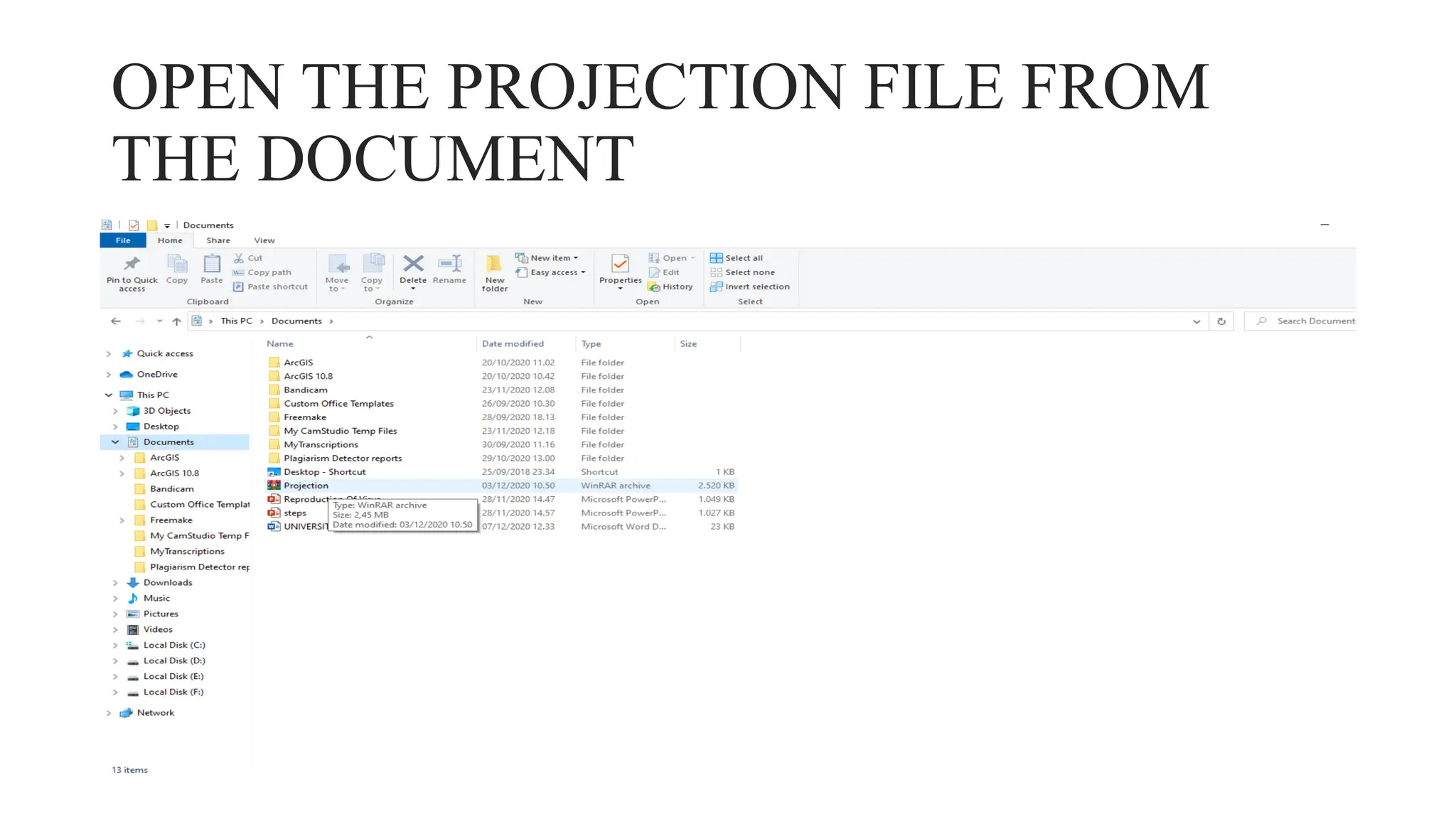
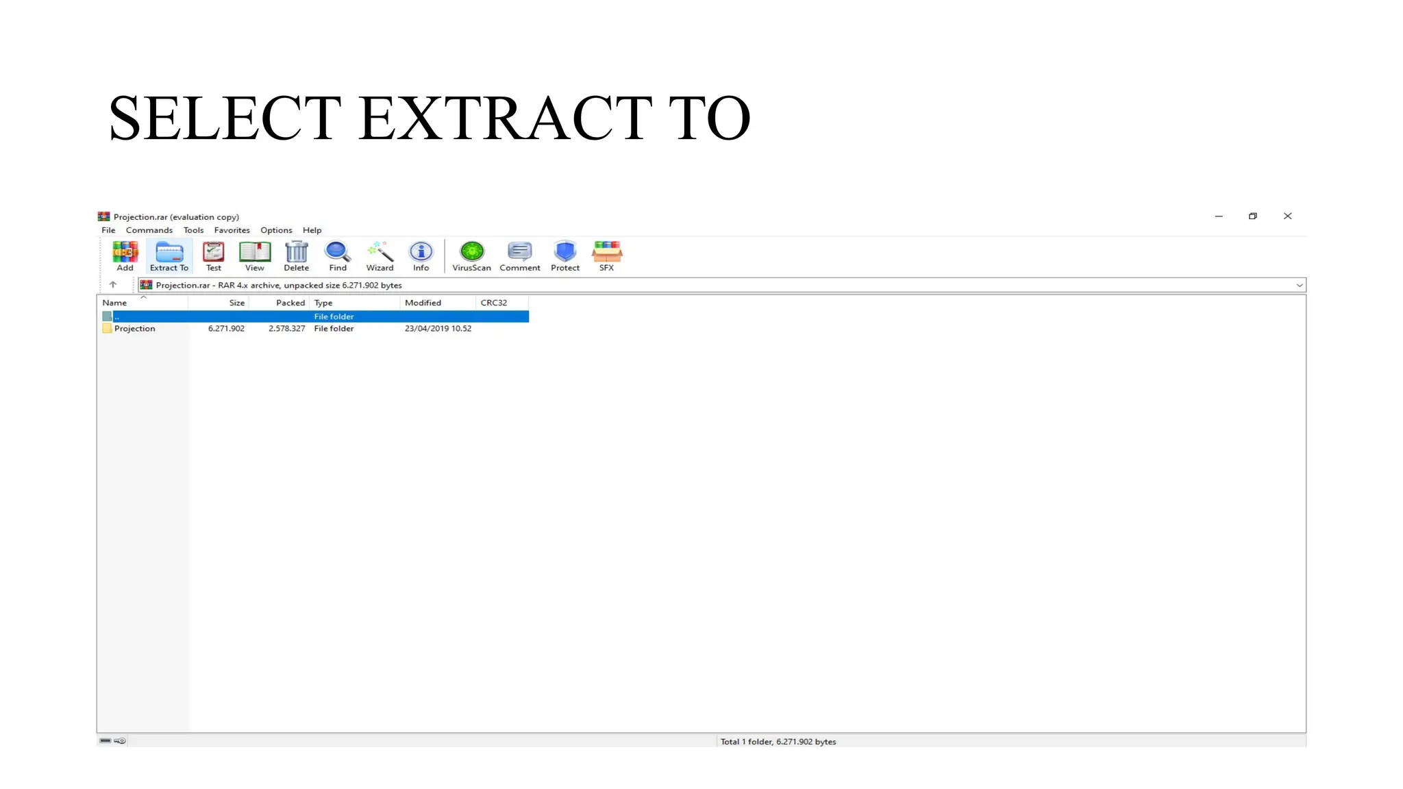
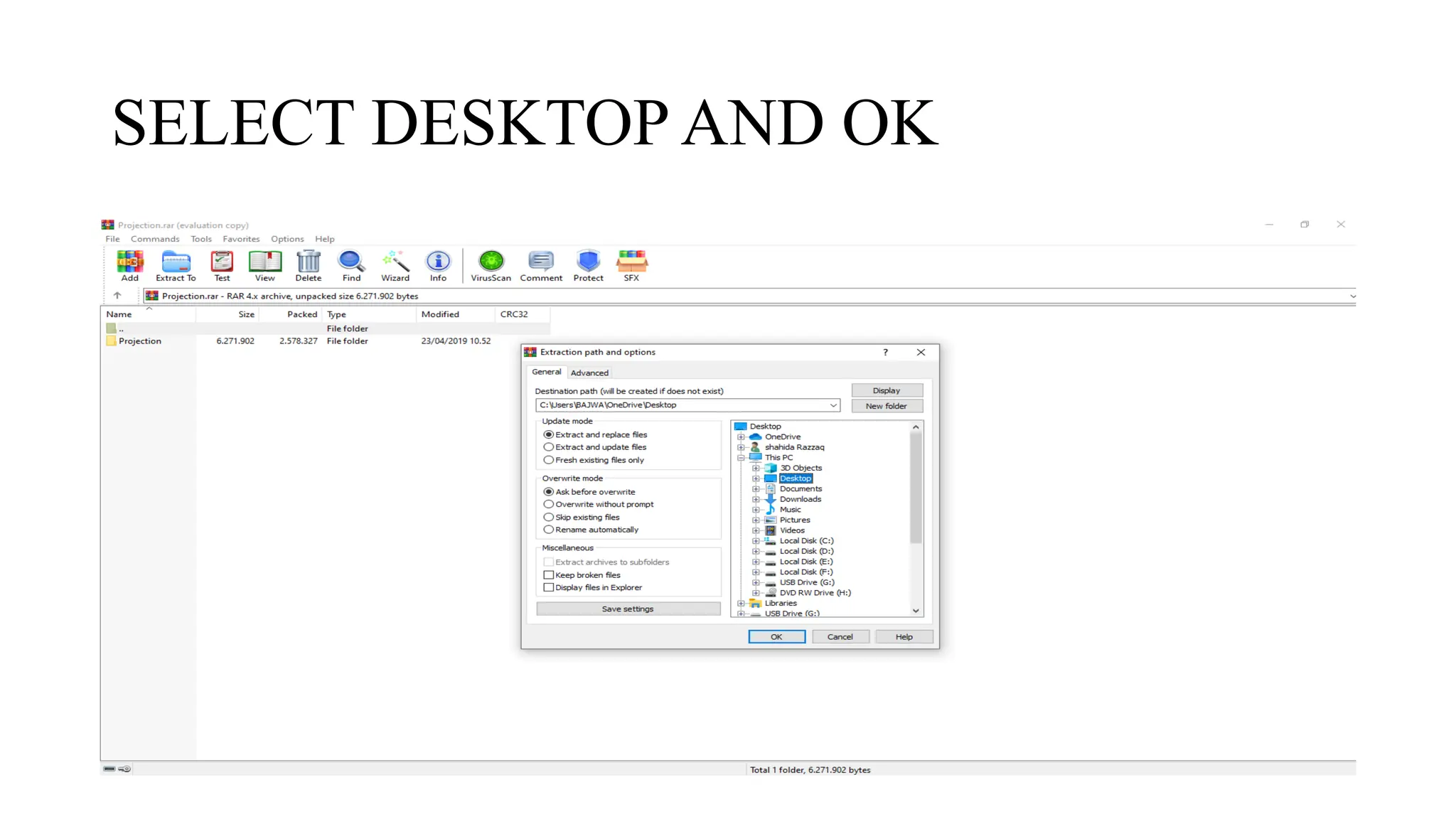
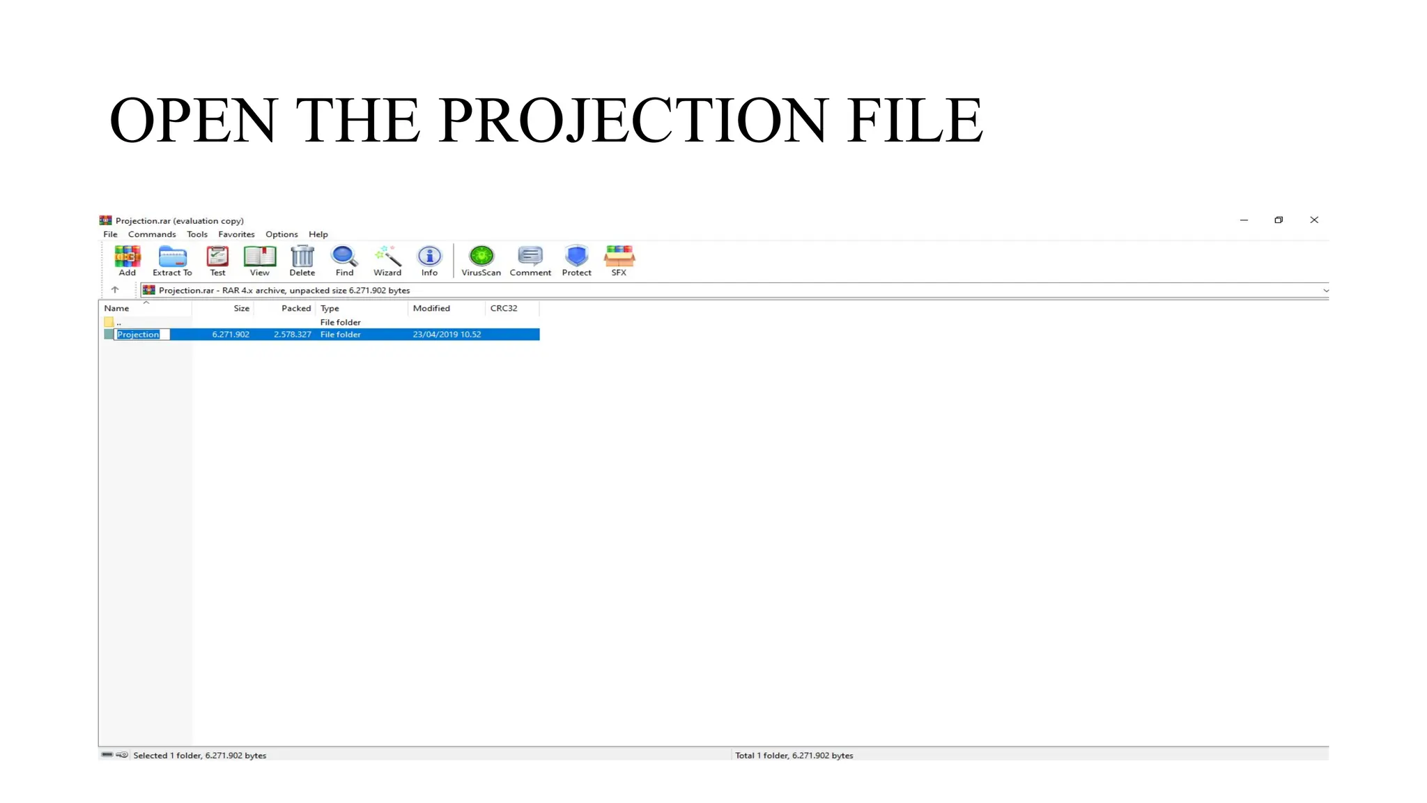
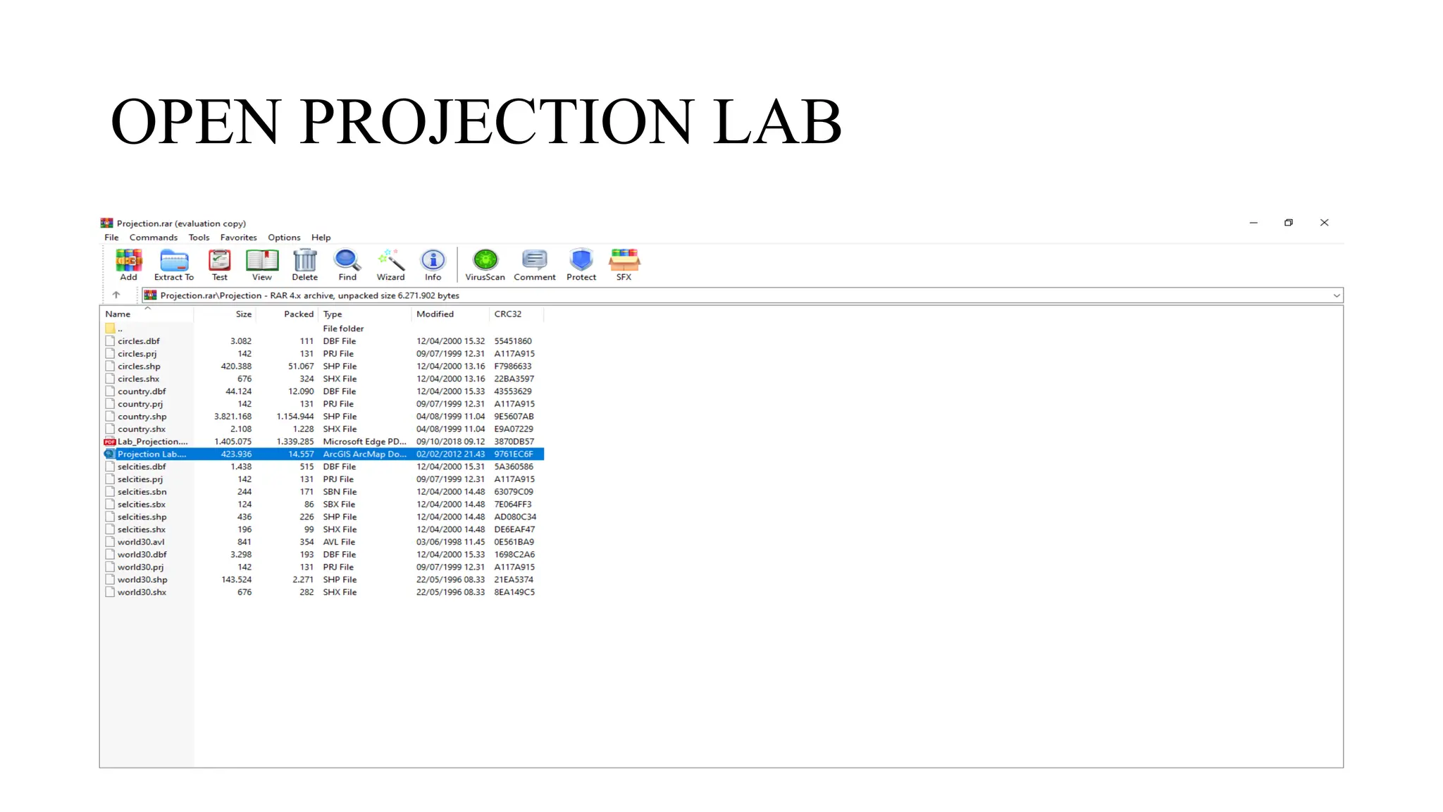
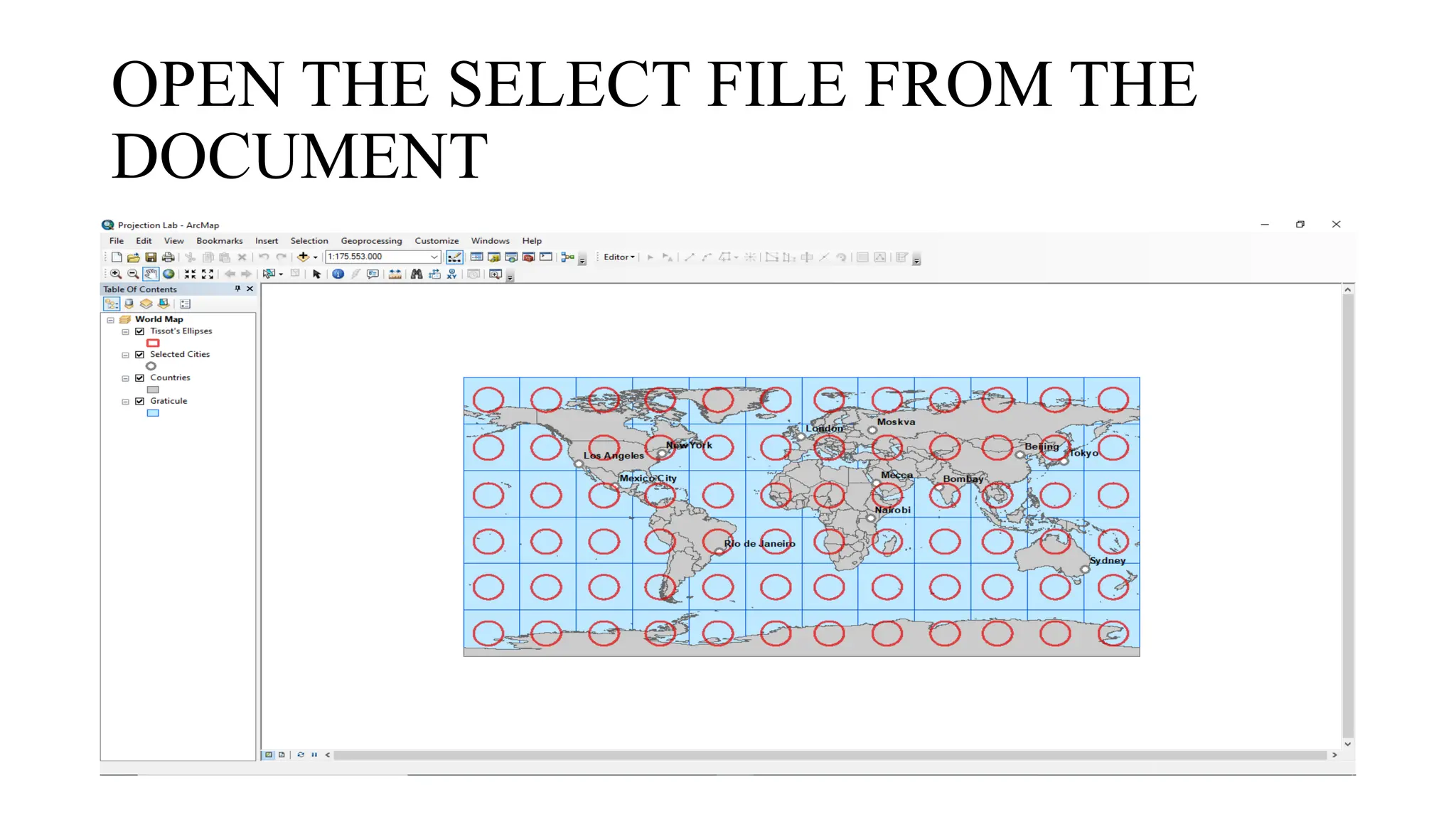
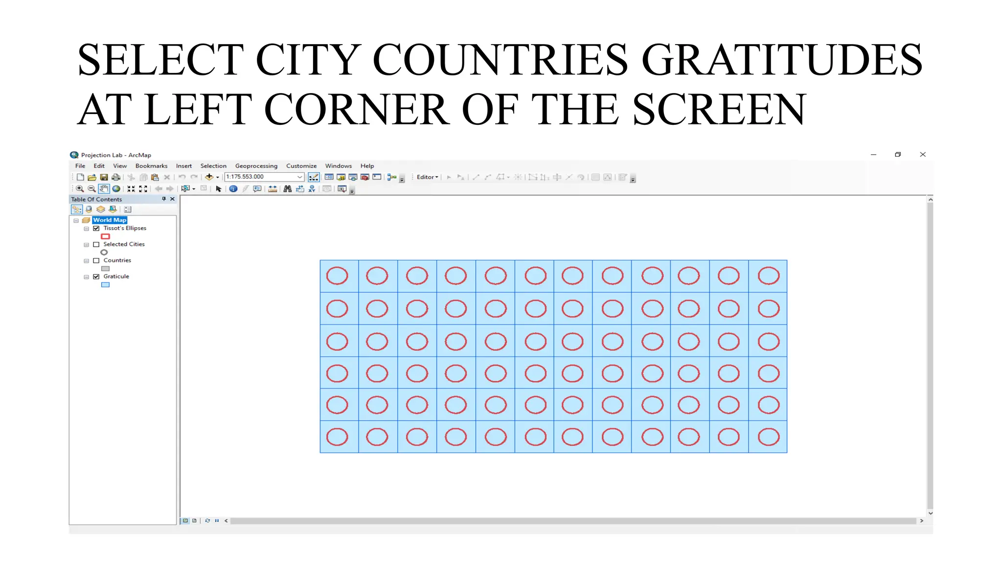
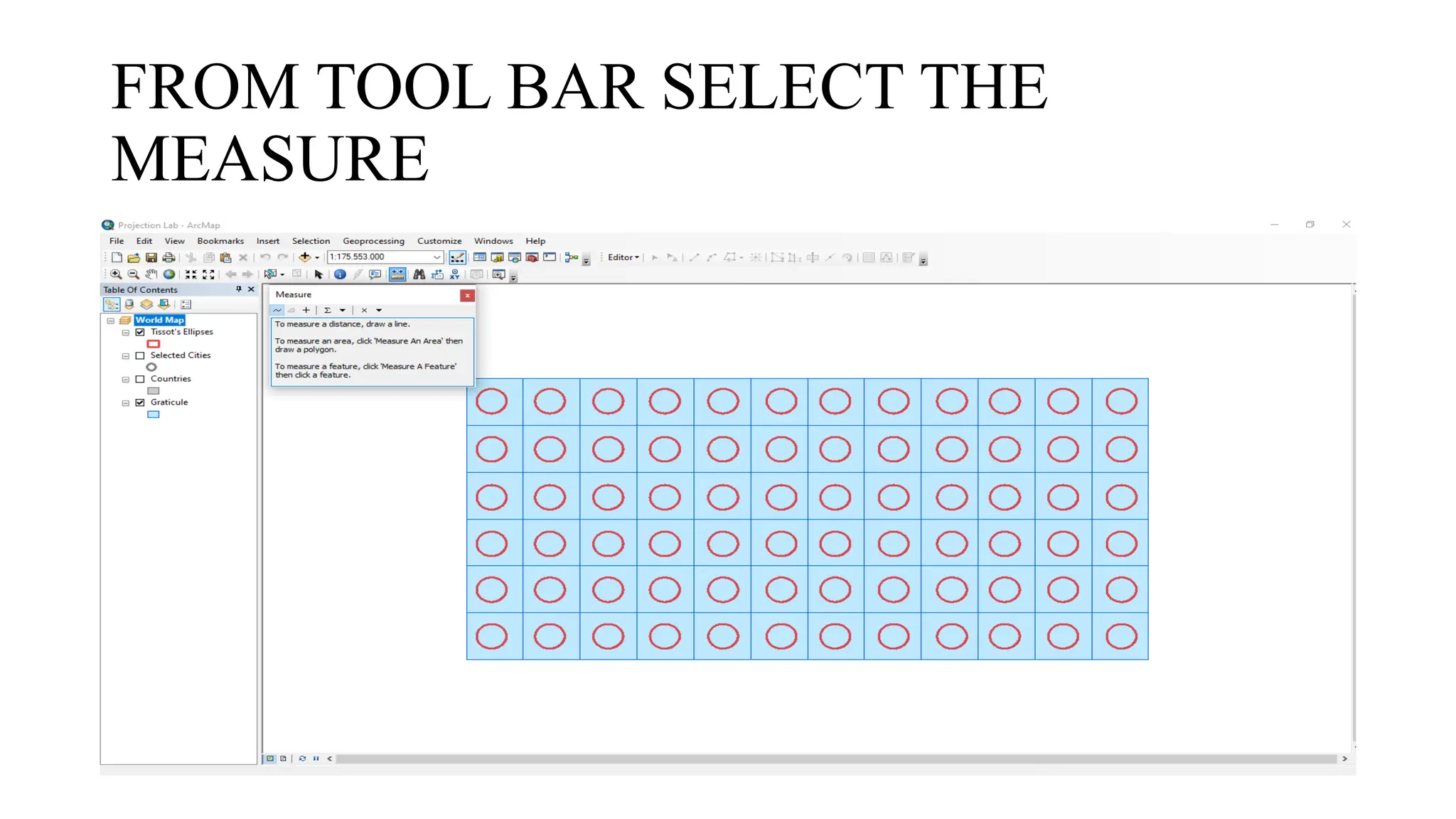
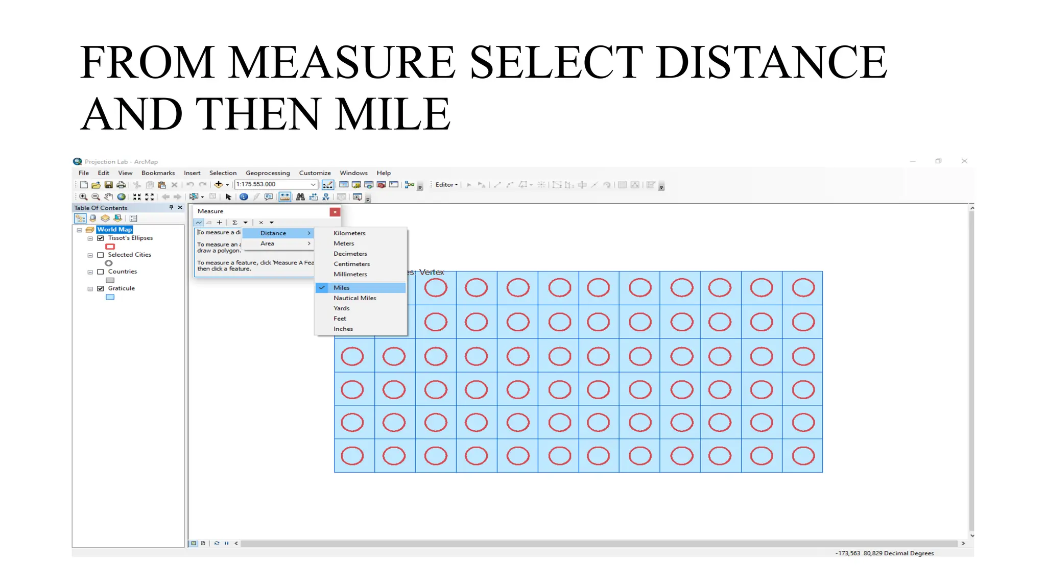
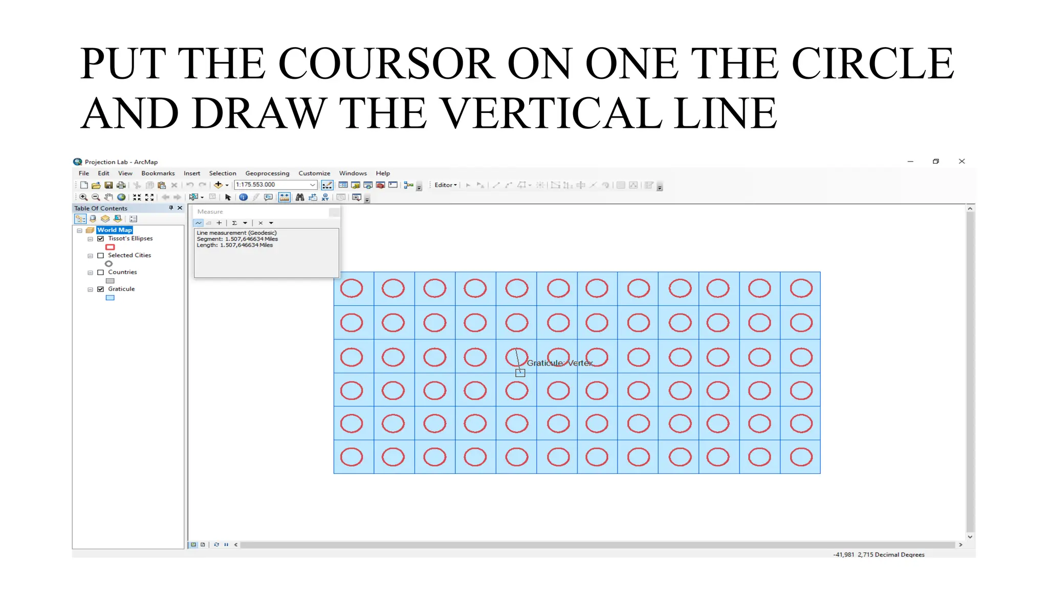
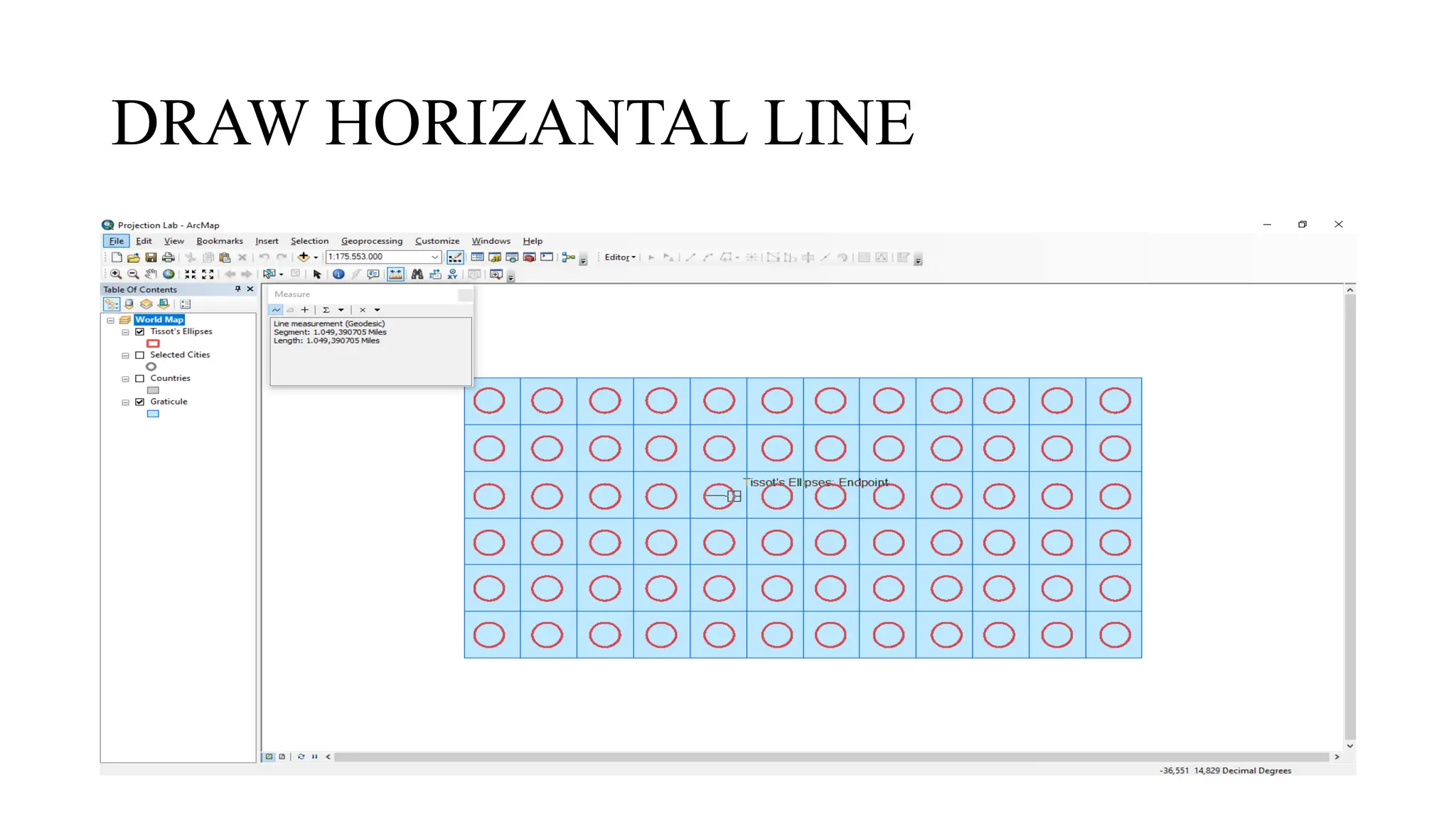
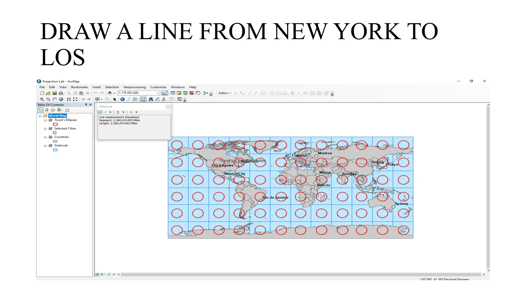
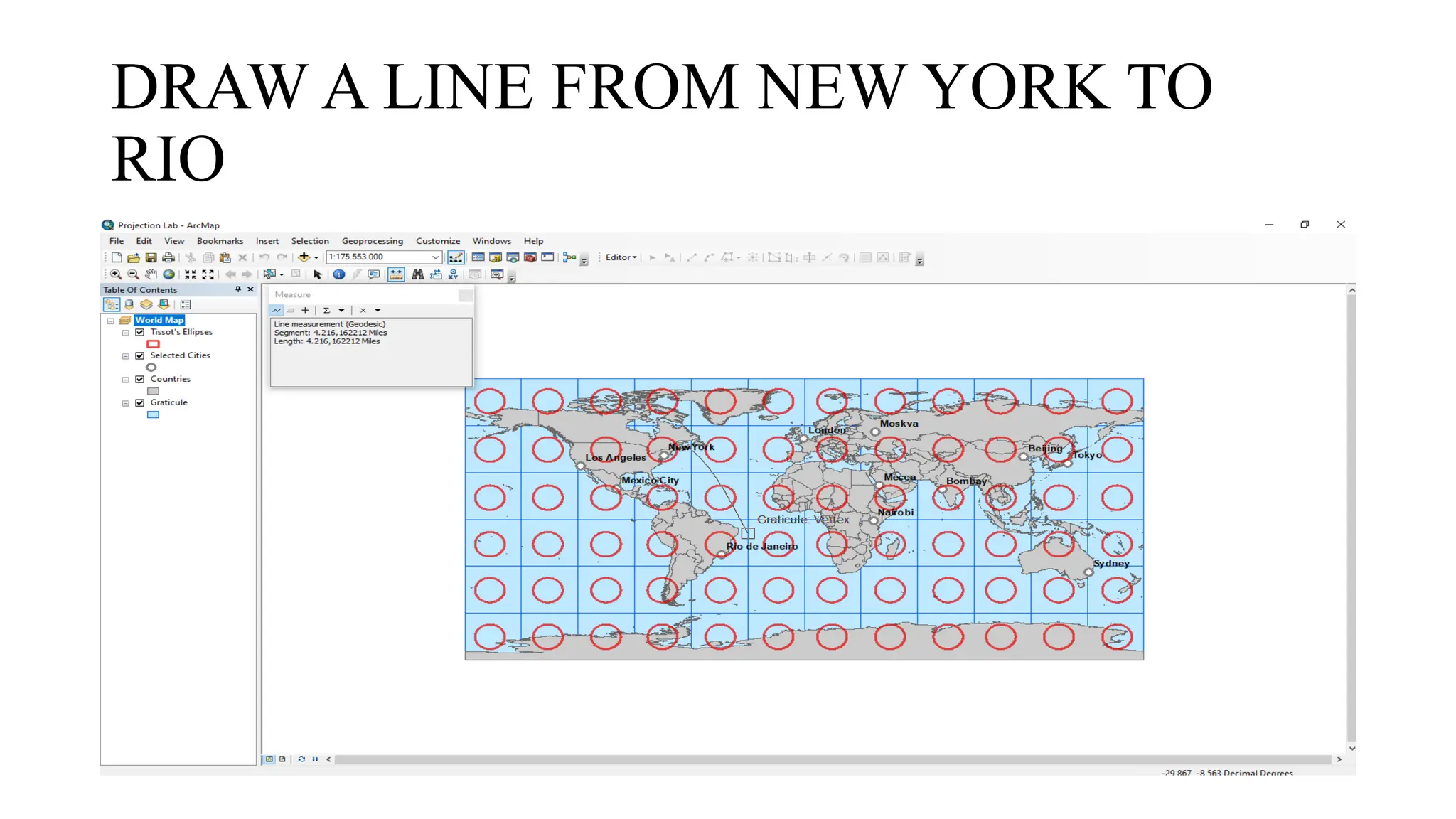
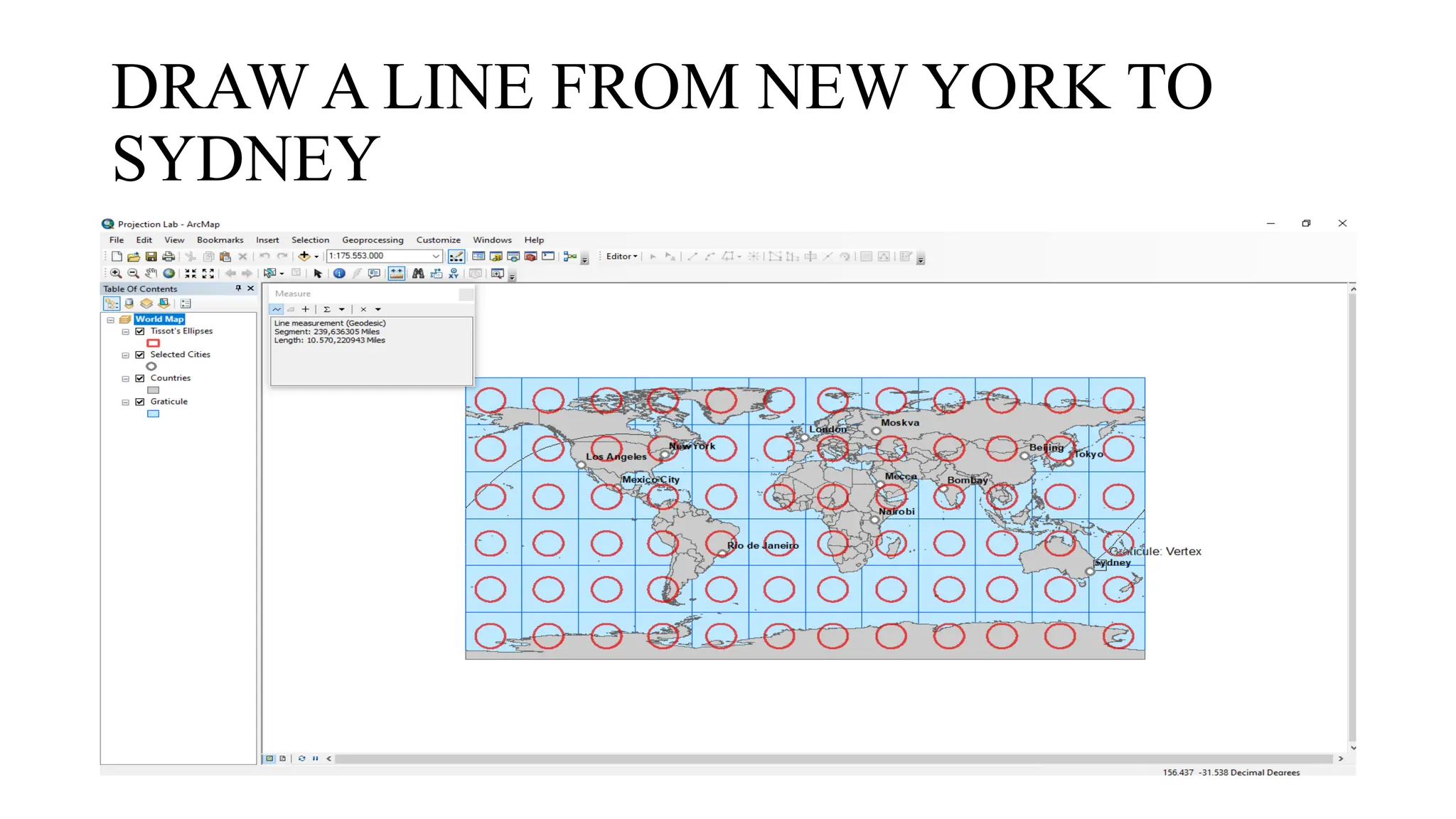
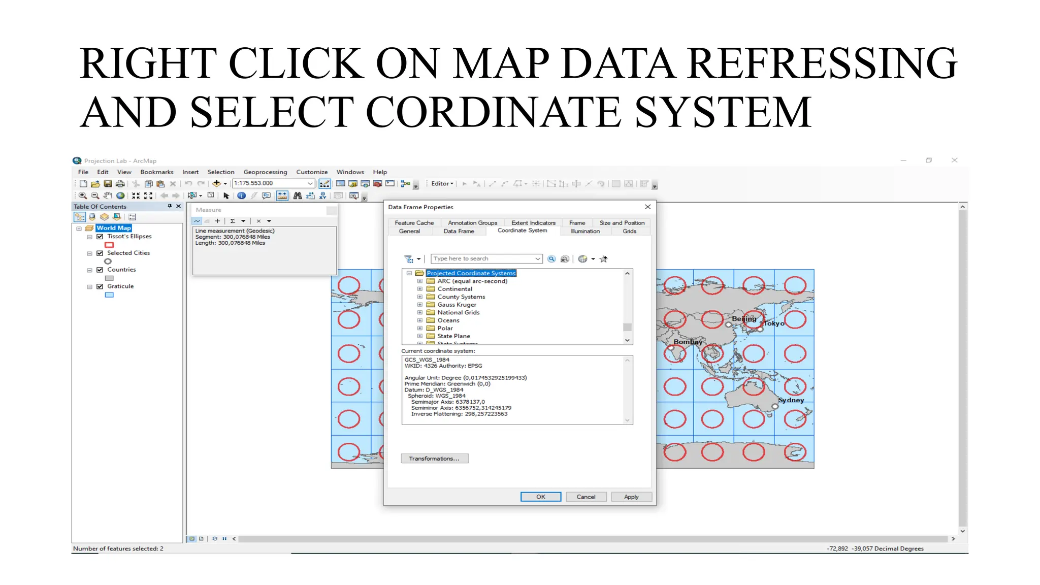
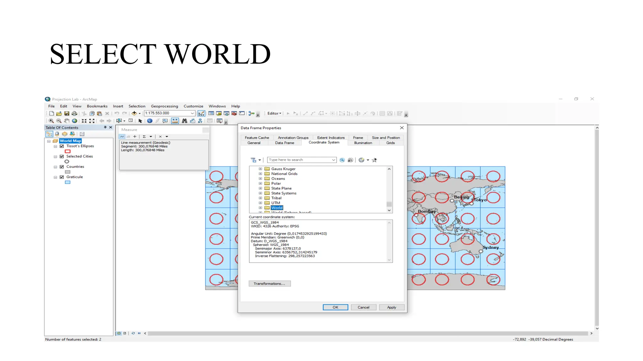
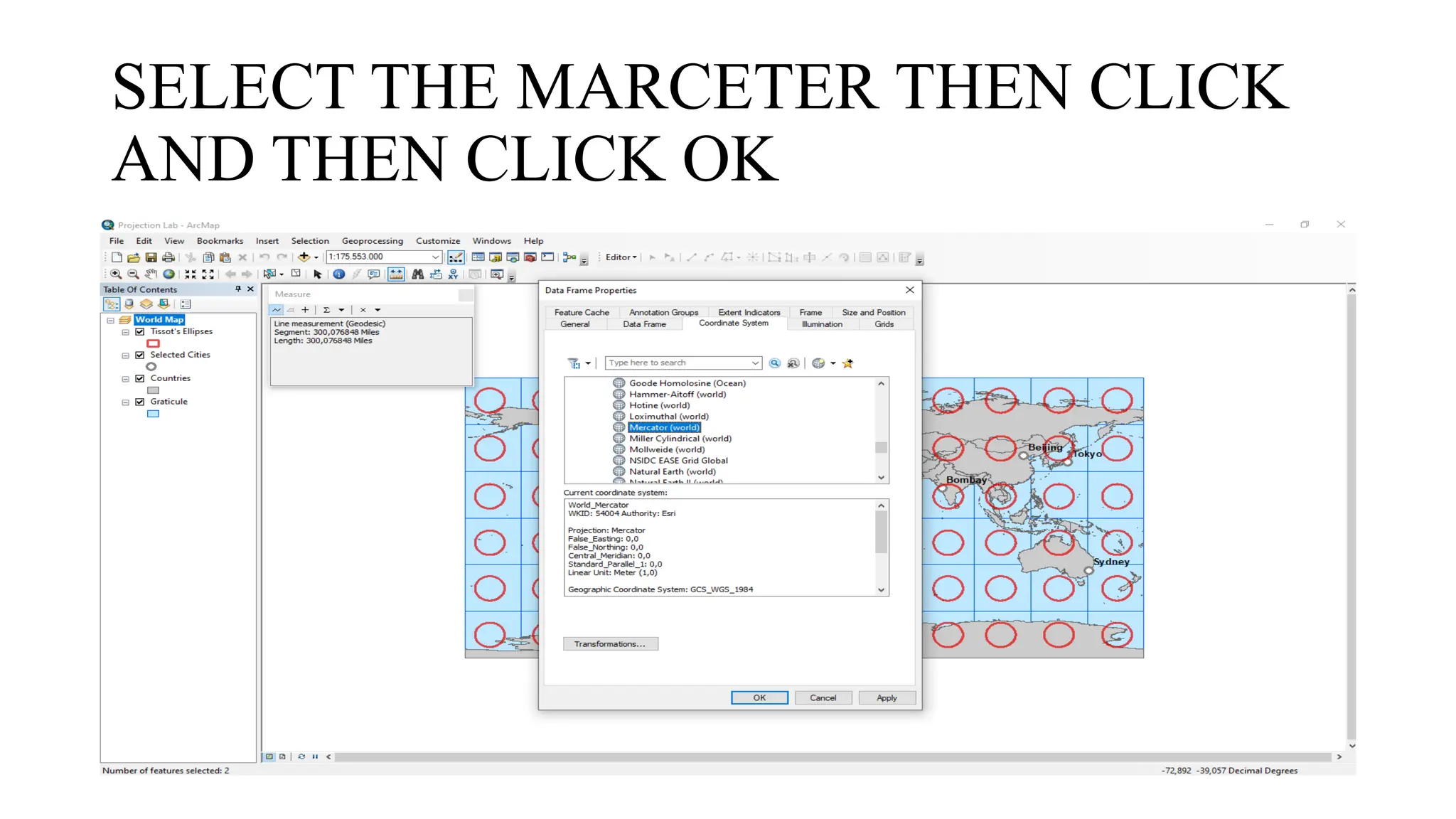
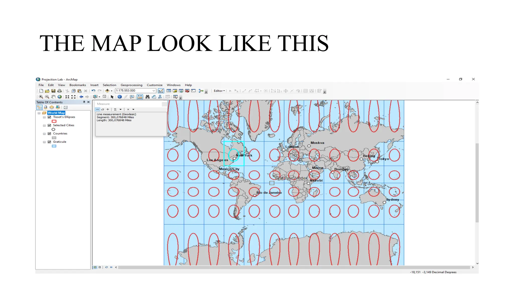
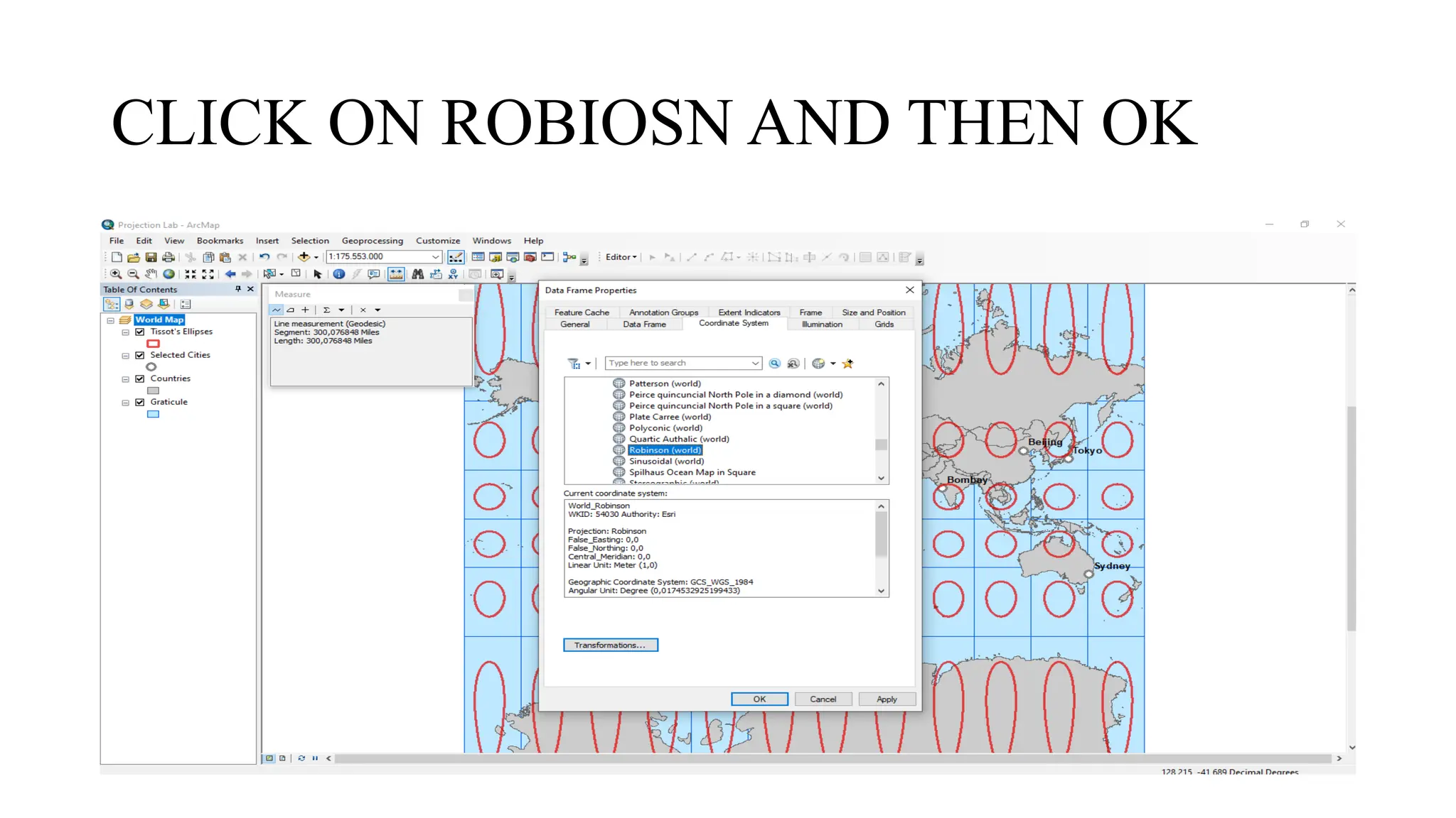
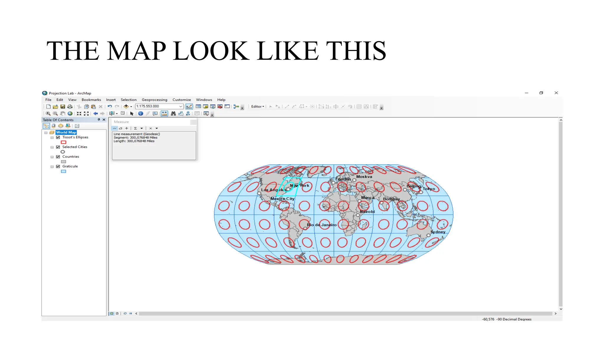
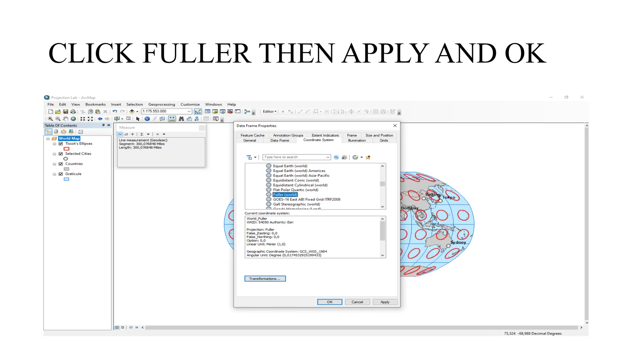
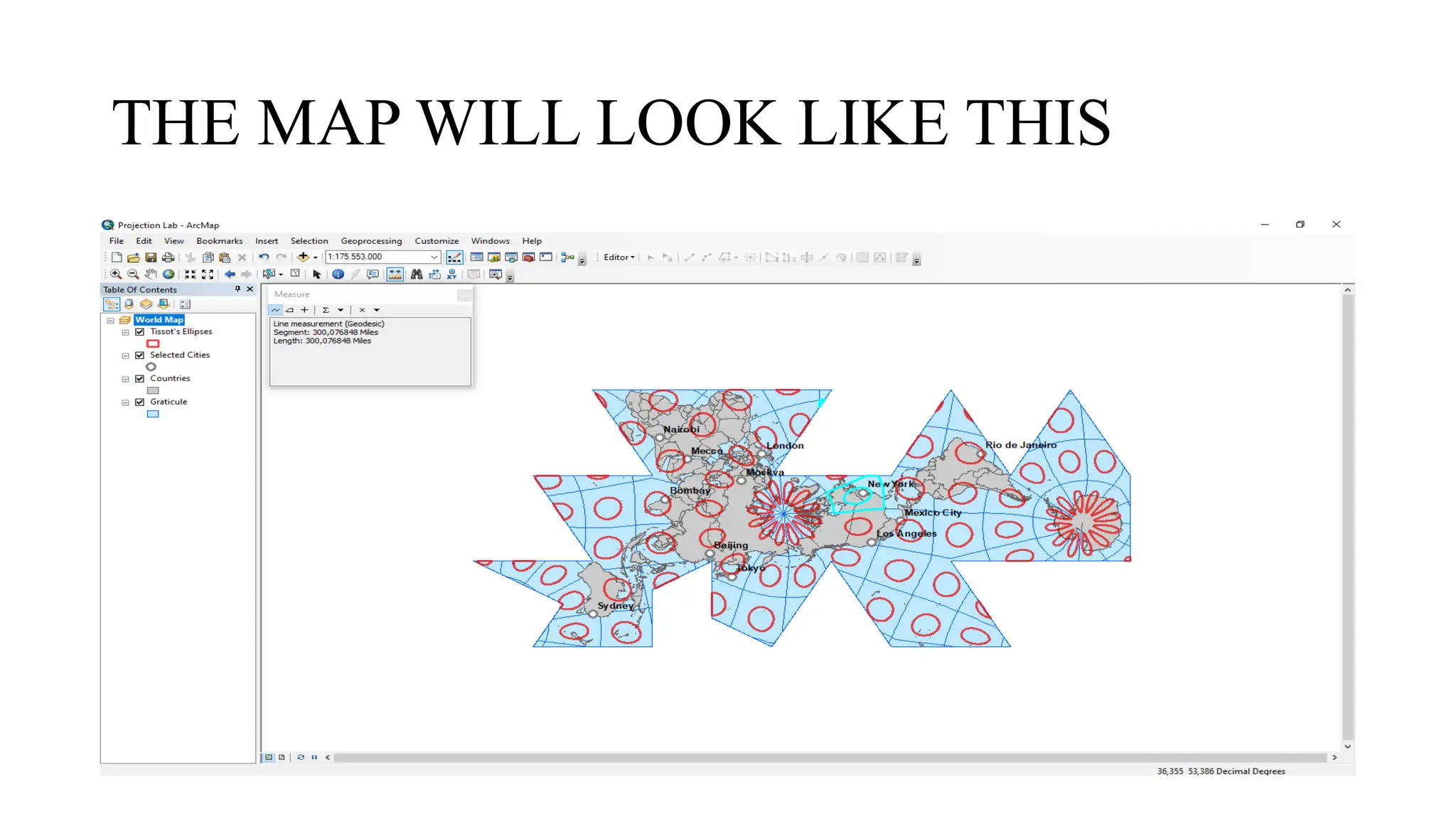
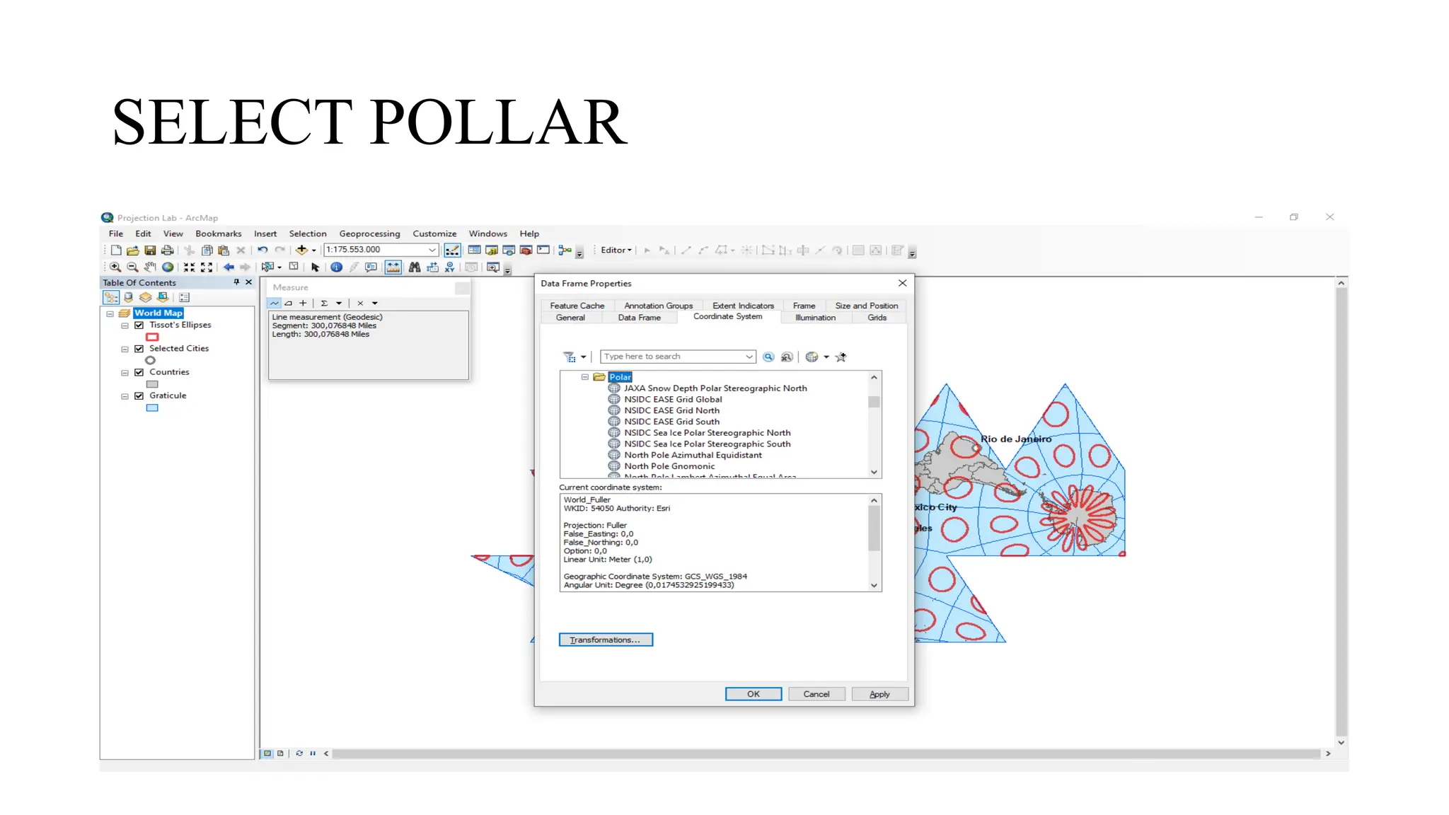
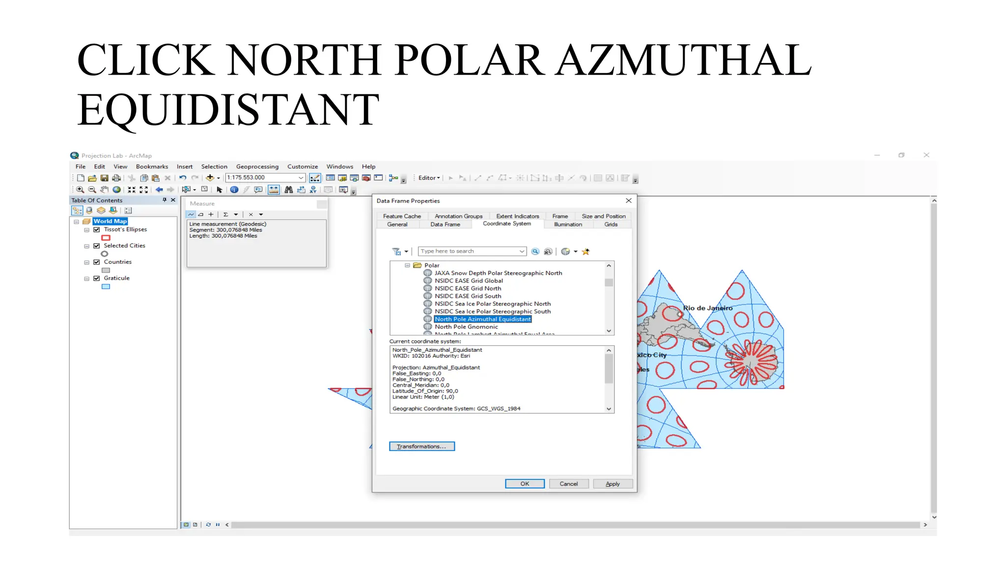
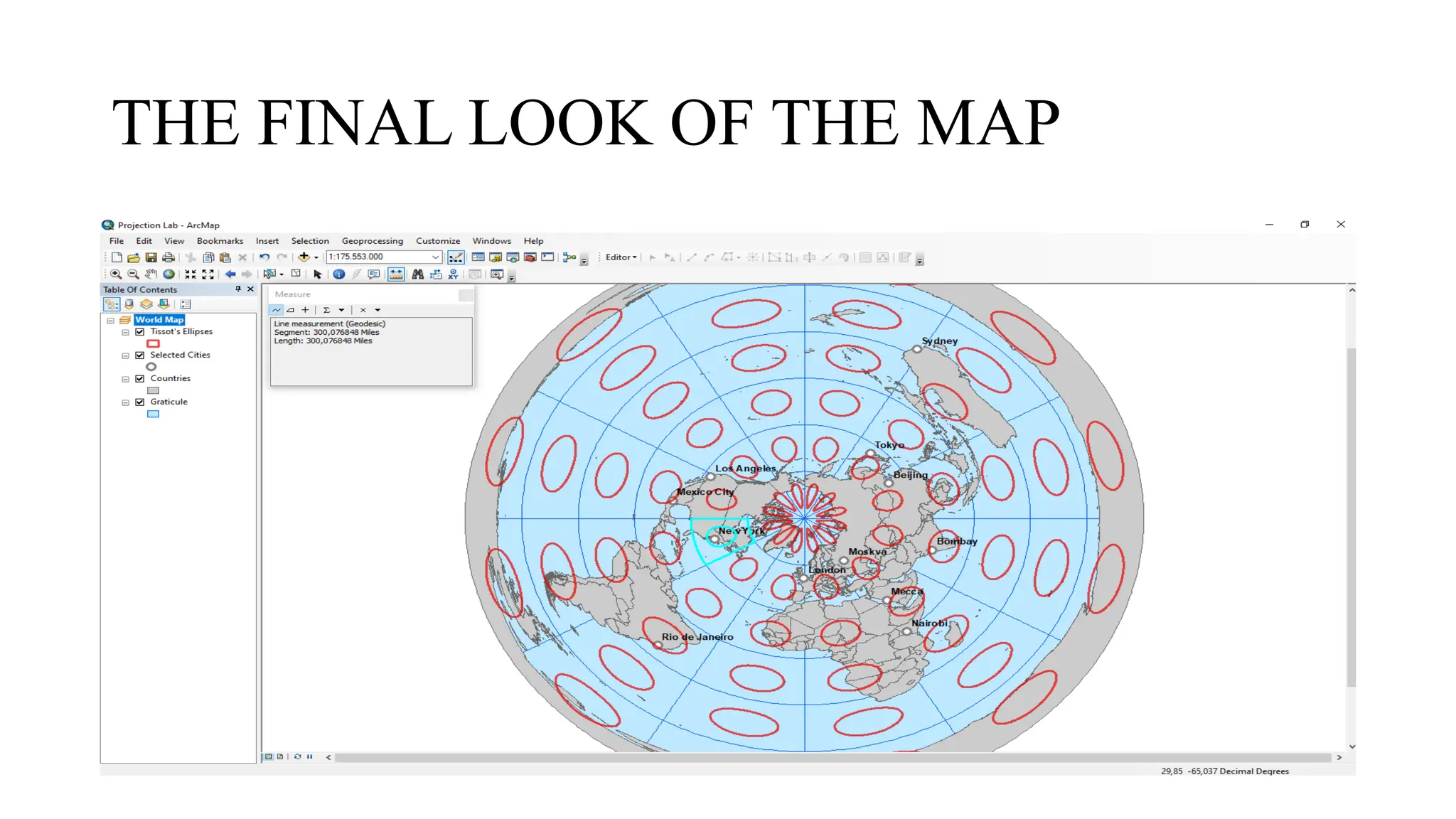


This presentation explains the concept of map projections and their importance in geography and cartography. It covers step-by-step instructions on using projection tools, measuring distances, and applying different projection techniques such as Mercator, Robinson, Fuller, and Polar Projections. Perfect for students, researchers, and geography enthusiasts who want to understand how the Earth’s 3D surface is represented on a 2D map. 👉 Learn how to: 1. Open and use projection files 2. Measure distances using map tools 3. Apply various world map projections 4. Compare the visual outcomes of different projection types.


