Download free for 30 days
Sign in
Upload
Language (EN)
Support
Business
Mobile
Social Media
Marketing
Technology
Art & Photos
Career
Design
Education
Presentations & Public Speaking
Government & Nonprofit
Healthcare
Internet
Law
Leadership & Management
Automotive
Engineering
Software
Recruiting & HR
Retail
Sales
Services
Science
Small Business & Entrepreneurship
Food
Environment
Economy & Finance
Data & Analytics
Investor Relations
Sports
Spiritual
News & Politics
Travel
Self Improvement
Real Estate
Entertainment & Humor
Health & Medicine
Devices & Hardware
Lifestyle
Change Language
Language
English
Español
Português
Français
Deutsche
Cancel
Save
EN
Uploaded by
Osamu Inoue
PPTX, PDF
758 views
大阪発Map guideを用いたスマホアプリ連携実装
大阪発MapGuideを用いたスマホアプリ連携実装 井上 修・林 博文
Technology
◦
Read more
0
Save
Share
Embed
Embed presentation
Download
Downloaded 10 times
1
/ 7
2
/ 7
3
/ 7
4
/ 7
5
/ 7
6
/ 7
7
/ 7
More Related Content
PPTX
3次元都市モデリングツールによる大槌町の復興計画イメージ作成
by
Osamu Inoue
PPTX
Autodesk Infraworksで地理院地図を実務で使い倒そう
by
Osamu Inoue
PPTX
InfraWorks超裏技public
by
Osamu Inoue
PDF
131114 g expo
by
Norio Kuroki
PDF
70万⼈のメンバーを駆使して開発を⾏う 〜 Topcoderが提案する新しい開発モデル ~
by
Salesforce Developers Japan
ODP
Infotalk#33 "みんなでつくる震災復興支援プラットホームSinsai.infoを実現する技術とチーム運営"
by
Hiroshi Miura
PPTX
Gis camp 2015 講義資料
by
Code for SAITAMA
PPTX
150220 自助・共助・公助×クラウド
by
Yuichiro USUDA
3次元都市モデリングツールによる大槌町の復興計画イメージ作成
by
Osamu Inoue
Autodesk Infraworksで地理院地図を実務で使い倒そう
by
Osamu Inoue
InfraWorks超裏技public
by
Osamu Inoue
131114 g expo
by
Norio Kuroki
70万⼈のメンバーを駆使して開発を⾏う 〜 Topcoderが提案する新しい開発モデル ~
by
Salesforce Developers Japan
Infotalk#33 "みんなでつくる震災復興支援プラットホームSinsai.infoを実現する技術とチーム運営"
by
Hiroshi Miura
Gis camp 2015 講義資料
by
Code for SAITAMA
150220 自助・共助・公助×クラウド
by
Yuichiro USUDA
Similar to 大阪発Map guideを用いたスマホアプリ連携実装
PDF
2012 05 12_osc2012_nagoya_osm
by
Tom Hayakawa
PDF
2012 04 14_foss4_g_nagoya_osm
by
Tom Hayakawa
PDF
自由な地図を作るオープンストリートマップの活動
by
Shu Higashi
PPT
MapGuide+Geopaparazziで作るスマートフォンソリューション
by
Hirofumi Hayashi
PDF
2012 06 30_osm-ws_1a
by
Tom Hayakawa
PDF
Open streetmap intro_20121019
by
Shu Higashi
PDF
2014 07 23 豊橋IT勉強会
by
Tom Hayakawa
PDF
OSMの概要
by
Shu Higashi
KEY
20120928 奈良大学
by
Taichi Furuhashi
PPTX
Osckyoto2012 osgeojp foss4g
by
Takashige Nakagawa
PPTX
Foss4g2012 MapGuide Hands-On
by
Osamu Inoue
PDF
20120320 hack foriwate
by
Taichi Furuhashi
PDF
世界をかえちゃったかもしれないFOSS4G
by
Yoichi Kayama
PDF
2012 07 14_osm-ws_2
by
Tom Hayakawa
PDF
Osm概要 20121104
by
Shu Higashi
PDF
2012 07 27_osm_project10
by
Tom Hayakawa
PDF
みんなで作る地図オープンストリートマップとオープンデータ
by
Shu Higashi
PDF
Foss4g2009tokyo Yachi Mapion
by
OSgeo Japan
PPT
FOSS4GとWebによる地図公開の共有
by
Hidenori Fujimura
PDF
120619 os mworkshop_presentation
by
Takayuki Nuimura
2012 05 12_osc2012_nagoya_osm
by
Tom Hayakawa
2012 04 14_foss4_g_nagoya_osm
by
Tom Hayakawa
自由な地図を作るオープンストリートマップの活動
by
Shu Higashi
MapGuide+Geopaparazziで作るスマートフォンソリューション
by
Hirofumi Hayashi
2012 06 30_osm-ws_1a
by
Tom Hayakawa
Open streetmap intro_20121019
by
Shu Higashi
2014 07 23 豊橋IT勉強会
by
Tom Hayakawa
OSMの概要
by
Shu Higashi
20120928 奈良大学
by
Taichi Furuhashi
Osckyoto2012 osgeojp foss4g
by
Takashige Nakagawa
Foss4g2012 MapGuide Hands-On
by
Osamu Inoue
20120320 hack foriwate
by
Taichi Furuhashi
世界をかえちゃったかもしれないFOSS4G
by
Yoichi Kayama
2012 07 14_osm-ws_2
by
Tom Hayakawa
Osm概要 20121104
by
Shu Higashi
2012 07 27_osm_project10
by
Tom Hayakawa
みんなで作る地図オープンストリートマップとオープンデータ
by
Shu Higashi
Foss4g2009tokyo Yachi Mapion
by
OSgeo Japan
FOSS4GとWebによる地図公開の共有
by
Hidenori Fujimura
120619 os mworkshop_presentation
by
Takayuki Nuimura
大阪発Map guideを用いたスマホアプリ連携実装
1.
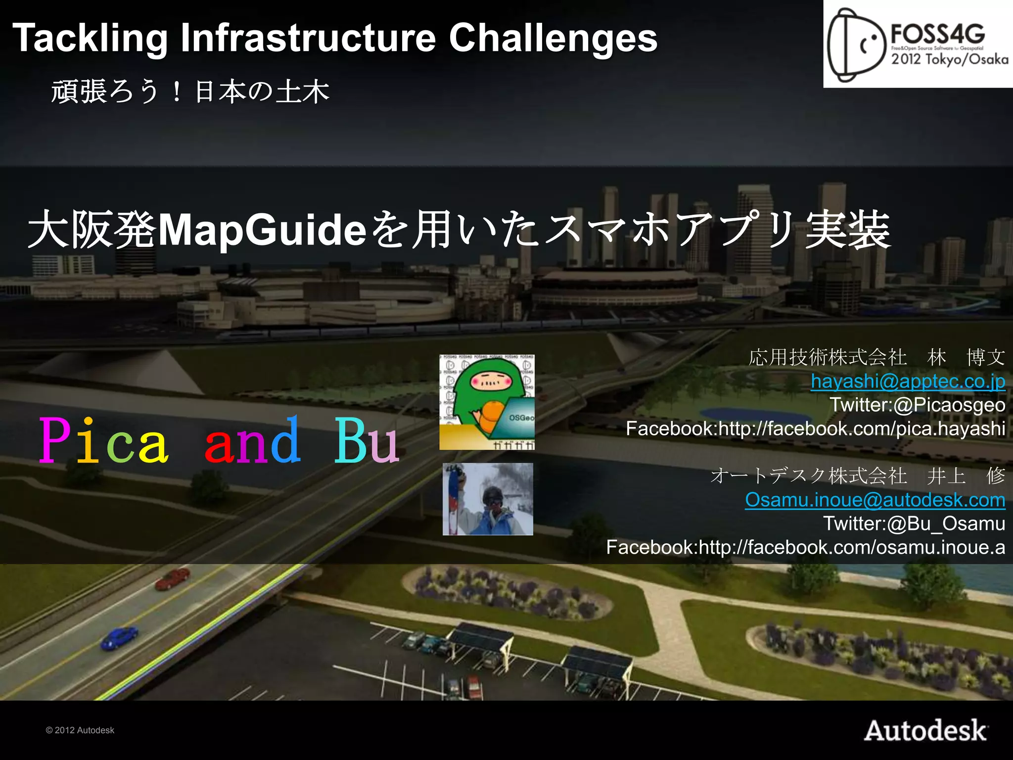
Tackling Infrastructure Challenges
頑張ろう!日本の土木 大阪発MapGuideを用いたスマホアプリ実装 応用技術株式会社 林 博文 hayashi@apptec.co.jp Twitter:@Picaosgeo Pica and Bu Facebook:http://facebook.com/pica.hayashi オートデスク株式会社 井上 修 Osamu.inoue@autodesk.com Twitter:@Bu_Osamu Facebook:http://facebook.com/osamu.inoue.a © 2012 Autodesk
2.
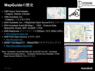
MapGuideの歴史
1995 Argus Technologies – Calgary, Alberta, Canada 1996 Autodesk, Inc. –Calgaryにて引き続き開発 2004 Autodesk, Inc. がMapGuide Open Source開発をスタート 2004 Autodesk AutoCAD Mapに、FDO (Feature Data Objects)for Oracle, SDF, ArcSDE を搭載 2006 MapGuide のソースコードをOSGeoに提供 (GNU LGPL) http://mapguide.osgeo.org/ 2006 FDO Open Source を同時に提供 http://fdo.osgeo.org/ 2008? CS-Map提供(MetaCRSのサブプロジェクト) http://trac.osgeo.org/csmap/ Note: AutodeskのAutoCAD Map 3D, AutoCAD Civil 3D、Autodesk Infrastructure Map Server 、Autodesk Infrastructure ModelerはFDO Open Source Platformを製品内で活用 © 2012 Autodesk
3.
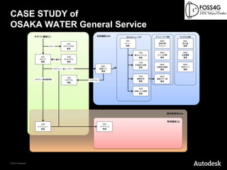
CASE STUDY of OSAKA
WATER General Service © 2012 Autodesk
4.
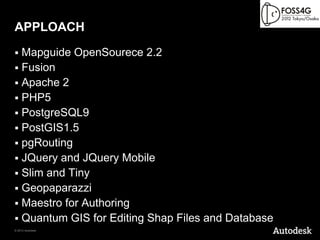
APPLOACH Mapguide OpenSourece
2.2 Fusion Apache 2 PHP5 PostgreSQL9 PostGIS1.5 pgRouting JQuery and JQuery Mobile Slim and Tiny Geopaparazzi Maestro for Authoring Quantum GIS for Editing Shap Files and Database © 2012 Autodesk
5.
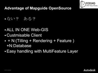
Advantage of Mapguide
OpenSource ない? ある? ALL IN ONE Web-GIS Custmisable Client + N:(Tilling + Rendering + Feature ) +N:Database Easy handling with MultiFeature Layer © 2012 Autodesk
6.
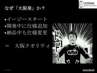
なぜ「大阪発」か? イージースタート 開発中に仕様追加
納品中も仕様変更 = 大阪クオリティ © 2012 Autodesk
7.
Demonstraton
ということで、デモです。 © 2012 Autodesk
Download