This document discusses the declining water levels of the Little Plover River in central Wisconsin. It provides background on the river, noting that 90% of its flow comes from groundwater and it dried up completely in 2005. This is attributed to overuse of high-capacity wells in the area, which now number over 3,000 and can pump over 300 million gallons per day. Community groups like the Friends of the Little Plover River have advocated for conservation and education around the issue. The document highlights their annual river appreciation day where local students learn about the river ecosystem and threats to the watershed.
This document summarizes research on juvenile Chinook salmon use of small streams in Whidbey Basin. Key findings include:
- Juvenile Chinook from multiple populations use small streams, sometimes residing for months.
- Restoration increased Chinook presence in one stream, suggesting preference for low salinity habitat early in year.
- Ongoing research is examining Chinook patterns, growth, and origins in more small streams to understand their importance.
- Proper protection of these small streams and watersheds as Chinook habitat is questioned given their vulnerability and importance.
Volunteer boaters will participate in removing derelict crab traps from six Tampa Bay locations on July 11 due to a regional closure of the blue crab fishery from July 10-19. The closure is mandated by the Florida Fish and Wildlife Conservation Commission to help remove abandoned traps that continue to catch crabs and other species, posing risks to wildlife and navigation. Tampa Bay Watch has removed over 1,400 traps through previous cleanup efforts and estimates thousands more remain, so the event aims to further preserve the bay by removing debris and protecting marine life.
The document discusses the possibility of restoring rapids to the Mississippi River Gorge by removing two dams. It notes that restoring the rapids could provide ecological and recreational benefits but would also involve challenges. Researching the feasibility and impacts would require funding current studies lack. Additionally, modifying the heavily engineered river could be difficult after two centuries of development. While restoring the river's natural state could benefit the region, the complex technical, economic and regulatory hurdles have prevented plans from moving forward.
The Yil-Me-Hu, the salmon recovery newsletter of the Nisqually Watershed, is produced annually by the Nisqually Indian Tribe and Nisqually River Council.
Casitas Municipal Water District is experiencing a drought, with water storage levels at Lake Casitas at their lowest point since 1967 and currently holding only 42.1% of total storage capacity. In response, the District has implemented a water allocation and conservation program that assigns individual water budgets, implements watering restrictions and prohibitions, offers rebates for water-efficient devices, and conducts outreach campaigns to encourage customers to reduce water use. Direct urban water use has been reduced by hundreds of acre-feet per month between 2013-2015 through these conservation efforts. The District is working with a consulting firm to complete its 2015 Urban Water Management Plan to address the ongoing drought conditions.
This document provides information on several reservoirs in Montana:
- East Fork of Rock Creek Dam and Painted Rocks Dam are currently at 71% and 100% capacity respectively, providing irrigation water to acres of land.
- Fred Burr Dam and Nevada Creek Dam are at lower storage levels, providing irrigation water to fewer acres than normal.
- The majority of state water project reservoirs started the water year with average or below average levels due to dry conditions the previous summer, though spring rains have increased the water supply outlook somewhat.
(See notes below) Four hundred years ago, the Chesapeake Bay that the English colonists found here was lined with huge oyster reefs that grew up from the bottom in waters both deep and shallow. Those reefs provided the base for much of the life in the Bay and its rivers, from worms and barnacles through mud crabs and tiny fish to big blue crabs and predators like sheepshead, drum, and rockfish (striped bass).
The oyster reefs weren’t as “pretty” (to us humans) as the coral reefs further south, but in terms of ecosystem richness, they were just as important. One key to their strength was their three-dimensional structure, which successive generations built gradually on the shells of their predecessors over several thousands of years. The structures placed the oysters up in the water column, away from gill-choking bottom sediments, where dissolved oxygen was plentiful and currents brought food in the form of algae cells seeking sunlight.
This PowerPoint presentation, developed by the Chesapeake Bay Foundation’s Fisheries Program Director Bill Goldsborough, tells the story of those reefs and what has happened to them over the past four hundred years. It is not a pretty story, but it offers a hopeful conclusion, as we learn more each year about how to restore these essential elements in the Chesapeake ecosystem.
Anglers have as much to gain as anyone in restoring the Chesapeake’s oysters. The presentation closes with suggestions for how to get involved in oyster restoration, and how to incorporate the restoration reefs into your 2015 angling season.
To participate in CBF’s oyster restoration programs in Virginia and Maryland, visit http://www.cbf.org/oysters.
This document discusses the threats posed by a proposed large factory farm, called Badgerwood LLC, to the health of Lake Superior and local communities. The farm would house over 26,000 pigs and produce 8.7 million gallons of liquid manure per year, far more than existing family farms in the region. Local activists are concerned this waste could contaminate the lake and surrounding areas through runoff, potentially closing beaches and harming fishing and tourism. The large scale of the operation and lack of oversight also raise worries about antibiotic resistance and impacts to local roads, property values, and public health. Opponents argue the farm prioritizes corporate profits over environmental stewardship and the existing agricultural system.
The document summarizes ecological changes over time at three lakes in Watsonville, California - College Lake, Kelley Lake, and Pinto Lake. It discusses how human activities like farming, transportation, and development have disrupted natural processes at the lakes. It provides details on the lakes' histories and current statuses, including drainage of College and Pinto Lakes into the ocean each year. The document also examines the native and invasive fish species found at College and Pinto Lakes, such as steelhead trout, brown bullhead catfish, and carp. Maps with directions to each lake are included.
Shirley Chisholm State Park-Brooklyn Update on phase two workecowatchers
An update by Leslie Wright director of NY state Parks on the planned future work for phase two in the newly created Shirley Chisholm State Park in Brooklyn NY
The document discusses the history of pollution and restoration efforts in the Willamette River in Oregon. It describes how the river was once declared an "open sewer" but water quality has improved due to various regulatory actions from the 1930s onward. However, the river and its fish populations still face threats including invasive species, pollution, and lack of access to cold water refuges during heat waves. Overall restoration progress depends on coordinated long-term efforts to improve habitat complexity and allow natural floodplain dynamics.
This document summarizes water usage statistics for Louisiana and other states. It reports that the average per capita domestic water use in Louisiana is 104 gallons per day, lower than Idaho, Utah, Arizona, and Hawaii. The total water use in Louisiana is 6,900 million gallons per day, with 63% used for power generation, agriculture, industry, and sewage. Major threats to Louisiana's water resources include industrial and agricultural impairment, subsidence, and saltwater intrusion into aquifers.
OLA 2009 -- 25 years-- a silver lined anniversaryPaul Robertson
Twenty-five years of lake management on Devils Lake in Oregon was celebrated as a silver anniversary. The lake has faced many challenges over the decades from excessive algae and weed growth due to sewage and agricultural runoff. In the 1980s, grass carp were introduced to control the weeds, which led to the total eradication of submerged plants but also harmful algae blooms. Today, the Devils Lake Water Improvement District continues efforts like water quality monitoring, septic system improvements, and native plant revegetation to improve the lake's health.
The opening of the St. Lawrence Seaway in 1959 unintentionally unleashed a biological plague on the Great Lakes. The Seaway allowed ocean freighters access to the lakes for the first time, and these ships dumped billions of gallons of untreated ballast water containing foreign species. Many of these invasive species caused profound ecological changes, including the proliferation of quagga and zebra mussels that depleted food sources for fish. While the Seaway provided some economic benefits, it has had major environmental costs including the introduction of over 50 invasive species that have disrupted fisheries and ecosystems. The lakes remain under threat from additional invaders like Asian carp spreading from other waterways.
The document summarizes issues surrounding a proposed water extraction project on the Gorman Hills in Los Angeles County. The Sierra Club has filed a lawsuit against the project due to concerns about impacts to local water supply and wildlife. Questions have been raised about the hydrological assessment and potential effects on wetland areas and local housing development. The Sierra Club believes the project requires further legal review given air quality, traffic, and biological survey issues. The document also provides updates on other environmental news including Senate approval of North Coast wilderness legislation and pro-environment leadership appointments in the California state legislature.
First Nations have a strong spiritual and cultural connection to water. Elders teach that water is sacred and must be respected. Traditional practices such as fishing, transportation, and ceremonies involve water. While some traditional practices continue, many communities face water quality issues. The Yellow Quill First Nation installed a new treatment plant using natural processes to address past boil water advisories. Northern communities are concerned about impacts of uranium mining on surrounding waters.
The document provides an overview of restoration efforts at the Willoughby Preserve that have benefited both the local community and wildlife. It describes how volunteers have removed over 10 acres of invasive vegetation and 900 tons of trash left by illicit campers over the past few years. As a result, native plant life is rebounding and more wildlife, including deer, bobcats, and various birds, are being seen on the preserve. The restoration is making the area safer for public use and recreation, while also improving water quality in the Ventura River watershed by reducing trash. The conservancy plans to add trail and interpretive improvements to further enhance public access and appreciation of the natural habitat.
The document summarizes a research project on developing the Vermillion River in Minnesota into a water trail for recreational activities like canoeing and kayaking. The river flows 38 miles through open fields and forests before reaching Vermillion Falls. The project identified potential access points along the river for canoes and in the gorge area for kayaking. It also explored the process needed to designate the river as an official recreation river. The research was presented to local governments and involved analyzing sites, stakeholder input, best practices, and political considerations to understand the feasibility of a water trail.
Salmon in the Deschutes by Don RatliffDesLandTrust
Large, ocean-going salmon historically returned annually to the Deschutes River and many of its tributaries. Today salmon and steelhead are coming back to their home waters after an absence of nearly 50 years. Join retired fisheries biologist Don Ratliff for an illustrated overview of salmon and steelhead in the Deschutes River basin. Learn about their historic and present distributions, their life histories, and how they fit into the extremely diverse river system that is the Deschutes River.
2011 annual mtg ais presentation website versionCarolynne White
The document discusses efforts to prevent the spread of aquatic invasive species (AIS), particularly zebra mussels, into Hubbard County lakes. It summarizes:
1) Funding for AIS inspection hours was obtained from various township and county sources but funding is in jeopardy for 2012 due to reductions.
2) Zebra mussels pose serious threats to native species and lake ecosystems by attaching to surfaces and filtering plankton. They have spread rapidly across many lakes in Minnesota.
3) Preventing the spread of zebra mussels to Hubbard County lakes is a priority, and volunteer monitoring and watercraft inspection programs need more support to protect lakes like Long Lake.
The document summarizes conditions in Puget Sound related to warm water anomalies, drought, and impacts on marine ecosystems. It notes that 2014 and early 2015 saw the warmest temperatures since 1981 due to a warm water blob in the Pacific. This, combined with low snowpack due to drought, led to record low river flows into Puget Sound. The warm water entered Puget Sound in late 2014 and 2015, bringing higher temperatures and lower oxygen levels. Observations from aerial photos and ferries detected large jellyfish blooms and algal blooms, indicating the marine food web may be changing.
A Superb, Historical Sunset Cruise of Discovery in the 1,000 IslandsFergus Ducharme
A sunset cruise into the old historic, fascinating and fabulously beautiful 1,000 Islands bordering New York State and Ontario. What better way to spend a relaxing summer evening?
This slide is special for master students (MIBS & MIFB) in UUM. Also useful for readers who are interested in the topic of contemporary Islamic banking.
How to Setup Warehouse & Location in Odoo 17 InventoryCeline George
In this slide, we'll explore how to set up warehouses and locations in Odoo 17 Inventory. This will help us manage our stock effectively, track inventory levels, and streamline warehouse operations.
Exploiting Artificial Intelligence for Empowering Researchers and Faculty, In...Dr. Vinod Kumar Kanvaria
Exploiting Artificial Intelligence for Empowering Researchers and Faculty,
International FDP on Fundamentals of Research in Social Sciences
at Integral University, Lucknow, 06.06.2024
By Dr. Vinod Kumar Kanvaria
(See notes below) Four hundred years ago, the Chesapeake Bay that the English colonists found here was lined with huge oyster reefs that grew up from the bottom in waters both deep and shallow. Those reefs provided the base for much of the life in the Bay and its rivers, from worms and barnacles through mud crabs and tiny fish to big blue crabs and predators like sheepshead, drum, and rockfish (striped bass).
The oyster reefs weren’t as “pretty” (to us humans) as the coral reefs further south, but in terms of ecosystem richness, they were just as important. One key to their strength was their three-dimensional structure, which successive generations built gradually on the shells of their predecessors over several thousands of years. The structures placed the oysters up in the water column, away from gill-choking bottom sediments, where dissolved oxygen was plentiful and currents brought food in the form of algae cells seeking sunlight.
This PowerPoint presentation, developed by the Chesapeake Bay Foundation’s Fisheries Program Director Bill Goldsborough, tells the story of those reefs and what has happened to them over the past four hundred years. It is not a pretty story, but it offers a hopeful conclusion, as we learn more each year about how to restore these essential elements in the Chesapeake ecosystem.
Anglers have as much to gain as anyone in restoring the Chesapeake’s oysters. The presentation closes with suggestions for how to get involved in oyster restoration, and how to incorporate the restoration reefs into your 2015 angling season.
To participate in CBF’s oyster restoration programs in Virginia and Maryland, visit http://www.cbf.org/oysters.
This document discusses the threats posed by a proposed large factory farm, called Badgerwood LLC, to the health of Lake Superior and local communities. The farm would house over 26,000 pigs and produce 8.7 million gallons of liquid manure per year, far more than existing family farms in the region. Local activists are concerned this waste could contaminate the lake and surrounding areas through runoff, potentially closing beaches and harming fishing and tourism. The large scale of the operation and lack of oversight also raise worries about antibiotic resistance and impacts to local roads, property values, and public health. Opponents argue the farm prioritizes corporate profits over environmental stewardship and the existing agricultural system.
The document summarizes ecological changes over time at three lakes in Watsonville, California - College Lake, Kelley Lake, and Pinto Lake. It discusses how human activities like farming, transportation, and development have disrupted natural processes at the lakes. It provides details on the lakes' histories and current statuses, including drainage of College and Pinto Lakes into the ocean each year. The document also examines the native and invasive fish species found at College and Pinto Lakes, such as steelhead trout, brown bullhead catfish, and carp. Maps with directions to each lake are included.
Shirley Chisholm State Park-Brooklyn Update on phase two workecowatchers
An update by Leslie Wright director of NY state Parks on the planned future work for phase two in the newly created Shirley Chisholm State Park in Brooklyn NY
The document discusses the history of pollution and restoration efforts in the Willamette River in Oregon. It describes how the river was once declared an "open sewer" but water quality has improved due to various regulatory actions from the 1930s onward. However, the river and its fish populations still face threats including invasive species, pollution, and lack of access to cold water refuges during heat waves. Overall restoration progress depends on coordinated long-term efforts to improve habitat complexity and allow natural floodplain dynamics.
This document summarizes water usage statistics for Louisiana and other states. It reports that the average per capita domestic water use in Louisiana is 104 gallons per day, lower than Idaho, Utah, Arizona, and Hawaii. The total water use in Louisiana is 6,900 million gallons per day, with 63% used for power generation, agriculture, industry, and sewage. Major threats to Louisiana's water resources include industrial and agricultural impairment, subsidence, and saltwater intrusion into aquifers.
OLA 2009 -- 25 years-- a silver lined anniversaryPaul Robertson
Twenty-five years of lake management on Devils Lake in Oregon was celebrated as a silver anniversary. The lake has faced many challenges over the decades from excessive algae and weed growth due to sewage and agricultural runoff. In the 1980s, grass carp were introduced to control the weeds, which led to the total eradication of submerged plants but also harmful algae blooms. Today, the Devils Lake Water Improvement District continues efforts like water quality monitoring, septic system improvements, and native plant revegetation to improve the lake's health.
The opening of the St. Lawrence Seaway in 1959 unintentionally unleashed a biological plague on the Great Lakes. The Seaway allowed ocean freighters access to the lakes for the first time, and these ships dumped billions of gallons of untreated ballast water containing foreign species. Many of these invasive species caused profound ecological changes, including the proliferation of quagga and zebra mussels that depleted food sources for fish. While the Seaway provided some economic benefits, it has had major environmental costs including the introduction of over 50 invasive species that have disrupted fisheries and ecosystems. The lakes remain under threat from additional invaders like Asian carp spreading from other waterways.
The document summarizes issues surrounding a proposed water extraction project on the Gorman Hills in Los Angeles County. The Sierra Club has filed a lawsuit against the project due to concerns about impacts to local water supply and wildlife. Questions have been raised about the hydrological assessment and potential effects on wetland areas and local housing development. The Sierra Club believes the project requires further legal review given air quality, traffic, and biological survey issues. The document also provides updates on other environmental news including Senate approval of North Coast wilderness legislation and pro-environment leadership appointments in the California state legislature.
First Nations have a strong spiritual and cultural connection to water. Elders teach that water is sacred and must be respected. Traditional practices such as fishing, transportation, and ceremonies involve water. While some traditional practices continue, many communities face water quality issues. The Yellow Quill First Nation installed a new treatment plant using natural processes to address past boil water advisories. Northern communities are concerned about impacts of uranium mining on surrounding waters.
The document provides an overview of restoration efforts at the Willoughby Preserve that have benefited both the local community and wildlife. It describes how volunteers have removed over 10 acres of invasive vegetation and 900 tons of trash left by illicit campers over the past few years. As a result, native plant life is rebounding and more wildlife, including deer, bobcats, and various birds, are being seen on the preserve. The restoration is making the area safer for public use and recreation, while also improving water quality in the Ventura River watershed by reducing trash. The conservancy plans to add trail and interpretive improvements to further enhance public access and appreciation of the natural habitat.
The document summarizes a research project on developing the Vermillion River in Minnesota into a water trail for recreational activities like canoeing and kayaking. The river flows 38 miles through open fields and forests before reaching Vermillion Falls. The project identified potential access points along the river for canoes and in the gorge area for kayaking. It also explored the process needed to designate the river as an official recreation river. The research was presented to local governments and involved analyzing sites, stakeholder input, best practices, and political considerations to understand the feasibility of a water trail.
Salmon in the Deschutes by Don RatliffDesLandTrust
Large, ocean-going salmon historically returned annually to the Deschutes River and many of its tributaries. Today salmon and steelhead are coming back to their home waters after an absence of nearly 50 years. Join retired fisheries biologist Don Ratliff for an illustrated overview of salmon and steelhead in the Deschutes River basin. Learn about their historic and present distributions, their life histories, and how they fit into the extremely diverse river system that is the Deschutes River.
2011 annual mtg ais presentation website versionCarolynne White
The document discusses efforts to prevent the spread of aquatic invasive species (AIS), particularly zebra mussels, into Hubbard County lakes. It summarizes:
1) Funding for AIS inspection hours was obtained from various township and county sources but funding is in jeopardy for 2012 due to reductions.
2) Zebra mussels pose serious threats to native species and lake ecosystems by attaching to surfaces and filtering plankton. They have spread rapidly across many lakes in Minnesota.
3) Preventing the spread of zebra mussels to Hubbard County lakes is a priority, and volunteer monitoring and watercraft inspection programs need more support to protect lakes like Long Lake.
The document summarizes conditions in Puget Sound related to warm water anomalies, drought, and impacts on marine ecosystems. It notes that 2014 and early 2015 saw the warmest temperatures since 1981 due to a warm water blob in the Pacific. This, combined with low snowpack due to drought, led to record low river flows into Puget Sound. The warm water entered Puget Sound in late 2014 and 2015, bringing higher temperatures and lower oxygen levels. Observations from aerial photos and ferries detected large jellyfish blooms and algal blooms, indicating the marine food web may be changing.
A Superb, Historical Sunset Cruise of Discovery in the 1,000 IslandsFergus Ducharme
A sunset cruise into the old historic, fascinating and fabulously beautiful 1,000 Islands bordering New York State and Ontario. What better way to spend a relaxing summer evening?
Similar to Little plover river presentation revised v2 2013 (10)
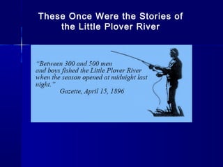
This slide is special for master students (MIBS & MIFB) in UUM. Also useful for readers who are interested in the topic of contemporary Islamic banking.
How to Setup Warehouse & Location in Odoo 17 InventoryCeline George
In this slide, we'll explore how to set up warehouses and locations in Odoo 17 Inventory. This will help us manage our stock effectively, track inventory levels, and streamline warehouse operations.
Exploiting Artificial Intelligence for Empowering Researchers and Faculty, In...Dr. Vinod Kumar Kanvaria
Exploiting Artificial Intelligence for Empowering Researchers and Faculty,
International FDP on Fundamentals of Research in Social Sciences
at Integral University, Lucknow, 06.06.2024
By Dr. Vinod Kumar Kanvaria
A review of the growth of the Israel Genealogy Research Association Database Collection for the last 12 months. Our collection is now passed the 3 million mark and still growing. See which archives have contributed the most. See the different types of records we have, and which years have had records added. You can also see what we have for the future.
Walmart Business+ and Spark Good for Nonprofits.pdfTechSoup
"Learn about all the ways Walmart supports nonprofit organizations.
You will hear from Liz Willett, the Head of Nonprofits, and hear about what Walmart is doing to help nonprofits, including Walmart Business and Spark Good. Walmart Business+ is a new offer for nonprofits that offers discounts and also streamlines nonprofits order and expense tracking, saving time and money.
The webinar may also give some examples on how nonprofits can best leverage Walmart Business+.
The event will cover the following::
Walmart Business + (https://business.walmart.com/plus) is a new shopping experience for nonprofits, schools, and local business customers that connects an exclusive online shopping experience to stores. Benefits include free delivery and shipping, a 'Spend Analytics” feature, special discounts, deals and tax-exempt shopping.
Special TechSoup offer for a free 180 days membership, and up to $150 in discounts on eligible orders.
Spark Good (walmart.com/sparkgood) is a charitable platform that enables nonprofits to receive donations directly from customers and associates.
Answers about how you can do more with Walmart!"
বাংলাদেশের অর্থনৈতিক সমীক্ষা ২০২৪ [Bangladesh Economic Review 2024 Bangla.pdf] কম্পিউটার , ট্যাব ও স্মার্ট ফোন ভার্সন সহ সম্পূর্ণ বাংলা ই-বুক বা pdf বই " সুচিপত্র ...বুকমার্ক মেনু 🔖 ও হাইপার লিংক মেনু 📝👆 যুক্ত ..
আমাদের সবার জন্য খুব খুব গুরুত্বপূর্ণ একটি বই ..বিসিএস, ব্যাংক, ইউনিভার্সিটি ভর্তি ও যে কোন প্রতিযোগিতা মূলক পরীক্ষার জন্য এর খুব ইম্পরট্যান্ট একটি বিষয় ...তাছাড়া বাংলাদেশের সাম্প্রতিক যে কোন ডাটা বা তথ্য এই বইতে পাবেন ...
তাই একজন নাগরিক হিসাবে এই তথ্য গুলো আপনার জানা প্রয়োজন ...।
বিসিএস ও ব্যাংক এর লিখিত পরীক্ষা ...+এছাড়া মাধ্যমিক ও উচ্চমাধ্যমিকের স্টুডেন্টদের জন্য অনেক কাজে আসবে ...
ISO/IEC 27001, ISO/IEC 42001, and GDPR: Best Practices for Implementation and...PECB
Denis is a dynamic and results-driven Chief Information Officer (CIO) with a distinguished career spanning information systems analysis and technical project management. With a proven track record of spearheading the design and delivery of cutting-edge Information Management solutions, he has consistently elevated business operations, streamlined reporting functions, and maximized process efficiency.
Certified as an ISO/IEC 27001: Information Security Management Systems (ISMS) Lead Implementer, Data Protection Officer, and Cyber Risks Analyst, Denis brings a heightened focus on data security, privacy, and cyber resilience to every endeavor.
His expertise extends across a diverse spectrum of reporting, database, and web development applications, underpinned by an exceptional grasp of data storage and virtualization technologies. His proficiency in application testing, database administration, and data cleansing ensures seamless execution of complex projects.
What sets Denis apart is his comprehensive understanding of Business and Systems Analysis technologies, honed through involvement in all phases of the Software Development Lifecycle (SDLC). From meticulous requirements gathering to precise analysis, innovative design, rigorous development, thorough testing, and successful implementation, he has consistently delivered exceptional results.
Throughout his career, he has taken on multifaceted roles, from leading technical project management teams to owning solutions that drive operational excellence. His conscientious and proactive approach is unwavering, whether he is working independently or collaboratively within a team. His ability to connect with colleagues on a personal level underscores his commitment to fostering a harmonious and productive workplace environment.
Date: May 29, 2024
Tags: Information Security, ISO/IEC 27001, ISO/IEC 42001, Artificial Intelligence, GDPR
-------------------------------------------------------------------------------
Find out more about ISO training and certification services
Training: ISO/IEC 27001 Information Security Management System - EN | PECB
ISO/IEC 42001 Artificial Intelligence Management System - EN | PECB
General Data Protection Regulation (GDPR) - Training Courses - EN | PECB
Webinars: https://pecb.com/webinars
Article: https://pecb.com/article
-------------------------------------------------------------------------------
For more information about PECB:
Website: https://pecb.com/
LinkedIn: https://www.linkedin.com/company/pecb/
Facebook: https://www.facebook.com/PECBInternational/
Slideshare: http://www.slideshare.net/PECBCERTIFICATION
This presentation includes basic of PCOS their pathology and treatment and also Ayurveda correlation of PCOS and Ayurvedic line of treatment mentioned in classics.
How to Fix the Import Error in the Odoo 17Celine George
An import error occurs when a program fails to import a module or library, disrupting its execution. In languages like Python, this issue arises when the specified module cannot be found or accessed, hindering the program's functionality. Resolving import errors is crucial for maintaining smooth software operation and uninterrupted development processes.
This presentation was provided by Steph Pollock of The American Psychological Association’s Journals Program, and Damita Snow, of The American Society of Civil Engineers (ASCE), for the initial session of NISO's 2024 Training Series "DEIA in the Scholarly Landscape." Session One: 'Setting Expectations: a DEIA Primer,' was held June 6, 2024.
Main Java[All of the Base Concepts}.docxadhitya5119
This is part 1 of my Java Learning Journey. This Contains Custom methods, classes, constructors, packages, multithreading , try- catch block, finally block and more.
5. WATERWATER
WATER is not an infinite resourceWATER is not an infinite resource
We can do without oil but not WATERWe can do without oil but not WATER
Currently, more WATER is beingCurrently, more WATER is being
pulled out of the ground than can bepulled out of the ground than can be
replenishedreplenished
The discussion has begunThe discussion has begun
6. Where is the LittleWhere is the Little
Plover?Plover?
The Little Plover starts in the town of Stockton, just below the
terminal moraine, flows west through the Town of Plover and the Village of Plover,
where it forms Springville Pond, and then joins the Wisconsin River.
7. Facts of the Little Plover
90% of flow is from Groundwater
Class I premier cold water trout stream
Most studied River in America
We have been warned since 1965 in report after
report of the pending dry up of the Little Plover
River
– 1965 Weeks study
– 1985 Hunt study
– 1997 Lampert & Lee watershed management study (this
report accurately predicted the dry up of the Little Plover in
2005)
As predicted, the Little Plover dried up in 2005
– The dry up was so severe that brook trout died and this
dry up continues 5 years later in 2010
– The ecosystem was been harmed
10. Public Rights Stage SetPublic Rights Stage Set
On March 23, 2009, The Wisconsin Department ofOn March 23, 2009, The Wisconsin Department of
Natural Resources announced the publishing of aNatural Resources announced the publishing of a
Public Rights Flow (PRF) Order for the Little PloverPublic Rights Flow (PRF) Order for the Little Plover
River setting a flow of 4 cfs at County Trunk R.River setting a flow of 4 cfs at County Trunk R.
Here are a number of documents, articles and news stories covering theHere are a number of documents, articles and news stories covering the
PRF; these can be found on our website:PRF; these can be found on our website:
– The March 23, 2009 news release from the DNR's West Central Office in Eau ClaireThe March 23, 2009 news release from the DNR's West Central Office in Eau Claire
announcing the PRF Orderannouncing the PRF Order
– The DNR's Findings of Facts and Order establishing the PRF at 4.0 cfsThe DNR's Findings of Facts and Order establishing the PRF at 4.0 cfs
– Portage County Gazette article on the PRFPortage County Gazette article on the PRF
– The River Alliance of Wisconsin's press release "Conservation Groups Applaud PublicThe River Alliance of Wisconsin's press release "Conservation Groups Applaud Public
Rights Flow for Little Plover"Rights Flow for Little Plover"
– A brief article fromA brief article from Words on the StreamWords on the Stream "Little Plover Gets A Lifeline" "Little Plover Gets A Lifeline"
– Stevens Point Journal article on the PRFStevens Point Journal article on the PRF
– A Milwaukee Journal Sentinel article from September 2009 "Trout kill in Little Plover RiverA Milwaukee Journal Sentinel article from September 2009 "Trout kill in Little Plover River""
11. Education - ConservationEducation - Conservation
RecreationRecreation
The Goal of the FLPR is to protect thisThe Goal of the FLPR is to protect this
valuable resource, the Little Plovervaluable resource, the Little Plover
River, and the groundwater that givesRiver, and the groundwater that gives
it life. We hope not to leave students,it life. We hope not to leave students,
“Our leaders of Tomorrow,” without the“Our leaders of Tomorrow,” without the
water we all enjoy todaywater we all enjoy today..
12. How Serious is theHow Serious is the
WATER Issue?WATER Issue?
13. Little Plover Dry upsLittle Plover Dry ups
20052005
20062006
2007 (augmentation)2007 (augmentation)
2008 (augmentation)2008 (augmentation)
20092009
2012 remains below the public rights stage2012 remains below the public rights stage
of 4 cfsof 4 cfs
1 cfs (cubic foot per second) = 7.5 gpm1 cfs (cubic foot per second) = 7.5 gpm
(gallons per minute)(gallons per minute)
15. Groundwater Levels Affect 90% of Wisconsin’sGroundwater Levels Affect 90% of Wisconsin’s
Lakes and Rivers (Not Just the Little Plover)Lakes and Rivers (Not Just the Little Plover)
Picture by Francie Rowe
Pleasant Lake, Waushara County
16. High Capacity WellsHigh Capacity Wells
(HCW)(HCW)
Pre 1950 the Golden Sands had 24 HCW. TodayPre 1950 the Golden Sands had 24 HCW. Today
there are over 3000 wellsthere are over 3000 wells
A High Capacity Well can pump at least 100,000A High Capacity Well can pump at least 100,000
gallons per day; for 3000 wells that equalsgallons per day; for 3000 wells that equals
300 million gallons per day300 million gallons per day
300 million gals/day is equivalent of 3” of water over300 million gals/day is equivalent of 3” of water over
the entire Central Sands per yearthe entire Central Sands per year
Current maximum pumping for all HCW wouldCurrent maximum pumping for all HCW would
exceed 30” of water over the Central Sands.exceed 30” of water over the Central Sands.
Wells areWells are PermittedPermitted notnot RegulatedRegulated
17.
18.
19.
20.
21. In 2013 there are 1000 highIn 2013 there are 1000 high
capacity wells in Portagecapacity wells in Portage
CountyCounty
andand
over 3000 in the 6 counties thatover 3000 in the 6 counties that
comprise the Central Sandscomprise the Central Sands
28. It’s Serious Enough that :It’s Serious Enough that :
In the 2009/2010 session, Wisconsin State legislatorsIn the 2009/2010 session, Wisconsin State legislators
considered groundwater legislation because theconsidered groundwater legislation because the
permitting of high capacitypermitting of high capacity wells is virtually
uncontrolled.
A fact finding work group was headed by Sen. MarkA fact finding work group was headed by Sen. Mark
Miller’s and Rep. Spencer BlackMiller’s and Rep. Spencer Black
The work group visited Portage County and the LittleThe work group visited Portage County and the Little
Plover River in October 2009Plover River in October 2009
30. What is Appreciation Day?What is Appreciation Day?
Each year 140+ students fromEach year 140+ students from
Roosevelt & Plover Whiting schoolsRoosevelt & Plover Whiting schools
Walk to Little Plover River ParkWalk to Little Plover River Park
(Hoover Ave) for hands on River(Hoover Ave) for hands on River
Education/ExperienceEducation/Experience
Bring own brown bag lunchBring own brown bag lunch
A Friday afternoon the first weekend inA Friday afternoon the first weekend in
May (opening of trout season)May (opening of trout season)
31. 8 Stations8 Stations
Fly castingFly casting
Fly tyingFly tying
Water conservationWater conservation
Would you drink this water?Would you drink this water?
Trout shockingTrout shocking
Stream flow monitoring/macro invertebratesStream flow monitoring/macro invertebrates
Incredible journeyIncredible journey
Aquatic Invasive SpeciesAquatic Invasive Species
32. To date, almost 900 students haveTo date, almost 900 students have
engaged in water conservation educationengaged in water conservation education
activitiesactivities
Over the years, many volunteers haveOver the years, many volunteers have
helped to make the Appreciation Day ahelped to make the Appreciation Day a
success. Ten of our volunteers havesuccess. Ten of our volunteers have
participated every year since 2007participated every year since 2007
In total, our volunteers have contributedIn total, our volunteers have contributed
approximately 1400 hours to this eventapproximately 1400 hours to this event
2012 was our 6th
Event
57. Friends Receive Wisconsin WildlifeFriends Receive Wisconsin Wildlife
Federation Water ConservationFederation Water Conservation
Organization of the Year Award forOrganization of the Year Award for
20112011
58. Award Installation at Roosevelt and Plover/Whiting
Schools November 28 and 29, 2011
3rd
, 4th
and 5th
Grade Students
59. WATER?WATER?
What value do you place on Wisconsin’sWhat value do you place on Wisconsin’s
streams, rivers and lakes; our Naturalstreams, rivers and lakes; our Natural
Resources that rely on groundwater?Resources that rely on groundwater?
Thank youThank you
For joining the WATER discussion!For joining the WATER discussion!
60. Join the FriendsJoin the Friends
ContactContact
Barb Gifford 715-344-3539Barb Gifford 715-344-3539
barbaragifford@charter.netbarbaragifford@charter.net
friendsofthelittleploverriver.orgfriendsofthelittleploverriver.org
PARTNERS
American Rivers River Alliance of Wisconsin
Golden Sands RC&D Wisconsin Wildlife Federation
Central Sands Water Action Committee
(MOVE TO TEXT BOX The Little Plover starts in the town of Stockton, just below the terminal moraine, flows west through the village of Plover, forms the Springville Pond, and then joins the Wisconsin River. This river gets about 90% of its water from groundwater, which bubbles up from the ground to wetlands and springs along the river corridor. The cold groundwater allows the stream to support a coldwater ecosystem that includes a native, naturally reproducing Brook Trout population. This, combined with its scenic beauty and recreational opportunities, has made the Little Plover a community treasure for decades. But the stream seems to have deteriorated, especially over the last few years, and concerns are arising about what the Little Plover will look like in 20 years. The time is now for good community stewards to work together to restore the river to its former health.