1. ECOLOGICAL CHANGES OF LAKES:
A FOCUS ON WATSONVILLE'S COLLEGE LAKE,
KELLEY LAKE, AND PINTO LAKE
Kenneth Antonio Rosales
Environmental Studies 117: Human Ecology
March 27, 2011
2. 2
INTRODUCTION
Burton L. Gordon's 1996 3rd edition of Monterey Bay Area: Natural History and
Cultural Imprints vaguely touched the subject on ecological changes of lakes in
Watsonville, California. Specifically, Gordon pointed out three lakes of interest: College
Lake, Kelley Lake, and Pinto Lake.
The three lakes of this study are currently plagued with human interferences of
natural processes. Issues that are apparent today have fused with predicaments made in
the past. Along with this, human population has been exponentially increasing. In 1970,
the population for the City of Watsonville was 14,719 and now it has risen to 51,495 (US
Federal Census, 2011). The civilians of Watsonville, California use intense farming
practices, utilize the car as their mode of transportation, and provide themselves shelter in
the form of either multi-family units or single-family homes. Together, these human
activities act as a deterrent for biotic functions to unfold in the three lakes of this study.
Moreover, College, and Pinto Lakes both are drained once a year into Monterey Bay.
This has harmfully affected its makeup of native freshwater and marine life forms.
College Lake is currently and recently undertaking heavy research procedures to
figure out its potential land use of storing potable water instead of continuing the
conventional intense agricultural practices that has been going on for several decades
(Podlech, 2011).
Kelley Lake is a privately owned lake that is situated between farming areas and
residential dwelling units and schools. Since Kelley Lake is privately owned, it was
difficult obtaining any kind of information and thus hindered any results of ecological
changes.
Conversely, Pinto Lake is publicly owned, by both the City of Watsonville and
the County of Santa Cruz and was easily and readily accessible. Pinto Lake was mostly
surrounded by residential housing units and several fishermen were spotted attempting to
harvest fish.
In my investigation of College Lake and Pinto Lakes, I found myself in a splendid
time frame that was fruitful with information to update Burton L Gordon's text in detail.
3. 3
CURRENT SITE MAP
How to get to College Lake:
1. Head southeast on S 8th St toward E San Salvador St
0.1 mi
2. Take the 1st right onto E San Salvador St
0.3 mi
3. Turn left at S 4th St
4. 4
0.2 mi
4. Take the ramp onto I-280 N
3.3 mi
5. Take exit 5B to merge onto CA-17 S toward Santa Cruz
26.7 mi
6. Merge onto CA-1 S/State Route 1 S via the ramp to Watsonville/Monterey
14.3 mi
7. Take exit 426 to merge onto CA-152 E/Main St toward Watsonville/Gilroy
0.7 mi
8. Turn left at S Green Valley Rd
1.8 mi
9. Turn right at Holohan Rd
0.8 mi
10. Take the 2nd left onto Grimmer Rd
0.5 mi
How to get to Kelley Lake:
1. Head southeast on S 8th St toward E San Salvador St
0.1 mi
2. Take the 1st right onto E San Salvador St
358 ft
3. Take the 1st left onto S 7th St
0.5 mi
4. Turn left to merge onto I-280 S toward US-101
1.2 mi
5. Take the exit onto US-101 S toward Los Angeles
37.8 mi
6. Take exit 347 for CA-129 toward Watsonville
0.3 mi
7. Turn right at CA-129 W/Chittenden Rd
Continue to follow CA-129 W
11.1 mi
8. Turn right at Lakeview Rd
1.1 mi
9. Turn left at College Rd
0.3 mi
10. Turn right at Cutter Dr
0.3 mi
5. 5
How to get to Pinto Lake:
1. Head southeast on S 8th St toward E San Salvador St
0.1 mi
2. Take the 1st right onto E San Salvador St
0.3 mi
3. Turn left at S 4th St
0.2 mi
4. Take the ramp onto I-280 N
3.3 mi
5. Take exit 5B to merge onto CA-17 S toward Santa Cruz 26.7 mi
6. Merge onto CA-1 S/State Route 1 S via the ramp to Watsonville/Monterey
14.3 m
7. Take exit 426 to merge onto CA-152 E/Main St toward Watsonville/Gilroy
0.7 mi
8. Turn left at S Green Valley Rd
2.1 mi
9. Turn left at Amesti Rd
0.8 mi
10. Turn right at Paraiso Dr
0.2 mi
INTERCONNECTION BETWEEN THE THREE LAKES
About 8,000 to 10,000 years ago during the Pleistocene Ice Age, the San Andreas
fault line that runs by Watsonville, CA may have caused a major slip earthquake that
formed College, Kelley, and Pinto Lakes (Ketley and Podlech, 2011). A slip earthquake
is when land is dropped under surface and results in ponds or lakes (Ketley, 2011). There
are very few lakes found in the Monterey Bay Area, however, these natural depressions
are mostly located in Watsonville, CA (Ketley 2011).
Pajaro River
Native species that make up College Lake, Kelley Lake, and Pinto Lake are said to be
very similar to those found in the Pajaro River (Ketley 2011). The following native
species have been recorded in the Pajaro River: Sacramento Sucker, California Roach,
Hitch, Steelhead Trout, Sacramento Blackfish, Sacramento Squawfish, Speckled Dace,
Tule Perch, Sacramento Perch, Hardhead, Slittail, and the Thicktail Chub (Moyle 1976,
19). However, only a few of the native species listed above were found in College Lake
and they are: Steelhead Trout, the Sacramento Sucker, Sacramento Pike minnow and
Hitch (Podlech, 2011). Unfortunately, no Native species currently exist in Pinto Lake
and because Kelley Lake is privately owned, no information was procured. However, an
6. 6
educated guess can be made. Kelley Lake may be stocked with invasive species like the
California Fish Commission does for Pinto Lake and may be supplied with the native
species listed above (Ketley, 2011).
Invasive
Several invasive fish species have been found in College Lake and Pinto Lake such as the
Brown Bullhead Catfish, Channel Catfish, the common Carp, the Largemouth Bass, and
Crappies (Podlech 2011). Podlech pointed out that “we have to be careful with the fact
that we're getting natives because there may be a lot of non natives that want to eat all the
natives” (2011).
Brown Bullhead Catfish, Ameirurius nebulosus The brown bullhead catfish is the
most abundant catfish of all catfishes and originally comes from the eastern quadrant of
the United States and southern Canada (Figure 1). First distributed into Suttersville,
Sacramento County of California in 1874 by a man named Livingston Stone due to the
demands of the California Fish Commission, it reached the San Joaquin, Eel, Klamath,
and elevations of up to 7,000 feet in the Sierra Nevadas by the 1950's (Dill and Cordone
1997, 71-72). “Warm still water, non-oxygenated grounds are perfect for catfish and thus
may not migrate” (Podlech 2011). These conditions clearly indicate an environment that
promotes paradise for the Brown Bullhead. During my interview with Mike Podlech and
Scott Bruce at College Lake, I was able to observe Podlech and Bruce had catch two
catfish and one hitch at Salsipuedes Creek next to College Lake (Figure 2 and 9). Once
they reached for the hitch, they had told me there were bite marks on the hitch, further
concluding that the catfish do feed off of small native fishes and can be potentially
threatening to other native fish. (Podlech 2011). It is remarkable how far the Brown
Bullhead Catfish has extended. The Catfish seem to be one of the most flexibly adaptive
species of all invasive species in this study.
7. 7
Figure 1 Brown Bullhead Catfish
(Photo taken from Inland Fishes of California)
Figure 2 Brown Bullhead Catfish at College Lake
(Photo taken by Kenneth Rosales)
Channel Catfish, Ictalurus punctatus. The Channel Catfish was first introduced on
1891 when the U.S. Fish Commission released 250 adult and juvenile Channel Catfish
into Lake Cuyamaca in the San Diego County, and the Feather River near Gridley
California respectively (Figure 3). From 1895 until the 1970's, Channel Catfish thrived
8. 8
and extended not only by California stocks, but elsewhere through fish hatchery stocks,
and Texas imports. The combination of such introductions resulted in rising propagated
populations in the Colorado River, the Sacramento River, and eventually in Watsonville's
hydrologic systems (Dill and Cordone 1997, 80).
Figure 3 Channel Catfish
(Photo taken from Inland Fishes of California)
Common Carp, cyprinus carpio Linnaeus. California was the first state to import
Carp in September 1877, but was primarily introduced by a German individual by the
name of J.A. Poppe in 1872 to fill his ponds in Pulpiili Rancho, Sanoma Valley (Figure
4) (Dill and Cordone 1997, 49). However, by 1896 the planting of carp ceased. It was the
species' high adaptive flexibility that allowed its population to multiply in great numbers.
It could not have been the number of restocks imposed by the California Fish
Commission because they were ranot abundant enough (Dill and Cordone 1997, 50). The
Carp population became an issue of concern by the year 1884 and “many articles
appeared condemning the fish, and blaming it for roiling the water, eating other fish and
their spawn, destroying levees by burrowing, and uprooting and eating aquatic plants”
(Dill and Cordone 1997, 50).
9. 9
Figure 4 Common Carp
(Photo taken from Inland Fishes of California)
Largemouth bass. Largemouth bass potentially could have entered California in
1891 from Quincy, Illinois into Lake Cuyamaca in San Diego County and in Feather
River near Gridley, California by the U.S. Fish Commission (Figure 5). Whether this is
true or not, the fact of the matter is that the largemouth bass has vastly spread into
reservoirs, farm ponds, rivers, lakes, and slough all over California, and are known to be
natural predators that feed on small native fish (Dill and Cordone 1997, 175).
10. 10
Figure 5 Largemouth Bass
(Photo taken from Inland Fishes of California)
Crappies Again, Lake Cuyamaca in San Diego County fell victim of another
stock, except this time it was the crappie in 1891 from Quincy, Illinois by the U.S. Fish
Commision (Figure 6). By 1930, crappies became more apparent as they showed up in
the San Joaquin Valley, California (Dill and Cordone 1997, 178-181).
11. 11
Figure 6 White Crappie
(Photo taken from Inland Fishes of California)
COLLEGE LAKE
Settled about one mile north of Watsonville's city borders, College Lake is a
naturally occurring lake that takes up 300 acres of space, but approximately 2,000 acre-
feet of its body of water is pumped for 200 acres of agricultural use during the summer to
grow flowers, raspberries, grapes, vegetables, and strawberries (IRWM 2010). To make
drainage practices feasible, the combination of a water pumping system, dams, and the
production of an outlet for water to flow away from the lake are utilized from the
beginning to the closure of Spring (Smith 2008, 1).College Lake's natural outflow runs
through Corralitos Creek and then merges with Salsipuedes Creek into the Pajaro River
and ultimately flows into the Monterey Bay. In addition, the outlet pumps the drained
water at these locations as well. College Lake collects water runoff during the winter
from several different creeks that receive water from surrounding mountains and rainfall.
As depicted in figure 5, the creeks that flow into College Lake are Casserly, Hughes, and
Green Valley Creeks (Smith 2008, 1).
12. 12
Figure 7 Map of College Lake with Green Valley Creek, Corralitos Creek and
Salsipuedes Creek labeled.
(Map taken from IRWM presentation)
History
The first reported pumping of water on College Lake was conducted in 1893 by a
farmer named R. Pinto so he could successfully grow strawberries on the bare lake. Only
about two years later in 1895, R.W. Eaton began to utilize pumping systems as well
except this time it was used on Salsipuedes Creek for the cultivation of berries. About
three decades later in 1923, the foundation of the 15 farm member College Farming
District was established (IRWM 2010). Later, in 1989, the property owner of this epoch
named simply Remde. Remde decided to sell the land to the Pajaro Valley Water
Management Agency (IRWM 2010). In contemporary times, the farm has been sold so a
multitude of farmers available for open access (IRWM 2010). However, old farming
techniques have been abandoned and organic farming has been active (Perloch 2011).
Native Fish
As mentioned earlier in the Interconnection Between the Three Lakes section of
this report between all the native fish in the three lakes, only College Lake withholds
13. 13
native fish. The native fish are: The Sacramento Pike minnow, the Prickly Sculpens,
Hitch, Sacramento Sucker, and the federally threatened Steelhead Trout.
Sacramento Pike minnow, Ptychocheilus grandis. The Sacramento Pike minnow
(Figure 8) is native to the Russian river, Sacramento-San Joaquin hydrological system,
Clear Lake Pajaro-Salinas Rivers systems, and upper Pit River drainages in California
(United States Geological Survey 2011).
Figure 8 The Sacramento Pike minnow
(Photo taken from the United States Geological Survey website)
Prickley Sculpins,Cottus asper. The Prickley Sculpens are nocturnal invertebrate
feeders and are great at camouflaging by hiding under objects on the floors of their
freshwater environments (Figure 9). Prickley Sculpin females lay up to 11,000 eggs
under rocks instead of open waters. On the topic of eggs, Prickley Sculpens are natural
predators to excess Salmon eggs (McGinnis 1984, 233).
14. 14
Figure 9 The Prickley Sculpen
(Photo taken from Freshwater Fishes of California)
Hitch, Lavinia exilicauda Not only does the Hitch live in a lake environment, but
they are known to dwell in steams, reservoirs, and sloughs (Figures 10 and 11). Hitch are
conventionally found from San Francisco to the Monterey Bay Area and has been known
to grow in large numbers by laying up to 9,000 eggs every spawning season. However,
invasive species such as the Threadfin Shad competes for their plankton and insect diets.
Threadfin Shad was reported to be in Pinto Lake by Burton L. Gordon in the past, but
none have been reported throughout this study (McGinnis 1984, 144). However, Robert
Ketley has reported that he “wouldn’t be surprised if they were in Pinto Lake as well”
(2011). In figure 11, the Hitch on Scott Bruce’s hand had been attacked by the Brown
Bullhead Catfish. They had been put in the same bucket after they were caught.
15. 15
Figure 10 Hitch
(Photo taken from Freshwater Fishes of California)
Figure 11 Hitch trapped at College Lake by Mike Polech and Scott Bruce
(Photo taken by Kenneth Rosales)
16. 16
Sacramento Sucker, Catostomus occidentalis From the Sacramento to the San
Joaquin hydrological systems, the Sacamento Sucker lives for an extensive amount of
time and age slowly. They usually live in water systems that are river and lake
interconnected (Figure 12). The Sacramento Sucker spawns in the last days of February
and lay their eggs between gravel like Trouts and Salmonid species until they are about
four years old (McGinnis 1984, 162). As adults, the Sacramento Sucker love to occupy
deep waters, but as juveniles they love to use gravel beds upstream as a way to
camouflage themselves from predators, and to protect themselves during heavy river
flows such as the heavy rainfalls College Lake receives during the winter (McGinnis
1984, 162.;Smith 2008, 2). As infants, however, they tend to be more comfortable in
shallow waters (McGinnis 1984, 162).
Figure 12 The Sacramento Sucker
(Photo taken from Freshwater Fishes of California)
The Steelhead Trout dilemma The Steelhead Trout (Oncorhynchus mykiss) may
be currently in danger on all ends of College Lake (Figure 13). Everywhere from its
rearing habitat, the seasons, outmigration, dredging, pumping, and damming operations.
No wonder they are a Federally Threatened species of concern (Podlech 2011). During
the winter, young of year Steelhead trouts are forced to survive heavy winter storms
where 70% to 90% may pass away on Casserly Creek (Smith 2008, 2). This is often a
conventional life cycle for most Steelhead Trout populations, however (Smith 2008, 2).
17. 17
In the case of College Lake, the Steelhead Trout may potentially utilize this lake
as a means of sanctuary for winter and spring (Figure 14). This may aid the Steelhead
Trout in yielding up to an increased smolt population of approximately 500% or more
(Smith 2008, 2). The Steelhead enters College Lake through the Casserly and Green
Valley Creek systems. The Steelhead Trout then may spawn and rear at upper Corralitos
Creek and use Salsipuedes Creek as an outmigration passage (Figure 15-17) (Smith 2008,
1). Outmigration peak is in between late May and early April. However, Steelhead Trout
are blocked by pumping, damming, and draining operations at the same time. Green
Valley and Casserly Creeks serve as primary inflow entrances, but face several blockades
during the spring outmigration period of smolts (Figure 18). Since draining operations
occur during the spring, the draining itself may not severely affect the Steelhead Trout.
The pumping of water from the lake over a dam force the Steelheads to live under
conditions where the water may be too warm in the lake (Smith 2008,1). “The dissolved
oxygen concentration is also stratified during the warmer months,” bacteria consumes
most of the oxygen at the bottom of lakes, and thus makes it hard for the Steelhead Trout
to undergo its necessary high demand of gas exchange with oxygen during the summer
(McGinnis 1984, 16-17). Additionally, the outlets at Salsipuedes Creek increase the
turbidity of the water and hinder Steelheads to breathe.
Invasive species also may easily feed on the Steelhead Trout during the summer
because they may be in their vulnerable rearing years (Smith 2008, 1). In addition, the
outmigration of the smolt Steehead trout is hindered by pumping operations because once
water pumping commences, the only outlet of water is through the pumps (Smith 2008,
3). In turn, the pumps use screens to deter fish from entering and clogging the pumps and
killing fish (Smith 2008, 2). The climax period of the Steelhead Trout's outmigration falls
within April and May and Smith's 2008 report observed drainage and pumping operations
begin in the first week of April at College Lake (Smith 2008, 3).
Figure 13 Once called the Steelhead Rainbow Trout, is now the Steelhead Trout.
(Photo taken from Freshwater Fishes of California)
18. 18
Figure 14 College Lake
(Photo taken by Kenneth Rosales)
Figure 15 Salsipuedes Creek
19. 19
(Photo taken from IRWM presentation)
Figure 16 Drainage pipe into Salsipuedes Creek
(Photo taken from IRWM presentation)
Figure 17 Salsipuedes Creek merging with Green Valley Creek at the right en
20. 20
Figure 18 Green Valley Creek
(Photo taken from IRWM presentation)
Current projects. When I interviewed Mike Podlech and Scott Bruce at College
Lake, they were in the midst of research for a potential project on College Lake for the
City of Watsonville by the Regional Water Management Group (RWMG), the County of
Santa Cruz, Pajaro Valley Water Management Agency (PVWMA), and the U.S. Corps of
Engineers. When I asked Mr. Bruce and Mr. Podlech what they were up to, Podlech
responded, “we are trapping juvenile Steelhead that are on their way out to the ocean
through Salsipuedes Creek and collecting data to figure out to what extent they can use
the lake for when it's flooded, in other words, are they traveling to creeks that feed into
the lake or are they only hanging out in the lake (Figure 19)?” Subsequently, I asked
Podlech the following question: Were there any current findings that you or anyone else
made that led you to this study? Podlech responded, “State and federal agencies respond
to protect the federally threatened Steelhead Trout and want to find out more on how they
use this lake to figure out a better way of managing the lake in the future rather than
turning on the pumps in the spring and farming in the summer'. ' Perhaps using College
Lake as a potential source of drinking water may be part of the plan, but we need to
further conduct more studies and find out there are various plans, I don't know'” (2011).
Thanks to Kristen Kittleson, a fishery resource planner for the County of Santa
Cruz, I was able to find an inside scoop on the potential projects of College Lake. The
Regional
21. 21
Figure 19 Podlech and Bruce evaluating trap catches at Salsipuedes Creek
(Photo taken by Kenneth Rosales)
Water Management Group (RWMG), the County of Santa Cruz, Pajaro Valley Water
Management, Agency (PVWMA), and the U.S. Corps of Engineers ultimately are
investigating College Lake to find a list of criteria that will supply potable water and
flood control management, recreation, aesthetics for the city of Watsonville while
protecting Steelhead migrations (Pajaro River Watershed Integrated Regional Water
Management 2010, 43-46). In order to make this project feasible, management would
have to raise the lake's elevation to 420 acres from its natural 260 acres and treat the
water due to recent discoveries of excessive concentrations of nitrogen, suspended solids,
disease born bacteria, and soluble pesticides. College Lake would also serve part of an
Aquifer Storage and Recovery Plan or ASR for short (Pajaro River Watershed Integrated
Regional Water Management 2010, 43-46).
KELLEY LAKE
Kelley Lake is a lake that is privately owned by its parallel and adjacent residents (Figure
20). It sits along housing units, farms, St. Francis catholic school, and Lakeview Middle
School. Farming practices with a highly toxic chemical called methyl bromide have been
22. 22
reported and may have entered Kelley Lake. The stock of fish may be maintained by the
local residents and are not reported since there is no city or county affiliation.
Figure 20 Kelley Lake, a view behind residential area
(Photo taken by Kenneth Rosales)
PINTO LAKE
Pinto Lake lies northwest of College Lake and used to be surrounded by Redwood
trees, but is now mostly an enclave of Eucalyptus trees (Figure 21 and 22). The northern
half of Pinto Lake is owned by the County of Santa Cruz, while the southern half is
owned by the City of Watsonville. In the city owned half of Pinto Lake, I interviewed
the city's water quality manager, Robert Ketley. According to Ketley, Steelhead Trout
may have spawned in Pinto Creek when flowed year round and may have visited and
rested in Pinto Lake before human intrusion. Pinto Creek used to start in the Santa Cruz
Mountains and the Foothills and flow into Pinto Lake (Ketley 2011).
“Pinto Lake used to be relatively undisturbed when the Costanoans inhabited the area to
only search for food until the European invasion began,” said Ketley (2011). “They
would go up to the watersheds, drain them, cut down trees, began cattle ranching
23. 23
practices and sheep operations, creating a conglomeration of sediment run-off loads
through intense agriculture” (Ketley 2011).
Figure 21 Pinto Lake
(Photo taken by Kenneth Rosales)
24. 24
Figure 22 Pinto Lake
(Photo taken by Kenneth Rosales)
The Modern Era
The chemical industry came into play around the 1940's and consequently,
farmers were using pesticides in their farming methods that showed
dichlorodiphenyltrichloroethane (DDT), and its broken down constituents, DDD and
DDE which are equally or more toxic (Ketley 2011). Eventually, runoff of these
chemicals ended up in Pinto Lake. Pinto Lake is currently listed as the lake with the
highest level of toxins of the state of California (Ketley 2011).
DDT was phased out in 1972 and farmers changed their practices from orchards
to berries and apples which demand a higher concentration of nutrients (Ketley 2011). In
the 1980's through the 1990's, heavy algal blooms appeared, but it was ignored by
civilians because they thought it was a natural occurrence (Ketley 2011).
25. 25
Blue-green algal bloom Robert Ketley and a team of scientists/professors from
California State University of Monterey Bay and University of California, Santa Cruz
sampled several river systems and the bottom of Pinto Lake. The results revealed that
they had found themselves with elevated concentrations of phosphate and nitrates due to
agricultural fertilizer runoff, thus rendering it a hyper eutrophic lake. In conclusion, high
phosphate and nitrogen yields in the propagation of microcystin, toxic algae or also
known as cyanotoxin.
Cyanobacteria have been in the earth for more than 3.8 billion years and their
genes structure is highly adapted to the lack of nitrogen, making them nitrogen fixated. If
an abundance of phosphorus is present in still, shallow water for over the course of six to
eight months, cyanobacteria populations will augment in substantial numbers because
they find this type of environment to be a sanctuary or as Ketley described it, “heaven.”
Pinto Lake's algal bloom revealed a total of 2,893,051 parts per billion (ppb) of
microcystin. The state of California limits 5 ppb, while the World Health Organization
restricts 1 ppb (Figure 23) (Miller MA et. al.2010, 9). One tablespoon of microcystin is a
legal dose for the aggregation of 10 humans deaths.
Figure 23 Traced contamination levels of microcystin from Pinto Lake to Pajaro
River and a picture of a jar full of microcystin
(Figure taken from Plos One journal article)
26. 26
The plight of the Sea Otter Pinto Lake is drained into Corralitos Creek and the
Pajaro River like College Lake and then is flushed into the Monterey Bay. In 2007, 11
Sea Otters were found dead on the shore of the Monterey Bay (Figure 24). This led to the
revelation of microcystin contamination of the Federally Threatened Southern Sea Otters
because of their ingestion of bivalves such as clams, mussels, and oysters. The bivalves
were highly intoxicated with the toxic algae (Miller MA et.al. 2011, 6). The federal
government aided the sea otters by providing the State Water Resources Control Board
with the California’s 319h grant money of 100,000 dollars to control the cyanobacterial
bloom (Ketley 2011). The blooms still remain a problem and Ketley said, “we're lucky if
we get to the state limit of 5 ppb's.' 'I've put signs up to warn people not to eat the fish
fisherman catch over here, but some of them ignore it and I wonder if they live past
tomorrow” (2011).
Figure 24 Detections of toxic cyanobacteria in the roof of a deceased Sea
Otter’s mouth found on the shores of Monterey Bay
(Figure taken from Plos One journal article)
27. 27
Global Climate Change Robert Ketley reported that the Belizean Grackle has
been sighted at Pinto Lake (2011). “This is a clear indication that global climate change is
indeed occurring because the Grackle has no idea where to go anymore and it definitely
does not belong here.”
Zebra Mussels Ketley pointed out that he has been alert about any boats that are
put on Pinto Lake because of the prolific invasive species from Russia, the Zebra Mussel.
The Zebra Mussel populates in large numbers and quickly. Its effects are harmful through
its potential poisoning of lakes, its ability to live on other species, and by competing with
local filter feeding food sources. Zebra Mussells have been well documented for getting
into the pipes of boats. Determining whether they are present or not is best by using pip-
like objects because Zebra Mussells leave sand like particles behind (Figure 25).
Figure 25 Robert Ketley measuring if there are any sandy traces of Zebra
Mussells leave behind in a rod like compartment.
(Photo taken by Kenneth Rosales
28. 28
SUMMARY STATEMENT
Two Key Understandings and One Legislative Addition
Human interaction with the environment will always have some sort of affect and
in turn the altered environment will affect human's physical and social worlds
simultaneously. Therefore, humans must open their eyes to see the interconnection
between all life, must strive for a total environmental perspective in their lives, and by
law, our agricultural techniques to support human population must be amended.
Interconnection. College Lake and Pinto Lake both had some type of
interconnection with species. In both cases, agricultural practices adversely affected
native species of the Monterey Bay Area. Humans need to understand that just because
the bodies of water are far away and out of sight from the shores of Monterey Bay, it
does not justify their actions to inhibit any reflection of unintended consequences. There
will always be some type of connection a few feet away, a mile away, or even 4,000
miles away as the stocks of invasive species into California further suggests. Critical
thinking is required to make such broad connections. Unfortunately, this is what humans
lack when it comes to the environment.
Total environmental perspective. In order to make such critical connections, one
must have a total environmental perspective. In other words, all planes need to be
carefully examined before taking action because what is thought to be a resolution may
end up being an enormous issue that exceeds the previous one that started it.
International policy. Watsonville's harmful agricultural runoff, drainage practices,
and damming operations are not only a local issue, but rather a global one. Farmers
throughout the world may use the same methodologies to supply agricultural products for
humans. Global issues calls for international agreements.
29. 29
CONTACTS
Robert Ketley- Water Quality
Program Manager for the City of
Watsonville.
Phone: (831)768-3137
Email:rketley@ci.watsonville.ca.us
Website: www.ci.watsonville.ca.us
30. 30
Kristen Kittleson- Fishery Resource
Planner for the County of Santa Cruz
Environmental Health Services Agency
Phone: (831) 454-3154
Email: kristen.kittleson@co.santa-
cruz.ca.us
31. 31
LIST OF FIGURES
Mike Podlech- Worked with the Endangered Species Act as a
biologist for 10 years in the San Francisco office
Email: mpodlech@sbcglobal.net
Scott Bruce- Worked with the Endangered Species Act in San
Francisco since 2003 in the fiber optics department as a
biologist.
Email: ScottandShan@comcast.net
32. 32
Figures
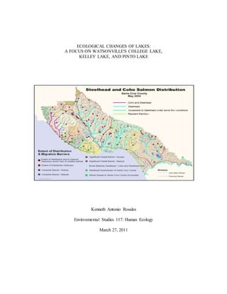
1. Steelhead and Coho Salmon Distribution……………………………………………Cover
2. Current Site Map……………………………………………………………………....... 3
3. Figure 1 Brown Bullhead Catfish ……………………………………………….. 7
4. Figure 2 Brown Bullhead Catfish at College Lake……………………………….. 7
5. Figure 3 Channel Catfish…………………………………………………………. 8
6. Figure 4 Common Carp………………………………………………………….. 9
7. Figure 5 Largemouth Bass……………………………………………………… 10
8. Figure 6 White Crappie…………………………………………………………. 11
9. Figure 7 College Lake Map…………………………………………………….. 12
10. Figure 8 Sacramento Pike minnow………………………………………………13
11. Figure 9 Prickly Sculpen………………………………………………………... 14
12. Figure 10 Hitch…………………………………………………………………. 15
13. Figure 11 Hitch at College Lake………………………………………………... 15
14. Figure 12 Sacramento Sucker………………………………………………….. 16
15. Figure 13 Steelhead Trout……………………………………………………… 17
16. Figure 14 College Lake………………………………………………………… 18
17. Figure 15 Salsipuedes Creek…………………………………………………… 18
18. Figure 16 Drainage pipe into Salsipuedes Creek………………………………. 17
19. Figure 17 Salsipuedes Creek merging with Green Valley Creek……………… 19
20. Figure 18 Green Valley Creek………………………………………………….. 19
21. Figure 19 Podlech and Bruce evaluating trap catches at Salsipuedes Creek…… 21
34. 34
REFERENCES
Bray, Richard . Keys to the Fishes of California with Information on their Biology and
Fishery . 1971.
Dill, William . History and Status of Introduced Fishes in California, 1871-1996. 1997.
Fuller, Pam. "NAS - Nonindigenous Aquatic Species." USGS science for a
changing world. Available from
http://nas.er.usgs.gov/queries/factsheet.aspx?SpeciesID=627. Internet; accessed
21 April 18 11.
Google Maps. Available from http://maps.google.com/. Internet; accessed 21 April 18 11.
Gordon, Burton L. Monterey Bay Area: Natural History and Cultural Imprints. Pacific
Grove: The Boxwood Press 1996.
Integrated Regional Water Management College Lake Presentation. 2010
Kristen Kittleson, interview by Kenneth Rosales, Watsonville, CA, April 15th, 2011
Kyle Nadeau, interview by Kenneth Rosales, San Jose, CA, April 15th, 2011
Mike Polech and Scott Bruce, interview by Kenneth Rosales, Watsonville, CA, April
15th, 2011
Miller MA, Kudela RM, Mekebri A, Crane D,Oates SC, et al. "Evidence for a Novel Marine
Harmful Algal Bloom: Cyanotoxin (Microcystin) Transfer From Land to Sea
OttersPlos One". 5. 9 (2010), 1-11,
http://www.plosone.org/article/info:doi/10.1371/journal.pone.0012576.
(accessed April 20, 2011)
Moyle, Peter. Inland Fishes of California. London: University of California Press, 1976.
McGinnis , Samuel M.. Freshwater Fishes of California. London: Regents of the
University of California, 1985.
Pajaro River Watershed Integrated Regional Water Management, 18. Implement Local
Watershed Planning Process- College Lake Improvement and Watershed
35. 35
Management (Santa Cruz County, 2010), 43-46.
Robert Ketley, interview by Kenneth Rosales, Watsonville, CA, March 31st , 2011.
Smith, Jerry. "Fisheries Issues Associated with the Present and Potential future
Operation of the College Lake Complex (Pajaro River Watershed)." Department
of Biological Sciences, San Jose State University (2008): 1-5.
"United States Census Bureau." Available from http://www.census.gov/. Internet;
accessed 21 April 18 11.