Download as PDF, PPTX
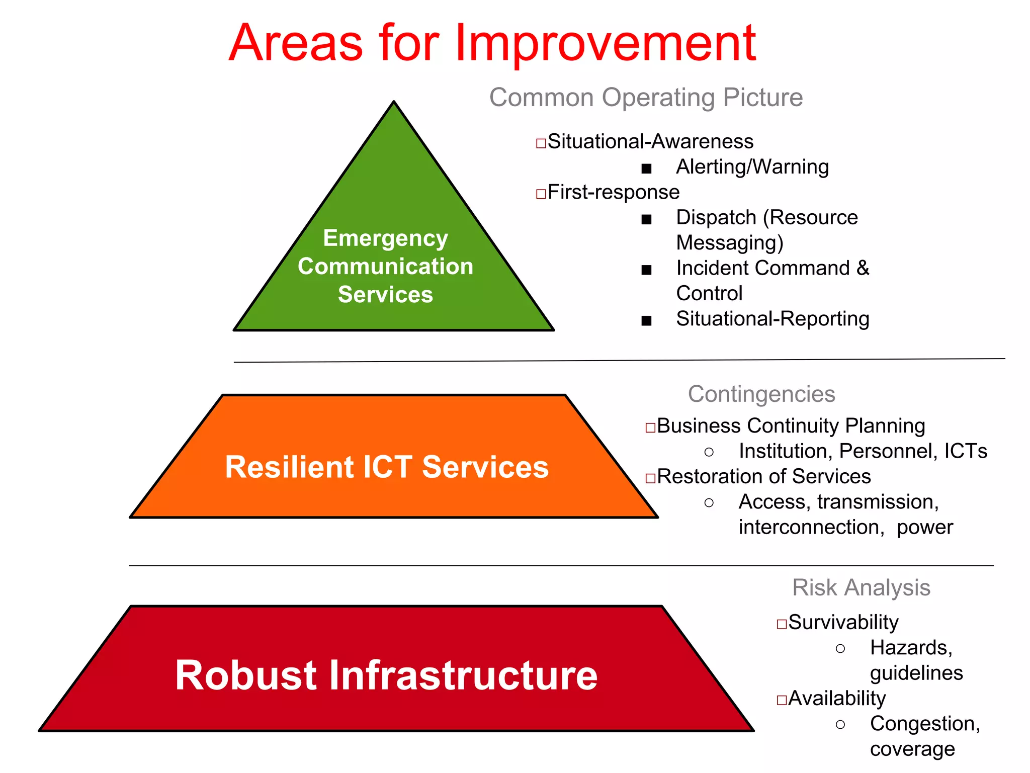
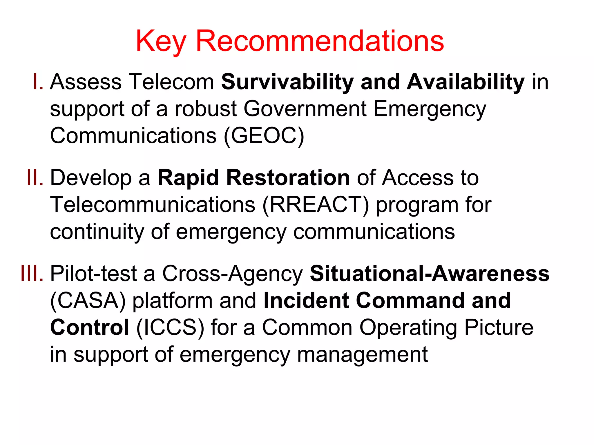
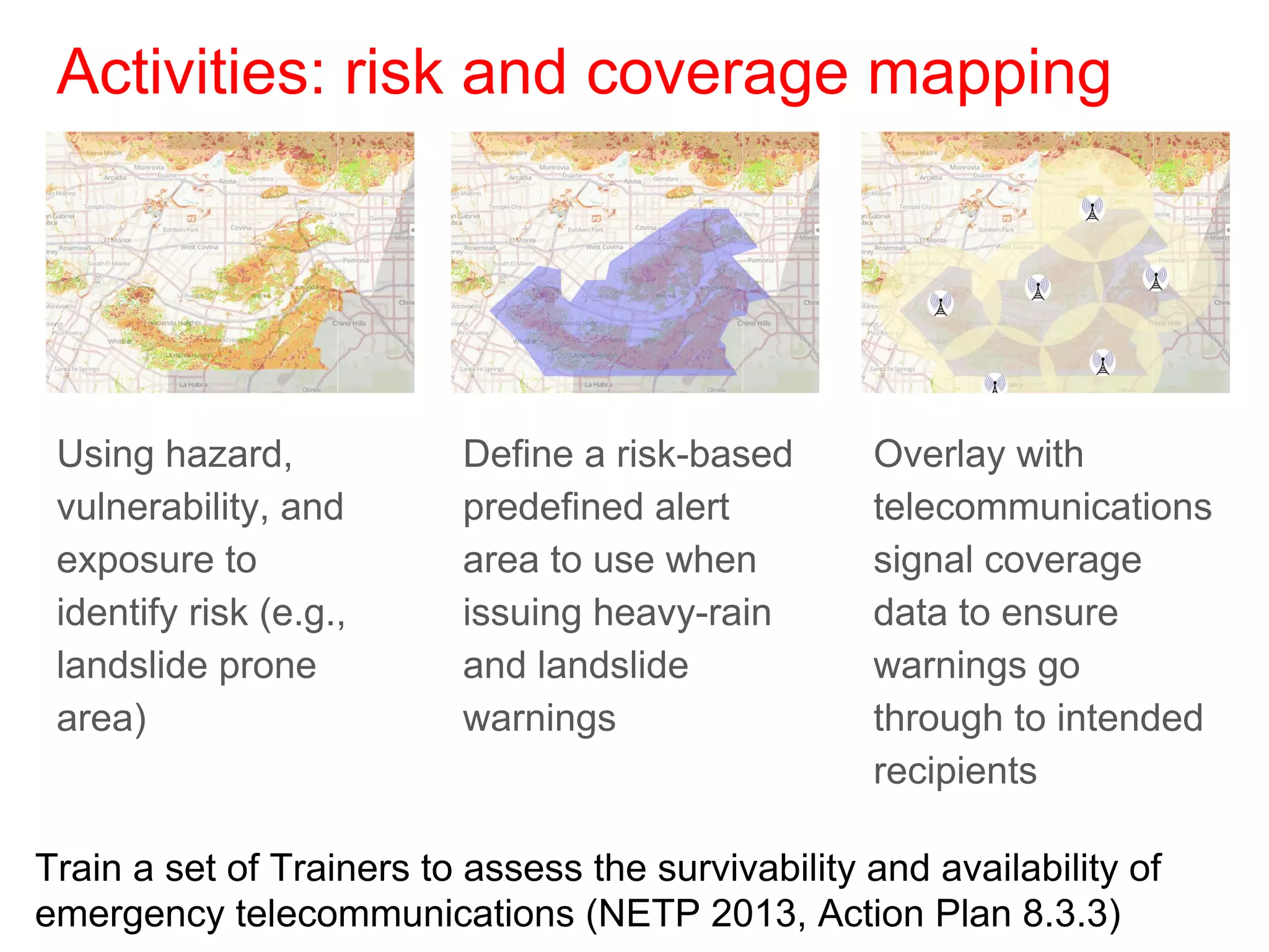
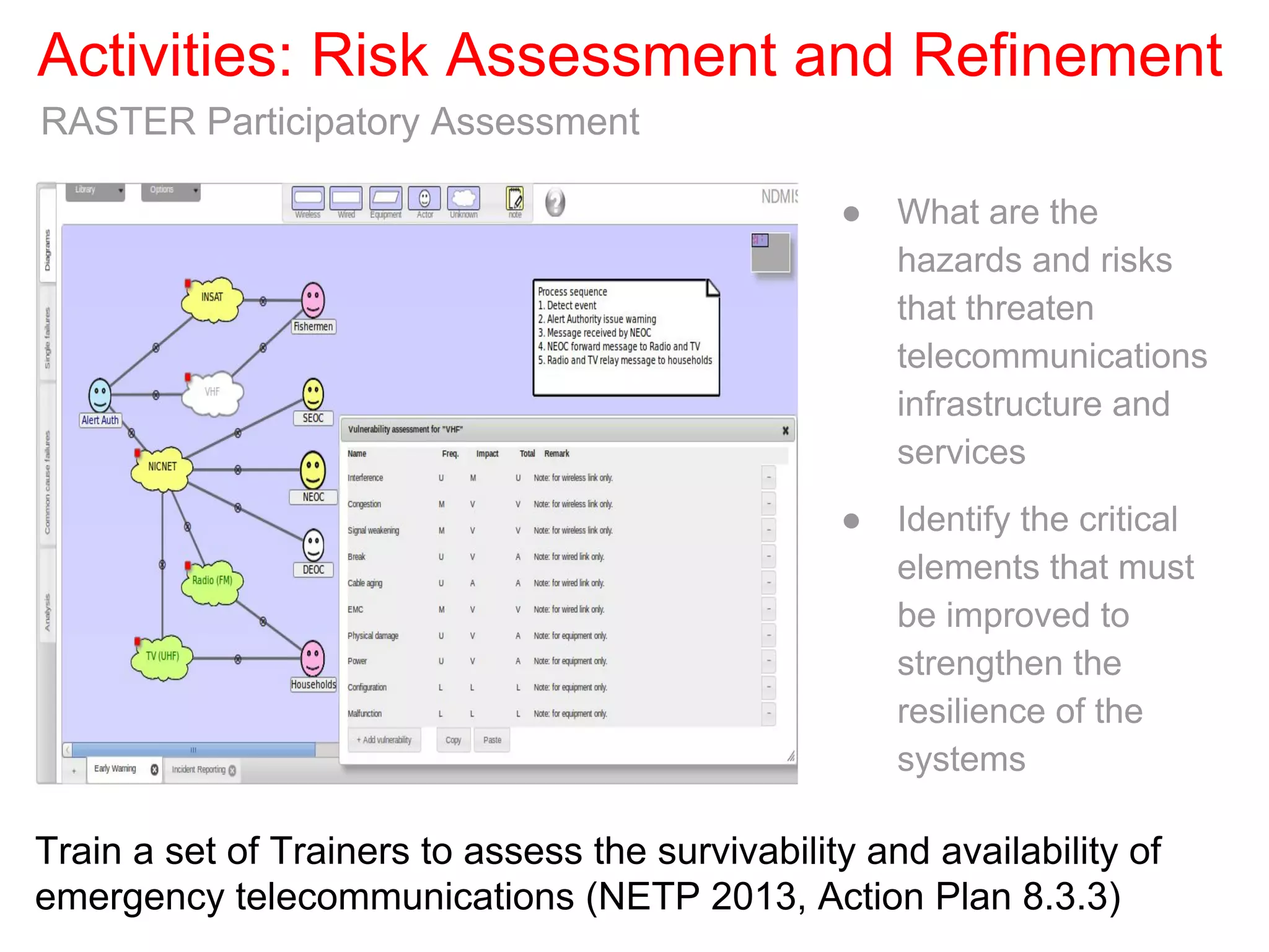
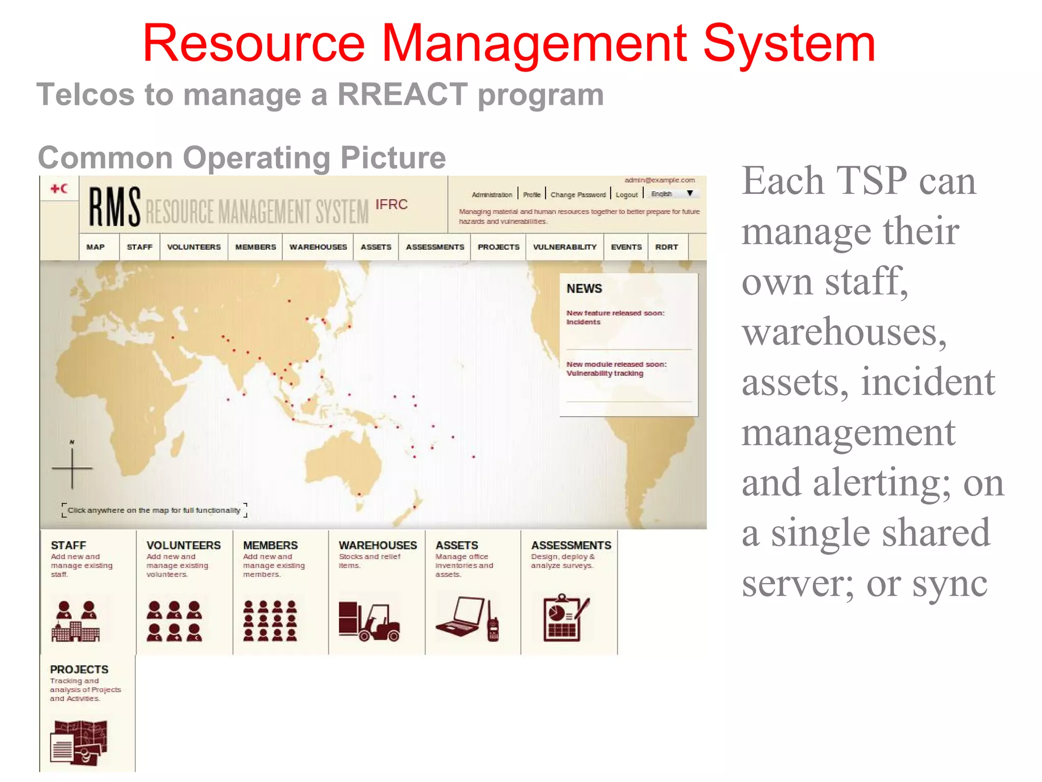
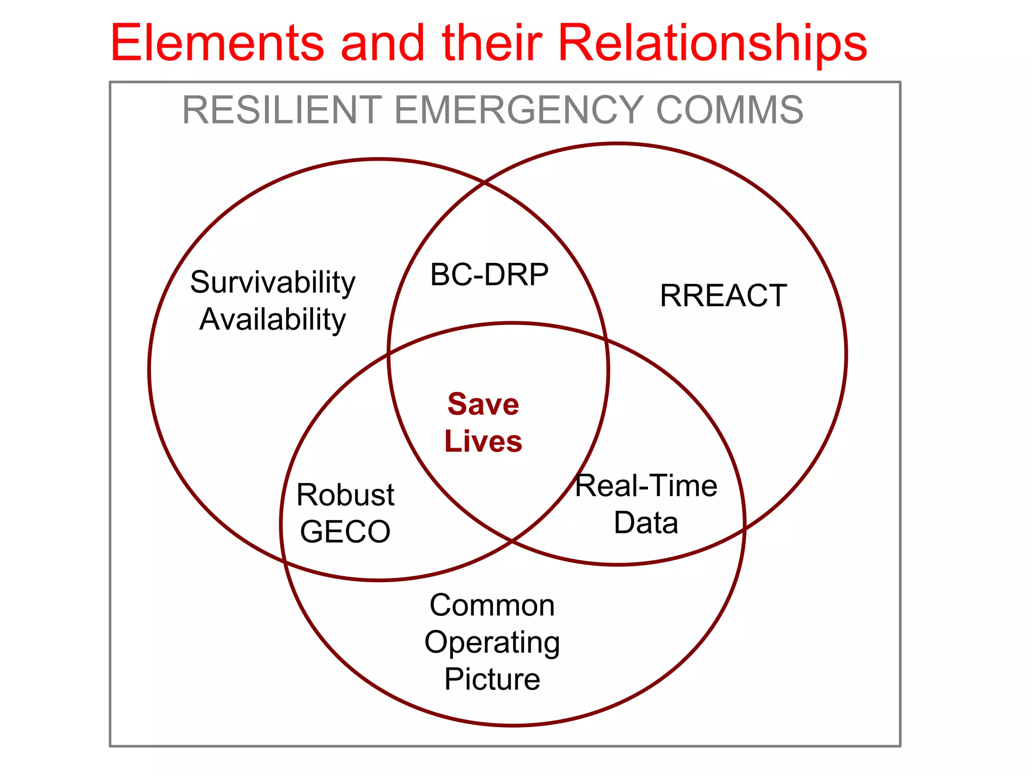


The document evaluates the effectiveness of Nepal's emergency communication system following the 2015 earthquake. It identifies critical areas for improvement in telecommunications resilience, emergency response coordination, and business continuity planning. Key recommendations include assessing telecom survivability, developing a rapid restoration program for emergency communications, and implementing a situational-awareness platform for better risk management and response.

![Common alerting protocol overview for pagasa 2016 [autosaved] [autosaved]](https://cdn.slidesharecdn.com/ss_thumbnails/afkeek3ltgarssplbg3m-signature-2203d1468a01ba8865d672aae887d2806433257ac41d5c75e5f62d95e20aca37-poli-161005154902-thumbnail.jpg?width=640&height=640&fit=bounds)


