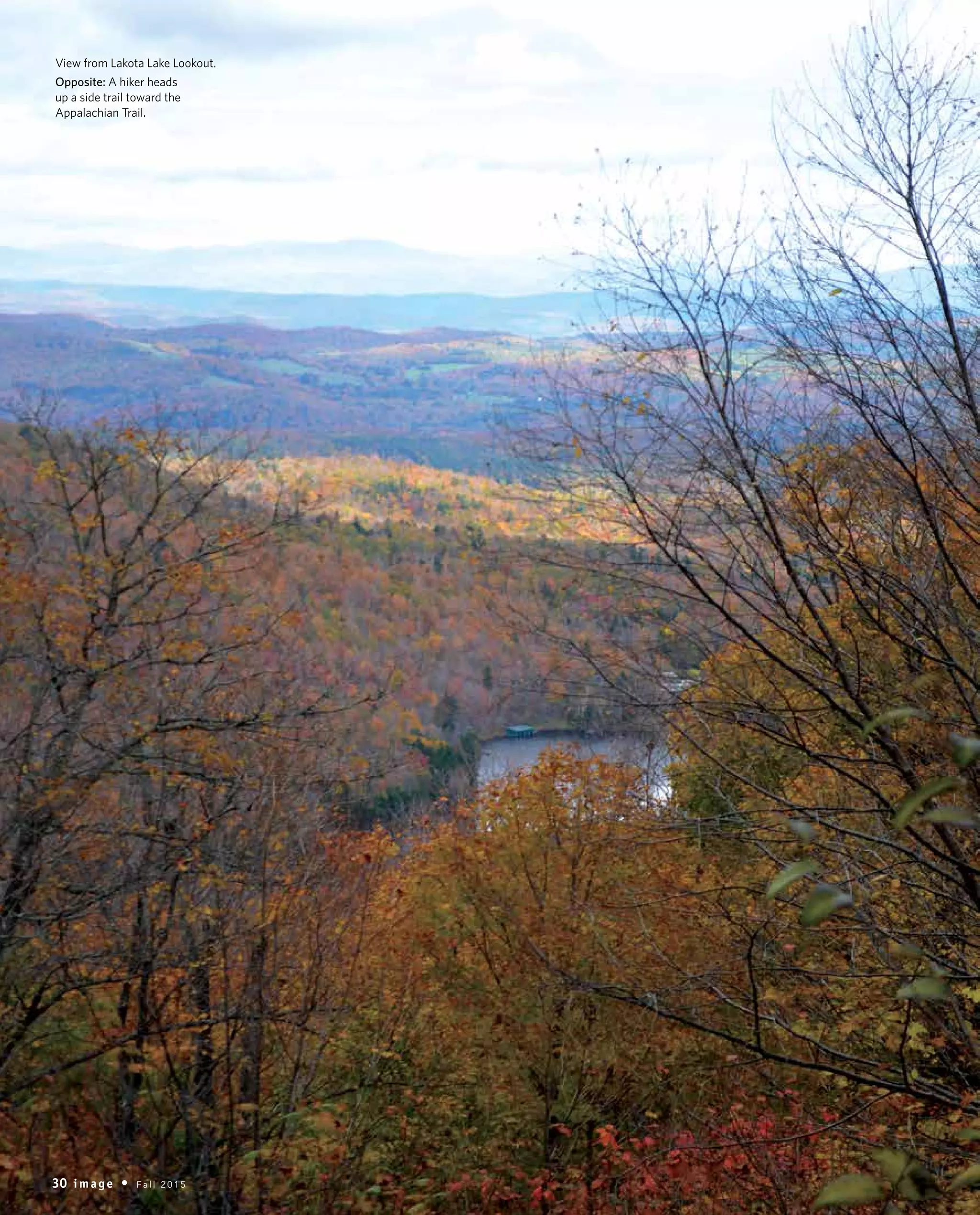
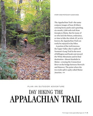
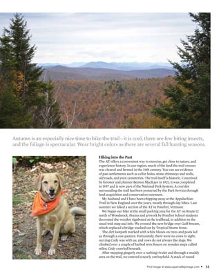
View from Lakota Lake Lookout.
Opposite: A hiker heads
up a side trail toward the
Appalachian Trail.
30 i m a g e • F a l l 2 0 1 5
Find image at www.uppervalleyimage.com • 31
Story and Photos by Susan Shea
day hiking the
Appalachian Trail
P l a n a n o u t d o o r a d v e n t u r e
The Appalachian Trail—the name
conjures images of lean, fit hikers
carrying heavy packs and a grueling,
six-month, 2,180-mile trek from
Georgia to Maine. But for many of
us who lack the fitness, endurance,
or time to hike the whole AT, as it is
known, the Appalachian Trail can
easily be enjoyed in day hikes.
A portion of the trail traverses
the Upper Valley after it splits off
Vermont’s Long Trail in the town
of Killington and heads east toward
the White Mountains and its final
destination—Mount Katahdin in
Maine—crossing the Connecticut
River on the bridge between Norwich
and Hanover. The point where the
two trails split is aptly called Maine
Junction. }}}
32 i m a g e • F a l l 2 0 1 5
Right: Milkweed
in bloom.
Below: A stone chimney
beside a cellar hole.
Opposite, top: View of
the Green Mountains
from the Lookout.
Below: Cody enjoys a
day of hiking.
day hiking
Find image at www.uppervalleyimage.com • 33
Hiking into the Past
The AT offers a convenient way to exercise, get close to nature, and
experience history. In our region, much of the land the trail crosses
was cleared and farmed in the 19th century. You can see evidence
of past settlements such as cellar holes, stone chimneys and walls,
old roads, and even cemeteries. The trail itself is historic. Conceived
by forester and planner Benton MacKaye in 1921, it was completed
in 1937 and is now part of the National Park System. A corridor
surrounding the trail has been protected by the Park Service through
land acquisition and conservation easement.
My husband and I have been chipping away at the Appalachian
Trail in New England over the years, mostly through day hikes. Last
summer we hiked a section of the AT in Pomfret, Vermont.
We began our hike at the small parking area for the AT on Route 12
north of Woodstock. Poems and artwork by Pomfret School students
decorated the wooden signboard at the trailhead, in addition to the
usual trail map and info. We crossed the new bridge over Gulf Stream,
which replaced a bridge washed out by Tropical Storm Irene.
The dirt footpath marked with white blazes on trees and posts led
us through a cow pasture. Fortunately, there were no cows in sight;
our dog Cody was with us, and cows do not always like dogs. We
climbed over a couple of barbed wire fences on wooden steps called
stiles; Cody crawled beneath.
After stepping gingerly over a rushing rivulet and through a muddy
area on the trail, we entered a newly cut hayfield. A stack of round
Autumn is an especially nice time to hike the trail—it is cool, there are few biting insects,
and the foliage is spectacular. Wear bright colors as there are several fall hunting seasons.
34 i m a g e • F a l l 2 0 1 5
day hiking Below: A white blaze
on a black cherry tree
marks the AT.
Right: Hilltop vista of the
White River Valley.
Find image at www.uppervalleyimage.com • 35
hay bales wrapped in white plastic
looked like giant marshmallows. We
turned and followed the trail uphill
along the edge of a brushy field sporting
clumps of milkweed with fragrant,
purple-pink flowers. A pair of gnarled
apple trees were silhouetted against the
sky. A white farmhouse and red barn
were visible below in the Route 12 valley,
framed by steep, wooded hills. As we
approached the tree line, a bearded older
man carrying a backpack emerged from
the woods. “It’s a warm day,” he greeted
us as he passed.
We entered the cool shade of the
woods. A deep ravine dropped off to
the left of the trail. The white blazes led
us past big sugar maples, then through
a dark hemlock forest followed by
hardwoods and white pine where the
trail was carpeted with pine needles.
Meeting a Thru-Hiker
We stepped over a stone wall and soon
came to an open hilltop, or “bald,” a
remnant of pasture from Vermont’s
sheep-farming days. (These balds are
now kept open by volunteers from the
Green Mountain Club, which maintains
36 i m a g e • F a l l 2 0 1 5
the Vermont portion of the AT.) Here there
was a hazy view of Mount Ascutney to the
southeast, with its distinctive fire tower and
ski trails.
We sat down under a tree on a carpet of
moss to eat our lunch. Cody lay in the cool
dirt of the trail. I watched an orange skipper
feeding on a nearby milkweed flower. Soon
it was joined by a tiger swallowtail, and I
grabbed my camera.
Resuming our hike, later that afternoon we
met a tanned young woman with dark hair
and eyes, wearing a tank top. She was hiking
the AT in long sections. On this trip, she’d
started in Great Barrington, Massachusetts,
and was hiking north to Hanover, where
she’d take a plane home to Georgia out of
Lebanon. She liked our dog, as her dog at
home was named Cody too.
We continued to a high point, then
descended to what hiking guidebooks
call a sag—a depression between hills or
mountains—and followed a woods road
and unofficial side trail to the parking area
on Green Gate Road where we’d left my
husband’s bike. Cody and I waited beside a
A hiker follows the AT along a road through the woods.
Find image at www.uppervalleyimage.com • 37
stream while Ted biked down dirt roads
to retrieve the car. I plunged my feet into
the ice-cold water.
That night, sitting in bed at home
writing in my journal, I looked out at the
full moon and thought of the woman we
had met enjoying the view of the moon
from her tent on the Appalachian Trail.
Autumn is an especially nice time
to hike the trail—it is cool, there are
few biting insects, and the foliage is
spectacular. Wear bright colors as there
are several fall hunting seasons. Dress
in layers and remember that it gets dark
earlier. Plan your trip accordingly and
bring a headlamp just in case. If you
haven’t done much hiking, be aware that
trail walking will take much longer than
the same mileage on a sidewalk. Happy
hiking! a
o n l i n e e x t r a
Visit www.uppervalleyimage.com for
a list of day hikes on the AT.

IM_0715_AppTrail_susanshea

  • 1.
    View from LakotaLake Lookout. Opposite: A hiker heads up a side trail toward the Appalachian Trail. 30 i m a g e • F a l l 2 0 1 5
  • 2.
    Find image atwww.uppervalleyimage.com • 31 Story and Photos by Susan Shea day hiking the Appalachian Trail P l a n a n o u t d o o r a d v e n t u r e The Appalachian Trail—the name conjures images of lean, fit hikers carrying heavy packs and a grueling, six-month, 2,180-mile trek from Georgia to Maine. But for many of us who lack the fitness, endurance, or time to hike the whole AT, as it is known, the Appalachian Trail can easily be enjoyed in day hikes. A portion of the trail traverses the Upper Valley after it splits off Vermont’s Long Trail in the town of Killington and heads east toward the White Mountains and its final destination—Mount Katahdin in Maine—crossing the Connecticut River on the bridge between Norwich and Hanover. The point where the two trails split is aptly called Maine Junction. }}}
  • 3.
    32 i ma g e • F a l l 2 0 1 5 Right: Milkweed in bloom. Below: A stone chimney beside a cellar hole. Opposite, top: View of the Green Mountains from the Lookout. Below: Cody enjoys a day of hiking. day hiking
  • 4.
    Find image atwww.uppervalleyimage.com • 33 Hiking into the Past The AT offers a convenient way to exercise, get close to nature, and experience history. In our region, much of the land the trail crosses was cleared and farmed in the 19th century. You can see evidence of past settlements such as cellar holes, stone chimneys and walls, old roads, and even cemeteries. The trail itself is historic. Conceived by forester and planner Benton MacKaye in 1921, it was completed in 1937 and is now part of the National Park System. A corridor surrounding the trail has been protected by the Park Service through land acquisition and conservation easement. My husband and I have been chipping away at the Appalachian Trail in New England over the years, mostly through day hikes. Last summer we hiked a section of the AT in Pomfret, Vermont. We began our hike at the small parking area for the AT on Route 12 north of Woodstock. Poems and artwork by Pomfret School students decorated the wooden signboard at the trailhead, in addition to the usual trail map and info. We crossed the new bridge over Gulf Stream, which replaced a bridge washed out by Tropical Storm Irene. The dirt footpath marked with white blazes on trees and posts led us through a cow pasture. Fortunately, there were no cows in sight; our dog Cody was with us, and cows do not always like dogs. We climbed over a couple of barbed wire fences on wooden steps called stiles; Cody crawled beneath. After stepping gingerly over a rushing rivulet and through a muddy area on the trail, we entered a newly cut hayfield. A stack of round Autumn is an especially nice time to hike the trail—it is cool, there are few biting insects, and the foliage is spectacular. Wear bright colors as there are several fall hunting seasons.
  • 5.
    34 i ma g e • F a l l 2 0 1 5 day hiking Below: A white blaze on a black cherry tree marks the AT. Right: Hilltop vista of the White River Valley.
  • 6.
    Find image atwww.uppervalleyimage.com • 35 hay bales wrapped in white plastic looked like giant marshmallows. We turned and followed the trail uphill along the edge of a brushy field sporting clumps of milkweed with fragrant, purple-pink flowers. A pair of gnarled apple trees were silhouetted against the sky. A white farmhouse and red barn were visible below in the Route 12 valley, framed by steep, wooded hills. As we approached the tree line, a bearded older man carrying a backpack emerged from the woods. “It’s a warm day,” he greeted us as he passed. We entered the cool shade of the woods. A deep ravine dropped off to the left of the trail. The white blazes led us past big sugar maples, then through a dark hemlock forest followed by hardwoods and white pine where the trail was carpeted with pine needles. Meeting a Thru-Hiker We stepped over a stone wall and soon came to an open hilltop, or “bald,” a remnant of pasture from Vermont’s sheep-farming days. (These balds are now kept open by volunteers from the Green Mountain Club, which maintains
  • 7.
    36 i ma g e • F a l l 2 0 1 5 the Vermont portion of the AT.) Here there was a hazy view of Mount Ascutney to the southeast, with its distinctive fire tower and ski trails. We sat down under a tree on a carpet of moss to eat our lunch. Cody lay in the cool dirt of the trail. I watched an orange skipper feeding on a nearby milkweed flower. Soon it was joined by a tiger swallowtail, and I grabbed my camera. Resuming our hike, later that afternoon we met a tanned young woman with dark hair and eyes, wearing a tank top. She was hiking the AT in long sections. On this trip, she’d started in Great Barrington, Massachusetts, and was hiking north to Hanover, where she’d take a plane home to Georgia out of Lebanon. She liked our dog, as her dog at home was named Cody too. We continued to a high point, then descended to what hiking guidebooks call a sag—a depression between hills or mountains—and followed a woods road and unofficial side trail to the parking area on Green Gate Road where we’d left my husband’s bike. Cody and I waited beside a A hiker follows the AT along a road through the woods.
  • 8.
    Find image atwww.uppervalleyimage.com • 37 stream while Ted biked down dirt roads to retrieve the car. I plunged my feet into the ice-cold water. That night, sitting in bed at home writing in my journal, I looked out at the full moon and thought of the woman we had met enjoying the view of the moon from her tent on the Appalachian Trail. Autumn is an especially nice time to hike the trail—it is cool, there are few biting insects, and the foliage is spectacular. Wear bright colors as there are several fall hunting seasons. Dress in layers and remember that it gets dark earlier. Plan your trip accordingly and bring a headlamp just in case. If you haven’t done much hiking, be aware that trail walking will take much longer than the same mileage on a sidewalk. Happy hiking! a o n l i n e e x t r a Visit www.uppervalleyimage.com for a list of day hikes on the AT.