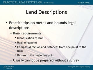
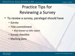
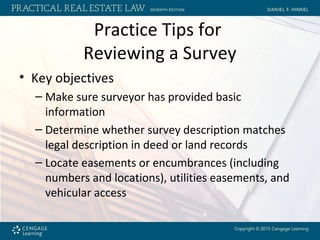
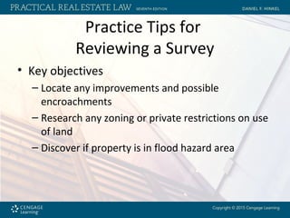
Chapter 3
Surveys and Land Descriptions
Objectives
• After reading this chapter, you should be able
to
– Read and understand three types of legal
descriptions.
• Government rectangular survey description
• Platted description
• Metes and bounds description
Objectives
• After reading this chapter, you should be able
to
– Review surveys.
– Review a land survey for the accuracy of a legal
description.
– Prepare a legal description from a land survey.
The Survey
• Surveyor evaluates real property to locate
physical limits of a particular parcel of land
• Surveyor uses physical field evidence, written
record evidence, and field measurements
• Surveyor forms opinion as to property lines
• Surveyor prepares map (plat)
– Known as a survey
The Survey
• Boundary survey
– Boundaries of land in question and physical
description
• As-built survey
– Locates all physical improvements and natural
features
• Includes easements and setbacks
The Survey
• Survey should provide paralegal with the
following:
– State, county, land district, and section where the
property surveyed is located
– Indication of which direction on the survey is
north
– Point of beginning for land description
The Survey
• Survey should provide paralegal with the
following:
– Courses and distances for each property line
– Name of surveyor
– Scale for distances not shown on the survey
– Legend of abbreviations or symbols used
• In most cases
Preparation of Surveys and
Survey Standards
• Surveyors and title insurance companies have
developed standards known as ALTA/ACSM
standards
– Revised in 2011
Preparation of Surveys and
Survey Standards
• When ordering a survey, paralegal should
provide
– Accurate legal description of the property
– Current title insurance commitment
– Copies of all recorded easements, servitudes, and
covenants affecting the property
– Copies of any appurtenant easements
– Names and deed data for all adjacent owners
Land Descriptions
• Government rectangular survey description
– Based on sets of two intersecting hypothetical
lines:
• Principal meridians
– Distance in degrees, minutes, and seconds west of Greenwich
meridian
• Base lines
– Certain number of degrees north of equator
Land Descriptions
• Township or range lines
– Township lines run east and west at 6-mile
intervals parallel with base lines
– Range lines run north and south at 6-mile intervals
parallel with meridians
– Squares of land formed by the intersecting
township lines and range lines are called
townships
Land Descriptions
• Correction lines and guide meridians
– Correction lines
• Because the earth is round, in the United States,
northern boundary lines would be approximately 50 to
200 feet shorter than southern boundary lines
• Correction lines are used to compensate for these
shortages
• Each fourth township line (24 miles) north and south of
a base line is designated as a correction line
Land Descriptions
• Correction lines and guide meridians
– Guide meridians
• Run north and south at 24-mile intervals on either side
of the principal meridian
• Begin at the base line and extend to the first correction
line in either direction
• Are not parallel to the principal meridians or to one
another
Land Descriptions
• Township squares
– Identified by
• Location of a township’s strip where the township is
located
• Designation of range strip
• Name or number of closest principal meridian
Land Descriptions
• Sections
– 36-square-mile township divided into 36 sections
• Each 1-mile square is 640 acres
– Numbered consecutively from 1 to 36
• Beginning at northeast corner of township
– Divided into quarter sections
• Then into halves or quarters
Land Descriptions
• Platted description
– Short-form description of a piece of land by
reference to a recorded survey or plat
– First requirement is that surveyor prepare the plat
– The plat is then recorded in the county where the
land is located
Land Descriptions
• Metes and bounds description
– Sets forth and completely describes boundary
lines of land
– Usually begins with an introduction that locates
the land in a general part of the state
Land Descriptions
• Metes and bounds description
– Each boundary line (“call”) is described by course
and distance
• Course
– Direction the boundary line travels
• Distance
– Length of the boundary line
Land Descriptions
• Curved property lines
– Surveyor should note
• Arc distance of curve
• Radius distance of curve
• Chord course
– A straight line drawn from the beginning point of arc to the
ending point of arc
• Distance of chord
Land Descriptions
• Closure
– Metes and bounds description must close
– Legal description starts at a beginning point,
follows each boundary line by course and
distance, and ends back at the beginning point
– If land description does not close, it is defective
Land Descriptions
• Practice tips on metes and bounds legal
descriptions
– Basic requirements
• Identification of land
• Beginning point
• Compass direction and distances from one point to the
next
• Return to the beginning point
– Usually cannot be prepared without a survey
Practice Tips for
Reviewing a Survey
• To review a survey, paralegal should have
– Survey
– Title commitment
• Also known as title report
– Survey checklist
– Marking pens
Practice Tips for
Reviewing a Survey
• Key objectives
– Make sure surveyor has provided basic
information
– Determine whether survey description matches
legal description in deed or land records
– Locate easements or encumbrances (including
numbers and locations), utilities easements, and
vehicular access
Practice Tips for
Reviewing a Survey
• Key objectives
– Locate any improvements and possible
encroachments
– Research any zoning or private restrictions on use
of land
– Discover if property is in flood hazard area
Ethics: Competency
• ABA Code of Professional Responsibility
provides that a lawyer should represent a
client competently
• Paralegals have a duty to do work diligently
and study whatever is necessary to perform
the work competently
– Ask for help from title companies, surveyors, or
other professionals under supervision of attorney
Summary
• Land survey is critical part of any real estate
transaction
• Surveyor describes boundaries and legal
description of real property, easements,
utilities, access, and improvements
Summary
• Paralegals must have full knowledge of land
descriptions and survey requirements to
better serve clients

LEGL 3485: Hinkel Chapter 3

  • 1.
    Chapter 3 Surveys andLand Descriptions
  • 2.
    Objectives • After readingthis chapter, you should be able to – Read and understand three types of legal descriptions. • Government rectangular survey description • Platted description • Metes and bounds description
  • 3.
    Objectives • After readingthis chapter, you should be able to – Review surveys. – Review a land survey for the accuracy of a legal description. – Prepare a legal description from a land survey.
  • 4.
    The Survey • Surveyorevaluates real property to locate physical limits of a particular parcel of land • Surveyor uses physical field evidence, written record evidence, and field measurements • Surveyor forms opinion as to property lines • Surveyor prepares map (plat) – Known as a survey
  • 5.
    The Survey • Boundarysurvey – Boundaries of land in question and physical description • As-built survey – Locates all physical improvements and natural features • Includes easements and setbacks
  • 6.
    The Survey • Surveyshould provide paralegal with the following: – State, county, land district, and section where the property surveyed is located – Indication of which direction on the survey is north – Point of beginning for land description
  • 7.
    The Survey • Surveyshould provide paralegal with the following: – Courses and distances for each property line – Name of surveyor – Scale for distances not shown on the survey – Legend of abbreviations or symbols used • In most cases
  • 8.
    Preparation of Surveysand Survey Standards • Surveyors and title insurance companies have developed standards known as ALTA/ACSM standards – Revised in 2011
  • 9.
    Preparation of Surveysand Survey Standards • When ordering a survey, paralegal should provide – Accurate legal description of the property – Current title insurance commitment – Copies of all recorded easements, servitudes, and covenants affecting the property – Copies of any appurtenant easements – Names and deed data for all adjacent owners
  • 10.
    Land Descriptions • Governmentrectangular survey description – Based on sets of two intersecting hypothetical lines: • Principal meridians – Distance in degrees, minutes, and seconds west of Greenwich meridian • Base lines – Certain number of degrees north of equator
  • 11.
    Land Descriptions • Townshipor range lines – Township lines run east and west at 6-mile intervals parallel with base lines – Range lines run north and south at 6-mile intervals parallel with meridians – Squares of land formed by the intersecting township lines and range lines are called townships
  • 12.
    Land Descriptions • Correctionlines and guide meridians – Correction lines • Because the earth is round, in the United States, northern boundary lines would be approximately 50 to 200 feet shorter than southern boundary lines • Correction lines are used to compensate for these shortages • Each fourth township line (24 miles) north and south of a base line is designated as a correction line
  • 13.
    Land Descriptions • Correctionlines and guide meridians – Guide meridians • Run north and south at 24-mile intervals on either side of the principal meridian • Begin at the base line and extend to the first correction line in either direction • Are not parallel to the principal meridians or to one another
  • 14.
    Land Descriptions • Townshipsquares – Identified by • Location of a township’s strip where the township is located • Designation of range strip • Name or number of closest principal meridian
  • 15.
    Land Descriptions • Sections –36-square-mile township divided into 36 sections • Each 1-mile square is 640 acres – Numbered consecutively from 1 to 36 • Beginning at northeast corner of township – Divided into quarter sections • Then into halves or quarters
  • 16.
    Land Descriptions • Platteddescription – Short-form description of a piece of land by reference to a recorded survey or plat – First requirement is that surveyor prepare the plat – The plat is then recorded in the county where the land is located
  • 17.
    Land Descriptions • Metesand bounds description – Sets forth and completely describes boundary lines of land – Usually begins with an introduction that locates the land in a general part of the state
  • 18.
    Land Descriptions • Metesand bounds description – Each boundary line (“call”) is described by course and distance • Course – Direction the boundary line travels • Distance – Length of the boundary line
  • 19.
    Land Descriptions • Curvedproperty lines – Surveyor should note • Arc distance of curve • Radius distance of curve • Chord course – A straight line drawn from the beginning point of arc to the ending point of arc • Distance of chord
  • 20.
    Land Descriptions • Closure –Metes and bounds description must close – Legal description starts at a beginning point, follows each boundary line by course and distance, and ends back at the beginning point – If land description does not close, it is defective
  • 21.
    Land Descriptions • Practicetips on metes and bounds legal descriptions – Basic requirements • Identification of land • Beginning point • Compass direction and distances from one point to the next • Return to the beginning point – Usually cannot be prepared without a survey
  • 22.
    Practice Tips for Reviewinga Survey • To review a survey, paralegal should have – Survey – Title commitment • Also known as title report – Survey checklist – Marking pens
  • 23.
    Practice Tips for Reviewinga Survey • Key objectives – Make sure surveyor has provided basic information – Determine whether survey description matches legal description in deed or land records – Locate easements or encumbrances (including numbers and locations), utilities easements, and vehicular access
  • 24.
    Practice Tips for Reviewinga Survey • Key objectives – Locate any improvements and possible encroachments – Research any zoning or private restrictions on use of land – Discover if property is in flood hazard area
  • 25.
    Ethics: Competency • ABACode of Professional Responsibility provides that a lawyer should represent a client competently • Paralegals have a duty to do work diligently and study whatever is necessary to perform the work competently – Ask for help from title companies, surveyors, or other professionals under supervision of attorney
  • 26.
    Summary • Land surveyis critical part of any real estate transaction • Surveyor describes boundaries and legal description of real property, easements, utilities, access, and improvements
  • 27.
    Summary • Paralegals musthave full knowledge of land descriptions and survey requirements to better serve clients