
Recommended
Recommended
More Related Content
Similar to GPC SDI Development Program
Similar to GPC SDI Development Program (20)
Recently uploaded
Recently uploaded (20)
GPC SDI Development Program
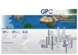
- 1. Environment Intelligence Defense Transportation Security Development Partnerships Human Health Business People Assessment Services Community EconomicBuilding SDI GIS Data Safety Oil Program Nationalization Certification GeoMaturity Technology Government Education Professional Management Resource Capacity Facilities Consulting Enterprise Risk Policies Human Communications GasUtilities Workforce Spatial Data Infrastructure (SDI) Development Program T: +1.909.867.7628 5 East Citrus Ave Suite 205 Redlands, CA 92373, USA T: +971.2.666.6574 PO Box 129060 Abu Dhabi, UAE T: +93.77.719.3003 House 1070, Street 2 Wazir Akbar Khan Kabul,Afghanistan www.thegpcgroup.com GP GroupA Global Network of Information Professionals Middle East&North Africa AfghanistanInternational
- 2. Geospatial Solutions That Matter Bridging Geospatial Information Disconnects The Challenge Today a large portion of the world’s population is interconnected globally and we have access to more information than ever before. The use of networks and information to support visionary, proac- tive, sustainable and resilient communities, organizations and companies is key to our lives, communities and organizations in the 21st Century. However, critical decisions are being made without the needed in- formation. The information either does not exist, is not accessible, is not reliable or its existence is unknown. It is usually distributed among multiple stakeholders that may cross political, geographic, regulatory, industry and economic boundaries and exist in multiple technologies and at various levels of quality and granularity. Often multiple stakeholders spend scarce resources on creating the same data, thus wasting time and money. Often stakehold- ers make uninformed decisions, simply because they do not know about the existence of the needed data in another organization. The Solution The GPC Group has developed effective and practical methods for the planning, design and implementation of Spatial Data Infrastruc- ture (SDI) and GIS Federations in different geographic and organi- zational contexts. The SDI’s focus and reach is scalable to the size and scope of the concerned community. The SDI may be Local, National, Regional, or Global in reach, and at the same time may have a very broad scope, such as all aspects of Government or specific scope related to a particular industry or business ecosystem. SDI provides a framework for information sharing between the various stakeholders that comprise any geographic or institutional community. The SDI framework addresses the following elements: Policies, Standards, Data, Procedures,Technology, Legal, Commu- nity, People, Partnerships. The Benefits The GPC Group Spatial Data Infrastructure (SDI) Development Program delivers the following benefits: • Provide tools, methods and procedures for sharing of information, while reducing redundancy. • Reduce the cost of data collection, maintenance and access. • Provide better access to current, reliable and accurate data. • Support better coordinated planning and operating. • Provide decision makers with a common view of the existing situation, trends and future projections. • Make better informed decisions about key issues that impact Society, Economy, Security and the Environment. The GPC Group Spatial Data Infrastructure (SDI) Development Program The GPC Group Spatial Data Infrastructure (SDI) Development Program ad- dress all elements needed for the creation and management of a complete SDI program, which is then customized to meet the needs of each SDI engage- ment. The program includes the following major elements: • Rapid Readiness Assessment The GPC Group conducts brief but highly intensive sessions to assess the overall readiness of a given community for the development of Spatial Data Infrastructure. This includes an evaluation of the existing institu- tional and technical environments, capacity issues, clear identification of potential barriers and opportunities for effective SDI implementation, and the identification of clear steps in a practical and effective way forward. • International Development Financing The GPC Group works closely with international development finance organizations to match project and organizational needs to lenders or granting agency portfolios Depending on the situation this may include multilateral development banks, bilateral development aid agencies, sovereign funds, foundations, foreign direct investment establishments and private sector banks. • Master Plan The GPC Group develops comprehensive SDI master plans to provide structured focus from the very start of the SDI implementation process and ensure that initial efforts are immediately effective, while remaining flexible and extensible to meet future needs. • Stakeholder Survey The GPC Group conducts in-depth interviews to identify the various aspects of the organization that have a direct bearing on the adoption of geospatial technologies. Such interviews focus on the overall mandate,business functions,data,systems, human capacity, and issues, opportunities and constraints. • Data Inventory During the interviews, the GPC Group pay particular atten- tion to inventory all relevant types of data across the differ- ent stakeholders, collecting samples where necessary, and establish an initial metadata database. Further work will assess issues of redundancy, gaps, content, accuracy, currency and related aspects. • Requirements Assessment The GPC Group synthesizes information identified in the survey into a comprehensive set of requirements crossing all concerned stakeholders, covering business functions, data, software applica- tions, technology infrastructure, human capacity, and institutional/ organizational requirements such as policy, legal, governance or financial needs. • Strategic Plan The GPC Group provides a consolidated perspective for the Spatial Data Infrastructure initiative on the vision mission, guiding principles, goals and prioritization of the requirements, and general implementation approach. • Program Design The GPC Group designs the Spatial Data Infrastructure program, defining the detailed business, technical application software, data, computing infrastructure, and staff capacity, and institutional (poli- cies, procedures, standards, and governance) elements required to attain the strategic goals. • Operation Plan The GPC Group prepares the operational framework that will be required to support an SDI program implementation, covering the establishment of different governance structures, operational teams, change management, and other required processes and activities to support the program design. • Implementation Plan The GPC Group identifies the implementation activities required to achieve the strategic plan according to the program design and operations plan, reflecting the set priorities, and distinguish the activities that a central coordination entity would lead versus those led by other stakeholder entities. • Implementation Support The GPC Group mobilizes dedicated and specialized teams to support the implementation of a Spatial Data Infrastructure program starting with the initial establishment through to the institutionalization and later monitoring stages. • Capacity Development The GPC Group Geospatial Information Technology and Services (GITS) Professional Development program is designed to build the human resource capacity of organizations and develop individuals through training and mentoring programs. GP GroupA Global Network of Information Professionals