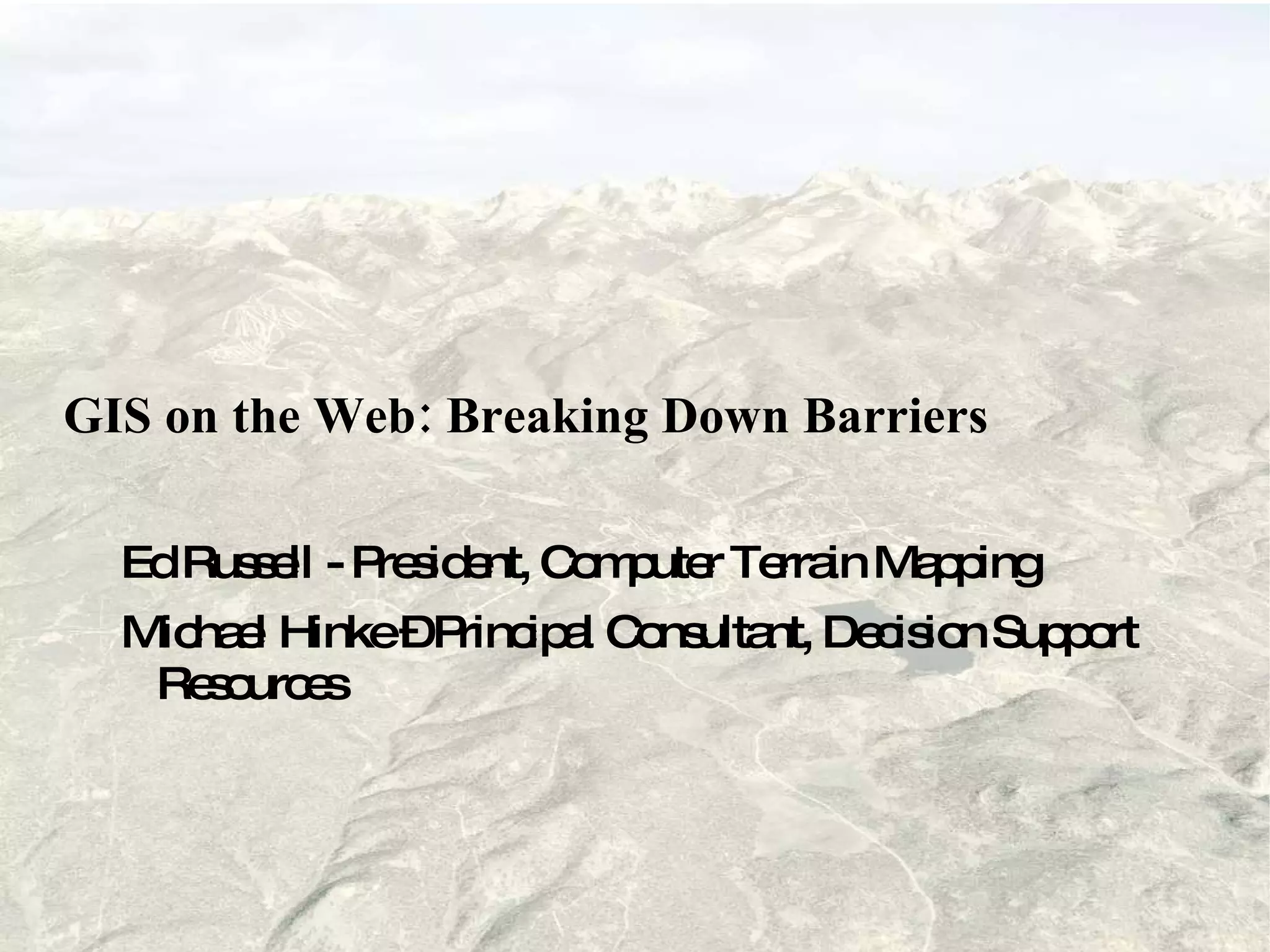
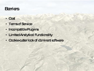
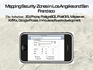
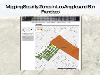
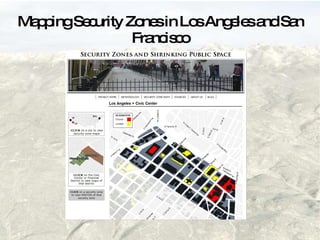
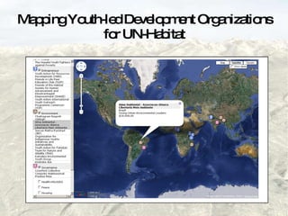
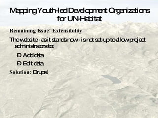
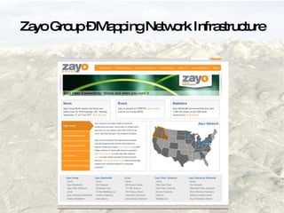
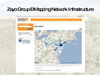
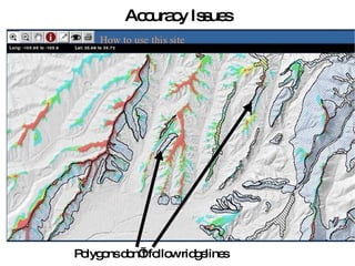
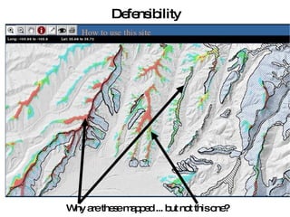
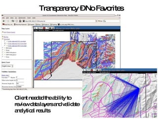
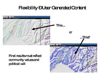
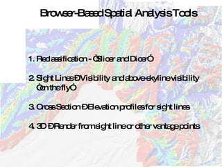
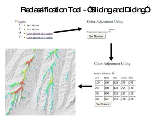
GIS on the Web: Breaking Down Barriers Ed Russell - President, Computer Terrain Mapping Michael Hinke – Principal Consultant, Decision Support Resources
Barriers  Cost Terms of Service Incompatible Plug-ins Limited Analytical Functionality Cookie-cutter look of dominant software
Mapping Security Zones in Los Angeles and San Francisco Barriers: Client inexperience Data collection Data QA/QC  Satellite Coverage Small budge t
Mapping Security Zones in Los Angeles and San Francisco Requirements: Open: results available on the WWW, Accurate: spatially and temporally, Extensible: website is set-up to let people add data from other cities,  Defensible: methods must withstand rigor of peer review
Mapping Security Zones in Los Angeles and San Francisco  The Solution:  3G iPhone, PostgreSQL/PostGIS, Mapserver, XifPix, Google Picasa, in-house software development
Mapping Security Zones in Los Angeles and San Francisco
Mapping Youth-led Development Organizations for UN-Habitat Barriers: International audience of decision-makers Plug-ins Data QA/QC  Terms of Service Budget
Mapping Youth-led Development Organizations for UN-Habitat Requirements: Open: results available to decision-makers (wherever they may be), Accurate: spatially, Extensible: website is set-up to let project administrators add and QA/QC data.
Mapping Youth-led Development Organizations for UN-Habitat
Mapping Youth-led Development Organizations for UN-Habitat Remaining Issue: Extensibility  The website - as it stands now - is not set-up to allow project administrators to: Add data Edit data Solution:  Drupal
Zayo Group – Mapping Network Infrastructure Barriers: Users located all over the United States
Zayo Group – Mapping Network Infrastructure Requirements: Open: maps available to anyone Accurate: spatially (roughly) and temporally Extensible: website is set-up to be extended to other business groups and to allow a variety of people to update the kml
Zayo Group – Mapping Network Infrastructure
Santa Fe Escarpment Re-Mapping Barriers to Overcome 1. Long distance client 2. Iterative process 3. Need for end user validation 4. Requires unique web-based analytical capabilities
Santa Fe Escarpment Re-Mapping Requirements 1. Accurate: Old zone had misaligned polygons 2. Defensible: Analytical foundation; acceptable methodology 3. Transparent: Access to data layers; validation tools 4. Flexible: Needs to adapt to community values and political will
Accuracy Issues Polygons don’t follow ridgelines
Defensibility Why are these mapped ... but not this one?
Transparency – No Favorites Client needed the ability to review data layers and validate analytical results
Flexibility – User Generated Content This ... ...This? or Final results must reflect community values and political will
Browser-Based Spatial Analysis Tools 1. Reclassification - “Slicer and Dicer” 2. Sight Lines – Visibility and above-skyline visibility “ on the fly” 3. Cross Section – Elevation profiles for sight lines 4. 3D – Render from sight line or other vantage points
Reclassification Tool - “Slicing and Dicing”
Slice and Dice – Part 2
Sight Line Tool – Viewsheds and Skylines
Cross Section Tool Elevation profile from selected sight line
3D Visualization – Browser Based
Summary of Solutions Leveraging Open Source software, APIs, and EdWare  Server-side analysis – reduces reliance on plug-ins/client-side technology Rolling our own to meet the needs of our clients, the results: User generated content  Custom look and feel
Websites Security Zones and Shrinking Public Space:  http://securecities.com Zayo Bandwidth:  http://zayo.com Any Questions?

GIS in the Rockies

  • 1.
    GIS on theWeb: Breaking Down Barriers Ed Russell - President, Computer Terrain Mapping Michael Hinke – Principal Consultant, Decision Support Resources
  • 2.
    Barriers CostTerms of Service Incompatible Plug-ins Limited Analytical Functionality Cookie-cutter look of dominant software
  • 3.
    Mapping Security Zonesin Los Angeles and San Francisco Barriers: Client inexperience Data collection Data QA/QC Satellite Coverage Small budge t
  • 4.
    Mapping Security Zonesin Los Angeles and San Francisco Requirements: Open: results available on the WWW, Accurate: spatially and temporally, Extensible: website is set-up to let people add data from other cities, Defensible: methods must withstand rigor of peer review
  • 5.
    Mapping Security Zonesin Los Angeles and San Francisco The Solution: 3G iPhone, PostgreSQL/PostGIS, Mapserver, XifPix, Google Picasa, in-house software development
  • 6.
    Mapping Security Zonesin Los Angeles and San Francisco
  • 7.
    Mapping Security Zonesin Los Angeles and San Francisco
  • 8.
    Mapping Youth-led DevelopmentOrganizations for UN-Habitat Barriers: International audience of decision-makers Plug-ins Data QA/QC Terms of Service Budget
  • 9.
    Mapping Youth-led DevelopmentOrganizations for UN-Habitat Requirements: Open: results available to decision-makers (wherever they may be), Accurate: spatially, Extensible: website is set-up to let project administrators add and QA/QC data.
  • 10.
    Mapping Youth-led DevelopmentOrganizations for UN-Habitat
  • 11.
    Mapping Youth-led DevelopmentOrganizations for UN-Habitat Remaining Issue: Extensibility The website - as it stands now - is not set-up to allow project administrators to: Add data Edit data Solution: Drupal
  • 12.
    Zayo Group –Mapping Network Infrastructure Barriers: Users located all over the United States
  • 13.
    Zayo Group –Mapping Network Infrastructure Requirements: Open: maps available to anyone Accurate: spatially (roughly) and temporally Extensible: website is set-up to be extended to other business groups and to allow a variety of people to update the kml
  • 14.
    Zayo Group –Mapping Network Infrastructure
  • 15.
    Zayo Group –Mapping Network Infrastructure
  • 16.
    Santa Fe EscarpmentRe-Mapping Barriers to Overcome 1. Long distance client 2. Iterative process 3. Need for end user validation 4. Requires unique web-based analytical capabilities
  • 17.
    Santa Fe EscarpmentRe-Mapping Requirements 1. Accurate: Old zone had misaligned polygons 2. Defensible: Analytical foundation; acceptable methodology 3. Transparent: Access to data layers; validation tools 4. Flexible: Needs to adapt to community values and political will
  • 18.
    Accuracy Issues Polygonsdon’t follow ridgelines
  • 19.
    Defensibility Why arethese mapped ... but not this one?
  • 20.
    Transparency – NoFavorites Client needed the ability to review data layers and validate analytical results
  • 21.
    Flexibility – UserGenerated Content This ... ...This? or Final results must reflect community values and political will
  • 22.
    Browser-Based Spatial AnalysisTools 1. Reclassification - “Slicer and Dicer” 2. Sight Lines – Visibility and above-skyline visibility “ on the fly” 3. Cross Section – Elevation profiles for sight lines 4. 3D – Render from sight line or other vantage points
  • 23.
    Reclassification Tool -“Slicing and Dicing”
  • 24.
    Slice and Dice– Part 2
  • 25.
    Sight Line Tool– Viewsheds and Skylines
  • 26.
    Cross Section ToolElevation profile from selected sight line
  • 27.
    3D Visualization –Browser Based
  • 28.
    Summary of SolutionsLeveraging Open Source software, APIs, and EdWare Server-side analysis – reduces reliance on plug-ins/client-side technology Rolling our own to meet the needs of our clients, the results: User generated content Custom look and feel
  • 29.
    Websites Security Zonesand Shrinking Public Space: http://securecities.com Zayo Bandwidth: http://zayo.com Any Questions?