Download as PDF, PPTX
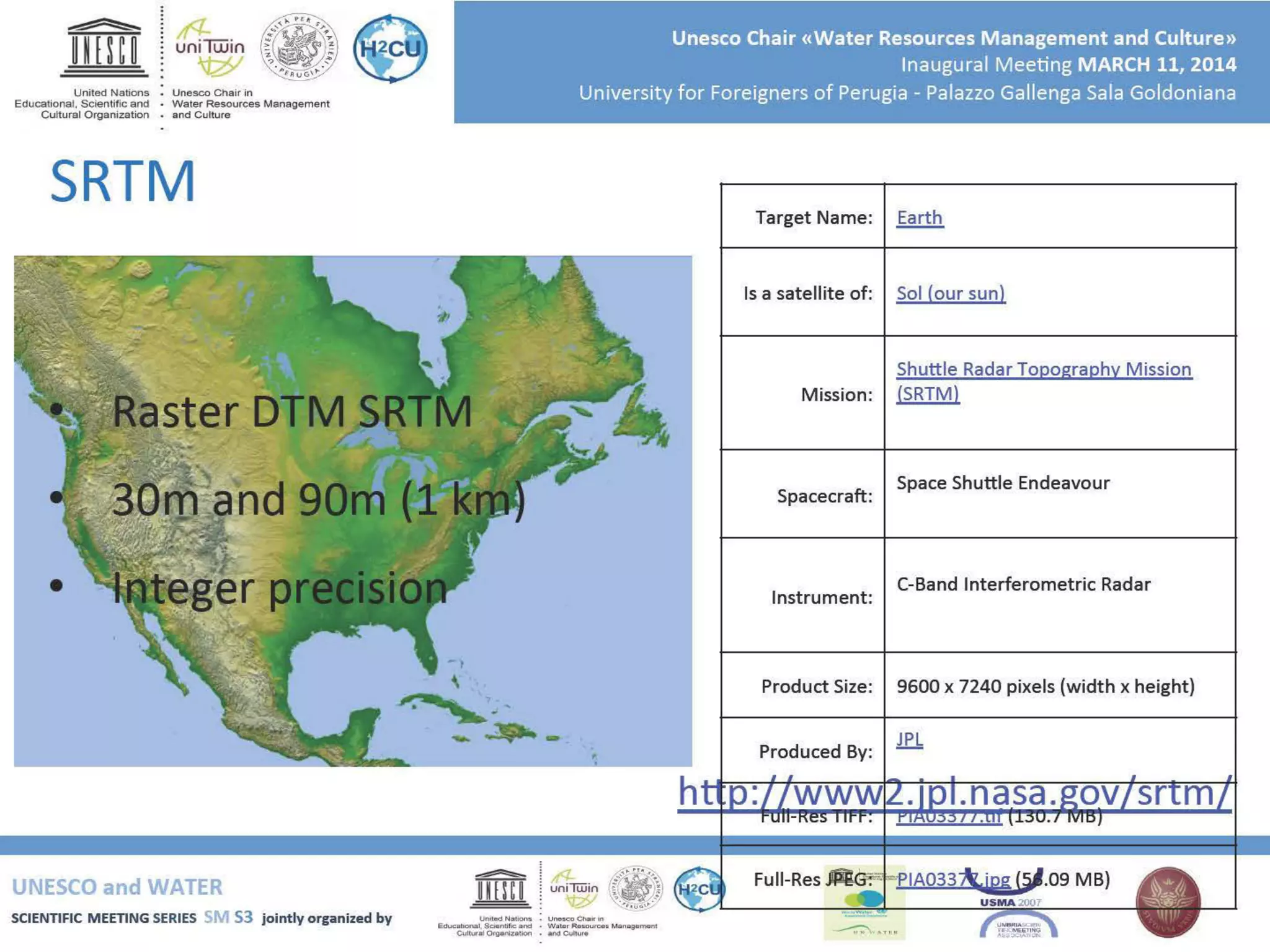
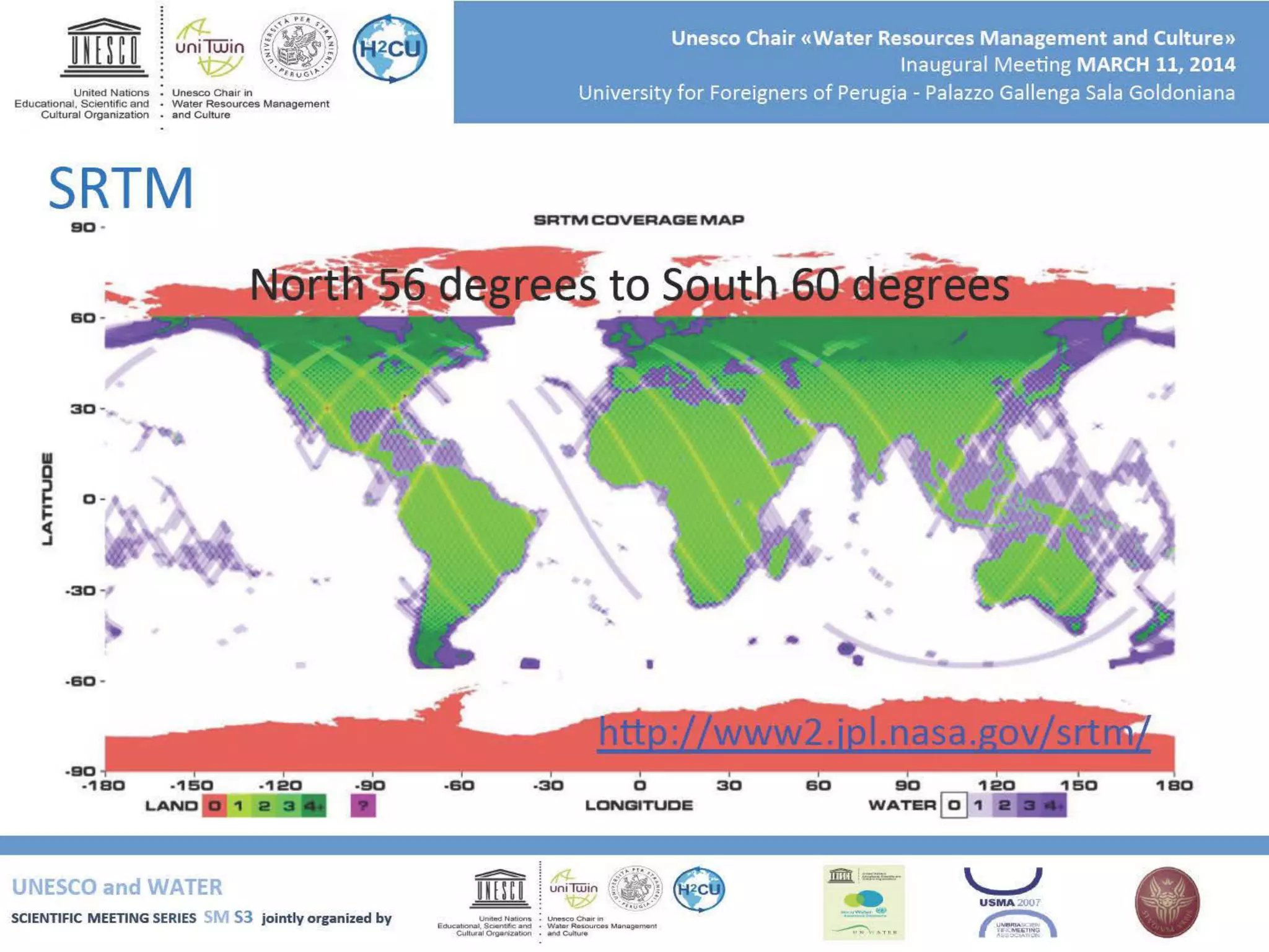
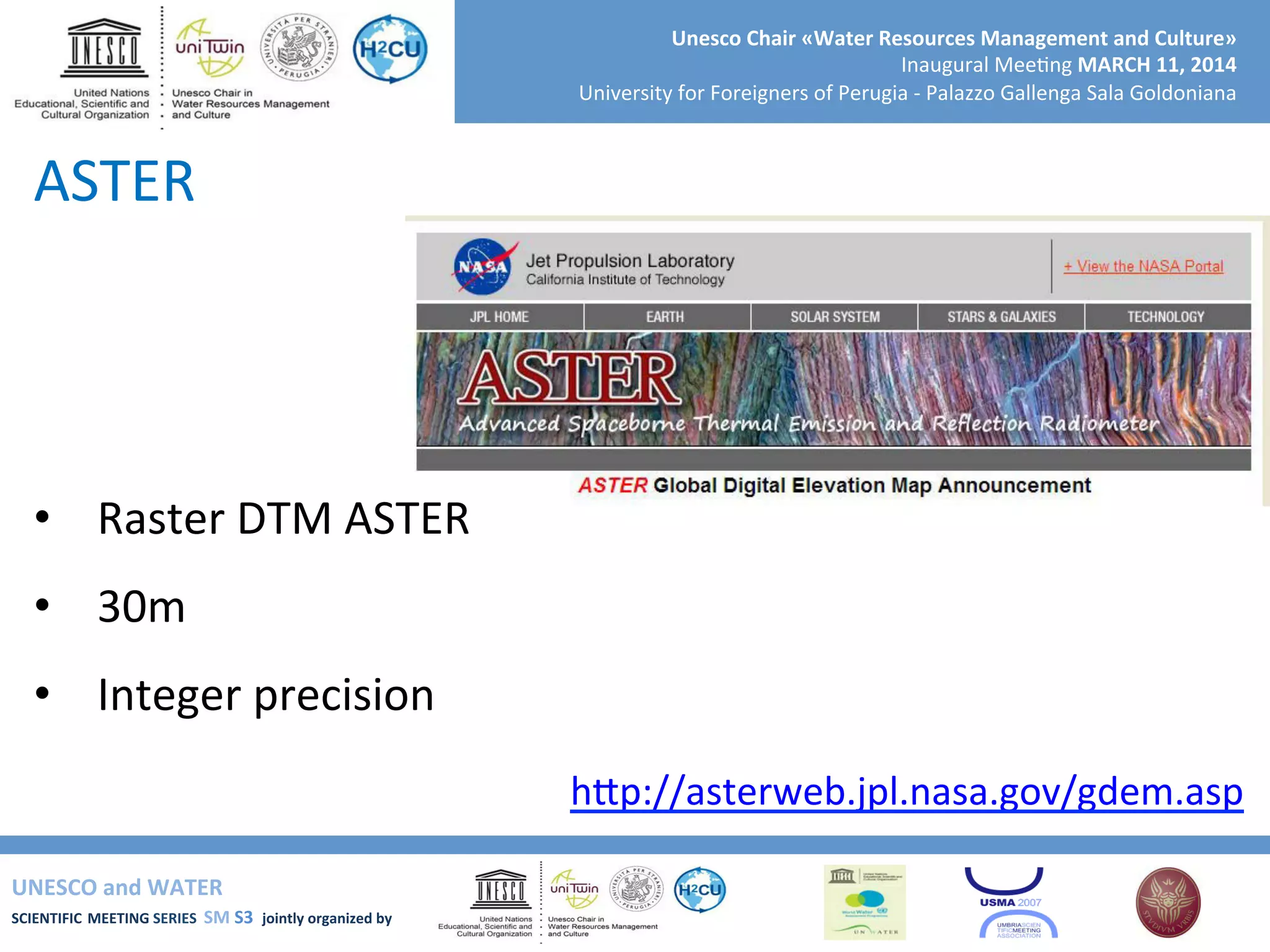
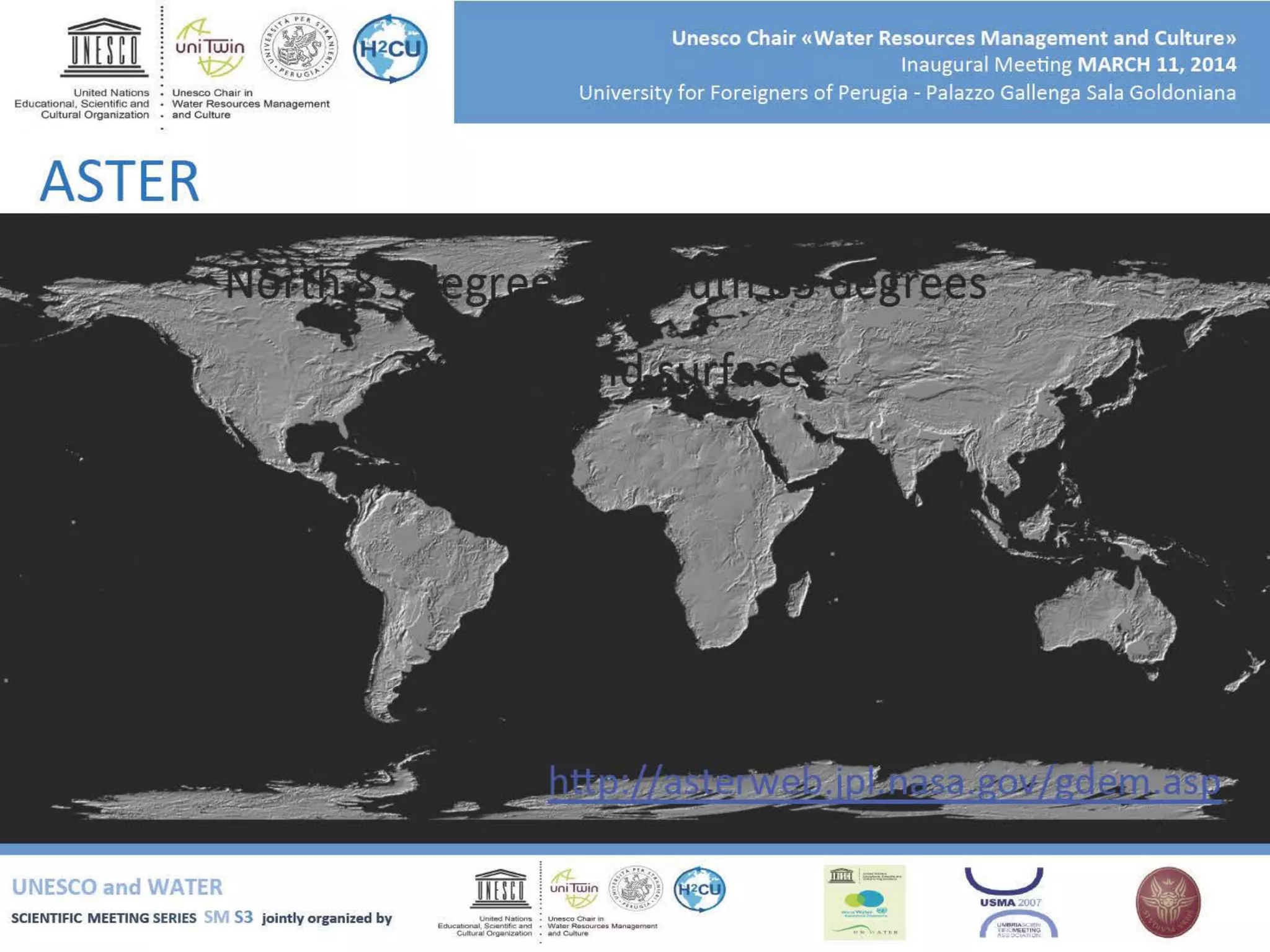
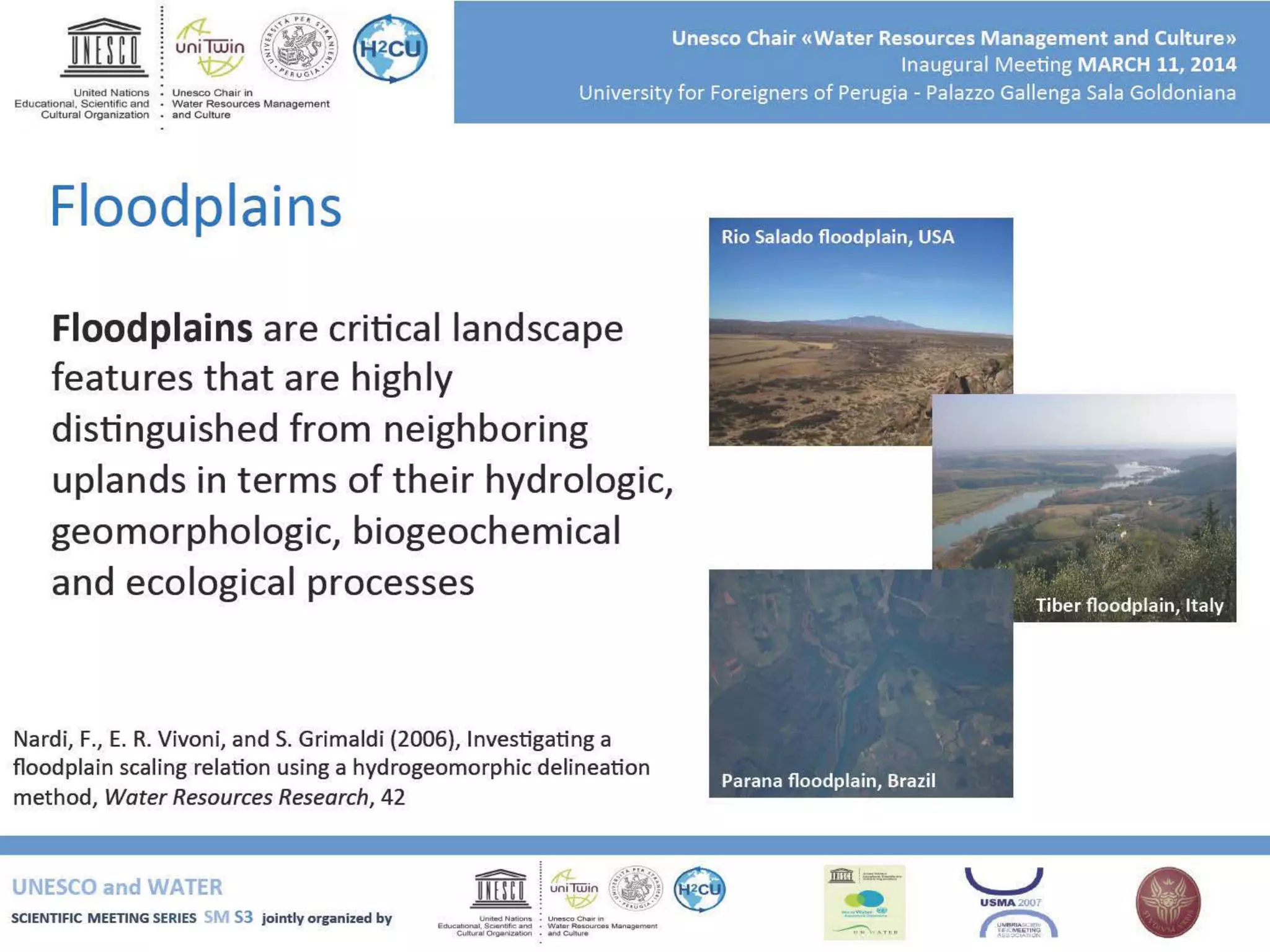
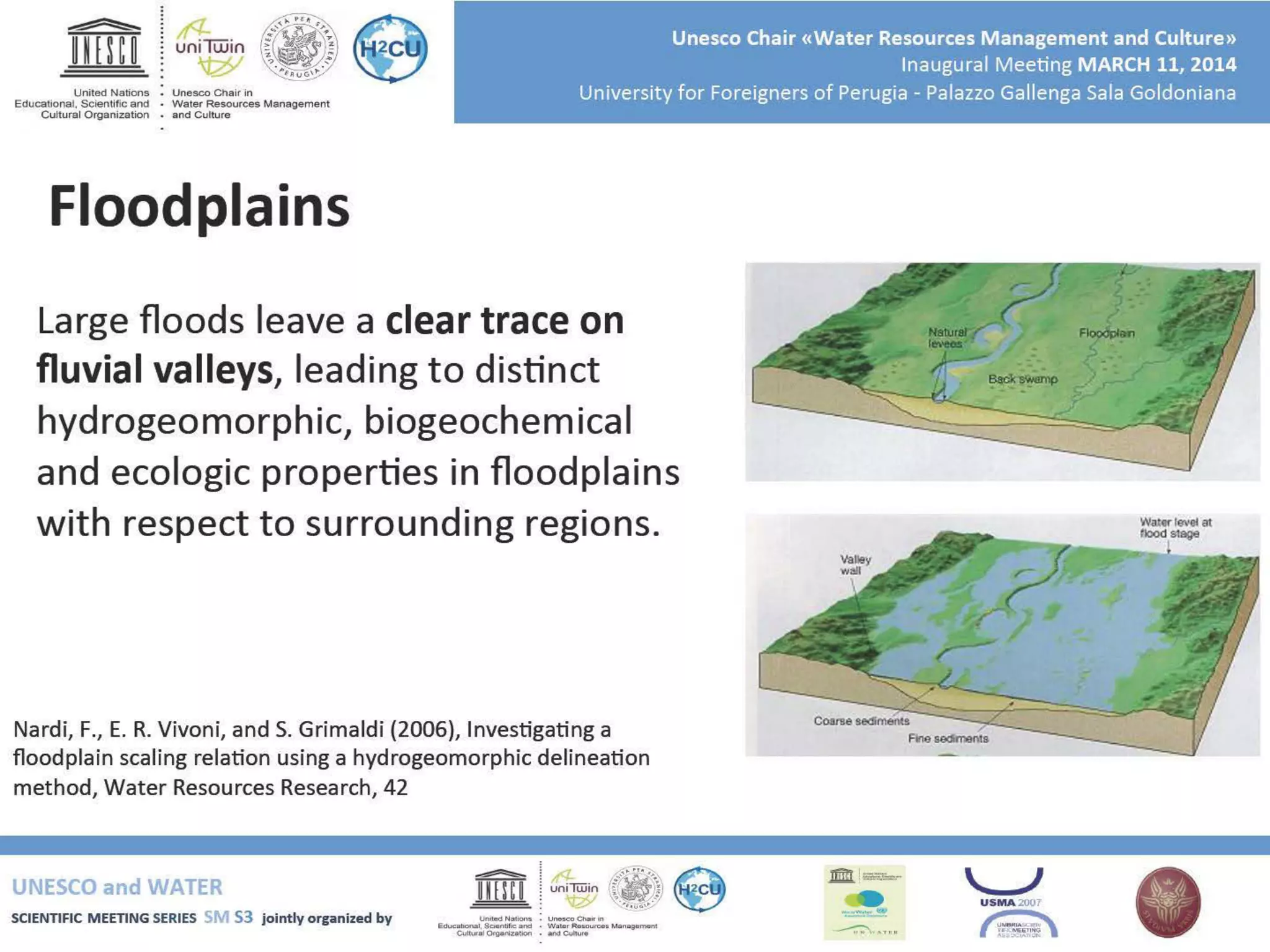
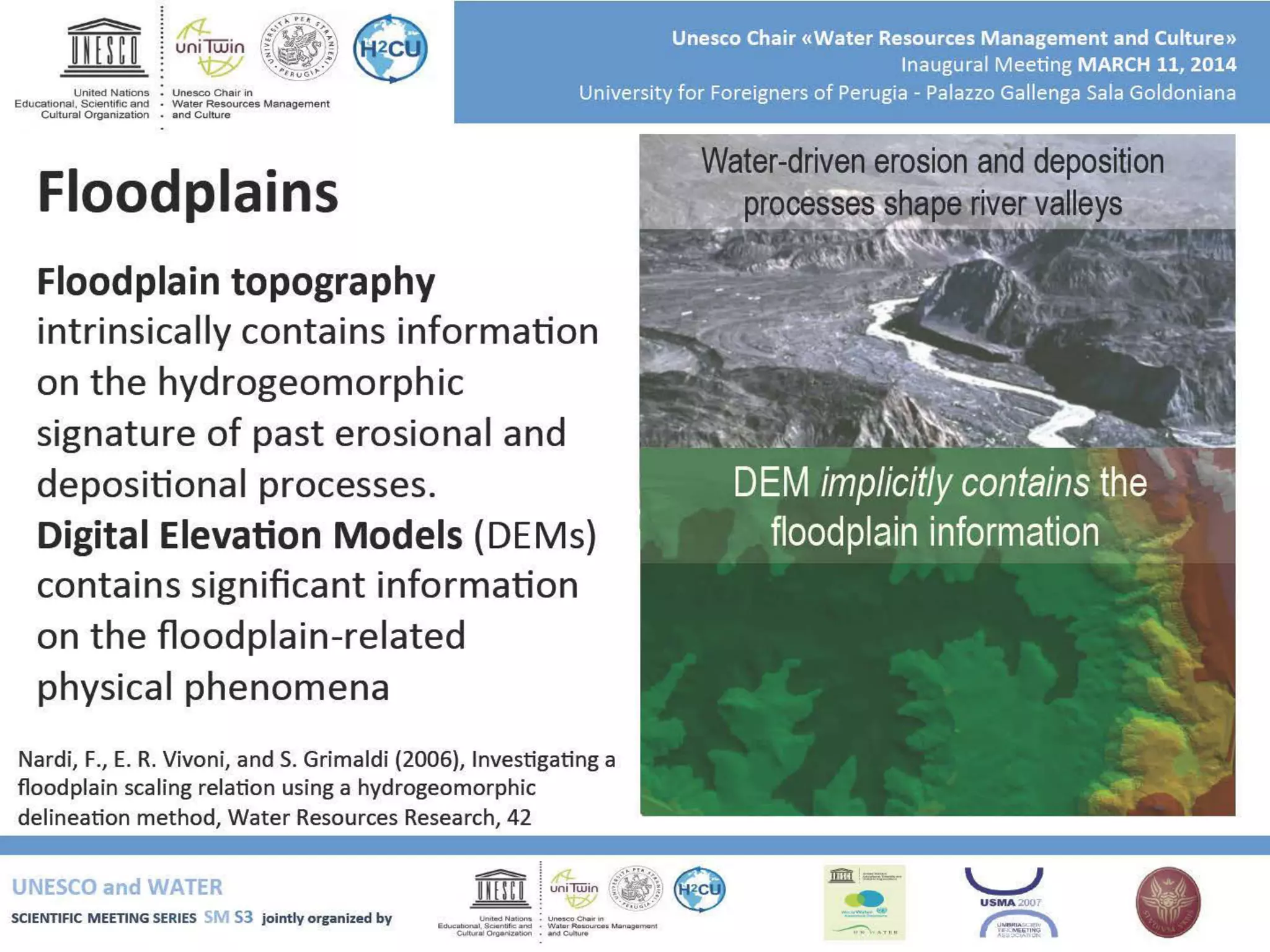
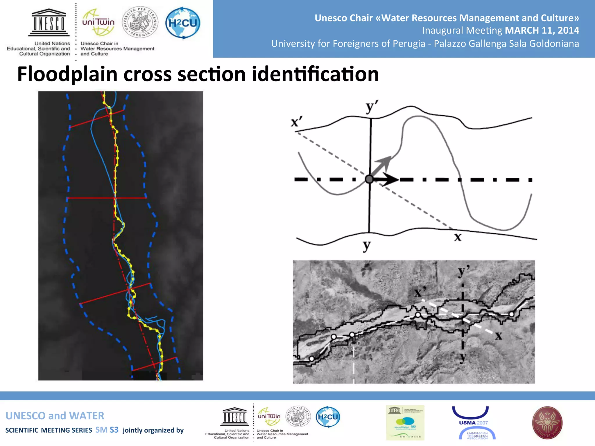
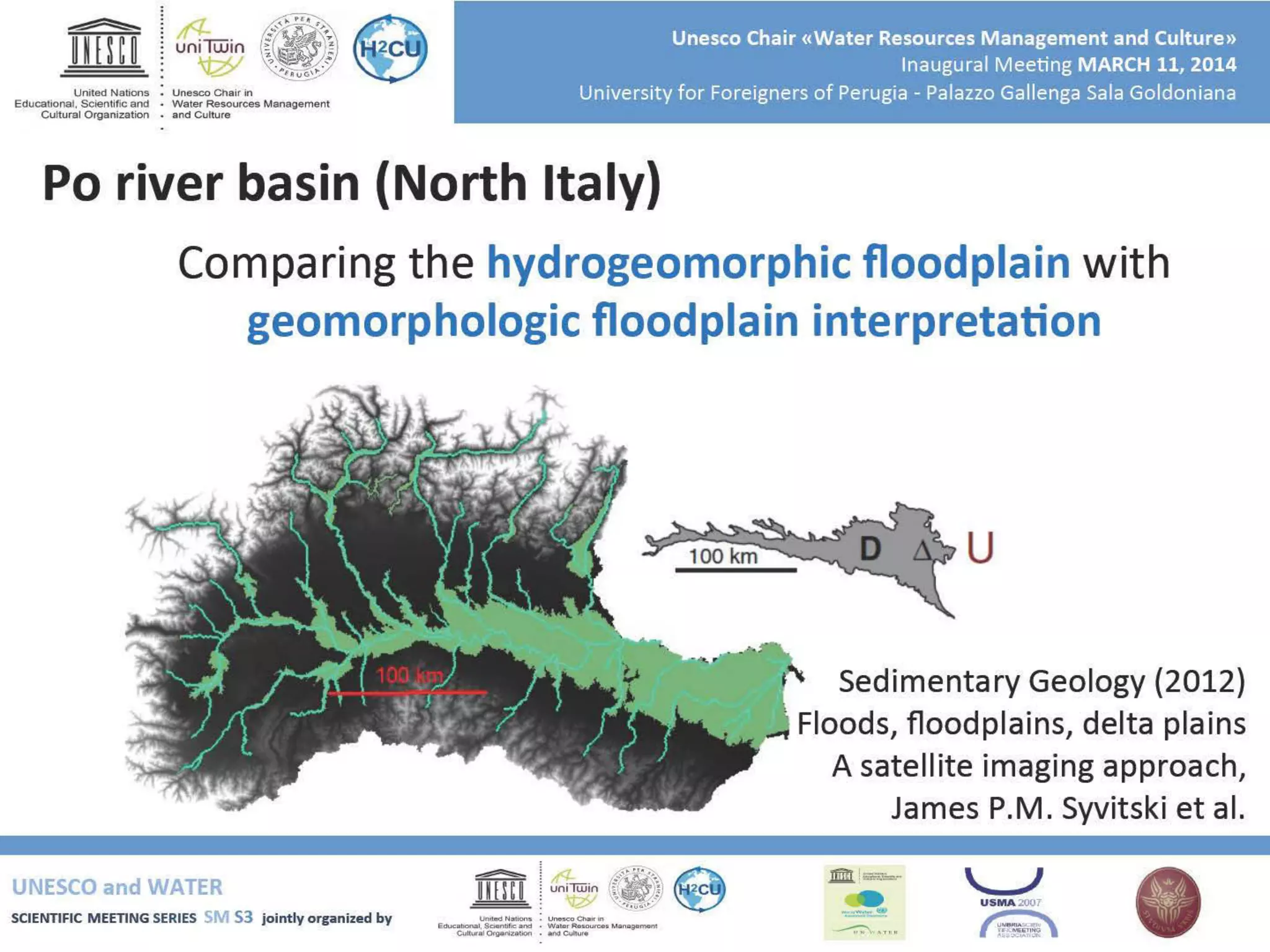
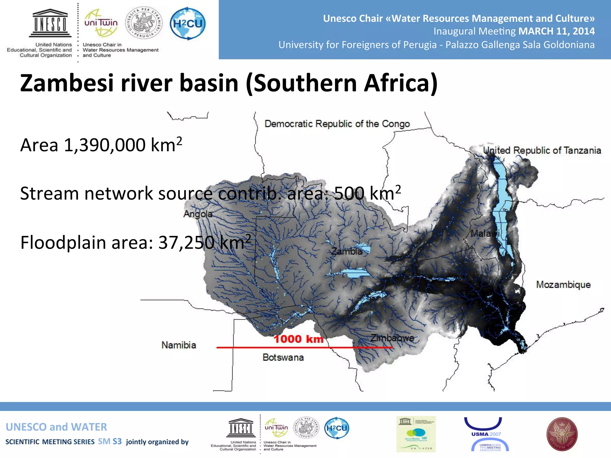
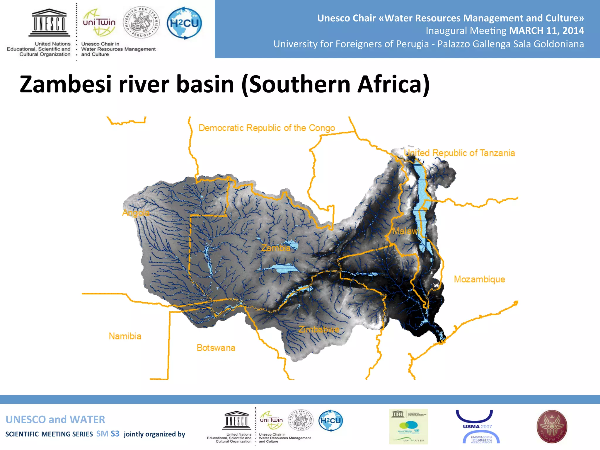
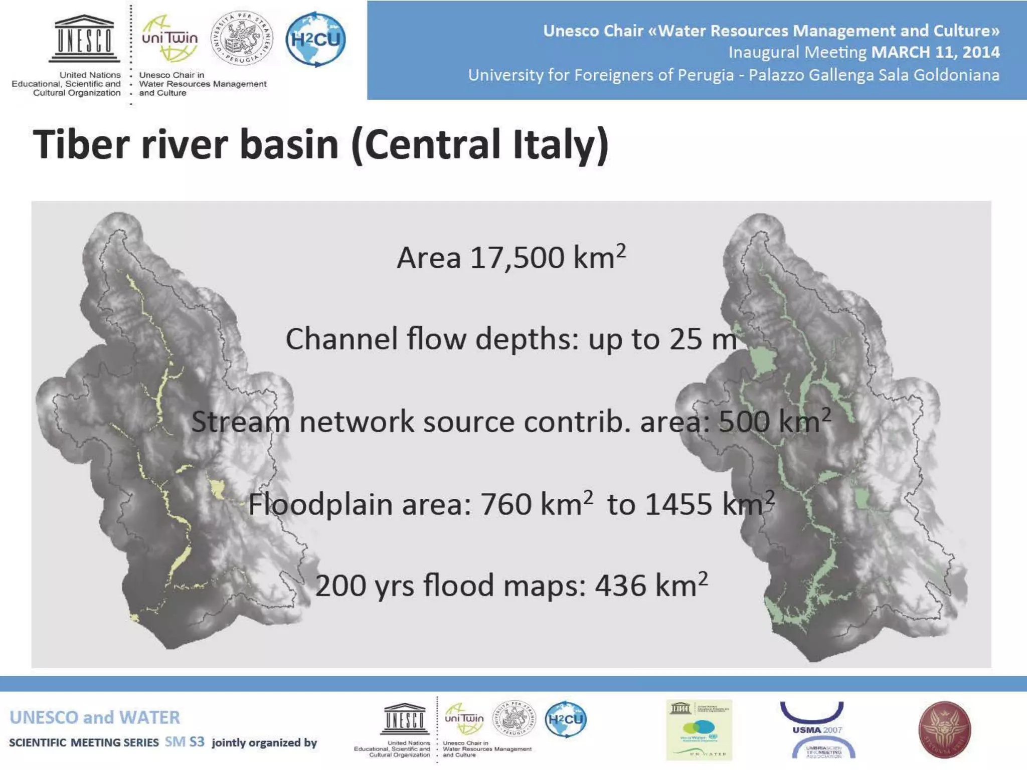
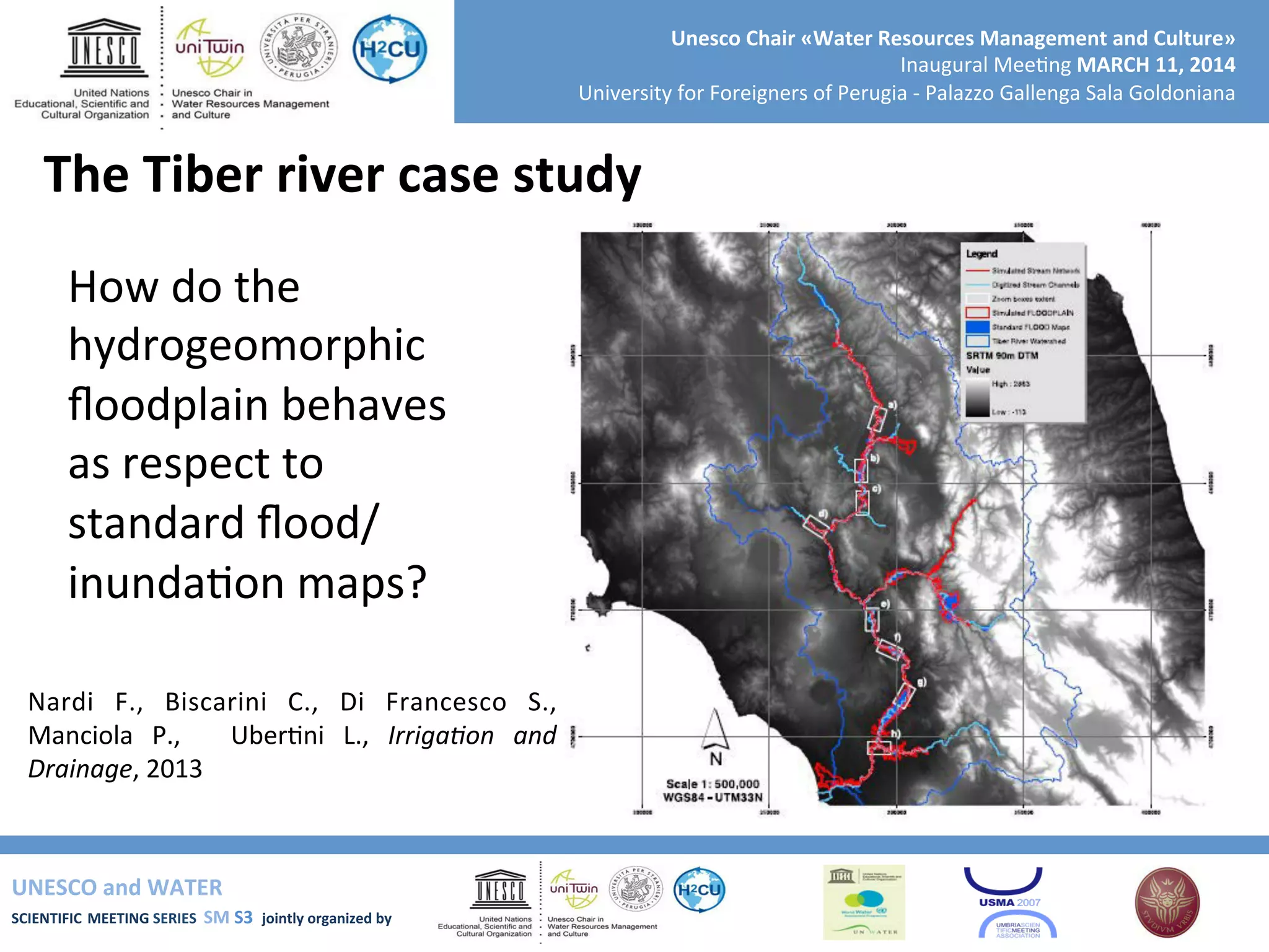
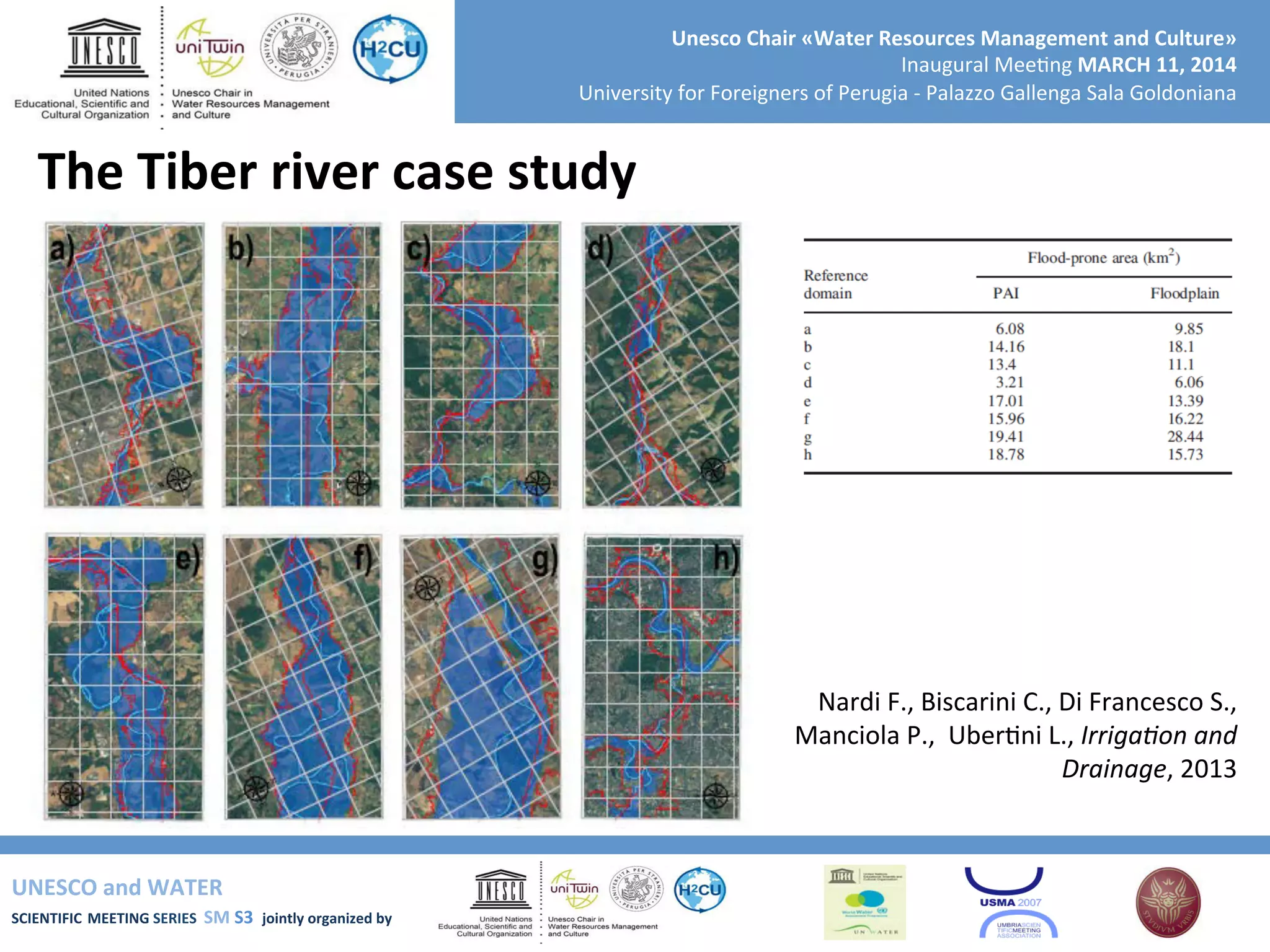
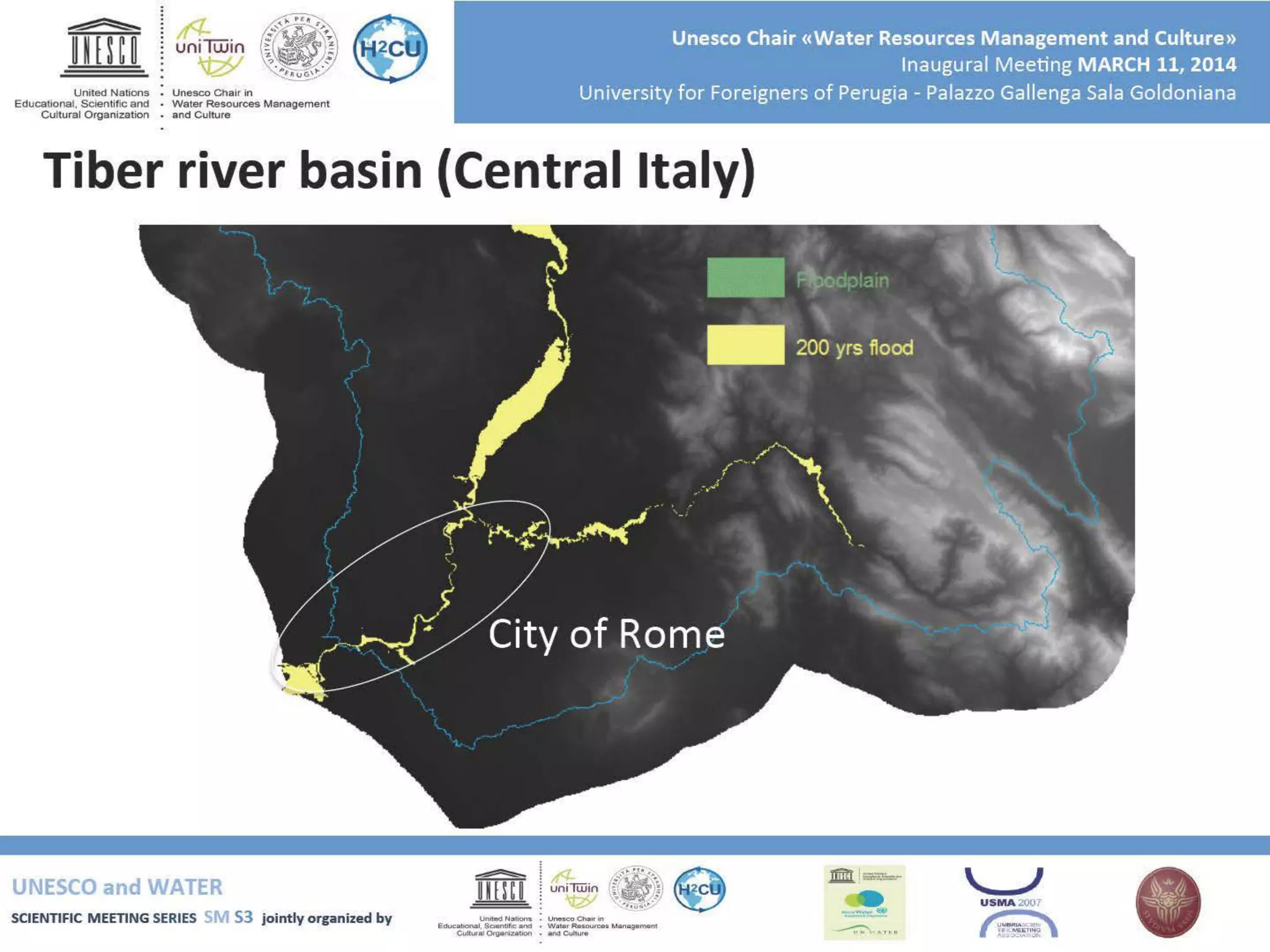
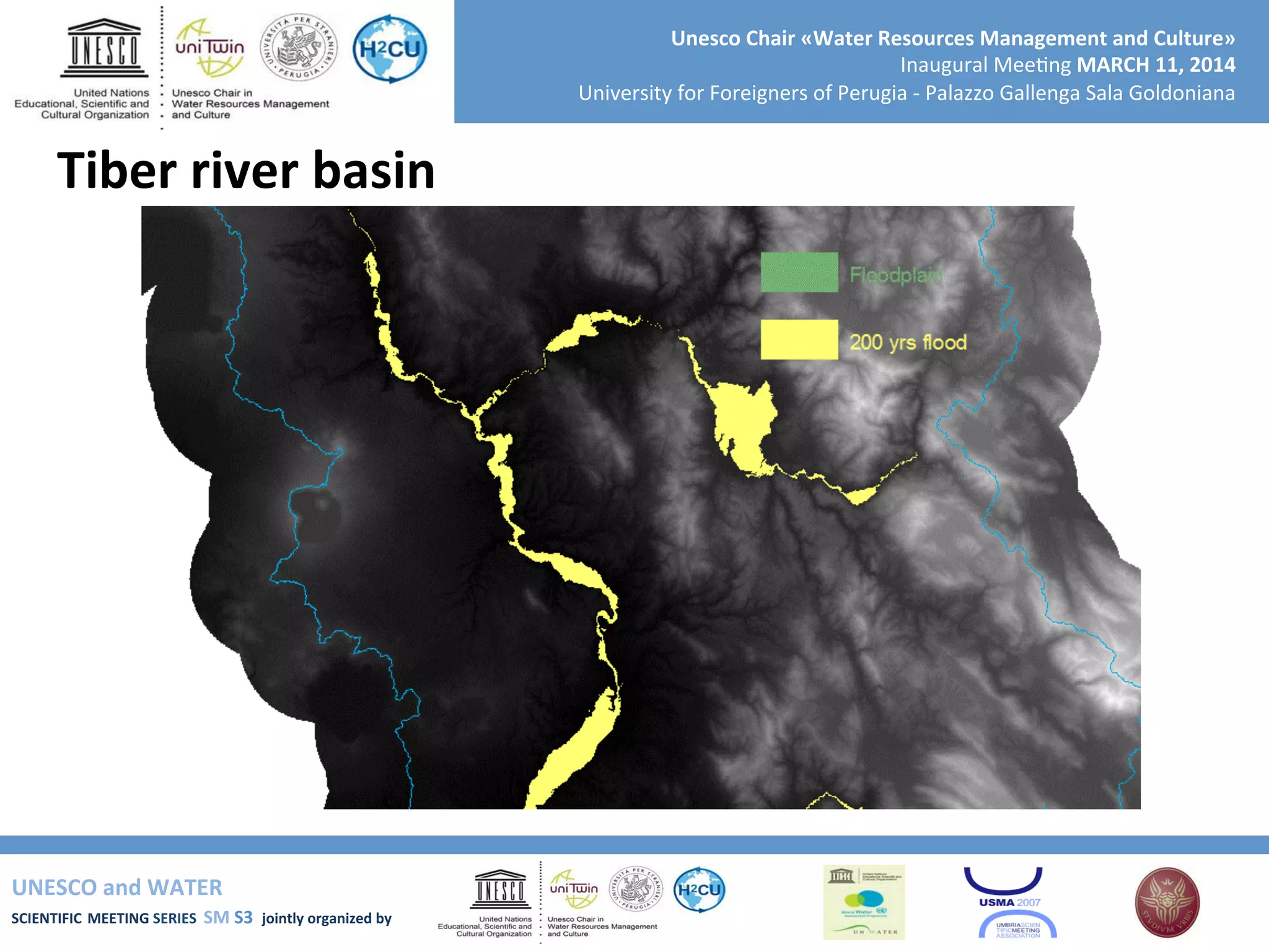
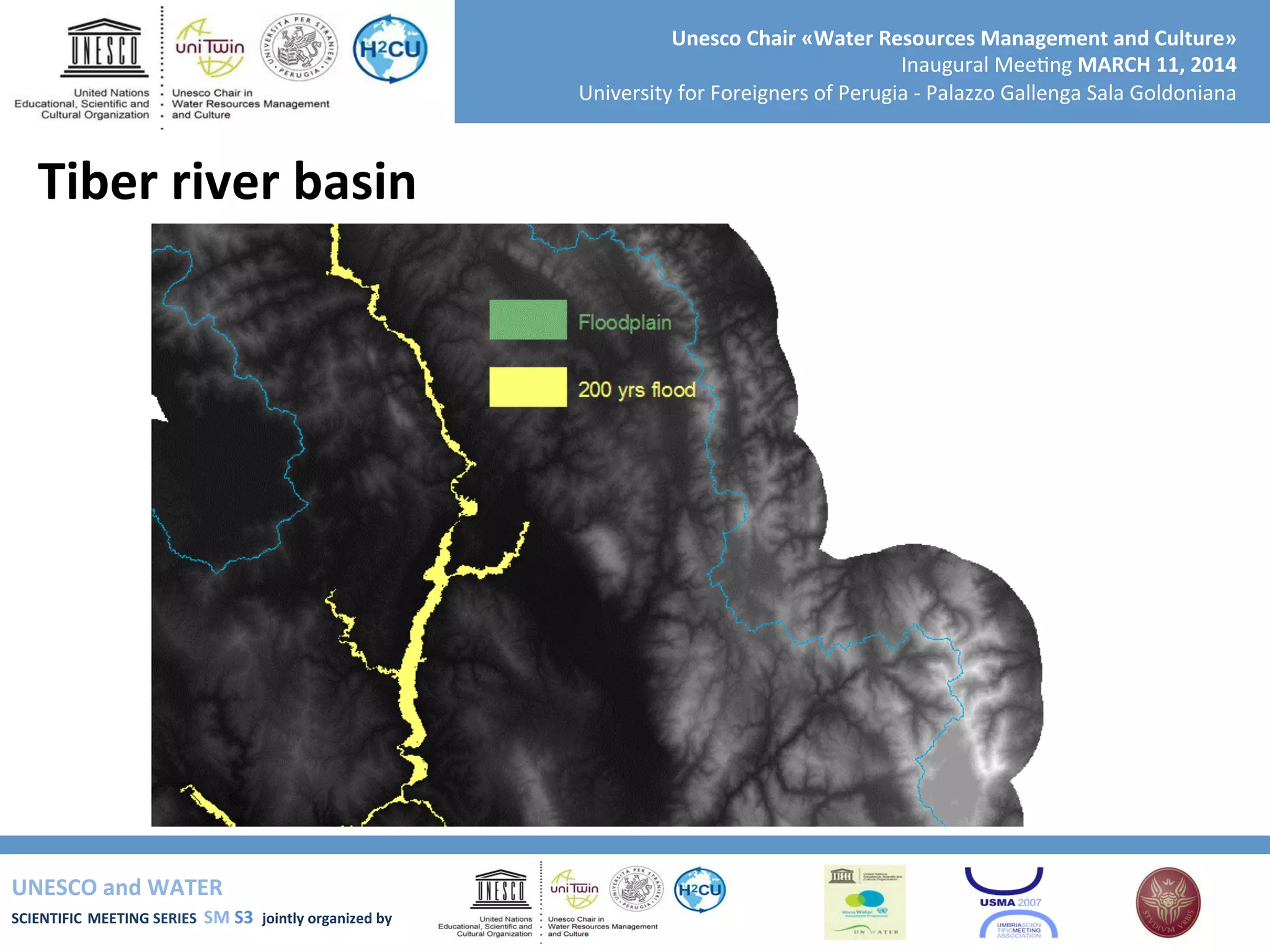
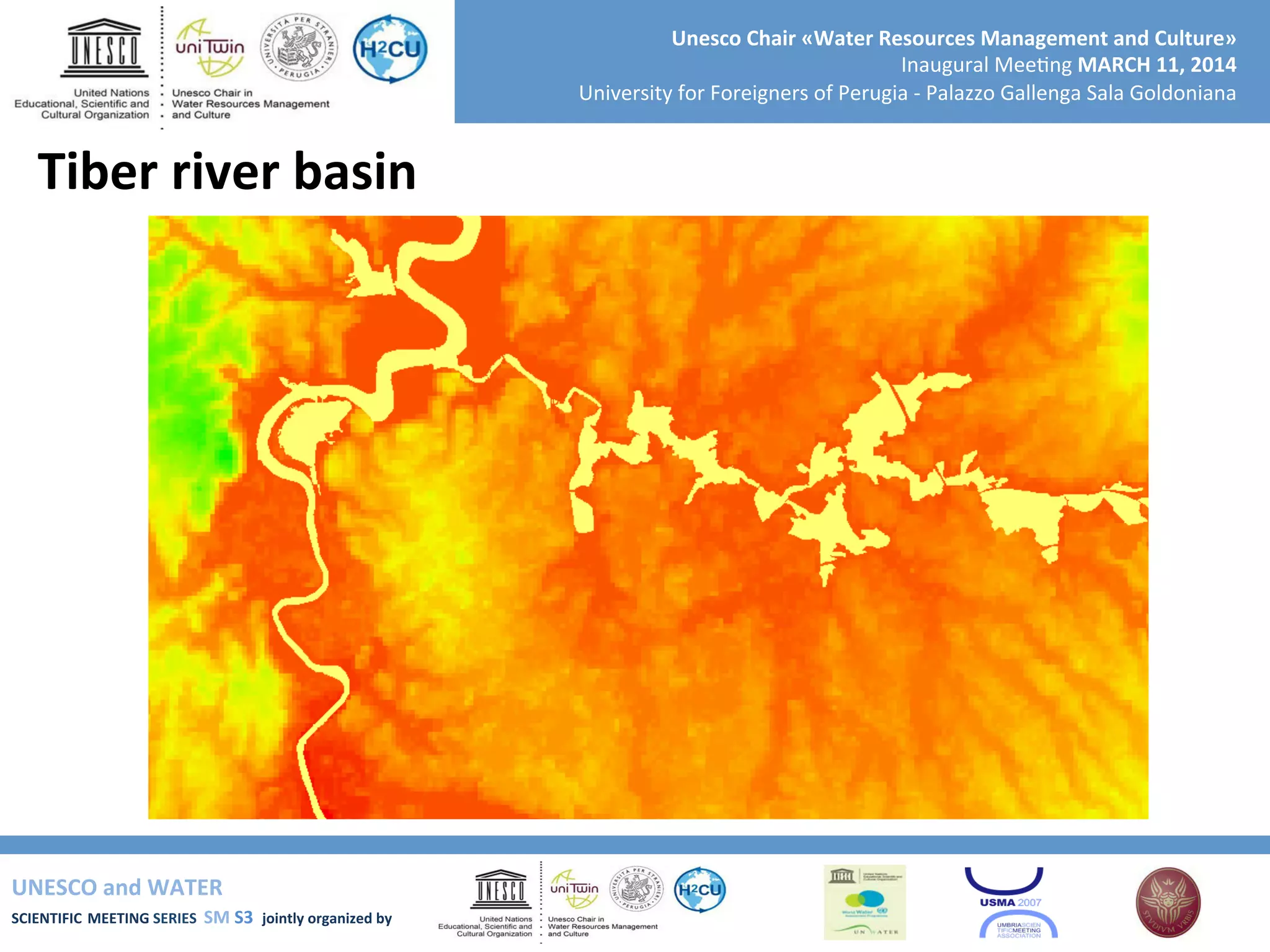
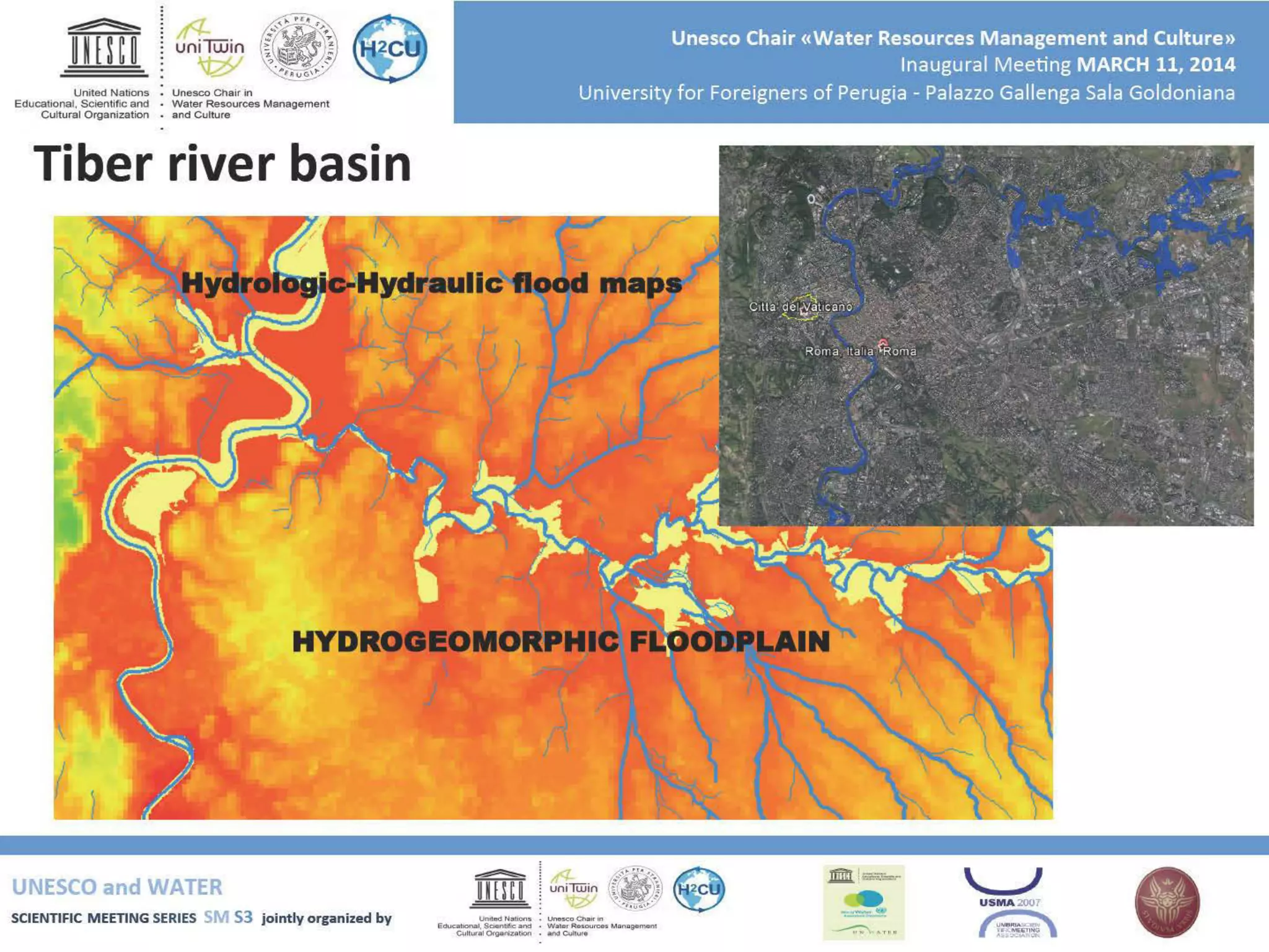
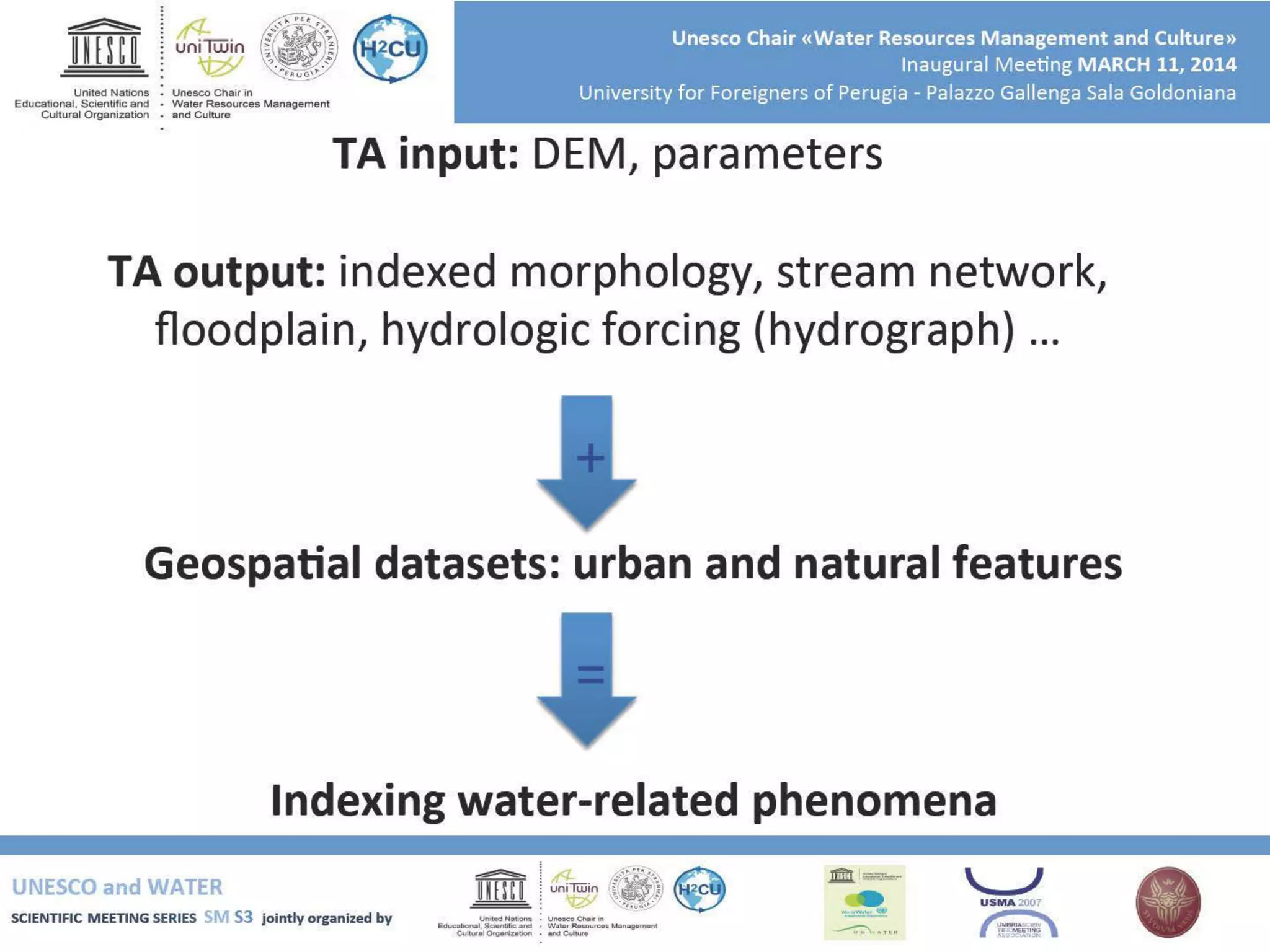
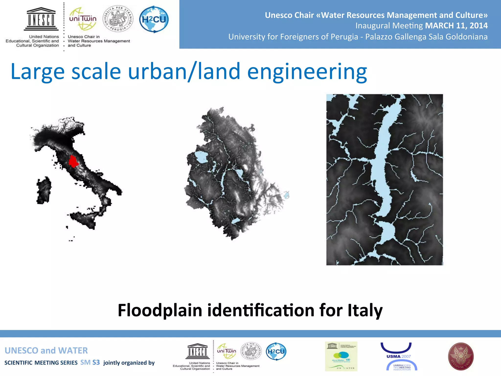
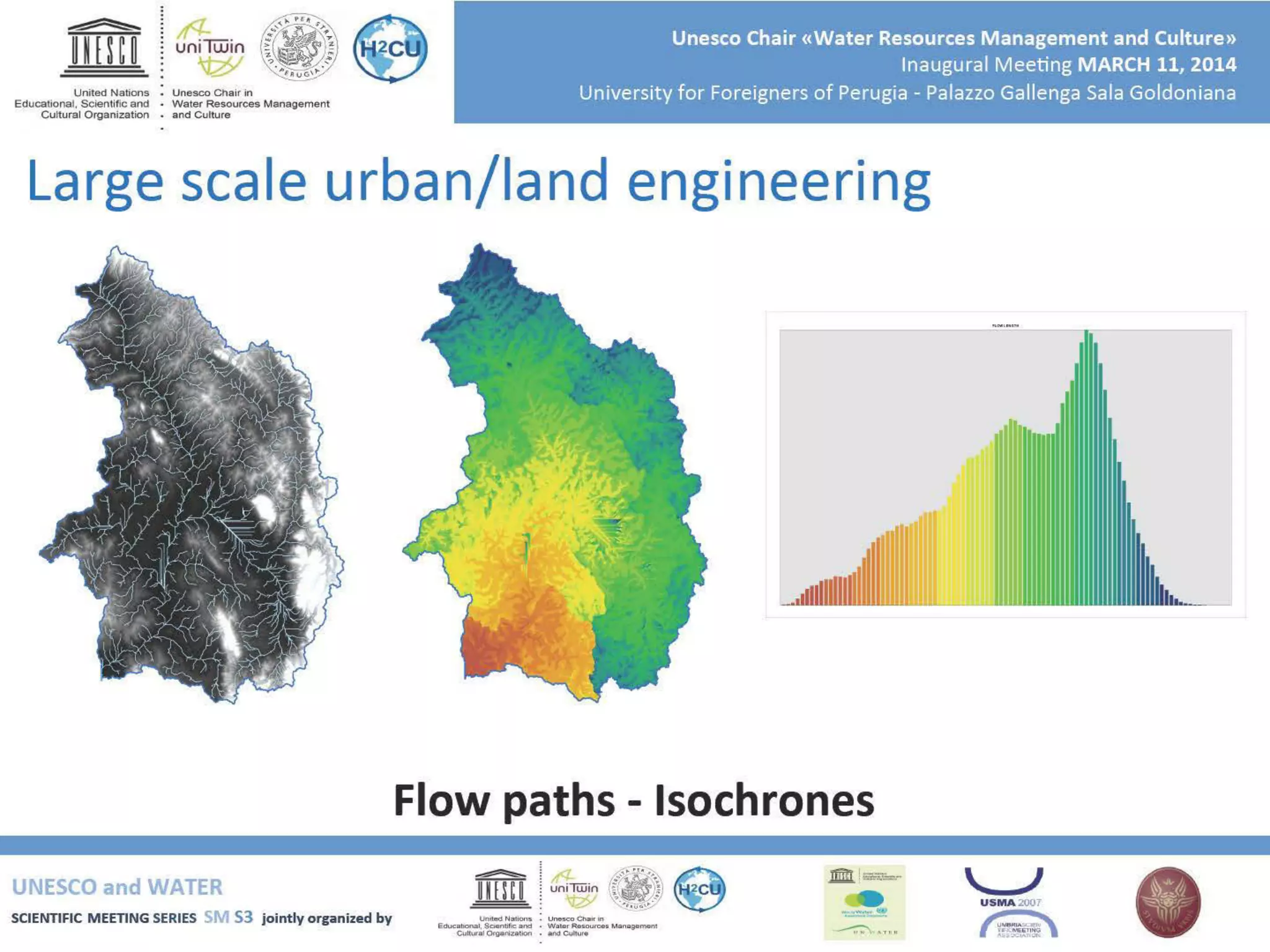
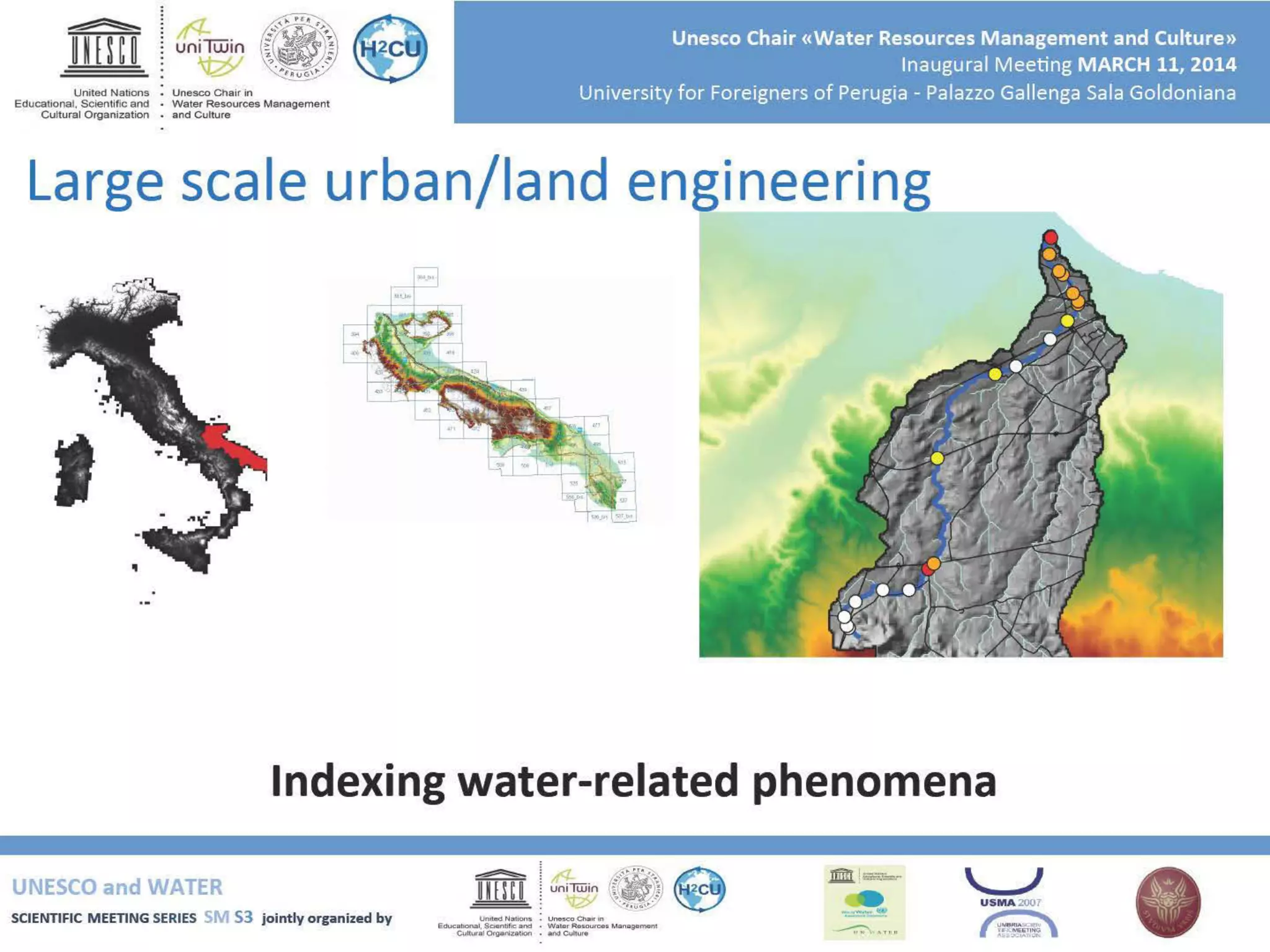
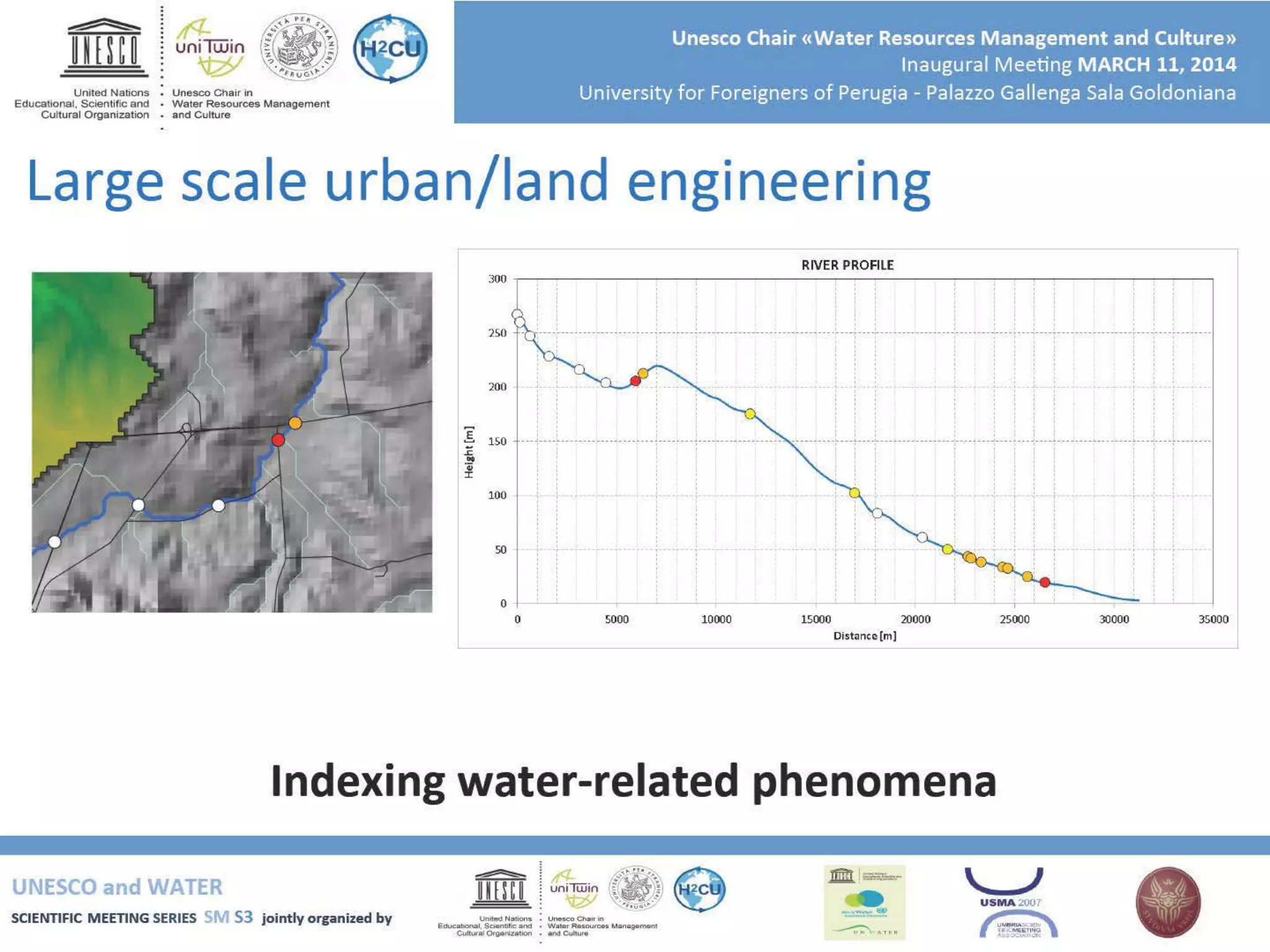
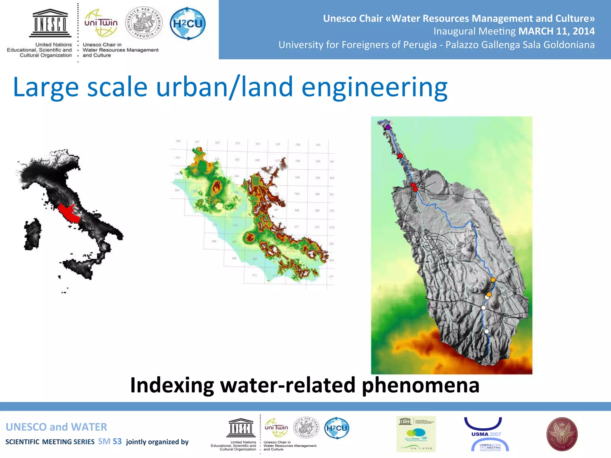
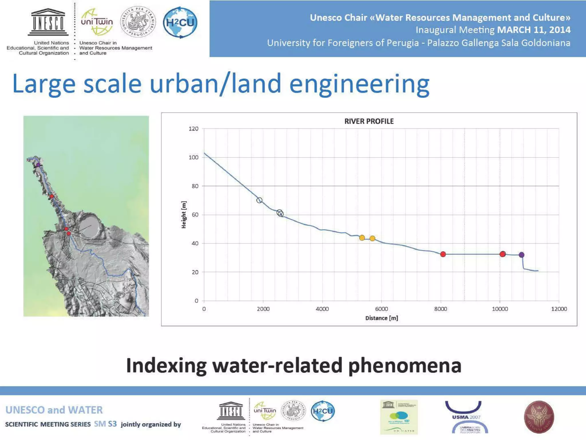
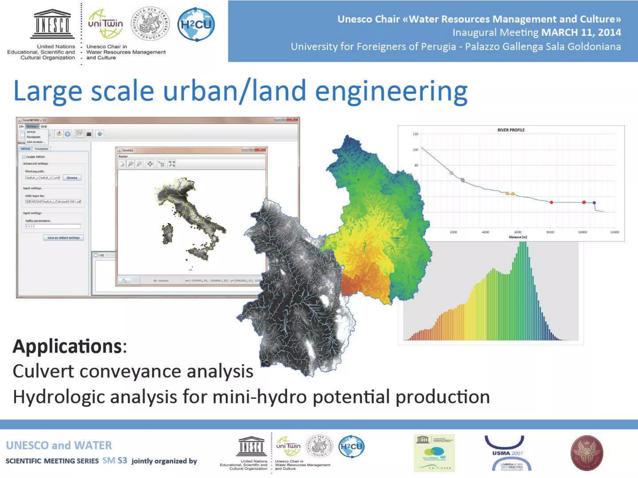

The document outlines the inaugural meeting of the UNESCO Water Scientific Meeting Series held on March 11, 2014, at the University for Foreigners of Perugia. It focuses on using GIS for terrain analysis related to water resources and hydrogeomorphic applications, including floodplain mapping and large-scale engineering applications. The meeting included presentations on various river basins, highlighting methodologies and ongoing research in understanding water processes through terrain analysis.


![[001198]](https://cdn.slidesharecdn.com/ss_thumbnails/001198-161227122410-thumbnail.jpg?width=640&height=640&fit=bounds)


