SlideShare a Scribd company logo
1 of 11
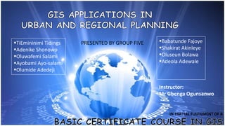
TiEmininimi Tidings
Adenike Shonowo
Oluwafemi Salami
Ayobami Ayo-salami
Olumide Adedeji
Babatunde Fajoye
Shakirat Akinleye
Oluseun Bolawa
Adeola Adewale
Instructor:
Mr Gbenga Ogunsanwo
IN PARTIAL FULFILMENT OF A
PRESENTED BY GROUP FIVE
GIS is a problem-solving TOOL
that is based on technological
developments that facilitates
the processing of all types of
digital spatial information and
capable of displaying the
results cartographically and
otherwise.
This is the planning of a city’s
development through the
design of its layout and
provision of services and
facilities.
Such developments may
include: Physical, Social and
others
“…methods used by the
public sector to influence
the future distribution of
activities in space with the
aim of creating more
rational territorial
organisation of land uses
and linkages to balance
demands…” (EC 1997)
 Zoning, subdivision planning
 Resource allocation and redistribution
 Economic development
 Code enforcement
 Housing renovation programs
 Emergency response
 Crime analysis
 Tax assessment
 Data update and management
1. Improves how city operates
2. Helps build and manage an
integrated database
3. Produces a highly accurate locational
information, frequent updating
4. Process modelling
5. Access & use from many if not all
agency departments
6. Increase efficiency.
7. Save time.
8. Generate revenue.
9. Provide decision support.
10. Improve accuracy.
11. Manage resources.
12. Automate tasks.
13. Save money.
14. Increase access to government.
15. Enhance public participation.
16. Promote greater collaboration
among public agencies.
Ahmed Amdihun, GIS application in Industrial Zone selection in Oroma
special zones
Basic Certificate Course in GIS lecture notes
GIS Solutions for Urban and Regional Planning Designing and Mapping the
Future of Your Community with GIS
Land use planning and GIS (video)
g5 presentation

More Related Content

What's hot

Spatial economics_presentation
Spatial economics_presentationSpatial economics_presentation
Spatial economics_presentationChethna Ben
 
Fundamentals of GIS
Fundamentals of GISFundamentals of GIS
Fundamentals of GISPallab Jana
 
Towards 'Resilient Cities' - Harmonisation of Spatial Planning Information as...
Towards 'Resilient Cities' - Harmonisation of Spatial Planning Information as...Towards 'Resilient Cities' - Harmonisation of Spatial Planning Information as...
Towards 'Resilient Cities' - Harmonisation of Spatial Planning Information as...Beniamino Murgante
 
Presentation on national mapping organization and spatial data infrastructure
Presentation on national mapping organization and spatial data infrastructurePresentation on national mapping organization and spatial data infrastructure
Presentation on national mapping organization and spatial data infrastructureBishwa oli
 
Prof. Melinda Laituri, Colorado State University | Open Data for Secondary Ci...
Prof. Melinda Laituri, Colorado State University | Open Data for Secondary Ci...Prof. Melinda Laituri, Colorado State University | Open Data for Secondary Ci...
Prof. Melinda Laituri, Colorado State University | Open Data for Secondary Ci...Kathmandu Living Labs
 
Living Land Use - Telecom Big Data Challenge - Trento ICT Days 2014
Living Land Use - Telecom Big Data Challenge - Trento ICT Days 2014Living Land Use - Telecom Big Data Challenge - Trento ICT Days 2014
Living Land Use - Telecom Big Data Challenge - Trento ICT Days 2014Irene Celino
 
Concepts And Issues In Planning Show
Concepts And Issues In Planning ShowConcepts And Issues In Planning Show
Concepts And Issues In Planning Showlandivc
 
State of the Map Africa by Geoffrey Kateregga
State of the Map Africa   by Geoffrey KatereggaState of the Map Africa   by Geoffrey Kateregga
State of the Map Africa by Geoffrey KatereggaKateregga Geoffrey
 
Ta2.09 6 mkhize.south africa digitization geneology and citizenship mkhize ja...
Ta2.09 6 mkhize.south africa digitization geneology and citizenship mkhize ja...Ta2.09 6 mkhize.south africa digitization geneology and citizenship mkhize ja...
Ta2.09 6 mkhize.south africa digitization geneology and citizenship mkhize ja...Statistics South Africa
 
Gis applications & Implement
Gis applications & ImplementGis applications & Implement
Gis applications & ImplementRAQIBSTELEGRAPH
 
Ramani Huria, East Africa Open Data Conference
Ramani Huria, East Africa Open Data ConferenceRamani Huria, East Africa Open Data Conference
Ramani Huria, East Africa Open Data ConferenceMark Iliffe
 
GIS: Bringing Geography to the World & the World to Geography; Slide Presenta...
GIS: Bringing Geography to the World & the World to Geography; Slide Presenta...GIS: Bringing Geography to the World & the World to Geography; Slide Presenta...
GIS: Bringing Geography to the World & the World to Geography; Slide Presenta...Barry Wellar
 
ESA Ramani Huria: Mapping for Flood Resilience, Fusing Remote Sensing and Com...
ESA Ramani Huria: Mapping for Flood Resilience, Fusing Remote Sensing and Com...ESA Ramani Huria: Mapping for Flood Resilience, Fusing Remote Sensing and Com...
ESA Ramani Huria: Mapping for Flood Resilience, Fusing Remote Sensing and Com...Mark Iliffe
 

What's hot (20)

Spatial economics_presentation
Spatial economics_presentationSpatial economics_presentation
Spatial economics_presentation
 
Fundamentals of GIS
Fundamentals of GISFundamentals of GIS
Fundamentals of GIS
 
Towards 'Resilient Cities' - Harmonisation of Spatial Planning Information as...
Towards 'Resilient Cities' - Harmonisation of Spatial Planning Information as...Towards 'Resilient Cities' - Harmonisation of Spatial Planning Information as...
Towards 'Resilient Cities' - Harmonisation of Spatial Planning Information as...
 
#Map lesotho
#Map lesotho#Map lesotho
#Map lesotho
 
Presentation on national mapping organization and spatial data infrastructure
Presentation on national mapping organization and spatial data infrastructurePresentation on national mapping organization and spatial data infrastructure
Presentation on national mapping organization and spatial data infrastructure
 
Prof. Melinda Laituri, Colorado State University | Open Data for Secondary Ci...
Prof. Melinda Laituri, Colorado State University | Open Data for Secondary Ci...Prof. Melinda Laituri, Colorado State University | Open Data for Secondary Ci...
Prof. Melinda Laituri, Colorado State University | Open Data for Secondary Ci...
 
Living Land Use - Telecom Big Data Challenge - Trento ICT Days 2014
Living Land Use - Telecom Big Data Challenge - Trento ICT Days 2014Living Land Use - Telecom Big Data Challenge - Trento ICT Days 2014
Living Land Use - Telecom Big Data Challenge - Trento ICT Days 2014
 
Concepts And Issues In Planning Show
Concepts And Issues In Planning ShowConcepts And Issues In Planning Show
Concepts And Issues In Planning Show
 
State of the Map Africa by Geoffrey Kateregga
State of the Map Africa   by Geoffrey KatereggaState of the Map Africa   by Geoffrey Kateregga
State of the Map Africa by Geoffrey Kateregga
 
River Region GIS Day 2012_info packet
River Region GIS Day 2012_info packetRiver Region GIS Day 2012_info packet
River Region GIS Day 2012_info packet
 
#MapLesotho
#MapLesotho #MapLesotho
#MapLesotho
 
Institutional Aspects of Urban Mobility - Vidyadhar Phatak
Institutional Aspects of Urban Mobility - Vidyadhar PhatakInstitutional Aspects of Urban Mobility - Vidyadhar Phatak
Institutional Aspects of Urban Mobility - Vidyadhar Phatak
 
Ta2.09 6 mkhize.south africa digitization geneology and citizenship mkhize ja...
Ta2.09 6 mkhize.south africa digitization geneology and citizenship mkhize ja...Ta2.09 6 mkhize.south africa digitization geneology and citizenship mkhize ja...
Ta2.09 6 mkhize.south africa digitization geneology and citizenship mkhize ja...
 
Sustainable comm-edra-6-1-13-davis
Sustainable comm-edra-6-1-13-davisSustainable comm-edra-6-1-13-davis
Sustainable comm-edra-6-1-13-davis
 
Gis
GisGis
Gis
 
Gis applications & Implement
Gis applications & ImplementGis applications & Implement
Gis applications & Implement
 
Ramani Huria, East Africa Open Data Conference
Ramani Huria, East Africa Open Data ConferenceRamani Huria, East Africa Open Data Conference
Ramani Huria, East Africa Open Data Conference
 
GIS: Bringing Geography to the World & the World to Geography; Slide Presenta...
GIS: Bringing Geography to the World & the World to Geography; Slide Presenta...GIS: Bringing Geography to the World & the World to Geography; Slide Presenta...
GIS: Bringing Geography to the World & the World to Geography; Slide Presenta...
 
ESA Ramani Huria: Mapping for Flood Resilience, Fusing Remote Sensing and Com...
ESA Ramani Huria: Mapping for Flood Resilience, Fusing Remote Sensing and Com...ESA Ramani Huria: Mapping for Flood Resilience, Fusing Remote Sensing and Com...
ESA Ramani Huria: Mapping for Flood Resilience, Fusing Remote Sensing and Com...
 
Crowd sourcing and high resolution satellite imagery in public health
Crowd sourcing and high resolution satellite imagery in public healthCrowd sourcing and high resolution satellite imagery in public health
Crowd sourcing and high resolution satellite imagery in public health
 

Similar to g5 presentation

Information and communication technology on planning administration
Information and communication technology on planning administrationInformation and communication technology on planning administration
Information and communication technology on planning administrationtimmosky
 
Information and communication technology on planning administration
Information and communication technology on planning administrationInformation and communication technology on planning administration
Information and communication technology on planning administrationtimmosky
 
A review on Geographical Information System (GIS) in Town Planning: Malaysia ...
A review on Geographical Information System (GIS) in Town Planning: Malaysia ...A review on Geographical Information System (GIS) in Town Planning: Malaysia ...
A review on Geographical Information System (GIS) in Town Planning: Malaysia ...Waqas Tariq
 
2015. ICRISAT. GIS and SDI for sustainable development
2015. ICRISAT. GIS and SDI for sustainable development2015. ICRISAT. GIS and SDI for sustainable development
2015. ICRISAT. GIS and SDI for sustainable developmentFOODCROPS
 
Aed1313 ibe week 5 urp
Aed1313 ibe week 5 urpAed1313 ibe week 5 urp
Aed1313 ibe week 5 urpnurun2010
 
Building Spatial Data Infrastructures for Spatial Planning in Africa: Lagos e...
Building Spatial Data Infrastructures for Spatial Planning in Africa: Lagos e...Building Spatial Data Infrastructures for Spatial Planning in Africa: Lagos e...
Building Spatial Data Infrastructures for Spatial Planning in Africa: Lagos e...Samuel Dekolo
 
Development of a Geographic Information Systems Road Network Database for Eme...
Development of a Geographic Information Systems Road Network Database for Eme...Development of a Geographic Information Systems Road Network Database for Eme...
Development of a Geographic Information Systems Road Network Database for Eme...inventionjournals
 
Ta1.01 santaella.unwdf capacity building jasc inegi - vr1.0
Ta1.01 santaella.unwdf   capacity building jasc inegi - vr1.0Ta1.01 santaella.unwdf   capacity building jasc inegi - vr1.0
Ta1.01 santaella.unwdf capacity building jasc inegi - vr1.0Statistics South Africa
 
SDI-Initiatives-in-Nepal (1).pptx
SDI-Initiatives-in-Nepal (1).pptxSDI-Initiatives-in-Nepal (1).pptx
SDI-Initiatives-in-Nepal (1).pptxFareLessmotiVation
 
Topographic Information System of Federal School of Surveying, Oyo East Local...
Topographic Information System of Federal School of Surveying, Oyo East Local...Topographic Information System of Federal School of Surveying, Oyo East Local...
Topographic Information System of Federal School of Surveying, Oyo East Local...IJAEMSJORNAL
 
Application of gis in urban planning
Application of gis in urban planningApplication of gis in urban planning
Application of gis in urban planningWESLEY MELI
 
Geographic Information Systems (GIS) in Egypt to support natural resource man...
Geographic Information Systems (GIS) in Egypt to support natural resource man...Geographic Information Systems (GIS) in Egypt to support natural resource man...
Geographic Information Systems (GIS) in Egypt to support natural resource man...Amira Sobeih
 
Geo sumr oct update
Geo sumr oct updateGeo sumr oct update
Geo sumr oct updateict4dev
 
Spatial Data Infrastructure (SDI) Is An Information...
Spatial Data Infrastructure (SDI) Is An Information...Spatial Data Infrastructure (SDI) Is An Information...
Spatial Data Infrastructure (SDI) Is An Information...Stacey Wilson
 

Similar to g5 presentation (20)

Information and communication technology on planning administration
Information and communication technology on planning administrationInformation and communication technology on planning administration
Information and communication technology on planning administration
 
Information and communication technology on planning administration
Information and communication technology on planning administrationInformation and communication technology on planning administration
Information and communication technology on planning administration
 
Modon GIS final draft
Modon GIS final draftModon GIS final draft
Modon GIS final draft
 
A review on Geographical Information System (GIS) in Town Planning: Malaysia ...
A review on Geographical Information System (GIS) in Town Planning: Malaysia ...A review on Geographical Information System (GIS) in Town Planning: Malaysia ...
A review on Geographical Information System (GIS) in Town Planning: Malaysia ...
 
2015. ICRISAT. GIS and SDI for sustainable development
2015. ICRISAT. GIS and SDI for sustainable development2015. ICRISAT. GIS and SDI for sustainable development
2015. ICRISAT. GIS and SDI for sustainable development
 
Aed1313 ibe week 5 urp
Aed1313 ibe week 5 urpAed1313 ibe week 5 urp
Aed1313 ibe week 5 urp
 
Building Spatial Data Infrastructures for Spatial Planning in Africa: Lagos e...
Building Spatial Data Infrastructures for Spatial Planning in Africa: Lagos e...Building Spatial Data Infrastructures for Spatial Planning in Africa: Lagos e...
Building Spatial Data Infrastructures for Spatial Planning in Africa: Lagos e...
 
Development of a Geographic Information Systems Road Network Database for Eme...
Development of a Geographic Information Systems Road Network Database for Eme...Development of a Geographic Information Systems Road Network Database for Eme...
Development of a Geographic Information Systems Road Network Database for Eme...
 
Ta1.01 santaella.unwdf capacity building jasc inegi - vr1.0
Ta1.01 santaella.unwdf   capacity building jasc inegi - vr1.0Ta1.01 santaella.unwdf   capacity building jasc inegi - vr1.0
Ta1.01 santaella.unwdf capacity building jasc inegi - vr1.0
 
FICCI Recommendations: Geospatial Information Regulation Bill
FICCI Recommendations: Geospatial Information Regulation BillFICCI Recommendations: Geospatial Information Regulation Bill
FICCI Recommendations: Geospatial Information Regulation Bill
 
Effect of information systems on revenue collection
Effect of information systems on revenue collectionEffect of information systems on revenue collection
Effect of information systems on revenue collection
 
SDI-Initiatives-in-Nepal (1).pptx
SDI-Initiatives-in-Nepal (1).pptxSDI-Initiatives-in-Nepal (1).pptx
SDI-Initiatives-in-Nepal (1).pptx
 
Topographic Information System of Federal School of Surveying, Oyo East Local...
Topographic Information System of Federal School of Surveying, Oyo East Local...Topographic Information System of Federal School of Surveying, Oyo East Local...
Topographic Information System of Federal School of Surveying, Oyo East Local...
 
Application of gis in urban planning
Application of gis in urban planningApplication of gis in urban planning
Application of gis in urban planning
 
Geographic Information Systems (GIS) in Egypt to support natural resource man...
Geographic Information Systems (GIS) in Egypt to support natural resource man...Geographic Information Systems (GIS) in Egypt to support natural resource man...
Geographic Information Systems (GIS) in Egypt to support natural resource man...
 
Geo sumr oct update
Geo sumr oct updateGeo sumr oct update
Geo sumr oct update
 
Minnesota GIS
Minnesota GISMinnesota GIS
Minnesota GIS
 
Geostor Essay
Geostor EssayGeostor Essay
Geostor Essay
 
Gramya Vikas-paper-gopesh
Gramya Vikas-paper-gopeshGramya Vikas-paper-gopesh
Gramya Vikas-paper-gopesh
 
Spatial Data Infrastructure (SDI) Is An Information...
Spatial Data Infrastructure (SDI) Is An Information...Spatial Data Infrastructure (SDI) Is An Information...
Spatial Data Infrastructure (SDI) Is An Information...
 

g5 presentation

  • 1. TiEmininimi Tidings Adenike Shonowo Oluwafemi Salami Ayobami Ayo-salami Olumide Adedeji Babatunde Fajoye Shakirat Akinleye Oluseun Bolawa Adeola Adewale Instructor: Mr Gbenga Ogunsanwo IN PARTIAL FULFILMENT OF A PRESENTED BY GROUP FIVE
  • 2. GIS is a problem-solving TOOL that is based on technological developments that facilitates the processing of all types of digital spatial information and capable of displaying the results cartographically and otherwise.
  • 3. This is the planning of a city’s development through the design of its layout and provision of services and facilities. Such developments may include: Physical, Social and others “…methods used by the public sector to influence the future distribution of activities in space with the aim of creating more rational territorial organisation of land uses and linkages to balance demands…” (EC 1997)
  • 4.
  • 5.  Zoning, subdivision planning  Resource allocation and redistribution  Economic development  Code enforcement  Housing renovation programs  Emergency response  Crime analysis  Tax assessment  Data update and management
  • 6. 1. Improves how city operates 2. Helps build and manage an integrated database 3. Produces a highly accurate locational information, frequent updating 4. Process modelling 5. Access & use from many if not all agency departments 6. Increase efficiency. 7. Save time. 8. Generate revenue. 9. Provide decision support. 10. Improve accuracy. 11. Manage resources. 12. Automate tasks. 13. Save money. 14. Increase access to government. 15. Enhance public participation. 16. Promote greater collaboration among public agencies.
  • 7.
  • 8.
  • 9.
  • 10. Ahmed Amdihun, GIS application in Industrial Zone selection in Oroma special zones Basic Certificate Course in GIS lecture notes GIS Solutions for Urban and Regional Planning Designing and Mapping the Future of Your Community with GIS Land use planning and GIS (video)