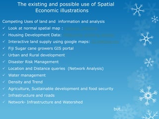
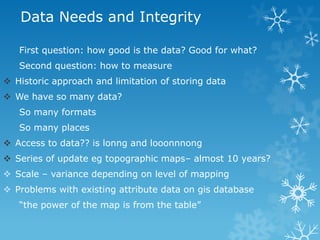
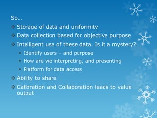
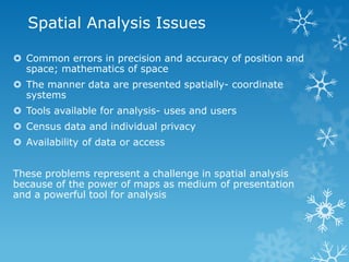
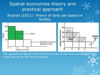
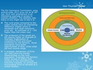
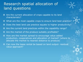
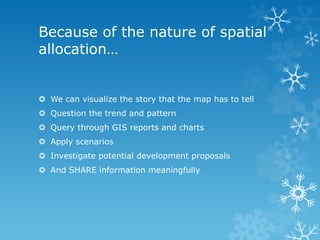
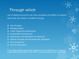
Spatial economics
“ where and what”
Chethna Ben
Graduate Assistant (Masters Student)
Gold Medallist 2012 BA Land Management and Development
© 2014
“Spatial Economics creates
original solutions and products
and provides practical advice to
assist planners, urban and
regional economists and policy
analysts understand the urban
and regional environment.”
The Flammarion engraving (1888) depicts a traveller who arrives at the edge
of a flat Earth and sticks his head through the firmament.
Source: Google
Cartography
Source: Department Town and Country Planning
ArcGIS (esri)
founded 1969
Jack and Laura
Dangermond
ArcGIS(esri)
The existing and possible use of Spatial
Economic illustrations
Competing Uses of land and information and analysis
 Look at normal spatial map : General_Chethna
 Housing Development Data: Melbourne dwelling density
 Interactive land supply using google maps: G21Melbourne
 Fiji Sugar cane growers GIS portal
 Urban and Rural development
 Disaster Risk Management
 Location and Distance queries (Network Analysis)
 Water management
 Density and Trend
 Agriculture, Sustainable development and food security
 Infrastructure and roads
 Network- Infrastructure and Watershed
but……
Data Needs and Integrity
First question: how good is the data? Good for what?
Second question: how to measure
 Historic approach and limitation of storing data
 We have so many data?
So many formats
So many places
 Access to data?? is lonng and looonnnong
 Series of update eg topographic maps– almost 10 years?
 Scale – variance depending on level of mapping
 Problems with existing attribute data on gis database
“the power of the map is from the table”
So…
 Storage of data and uniformity
 Data collection based for objective purpose
 Intelligent use of these data. Is it a mystery?
 Identify users – and purpose
 How are we interpreting, and presenting
 Platform for data access
 Ability to share
 Calibration and Collaboration leads to value
output
Spatial Analysis Issues
 Common errors in precision and accuracy of position and
space; mathematics of space
 The manner data are presented spatially- coordinate
systems
 Tools available for analysis- uses and users
 Census data and individual privacy
 Availability of data or access
These problems represent a challenge in spatial analysis
because of the power of maps as medium of presentation
and a powerful tool for analysis
Agriculture Sector
 Policy driven- economic GDP per captia
 Allocation and use of land limited - Lease structure, traditions and
policy
 Agenda 21 “Land use planning is a decision making process that
facilitates the allocation of land to the uses that provide the
greatest sustainable benefits”
 In Fiji - Sugar cane as its major export commodity- capable?
Suitable?
 Agricultural land conversion made simpler
- 2013, September - Fiji
- 2014 July, - Maharashtra
Ricardo (1821): Theory of land use based on
fertility
Spatial economies theory and
practical approach
The agricultural leased land rental are based on the land use classes in Fiji
is also driven by the same principle
The Fiji Commerce Commission, price
control order 2012 price list as at 20th
July 2014 with amendment is an
interesting example of access to
market condition. The idealistic way
many of you might say to see it is:
 The rural areas compared to the
urban centres have an interesting
difference (higher price) in
wholesale and retail maximum
price set. An estimate of 3 – 5%
higher than the urban cost.
 The producers of the goods are
left paying higher an example of
improper organisation of
cooperative firms and lower
incentives for the farmers. Rural
population have lesser
opportunities of blue, white collar
job and income range.
 A strategic distribution of firms
can help solve the market
disadvantage on the rural
population. Examples are farmers
better access of selling their
produce to the manufacturing,
industrial markets, by zoning and
encouraging firms to develop at a
suited location.
Von Thumen Model
Spatial Economies Approach
 Henderson (1974) “ urban systems” In this
type of framework, cities arise endogenously
as the result of a trade-off between
agglomeration economies and urban crowding.
 Urban concentration and policies and mapping
have been widespread
 The rural planning is a timely need for highly
concentration. Filled with open space, rich
soil, air, natural resources, filled with
agricultural land. Once the natural resources
are lost, its hard to renew or convert it back.
 The one of the major problem faced by spatial
economics is that many fundamental issues having to
do with regional and urban development call for
general equilibrium modelling.
 For instance, some cities can afford to specialize
because they can trade with other cities.
 Hence, looking at one isolated city in the tradition of
Thümen and Alonso (theory of location and land use)
may not be enough for some purposes. Similarly, the
agglomeration of economic activity in core regions
may occur because firms find larger markets there
and because consumers find cheaper and more
diverse supplies.
 These two forces are mutually reinforcing.
Research spatial allocation of
land questions
 Are the current allocation of crops capable to its land
characteristic?
 What are the most capable crops to ensure land best practice?
 Does the best land use practice equate to higher productivity?
 Are the current land practices within the capability range?
 Are the market of the produce suitably profitable?
 How are the market spread to encourage value added
production, cooperatives and allocation of market? (where to
allocate the market to nearest distance to produce)
 Can now the lease rental be based on land output- residual
value approach?
NOT TO LET THE CAT OF THE
BAG
 WAIT FOR THE CABILITY AND SUITABILITY ANALYSIS IN
THE THESIS
Because of the nature of spatial
allocation…
 We can visualize the story that the map has to tell
 Question the trend and pattern
 Query through GIS reports and charts
 Apply scenarios
 Investigate potential development proposals
 And SHARE information meaningfully
Through which
use of spatial economics has many purposes and ability to analyse
more than one theme in problem solving;
 Use of space
 Manage assets
 Urban Regional development
 Sustainable development
 Distribution and allocation of resources
 Market Proposal and development strategies
 Price economics
 Poverty alleviation
If we place spatial economic allocation at the forefront in regional,
urban planning context. And with a strong network with ministries.
Solve
 Management issue of local capacity building
 Attract investment through competent market
allocation
 Improve network building
 Infrastructure development and management
 Population - Human resources allocation
 Focus on the regional and local development
policies
 Policy improvement
The strategy we develop today will affect
our world’s actions tomorrow
Source: Courtesy of the Social and Spatial Inequalities Research Group

Spatial economics_presentation

  • 1.
    Spatial economics “ whereand what” Chethna Ben Graduate Assistant (Masters Student) Gold Medallist 2012 BA Land Management and Development © 2014 “Spatial Economics creates original solutions and products and provides practical advice to assist planners, urban and regional economists and policy analysts understand the urban and regional environment.”
  • 2.
    The Flammarion engraving(1888) depicts a traveller who arrives at the edge of a flat Earth and sticks his head through the firmament. Source: Google
  • 3.
  • 4.
    Source: Department Townand Country Planning ArcGIS (esri) founded 1969 Jack and Laura Dangermond
  • 5.
  • 6.
    The existing andpossible use of Spatial Economic illustrations Competing Uses of land and information and analysis  Look at normal spatial map : General_Chethna  Housing Development Data: Melbourne dwelling density  Interactive land supply using google maps: G21Melbourne  Fiji Sugar cane growers GIS portal  Urban and Rural development  Disaster Risk Management  Location and Distance queries (Network Analysis)  Water management  Density and Trend  Agriculture, Sustainable development and food security  Infrastructure and roads  Network- Infrastructure and Watershed but……
  • 7.
    Data Needs andIntegrity First question: how good is the data? Good for what? Second question: how to measure  Historic approach and limitation of storing data  We have so many data? So many formats So many places  Access to data?? is lonng and looonnnong  Series of update eg topographic maps– almost 10 years?  Scale – variance depending on level of mapping  Problems with existing attribute data on gis database “the power of the map is from the table”
  • 8.
    So…  Storage ofdata and uniformity  Data collection based for objective purpose  Intelligent use of these data. Is it a mystery?  Identify users – and purpose  How are we interpreting, and presenting  Platform for data access  Ability to share  Calibration and Collaboration leads to value output
  • 9.
    Spatial Analysis Issues Common errors in precision and accuracy of position and space; mathematics of space  The manner data are presented spatially- coordinate systems  Tools available for analysis- uses and users  Census data and individual privacy  Availability of data or access These problems represent a challenge in spatial analysis because of the power of maps as medium of presentation and a powerful tool for analysis
  • 10.
    Agriculture Sector  Policydriven- economic GDP per captia  Allocation and use of land limited - Lease structure, traditions and policy  Agenda 21 “Land use planning is a decision making process that facilitates the allocation of land to the uses that provide the greatest sustainable benefits”  In Fiji - Sugar cane as its major export commodity- capable? Suitable?  Agricultural land conversion made simpler - 2013, September - Fiji - 2014 July, - Maharashtra
  • 11.
    Ricardo (1821): Theoryof land use based on fertility Spatial economies theory and practical approach The agricultural leased land rental are based on the land use classes in Fiji is also driven by the same principle
  • 12.
    The Fiji CommerceCommission, price control order 2012 price list as at 20th July 2014 with amendment is an interesting example of access to market condition. The idealistic way many of you might say to see it is:  The rural areas compared to the urban centres have an interesting difference (higher price) in wholesale and retail maximum price set. An estimate of 3 – 5% higher than the urban cost.  The producers of the goods are left paying higher an example of improper organisation of cooperative firms and lower incentives for the farmers. Rural population have lesser opportunities of blue, white collar job and income range.  A strategic distribution of firms can help solve the market disadvantage on the rural population. Examples are farmers better access of selling their produce to the manufacturing, industrial markets, by zoning and encouraging firms to develop at a suited location. Von Thumen Model
  • 13.
    Spatial Economies Approach Henderson (1974) “ urban systems” In this type of framework, cities arise endogenously as the result of a trade-off between agglomeration economies and urban crowding.  Urban concentration and policies and mapping have been widespread  The rural planning is a timely need for highly concentration. Filled with open space, rich soil, air, natural resources, filled with agricultural land. Once the natural resources are lost, its hard to renew or convert it back.
  • 14.
     The oneof the major problem faced by spatial economics is that many fundamental issues having to do with regional and urban development call for general equilibrium modelling.  For instance, some cities can afford to specialize because they can trade with other cities.  Hence, looking at one isolated city in the tradition of Thümen and Alonso (theory of location and land use) may not be enough for some purposes. Similarly, the agglomeration of economic activity in core regions may occur because firms find larger markets there and because consumers find cheaper and more diverse supplies.  These two forces are mutually reinforcing.
  • 15.
    Research spatial allocationof land questions  Are the current allocation of crops capable to its land characteristic?  What are the most capable crops to ensure land best practice?  Does the best land use practice equate to higher productivity?  Are the current land practices within the capability range?  Are the market of the produce suitably profitable?  How are the market spread to encourage value added production, cooperatives and allocation of market? (where to allocate the market to nearest distance to produce)  Can now the lease rental be based on land output- residual value approach?
  • 17.
    NOT TO LETTHE CAT OF THE BAG  WAIT FOR THE CABILITY AND SUITABILITY ANALYSIS IN THE THESIS
  • 18.
    Because of thenature of spatial allocation…  We can visualize the story that the map has to tell  Question the trend and pattern  Query through GIS reports and charts  Apply scenarios  Investigate potential development proposals  And SHARE information meaningfully
  • 19.
    Through which use ofspatial economics has many purposes and ability to analyse more than one theme in problem solving;  Use of space  Manage assets  Urban Regional development  Sustainable development  Distribution and allocation of resources  Market Proposal and development strategies  Price economics  Poverty alleviation If we place spatial economic allocation at the forefront in regional, urban planning context. And with a strong network with ministries.
  • 20.
    Solve  Management issueof local capacity building  Attract investment through competent market allocation  Improve network building  Infrastructure development and management  Population - Human resources allocation  Focus on the regional and local development policies  Policy improvement
  • 21.
    The strategy wedevelop today will affect our world’s actions tomorrow Source: Courtesy of the Social and Spatial Inequalities Research Group