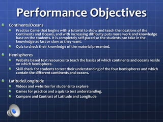
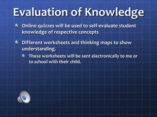
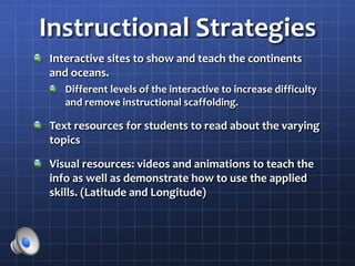
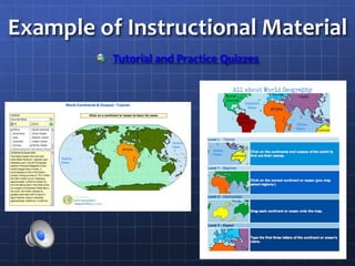
Introduction to
Geography for Parents
Christopher Brown
ETD 560
Introduction and
Instructional Goals
In my distance learning course, my students(the
parents of my 5th graders) will be presented with
basic geography knowledge and skills.
The purpose of this is for adults to refresh, review,
and update their geography knowledge.
This will aid in their own knowledge of the topics, as
well as aid them in helping their children at home.
Analysis of Content Objectives
To refresh, update, and deepen my students knowledge of the following
geography topics
Students will be able to list and locate the 7 continents and 5 oceans on a
map or globe.
Students will be able to compare and contrast which continents and oceans
reside on which hemispheres of the globe.
Students will be able to explain why we use latitude and longitude to help
us find a location on a globe or map and be able to compare and contrast
the differences between latitude and longitude.
Students will be able to find different locations when given the latitude and
longitude of those locations, or when given the location report the latitude
and longitude.
To gain a deeper understanding of this knowledge so they can use this
knowledge to help their students. (their children)
Analysis of Target Audience:
Who is your target audience for your ePortfolio artifact project?
The parents of my 5th grade students. Being that some of the material has changed, become
more in-depth, or simply not known to the parents (whether they are new to the country, or
have not had formal education for a long time
What type of learners are they?
I am going to assume that the learners are just like the learners in my classroom, being that
the learners in any class are of all different types. I may have learners that are currently in
school, have advanced degrees, or haven’t had any formal education for an extended period
of time, or in the case of some immigrant student’s parents; no formal education at all.
Where do you find them? Where are they located?
I will be able to connect with them through my students, and they would be located within
the surrounding area of my school. They are distance learners because my schedule, as well
as theirs, do not allow us to meet in a formal setting, but at a distance, through online or
other means of correspondence, distance learner is a viable option.
What do they need to learn? Why?
Since I am going to focus on social studies, particularly basic geography skills
(latitude/longitude, etc), with my distance learners, because that is the subject where most
of my students struggle. This way the parents are able to help their children, as well as
relearn, or learn for the first time, this material.
Performance Objectives
Continents/Oceans
Practice Game that begins with a tutorial to show and teach the locations of the
Continents and Oceans, and with increasing difficulty puts more work and knowledge
base on the students. It is completely self-paced so the students can take in the
knowledge as fast or slow as they want.
Quiz to check their knowledge of the material presented.
Hemispheres
Website based text resources to teach the basics of which continents and oceans reside
on which hemisphere.
Skill check for students to test their understanding of the four hemispheres and which
contain the different continents and oceans.
Latitude/Longitude
Videos and websites for students to explore
Games for practice and a quiz to test understanding.
Compare and Contrast of Latitude and Longitude
Evaluation of Knowledge
Online quizzes will be used to self-evaluate student
knowledge of respective concepts
Different worksheets and thinking maps to show
understanding.
These worksheets will be sent electronically to me or
to school with their child.
Instructional Strategies
Interactive sites to show and teach the continents
and oceans.
Different levels of the interactive to increase difficulty
and remove instructional scaffolding.
Text resources for students to read about the varying
topics
Visual resources: videos and animations to teach the
info as well as demonstrate how to use the applied
skills. (Latitude and Longitude)
Example of Instructional Material
Tutorial and Practice Quizzes
Etd 560 E_Portfolio

Etd 560 E_Portfolio

  • 1.
    Introduction to Geography forParents Christopher Brown ETD 560
  • 2.
    Introduction and Instructional Goals Inmy distance learning course, my students(the parents of my 5th graders) will be presented with basic geography knowledge and skills. The purpose of this is for adults to refresh, review, and update their geography knowledge. This will aid in their own knowledge of the topics, as well as aid them in helping their children at home.
  • 3.
    Analysis of ContentObjectives To refresh, update, and deepen my students knowledge of the following geography topics Students will be able to list and locate the 7 continents and 5 oceans on a map or globe. Students will be able to compare and contrast which continents and oceans reside on which hemispheres of the globe. Students will be able to explain why we use latitude and longitude to help us find a location on a globe or map and be able to compare and contrast the differences between latitude and longitude. Students will be able to find different locations when given the latitude and longitude of those locations, or when given the location report the latitude and longitude. To gain a deeper understanding of this knowledge so they can use this knowledge to help their students. (their children)
  • 4.
    Analysis of TargetAudience: Who is your target audience for your ePortfolio artifact project? The parents of my 5th grade students. Being that some of the material has changed, become more in-depth, or simply not known to the parents (whether they are new to the country, or have not had formal education for a long time What type of learners are they? I am going to assume that the learners are just like the learners in my classroom, being that the learners in any class are of all different types. I may have learners that are currently in school, have advanced degrees, or haven’t had any formal education for an extended period of time, or in the case of some immigrant student’s parents; no formal education at all. Where do you find them? Where are they located? I will be able to connect with them through my students, and they would be located within the surrounding area of my school. They are distance learners because my schedule, as well as theirs, do not allow us to meet in a formal setting, but at a distance, through online or other means of correspondence, distance learner is a viable option. What do they need to learn? Why? Since I am going to focus on social studies, particularly basic geography skills (latitude/longitude, etc), with my distance learners, because that is the subject where most of my students struggle. This way the parents are able to help their children, as well as relearn, or learn for the first time, this material.
  • 5.
    Performance Objectives Continents/Oceans Practice Gamethat begins with a tutorial to show and teach the locations of the Continents and Oceans, and with increasing difficulty puts more work and knowledge base on the students. It is completely self-paced so the students can take in the knowledge as fast or slow as they want. Quiz to check their knowledge of the material presented. Hemispheres Website based text resources to teach the basics of which continents and oceans reside on which hemisphere. Skill check for students to test their understanding of the four hemispheres and which contain the different continents and oceans. Latitude/Longitude Videos and websites for students to explore Games for practice and a quiz to test understanding. Compare and Contrast of Latitude and Longitude
  • 6.
    Evaluation of Knowledge Onlinequizzes will be used to self-evaluate student knowledge of respective concepts Different worksheets and thinking maps to show understanding. These worksheets will be sent electronically to me or to school with their child.
  • 7.
    Instructional Strategies Interactive sitesto show and teach the continents and oceans. Different levels of the interactive to increase difficulty and remove instructional scaffolding. Text resources for students to read about the varying topics Visual resources: videos and animations to teach the info as well as demonstrate how to use the applied skills. (Latitude and Longitude)
  • 8.
    Example of InstructionalMaterial Tutorial and Practice Quizzes