Proposal for affordable farmworkers' housing in Castroville, CA
Compendium of student work,
LDA182 Advanced LA studio at Uc Davis, Fall 2019.
Instructor: Dr. Deni Ruggeri
Students: Tianyu Xing, Doris Zeng, Tony Rogers, Yitong Zhang, Byron Li
Living with stimulation proposal for affordable farmworkers' housing in Castr...Deni Ruggeri
Compendium of student work, LDA182 Advanced LA studio at Uc Davis, Fall 2019.
Instructor: Dr. Deni Ruggeri
Students: Sarah Burson, Cialre Corbett, Kotaro (Tristan) Kamata, , Hillary Huang, Krongkan Klabkaeo.
Strengthening Identity through a more livable social realmDeni Ruggeri
Proposal for affordable farmworkers' housing in Castroville, CA
Compendium of student work, LDA182 Advanced LA studio at Uc Davis, Fall 2019.
Instructor: Dr. Deni Ruggeri
Students: Lizbeth Giron, Sandro Montes, Nou Moua, Nathaly Ojeda, Tianyue Wang.
"Pueblo de Flor"affordable farmworkers' housing proposal for Castroville, CADeni Ruggeri
The document presents the final presentation for a proposed residential development in Castroville, CA called Pueblo de Flor. The presentation includes analysis of site conditions, community feedback, master planning, and design of the development. The proposed development aims to promote healthy living through pedestrian-focused design, mixed-use spaces, and public amenities like parks and orchards. It seeks to serve as a model for future growth that supports the local economy and integrates the community.
Nottingham has undertaken several urban rebranding efforts to change its image and regenerate parts of the city. These include rebranding the Lace Market area near the new tram stop through environmental improvements and attracting new commercial and residential developments. Another project, The Hub, aimed to rebrand the run-down railway station area through a £60 million investment that included refurbishing the station, improving retail, and regenerating surrounding land. A third rebranding involved transforming the old canal district through landscaping and developments like the contemporary art gallery that boosted local business and tourism.
- The Harris Creek Watershed Project targeted a 4000-house area within the watershed for a coordinated trash sweep over 10 weeks during the summer of 2010. This resulted in over 100 trash sites being reported and cleaned up through Baltimore City services.
- The trash sweep discovered that vacant homes, especially those in deterioration, were the location of "mini-landfills" that contributed significantly to the watershed's trash issues. Residents felt some areas received unequal trash services from the city.
- Reducing trash through continued organized cleanups and engagement with city services could serve as a model for improving water quality in the Baltimore Harbor by reducing trash from its contributing watersheds.
The document is PEC's 2014 annual report. It summarizes their work over the past year to conserve land, protect air and water quality, preserve history and culture, support rural economies, and encourage sensible growth. Some of the key accomplishments mentioned include helping to protect over 6,500 acres of land through conservation easements, improving stream conditions for brook trout, and providing education on water quality and land conservation issues.
The document summarizes the achievements of the Piedmont Environmental Council (PEC) in 2015. Some key points:
- PEC helped protect over 11,500 acres in its nine-county region in Virginia, bringing the total conserved land to over 387,000 acres. This includes protecting a 1,219 acre forested property along the Rappahannock River.
- Fauquier County became the first in Virginia to surpass 100,000 acres of privately conserved land, achieving a significant conservation milestone. The Wainbur Farm helped put the county over this threshold.
- PEC worked with landowners to secure USDA funding to establish agricultural land easements to preserve large family farms
The document summarizes a SWOT (strengths, weaknesses, opportunities, threats) analysis for a site called Glasgow Fields located in Pickering, Ontario. Some key strengths identified include the site's proximity to the Greater Toronto Area and existing infrastructure like Highway 407. Weaknesses include a lack of existing infrastructure on the site and environmentally sensitive areas. Opportunities include incorporating environmental and cultural heritage elements, while threats include potential increased traffic and degradation of natural areas.
Simran deo- architectural conservation- neighbourhood design and planningsimrandeo3
1. Judkins Park in Seattle is working to improve its neighborhood through park upgrades, expanded community gardens, and improved transit access. Plans include expanding picnic areas and greenways in Judkins Park, improving the community garden, and establishing a new RapidRide bus line and neighborhood greenway that will enhance connectivity. The goal is to prepare for future growth through better parks, open spaces, and transportation options.
Landscape Architecture works from undergraduate studios at ASU. Work ranging from scale of intimate, yet impactful site design to large, regional analysis of urban systems.
Urban Design for a Greener & Healthier City Antipolo City.pdfPeraltaSheena1
Urban Design for a Greener & Healthier City Antipolo City. Understanding the different problems that come with rapid urbanization, its' impact on the environment, and proposed green solutions to mitigate the negative impact of urbanization.
The document proposes creating an urban green trail in Kingston, New York to promote sustainability and community development. It identifies partners for the project and outlines objectives to reduce the city's carbon footprint through green building renovations, public art, and engaging the community. The proposed trail would connect sites like the historic Kirkland Hotel and Main Street areas to parks and the Hudson River waterfront, promoting alternative transportation, energy efficiency, and environmental education.
The document proposes creating an urban green trail in Kingston, New York to promote sustainability and community development. It identifies partner organizations and outlines several projects along the proposed trail, including restoring the historic Kirkland Hotel with green features, creating a green roof garden and solar installation, and connecting local people with local food through a farmers market. The green trail aims to reduce Kingston's carbon footprint through strategic partnerships and replicable models that energize the community and focus on green building renovations.
Las vegas preferred plan presentation boards Darin Dinsmore
The document summarizes the Downtown Las Vegas Master Plan process and preferred plan. It discusses expanding the study area to anticipate growth, challenges facing downtown like lack of investment and poverty, and needed improvements such as light rail and bike networks. Community outreach included over 2,400 participants and identified priorities like housing, parks, and mixed uses. The preferred plan projects aggressive development of over 11 million square feet over 20 years, focusing on housing, retail, office, and institutional space.
This document provides summaries of several design projects including a modular dwelling proposal, an analysis of iterative paper models to understand how form is affected by different cuts, a proposal for a pedestrian greenway along Baltimore's Inner Harbor to improve connectivity, drawings and observations from investigating Roman ruins in Turkey, and the renovation of a school building focusing on a central courtyard space around a large tree. The summaries describe the design concepts, methods, and goals of improving housing, understanding form manipulation, enhancing access to waterfront areas, documenting archaeological findings, and incorporating a focal point in a school renovation.
The plan uses the upcycling concept and project design as a catalyst for an historic neighborhood resurgence to help redefine the essence and rebrand the St. Clair neighborhood and Cleveland region. The presentation identifies and showcases the best ways to leverage the structure and its surrounding area for redevelopment.
Chapter volunteers participated in a public charette in Seaside Heights on October 29 to support the non-profit, Architecture for Humanity. AfH is working with the community to design a new event center on the boardwalk in Seaside Heights. The event center will be funded with money raised by MTV after Superstorm Sandy damaged the Seaside Heights boardwalk.
Lifestyle sports such as surfing, skateboarding, and snowboarding have experienced significant growth in popularity. These sports contribute billions to economies through surf schools, camps, and tourism. They also provide benefits like youth development by building confidence and problem-solving skills. Communities that embrace these sports by building parks and facilities attract residents and tourists, ensuring sustainable economic development.
Lifestyle sports such as surfing, skateboarding, and snowboarding have grown rapidly in popularity globally. Over 250 million people now participate in these sports. This growth has been driven by hardcore fans, success of professional athletes, inclusion in the Olympics, and broadcasts of competitions. This rising interest has significant economic and social benefits, as communities that have supported lifestyle sports through facilities and events have seen financial gains through tourism and local spending, improved health and social interaction among residents, increased property values, and other advantages.
Clifton Ave Streetscape Report- Spring 2015.compressedJake Henderson
The document summarizes a proposal to redesign Clifton Avenue in Cincinnati, Ohio to improve walkability, connectivity, and balance different transportation modes. The proposal was created by Jake Henderson, Stephanie Godsey, and Nicole Dibble. It includes an analysis of the existing conditions, design criteria focused on balance, safety and eco-design, a proposed street section, master plan and renderings of the redesign. The goal is to transform Clifton Avenue from an automobile-dominated corridor into a multi-modal public space that better connects surrounding neighborhoods and institutions.
Prescott Sixth Street Redevelopment
Project Description
The Ecosa students have been asked by a council member of the City of Prescott to create a vibrant new "urban" component in the downtown area of Prescott that will enhance the visitor experience and bring a new economic hub into the core of the city.
In broad terms, the client's vision is:
To create an area near downtown Prescott that will act as a hub for a variety of outdoor activities including biking and hiking, and help develop awareness of the outdoor opportunities available in Prescott. To enhance Granite creek that bisects the site and explore possibilities for an interface between commercial, housing, retail spaces, and nature. To create a walkable neigborhood with multi-modal transit throughout. To explore planning strategies to create a lively area that can complement the downtown and bring additional revenues into the city. To anchor the development with small retail stores and avoid any “big box” retail in the area.
The client hopes to create an identifiable neighborhood that potentially includes a main street/corridor for mixed uses, including small retail with residential and/or commercial above. The City of Prescott is repositioning its marketing program to emphasize the natural resources in the area, such as walking and biking trails and the natural beauty surrounding the area. This redevelopment project should tie into this aspect of Prescott and make the Granite Creek area the hub for biking and walking to other areas in the trail system.
Site Assessment
Located in the heart of Prescott, Arizona, this project is approximately 140 acres in extent. It is bounded by North Montezuma Street on the West, the Yavapai tribal lands on the East and East Merritt Street on the North. The southern boundary is the property line of businesses that are accessed from EZ Street or from North Mount Vernon Street. The Albertsons shopping center and the Springhill suites define the South East corner.
Currently most of this area is industrial and many of these buildings are vacant and the land in the area is not well utilized. The existing infrastucture of roads was to be maintained, however, simple modifications can be made such as median strips, sidewalks and bike lanes.
Granite creek bisects this area and is a highly under utilized resource. There is a great opportunity to enhance this whole redevelopment by expanding and acknowledging the creek as a superb resource for any redevelopment.
Culture, Environment, Economy
Students researched into both the social, economic and natural systems of the area. Students developed an understanding of the whole area, not only its history and the current human impact, but also the climate flows; air, water, vegetation, fauna, people, and traffic in all parts of this area.
To learn more about this project, click here: http://www.ecosainstitute.org/projects/prescott-sixth-street-redevelopment.html
Kingston Greenline & Ulster County Trails Summit - Summit PresentationThe Kingston Land Trust
The Kingston Greenline & Ulster County Trails Summit was made possible with funding from the Land Trust Alliance's Conservation Partnership Catalyst Grant Program. The Summit included a keynote presentation from Jeff Olson, author of The Third Mode and principal with Alta Planning + Design. Lindsay Zefting, planner and engineer with Alta Planning + Design presented the final report for the Kingston Point Rail Trail Feasibility Study. A panel comprising representatives from the Kingston Land Trust, Ulster County Planning, the Hudson River Valley Greenway and Parks & Trails NY discussed the emerging trail network in Ulster County.
This document summarizes the West Houston Trails Master Plan presented at the 2012 Texas Trails & Active Transportation Conference in San Antonio. The plan was developed through community involvement to create over 100 miles of interconnected trails. It provides the timeline of the plan from 2007-2011. Citizen surveys showed most want to use the trails for exercise and recreation. The plan identifies existing and proposed trails, including along drainage corridors, and how they will provide transportation and recreation benefits to the community.
This document is Laura Handleton's landscape architecture portfolio, which includes summaries of 6 projects she worked on. The projects showcase her skills in urban design, stormwater management, recreation planning, and tactical urbanism. They include an urban sports park in Columbus, Ohio that incorporates ravines to improve stormwater function; a small-scale art installation for crickets in Salem, Massachusetts; a flexible event space in Brooklyn, New York that can be reconfigured using shipping container modules; a plaza redesign for the Wexner Center in Columbus with interlocking terraces and program elements; complete streets recommendations for Clintonville, Ohio implemented through a tactical demonstration; and miscellaneous sketches, fabrications and invitations.
The document describes a proposed development called "The Green" that was designed to address issues like sprawl, traffic, and sustainability in southeast Wisconsin. It aimed to create a walkable, transit-oriented mixed-use community with housing, retail, and offices. However, the project is now unlikely due to the state approving overhead power lines instead of burying them as requested. The development was intended to serve as an additional downtown for Wauwatosa and destination for local institutions and visitors.
The document outlines Keith Jacobi's portfolio, which includes landscape design and construction experience working on both residential and commercial projects. His education background includes a Bachelor's Degree in Landscape Architecture from Oklahoma State University. The portfolio then provides details on Jacobi's previous work experience at various landscape architecture, construction, and natural gas firms, as well as his roles and responsibilities at each position.
The Cultural performance of greenways. The Case of Irvine's Jeffrey Open Spac...Deni Ruggeri
This paper, which was presented at the 5th Fábos Conference on Landscape and Greenway Planning, discusses the cultural performance of a recently established greenway in Irvine, one of America's few New Towns. While there are many studies focusing on the biotic and abiotic performance of greenways, very few studies have focused on the cultural performance of linear parks and greenways. Borrowing a definition of cultural performance from Ahern (2007) this post occupancy evaluation used user-behaviour and physical activities observations conducted over the course of a week to illustrate successes and drawbacks in the design of the Jeffrey Open Space in terms of social life, physical health and identity promotion
Teaching Landscape Democracy for landscape architects and environmental plann...Deni Ruggeri
This presentation attempted to evaluate the first year of a three-year project funded by the Erasmus + strategic partnership program funded by the European Union. The LED-Landscape Education for Democracy project aimed at developing a new online/on-site course that would fill a gap in current design and planning education regarding issues of landscape and ecological democracy, social justice and democratic design theories and practices. The presentation was given at this year's 5th Fabos Conference that took place in Budapest June 30-July 2nd.
More Related Content
Similar to Enhancing Community through Connectivity
The document summarizes a SWOT (strengths, weaknesses, opportunities, threats) analysis for a site called Glasgow Fields located in Pickering, Ontario. Some key strengths identified include the site's proximity to the Greater Toronto Area and existing infrastructure like Highway 407. Weaknesses include a lack of existing infrastructure on the site and environmentally sensitive areas. Opportunities include incorporating environmental and cultural heritage elements, while threats include potential increased traffic and degradation of natural areas.
Simran deo- architectural conservation- neighbourhood design and planningsimrandeo3
1. Judkins Park in Seattle is working to improve its neighborhood through park upgrades, expanded community gardens, and improved transit access. Plans include expanding picnic areas and greenways in Judkins Park, improving the community garden, and establishing a new RapidRide bus line and neighborhood greenway that will enhance connectivity. The goal is to prepare for future growth through better parks, open spaces, and transportation options.
Landscape Architecture works from undergraduate studios at ASU. Work ranging from scale of intimate, yet impactful site design to large, regional analysis of urban systems.
Urban Design for a Greener & Healthier City Antipolo City.pdfPeraltaSheena1
Urban Design for a Greener & Healthier City Antipolo City. Understanding the different problems that come with rapid urbanization, its' impact on the environment, and proposed green solutions to mitigate the negative impact of urbanization.
The document proposes creating an urban green trail in Kingston, New York to promote sustainability and community development. It identifies partners for the project and outlines objectives to reduce the city's carbon footprint through green building renovations, public art, and engaging the community. The proposed trail would connect sites like the historic Kirkland Hotel and Main Street areas to parks and the Hudson River waterfront, promoting alternative transportation, energy efficiency, and environmental education.
The document proposes creating an urban green trail in Kingston, New York to promote sustainability and community development. It identifies partner organizations and outlines several projects along the proposed trail, including restoring the historic Kirkland Hotel with green features, creating a green roof garden and solar installation, and connecting local people with local food through a farmers market. The green trail aims to reduce Kingston's carbon footprint through strategic partnerships and replicable models that energize the community and focus on green building renovations.
Las vegas preferred plan presentation boards Darin Dinsmore
The document summarizes the Downtown Las Vegas Master Plan process and preferred plan. It discusses expanding the study area to anticipate growth, challenges facing downtown like lack of investment and poverty, and needed improvements such as light rail and bike networks. Community outreach included over 2,400 participants and identified priorities like housing, parks, and mixed uses. The preferred plan projects aggressive development of over 11 million square feet over 20 years, focusing on housing, retail, office, and institutional space.
This document provides summaries of several design projects including a modular dwelling proposal, an analysis of iterative paper models to understand how form is affected by different cuts, a proposal for a pedestrian greenway along Baltimore's Inner Harbor to improve connectivity, drawings and observations from investigating Roman ruins in Turkey, and the renovation of a school building focusing on a central courtyard space around a large tree. The summaries describe the design concepts, methods, and goals of improving housing, understanding form manipulation, enhancing access to waterfront areas, documenting archaeological findings, and incorporating a focal point in a school renovation.
The plan uses the upcycling concept and project design as a catalyst for an historic neighborhood resurgence to help redefine the essence and rebrand the St. Clair neighborhood and Cleveland region. The presentation identifies and showcases the best ways to leverage the structure and its surrounding area for redevelopment.
Chapter volunteers participated in a public charette in Seaside Heights on October 29 to support the non-profit, Architecture for Humanity. AfH is working with the community to design a new event center on the boardwalk in Seaside Heights. The event center will be funded with money raised by MTV after Superstorm Sandy damaged the Seaside Heights boardwalk.
Lifestyle sports such as surfing, skateboarding, and snowboarding have experienced significant growth in popularity. These sports contribute billions to economies through surf schools, camps, and tourism. They also provide benefits like youth development by building confidence and problem-solving skills. Communities that embrace these sports by building parks and facilities attract residents and tourists, ensuring sustainable economic development.
Lifestyle sports such as surfing, skateboarding, and snowboarding have grown rapidly in popularity globally. Over 250 million people now participate in these sports. This growth has been driven by hardcore fans, success of professional athletes, inclusion in the Olympics, and broadcasts of competitions. This rising interest has significant economic and social benefits, as communities that have supported lifestyle sports through facilities and events have seen financial gains through tourism and local spending, improved health and social interaction among residents, increased property values, and other advantages.
Clifton Ave Streetscape Report- Spring 2015.compressedJake Henderson
The document summarizes a proposal to redesign Clifton Avenue in Cincinnati, Ohio to improve walkability, connectivity, and balance different transportation modes. The proposal was created by Jake Henderson, Stephanie Godsey, and Nicole Dibble. It includes an analysis of the existing conditions, design criteria focused on balance, safety and eco-design, a proposed street section, master plan and renderings of the redesign. The goal is to transform Clifton Avenue from an automobile-dominated corridor into a multi-modal public space that better connects surrounding neighborhoods and institutions.
Prescott Sixth Street Redevelopment
Project Description
The Ecosa students have been asked by a council member of the City of Prescott to create a vibrant new "urban" component in the downtown area of Prescott that will enhance the visitor experience and bring a new economic hub into the core of the city.
In broad terms, the client's vision is:
To create an area near downtown Prescott that will act as a hub for a variety of outdoor activities including biking and hiking, and help develop awareness of the outdoor opportunities available in Prescott. To enhance Granite creek that bisects the site and explore possibilities for an interface between commercial, housing, retail spaces, and nature. To create a walkable neigborhood with multi-modal transit throughout. To explore planning strategies to create a lively area that can complement the downtown and bring additional revenues into the city. To anchor the development with small retail stores and avoid any “big box” retail in the area.
The client hopes to create an identifiable neighborhood that potentially includes a main street/corridor for mixed uses, including small retail with residential and/or commercial above. The City of Prescott is repositioning its marketing program to emphasize the natural resources in the area, such as walking and biking trails and the natural beauty surrounding the area. This redevelopment project should tie into this aspect of Prescott and make the Granite Creek area the hub for biking and walking to other areas in the trail system.
Site Assessment
Located in the heart of Prescott, Arizona, this project is approximately 140 acres in extent. It is bounded by North Montezuma Street on the West, the Yavapai tribal lands on the East and East Merritt Street on the North. The southern boundary is the property line of businesses that are accessed from EZ Street or from North Mount Vernon Street. The Albertsons shopping center and the Springhill suites define the South East corner.
Currently most of this area is industrial and many of these buildings are vacant and the land in the area is not well utilized. The existing infrastucture of roads was to be maintained, however, simple modifications can be made such as median strips, sidewalks and bike lanes.
Granite creek bisects this area and is a highly under utilized resource. There is a great opportunity to enhance this whole redevelopment by expanding and acknowledging the creek as a superb resource for any redevelopment.
Culture, Environment, Economy
Students researched into both the social, economic and natural systems of the area. Students developed an understanding of the whole area, not only its history and the current human impact, but also the climate flows; air, water, vegetation, fauna, people, and traffic in all parts of this area.
To learn more about this project, click here: http://www.ecosainstitute.org/projects/prescott-sixth-street-redevelopment.html
Kingston Greenline & Ulster County Trails Summit - Summit PresentationThe Kingston Land Trust
The Kingston Greenline & Ulster County Trails Summit was made possible with funding from the Land Trust Alliance's Conservation Partnership Catalyst Grant Program. The Summit included a keynote presentation from Jeff Olson, author of The Third Mode and principal with Alta Planning + Design. Lindsay Zefting, planner and engineer with Alta Planning + Design presented the final report for the Kingston Point Rail Trail Feasibility Study. A panel comprising representatives from the Kingston Land Trust, Ulster County Planning, the Hudson River Valley Greenway and Parks & Trails NY discussed the emerging trail network in Ulster County.
This document summarizes the West Houston Trails Master Plan presented at the 2012 Texas Trails & Active Transportation Conference in San Antonio. The plan was developed through community involvement to create over 100 miles of interconnected trails. It provides the timeline of the plan from 2007-2011. Citizen surveys showed most want to use the trails for exercise and recreation. The plan identifies existing and proposed trails, including along drainage corridors, and how they will provide transportation and recreation benefits to the community.
This document is Laura Handleton's landscape architecture portfolio, which includes summaries of 6 projects she worked on. The projects showcase her skills in urban design, stormwater management, recreation planning, and tactical urbanism. They include an urban sports park in Columbus, Ohio that incorporates ravines to improve stormwater function; a small-scale art installation for crickets in Salem, Massachusetts; a flexible event space in Brooklyn, New York that can be reconfigured using shipping container modules; a plaza redesign for the Wexner Center in Columbus with interlocking terraces and program elements; complete streets recommendations for Clintonville, Ohio implemented through a tactical demonstration; and miscellaneous sketches, fabrications and invitations.
The document describes a proposed development called "The Green" that was designed to address issues like sprawl, traffic, and sustainability in southeast Wisconsin. It aimed to create a walkable, transit-oriented mixed-use community with housing, retail, and offices. However, the project is now unlikely due to the state approving overhead power lines instead of burying them as requested. The development was intended to serve as an additional downtown for Wauwatosa and destination for local institutions and visitors.
The document outlines Keith Jacobi's portfolio, which includes landscape design and construction experience working on both residential and commercial projects. His education background includes a Bachelor's Degree in Landscape Architecture from Oklahoma State University. The portfolio then provides details on Jacobi's previous work experience at various landscape architecture, construction, and natural gas firms, as well as his roles and responsibilities at each position.
Similar to Enhancing Community through Connectivity (20)
The Cultural performance of greenways. The Case of Irvine's Jeffrey Open Spac...Deni Ruggeri
This paper, which was presented at the 5th Fábos Conference on Landscape and Greenway Planning, discusses the cultural performance of a recently established greenway in Irvine, one of America's few New Towns. While there are many studies focusing on the biotic and abiotic performance of greenways, very few studies have focused on the cultural performance of linear parks and greenways. Borrowing a definition of cultural performance from Ahern (2007) this post occupancy evaluation used user-behaviour and physical activities observations conducted over the course of a week to illustrate successes and drawbacks in the design of the Jeffrey Open Space in terms of social life, physical health and identity promotion
Teaching Landscape Democracy for landscape architects and environmental plann...Deni Ruggeri
This presentation attempted to evaluate the first year of a three-year project funded by the Erasmus + strategic partnership program funded by the European Union. The LED-Landscape Education for Democracy project aimed at developing a new online/on-site course that would fill a gap in current design and planning education regarding issues of landscape and ecological democracy, social justice and democratic design theories and practices. The presentation was given at this year's 5th Fabos Conference that took place in Budapest June 30-July 2nd.
Teaching participation in planning and design: a few lessons from NMBU's depa...Deni Ruggeri
This morning, students from my fall course, LAA341 - The Urban landscape as a social arena, presented their vision for the future of Ski, one of the fastest growing municipalities in the Oslo region. Their work translated findings from a workshop with students from the local elementary school into design principles and strategic design proposals for denser yet livable, child-friendly urban neighborhoods integrating walkability, bikeability, stormwater management and a mix of uses.
I have attached a presentation of the goals and objectives of the course, which were to introduce students to theories and practices of participation in urban and landscape design. Students developed customized processes and engaged in a rich dialogue with the Ski community as well as within their own classroom community, resulting in collective visions that were more than the sum of each students' part. The presentation begins with an introduction of NMBU, the Norwegian University of Life Sciences, and its commitment to action-research and research directly affecting decision making and planning of the sustainable city. I then introduce some of the theories introduced as guidance and inspiration for the students. I then discuss some of the principles and goals of the course. I conclude with reflections using student feedback from their "post-facto" survey.
This document compares two case studies of community design processes that utilized different levels of digital participation: Hawthorne Park in Medford, OR and Mirror Pond Visioning in Bend, OR. It analyzes data on the number of workshops, total participants, and percentage of online users for each case. Tables evaluate the two cases based on indicators of participation quality and the performance of democratic process, power distribution, community considerations, environmental justice, and design outcomes. The document finds that the Bend process incorporated more digital engagement but both could be improved.
This document summarizes a presentation about using stories as a democratic tool for placemaking. It discusses how stories can be used to manage public disputes, level power imbalances, and reveal or heal conflicts. The presentation focuses on a project in Zingonia, Italy that used participatory action research and storytelling to empower residents and change the area's negative narrative. Over 1,000 residents were involved in activities to establish a new "core story" including the story of self, the story of now, and the story of us. This resulted in stronger social networks and a more positive reputation for the area. The presentation concludes that storytelling is an effective way to enable bottom-up placemaking and emergent community identity when done through
Deni Ruggeri has degrees in architecture and landscape architecture from Milan Polytechnic, Cornell University, and UC Berkeley. She has over 6 years of experience practicing landscape architecture and now focuses her research on community urban design, sustainable urban design, and new towns. Some of her areas of research interest include retrofitting modernist landscapes, developing ecodistricts and eco-cities, fostering identity and attachment in neighborhoods, and tapping into personal narratives. She utilizes participatory action research and community engagement approaches.
Explore the essential graphic design tools and software that can elevate your creative projects. Discover industry favorites and innovative solutions for stunning design results.
Architectural and constructions management experience since 2003 including 18 years located in UAE.
Coordinate and oversee all technical activities relating to architectural and construction projects,
including directing the design team, reviewing drafts and computer models, and approving design
changes.
Organize and typically develop, and review building plans, ensuring that a project meets all safety and
environmental standards.
Prepare feasibility studies, construction contracts, and tender documents with specifications and
tender analyses.
Consulting with clients, work on formulating equipment and labor cost estimates, ensuring a project
meets environmental, safety, structural, zoning, and aesthetic standards.
Monitoring the progress of a project to assess whether or not it is in compliance with building plans
and project deadlines.
Attention to detail, exceptional time management, and strong problem-solving and communication
skills are required for this role.
ARENA - Young adults in the workplace (Knight Moves).pdfKnight Moves
Presentations of Bavo Raeymaekers (Project lead youth unemployment at the City of Antwerp), Suzan Martens (Service designer at Knight Moves) and Adriaan De Keersmaeker (Community manager at Talk to C)
during the 'Arena • Young adults in the workplace' conference hosted by Knight Moves.
Revolutionizing the Digital Landscape: Web Development Companies in Indiaamrsoftec1
Discover unparalleled creativity and technical prowess with India's leading web development companies. From custom solutions to e-commerce platforms, harness the expertise of skilled developers at competitive prices. Transform your digital presence, enhance the user experience, and propel your business to new heights with innovative solutions tailored to your needs, all from the heart of India's tech industry.
Practical eLearning Makeovers for EveryoneBianca Woods
Welcome to Practical eLearning Makeovers for Everyone. In this presentation, we’ll take a look at a bunch of easy-to-use visual design tips and tricks. And we’ll do this by using them to spruce up some eLearning screens that are in dire need of a new look.
Connect Conference 2022: Passive House - Economic and Environmental Solution...TE Studio
Passive House: The Economic and Environmental Solution for Sustainable Real Estate. Lecture by Tim Eian of TE Studio Passive House Design in November 2022 in Minneapolis.
- The Built Environment
- Let's imagine the perfect building
- The Passive House standard
- Why Passive House targets
- Clean Energy Plans?!
- How does Passive House compare and fit in?
- The business case for Passive House real estate
- Tools to quantify the value of Passive House
- What can I do?
- Resources
EASY TUTORIAL OF HOW TO USE CAPCUT BY: FEBLESS HERNANEFebless Hernane
CapCut is an easy-to-use video editing app perfect for beginners. To start, download and open CapCut on your phone. Tap "New Project" and select the videos or photos you want to edit. You can trim clips by dragging the edges, add text by tapping "Text," and include music by selecting "Audio." Enhance your video with filters and effects from the "Effects" menu. When you're happy with your video, tap the export button to save and share it. CapCut makes video editing simple and fun for everyone!
Maximize Your Content with Beautiful Assets : Content & Asset for Landing Page pmgdscunsri
Figma is a cloud-based design tool widely used by designers for prototyping, UI/UX design, and real-time collaboration. With features such as precision pen tools, grid system, and reusable components, Figma makes it easy for teams to work together on design projects. Its flexibility and accessibility make Figma a top choice in the digital age.
Decormart Studio is widely recognized as one of the best interior designers in Bangalore, known for their exceptional design expertise and ability to create stunning, functional spaces. With a strong focus on client preferences and timely project delivery, Decormart Studio has built a solid reputation for their innovative and personalized approach to interior design.
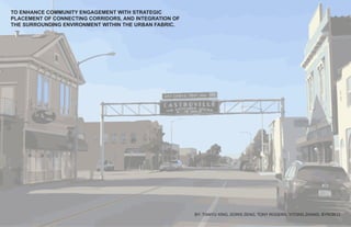
1. TO ENHANCE COMMUNITY ENGAGEMENT WITH STRATEGIC
PLACEMENT OF CONNECTING CORRIDORS, AND INTEGRATION OF
THE SURROUNDING ENVIRONMENT WITHIN THE URBAN FABRIC.
BY: TIANYU XING, DORIS ZENG, TONY ROGERS, YITONG ZHANG, BYRON LI
ENHANCING COMMUNITY THROUGH CONNECTIVITY
2. TABLE OF CONTENTS
SITE ANALYSIS
DEMOGRAPHICS
ARCHITECTURAL
ECOLOGICAL
GAMEBOARD
GOALS
SWOT
ILLUSTRATED GOALS
EXISTING COMMERCIAL
EXISTING SCHOOLS
RECREATIONAL OPPORTUNITIES
BIKE PATH OPPORTUNITIES
COMMUNITY ENGAGEMENT OPPORTUNITIES
SUSTAINABLE OPPORTUNITIES
CIRCUCULATION OPPORTUNITIES
TEAM DESIGN
MASTER PLAN
UNITING COMMUNITES
ARTERIAL ROAD LAYOUT
ARTERIAL ROAD MAIN ENTRANCE
ARTERIAL ROAD MEDIAN STRIPS
ARTERIAL ROAD RAISED CROSSWALKS
ARTERIAL ROAD FEATURES
BIKE PATH CIRCULATION
BIKE PATH FEATURES
LOCAL ROAD CIRCULATION
PARKING FEATURES
ROLLING HILLS PARK
LIVE OAK PARK
POCKET PARKS
OBSERVATION DECK AND PAVILION
BOOTS WASHING STATIONS
STORM WATER MANAGEMENT
FUTURE OF CASTROVILLE OAKS
1
2
3
4
5
6
7
8
9
10
11
12
13
14
15
16
17
18
19
20
21
22
23
24
25 - 26
27 - 30
31
32 - 33
34
35-36
NOLLI MAP OF CASTROVILLE, CA
37
3. Castroville Ca Population
https://suburbanstats.org/population/california/how-many-people-live-in-castroville
https://datausa.io/profile/geo/castroville-ca/
Type Count Average Size Owned
All 1,541 4.33 36.3
Married 901 4.8 45
Female 283 4.58 32.5
Male 185 4.15 15.7
Non Family 172 1.63 19.2
4.47 Average Family Size
4.33 Average Household Size
13.2% Unmarried (Opposite Sex)
0% Unmarried (Same Sex)
https://www.areavibes.com/castroville-ca/livability/
http://worldpopulationreview.com/us-cities/castroville-ca-population/
Population Demographic
by Gender and Race
Castroville Ca Sex Ratio
11.2% Non Family
12.0% Male
18.4% Female
58.5% Married
Castroville Ca Median Age
28.6 29.6 27.7
Total Male Female
Castroville Ca Age Dependency
74.1 Age Dependency Ratio
13.8 Old Age Dependency Ratio
60.3 Child Dependency Ratio
Female 3,254 48.65%
Male 3,435 51.35%
SITE ANALYSIS: DEMOGRAPHICS
CASTROVILLE OAKS | PAGE 1
4. ANALYSIS: ARCHITECTURAL
CASTROVILLE, CA | PAGE #
COMMERCIAL COMMERCIALWALK WALKMERRIT ST
PLAZA INSTITUTIONWALKPRESTON ST
PRESTON
SPEEGLE ST
CL
CL
WALK SINGLE FAMILY
MULTI-FAMILY
VACANT LOT
SINGLE FAMILYWALK WALK
DOWNTOWN COMMERCIAL
• ROAD WIDTH:
• BUILDING SETBACK:
• BUILDING HEIGHT:
50’
6’
38’ MERRITT ST
PRESTONST
PLAZA AND INSTITUTION
• ROAD WIDTH:
• BUILDING SETBACK:
VACANT LOT & SINGLE FAMILY
• ROAD WIDTH:
• BUILDING SETBACK:
• BUILDING HEIGHT:
MULTI-FAMILY & SINGLE FAMILY
• ROAD WIDTH:
• BUILDING SETBACK:
• BUILDING HEIGHT:
50’
>30’
26’
>31’
12’
40’
20-22’
23-28’
A.
A
B
B.
B
A
AA
B B
MC DOUGALL ST
PRESTONST
AXTELL ST
PRESTONST
C.
C C C C
AXTELL ST
SPEEGLEST
D.
D D
D D
• RENDERED AERIALS AND SECTIONS OF CASTROVILLE, CA
• LACK OF SOFTSCAPE
• ABUNDANCE OF HARDSCAPE
0 10 205
CASTROVILLE OAKS | PAGE 2
SITE ANALYSIS: ARCHITECTURAL
5. SITE ANALYSIS: ECOLOGICAL
CASTROVILLE OAKS | PAGE 3
CASTROVILLE, CA - SITE ANALYSIS | PAGE 6
ECOLOGY
Precipitation Map
CASTROVILLE, CA - SITE ANALYSIS | PAGE 7
Y
n Map
CASTROVILLE, CA - SITE ANALYSIS | PAGE 8
ECOLOGY ROAD
ARTIFICIAL
LANDSCAPE
NON-ARTIFICIAL
LANDSCAPE
From the north to the south Castro-
ville, the disturbute of different types of
landscpae have amount of difference.
The north side of the Castroville
has more well planed artificial landscape
because there are more new designed
sustainable communities and contain
more community activities.
PRECIPITATION PATTERNS
ECOLOGY
Wind Direction MapWIND PATTERNS
WIND DIRECTION
AVERAGE WIND SPEED
IN THE CITY OF CASTROVILLE, THE
DISTRIBUTION OF DIFFERENT LANDSCAPES
PROVE TO DIFFER FROM NORTH TO SOUTH.
AS THE ILLUSTRATION REPRESENTS, THE
NORTH SIDE OF CASTROVILLE FEATURES
MORE DEVELOPED LANDSCAPES VS. THE
SOUTH SIDE OF CASTROVILLE WHICH
FEATURES LESS DEVELOPED LANDSCAPES.
ROAD
DEVELOPED
LANDSCAPE
NON-DEVELOPED
LANDSCAPE
THE PRECIPITATION RATES IN CASTROVILLE
ARE MOST PREVALENT BETWEEN THE
MONTHS OF NOVEMBER AND MARCH.
THE WIND DIRECTION PRIMARY ARRIVES
FROM THE WEST BUT CAN BE CHANGE
DIRECTIONS BETWEEN THE MONTHS OF
NOVEMEBER AND MARCH. THIS CORRELATES
WITH THE PRECIPITATION PATTERNS.
THE WIND SPEED REMAINS FAIRLY
CONSISTANT THROUGHOUT THE YEAR
BETWEEN 5.8 - 7.5 MPH.
6. GAMEBOARD: GOALS
GOALS and players
1. Encourage the use of
bicycles for basic daily
transportation needs.
2. Increase the level of
community engagement
through designs that
strengthen cultural identity.
3. Promote sustainable
approaches in the
landscape.
CASTROVILLE OAKS | PAGE 4
7. Oak Hills
Monterey
Marina
Castroville
Neponset
Salinas
Springtown
Elkhorn
S
W
O
T
Mediterranean climate. Average temperature of 64 degrees.
Located in the middle of many cities. Wildlife from Santa Cruz.
Views of landscape. Establishment of cultural identities. Proximity fo
highway entrance. Existing bike path.
Residents have language barriers. Limited choices of transportation,
entertaining activities, and common grounds.
Climate change. Cost of living.
Natural Resources
Limited Public Transit
Wildlife Habitat
Station for Views
Natural Resources
Existing Bike Ciculation
Local Farms
GAMEBOARD: SWOT
S
W
O
T
STRENGTHS
WEAKNESSES
OPPORTUNITIES
THREATS
CASTROVILLE OAKS | PAGE 5
9. CASTROVILLE, CA - SITE ANALYSIS | PAGE 5
CASTROVILLE OAKS | PAGE 7
GAMEBOARD: EXISTING COMMERCIAL
10. CASTROVILLE, CA - SITE ANALYSIS | PAGE 6
CASTROVILLE OAKS | PAGE 8
GAMEBOARD: EXISTING SCHOOLS
11. CASTROVILLE, CA - SITE ANALYSIS | PAGE 7
CASTROVILLE OAKS | PAGE 9
GAMEBOARD: RECREATIONAL OPPORTUNITIES
12. CASTROVILLE, CA - SITE ANALYSIS | PAGE 8
CASTROVILLE OAKS | PAGE 10
GAMEBOARD: BIKE PATH OPPORTUNITIES
13. CASTROVILLE, CA - SITE ANALYSIS | PAGE 10
The proper programming of public
gathering space provides residents the
opportunity to participate in community
events such as local, cultural festivals
and sports tournaments.
After school programs
focusing on both indoor
and outdoor activities are
the main tools used to
cultivate future leaders.
A friendly, collaborative, and
leanring environment that
connects people to people
and people to nature would
strengthen community links
and merits.
Programs like food trucks not
only preserve and honor the local
cultures, but also consolidate
the idenities of the residents by
providing services that remind
them of their roots.
Existing
Potential
Preser
vationofCulture
4
Public
G
athering
1
Educat
ionandLeadership
2 Comm
unityGarden
3
COMMUNITY ENGAGEMENT AND CULTURAL IDENTITY
CASTROVILLE OAKS | PAGE 11
GAMEBOARD: COMMUNITY ENGAGEMENT OPPORTUNITIES
14. CASTROVILLE, CA - SITE ANALYSIS | PAGE 11
PROMOTE SUSTAINABLE APPROCHES IN THE LANDSCAPE
LandPres
ervation
UrbanGree
ning
Detent
ionBasins
Wind B
reaks
Solar P
anels
Reclai
m
edWater
Native
Plants
Borrowed
Scenery
1
2
3
4
5
6
78
CASTROVILLE OAKS | PAGE 12
GAMEBOARD: SUSTAINABLE OPPORTUNITIES
16. TEAM DESIGN: MASTER PLAN
Walking Trail
Shared Bike Path/Road
Shared Bike Path/Walkway
Road
Bike Pumping Station
Bike Parking Lot
Scenery
Park
Map Legend Castroville Oaks Community
----------------------------------
Circulation Map 2019-20
CASTROVILLE OAKS | PAGE 14
PLAN
HIGHWAY 156
MONTE DEL LAGO
SINGLE FAMILY HOUSING
MULTI-FAMILY HOUSING
ARTERIAL ROAD
CORRIDOR
RENDERED MASTER PLAN
• THREE UNIFIED COMMUNITES
• CONNECTIONS AND CORRIDORS WITH
ROADS, BIKE PATHS, AND GREEN SPACE.
• INCLUSION OF MONTE DEL LAGO WITH
FOUR POINTS OF ENTRY INTO THE
SHARED SPACE.
• THREE PARKS LOCATED THROUGHOUT
THE SPACE.
• BIOINFILTRATION AREAS FOR ON-SITE
STORM WATER MANAGEMENT
CASTROVILLE
BLVD
TIANYU XING
17. 0 100 200 400
Arterial Road
Single Family Local Road
Multi-Family Local Road
Highway Connections
Central Corridor
Map Legend
TEAM DESIGN: UNITING COMMUNITIES
CASTROVILLE
BLVD
ROLLINGHILLSRD
MONTEDELLAGO
HIGHWAY 156
OPPORTUNITIES
• TO CREATE A UNIFIED SENSE OF COMMUNITY
• TO ESTABLISH A GREEN CENTRAL CORRIDOR
• TO PROMOTE CIRCULATION AND CONNECTIVITY
• TO PROVIDE SAFE ACCESS FOR ALL USERS
MONTE DEL LAGO
SINGLE FAMILY HOUSING
MULTI-FAMILY HOUSINGLIMIT OF WORK
CIELO AZUL
MIRALOMA
CASTROVILLE OAKS | PAGE 15
TONY ROGERS
18. 0 100 200 400
TEAM DESIGN: ARTERIAL ROAD LAYOUT
DEFINITION:
• HIGH CAPACITY URBAN ROAD
• DIRECTS TRAFFIC TO MAJOR HIGHWAYS OR EXPRESSWAYS
• TRAFFIC FREQUENTLY MOVES AT A FASTER PACE
• REQUIRES TRAFFIC CALMING TO INCREASE SAFETY
CL
CL
CL
CL
CL
CL
CL
CL
CL
CASTROVILLE
BLVD
ROLLING HILLS RD
HIGHWAY156
CIELOAZUL
ENTRANCE
MEDIAN STRIP
RAISED
CROSSWALK
CASTROVILLE OAKS | PAGE 16
PLAN
TONY ROGERS
19. PLAN
0 100 200 400
TEAM DESIGN: ARTERIAL ROAD MAIN ENTRANCE
KEY MAP
PLANTERROADMEDIAN BIOINFILTRATION BASIN
PLANTERLANDSCAPE
ROAD
• DIVIDED ROADWAY
• PROMOTES SAFETY
PLANTER
• CUSTOM SIGNAGE
• NATIVE VEGETATION
MEDIAN STRIP
• TRAFFIC CALMING
• CURB CUTS AND RAIN GARDENS
BIOFILTRATION BASIN
• ON-SITE STORM WATER MANAGEMENT
• ENHANCED BIODIVERSITY
LANDSCAPE
• LOW WATER USE
• NATIVE HYDROSEED MIX
AA
SECTION A-A
CASTROVILLE OAKS | PAGE 17
TONY ROGERS
20. TEAM DESIGN: ARTERIAL ROAD MEDIAN STRIPS
PLAN
KEY MAP
SECTION B-B
0 100 200 400
FOOD VENUE PLANTER ROAD MEDIAN ROAD PLANTER LANDSCAPELANDSCAPE WALK WALK
ROAD
• DIVIDED ROADWAY
• PROMOTES SAFETY
PLANTER
• VEGETATIVE STRIP
• CURB CUTS RAIN GARDENS
MEDIAN STRIP
• TRAFFIC CALMING
• CURB CUTS AND RAIN GARDENS
WALK
• PEDESTRIAN FRIENDLY
• PROMOTES CIRCULATION
LANDSCAPE
• LOW WATER USE
• NATIVE HYDROSEED MIX
B
B
CASTROVILLE OAKS | PAGE 18
TONY ROGERS
21. TEAM DESIGN: ARTERIAL ROAD RAISED CROSSWALKS
PLAN
KEY MAP
SECTION C-C
0 100 200 400
MEDIANRAISED CROSSWALK ROLLING HILLS RD
ROAD
• DIVIDED ROADWAY
• PROMOTES SAFETY
PLANTER
• VEGETATIVE STRIP
• CURB CUTS AND RAIN GARDENS
MEDIAN
• TRAFFIC CALMING
• CURB CUTS AND RAIN GARDENS
RAISED CROSSWALK
• TRAFFIC CALMING
• PROMOTES SAFETY WITH LIGHTING
LANDSCAPE
• LOW WATER USE
• NATIVE HYDROSEED MIX
C
C
MEDIANROLLING HILLS RD
CASTROVILLE OAKS | PAGE 19
TONY ROGERS
22. CUSTOM SIGNAGE
PHOTO CREDIT: PCSEED.COM
TEAM DESIGN: ARTERIAL ROAD FEATURES
STRATEGIC SAFETY INSTALLATIONS
NATIVE HYDROSEED
AGROSTIS
PALLENS
CALIFO
RNIA
THINGRASS
• BACKLIT DISPLAY
• CUSTOMIZED “ROLLING HILLS” FORM
• A UNIQUE FORM OF IDENTIFICATIONAL WAYFINDING
FRONT SECTION END SECTION
• REQUIRES NO PERMENANT IRRIGATION
• ESTABLISHED NATIVE GRASSES OF CALIFORNIA
• ALTERNATIVE WATER-CONSERVATIVE GRASS
• PHOTO-SENSOR BOLLARDS IN CROSSWALKS
• TRIGGERS FLASHING SIGNS AND IN-PAVEMENT LIGHTS
• INCREASED SAFETY FOR PEDESTRIANS AND BICYCLISTS
CASTROVILLE OAKS | PAGE 20
TONY ROGERS
23. Walking Trail
Shared Bike Path/Road
Shared Bike Path/Walkway
Road
Bike Pumping Station
Bike Parking Lot
Scenery
Park
Map Legend Castroville Oaks Community
----------------------------------
Circulation Map 2019-20
Walking Trail
Shared Bike Path/Road
Shared Bike Path/Walkway
Road
Bike Pumping Station
Bike Parking Lot
Scenery
Park
Map Legend Castroville Oaks Community
----------------------------------
Circulation Map 2019-20
CASTROVILLE OAKS | PAGE 21
TEAM DESIGN: BIKE PATH CIRCULATION
YITONG ZHANG
24. One of our goal is to figure out a better way
of connecting one place to another. Enhancing bike
trails will provide more opportunities for residents
being outdoor to interact with their neighbors and
their surroundings. As well as inspiring them to use
this more sustainable transportion tool, bicycle.
Location
FILL THE BIKE PATH WITH FUN AND WARMTH
Connections will be created between Monte Del
Lago and Castroville Oaks communities. Bike
trail additions and enhancment will provide more
opportunities for residents to enjoy the outdoors
and intract with their neighbors and surroundings.
This will serve as an inspiration for more sustainable
transportion options.
GO
F
OR
A WALK AFTE
R
AMEAL
WAL
K
THEIR DOGS
RUNN
ING CONTEST
HI
KING
CASTROVILLE OAKS | PAGE 22
TEAM DESIGN: BIKE PATH FEATURES
YITONG ZHANG
25. CASTROVILLE OAKS | PAGE 23
TEAM DESIGN: LOCAL ROAD CIRCULATION
MAIN ROAD AND BIKE LANE
• MAIN ROAD ALLOWS TRAFFIC TO MOVE EFFICIENTLY
THROUGHOUT THE NEIGHBORHOOD.
• MAIN ROAD FEATURES TWO ENTRANCES FROM
ROLLING HILLS ROAD TO MONTE DEL LAGO.
• BIKE LANE FOLLOWS ALONGSIDE THE MAIN ROAD
AND BUFFERED BY GREEN SPACES.
MULTI-FAMILY HOUSING
PERSPECTIVE
SECTION
BYRON LI
26. CASTROVILLE OAKS | PAGE 24
TEAM DESIGN: PARKING FEATURES
PARKING FEATURES
• PROVIDES PARELLEL PARKING FOR VISITORS.
• CONVENIENTLY DESIGNED PARKING LOOP INCREASES CIRCULATION.
• TREE AND SHRUB PLANTERS PROVIDE SHADE AND REDUCE THE HEAT
ISLAND EFFECT.
• PARKING LOT CAPTURES SURFACE RUNOFF IN A CENTRAL RAIN GARDEN
FOR ON-SITE STORM WATER MANAGEMENT.
SECTION
PERSPECTIVE
PLAN
MULTI-FAMILY HOUSING
BYRON LI
27. SECTION CUT LINE
SECTION VIEW
SEATING & DINING
SEATING & DINING
POWER OF FOOD AND COMPANY
The occasional introduction of food
trucks to the park will create a more
engaging social environmentas food
and gathering are irreplaceable
components of Latino culture.
When located, the food truck area
could also be used for local social
events such as mini concerts and
galas.
CASTROVILLE OAKS | PAGE 25
TEAM DESIGN: ROLLING HILLS PARK
POWER OF FOOD AND COMPANY
DORIS ZENG
28. POWER OF NATURE AND HEALTH
SIGHTSEEING & HEALTH
The bike trail is set in a huge
meadow forested by different
species of hydroseeds, providing
a natural envrionment for nearby
residents who like to bike, jog, and
picnic. This huge space also has
the potential to be converted to
different grounds for better use and
higher density in the future.
CASTROVILLE OAKS | PAGE 26
TEAM DESIGN: ROLLING HILLS PARK
POWER OF NATURE AND HEALTH
DORIS ZENG
29. TEAM DESIGN: LIVE OAK PARK
CASTROVILLE OAKS | PAGE 27
PLAN
LIVE OAK PARK
• ORGANIC FREE FLOWING DESIGN
• BIKE PATH CONNECTIONS FROM CASTROVILLE RD
• PARALLEL PARKING FOR VISITORS AND EVENTS
• PROGRAMED AMENITIES TO ENHANCE COMMUNITY ENGAGEMENT
PLAN
SINGLE FAMILY PARK AMENITIES
TIANYU XING
30. CATCH BASIN
STREET
PARKING
CONCRETE
PAVEMENT LAWN
BIOFULTRATION
30’ WIDTH RIM
WOOD
STRUTURE
WITH
CONCRETE
FOOTING
WOOD DECK
CONCRETE
PAVEMENT
SIDE
WALK WAY
4’ WIDTH
STREET
PARKING
ONE-WAY
BIKE
ROAD
TWO WAY
BIKE PATH
12’ WIDTH
WALK WAY
8’ WIDTH
BIKE RACK
WITH SOLAR
PANEL
SECTION
TEAM DESIGN: LIVE OAK PARK
CASTROVILLE OAKS | PAGE 28
SECTION
SINGLE FAMILY PARK AMENITIES
TIANYU XING
31. CASTROVILLE OAKS | PAGE 31
TEAM DESIGN: POCKET PARKS
PERSPECTIVE
POCKET PARKS
• SMALL GREEN SPACES ARE LOCATED BETWEEN HOUSING
TO CREATE POINTS AND NODES.
• DESIGNED TO INCREASE INTERACTION AND COMMUNITY
ENGAGEMENT.
• AREAS WOULD BE ILLUMINATED AT NIGHT TO PROVIDE
SAFETY DURING ANY TIME OF DAY.
PLAN
MULTI-FAMILY HOUSING
BYRON LI
32. CASTROVILLE OAKS | PAGE 32
TEAM DESIGN: IDENTITY & ECOLOGICAL AWARENESS
OBSERVATION DECK & SUSTAINABLE PAVILION
L2
L1
L2
L1
SCALE: 1”= 200’-0”
11/2
ft
11/2
ft
1/2
ft1/2
ft
55 ft
25ft
30 ft
25 ft
30ft
1 ft
22ft
TOP
VIE
W
FRONTVIE
W
SID
E
VIE
W
(RIG
HT)
L2
L1
L2 L1
SCALE: 1”= 200’-0”
11/2ft
11/2ft
1/2ft
1/2ft
55 ft
25ft
30 ft 25 ft
30ft
1 ft
22ft
TOPVIEWFRONTVIEWSIDEVIEW(RIGHT)
L2
L2
11/2ft
1/2ft
55 ft
25ft
30 ft
1 f
TOPVIEWFRONTVIEWSIDEVIEW(RIGHT)
Located immediately south to the
entrance of the bike trail system
and right above the vernal pool/
wetland on site, the observation
deck is an integration of sustainable
techonologies into the natural
landscape. It not only offers
unbelievable views and endless
educational values, but also provides
an opportunity for local people and
visitors to gather and interact with the
surrounding landscape.
TEAM DESIGN: OBSERVATION DECK & SUSTAINABLE PAVILION
DORIS ZENG
33. L2
L1
L2 L1
SCALE: 1”= 200’-0”
11/2ft
11/2ft
1/2ft
1/2ft
55 ft
25ft
30 ft 25 ft
30ft
1 ft
22ft
TOPVIEWFRONTVIEWSIDEVIEW(RIGHT)
IDENTITY
OBSERVATION DECK & SUSTAINABLE PAVILION
In the shape of
artichoke leaves, the
pavilion promotes the
identy of the residents
as farmers and a vital
part of Castroville.
WATER
MANAGEMENT
SOLAR
ENERGY
A slanted design allows
water collectionat
the lower edges
of the pavilion and
transportation of the
water to the wetland
below the deck.
The edges of the
pavilion are finished
with rings of solar light
that acculates energy
in the day and use it at
night to keep the deck
accessible 24-7.
The location of the deck
provides the opportuniy
for visitors and residents
to appreciate nature as
a part of their lives and
help raise ecological
awareness in the region.
EDUCATIONAL
VALUE
CASTROVILLE OAKS | PAGE 33
TEAM DESIGN: OBSERVATION DECK & SUSTAINABLE PAVILION
DORIS ZENG
34. CASTROVILLE OAKS | PAGE 36
TEAM DESIGN: STORM WATER MANAGEMENT
BIOINFILTRATION BASIN
• CURBLESS PARKING LOTS ALLOWS ALL SURFACE WATER
TO BE DIRECTED INTO THE CENTRAL RAIN GARDEN.
PERSPECTIVE
CURB CUTS
• STRATEGICALLY PLACED 18” WIDE CURB CUTS ALLOW
SURFACE RUNOFF TO BE DIRECTED INTO RAIN GARDENS
ALONGSIDE THE MAIN ROAD.
PERSPECTIVE
PLAN
MULTI-FAMILY HOUSING
PERSPECTIVE
BYRON LI
35. FUTURE OF CASTROVILLE OAKS
CASTROVILLE OAKS | PAGE 37
UNIFICATION OF
COMMUNITIES AND
A SHARED SPACE
SINGLE FAMILY HOUSING
MONTE DEL LAGO
MULTI-FAMILY HOUSING
AFTER CAREFUL ANALYSIS AND CREATION OF A STRATEGIC GAMEBOARD, OUR GOALS WERE APPLIED TO ENCOURAGE BICYCLE
USAGE, INCREASE COMMUNITY INTERACTION, AND PROMOTE SUSTAINABILITY. WE BELIEVE THE PROPOSED MASTER PLAN WILL
ACCOMPLISH OUR VISION AS FOLLOWS. AS A HOLISTIC DESIGN, THE PROPOSED MASTER PLAN IS INTENDED TO ENHANCE COMMUNITY
ENGAGEMENT WITH STRATEGIC PLACEMENT OF CONNECTING CORRIDORS, AS WELL AS INTEGRATE THE SURROUNDING ENVIRONMENT
WITHIN THE URBAN FABRIC. ULTIMATLY, THE THREE COMMUNITIES WILL BE UNIFIED AS ONE