ELECTRONIC CHART FAQ
WHAT ARE
ELECTRONIC
CHARTS?
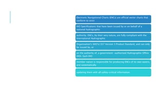
1. Electronic charts are the next generation of navigational charts. Their use in
electronic
charting systems simplify traditional navigation processes such as route planning
and
chart updating, and also enable automation of route tracking through use of
satellite
positioning devices. These features can greatly enhance navigational safety by
improving situational awareness, especially in busy or confined waters.
Digital technology is used to develop electronic charts from traditional paper
charts and
directly from marine survey data. The importance of using official data is, as
with paper
charts, absolutely paramount to maximising safety and other related benefits.
Official
electronic charts currently take two forms: Electronic Navigational Charts
(ENCs) and
Raster Navigational Charts (RNCs).
WHAT ARE
ENCS
(ELECTRONIC
NAVIGATIONAL
CHARTS)?
Electronic Navigational Charts (ENCs) are official vector charts that
conform to strict
IHO Specifications that have been issued by or on behalf of a
national hydrographic
authority. ENCs, by their very nature, are fully compliant with the
International Hydrographic
Organisation's (IHO's) S57 Version 3 Product Standard, and can only
be issued by, or
on the authority of, a government -authorised Hydrographic Office
(HO). Each IHO
member nation is responsible for producing ENCs of its own waters,
and systematically
updating them with all safety-critical information.
ENCs are the only vector
charts that may be used
for primary navigation in
place of
paper charts. When
operating with ENCs, an
ECDIS can be
programmed to
automatically trigger
alarms to warn of
impending dangers and
provide significant
benefits in terms of
maritime safety, risk
management, cost
savings and other
operational efficiencies.
ENCs consist of digitised
data that records all the
relevant chart features
such as
coastlines, buoys, lights,
etc. These features and
their attributes (such as
position,
colour, shape) are held in
a database -like structure
that allows them to be
selectively
displayed and queried,
creating the potential to
manipulate the chart
image when
displayed on screen.
Because of their vector
format, ENCs can also be
linked to other
onboard systems to
provide additional
automatic features such
as warning alarms.
3 variations of the same
ENC, showing minimum,
intermediate and
maximum data
display levels.
Thank you

Electronic Chart FAQ's.pptx

  • 1.
  • 2.
    WHAT ARE ELECTRONIC CHARTS? 1. Electroniccharts are the next generation of navigational charts. Their use in electronic charting systems simplify traditional navigation processes such as route planning and chart updating, and also enable automation of route tracking through use of satellite positioning devices. These features can greatly enhance navigational safety by improving situational awareness, especially in busy or confined waters. Digital technology is used to develop electronic charts from traditional paper charts and directly from marine survey data. The importance of using official data is, as with paper charts, absolutely paramount to maximising safety and other related benefits. Official electronic charts currently take two forms: Electronic Navigational Charts (ENCs) and Raster Navigational Charts (RNCs).
  • 3.
    WHAT ARE ENCS (ELECTRONIC NAVIGATIONAL CHARTS)? Electronic NavigationalCharts (ENCs) are official vector charts that conform to strict IHO Specifications that have been issued by or on behalf of a national hydrographic authority. ENCs, by their very nature, are fully compliant with the International Hydrographic Organisation's (IHO's) S57 Version 3 Product Standard, and can only be issued by, or on the authority of, a government -authorised Hydrographic Office (HO). Each IHO member nation is responsible for producing ENCs of its own waters, and systematically updating them with all safety-critical information.
  • 4.
    ENCs are theonly vector charts that may be used for primary navigation in place of paper charts. When operating with ENCs, an ECDIS can be programmed to automatically trigger alarms to warn of impending dangers and provide significant benefits in terms of maritime safety, risk management, cost savings and other operational efficiencies. ENCs consist of digitised data that records all the relevant chart features such as coastlines, buoys, lights, etc. These features and their attributes (such as position, colour, shape) are held in a database -like structure that allows them to be selectively displayed and queried, creating the potential to manipulate the chart image when displayed on screen. Because of their vector format, ENCs can also be linked to other onboard systems to provide additional automatic features such as warning alarms. 3 variations of the same ENC, showing minimum, intermediate and maximum data display levels.
  • 5.