Discovering projection of tropical world
•Download as PPTX, PDF•
0 likes•89 views

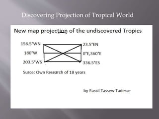
Scientists have discovered a new method of projecting tropical regions onto a flat map without significant distortion. By using a new mapping technique called the Authalic projection, cartographers can now represent the sizes and shapes of tropical landmasses and oceans more accurately than previous projections. This new projection type should allow for improved weather forecasting and climate modeling in tropical parts of the world.
Recommended

Recommended
More Related Content
More from Fassil
More from Fassil (20)
Recently uploaded
Recently uploaded (11)
Discovering projection of tropical world
- 1. Discovering Projection of Tropical World