SlideShare a Scribd company logo
1 of 127
Download to read offline
MAY 2023
WATERFRONT
SPECIFIC PLAN
Real. Authentic.
Different.
VISITEUREKA.COM
D
R
A
F
T
1-3
WEP Chapter 1
Introduction
D
R
A
F
T
As the official seat of the world-famous Humboldt County, California, the City of Eureka (City)
is the heart of the U.S. Redwood Coast. Eureka is the market and cultural center of a beautiful
region filled with iconic redwoods—the world’s tallest trees—and stunningly beautiful, rugged,
and remote ocean landscapes. Bordered on the west and north by Humboldt Bay, Eureka
extends east and south toward redwood forest. Highway 101 extends from Los Angeles in
Southern California to beyond the Oregon border in the north, and runs through Eureka,
connecting it to smaller cities in Humboldt County and to the entire West Coast of the United
States. Eureka is known for its unique Victorian architecture; a creative artistic culture; and
one-of-a-kind shops, restaurants, and artisanal businesses nestled behind the “Redwood
Curtain.” Cal Poly Humboldt is located just north of Eureka, and Highway 299 East connects
Eureka to Interstate 5, which stretches between the Canadian and Mexican borders through
California, Oregon, and Washington.
The Waterfront Eureka Plan Area (Plan Area) for the Waterfront Eureka Plan (WEP)
encompasses approximately 130 acres in the northern portion of Eureka, between Humboldt
Bay and Downtown Eureka. The Plan Area consists of three districts identified in the City of
Eureka 2040 General Plan: Commercial Bayfront, with primarily coastal-dependent, recreation,
visitor-serving uses, open space, and the Waterfront Trail, as well as the Blue Ox Mill Works,
residences and office buildings; Old Town, the commercial heart of the Plan Area and a premiere
historic and cultural district; and Library, a mixed residential/office area, home to the namesake
Humboldt County Library and the Carson Mansion (see WEP Figure 1-1, Plan Area). The Plan
Area is described in detail in WEP Chapter 2 Background Report.
D
R
A
F
T
1-3
WEP Figure 1-1. Plan Area
Guiding Principles, Organization, and Authority of the
Waterfront Eureka Plan
The City embarked on the WEP to provide a roadmap for development and redevelopment of
the vacant and underutilized sites and buildings along and near Eureka’s central waterfront, to
facilitate new mixed-use development and result in the creation of at least 115 housing units in
the Plan Area by 2027, in part by streamlining environmental review of subsequent projects. The
WEP will serve as the land use, circulation, and infrastructure regulatory document governing
development of the Plan Area. The WEP is a regulatory blueprint and will be used by City
leaders, residents, businesses, and developers to implement the 2040 General Plan and the
certified Local Coastal Program (LCP). The WEP outlines community-led visions for the future
of the Plan Area, and contains focused policies, programs, and regulations, which will govern
and shape development in the Plan Area to achieve these visions.
Guiding Principles
A number of Guiding Principles emerged from community and decision-maker input throughout
the planning process for the WEP. Together, these Guiding Principles discussed below support
the overall vision for the Plan Area and are reflected in the goals, policies, and implementation
measures of the WEP, which are described and discussed in WEP Chapter 4 Future
Opportunities; WEP Chapter 5 Land Use, Housing, and Mobility; and WEP Chapter 7
Administration and Implementation.
D
R
A
F
T
1-3
A. Increase Housing Options
Support a diversity of housing opportunities in the Plan Area to meet the needs of the community.
Provide housing choices for both longtime residents and newcomers to Eureka, recognizing a
range of household sizes and needs. Encourage increased housing density throughout the Plan
Area, while maintaining the area’s character. Increasing the number of people living in the Plan
Area will bring more activity, vibrance, and business to the local community.
B. Promote the Plan Area as a Vibrant and Safe Destination for Residents, Tourists,
Businesses, and the Arts
Establish a balance of uses, urban design, and public spaces and events to encourage people
to work, shop, dine, and play in the Plan Area throughout the day and evening. Ensure long-term
economic sustainability by accommodating a broader array of uses and activities. Increase the
residential and employment populations to support growth for commercial uses and businesses
in the Plan Area.
C. Expand Access and Strengthen the Connection to Humboldt Bay
Increase opportunities for Waterfront Trail enhancements, connections, and extensions to inland
areas. Create parking strategies to accommodate visitors without limiting potential development.
Support port- and harbor-related industries in industrial locations by encouraging visitor-serving and
recreational water-oriented and water-related development along the waterfront in the Plan Area.
D. Prepare for and Adapt to Sea-Level Rise
Continue to develop and implement short-, medium-,
and long-term strategies to minimize impacts from sea-
level rise (SLR) on existing and future structures, sites,
and infrastructure, including roadways and utilities.
Create flexible standards to respond to changing
conditions. Use nature-based adaptation solutions,
also known as green infrastructure, where appropriate
and feasible, to protect and enhance coastal
resources. Develop adaptation strategies to maximize
social, environmental, and economic benefits, and to
minimize costs for current and future generations.
Encourage temporary and recreational uses in areas already experiencing the effects of SLR.
E. Foster a Diverse and Robust Business Community
Support a local economy friendly to new business investment and the creation and retention of
quality jobs. Develop parking and wayfinding strategies that help visitors locate and patronize
businesses in the area. Create clear and feasible development regulations to encourage
redevelopment. Provide public services and maintenance.
Organization of the Waterfront Eureka Plan
This document is structured to provide a thorough and detailed account of all facets of the WEP,
ranging from its vision and conceptual framework to the implementation strategies needed to
bring it to fruition. The WEP is organized into the following seven chapters:
GREEN INFRASTRUCTURE
Refers to the use of vegetative planting,
sediment nourishment, or other methods
that mimic natural systems to capitalize
on the ability of these systems to provide
flood and erosion protection, stormwater
management, and other ecosystem
services while also contributing to the
enhancement or creation of natural
habitat areas.
D
R
A
F
T
1-3
WEP Chapter 1 Introduction: This chapter summarizes the purpose and authority of the
WEP and the relationship to other regulatory documents and City codes and plans.
WEP Chapter 2 Background Report: This chapter summarizes the existing conditions and
development potential of the Plan Area.
WEP Chapter 3 Community Engagement: This chapter catalogs the results of extensive
public outreach and how public input was used in the development of the WEP.
WEP Chapter 4 Future Opportunities: This chapter explores three potential futures and
how these different visions could shape the Plan Area.
WEP Chapter 5 Land Use, Housing, and Mobility: This chapter contains the goals and
policies and outlines the allowed land uses and infrastructure, which will facilitate the
movement of goods and people in the Plan Area.
WEP Chapter 6 Regulations, Standards, and Guidelines: This chapter describes the WEP
zoning districts, identifies the types of uses allowed in each district, and provides
development and design standards and guidelines for the Plan Area.
WEP Chapter 7 Administration and Implementation: This chapter outlines the
administration of the WEP and summarizes implementation strategies including California
Environmental Quality Act (CEQA) streamlining efforts, supportive funding sources, and
financial tools to implement the WEP.
WEP Chapter 8 Use Classification Glossary: This chapter defines any relevant terms that
are not defined in WEP Chapter 6 Regulations, Standards, and Guidelines.
WEP Appendices:
Appendix A, Affordable Housing and Anti-Displacement Strategies, explores
housing strategies to avoid displacing current residents as the Plan Area is
redeveloped.
Appendix B, Online Engagement Results, includes more details regarding the
results of the online survey that is discussed in WEP Chapter 3 Community
Engagement.
Appendix C, General Plan Consistency Analysis, outlines how the WEP is
consistent with the General Plan and the goals and policies in Chapter 3.4 of the
2040 General Plan.
Authority
California Government Code Section 65450 states planning agencies may “prepare specific
plans for the systematic implementation of the general plan for all or part of the area covered
by the general plan.” A specific plan must include text and a diagram or diagrams that specify,
in detail, the following:
D
R
A
F
T
1-3
The distribution, location, extent, and intensity of the uses of land, including open
space, within the area covered by the plan (WEP Chapter 5 Land Use, Housing,
and Mobility).
The proposed distribution, location, and extent of major components of public and
private transportation, sewage, water, drainage, solid waste disposal, energy, and
other essential facilities located within the area covered by the plan and needed to
support the land uses described in the plan (WEP Chapter 5 Land Use, Housing,
and Mobility).
Standards and criteria by which development will proceed, and standards for the
conservation, development, and utilization of natural resources (WEP Chapter 5
Land Use, Housing, and Mobility and WEP Chapter 6 Regulations, Standards, and
Guidelines).
A program of implementation measures, including regulations, programs, public
works projects, and financing measures necessary to carry out the plan. In
addition, the specific plan must define the relationship between the specific plan
and the general plan (WEP Chapter 7 Administration and Implementation).
Relationship to the General Plan, Municipal Code, and
Other Laws
General Plan
California law states specific plans can only be adopted or amended if they are consistent with
the adopted local general plan and, by extension, the Coastal Land Use Plan. The intent of the
WEP is to be consistent with the goals of both the City of Eureka 2040 General Plan and the
Land Use Plan portion of the City’s certified LCP. While the 2040 General Plan addresses issues
relevant to the entire City, the WEP focuses specifically on the revisioning and buildout of the
City’s Coastal Core Area (see WEP Figure 1-2), providing detail on policies and implementation
strategies to achieve the community’s visions for three Core Area districts: Commercial Bayfront,
Old Town, and Library. The 2040 General Plan Land Use Policy 2.11 serves as the impetus to
develop a specific plan to implement the 2040 General Plan’s vision for Eureka’s Plan Area.
D
R
A
F
T
1-3
WEP Figure 1-2. Core Area
The 2040 General Plan recognizes Eureka is experiencing a
shortage of housing at all income levels. The City is especially
hard hit by this trend because it is almost completely built-out
and has little to no room for expansion beyond current City
limits, or expanding any zones, especially the City’s
residential zones. For this reason, the 2040 General Plan
establishes Downtown and the central waterfront as primary
areas for future growth, including for residential and
employment uses to be built as higher-density, mixed-use,
infill development. The 2040 General Plan’s policies envision the Core Area continuing to grow
as a thriving, compact, and pedestrian-oriented place serving as the heart of Eureka’s civic,
cultural, business, and visitor area, and appealing to new investment.
Local Coastal Program
The standard of review for land use planning and development in the Coastal Zone is the City’s
LCP, which implements the California Coastal Act at the local level. An LCP consists of the
following two parts:
The Land Use Plan (LUP), which is the relevant portion of a local government’s
general plan pertaining to the Coastal Zone and conformance with the California
Coastal Act; the LUP is composed of land use maps and policies and programs,
which are sufficiently detailed to indicate the kind, location, and intensity of land
uses, resource protection, and development in the Coastal Zone.
Core Area
The Core Area, as defined in the
2040 General Plan, is the
traditional business center and
cultural hub of the City. It includes
the three districts in the Plan Area
– which constitute the Coastal
Core Area – as well as Downtown.
D
R
A
F
T
1-3
The Implementation Plan (IP) is the Coastal Zoning Code that includes zoning
maps, development standards, and other implementing ordinances that conform
with and carry out the goals and policies of the LUP.
The City’s LCP was originally certified by the California Coastal Commission in 1984. A
comprehensive update to the City’s LUP was effectively certified by the California Coastal
Commission in 1999. The City’s IP has not been comprehensively updated since 1984 and still
includes much of the City’s zoning code from the 1960s. The City recently adopted a 2040
General Plan and updated its Inland Zoning Code in 2018 and 2019, respectively, and is working
to comprehensively update its LUP and IP to incorporate the relevant portions of these
documents.
The Plan Area is entirely within the Coastal Zone under the purview of the LUP and IP. As a
result, the 2040 General Plan and Inland Zoning Code do not apply to the Plan Area; instead,
the Plan Area continues to be governed by the LCP documents originally developed and certified
in the 1980s and 1990s. The City intends to use the information collected, and the environmental
analysis performed, during the WEP process to inform and facilitate the ongoing comprehensive
LCP update to ensure the WEP and LCP are consistent. The WEP may be certified by the
California Coastal Commission prior to, concurrently with, or subsequent to adoption of the
comprehensive LCP update.
D
R
A
F
T
2
BACKGROUND
REPORT
D
R
A
F
T
2-2 THE CITY OF EUREKA | WATERFRONT SPECIFIC PLAN
CHAPTER
2
:
BACKGROUND
REPORT
INTRODUCTION
This section summarizes the existing conditions
of the Waterfront Eureka Plan Area (Plan
Area) related to land uses, jobs, mobility,
historic resources, parks, and natural hazards.
The findings of this assessment will inform the
policies and actions included in the Waterfront
Eureka Plan to encourage high-quality new
development, foster economic development,
and prepare for climate change.
COMMUNITY DISTRICTS
AND LAND USE
The City’s 2040 General Plan identified and
named three community places that the
Waterfront Eureka Plan centers around:
Commercial Bayfront, Library District, and
Old Town (See Figure 1).
Figure 1. Eureka 2040 General Plan Area Districts
These three community places or districts have
distinct personalities and roles in making the
Plan Area a place where people can live, work,
and play. The development potential as currently
allowed in the 1997 Local Coastal Program and
zoning code is described below for each district.
Carson Mansion
D
R
A
F
T
2-3
LOCAL COASTAL PROGRAM
The entire Plan Area is governed by the Local Coastal Program. At the time
the Waterfront Eureka Plan was being developed, the City of Eureka (City)
was concurrently updating the Local Coastal Program to reflect the direction
of the City’s 2040 General Plan. Until the California Coastal Commission
approves a Local Coastal Program Update, the standards of the existing
(1997) Local Coastal Program will prevail. This section includes future uses
consistent with the 2040 General Plan, which are consistent with the most
recent public visioning and the anticipated Local Coastal Program Update.
KEY TERMS The following key terms are used throughout this section.
District
Districts are recognized community
places with their own identity. District
areas were derived during the General
Plan Update planning process.
Land Use Designation
The desired future uses and development
pattern in a given area accomplished with
density and intensity restrictions.
Existing Land Use
How the site is being used now. This
could include vacant sites that have no
current land uses. It could also include
uses that were permitted in the past
and are no longer allowed, but they
continue to exist because their use is
grandfathered in.
Zoning
Specifically defines and regulates
what kinds of uses are allowed on
specific parcels and outlines design and
development requirements
and guidelines.
D
R
A
F
T
2-4 THE CITY OF EUREKA | WATERFRONT SPECIFIC PLAN
CHAPTER
2
:
BACKGROUND
REPORT
Figure 2. Vacant Sites in Plan Area
Commercial Bayfront
EXISTING USES
The Commercial Bayfront consists of the
Eureka waterfront north of 1st Street, and
west-east from C Street to Y Street. This
District includes commercial and public sites
such as Madaket Plaza, Coast Guard Plaza,
the Adorni Center, Bonnie Gool Guest Dock,
Samoa Boat Launch, and Halvorsen Park.
The Eureka Boardwalk and a portion of the
Eureka Waterfront Trail are also located
generally along the northern boundary of the
Commercial Bayfront District. Much of the
Commercial Bayfront is vacant land that once
supported a bustling maritime- and timber-
industrial setting. Because of the existing
vacant land and proximity to Humboldt
Bay, this District has major redevelopment
potential.
The Commercial Bayfront includes a variety of
commercial, recreational, and limited residential
uses. The Commercial Bayfront District contains
approximately 50 parcels totaling 66 acres.
Approximately 6% of the Commercial Bayfront’s
acreage is covered by unconstrained vacant
sites, 23% is covered by constrained vacant sites
(as shown in
Figure 2), 6% is covered by surface parking
lots (as shown in Figure 3), and 15% of the
land is underutilized.
FUTURE USES
According to the 2040 GP, the Bayfront
Commercial land use designation accommodates
“visitor-related retail, restaurants, multi-story
CONSTRAINED VS.
UNCONSTRAINED SITES
Constrained sites have requirements or
covenants that restrict the types of uses
possible. These sites may be constrained
because they are environmentally sensitive
(such as wetlands) or are hazardous (such as
waste cleanup sites). Unconstrained sites do
not have these added restrictions.
D
R
A
F
T
2-5
Woodley Island Marina
lodging, entertainment, recreation, boating, and
tourist services, as well as residential, office,
and a mix of coastal and non-coastal dependent
uses.” This land use designation is meant to result
in multi-story buildings with pedestrian-scaled
storefronts along the sidewalks, boardwalk, and
waterfront trails. Residential and office uses will
be allowed on upper floors or non-street facing
portions of buildings to allow for a mix of uses and
density, while still focusing on engaging activities
along the street. A small portion of the District is
designated Public/Quasi-Public, as it is occupied by
the Adorni Center. This land use is for government
facilities, parks, and other institutional uses.
Much of the City’s expected growth in the next
20 years is centered around development of
1997 LOCAL COASTAL PROGRAM ON THE COMMERCIAL BAYFRONT
In the 1997 Local Coastal Program, the entire Bayfront Commercial District
is zoned Waterfront Commercial. The existing maximum FAR is 2.5, allowing
25% of the maximum development contemplated by the Waterfront Eureka
Plan. Coastal related uses, recreation, and tourist-oriented developments are
allowed by right. Other commercial uses, such as offices and retail are allowed
with discretionary approval. Housing as outlined in the Multi-family Residential
Zones are allowed in waterfront commercial zones above the ground floor with
discretionary approval.
FLOOR AREA RATIO (FAR)
A measurement to show how much floor area is
allowed on a parcel or lot. It’s calculated by dividing
the total floor area of a building by the total land
area of the parcel.
the vacant and underutilized land in the Bayfront
Commercial District. Table 1 includes maximum
floor area ratio (FAR), within the Commercial
Bayfront District, and how development is projected
to be built out, in accordance with the City of
Eureka’s 2040 General Plan. When accounting for
the development of vacant and underutilized sites,
1219 jobs are expected to be added to this District
alone; 773 dwelling units also have potential to be
added.
D
R
A
F
T
2-6 THE CITY OF EUREKA | WATERFRONT SPECIFIC PLAN
CHAPTER
2
:
BACKGROUND
REPORT
Figure 3. Parking Lots
Library District
Adjacent to historic Old Town to the west and
the Bayfront to the north, the Library District
has easy access to culture, retail, recreation,
and community events while maintaining its
primarily residential and quiet nature. The
District’s namesake is the Humboldt County
Library which is situated at the center of the
community. In addition to the library, the area
boasts the famous Carson Mansion among
other historic structures that foster beauty
and community identity. The District also hosts
modest retail, accommodation, and professional
office uses. Some of these nonresidential uses
occupy historic houses which maintains the
aesthetics of the neighborhood.
EXISTING USES
In addition to the library and residential uses,
the District also supports accommodations such
as the Carter House Inns and vacation rentals.
The Library District contains approximately 80
parcels, totaling 18 acres. Approximately 5% of
the Library District’s acreage is underutilized,
and 30% is used as surface parking lots
(Figures 3).
Table 1. Bayfront Commercial District
Development Potential
Development
Potential
Bayfront
Commercial
(BC)
Maximum Allowed Floor Area
Ratio (FAR)1
4
Assumed Average FAR 0.40
Underutilized and Vacant Acres 29.27
Potential Net Jobs Added2
1219
Potential Net Housing Units
Added3
773
Source: City of Eureka. 2018. City of Eureka 2040 General Plan.
Table 1 Notes: The 2040 General Plan designates parcels as
Public/Quasi-Public in the Bayfront Commercial District that are
not reflected on this table due to a limited or lack of development
potential related to jobs and housing
1
The allowable FAR in the Local Coastal Program is 2.5
2
Net Jobs Added are directly related to the underutilized and vacant
acres. This does not include jobs that may be added from parcels
that are environmentally constrained and cannot have housing.
3
58 of the Net Housing Units Added are directly related to the
underutilized and vacant acres. 70 additional net housing units are
included here related to the development of housing at 1st and C-F
Street.
D
R
A
F
T
2-7
Table 2: Library District Development
Potential
Development Potential Professional
Office (PO)1
Maximum Allowed Floor Area
Ratio (FAR)
2.5
Assumed Average FAR 0.60
Underutilized and Vacant Acres 1.02
Potential Net Jobs Added2
75
Potential Net Housing Units
Added3
14
Source: City of Eureka. 2018. City of Eureka 2040 General Plan.
1997 LOCAL COASTAL PROGRAM
ON THE LIBRARY DISTRICT
In the 1997 Local Coastal Program, the
entire Library District is zoned Office and
Multifamily Residential. The existing zoning’s
FAR is 2.5, allowing for similar development
contemplated in the Waterfront Eureka Plan.
This zone allows offices and parking facilities
by right. Housing is also allowed by right as
permitted in the Multifamily Residential zone
with additional regulations specified in the
zoning code depending on whether housing is
above a non-residential use or not. Nursing
homes, schools, and certain other similar uses
are allowed with discretionary approval.
FUTURE USES
Most parcels in the Library District are designated
Professional Office (PO) in the 2040 General Plan.
The vision in the 2040 General Plan for this land
use is to promote “a mix of single-family and multi-
family housing, small scale offices, some converted
residential buildings, and lodging where the intent
is to generally retain the character, scale and form
of the residential neighborhood.” A few parcels in
the Library District are designated Public/ Quasi-
Public (PQP) which is intended to support public and
private institutional uses, government facilities and
services, schools, courts, cemeteries, fairgrounds,
airports, marinas and wharves, and major utility
facilities, as well as parks, golf courses, and other
public recreational facilities. These parcels are
located along the railroad, library, and N Street.
The City has created unique zoning standards to
guide the size and shape of proposed development
to ensure the vision above. Table 2 depicts
development potential in the Library District, in
accordance with the 2040 General Plan.
Single Family Housing
Multi-Family Housing
Table 2 Notes: There are parcels designated in the 2040 General Plan
as Public/Quasi-Public in the Library District that are not reflected on this
table due to a limited or lack of development potential related to jobs and
housing
1
The maximum FAR for the PQP designation in the 2040 General Plan
is 4.0. Due to the public nature of PQP, these areas are less likely to
be redeveloped and do not have assumed averages and employment
additions in the 2040 General Plan
2
Potential Net Jobs Added are directly related to the underutilized and
vacant acres
3
Potential Net Housing Units Added are directly related to the
underutilized and vacant acres
D
R
A
F
T
2-8
Old Town District
The Old Town District was once the central
downtown core of the historic City of
Eureka and is on the National Register of
Historic Places as a Designated Historic
District. Host to buildings and structures
dating back to the 1850s, this District is a
window into Eureka’s rich history and is now
a celebrated place occupied by modern and
vibrant cultural facilities, theaters, lodging,
retail, and office spaces.
Old Town is appreciated by visiting tourists
and strongly represented in the local identity.
EXISTING USES
The Old Town District organically developed
as the retail and entertainment hub of Eureka
and continues to provide similar amenities
today. It largely serves tourism and small
local businesses. In addition to the small retail
and cultural uses, Old Town also supports
some residential and office spaces. The Old
Town District contains approximately 100
parcels, totaling 19 acres. Approximately
5% of the District’s acreage is underutilized,
5% is covered by unconstrained vacant sites
(Figure 2), and 21% is used as surface
parking lots (Figure 3).
FUTURE USES
The majority of parcels in Old Town are
designated Old Town Commercial (OC) in
the 2040 General Plan. The vision in the 2040
General Plan for this land use is to promote
“commercial retail and tourism-related
uses, recreation, leisure activities, hotels,
and upper floor office/residential uses.” A
few parcels in Old Town are designated
Public Facilities (PF) which are intended to
support public and private institutional uses,
government facilities and services, schools,
courts, cemeteries, fairgrounds, airports,
marinas and wharves, and major utility
facilities, as well as parks, golf courses, and
other public recreational facilities.
Table 3: Old Town Development
Potential
Development
Potential
Old Town
Commercial
(OC)
Maximum Allowed Floor Area
Ratio (FAR)
5.0
Assumed Average FAR 0.35
Underutilized and Vacant
Acres
1.99
Potential Net Jobs Added1
355
Potential Net Housing Units
Added2
226
Source: City of Eureka. 2018. City of Eureka 2040 General Plan.
The Old Town Commercial land use was
created to encourage “historic and multi-story
buildings with pedestrian-scaled storefronts
lining the sidewalks,” with residential and office
spaces primarily existing in the upper floors
and building areas that do not face a street
front. Table 3 depicts development potential
in Old Town, in accordance with the 2040
General Plan.
THE CITY OF EUREKA | WATERFRONT SPECIFIC PLAN
CHAPTER
2
:
BACKGROUND
REPORT
DESIGNATED HISTORIC DISTRICT
A designated Historic District is listed in the
National Register of Historic Places. Historic
Districts make available specific federal and
state tax incentives for preservation purposes
and qualify property owners for federal and
state grants for preservation purposes when
funds are available.
Table 3 Notes: There are parcels designated in the 2040 General
Plan as Public/Quasi-Public in the Old Town District that are not
reflected on this table due to a limited or lack of development
potential related to jobs and housing.
1
Potential Net Jobs Added are directly related to the underutilized
and vacant acres
2
Potential Net Housing Units Added are directly related to the
underutilized and vacant acres
D
R
A
F
T
2-9
1997 LOCAL COASTAL PROGRAM
In the 1997 Local Coastal Program, the western 88.5% of the Old Town District is
zoned Waterfront Commercial, and the remaining 11.5% of the district is zoned Office
and Multifamily Residential.
In the area zoned Waterfront Commercial, the existing maximum FAR is 2.5, allowing
50% of the maximum development allowed in the Waterfront Eureka Plan. Coastal
related uses, recreation, and tourist-oriented developments are allowed by right.
Other commercial uses, such as offices and retail are allowed with discretionary
approval. Housing, as outlined in the Multifamily Residential zones, is allowed in
Waterfront Commercial zones above the ground floor with discretionary approval.
In the portion of the Old Town District zoned Office and Multifamily Residential,
the existing FAR is 2.5, allowing 50% of the maximum development allowed in the
Waterfront Eureka Plan. This zone allows offices and parking facilities by right.
Housing is also allowed by right as permitted in the Multifamily Residential
zone with additional regulations specified in the zoning code depending
on whether housing is above the first floor or not. Nursing homes, schools,
and certain other similar uses are allowed with discretionary approval.
2nd Street
D
R
A
F
T
2-10 THE CITY OF EUREKA | WATERFRONT SPECIFIC PLAN
CHAPTER
2
:
BACKGROUND
REPORT
Bayfront One mixed-use building
JOBS
The Plan Area borders Downtown (as identified
in the 2040 General Plan) and supports
restaurants and shopping serving visitors and
residents alike. The Plan Area also supports
small offices, bolstered by its proximity to
downtown and City and County facilities. The
Plan Area has a significant in-commute, with
1,150 jobs in the Plan Area, while housing only
249 people. That means this area has a jobs-
housing imbalance and raises potential
concerns about housing affordability in the
District and traffic or parking for people who
commute in for work.
Commercial Bayfront
Historically, the Commercial Bayfront District’s
economic activity was anchored by maritime
JOBS-HOUSING IMBALANCE
This occurs when an area is a hub for either
housing or employment, but does not contain
the other at a similar level.
and coastal jobs. Today one active fishery
remains in the Commercial Bayfront District,
and fisheries, oyster farms, and maritime
industry jobs exist elsewhere in Eureka and
Humboldt Bay.
The Commercial Bayfront District supports
approximately 190 jobs. The largest industry
sector for jobs is the Accommodation and Food
Services sector with 38% of the jobs. These jobs
are spread among the multiple restaurants in the
District. Other significant sectors for the area
include retail trade and professional, scientific,
and technical services.
Library District
The Library District is host to over 300 jobs.
The largest industry sector is manufacturing
with 26.7% of jobs, however, this sector has
been rapidly declining in recent years.1
Other
significant sectors of the area include health care
and social assistance (15.2%) and other (24.1%).2
1
United States Census Bureau. 2019. “OnTheMap”. https://onthemap.ces.census.gov/
2
United States Census Bureau. 2019. “OnTheMap”. https://onthemap.ces.census.gov/
D
R
A
F
T
2-11
Figure 4. Public Transit
While most of the buildings throughout the District
are of residential design, many have been converted
into office spaces while maintaining the character of
the District.
Old Town
Old Town represents the largest job center in the
Plan Area and is host to over 660 jobs. Health Care
and Social Assistance (45.7%), Accommodation and
Food Services (17.7%), and Retail Trade (12.6%) make
up 76% of employment in Old Town.2
Many of the
buildings throughout Old Town are multi-story and
thus provide ample office and professional space
for businesses above the ground floor shops and
restaurants. The professional, scientific, and technical
services industry employed roughly 68 people
(10.3%) in 2019.
MOBILITY
Transit
The entire Plan Area is within walking distance of
a bus stop (See Figure 4). The Eureka Transit
System’s five bus lines offer local transit throughout
the City. Four of these lines (Purple, Gold, Red, and
Rainbow) make stops in the Plan Area, providing
access to much of Eureka by bus. Additionally,
the Redwood Transit Authority has stops directly
adjacent to the Plan Area on 4th and 5th streets,
providing access as far north as Trinidad and as far
south as Scotia.
Walking and Biking
The Waterfront Trail and Eureka Boardwalk are
two walking trails that run through the Commercial
Bayfront District. The Waterfront Trail begins near
the water at Halvorsen Park, and runs eastward all
the way through the District, continuing eastward
and then looping south along the Eureka Slough.
The Eureka Boardwalk is a trail along the Bay
that runs from C Street to G Street and connects
commercial areas (See Figure 5).
Together, the Waterfront Trail, Eureka Boardwalk,
and 1st Street/Waterfront Drive form a continuous
trail network along the Eureka waterfront which in
turn contributes to the California Coastal Trail.
D
R
A
F
T
2-12 THE CITY OF EUREKA | WATERFRONT SPECIFIC PLAN
CHAPTER
2
:
BACKGROUND
REPORT
Old Town Parking
Figure 5. Boardwalk and Waterfront Trail
The Library District and Old Town are
connected active retail areas. Old Town
is characterized by mixed-use buildings,
supporting shops on the ground floor, flowing
eastward into the Library District that supports
small businesses and government offices.
Stylized sidewalks run along J, K, and L streets
and form a promenade on 2nd Street leading up
to the Carson Mansion.
Otherwise, exposed aggregate concrete
sidewalks are present throughout the majority
of the District. There are designated bike lanes
along Waterfront Drive between H Street
and the Humboldt Bay Aquatic Center. Future
bike lanes are proposed by the 2040 General
Plan throughout the plan area. There are two
alleyways that run the length of the Library
District from east to west between 1st and 2nd
Streets (Snug Alley) and 2nd and 3rd Streets
(Opera Alley) that terminate at M Street. These
serve as informal passageways for bikes and
pedestrians.
Parking
The Eureka Downtown Parking Study, which
encompasses Old Town and Downtown, found
that safety was the primary concern of both
members of the general public and people who
work in the study area. Whereas the general
public did not perceive a parking shortage in
the study area, people who work in the project
area thought time-limits on parking spaces
(such as 2-hour parking) created a shortage of
parking suitable to their needs. While requiring
parking for new development may meet the
D
R
A
F
T
2-13
needs and desires of businesses, the workforce, and
residents, having development standards for parking
can make development more expensive. To address
this, the Eureka Downtown Parking Plan includes
goals and strategies to balance existing parking
demand and encourage new development and uses.
These goals include:
‒ Increase public awareness of parking options
and wayfinding signs
‒ Make parking desirable for all users, including
residents, employees, and visitors
‒ Improve access and safety
‒ Explore innovating parking management
strategies
The Waterfront Eureka Plan will incorporate
strategies to implement the Eureka Downtown
Parking Plan.
HISTORIC AND CULTURAL
LANDMARKS
Wiyot History
Eureka was originally populated by the Wiyot
people, a Native American tribe that has lived in
the Humboldt Bay region for thousands of years.
Between 1,000 and 3,300 Wiyot lived in villages
along the shores of Humboldt Bay and near the
mouths of the Eel and Mad Rivers.3
The Wiyot used
redwood dugout canoes and elaborate fishing and
hunting technology to sustain themselves. Wiyot
people produced a variety of materials to improve
their daily lives such as twined basketry and woven
tule mats.
The Wiyot also commonly traded with neighboring
groups, including the Mattole, Yurok, Sikyone,
and other inland groups. White explorers and
fur trappers arrived in the area in the 1800s, and
the City of Eureka was founded in 1850. By 1853,
white settlers outnumbered the Wiyot people, and
Fort Humboldt was established by the U.S. Army
to assist in conflict resolution between Native
Americans and gold-seekers. The conflict was not
resolved peacefully; in 1860 the majority of the
Wiyot tribe was tragically murdered in what became
known locally as the “Wiyot Massacre.” Wiyot
who survived the violence and diseases introduced
by the Euro-Americans were displaced to distant
reservations or marginal lands.
To this day, over 200 individuals of Wiyot descent
are associated with the Blue Lake, Rohnerville, and
Table Bluff Reservations. In October of 2019, the
City of Eureka made international headlines when
they returned a sacred island, Tuluwat Island across
the Eureka Channel from the Plan Area, to their
friends and neighbors in the Wiyot tribe. This event
marked the first time a local government had taken
such action anywhere in the United States and was
a long-awaited and deeply significant moment of
healing for the entire community.
Historic Resources
The Plan Area’s proximity to the Bay made it the
center of European settlement in Eureka. Economic
prosperity from the lumber industry turned Eureka’s
waterfront into a bustling commercial district. The
Library District and Old Town were part of the
original residential and commercial portions of the
City, respectively. Within these neighborhoods, fine
architecture is interspersed throughout. Of the
20 buildings in Eureka recognized on the National
Register of Historic Places, the Plan Area is home to
6. Additionally, 47 buildings in the Plan Area are on
the Local Register of Historic Places.4
As stated earlier when discussing community
districts and land use, the Plan Area also contains
the Old Town Historic District, which is part of the
United States National Register of Historic Places.
Structures on the national and local registers are
a priority for preservation by the City, as these
structures help to tell the story of Eureka.
The Eureka Chinatown Project is a recent
commitment to honoring and preserving the City’s
history and culture. The Project includes murals and
monuments acknowledging the historic Chinatown
district between 3rd and 4th streets and F and E
streets.
3
City of Eureka. 2015. “Community Background Report.” http://www.eureka2040gpu.com/Links/pdfs/City%20of%20Eureka%20CBR%20(June%202015).pdf
4
City of Eureka. 2019. “Local Register of Historic Places”. https://www.ci.eureka.ca.gov/civicax/filebank/blobdload.aspx?BlobID=15628
D
R
A
F
T
2-14 THE CITY OF EUREKA | WATERFRONT SPECIFIC PLAN
CHAPTER
2
:
BACKGROUND
REPORT
PARKS AND RECREATION
Commercial Bayfront
Parks and public-serving facilities are especially
important in and along Humboldt Bay, which
is a wonderful natural and scenic resource
that deserves to be shared with the public.
In the Commercial Bayfront District there
is Halvorsen Park, a recreation center, and
plazas meant for public use. The entirety of
the District is within walking distance of one
or multiple parks or public spaces, as shown
on Figure 6. On the western edge of the
Commercial Bayfront District at the foot of C
Street is Madaket Plaza. This site has a ticket
booth and dock for the Madaket, the oldest
passenger carrying ferry in continuous service
in the United States.5
The Plaza also hosts the
Eureka Summer Concert Series. Just east of
Madaket Plaza, and connected by the Eureka
Boardwalk, is Coast Guard Plaza at the foot of
F Street. This plaza has a restaurant and retail
store (currently an ice cream shop), as well as
upper floor residential uses.
Further eastward is another recreation-
serving facility, the Humboldt Bay Aquatic
Center (HBAC), which offers outdoor
recreation in the form of kayak rentals and
scenic boat tours.6
Adjacent to the HBAC is
the Adorni Memorial Recreation Center. This
is a fitness facility run by the City of Eureka’s
Community Services Department. The Adorni
Center offers fitness classes and facilities for
members.7
Finally, the Sacco Amphitheater
and Halvorsen Park are found directly east
of the Adorni Center. The area provides
approximately 3.5 acres of open space and
facilities for public concerts and contains a
section of the Waterfront Trail.8
It should also
be noted that boat and kayak launches are
present along the Commercial Bayfront District
and provide for additional forms of recreation
and transportation in the Bay.
Figure 6. Access to Parks and Public Spaces
5
Madaket Cruises. 2021. https://humboldtbaymaritimemuseum.com/madaketmainpage.html
6
Humboldt State University. (n.d.) Humboldt Bay Aquatic Center. https://centeractivities.humboldt.edu/feeds/feeddetails?feed=86686668-94db-4e7b-
aab7-c0dfae8832f2
7
City of Eureka. (n.d.) Adorni Recreation Center. http://www.ci.eureka.ca.gov/depts/recreation/adorni_center.asp
8
City of Eureka. (n.d.) Halvorsen Park. https://www.ci.eureka.ca.gov/depts/recreation/facility_rentals/halvorsen_park.asp
D
R
A
F
T
2-15
2nd Street Promenade
Within the Plan Area, kayaks can be launched at
Madaket Plaza, the HBAC, and the Samoa Boat
Ramp, while boats can only be launched at the
Samoa Boat Ramp. No marinas are in the Plan Area,
but the closest marina is across the Bay to the north
on Woodley Island.
Library District
In addition to the namesake Humboldt County
Library building, the district also hosts the Clara
May Berry Park and Playground adjacent to the
Library. Other park and recreation spaces are less
formal or linear in design including the 2nd Street
pedestrian pathway which includes beautified and
protected sidewalks, street trees, and sitting areas.
The pathway extends from the corner of 2nd and I
Streets on one end to the famous Carson Mansion,
and also has an improved pedestrian connection to
3rd Street along K Street. There are also a Class II
bikeway and sidewalk that run along Waterfront
Drive between the Library and Commercial
Bayfront Districts.
Old Town
Old Town is home to formal public spaces such as
the Clarke Plaza across E Street from the Clarke
Historical Museum. Friday Night Market’s are held
from August to October on 2nd Street from F to C
Streets, and E Street from Snug Alley to 3rd Street.
On the corner of F Street and 2nd Street is the Old
Town Gazebo which boasts the Gazebo Fountain
and many community events including the Old Town
Farmers’ Market.
These plazas provide areas to bring entertainment,
healthy food, economic development, and culture
to Old Town and the surrounding community. Art
galleries, restaurants, and retail shops surround the
Old Town Gazebo and pull visitors and residents
to activate the space. Both plazas in Old Town are
connected to alleyways that run between C and M
Street through Old Town and part of the Library
District; the Clarke Plaza is connected to Opera
Alley and the Old Town Gazebo is connected to
Snug Alley. The original purpose of these alleys
was to act as delivery and waste access for the
commercial and residential tenants of buildings
abutting the passageway. However, over time they
have become pedestrian pathways and public spaces
off the main streets. In some sections, the alleys
resemble a linear park with murals painted on
buildings, string lights, trees, and local art.
CLASS II BIKEWAY
These are often called bike lanes. They run
alongside a street and are separated from the cars
using paint.
D
R
A
F
T
2-16 THE CITY OF EUREKA | WATERFRONT SPECIFIC PLAN
CHAPTER
2
:
BACKGROUND
REPORT
King Tide in the Commercial Bayfront
© Humboldt Baykeeper
CLIMATE CHANGE
AND HAZARDS
Sea-level Rise, Coastal
Flooding, and Erosion
Flooding and coastal erosion are significant
hazards for the low-lying and bayfront portions
of the Plan Area, and these hazards are
expected to increase exponentially with time,
given anticipated sea level rise.
Humboldt Bay is experiencing the fastest rate of
local sea-level rise (SLR) on the U.S. West
Coast.9
The main driver of global SLR is climate
change, but localized subsidence caused by
tectonic plate movement is a major reason why
Humboldt Bay is experiencing higher rates of
local SLR than other coastal areas, even when
compared to areas as close as Crescent City
(~68 miles away).10
The Coastal Commission recommends
considering potential SLR over the anticipated
life or duration of a proposed structure, after
which the structure is expected to be removed,
replaced or redeveloped. For new residential
and commercial structures, a 75-year to 100-
year design life is typically used.
The current mean monthly maximum water
(MMMW) (spring tides) elevation on Humboldt
Bay is 7.74 feet (2.58 meters) and the mean
annual maximum water (MAMW) (king tides)
elevation is 8.8 feet (2.93 meters). The 100-
year still-water level at the North Spit is 10.2
feet (3.4 meters). For informational purposes,
this report includes a map of future MMMW,
MHHW, MAMW, and the 100-year storm with
6.5 feet (2.16 meters) of SLR to visualize where
in the Plan Area development may need to
adapt to SLR (see Figure 7)11
.
SLR vulnerabilities are concentrated in the
western portion of the Old Town District and
throughout the Bayfront Commercial District.
Risks are somewhat mitigated by the artificial
shoreline and relatively large range of elevations
in the Plan Area, which start at sea level and
reach as high as 45 feet (13.72 meters) in some
parts. The current waterfront is artificial,
created out of fill from the Bay and fortified
with rock armoring. It is important to note that
LOCAL SEA-LEVEL RISE (SLR)
This term recognizes that sea-level rise can vary
locally depending on regional ocean-atmosphere
circulation dynamics (such as El Niño Southern
Oscillation) and local tectonic vertical land
motions (like subsidence).
9
Anderson, J.K. (2018) Sea Level Rise in the Humboldt Bay Region – Update 2: December 2018. http://www.coastalecosystemsinstitute.org/wp-content/
uploads/2021/09/HumBaySeaLevelRise_Update2_Dec2018_190118.pdf
10
Zervas, C., S. (2009) Sea Level Variations of the United States 1854-2006. NOAA. NOAA Technical Report NOS CO-OPS 053. 78 pp.
11
City of Eureka. 2018. City of Eureka 2040 General Plan. “Liquefaction Hazards.”
D
R
A
F
T
2-17
12
Environmental Science Associates (ESA). 2019. Elk River Wastewater Treatment Plant Enclosed Bay and Estuaries Compliance Feasibility Study –
Climate Change Readiness Study and Vulnerability Assessment Prepared for the City of Eureka.
13
Cal-Adapt. (2021). Extreme Precipitation Climate Modeling Tool. https://cal-adapt.org/tools/extreme-precipitation
Figure 7 assumes that shoreline barriers will not be
constructed or fortified to prevent tidal flooding of
inland areas.
In addition to tidal flooding and inundation, other
potential SLR-related issues include shoreline
erosion, rising groundwater, and impairment to
drainage systems. More studies are needed to better
understand these risks.
Climate change is projected to impact a number
of other natural systems, including hazards like
extreme storms. Flooding caused by extreme storms
is predicted to be intensified in the region due to
climate change. The 100-year rainfall is predicted
to increase from approximately 11% to 16% by mid-
century, and to 20% by late-century.12
Furthermore,
the number of annual extreme storms that last 2 or
more days is projected to increase from two events
per year to four events per year by 2100.13
Earthquakes
Earthquakes can damage public infrastructure,
property, and buildings. The Plan Area is within a
seismically active region that regularly experiences
minor earthquakes, and large earthquakes are
expected to occur during the lifespan of new
development. There are no faults or Alquist
Priolo Zones within the Plan Area, but there is
still a risk of liquefaction, differential settlement,
and structure damage from ground shaking. These
risks are especially high near the shoreline, where
there is unconsolidated fill material, sandy marine
deposits, and high groundwater tables. Ground
shaking can also be especially damaging to older
buildings, as they were built before seismic resilient
building codes existed. For instance, unreinforced
masonry buildings are commonly known as the most
vulnerable structures to earth shaking. Furthermore,
Figure 7. Sea Level Rise Scenarios
100-YEAR RAINFALL
This references a local rain event with such a large
magnitude that it has a 1% chance of occurring in
any given year.
ALQUIST PRIOLO ZONES
This is a zone around surface traces of active
faults. Active faults are faults that have ruptured in
the last 11,000 years.
D
R
A
F
T
2-18 THE CITY OF EUREKA | WATERFRONT SPECIFIC PLAN
CHAPTER
2
:
BACKGROUND
REPORT
open front wood buildings (permitted pre-
1980), concrete buildings (permitted pre-1976),
and steel moment frame buildings (permitted
pre-1997) are all vulnerable to varied severities
of damage if not retrofitted.14
Unreinforced
masonry buildings in the City were inventoried in
2002 and many have been retrofitted in the past
20 years. Three unreinforced masonry buildings
are still present within the Plan Area.
The City of Eureka is also near the Mendocino
Triple Junction that poses elevated seismic
threats in addition to subsidence which has the
potential to compound sea level rise impacts.
14
Structural Engineers Association of Southern California. October 2020. “Buildings, Building Codes, and Earthquake Safety”.
https://www.seaosc.org/resources/Documents/Board%20Docs/SEAOSC%20Existing%20Buildings%20Fact%20Sheet%20-%20Oct%202020.pdf
15
State of California. (2021). Tsunami Hazard Area Map, Humboldt County; produced by the California Geological Survey, the California
Figure 8. Tsunami Hazard Areas
Tsunami
There is the potential for tsunamis triggered
by both local source events like an earthquake
on the Cascadia subduction zone, or far
field/distance source events (like an Alaskan
earthquake). Tsunamis can also be caused by an
underwater landslide, calving glacier, impacting
meteor, or other large ocean disturbances. The
Tsunami Hazard Area covers the entirety of the
Commercial Bayfront, the western half of Old
Town to the west of E Street as well as to the
north and west of the Old Town Gazebo, and
slivers off the northern portion of the Library
District. Currently the portions of the Plan Area
in the Tsunami Hazard Area are all well within
a 10-minute, or half-mile, walk to higher ground
outside of the Tsunami Hazard Area. There are
currently approximately 119 dwelling units, home
to 212 people, within the Plan Area’s Tsunami
Hazard Area. None of the buildings in the
MENDOCINO TRIPLE JUNCTION
The Mendocino Triple Junction is the point where
the Gorda tectonic plate, the North American
plate, and the Pacific plate meet. Due to the
junction of three plates, the area is subject to an
especially seismically active enviroment.
D
R
A
F
T
2-19
Tsunami Hazard Area are unreinforced masonry
buildings. See Figure 8 to see the Tsunami Hazard
Area in relation to the Plan Area.15
Hazardous Materials
The human-caused hazard of soil and groundwater
contamination is another major constraint. It is
also a consideration when discussing retreat of the
shoreline, as exposure of buried contamination
could be detrimental to the health of the Bay if not
dealt with prior to inundation.
In the Plan Area there are 15 cleanup cases.16
Ten of these cases have been completed and closed
out, but five cases are open. All open cases are
within the Commercial Bayfront District. One
contaminated site, 701 1st Street and its adjoining
parcels, has entered into a land covenant that does
not allow residential uses on the land. See Figure
9 to view open and closed cleanup or monitoring
sites in the Plan Area.
When comparing the sea level rise projections on
Figure 5 with the cleanup cases, all open cleanup
cases are within or directly next to areas that are
projected to experience coastal flooding.
Governor’s Office of Emergency Services, and AECOM; dated 2021, mapped at multiple scales. https://maps.conservation.ca.gov/cgs/informationwarehouse/ts_
evacuation/?extent=-14053625.7008%2C4874747.2092%2C-13583996.599%2C5083267.4224%2C102100&utm_source=cgs+active&utm_content=humboldt
16
State Water Resources Control Board. (2018, November). “GeoTracker Sites Data Download.” https://geotracker.waterboards.ca.gov/datadownload
CLEANUP CASES
These are sites that require groundwater
cleanup due to a hazardous leak or spill, or
sites that require permitting and monitoring
due to a facility’s potential to impact
groundwater.
Figure 9. Hazardous Waste Cleanup and Monitoring Sites
D
R
A
F
T
1-3
Development of the Waterfront Eureka Plan (WEP) was achieved through a multi-faceted
community engagement strategy, which solicited input and feedback from community members
during every phase of the planning process. This included holding public meetings focused on
education, project visioning, strategy input, and community preferences, and ultimately
presenting potential scenario-based planning approaches for community members to prioritize.
Focused outreach conversations also engaged local stakeholders on particular project subjects
related to their expertise. Meetings and events were scheduled around project milestones to
ensure engagement and input was provided at critical decision points.
Virtual Workshops
Community Workshop 1
On March 10, 2022, the WEP team conducted a virtual community workshop to introduce the
WEP and gain insight into how the community perceived the Plan Area and how they envisioned
its future. A digital presentation briefed attendees on the purpose of the WEP, the three planning
districts (Commercial Bayfront, Old Town, and Library), and the goal of developing 115 housing
units. A total of 74 attendees logged into the virtual meeting, which lasted a total of 86 minutes.
The meeting was recorded and posted to the project website.
During the workshop, attendees participated in a series of polls asking how they would
summarize the characteristics of each planning district within the Plan Area. WEP Figure 3-1
shows the results of this exercise, which produced a word cloud in real time where the most
frequented responses were centered and enlarged proportionally to the number of times
different participants entered the same word or phrase. Attendees were also encouraged to
participate in a remote polling activity to decide which district or districts in the Plan Area are
appropriate for different types of mobility, public parks and spaces, housing, business and jobs,
and tourism-related opportunities. Each of the five topics had three unique planning
opportunities. WEP Figure 3-2 depicts the results from this activity.
WEP Chapter 3
Community
Engagement
D
R
A
F
T
1-3
WEP Figure 3-1. Community-Identified Characteristics of the Plan Area
D
R
A
F
T
WEP Figure 3-2. Planning District Priorities
D
R
A
F
T
1-3
D
R
A
F
T
1-3
Community Workshop 2
On June 9, 2022, the WEP team conducted a second virtual community workshop to re-introduce
the WEP, review the previous workshop results and findings, and ultimately evaluate potential
planning scenarios. The meeting focused on three unique conceptual development scenarios
focusing on sea-level rise (SLR; Managed Retreat Scenario), tourism (Tourism and Visitor-
Serving Scenario), and complete communities (Complete Communities Scenario). A total of 48
attendees logged into the virtual meeting, and the meeting lasted approximately 1 hour. The
meeting was recorded and posted to the project website.
Attendees were again encouraged to participate in a remote polling activity showing photos of
underutilized project sites in each district, accompanied by draft sketches of what the same site
could look like if redeveloped under each planning scenario. These conceptual development
scenarios are described in WEP Chapter 4 Future Opportunities. Participants were asked what
they liked about each of the planning scenarios and ultimately which scenarios were their
preferred future for the entire Plan Area.
The Complete Communities Scenario was the most popular scenario. This scenario focused on
providing everyday uses to support people living, working, and shopping in the Plan Area. Across
scenarios, participants consistently liked dense housing and supporting small businesses.
Another polling activity focused on the types of residential buildings attendees would like to see
in each district. Example pictures and descriptions of six unique housing types were presented.
Participants were asked which of the three planning districts they thought would be most
appropriate for each housing type. WEP Figure 3-3 depicts the results from this activity.
D
R
A
F
T
1-3
WEP Figure 3-3. Development Types by District
D
R
A
F
T
1-3
D
R
A
F
T
1-3
D
R
A
F
T
1-3
Website
The WEP team developed a unique project website to host community outreach material and
basic project information. Among the features on the website were an interactive mapping
activity, which familiarized visitors with the Plan Area, the three planning districts (Commercial
Bayfront, Old Town, and Library), and what those districts could develop into under the three
conceptual development scenarios (Managed Retreat, Tourism and Visitor-Serving, and
Complete Communities). The project survey was also hosted online and accessible via a link on
the webpage. Recorded public workshops were embedded1 into the website for viewing. In
addition to the outreach material, the website hosted a robust “Project Overview” section, which
discussed planning considerations, the purpose and goal of the WEP, and a number of frequently
asked questions and associated answers. The last feature of the website was a short form
allowing anyone to register for a project mailing list and provide comments.
Online Survey
An online public survey was available on the project website. Participants were asked
approximately 15 questions regarding their preferences for the future of the Plan Area. The
survey covered topics such as housing development, economic recovery, public transit, active
transportation, and signage. Participants were asked to rank a number of strategies from most
preferred to least preferred for each district in the Plan Area. Between June and September
2022, 281 people responded to the survey.
Overall, survey respondents collectively ranked the Plan Area being “safe and attractive” as the
most important theme to address in future waterfront planning efforts. Furthermore, 41% of
survey respondents noted that increasing housing options is “very important” to them on a scale
from “Not Important” to “Very Important.” The most popular strategy preferred by the respondents
was to develop the Plan Area primarily through residential infill and adaptive reuse of existing
structures. The most prioritized building typology were live-work units in all three districts, with
neighborhood markets, activated alleyways, and nighttime uses also garnering popular support.
When asked how the WEP may address SLR, responses ranged largely from adaptive planning
that considers rising sea levels to building up and away from the Plan Area where flooding may
likely occur. Lastly, respondents wanted to see active and safe gathering spaces, connected by
safe walking and biking routes. The full report of survey results is in WEP Appendix B.
Stakeholder Meetings
The WEP team identified key stakeholders and community groups to participate in stakeholder
conversations. The stakeholders were consolidated into five groupings based on similar
expertise and interests of their respective organizations. City Staff hosted a total of six workshops
to accommodate each of the groups where stakeholders were invited to attend in person or
online to participate in a strengths, weaknesses, opportunities, and threats (SWOT) discussion
activity. One stakeholder conversation, the Cultural District Group, was solely on zoom at their
request. The following table, WEP Table 3-1, shows the date of each stakeholder conversation
and the associated stakeholders invited to each conversation.
1
Not all meetings were recorded. The meetings that were recorded were made available to the public.
D
R
A
F
T
1-3
WEP Table 3-1. Stakeholder Conversations
During these stakeholder conversations, participants were encouraged to share thoughts on
strengths, weaknesses, opportunities, and threats to implementing the WEP. Responses were
organized on a collaborative virtual whiteboard for all attendees to view during the workshop.
The discussions revealed, among other issues, stakeholder’s general concerns regarding the
impacts of SLR, the lack of incentives to motivate developers to build infill projects, existing gaps
in community services, and the need to ensure there are adequate housing options in the Plan
Area. Stakeholders found encouragement in the opportunities presented in existing historic
buildings and cultural influences of the Plan Area, the proximity to the natural resource that is
the Humboldt Bay, the access to new bandwidth (fiber optic cable), jobs (Nordic Aquafarms,
offshore wind energy, Cal Poly Humboldt) for a diverse business community, and the potential
for enhancing existing public lands.
Following the conversations, an email was sent to every stakeholder containing a link to the
SWOT survey, which more broadly continued the discussions held during the meetings and
allowed for stakeholders who were unable to attend to provide input. These responses, along
with the results from the collaborative whiteboards, were compiled into a word cloud and shown
in WEP Figure 3-4.
Workshop # Date Stakeholder Groups
1 7/27/2022 Environmental, Alternative Transportation, and Housing Advocacy Groups
2 7/28/2022 Eureka Main Street
3 7/29/2022 Eureka Chamber of Commerce, and Eureka Visitor Center
4 8/11/2022 Eureka Cultural District Group
5 8/18/2022 City Committee and Commission Members
6 8/22/2022 City Committee and Commission Members
D
R
A
F
T
1-3
WEP Figure 3-4. Stakeholder SWOT Word cloud
Planning Commission and City Council
A. Planning Commission Update
City Staff provided Planning Commissioners a project update during their July 11, 2022, public
meeting. The update consisted of a brief project progress report, snapshot of public feedback to
date, findings from public engagements, and a description of the remaining project timeline.
Planning Commissioners were invited to share comments, ask questions, and provide statements
to City Staff. Planning Commissioners recommended ensuring the local business community was
encouraged to participate in stakeholder workshops, to look into different bike and pedestrian
alternatives for street design inside the Plan Area, and to prioritize the enrichment of Old Town and
revitalization of the Second Street corridor leading to the Carson Mansion. These comments were
recorded, and all other questions were responded to by City Staff in real time. The Planning
Commission meeting recording is available on the City’s website.
City Staff also encouraged Commissioners, attendees, and viewers of the meeting to provide
feedback through the project website and survey. Planning Commissioners were encouraged to
attend the sequential City Council project update to provide input and ask any further questions.
D
R
A
F
T
1-3
B. City Council Updates
The City Council received one project update during the Council’s July 19, 2022, public
meeting, which was held in person and virtually. The purpose of the WEP, the planning
process and timeline, and initial feedback from public engagement workshops were presented,
and the Council, attendees, and viewers of the meeting were encouraged to provide feedback
through the project website and survey.
Council asked for clarification on various terminology, the level of participation received in
outreach efforts to date, and additions to the list of invitees of the future stakeholder
conversations. The mayor requested City Staff post project flyers and survey QR codes around
the Plan Area (over 100 flyers were subsequently distributed). Overall, Council applauded the
methodology and scale of public engagement. The City Council meeting recordings are
available on the City’s website. A second project update will occur during the Public Draft
Review.
Conclusion
Across public engagement opportunities, community members and decision makers broadly
envisioned the Plan Area as a safe and comfortable area, which can be enjoyed by both locals
and tourists. The majority of feedback supported dense housing development, safe walking
and biking, and events in and around the Plan Area, bringing eyes to the street and patrons for
local businesses. The Plan Area was acclaimed as a cultural and civic hub with a rich history,
beautiful architecture, coastal connections, recreational opportunities, and an important
business community—all of which should be centered and celebrated in the development of the
WEP.
D
R
A
F
T
1-3
The concept for creating the Waterfront Eureka Plan (WEP) evolved during the 2040 General
Plan Update, which was started in 2012 and completed in 2018. The Waterfront Eureka Plan
Area (Plan Area) was further envisioned and refined during the public engagement process, as
described in WEP Chapter 3 Community Engagement, which began in March 2022. Once a
more cohesive concept had been developed for the Plan Area, the WEP team created three
alternatives using scenario sketches for the Commercial Bayfront, Old Town, and Library
Districts. The three scenario sketches in each district were designed to reflect the vision of the
2040 General Plan, the goals of the California Coastal Act, and the results of the initial public
outreach for the WEP. The scenario sketches illustrated the potential maximum development
(e.g., height and mass) and ideal uses. The scenario sketches in each district were evaluated
by the public for how well they implemented the purpose of the WEP and the specific district
and were refined into one Preferred Future for each district, based on community feedback.
This Chapter presents the potential buildout for each scenario in each district. The scenarios
were analyzed to determine how well each aligns with the WEP’s Guiding Principles. Each
scenario has also been determined to be consistent with the goals of the 2040 General Plan
and density/intensity assumptions of the 2040 General Plan Environmental Impact Report.
Scenario Sketches
Managed Retreat
The Managed Retreat Scenario is a strong response to the
impending threat of sea-level rise (SLR), as outlined in
WEP Chapter 2 Background Report. This scenario
anticipates 6.3 feet of SLR by 2100, with the majority of the
Commercial Bayfront District and roughly half of the Old
Town District below sea level and thus threatened by tidal
inundation. Under this scenario, the Commercial Bayfront
District would be rezoned for resilient uses, such as community parks and floodable temporary
uses, and the Old Town District would be protected and/or would require elevated construction,
among other adaptation measures. Due to the loss of developable lands, the density required
to accommodate the housing, retail, and tourism goals of the WEP would be accommodated
throughout the portions of the Plan Area protected from, or not threatened by, SLR. Compared
to the other scenarios, the Managed Retreat Scenario contains both the lowest-density in the
Commercial Bayfront District, and highest-density in the protected areas.
WEP Chapter 4
Future Opportunities
Managed Retreat
The voluntary movement and
transition of people and
ecosystems away from vulnerable
coastal areas.
D
R
A
F
T
WEP Figure 4-1. Commercial Bayfront Managed Retreat Scenario Proposed and Existing
A. Commercial Bayfront District
For the Managed Retreat Scenario in the Commercial Bayfront District, the scenario sketch imagined flexible recreational
and visitor-serving uses. These uses could periodically be inundated by coastal flooding and still remain functional. As
illustrated in WEP Figure 4-1, this could include improvements to the Waterfront Trail, educational signage, public open
space, and a visitor center.
D
R
A
F
T
WEP Figure 4-2. Old Town Managed Retreat Scenario Proposed and Existing
B. Old Town District
For the Managed Retreat Scenario in the Old Town District, the scenario sketch imagined concentrating density in non-
hazard and protected areas to accommodate the loss of potential development in the Commercial Bayfront District. As
illustrated in WEP Figure 4-2, this could be a six-story, mixed-use development, with commercial uses on the ground floor
and up to five stories of housing.
D
R
A
F
T
WEP Figure 4-3. Library District Managed Retreat Scenario Proposed and Existing
C. Library District
The Managed Retreat Scenario encourages the densest uses for the Library District when compared to the other
scenarios. However, due to the residential and quiet nature of the Library District, this district’s density is still less intense
than the concept for the Old Town District under the same scenario. As illustrated in WEP Figure 4-3, the Library District
could host a four-story apartment building.
D
R
A
F
T
Tourism and Visitor-Serving
The Tourism and Visitor-Serving Scenario facilitates the development of uses and community
design that support the tourism industry and
make the Plan Area more welcoming and
accessible to visitors. Under this scenario, the
Commercial Bayfront District is recognized as a
major opportunity site for the development of a
convention center and hotels. The Old Town
District’s historic charm and enticing character
would be promoted through mixed-use zoning
and live/work development. The Library District
would host a greater number of smaller-scale
visitor accommodations, such as bed and
breakfasts and boutique restaurants, than the Commercial Bayfront District. Ultimately,
throughout the Plan Area, visitor-serving uses would be prioritized, while also meeting the City’s
housing goals.
Pedestrian-Oriented Design
Pedestrian-oriented design is a design choice
encouraging pedestrian activity. Transportation
considerations include pedestrian access and
safety, while design features promote
interactions with the environment through
features like interesting building façades,
benches, or public art. These designs slow car
traffic and make walking safer and more
enjoyable.
D
R
A
F
T
WEP Figure 4-4. Commercial Bayfront Tourism and Visitor-Serving Scenario Proposed and Existing
A. Commercial Bayfront District
For the Tourism and Visitor-Serving Scenario, the sketch created to reimagine the Commercial Bayfront District depicts
a vibrant boardwalk and convention center. More visitor attractions and accommodations could take advantage of the
proximity to the iconic waterfront. As illustrated in WEP Figure 4-4, this could include pedestrian-oriented design, a
convention center, and hotels to better serve visitors’ needs.
D
R
A
F
T
WEP Figure 4-5. Old Town Tourism and Visitor-Serving Scenario Proposed and Existing
B. Old Town District
The Tourism and Visitor-Serving Scenario is a natural expansion of the existing uses in the Old Town District. Under this
scenario, greater density and mixed uses would not only accommodate more visitor-serving uses in the tourism center of
Eureka, but would also allow for more upper-floor residential uses to meet housing goals. As illustrated in WEP Figure 4-5,
this scenario would support Eureka’s art, cultural, and entertainment businesses and professionals with the possibility of
live/work studios.
D
R
A
F
T
WEP Figure 4-6. Library District Tourism and Visitor-Serving Scenario Proposed and Existing
C. Library District
The Tourism and Visitor-Serving Scenario would moderately increase density in the Library District to welcome both
tourist accommodations and increased housing opportunities. As illustrated in WEP Figure 4-6, this scenario would
support Eureka’s tourism industry by encouraging visitor accommodations, such as bed and breakfasts and boutique
eateries, as well as incorporating new housing.
D
R
A
F
T
Complete Communities
The Complete Communities Scenario prioritizes resident needs and quality of life by providing
a balanced set of neighborhood and service uses throughout the Plan Area. The Commercial
Bayfront District would continue to provide dining and retail options, while also hosting the
major recreation facilities and Waterfront Trail it does today, with the addition of housing on
upper floors of new development and commercial uses that focus on daily needs. The Old
Town District would densify to accommodate more residential and commercial mixed-uses.
The Library District would also welcome more mixed-use buildings to the area, emphasizing
neighborhood commercial uses, such as childcare and corner markets. Ultimately, the
Complete Communities Scenario facilitates a stronger jobs/housing balance and focuses on
uses directed toward the everyday life of locals.
D
R
A
F
T
WEP Figure 4-7. Commercial Bayfront Complete Communities Scenario Proposed and Existing
A. Commercial Bayfront District
For the Complete Communities Scenario, the sketch created to reimagine the Commercial Bayfront District depicts a lively
waterfront with more mixed-use buildings hosting retail and entertainment uses on the ground floor and long- and short-
term residential uses above. Greater infill development along the bayfront would help the City meet its housing and
tourism goals. As illustrated in WEP Figure 4-7, this could include pedestrian-oriented design enhancements and a variety
of mixed uses to serve both residents and visitors.
D
R
A
F
T
WEP Figure 4-8. Old Town Complete Communities Scenario Proposed and Existing
B. Old Town District
For the Complete Communities Scenario, the sketch created to reimagine the Old Town District depicts high-density,
resident-serving, mixed-use buildings. The Old Town District is already the densest district in the Plan Area, and
increasing the density would allow housing for new residents to patronize existing local businesses. As illustrated in WEP
Figure 4-8, this could also support new businesses such as a grocery store on the ground level and apartments above.
D
R
A
F
T
WEP Figure 4-9. Library District Complete Communities Scenario Proposed and Existing
C. Library District
The Complete Communities Scenario would slightly increase density in the Library District to welcome both neighborhood
retail and increased housing opportunities. As illustrated in WEP Figure 4-9, this scenario would maintain the character of
the Library District while providing incentives for development, such as rowhouses with accessory commercial uses.
D
R
A
F
T
Preferred Futures
A Preferred Future was created for each district by combining features from community
engagement and each of the scenario sketches, and includes developing open space and
recreational uses in high hazard areas; encouraging an easy-to-navigate, safe, and vibrant
retail environment for visitors from near and far; and supporting resident-serving uses to allow
people to live, work, shop, and play without leaving the Plan Area. Below, the Preferred Future
is described for each Plan Area district. This future was created in response to community
feedback on the three scenarios listed above, stakeholder group feedback, and how well each
future scenario to the WEP’s Guiding Principles as described below. Further details
surrounding community feedback to each of the scenarios can be found in WEP Chapter 3
Community Engagement. The Preferred Future is a combination of the well-received factors
and priorities from each of the three planning scenarios. Ultimately, this plan hosts policies and
programs that will, once implemented, achieve the community’s Preferred Future as described
below and in WEP Chapter 7 Administration and Implementation.
A. Commercial Bayfront District
The Commercial Bayfront District will celebrate the Waterfront Trail and engage pedestrians
with open space and design elements connecting to the interior of the Plan Area and beyond.
Ground floor uses will primarily include retail, restaurant, and recreational uses, while upper
floor uses will include housing and commercial lodging, among other uses. New development
will be designed and sited to address coastal hazards, including SLR, over the development’s
design life.
B. Old Town District
The Old Town District will include a dense mix of retail, arts, cultural facilities, commercial
uses, housing, hotels, and live/work units. Urban design will encourage walking, biking, kids
playing, and dog walking to increase eyes on the street. Wayfinding will help visitors find “park-
once” areas. Architecture for new buildings will complement, but not copy, existing historic
structures. To adapt to climate change in the Old Town District, the stormwater management
system will be improved to increase capacity and accommodate more frequent flooding.
C. Library District
The Library District will retain its lower intensity and quiet neighborhood character and
accommodate housing through accessory dwelling unit, townhome, and mid-rise mixed-use or
residential-only infill opportunities. Commercial uses will primarily support residents by
providing everyday goods and services such as childcare, grocery, and hardware stores. Uses
in the Library District will include offices, live/work opportunities, coworking spaces, commercial
lodging, and home-based businesses.
Plan Guiding Principles Conformance
Below, each of the scenarios were compared to the WEP’s overarching Guiding Principles.
These findings were used to create the Preferred Futures, above.
A. Increase Housing Options
D
R
A
F
T
1-3
Each scenario results in at least 115 residential units to assist the City with meeting its
Regional Housing Needs Assessment requirements. The Complete Communities Scenario
includes the broadest range of housing options, the Managed Retreat Scenario is consistently
denser outside of vulnerable shoreline areas, and the Tourism and Visitor-Serving Scenario
includes a balance of residential and visitor-serving accommodations.
B. Promote the Plan Area as a Vibrant and Safe Destination for Residents, Tourists,
Businesses, and the Arts
Each scenario allows for a mix of uses that would encourage people shopping, dining, and
playing throughout the day, creating a safe and welcoming environment. The Tourism and
Visitor-Serving and Complete Communities Scenarios both have a stronger focus on
commercial and retail uses. The Tourism and Visitor-Serving Scenario best supports arts and
dining uses, which would be most viable with tourists and local residents.
C. Expand Access and Strengthen the Connection to Humboldt Bay
The Managed Retreat and Tourism and Visitor-Serving Scenarios best achieve improved
access to Humboldt Bay through different means. The Managed Retreat Scenario supports
recreation and environmental education along Humboldt Bay’s soft changing shoreline.
Conversely, the Tourism and Visitor-Serving Scenario provides accommodations for people
near and far to visit the waterfront, an important goal of the Local Coastal Program, the 2040
General Plan, and the California Coastal Act. However, additional development may not leave
room to accommodate the shoreline moving landward with SLR.
D. Prepare for and Adapt to Sea-Level Rise
The Managed Retreat Scenario best achieves SLR accommodation by focusing development
outside of vulnerable shoreline areas, except for low-intensity and temporary uses. Elements of
this scenario would be required to conform with this principle, including limiting certain uses,
such as residential on the first floor of buildings; elevating land and/or buildings; and flood
proofing in vulnerable shoreline areas.
E. Foster a Diverse and Robust Business Community
Each scenario supports the local business community;
however, the Tourism and Visitor-Serving and Complete
Communities Scenarios both have a stronger focus on
commercial and retail uses. The Tourism and Visitor-
Serving Scenario focuses on increasing tourism, which
would increase local revenues through Transient
Occupancy Tax (TOT) and sales tax revenues. Such
revenues help provide services and infrastructure that
enhance the sense of place and welcome residents and
visitors alike to patron a clean, well-maintained community
of local shops and businesses.
Transient Occupancy Tax (TOT)
The transit occupancy tax is a tax
that people pay when they stay at a
hotel or motel. This tax helps the
City pay for public services and
infrastructure such as parks, roads,
and other services that people use
when they visit.
D
R
A
F
T
1-3
Introduction
This Chapter describes in detail the land use and mobility components of the Waterfront
Eureka Plan (WEP) to guide new development within the Waterfront Eureka Plan Area (Plan
Area) and associated mobility improvements including roadway, pedestrian, and bicycle
facilities, to enable the movement of goods and people in the Plan Area.
Content in this Chapter draws from community and stakeholder input and provides the
foundation for the detailed land use regulations and development and design standards found
in WEP Chapter 6 Regulations, Standards, and Guidelines. WEP Chapter 7 Administration and
Implementation further expands upon the goals and policies laid out below.
Land Use Plan
The Land Use Plan for the WEP establishes general land uses and intensity standards for the
Plan Area to support the City’s goals of creating a vibrant Core Area. The general distribution,
location, and intensity of land uses established by the Land Use Plan are based on the WEP’s
Guiding Principles specified in WEP Chapter 1 Introduction. The Coastal Core Area is
designed to serve as the cultural hub and business center in the Coastal Zone portion of the
City, with increased opportunities for bayfront commercial, visitor-serving, and upper floor
residential uses. The approximately 130-acre Plan Area provides the opportunity to create and
expand recreational, retail, and residential uses for Eureka residents and visitors.
The Land Use Plan (see WEP Figure 5-1, Land Use Plan Map) and the Development
Standards in WEP Chapter 6 Regulations, Standards, and Guidelines provide the framework
for development of the Plan Area.
Core Area
The Core Area is the traditional business center and cultural hub of the City and encompasses
the Commercial Bayfront, Old Town, and Library Districts within the Coastal Zone (the Coastal
Core Area and Plan Area), as well as the inland Downtown. Built upon a grid pattern of streets,
which extend to the Plan Area, with an extensive inventory of historic structures, the Core Area
currently contains the largest concentration of multi-story buildings, cultural facilities (such as
museums and theaters), restaurants, and professional offices on the north coast of California
WEP Chapter 5
Land Use, Housing,
and Mobility
D
R
A
F
T
1-3
(Humboldt, Mendocino, Del Norte Counties). The Core Area presents numerous opportunities
for revitalization and also includes a significant number of resources worth preserving. In the
coming 20 years, the City envisions the Core Area expanding its influence as the business and
cultural center of the City, with increased opportunities for tourism and expanded upper floor
residential uses. WEP Table 5-1 below explains how the various key community places within
the Core Area will change by 2040.
D
R
A
F
T
WEP Table 5-1. 2040 Key Community Place Descriptions within the Core Area
2040 General Plan Core Area Descriptions Preferred Futures Based on Community
Feedback
New Core Area Descriptions
Commercial Bayfront
Consists of the Eureka waterfront north of 1st Street
spanning from C Street on the west to Y Street on the
east. This district includes C Street Plaza, F Street
Plaza, the Eureka Boardwalk, the Adorni Center,
Halverson Park, and a portion of the Eureka Waterfront
Trail. The district primarily consists of vacant land that
was once home to buildings and facilities that supported
Eureka’s bustling maritime-industrial activities. The
majority of buildings that once stood in this area have
been demolished. All but one of the legacy maritime
buildings that remain standing have been converted to
commercial uses, residential, office uses, and other non-
coastal-dependent uses. The area has significant
potential for development and is envisioned to become a
centerpiece for bayfront commercial development,
tourism, recreation, leisure activities, retail uses, hotels,
and upper floor residential uses. The entire area is
envisioned to include substantial future development that
will be compatible with and similar to the historic
development pattern of Old Town. Future development is
expected to include dense multi-story buildings at the
back of the sidewalk that include pedestrian-scaled
shops, storefronts, restaurants, museums and cultural
facilities, art galleries, theaters, lodging facilities, other
related uses lining the sidewalks, and a range of office
and residential uses in non-street-facing portions of
buildings and above the first floor.
• Celebrate the Waterfront Trail and engage
pedestrians with open space and design elements
that connect to the interior of the Plan Area and
beyond.
• Ground floor uses primarily include retail, restaurant,
and recreational uses, while upper floor uses include
housing and commercial lodging, among other uses,
in Old Town and the western portion of the
Commercial Bayfront.
• New development is designed and sited to address
coastal hazards, including sea-level rise (SLR), over
its design life.
• Utilize the boardwalk to address SLR, and require
properties interact with boardwalk on western portion
of the Commercial Bayfront.
• Line of buildings interact with boardwalk, open
space, and First Street.
Commercial Bayfront (CB)
Consists of the Eureka bayfront north of First
Street/Waterfront Drive spanning from C Street on
the west to Y Street on the east. This district
includes Madaket Plaza (C Street Plaza), Coast
Guard Plaza (F Street Plaza), the Eureka
Boardwalk, the Adorni Center, Halverson Park, and
a portion of the Eureka Waterfront Trail. The
western portion of the district from C Street to F
Street is part of the nationally recognized Old Town
Historic District. The entire district primarily consists
of vacant land that was once home to buildings and
facilities supporting Eureka’s bustling maritime-
industrial activities, as well as mixed-use and
visitor-serving neighborhood uses. The majority of
the legacy maritime buildings that once stood in
this area have been demolished, with the remaining
structures having been converted to commercial,
residential, office, and other non-coastal-dependent
uses. The area is envisioned to become a
centerpiece for bayfront commercial development,
tourism, recreation, leisure activities, retail, hotels,
and upper floor office and residential uses. The
Commercial Bayfront for I western portion of the
area is envisioned to develop in a manner
compatible with and similar to the historic
development pattern of Old Town, with multi-story
buildings at the back of the sidewalk containing
pedestrian-scaled uses, and a range of office and
residential uses in non-street-facing portions of
buildings and above the first floor. New
development along the Boardwalk may utilize the
Boardwalk to address sea-level rise and will
interact with the Boardwalk and First Street. The
central portion of the Commercial Bayfront includes
larger buildings accommodating recreational and
fishing uses, largely oriented toward the water.
Development on the eastern portion of the
Commercial Bayfront connects to Waterfront Drive
and the Waterfront Trail with pedestrian pathways
and accommodates sea-level rise by promoting
temporary recreational and community-serving
outdoor uses in high-risk flood areas. Future
development throughout the area is expected to
promote cultural tourism, and connect the public to
Native American history, culture, and environment,
D
R
A
F
T
WEP Table 5-1. 2040 Key Community Place Descriptions within the Core Area
2040 General Plan Core Area Descriptions Preferred Futures Based on Community
Feedback
New Core Area Descriptions
and include open space and new development
designed and sited to address coastal hazards,
including sea-level rise, over its design life.
Old Town
Includes historic multi-story buildings from the 1850s and
beyond with pedestrian-scaled shops, storefronts,
restaurants, museums and cultural facilities, art galleries,
theaters, lodging facilities, other related uses lining the
sidewalks, and a range of office and residential uses
above the first floor. The original heart of the City, Old
Town has been declared a Historic District and is on the
National Register of Historic Places. Old Town is
envisioned to continue its legacy as a premiere historic
district with a dense development pattern, multi-story
buildings, and upper floor office and residential uses, and
to become a primary regional center for tourism,
recreation, leisure activities, and shopping.
• Include a dense mix of retail, arts, cultural facilities,
commercial uses, housing, hotels, and live/work
units.
• Urban design encourages walking, biking, kids
playing, and dog walking to increase eyes on the
street.
• Wayfinding helps visitors find “park-once” areas.
• Architecture for new buildings complements existing
historic structures.
• Adapt to climate change by ensuring a stormwater
management system is improved to increase
capacity and accommodate more frequent flooding.
Old Town
Includes historic multi-story buildings from the
1850s and beyond with pedestrian-scaled shops
and storefronts, restaurants, museums and cultural
facilities, art galleries, theaters, lodging facilities,
other related uses lining the sidewalks, and a range
of office and residential uses above the first floor.
The original heart of the City, portions of Old Town
(along with portions of the Library District and
western Commercial Bayfront) have been declared
a Historic District and is on the National Register of
Historic Places. Old Town is also the center of the
Eureka Cultural Arts District. Old Town is
envisioned to continue its legacy as a premiere
historic district with a dense development pattern
and a mix of retail, arts, cultural facilities,
commercial uses, housing, hotels, and live/work
units, in multi-story buildings with upper floor office
and residential uses to allow Old Town to continue
and expand as a primary regional center for
tourism, recreation, leisure activities, and shopping.
“Park-once” strategies with wayfinding will
encourage walking, biking, kids playing, and dog
walking. New development will preserve and
complement existing historic structures, and
stormwater improvements will preemptively
address potential stormwater drainage capacity
and rising groundwater issues in the lower-lying,
western-most portion of the district as the climate
changes and sea levels rise.
Library
East of Old Town, north of Downtown, and one of the
earliest residential neighborhoods in Eureka, the Library
District includes multiple historic single-family homes,
and multi-family residential structures as well as
residential structures that have been converted into
professional offices, office buildings, vacation rentals,
restaurants, and entertainment and cultural uses, with
the Carson Mansion (Ingomar Club) and the Humboldt
County Library in the heart of the district. The Library
District is envisioned to continue as a “quiet” district of
• Retain its lower intensity and quiet neighborhood
character and accommodate housing through
accessory dwelling unit, townhome, and mid-rise
mixed-use infill opportunities.
• Commercial uses primarily support residents by
providing everyday goods and services such as
childcare, grocery, and hardware stores.
• Uses in the Library District include offices, live/work
opportunities, coworking spaces, commercial
lodging, and home-based businesses.
Library District
East of Old Town, north of Downtown, and one of
the earliest residential neighborhoods in Eureka,
the Library District includes multiple historic single-
family homes and multi-family residential
structures, as well as residential structures
converted to professional offices, office buildings,
vacation rentals, restaurants, and entertainment
and cultural uses, with the Carson Mansion
(Ingomar Club) and the Humboldt County Library in
the heart of the district. The Library District is part
of the nationally recognized Old Town Historic
District and the Eureka Cultural Arts District and is
D
R
A
F
T
WEP Table 5-1. 2040 Key Community Place Descriptions within the Core Area
2040 General Plan Core Area Descriptions Preferred Futures Based on Community
Feedback
New Core Area Descriptions
low impact uses (such as offices and vacation rentals)
and well-preserved historic structures.
located on a raised terrace above the Commercial
Bayfront, outside of areas subject to flood risk. The
Library District is envisioned to continue as a
“quiet,” walkable district of low-impact uses, such
as offices, live/work opportunities, coworking
spaces, commercial lodging, neighborhood-serving
commercial uses (childcare, corner grocery, and
hardware stores) and single- and multi-family
homes, accessory dwelling units, and vacation
rentals, while preserving historic structures.
Land Use Designations
WEP Table 5-2, Land Uses, describes generally what was heard during the WEP community outreach process for each district
(consistent with the preferred futures in WEP Chapter 4 Future Opportunities) and provides new land use designation
descriptions, which build upon the 2040 General Plan’s land use designations and “Community Places” descriptions and are
applied to properties within the Plan Area as shown in WEP Figure 5-1.
WEP Table 5-2. Land Uses
WEP Land Use
Designation
2040 General Plan Land Use
Designation Description
Preferred Futures Based on
Community Feedback
New Land Use Designations
Commercial
Bayfront West
(CBW)
Commercial
Bayfront Central
(CBC)
Commercial
Bayfront East
(CBE)
Visitor-related retail, restaurants,
multi-story lodging, entertainment,
recreation, boating, and tourist
services, as well as residential,
office, and a mix of coastal and non-
coastal dependent uses. Intended to
emphasize commercial retail and
tourism-related uses, leisure
activities, hotels, and upper floor
office/residential uses along the
bayfront. Primarily caters to local and
non-local visitors in multi-story
buildings with pedestrian-scaled
storefronts lining the sidewalks,
boardwalk, and waterfront trails.
Residential and office uses are
• Celebrate the Waterfront Trail and
engage pedestrians with open
space and design elements that
connect to the interior of the Plan
Area and beyond.
• Ground floor uses primarily include
retail, restaurant, and recreational
uses, while upper floor uses include
housing and commercial lodging,
among other uses, in Old Town and
the western portion of the
Commercial Bayfront.
• New development is designed and
sited to address coastal hazards,
including sea-level rise (SLR), over
its design life.
Commercial Bayfront West (CBW)
Located between C and I Streets, north of First Street with uses
primarily catering to local and non-local visitors, with a mix of
coastal and non-coastal dependent uses. Intended as an
extension of Old Town with pedestrian-focused, visitor-related
retail, casual and outdoor restaurants, outdoor seating, and
family-friendly spaces for outdoor concerts and markets, multi-
story lodging, entertainment, leisure activities, recreation, and
tourist services, as well as residential uses on upper floors, and
office uses on upper floors or non-street-facing portions of
buildings.
Intensity: Maximum 4.0 FAR
Commercial Bayfront Central (CBC)
D
R
A
F
T
Eureka WEP Public Review_May12.pdf

More Related Content

Similar to Eureka WEP Public Review_May12.pdf

Plan Area Profile DRAFT.pdf
Plan Area Profile DRAFT.pdfPlan Area Profile DRAFT.pdf
Plan Area Profile DRAFT.pdfDarin Dinsmore
 
Carbondale Comp Plan - Overview
Carbondale Comp Plan - OverviewCarbondale Comp Plan - Overview
Carbondale Comp Plan - OverviewMikePierceall
 
Economic development and revitalization in Leonia FAQ
Economic development and revitalization in Leonia FAQEconomic development and revitalization in Leonia FAQ
Economic development and revitalization in Leonia FAQBorough of Leonia
 
S out 13_1555-design_and_access_statement-409727
S out 13_1555-design_and_access_statement-409727S out 13_1555-design_and_access_statement-409727
S out 13_1555-design_and_access_statement-409727Donald Jones
 
town planning on SlideShare, one of the lecture of town planning
town planning on SlideShare, one of the lecture of town planningtown planning on SlideShare, one of the lecture of town planning
town planning on SlideShare, one of the lecture of town planningZubairRahoojo
 
Structural plan for bangalore
Structural plan for bangaloreStructural plan for bangalore
Structural plan for bangalorevidhya monisha
 
2015 - Oakridge Transit Centre Policy Statement
2015 - Oakridge Transit Centre Policy Statement2015 - Oakridge Transit Centre Policy Statement
2015 - Oakridge Transit Centre Policy StatementBen Johnson
 
Recreational
RecreationalRecreational
RecreationalThien Hee
 
Riverfront development Case study Hoshangabad Thesis
Riverfront development  Case study Hoshangabad Thesis Riverfront development  Case study Hoshangabad Thesis
Riverfront development Case study Hoshangabad Thesis Praveen Mukati
 
Our Future Valley - May 25, 2021 Committee of the Whole
Our Future Valley - May 25, 2021 Committee of the Whole Our Future Valley - May 25, 2021 Committee of the Whole
Our Future Valley - May 25, 2021 Committee of the Whole Lucas Warren
 
Comprehensive planning atty. dagnalan, en.p.
Comprehensive planning atty. dagnalan, en.p.Comprehensive planning atty. dagnalan, en.p.
Comprehensive planning atty. dagnalan, en.p.Primum Nocere
 

Similar to Eureka WEP Public Review_May12.pdf (20)

Plan Area Profile DRAFT.pdf
Plan Area Profile DRAFT.pdfPlan Area Profile DRAFT.pdf
Plan Area Profile DRAFT.pdf
 
Carbondale Comp Plan - Overview
Carbondale Comp Plan - OverviewCarbondale Comp Plan - Overview
Carbondale Comp Plan - Overview
 
Economic development and revitalization in Leonia FAQ
Economic development and revitalization in Leonia FAQEconomic development and revitalization in Leonia FAQ
Economic development and revitalization in Leonia FAQ
 
ud policies.pdf
ud policies.pdfud policies.pdf
ud policies.pdf
 
S out 13_1555-design_and_access_statement-409727
S out 13_1555-design_and_access_statement-409727S out 13_1555-design_and_access_statement-409727
S out 13_1555-design_and_access_statement-409727
 
town planning on SlideShare, one of the lecture of town planning
town planning on SlideShare, one of the lecture of town planningtown planning on SlideShare, one of the lecture of town planning
town planning on SlideShare, one of the lecture of town planning
 
Structural plan for bangalore
Structural plan for bangaloreStructural plan for bangalore
Structural plan for bangalore
 
URBAN SYSTEMS REPORT
URBAN SYSTEMS REPORTURBAN SYSTEMS REPORT
URBAN SYSTEMS REPORT
 
Final EIS Appendix J
Final EIS Appendix JFinal EIS Appendix J
Final EIS Appendix J
 
2015 - Oakridge Transit Centre Policy Statement
2015 - Oakridge Transit Centre Policy Statement2015 - Oakridge Transit Centre Policy Statement
2015 - Oakridge Transit Centre Policy Statement
 
Recreational
RecreationalRecreational
Recreational
 
Regional Physical Framework Plan, 2004 2030 of SOCCSKSARGEN
Regional Physical Framework Plan, 2004 2030 of SOCCSKSARGENRegional Physical Framework Plan, 2004 2030 of SOCCSKSARGEN
Regional Physical Framework Plan, 2004 2030 of SOCCSKSARGEN
 
Riverfront development Case study Hoshangabad Thesis
Riverfront development  Case study Hoshangabad Thesis Riverfront development  Case study Hoshangabad Thesis
Riverfront development Case study Hoshangabad Thesis
 
Nelson quarry lanteigne
Nelson quarry lanteigneNelson quarry lanteigne
Nelson quarry lanteigne
 
Our Future Valley - May 25, 2021 Committee of the Whole
Our Future Valley - May 25, 2021 Committee of the Whole Our Future Valley - May 25, 2021 Committee of the Whole
Our Future Valley - May 25, 2021 Committee of the Whole
 
Comprehensive planning atty. dagnalan, en.p.
Comprehensive planning atty. dagnalan, en.p.Comprehensive planning atty. dagnalan, en.p.
Comprehensive planning atty. dagnalan, en.p.
 
Broadview Heights Master Plan: City Council Presentation
Broadview Heights Master Plan: City Council PresentationBroadview Heights Master Plan: City Council Presentation
Broadview Heights Master Plan: City Council Presentation
 
NRF Dryline Proposal.Short.051115
NRF Dryline Proposal.Short.051115NRF Dryline Proposal.Short.051115
NRF Dryline Proposal.Short.051115
 
Presentation on Redevelopment
Presentation on RedevelopmentPresentation on Redevelopment
Presentation on Redevelopment
 
spatial planning
spatial planning spatial planning
spatial planning
 

More from Darin Dinsmore

Eureka WEP Appendices A and B_May12.pdf
Eureka WEP Appendices A and B_May12.pdfEureka WEP Appendices A and B_May12.pdf
Eureka WEP Appendices A and B_May12.pdfDarin Dinsmore
 
Waterfront Eureka - AFFORDABLE HOUSING AND ANTI-DISPLACEMENT STRATEGIES
Waterfront Eureka - AFFORDABLE HOUSING AND ANTI-DISPLACEMENT STRATEGIESWaterfront Eureka - AFFORDABLE HOUSING AND ANTI-DISPLACEMENT STRATEGIES
Waterfront Eureka - AFFORDABLE HOUSING AND ANTI-DISPLACEMENT STRATEGIESDarin Dinsmore
 
Gather Tiny House Village - Artist Renderings
Gather Tiny House Village  - Artist RenderingsGather Tiny House Village  - Artist Renderings
Gather Tiny House Village - Artist RenderingsDarin Dinsmore
 
Gather by TinyCamp - Village Coming Soon!
Gather by TinyCamp - Village Coming Soon!Gather by TinyCamp - Village Coming Soon!
Gather by TinyCamp - Village Coming Soon!Darin Dinsmore
 
Gather by TinyCamp - Sustainable Conservation Design Tiny House Village
Gather by TinyCamp - Sustainable Conservation Design Tiny House VillageGather by TinyCamp - Sustainable Conservation Design Tiny House Village
Gather by TinyCamp - Sustainable Conservation Design Tiny House VillageDarin Dinsmore
 
Tiny houses & Missing Middle Housing presentation
Tiny houses & Missing Middle Housing presentationTiny houses & Missing Middle Housing presentation
Tiny houses & Missing Middle Housing presentationDarin Dinsmore
 
Las vegas crowdbrite proposal sm
Las vegas crowdbrite proposal smLas vegas crowdbrite proposal sm
Las vegas crowdbrite proposal smDarin Dinsmore
 
Tying it all together meeting materials
Tying it all together meeting materialsTying it all together meeting materials
Tying it all together meeting materialsDarin Dinsmore
 
Brea ATP Draft_October-2019
Brea ATP Draft_October-2019Brea ATP Draft_October-2019
Brea ATP Draft_October-2019Darin Dinsmore
 
Brea atp open house_presentation_evening public workshop
Brea atp open house_presentation_evening public workshopBrea atp open house_presentation_evening public workshop
Brea atp open house_presentation_evening public workshopDarin Dinsmore
 
City of Brea Student Site Walk audit presentation
City of Brea Student Site Walk audit presentationCity of Brea Student Site Walk audit presentation
City of Brea Student Site Walk audit presentationDarin Dinsmore
 
PHX Block planning Presentation Final by CRTKL powered by Crowdbrite
PHX Block planning Presentation Final by CRTKL powered by CrowdbritePHX Block planning Presentation Final by CRTKL powered by Crowdbrite
PHX Block planning Presentation Final by CRTKL powered by CrowdbriteDarin Dinsmore
 
Rapo presentation 10 16 crowdbrite
Rapo presentation 10 16 crowdbriteRapo presentation 10 16 crowdbrite
Rapo presentation 10 16 crowdbriteDarin Dinsmore
 
Implement PHX Community Meeting #1 Summary
Implement PHX Community Meeting #1 Summary Implement PHX Community Meeting #1 Summary
Implement PHX Community Meeting #1 Summary Darin Dinsmore
 
PHX Community Workshop - Quick Hits Ideas
PHX Community Workshop - Quick Hits IdeasPHX Community Workshop - Quick Hits Ideas
PHX Community Workshop - Quick Hits IdeasDarin Dinsmore
 
PHX LAND REUSE STRATEGY - March 28 Community Meeting Presentation
PHX LAND REUSE STRATEGY - March 28 Community Meeting PresentationPHX LAND REUSE STRATEGY - March 28 Community Meeting Presentation
PHX LAND REUSE STRATEGY - March 28 Community Meeting PresentationDarin Dinsmore
 
Mammoth Lakes Downtown Revitalization Action Plan 2.0
Mammoth Lakes Downtown Revitalization Action Plan 2.0Mammoth Lakes Downtown Revitalization Action Plan 2.0
Mammoth Lakes Downtown Revitalization Action Plan 2.0Darin Dinsmore
 
Brea Envisions Community Strategic Plan - powered by Crowdbrite
Brea Envisions Community Strategic Plan - powered by CrowdbriteBrea Envisions Community Strategic Plan - powered by Crowdbrite
Brea Envisions Community Strategic Plan - powered by CrowdbriteDarin Dinsmore
 

More from Darin Dinsmore (20)

Eureka WEP Appendices A and B_May12.pdf
Eureka WEP Appendices A and B_May12.pdfEureka WEP Appendices A and B_May12.pdf
Eureka WEP Appendices A and B_May12.pdf
 
Waterfront Eureka - AFFORDABLE HOUSING AND ANTI-DISPLACEMENT STRATEGIES
Waterfront Eureka - AFFORDABLE HOUSING AND ANTI-DISPLACEMENT STRATEGIESWaterfront Eureka - AFFORDABLE HOUSING AND ANTI-DISPLACEMENT STRATEGIES
Waterfront Eureka - AFFORDABLE HOUSING AND ANTI-DISPLACEMENT STRATEGIES
 
Gather Tiny House Village - Artist Renderings
Gather Tiny House Village  - Artist RenderingsGather Tiny House Village  - Artist Renderings
Gather Tiny House Village - Artist Renderings
 
Gather by TinyCamp - Village Coming Soon!
Gather by TinyCamp - Village Coming Soon!Gather by TinyCamp - Village Coming Soon!
Gather by TinyCamp - Village Coming Soon!
 
Gather by TinyCamp - Sustainable Conservation Design Tiny House Village
Gather by TinyCamp - Sustainable Conservation Design Tiny House VillageGather by TinyCamp - Sustainable Conservation Design Tiny House Village
Gather by TinyCamp - Sustainable Conservation Design Tiny House Village
 
Tiny houses & Missing Middle Housing presentation
Tiny houses & Missing Middle Housing presentationTiny houses & Missing Middle Housing presentation
Tiny houses & Missing Middle Housing presentation
 
Las vegas crowdbrite proposal sm
Las vegas crowdbrite proposal smLas vegas crowdbrite proposal sm
Las vegas crowdbrite proposal sm
 
Tying it all together meeting materials
Tying it all together meeting materialsTying it all together meeting materials
Tying it all together meeting materials
 
Brea ATP Draft_October-2019
Brea ATP Draft_October-2019Brea ATP Draft_October-2019
Brea ATP Draft_October-2019
 
Brea atp open house_presentation_evening public workshop
Brea atp open house_presentation_evening public workshopBrea atp open house_presentation_evening public workshop
Brea atp open house_presentation_evening public workshop
 
City of Brea Student Site Walk audit presentation
City of Brea Student Site Walk audit presentationCity of Brea Student Site Walk audit presentation
City of Brea Student Site Walk audit presentation
 
Existing Conditions
Existing Conditions Existing Conditions
Existing Conditions
 
PHX Block planning Presentation Final by CRTKL powered by Crowdbrite
PHX Block planning Presentation Final by CRTKL powered by CrowdbritePHX Block planning Presentation Final by CRTKL powered by Crowdbrite
PHX Block planning Presentation Final by CRTKL powered by Crowdbrite
 
Future State Slides
Future State Slides   Future State Slides
Future State Slides
 
Rapo presentation 10 16 crowdbrite
Rapo presentation 10 16 crowdbriteRapo presentation 10 16 crowdbrite
Rapo presentation 10 16 crowdbrite
 
Implement PHX Community Meeting #1 Summary
Implement PHX Community Meeting #1 Summary Implement PHX Community Meeting #1 Summary
Implement PHX Community Meeting #1 Summary
 
PHX Community Workshop - Quick Hits Ideas
PHX Community Workshop - Quick Hits IdeasPHX Community Workshop - Quick Hits Ideas
PHX Community Workshop - Quick Hits Ideas
 
PHX LAND REUSE STRATEGY - March 28 Community Meeting Presentation
PHX LAND REUSE STRATEGY - March 28 Community Meeting PresentationPHX LAND REUSE STRATEGY - March 28 Community Meeting Presentation
PHX LAND REUSE STRATEGY - March 28 Community Meeting Presentation
 
Mammoth Lakes Downtown Revitalization Action Plan 2.0
Mammoth Lakes Downtown Revitalization Action Plan 2.0Mammoth Lakes Downtown Revitalization Action Plan 2.0
Mammoth Lakes Downtown Revitalization Action Plan 2.0
 
Brea Envisions Community Strategic Plan - powered by Crowdbrite
Brea Envisions Community Strategic Plan - powered by CrowdbriteBrea Envisions Community Strategic Plan - powered by Crowdbrite
Brea Envisions Community Strategic Plan - powered by Crowdbrite
 

Recently uploaded

“Exploring the world: One page turn at a time.” World Book and Copyright Day ...
“Exploring the world: One page turn at a time.” World Book and Copyright Day ...“Exploring the world: One page turn at a time.” World Book and Copyright Day ...
“Exploring the world: One page turn at a time.” World Book and Copyright Day ...Christina Parmionova
 
High Class Call Girls Bangalore Komal 7001305949 Independent Escort Service B...
High Class Call Girls Bangalore Komal 7001305949 Independent Escort Service B...High Class Call Girls Bangalore Komal 7001305949 Independent Escort Service B...
High Class Call Girls Bangalore Komal 7001305949 Independent Escort Service B...narwatsonia7
 
Call Girls Connaught Place Delhi reach out to us at ☎ 9711199012
Call Girls Connaught Place Delhi reach out to us at ☎ 9711199012Call Girls Connaught Place Delhi reach out to us at ☎ 9711199012
Call Girls Connaught Place Delhi reach out to us at ☎ 9711199012rehmti665
 
Call Girls Service Race Course Road Just Call 7001305949 Enjoy College Girls ...
Call Girls Service Race Course Road Just Call 7001305949 Enjoy College Girls ...Call Girls Service Race Course Road Just Call 7001305949 Enjoy College Girls ...
Call Girls Service Race Course Road Just Call 7001305949 Enjoy College Girls ...narwatsonia7
 
Premium Call Girls Btm Layout - 7001305949 Escorts Service with Real Photos a...
Premium Call Girls Btm Layout - 7001305949 Escorts Service with Real Photos a...Premium Call Girls Btm Layout - 7001305949 Escorts Service with Real Photos a...
Premium Call Girls Btm Layout - 7001305949 Escorts Service with Real Photos a...narwatsonia7
 
Goa Escorts WhatsApp Number South Goa Call Girl … 8588052666…
Goa Escorts WhatsApp Number South Goa Call Girl … 8588052666…Goa Escorts WhatsApp Number South Goa Call Girl … 8588052666…
Goa Escorts WhatsApp Number South Goa Call Girl … 8588052666…nishakur201
 
VIP High Profile Call Girls Gorakhpur Aarushi 8250192130 Independent Escort S...
VIP High Profile Call Girls Gorakhpur Aarushi 8250192130 Independent Escort S...VIP High Profile Call Girls Gorakhpur Aarushi 8250192130 Independent Escort S...
VIP High Profile Call Girls Gorakhpur Aarushi 8250192130 Independent Escort S...Suhani Kapoor
 
2024: The FAR, Federal Acquisition Regulations - Part 26
2024: The FAR, Federal Acquisition Regulations - Part 262024: The FAR, Federal Acquisition Regulations - Part 26
2024: The FAR, Federal Acquisition Regulations - Part 26JSchaus & Associates
 
history of 1935 philippine constitution.pptx
history of 1935 philippine constitution.pptxhistory of 1935 philippine constitution.pptx
history of 1935 philippine constitution.pptxhellokittymaearciaga
 
(多少钱)Dal毕业证国外本科学位证
(多少钱)Dal毕业证国外本科学位证(多少钱)Dal毕业证国外本科学位证
(多少钱)Dal毕业证国外本科学位证mbetknu
 
VIP Greater Noida Call Girls 9711199012 Escorts Service Noida Extension,Ms
VIP Greater Noida Call Girls 9711199012 Escorts Service Noida Extension,MsVIP Greater Noida Call Girls 9711199012 Escorts Service Noida Extension,Ms
VIP Greater Noida Call Girls 9711199012 Escorts Service Noida Extension,Msankitnayak356677
 
Greater Noida Call Girls 9711199012 WhatsApp No 24x7 Vip Escorts in Greater N...
Greater Noida Call Girls 9711199012 WhatsApp No 24x7 Vip Escorts in Greater N...Greater Noida Call Girls 9711199012 WhatsApp No 24x7 Vip Escorts in Greater N...
Greater Noida Call Girls 9711199012 WhatsApp No 24x7 Vip Escorts in Greater N...ankitnayak356677
 
VIP Call Girls Service Bikaner Aishwarya 8250192130 Independent Escort Servic...
VIP Call Girls Service Bikaner Aishwarya 8250192130 Independent Escort Servic...VIP Call Girls Service Bikaner Aishwarya 8250192130 Independent Escort Servic...
VIP Call Girls Service Bikaner Aishwarya 8250192130 Independent Escort Servic...Suhani Kapoor
 
##9711199012 Call Girls Delhi Rs-5000 UpTo 10 K Hauz Khas Whats Up Number
##9711199012 Call Girls Delhi Rs-5000 UpTo 10 K Hauz Khas  Whats Up Number##9711199012 Call Girls Delhi Rs-5000 UpTo 10 K Hauz Khas  Whats Up Number
##9711199012 Call Girls Delhi Rs-5000 UpTo 10 K Hauz Khas Whats Up NumberMs Riya
 
VIP Call Girls Doodh Bowli ( Hyderabad ) Phone 8250192130 | ₹5k To 25k With R...
VIP Call Girls Doodh Bowli ( Hyderabad ) Phone 8250192130 | ₹5k To 25k With R...VIP Call Girls Doodh Bowli ( Hyderabad ) Phone 8250192130 | ₹5k To 25k With R...
VIP Call Girls Doodh Bowli ( Hyderabad ) Phone 8250192130 | ₹5k To 25k With R...Suhani Kapoor
 
Action Toolkit - Earth Day 2024 - April 22nd.
Action Toolkit - Earth Day 2024 - April 22nd.Action Toolkit - Earth Day 2024 - April 22nd.
Action Toolkit - Earth Day 2024 - April 22nd.Christina Parmionova
 
Powering Britain: Can we decarbonise electricity without disadvantaging poore...
Powering Britain: Can we decarbonise electricity without disadvantaging poore...Powering Britain: Can we decarbonise electricity without disadvantaging poore...
Powering Britain: Can we decarbonise electricity without disadvantaging poore...ResolutionFoundation
 
Madurai Call Girls 7001305949 WhatsApp Number 24x7 Best Services
Madurai Call Girls 7001305949 WhatsApp Number 24x7 Best ServicesMadurai Call Girls 7001305949 WhatsApp Number 24x7 Best Services
Madurai Call Girls 7001305949 WhatsApp Number 24x7 Best Servicesnajka9823
 
Precarious profits? Why firms use insecure contracts, and what would change t...
Precarious profits? Why firms use insecure contracts, and what would change t...Precarious profits? Why firms use insecure contracts, and what would change t...
Precarious profits? Why firms use insecure contracts, and what would change t...ResolutionFoundation
 

Recently uploaded (20)

“Exploring the world: One page turn at a time.” World Book and Copyright Day ...
“Exploring the world: One page turn at a time.” World Book and Copyright Day ...“Exploring the world: One page turn at a time.” World Book and Copyright Day ...
“Exploring the world: One page turn at a time.” World Book and Copyright Day ...
 
High Class Call Girls Bangalore Komal 7001305949 Independent Escort Service B...
High Class Call Girls Bangalore Komal 7001305949 Independent Escort Service B...High Class Call Girls Bangalore Komal 7001305949 Independent Escort Service B...
High Class Call Girls Bangalore Komal 7001305949 Independent Escort Service B...
 
Call Girls Connaught Place Delhi reach out to us at ☎ 9711199012
Call Girls Connaught Place Delhi reach out to us at ☎ 9711199012Call Girls Connaught Place Delhi reach out to us at ☎ 9711199012
Call Girls Connaught Place Delhi reach out to us at ☎ 9711199012
 
Model Town (Delhi) 9953330565 Escorts, Call Girls Services
Model Town (Delhi)  9953330565 Escorts, Call Girls ServicesModel Town (Delhi)  9953330565 Escorts, Call Girls Services
Model Town (Delhi) 9953330565 Escorts, Call Girls Services
 
Call Girls Service Race Course Road Just Call 7001305949 Enjoy College Girls ...
Call Girls Service Race Course Road Just Call 7001305949 Enjoy College Girls ...Call Girls Service Race Course Road Just Call 7001305949 Enjoy College Girls ...
Call Girls Service Race Course Road Just Call 7001305949 Enjoy College Girls ...
 
Premium Call Girls Btm Layout - 7001305949 Escorts Service with Real Photos a...
Premium Call Girls Btm Layout - 7001305949 Escorts Service with Real Photos a...Premium Call Girls Btm Layout - 7001305949 Escorts Service with Real Photos a...
Premium Call Girls Btm Layout - 7001305949 Escorts Service with Real Photos a...
 
Goa Escorts WhatsApp Number South Goa Call Girl … 8588052666…
Goa Escorts WhatsApp Number South Goa Call Girl … 8588052666…Goa Escorts WhatsApp Number South Goa Call Girl … 8588052666…
Goa Escorts WhatsApp Number South Goa Call Girl … 8588052666…
 
VIP High Profile Call Girls Gorakhpur Aarushi 8250192130 Independent Escort S...
VIP High Profile Call Girls Gorakhpur Aarushi 8250192130 Independent Escort S...VIP High Profile Call Girls Gorakhpur Aarushi 8250192130 Independent Escort S...
VIP High Profile Call Girls Gorakhpur Aarushi 8250192130 Independent Escort S...
 
2024: The FAR, Federal Acquisition Regulations - Part 26
2024: The FAR, Federal Acquisition Regulations - Part 262024: The FAR, Federal Acquisition Regulations - Part 26
2024: The FAR, Federal Acquisition Regulations - Part 26
 
history of 1935 philippine constitution.pptx
history of 1935 philippine constitution.pptxhistory of 1935 philippine constitution.pptx
history of 1935 philippine constitution.pptx
 
(多少钱)Dal毕业证国外本科学位证
(多少钱)Dal毕业证国外本科学位证(多少钱)Dal毕业证国外本科学位证
(多少钱)Dal毕业证国外本科学位证
 
VIP Greater Noida Call Girls 9711199012 Escorts Service Noida Extension,Ms
VIP Greater Noida Call Girls 9711199012 Escorts Service Noida Extension,MsVIP Greater Noida Call Girls 9711199012 Escorts Service Noida Extension,Ms
VIP Greater Noida Call Girls 9711199012 Escorts Service Noida Extension,Ms
 
Greater Noida Call Girls 9711199012 WhatsApp No 24x7 Vip Escorts in Greater N...
Greater Noida Call Girls 9711199012 WhatsApp No 24x7 Vip Escorts in Greater N...Greater Noida Call Girls 9711199012 WhatsApp No 24x7 Vip Escorts in Greater N...
Greater Noida Call Girls 9711199012 WhatsApp No 24x7 Vip Escorts in Greater N...
 
VIP Call Girls Service Bikaner Aishwarya 8250192130 Independent Escort Servic...
VIP Call Girls Service Bikaner Aishwarya 8250192130 Independent Escort Servic...VIP Call Girls Service Bikaner Aishwarya 8250192130 Independent Escort Servic...
VIP Call Girls Service Bikaner Aishwarya 8250192130 Independent Escort Servic...
 
##9711199012 Call Girls Delhi Rs-5000 UpTo 10 K Hauz Khas Whats Up Number
##9711199012 Call Girls Delhi Rs-5000 UpTo 10 K Hauz Khas  Whats Up Number##9711199012 Call Girls Delhi Rs-5000 UpTo 10 K Hauz Khas  Whats Up Number
##9711199012 Call Girls Delhi Rs-5000 UpTo 10 K Hauz Khas Whats Up Number
 
VIP Call Girls Doodh Bowli ( Hyderabad ) Phone 8250192130 | ₹5k To 25k With R...
VIP Call Girls Doodh Bowli ( Hyderabad ) Phone 8250192130 | ₹5k To 25k With R...VIP Call Girls Doodh Bowli ( Hyderabad ) Phone 8250192130 | ₹5k To 25k With R...
VIP Call Girls Doodh Bowli ( Hyderabad ) Phone 8250192130 | ₹5k To 25k With R...
 
Action Toolkit - Earth Day 2024 - April 22nd.
Action Toolkit - Earth Day 2024 - April 22nd.Action Toolkit - Earth Day 2024 - April 22nd.
Action Toolkit - Earth Day 2024 - April 22nd.
 
Powering Britain: Can we decarbonise electricity without disadvantaging poore...
Powering Britain: Can we decarbonise electricity without disadvantaging poore...Powering Britain: Can we decarbonise electricity without disadvantaging poore...
Powering Britain: Can we decarbonise electricity without disadvantaging poore...
 
Madurai Call Girls 7001305949 WhatsApp Number 24x7 Best Services
Madurai Call Girls 7001305949 WhatsApp Number 24x7 Best ServicesMadurai Call Girls 7001305949 WhatsApp Number 24x7 Best Services
Madurai Call Girls 7001305949 WhatsApp Number 24x7 Best Services
 
Precarious profits? Why firms use insecure contracts, and what would change t...
Precarious profits? Why firms use insecure contracts, and what would change t...Precarious profits? Why firms use insecure contracts, and what would change t...
Precarious profits? Why firms use insecure contracts, and what would change t...
 

Eureka WEP Public Review_May12.pdf

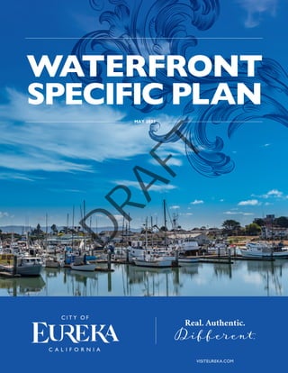
  • 1. MAY 2023 WATERFRONT SPECIFIC PLAN Real. Authentic. Different. VISITEUREKA.COM D R A F T
  • 3. As the official seat of the world-famous Humboldt County, California, the City of Eureka (City) is the heart of the U.S. Redwood Coast. Eureka is the market and cultural center of a beautiful region filled with iconic redwoods—the world’s tallest trees—and stunningly beautiful, rugged, and remote ocean landscapes. Bordered on the west and north by Humboldt Bay, Eureka extends east and south toward redwood forest. Highway 101 extends from Los Angeles in Southern California to beyond the Oregon border in the north, and runs through Eureka, connecting it to smaller cities in Humboldt County and to the entire West Coast of the United States. Eureka is known for its unique Victorian architecture; a creative artistic culture; and one-of-a-kind shops, restaurants, and artisanal businesses nestled behind the “Redwood Curtain.” Cal Poly Humboldt is located just north of Eureka, and Highway 299 East connects Eureka to Interstate 5, which stretches between the Canadian and Mexican borders through California, Oregon, and Washington. The Waterfront Eureka Plan Area (Plan Area) for the Waterfront Eureka Plan (WEP) encompasses approximately 130 acres in the northern portion of Eureka, between Humboldt Bay and Downtown Eureka. The Plan Area consists of three districts identified in the City of Eureka 2040 General Plan: Commercial Bayfront, with primarily coastal-dependent, recreation, visitor-serving uses, open space, and the Waterfront Trail, as well as the Blue Ox Mill Works, residences and office buildings; Old Town, the commercial heart of the Plan Area and a premiere historic and cultural district; and Library, a mixed residential/office area, home to the namesake Humboldt County Library and the Carson Mansion (see WEP Figure 1-1, Plan Area). The Plan Area is described in detail in WEP Chapter 2 Background Report. D R A F T
  • 4. 1-3 WEP Figure 1-1. Plan Area Guiding Principles, Organization, and Authority of the Waterfront Eureka Plan The City embarked on the WEP to provide a roadmap for development and redevelopment of the vacant and underutilized sites and buildings along and near Eureka’s central waterfront, to facilitate new mixed-use development and result in the creation of at least 115 housing units in the Plan Area by 2027, in part by streamlining environmental review of subsequent projects. The WEP will serve as the land use, circulation, and infrastructure regulatory document governing development of the Plan Area. The WEP is a regulatory blueprint and will be used by City leaders, residents, businesses, and developers to implement the 2040 General Plan and the certified Local Coastal Program (LCP). The WEP outlines community-led visions for the future of the Plan Area, and contains focused policies, programs, and regulations, which will govern and shape development in the Plan Area to achieve these visions. Guiding Principles A number of Guiding Principles emerged from community and decision-maker input throughout the planning process for the WEP. Together, these Guiding Principles discussed below support the overall vision for the Plan Area and are reflected in the goals, policies, and implementation measures of the WEP, which are described and discussed in WEP Chapter 4 Future Opportunities; WEP Chapter 5 Land Use, Housing, and Mobility; and WEP Chapter 7 Administration and Implementation. D R A F T
  • 5. 1-3 A. Increase Housing Options Support a diversity of housing opportunities in the Plan Area to meet the needs of the community. Provide housing choices for both longtime residents and newcomers to Eureka, recognizing a range of household sizes and needs. Encourage increased housing density throughout the Plan Area, while maintaining the area’s character. Increasing the number of people living in the Plan Area will bring more activity, vibrance, and business to the local community. B. Promote the Plan Area as a Vibrant and Safe Destination for Residents, Tourists, Businesses, and the Arts Establish a balance of uses, urban design, and public spaces and events to encourage people to work, shop, dine, and play in the Plan Area throughout the day and evening. Ensure long-term economic sustainability by accommodating a broader array of uses and activities. Increase the residential and employment populations to support growth for commercial uses and businesses in the Plan Area. C. Expand Access and Strengthen the Connection to Humboldt Bay Increase opportunities for Waterfront Trail enhancements, connections, and extensions to inland areas. Create parking strategies to accommodate visitors without limiting potential development. Support port- and harbor-related industries in industrial locations by encouraging visitor-serving and recreational water-oriented and water-related development along the waterfront in the Plan Area. D. Prepare for and Adapt to Sea-Level Rise Continue to develop and implement short-, medium-, and long-term strategies to minimize impacts from sea- level rise (SLR) on existing and future structures, sites, and infrastructure, including roadways and utilities. Create flexible standards to respond to changing conditions. Use nature-based adaptation solutions, also known as green infrastructure, where appropriate and feasible, to protect and enhance coastal resources. Develop adaptation strategies to maximize social, environmental, and economic benefits, and to minimize costs for current and future generations. Encourage temporary and recreational uses in areas already experiencing the effects of SLR. E. Foster a Diverse and Robust Business Community Support a local economy friendly to new business investment and the creation and retention of quality jobs. Develop parking and wayfinding strategies that help visitors locate and patronize businesses in the area. Create clear and feasible development regulations to encourage redevelopment. Provide public services and maintenance. Organization of the Waterfront Eureka Plan This document is structured to provide a thorough and detailed account of all facets of the WEP, ranging from its vision and conceptual framework to the implementation strategies needed to bring it to fruition. The WEP is organized into the following seven chapters: GREEN INFRASTRUCTURE Refers to the use of vegetative planting, sediment nourishment, or other methods that mimic natural systems to capitalize on the ability of these systems to provide flood and erosion protection, stormwater management, and other ecosystem services while also contributing to the enhancement or creation of natural habitat areas. D R A F T
  • 6. 1-3 WEP Chapter 1 Introduction: This chapter summarizes the purpose and authority of the WEP and the relationship to other regulatory documents and City codes and plans. WEP Chapter 2 Background Report: This chapter summarizes the existing conditions and development potential of the Plan Area. WEP Chapter 3 Community Engagement: This chapter catalogs the results of extensive public outreach and how public input was used in the development of the WEP. WEP Chapter 4 Future Opportunities: This chapter explores three potential futures and how these different visions could shape the Plan Area. WEP Chapter 5 Land Use, Housing, and Mobility: This chapter contains the goals and policies and outlines the allowed land uses and infrastructure, which will facilitate the movement of goods and people in the Plan Area. WEP Chapter 6 Regulations, Standards, and Guidelines: This chapter describes the WEP zoning districts, identifies the types of uses allowed in each district, and provides development and design standards and guidelines for the Plan Area. WEP Chapter 7 Administration and Implementation: This chapter outlines the administration of the WEP and summarizes implementation strategies including California Environmental Quality Act (CEQA) streamlining efforts, supportive funding sources, and financial tools to implement the WEP. WEP Chapter 8 Use Classification Glossary: This chapter defines any relevant terms that are not defined in WEP Chapter 6 Regulations, Standards, and Guidelines. WEP Appendices: Appendix A, Affordable Housing and Anti-Displacement Strategies, explores housing strategies to avoid displacing current residents as the Plan Area is redeveloped. Appendix B, Online Engagement Results, includes more details regarding the results of the online survey that is discussed in WEP Chapter 3 Community Engagement. Appendix C, General Plan Consistency Analysis, outlines how the WEP is consistent with the General Plan and the goals and policies in Chapter 3.4 of the 2040 General Plan. Authority California Government Code Section 65450 states planning agencies may “prepare specific plans for the systematic implementation of the general plan for all or part of the area covered by the general plan.” A specific plan must include text and a diagram or diagrams that specify, in detail, the following: D R A F T
  • 7. 1-3 The distribution, location, extent, and intensity of the uses of land, including open space, within the area covered by the plan (WEP Chapter 5 Land Use, Housing, and Mobility). The proposed distribution, location, and extent of major components of public and private transportation, sewage, water, drainage, solid waste disposal, energy, and other essential facilities located within the area covered by the plan and needed to support the land uses described in the plan (WEP Chapter 5 Land Use, Housing, and Mobility). Standards and criteria by which development will proceed, and standards for the conservation, development, and utilization of natural resources (WEP Chapter 5 Land Use, Housing, and Mobility and WEP Chapter 6 Regulations, Standards, and Guidelines). A program of implementation measures, including regulations, programs, public works projects, and financing measures necessary to carry out the plan. In addition, the specific plan must define the relationship between the specific plan and the general plan (WEP Chapter 7 Administration and Implementation). Relationship to the General Plan, Municipal Code, and Other Laws General Plan California law states specific plans can only be adopted or amended if they are consistent with the adopted local general plan and, by extension, the Coastal Land Use Plan. The intent of the WEP is to be consistent with the goals of both the City of Eureka 2040 General Plan and the Land Use Plan portion of the City’s certified LCP. While the 2040 General Plan addresses issues relevant to the entire City, the WEP focuses specifically on the revisioning and buildout of the City’s Coastal Core Area (see WEP Figure 1-2), providing detail on policies and implementation strategies to achieve the community’s visions for three Core Area districts: Commercial Bayfront, Old Town, and Library. The 2040 General Plan Land Use Policy 2.11 serves as the impetus to develop a specific plan to implement the 2040 General Plan’s vision for Eureka’s Plan Area. D R A F T
  • 8. 1-3 WEP Figure 1-2. Core Area The 2040 General Plan recognizes Eureka is experiencing a shortage of housing at all income levels. The City is especially hard hit by this trend because it is almost completely built-out and has little to no room for expansion beyond current City limits, or expanding any zones, especially the City’s residential zones. For this reason, the 2040 General Plan establishes Downtown and the central waterfront as primary areas for future growth, including for residential and employment uses to be built as higher-density, mixed-use, infill development. The 2040 General Plan’s policies envision the Core Area continuing to grow as a thriving, compact, and pedestrian-oriented place serving as the heart of Eureka’s civic, cultural, business, and visitor area, and appealing to new investment. Local Coastal Program The standard of review for land use planning and development in the Coastal Zone is the City’s LCP, which implements the California Coastal Act at the local level. An LCP consists of the following two parts: The Land Use Plan (LUP), which is the relevant portion of a local government’s general plan pertaining to the Coastal Zone and conformance with the California Coastal Act; the LUP is composed of land use maps and policies and programs, which are sufficiently detailed to indicate the kind, location, and intensity of land uses, resource protection, and development in the Coastal Zone. Core Area The Core Area, as defined in the 2040 General Plan, is the traditional business center and cultural hub of the City. It includes the three districts in the Plan Area – which constitute the Coastal Core Area – as well as Downtown. D R A F T
  • 9. 1-3 The Implementation Plan (IP) is the Coastal Zoning Code that includes zoning maps, development standards, and other implementing ordinances that conform with and carry out the goals and policies of the LUP. The City’s LCP was originally certified by the California Coastal Commission in 1984. A comprehensive update to the City’s LUP was effectively certified by the California Coastal Commission in 1999. The City’s IP has not been comprehensively updated since 1984 and still includes much of the City’s zoning code from the 1960s. The City recently adopted a 2040 General Plan and updated its Inland Zoning Code in 2018 and 2019, respectively, and is working to comprehensively update its LUP and IP to incorporate the relevant portions of these documents. The Plan Area is entirely within the Coastal Zone under the purview of the LUP and IP. As a result, the 2040 General Plan and Inland Zoning Code do not apply to the Plan Area; instead, the Plan Area continues to be governed by the LCP documents originally developed and certified in the 1980s and 1990s. The City intends to use the information collected, and the environmental analysis performed, during the WEP process to inform and facilitate the ongoing comprehensive LCP update to ensure the WEP and LCP are consistent. The WEP may be certified by the California Coastal Commission prior to, concurrently with, or subsequent to adoption of the comprehensive LCP update. D R A F T
  • 11. 2-2 THE CITY OF EUREKA | WATERFRONT SPECIFIC PLAN CHAPTER 2 : BACKGROUND REPORT INTRODUCTION This section summarizes the existing conditions of the Waterfront Eureka Plan Area (Plan Area) related to land uses, jobs, mobility, historic resources, parks, and natural hazards. The findings of this assessment will inform the policies and actions included in the Waterfront Eureka Plan to encourage high-quality new development, foster economic development, and prepare for climate change. COMMUNITY DISTRICTS AND LAND USE The City’s 2040 General Plan identified and named three community places that the Waterfront Eureka Plan centers around: Commercial Bayfront, Library District, and Old Town (See Figure 1). Figure 1. Eureka 2040 General Plan Area Districts These three community places or districts have distinct personalities and roles in making the Plan Area a place where people can live, work, and play. The development potential as currently allowed in the 1997 Local Coastal Program and zoning code is described below for each district. Carson Mansion D R A F T
  • 12. 2-3 LOCAL COASTAL PROGRAM The entire Plan Area is governed by the Local Coastal Program. At the time the Waterfront Eureka Plan was being developed, the City of Eureka (City) was concurrently updating the Local Coastal Program to reflect the direction of the City’s 2040 General Plan. Until the California Coastal Commission approves a Local Coastal Program Update, the standards of the existing (1997) Local Coastal Program will prevail. This section includes future uses consistent with the 2040 General Plan, which are consistent with the most recent public visioning and the anticipated Local Coastal Program Update. KEY TERMS The following key terms are used throughout this section. District Districts are recognized community places with their own identity. District areas were derived during the General Plan Update planning process. Land Use Designation The desired future uses and development pattern in a given area accomplished with density and intensity restrictions. Existing Land Use How the site is being used now. This could include vacant sites that have no current land uses. It could also include uses that were permitted in the past and are no longer allowed, but they continue to exist because their use is grandfathered in. Zoning Specifically defines and regulates what kinds of uses are allowed on specific parcels and outlines design and development requirements and guidelines. D R A F T
  • 13. 2-4 THE CITY OF EUREKA | WATERFRONT SPECIFIC PLAN CHAPTER 2 : BACKGROUND REPORT Figure 2. Vacant Sites in Plan Area Commercial Bayfront EXISTING USES The Commercial Bayfront consists of the Eureka waterfront north of 1st Street, and west-east from C Street to Y Street. This District includes commercial and public sites such as Madaket Plaza, Coast Guard Plaza, the Adorni Center, Bonnie Gool Guest Dock, Samoa Boat Launch, and Halvorsen Park. The Eureka Boardwalk and a portion of the Eureka Waterfront Trail are also located generally along the northern boundary of the Commercial Bayfront District. Much of the Commercial Bayfront is vacant land that once supported a bustling maritime- and timber- industrial setting. Because of the existing vacant land and proximity to Humboldt Bay, this District has major redevelopment potential. The Commercial Bayfront includes a variety of commercial, recreational, and limited residential uses. The Commercial Bayfront District contains approximately 50 parcels totaling 66 acres. Approximately 6% of the Commercial Bayfront’s acreage is covered by unconstrained vacant sites, 23% is covered by constrained vacant sites (as shown in Figure 2), 6% is covered by surface parking lots (as shown in Figure 3), and 15% of the land is underutilized. FUTURE USES According to the 2040 GP, the Bayfront Commercial land use designation accommodates “visitor-related retail, restaurants, multi-story CONSTRAINED VS. UNCONSTRAINED SITES Constrained sites have requirements or covenants that restrict the types of uses possible. These sites may be constrained because they are environmentally sensitive (such as wetlands) or are hazardous (such as waste cleanup sites). Unconstrained sites do not have these added restrictions. D R A F T
  • 14. 2-5 Woodley Island Marina lodging, entertainment, recreation, boating, and tourist services, as well as residential, office, and a mix of coastal and non-coastal dependent uses.” This land use designation is meant to result in multi-story buildings with pedestrian-scaled storefronts along the sidewalks, boardwalk, and waterfront trails. Residential and office uses will be allowed on upper floors or non-street facing portions of buildings to allow for a mix of uses and density, while still focusing on engaging activities along the street. A small portion of the District is designated Public/Quasi-Public, as it is occupied by the Adorni Center. This land use is for government facilities, parks, and other institutional uses. Much of the City’s expected growth in the next 20 years is centered around development of 1997 LOCAL COASTAL PROGRAM ON THE COMMERCIAL BAYFRONT In the 1997 Local Coastal Program, the entire Bayfront Commercial District is zoned Waterfront Commercial. The existing maximum FAR is 2.5, allowing 25% of the maximum development contemplated by the Waterfront Eureka Plan. Coastal related uses, recreation, and tourist-oriented developments are allowed by right. Other commercial uses, such as offices and retail are allowed with discretionary approval. Housing as outlined in the Multi-family Residential Zones are allowed in waterfront commercial zones above the ground floor with discretionary approval. FLOOR AREA RATIO (FAR) A measurement to show how much floor area is allowed on a parcel or lot. It’s calculated by dividing the total floor area of a building by the total land area of the parcel. the vacant and underutilized land in the Bayfront Commercial District. Table 1 includes maximum floor area ratio (FAR), within the Commercial Bayfront District, and how development is projected to be built out, in accordance with the City of Eureka’s 2040 General Plan. When accounting for the development of vacant and underutilized sites, 1219 jobs are expected to be added to this District alone; 773 dwelling units also have potential to be added. D R A F T
  • 15. 2-6 THE CITY OF EUREKA | WATERFRONT SPECIFIC PLAN CHAPTER 2 : BACKGROUND REPORT Figure 3. Parking Lots Library District Adjacent to historic Old Town to the west and the Bayfront to the north, the Library District has easy access to culture, retail, recreation, and community events while maintaining its primarily residential and quiet nature. The District’s namesake is the Humboldt County Library which is situated at the center of the community. In addition to the library, the area boasts the famous Carson Mansion among other historic structures that foster beauty and community identity. The District also hosts modest retail, accommodation, and professional office uses. Some of these nonresidential uses occupy historic houses which maintains the aesthetics of the neighborhood. EXISTING USES In addition to the library and residential uses, the District also supports accommodations such as the Carter House Inns and vacation rentals. The Library District contains approximately 80 parcels, totaling 18 acres. Approximately 5% of the Library District’s acreage is underutilized, and 30% is used as surface parking lots (Figures 3). Table 1. Bayfront Commercial District Development Potential Development Potential Bayfront Commercial (BC) Maximum Allowed Floor Area Ratio (FAR)1 4 Assumed Average FAR 0.40 Underutilized and Vacant Acres 29.27 Potential Net Jobs Added2 1219 Potential Net Housing Units Added3 773 Source: City of Eureka. 2018. City of Eureka 2040 General Plan. Table 1 Notes: The 2040 General Plan designates parcels as Public/Quasi-Public in the Bayfront Commercial District that are not reflected on this table due to a limited or lack of development potential related to jobs and housing 1 The allowable FAR in the Local Coastal Program is 2.5 2 Net Jobs Added are directly related to the underutilized and vacant acres. This does not include jobs that may be added from parcels that are environmentally constrained and cannot have housing. 3 58 of the Net Housing Units Added are directly related to the underutilized and vacant acres. 70 additional net housing units are included here related to the development of housing at 1st and C-F Street. D R A F T
  • 16. 2-7 Table 2: Library District Development Potential Development Potential Professional Office (PO)1 Maximum Allowed Floor Area Ratio (FAR) 2.5 Assumed Average FAR 0.60 Underutilized and Vacant Acres 1.02 Potential Net Jobs Added2 75 Potential Net Housing Units Added3 14 Source: City of Eureka. 2018. City of Eureka 2040 General Plan. 1997 LOCAL COASTAL PROGRAM ON THE LIBRARY DISTRICT In the 1997 Local Coastal Program, the entire Library District is zoned Office and Multifamily Residential. The existing zoning’s FAR is 2.5, allowing for similar development contemplated in the Waterfront Eureka Plan. This zone allows offices and parking facilities by right. Housing is also allowed by right as permitted in the Multifamily Residential zone with additional regulations specified in the zoning code depending on whether housing is above a non-residential use or not. Nursing homes, schools, and certain other similar uses are allowed with discretionary approval. FUTURE USES Most parcels in the Library District are designated Professional Office (PO) in the 2040 General Plan. The vision in the 2040 General Plan for this land use is to promote “a mix of single-family and multi- family housing, small scale offices, some converted residential buildings, and lodging where the intent is to generally retain the character, scale and form of the residential neighborhood.” A few parcels in the Library District are designated Public/ Quasi- Public (PQP) which is intended to support public and private institutional uses, government facilities and services, schools, courts, cemeteries, fairgrounds, airports, marinas and wharves, and major utility facilities, as well as parks, golf courses, and other public recreational facilities. These parcels are located along the railroad, library, and N Street. The City has created unique zoning standards to guide the size and shape of proposed development to ensure the vision above. Table 2 depicts development potential in the Library District, in accordance with the 2040 General Plan. Single Family Housing Multi-Family Housing Table 2 Notes: There are parcels designated in the 2040 General Plan as Public/Quasi-Public in the Library District that are not reflected on this table due to a limited or lack of development potential related to jobs and housing 1 The maximum FAR for the PQP designation in the 2040 General Plan is 4.0. Due to the public nature of PQP, these areas are less likely to be redeveloped and do not have assumed averages and employment additions in the 2040 General Plan 2 Potential Net Jobs Added are directly related to the underutilized and vacant acres 3 Potential Net Housing Units Added are directly related to the underutilized and vacant acres D R A F T
  • 17. 2-8 Old Town District The Old Town District was once the central downtown core of the historic City of Eureka and is on the National Register of Historic Places as a Designated Historic District. Host to buildings and structures dating back to the 1850s, this District is a window into Eureka’s rich history and is now a celebrated place occupied by modern and vibrant cultural facilities, theaters, lodging, retail, and office spaces. Old Town is appreciated by visiting tourists and strongly represented in the local identity. EXISTING USES The Old Town District organically developed as the retail and entertainment hub of Eureka and continues to provide similar amenities today. It largely serves tourism and small local businesses. In addition to the small retail and cultural uses, Old Town also supports some residential and office spaces. The Old Town District contains approximately 100 parcels, totaling 19 acres. Approximately 5% of the District’s acreage is underutilized, 5% is covered by unconstrained vacant sites (Figure 2), and 21% is used as surface parking lots (Figure 3). FUTURE USES The majority of parcels in Old Town are designated Old Town Commercial (OC) in the 2040 General Plan. The vision in the 2040 General Plan for this land use is to promote “commercial retail and tourism-related uses, recreation, leisure activities, hotels, and upper floor office/residential uses.” A few parcels in Old Town are designated Public Facilities (PF) which are intended to support public and private institutional uses, government facilities and services, schools, courts, cemeteries, fairgrounds, airports, marinas and wharves, and major utility facilities, as well as parks, golf courses, and other public recreational facilities. Table 3: Old Town Development Potential Development Potential Old Town Commercial (OC) Maximum Allowed Floor Area Ratio (FAR) 5.0 Assumed Average FAR 0.35 Underutilized and Vacant Acres 1.99 Potential Net Jobs Added1 355 Potential Net Housing Units Added2 226 Source: City of Eureka. 2018. City of Eureka 2040 General Plan. The Old Town Commercial land use was created to encourage “historic and multi-story buildings with pedestrian-scaled storefronts lining the sidewalks,” with residential and office spaces primarily existing in the upper floors and building areas that do not face a street front. Table 3 depicts development potential in Old Town, in accordance with the 2040 General Plan. THE CITY OF EUREKA | WATERFRONT SPECIFIC PLAN CHAPTER 2 : BACKGROUND REPORT DESIGNATED HISTORIC DISTRICT A designated Historic District is listed in the National Register of Historic Places. Historic Districts make available specific federal and state tax incentives for preservation purposes and qualify property owners for federal and state grants for preservation purposes when funds are available. Table 3 Notes: There are parcels designated in the 2040 General Plan as Public/Quasi-Public in the Old Town District that are not reflected on this table due to a limited or lack of development potential related to jobs and housing. 1 Potential Net Jobs Added are directly related to the underutilized and vacant acres 2 Potential Net Housing Units Added are directly related to the underutilized and vacant acres D R A F T
  • 18. 2-9 1997 LOCAL COASTAL PROGRAM In the 1997 Local Coastal Program, the western 88.5% of the Old Town District is zoned Waterfront Commercial, and the remaining 11.5% of the district is zoned Office and Multifamily Residential. In the area zoned Waterfront Commercial, the existing maximum FAR is 2.5, allowing 50% of the maximum development allowed in the Waterfront Eureka Plan. Coastal related uses, recreation, and tourist-oriented developments are allowed by right. Other commercial uses, such as offices and retail are allowed with discretionary approval. Housing, as outlined in the Multifamily Residential zones, is allowed in Waterfront Commercial zones above the ground floor with discretionary approval. In the portion of the Old Town District zoned Office and Multifamily Residential, the existing FAR is 2.5, allowing 50% of the maximum development allowed in the Waterfront Eureka Plan. This zone allows offices and parking facilities by right. Housing is also allowed by right as permitted in the Multifamily Residential zone with additional regulations specified in the zoning code depending on whether housing is above the first floor or not. Nursing homes, schools, and certain other similar uses are allowed with discretionary approval. 2nd Street D R A F T
  • 19. 2-10 THE CITY OF EUREKA | WATERFRONT SPECIFIC PLAN CHAPTER 2 : BACKGROUND REPORT Bayfront One mixed-use building JOBS The Plan Area borders Downtown (as identified in the 2040 General Plan) and supports restaurants and shopping serving visitors and residents alike. The Plan Area also supports small offices, bolstered by its proximity to downtown and City and County facilities. The Plan Area has a significant in-commute, with 1,150 jobs in the Plan Area, while housing only 249 people. That means this area has a jobs- housing imbalance and raises potential concerns about housing affordability in the District and traffic or parking for people who commute in for work. Commercial Bayfront Historically, the Commercial Bayfront District’s economic activity was anchored by maritime JOBS-HOUSING IMBALANCE This occurs when an area is a hub for either housing or employment, but does not contain the other at a similar level. and coastal jobs. Today one active fishery remains in the Commercial Bayfront District, and fisheries, oyster farms, and maritime industry jobs exist elsewhere in Eureka and Humboldt Bay. The Commercial Bayfront District supports approximately 190 jobs. The largest industry sector for jobs is the Accommodation and Food Services sector with 38% of the jobs. These jobs are spread among the multiple restaurants in the District. Other significant sectors for the area include retail trade and professional, scientific, and technical services. Library District The Library District is host to over 300 jobs. The largest industry sector is manufacturing with 26.7% of jobs, however, this sector has been rapidly declining in recent years.1 Other significant sectors of the area include health care and social assistance (15.2%) and other (24.1%).2 1 United States Census Bureau. 2019. “OnTheMap”. https://onthemap.ces.census.gov/ 2 United States Census Bureau. 2019. “OnTheMap”. https://onthemap.ces.census.gov/ D R A F T
  • 20. 2-11 Figure 4. Public Transit While most of the buildings throughout the District are of residential design, many have been converted into office spaces while maintaining the character of the District. Old Town Old Town represents the largest job center in the Plan Area and is host to over 660 jobs. Health Care and Social Assistance (45.7%), Accommodation and Food Services (17.7%), and Retail Trade (12.6%) make up 76% of employment in Old Town.2 Many of the buildings throughout Old Town are multi-story and thus provide ample office and professional space for businesses above the ground floor shops and restaurants. The professional, scientific, and technical services industry employed roughly 68 people (10.3%) in 2019. MOBILITY Transit The entire Plan Area is within walking distance of a bus stop (See Figure 4). The Eureka Transit System’s five bus lines offer local transit throughout the City. Four of these lines (Purple, Gold, Red, and Rainbow) make stops in the Plan Area, providing access to much of Eureka by bus. Additionally, the Redwood Transit Authority has stops directly adjacent to the Plan Area on 4th and 5th streets, providing access as far north as Trinidad and as far south as Scotia. Walking and Biking The Waterfront Trail and Eureka Boardwalk are two walking trails that run through the Commercial Bayfront District. The Waterfront Trail begins near the water at Halvorsen Park, and runs eastward all the way through the District, continuing eastward and then looping south along the Eureka Slough. The Eureka Boardwalk is a trail along the Bay that runs from C Street to G Street and connects commercial areas (See Figure 5). Together, the Waterfront Trail, Eureka Boardwalk, and 1st Street/Waterfront Drive form a continuous trail network along the Eureka waterfront which in turn contributes to the California Coastal Trail. D R A F T
  • 21. 2-12 THE CITY OF EUREKA | WATERFRONT SPECIFIC PLAN CHAPTER 2 : BACKGROUND REPORT Old Town Parking Figure 5. Boardwalk and Waterfront Trail The Library District and Old Town are connected active retail areas. Old Town is characterized by mixed-use buildings, supporting shops on the ground floor, flowing eastward into the Library District that supports small businesses and government offices. Stylized sidewalks run along J, K, and L streets and form a promenade on 2nd Street leading up to the Carson Mansion. Otherwise, exposed aggregate concrete sidewalks are present throughout the majority of the District. There are designated bike lanes along Waterfront Drive between H Street and the Humboldt Bay Aquatic Center. Future bike lanes are proposed by the 2040 General Plan throughout the plan area. There are two alleyways that run the length of the Library District from east to west between 1st and 2nd Streets (Snug Alley) and 2nd and 3rd Streets (Opera Alley) that terminate at M Street. These serve as informal passageways for bikes and pedestrians. Parking The Eureka Downtown Parking Study, which encompasses Old Town and Downtown, found that safety was the primary concern of both members of the general public and people who work in the study area. Whereas the general public did not perceive a parking shortage in the study area, people who work in the project area thought time-limits on parking spaces (such as 2-hour parking) created a shortage of parking suitable to their needs. While requiring parking for new development may meet the D R A F T
  • 22. 2-13 needs and desires of businesses, the workforce, and residents, having development standards for parking can make development more expensive. To address this, the Eureka Downtown Parking Plan includes goals and strategies to balance existing parking demand and encourage new development and uses. These goals include: ‒ Increase public awareness of parking options and wayfinding signs ‒ Make parking desirable for all users, including residents, employees, and visitors ‒ Improve access and safety ‒ Explore innovating parking management strategies The Waterfront Eureka Plan will incorporate strategies to implement the Eureka Downtown Parking Plan. HISTORIC AND CULTURAL LANDMARKS Wiyot History Eureka was originally populated by the Wiyot people, a Native American tribe that has lived in the Humboldt Bay region for thousands of years. Between 1,000 and 3,300 Wiyot lived in villages along the shores of Humboldt Bay and near the mouths of the Eel and Mad Rivers.3 The Wiyot used redwood dugout canoes and elaborate fishing and hunting technology to sustain themselves. Wiyot people produced a variety of materials to improve their daily lives such as twined basketry and woven tule mats. The Wiyot also commonly traded with neighboring groups, including the Mattole, Yurok, Sikyone, and other inland groups. White explorers and fur trappers arrived in the area in the 1800s, and the City of Eureka was founded in 1850. By 1853, white settlers outnumbered the Wiyot people, and Fort Humboldt was established by the U.S. Army to assist in conflict resolution between Native Americans and gold-seekers. The conflict was not resolved peacefully; in 1860 the majority of the Wiyot tribe was tragically murdered in what became known locally as the “Wiyot Massacre.” Wiyot who survived the violence and diseases introduced by the Euro-Americans were displaced to distant reservations or marginal lands. To this day, over 200 individuals of Wiyot descent are associated with the Blue Lake, Rohnerville, and Table Bluff Reservations. In October of 2019, the City of Eureka made international headlines when they returned a sacred island, Tuluwat Island across the Eureka Channel from the Plan Area, to their friends and neighbors in the Wiyot tribe. This event marked the first time a local government had taken such action anywhere in the United States and was a long-awaited and deeply significant moment of healing for the entire community. Historic Resources The Plan Area’s proximity to the Bay made it the center of European settlement in Eureka. Economic prosperity from the lumber industry turned Eureka’s waterfront into a bustling commercial district. The Library District and Old Town were part of the original residential and commercial portions of the City, respectively. Within these neighborhoods, fine architecture is interspersed throughout. Of the 20 buildings in Eureka recognized on the National Register of Historic Places, the Plan Area is home to 6. Additionally, 47 buildings in the Plan Area are on the Local Register of Historic Places.4 As stated earlier when discussing community districts and land use, the Plan Area also contains the Old Town Historic District, which is part of the United States National Register of Historic Places. Structures on the national and local registers are a priority for preservation by the City, as these structures help to tell the story of Eureka. The Eureka Chinatown Project is a recent commitment to honoring and preserving the City’s history and culture. The Project includes murals and monuments acknowledging the historic Chinatown district between 3rd and 4th streets and F and E streets. 3 City of Eureka. 2015. “Community Background Report.” http://www.eureka2040gpu.com/Links/pdfs/City%20of%20Eureka%20CBR%20(June%202015).pdf 4 City of Eureka. 2019. “Local Register of Historic Places”. https://www.ci.eureka.ca.gov/civicax/filebank/blobdload.aspx?BlobID=15628 D R A F T
  • 23. 2-14 THE CITY OF EUREKA | WATERFRONT SPECIFIC PLAN CHAPTER 2 : BACKGROUND REPORT PARKS AND RECREATION Commercial Bayfront Parks and public-serving facilities are especially important in and along Humboldt Bay, which is a wonderful natural and scenic resource that deserves to be shared with the public. In the Commercial Bayfront District there is Halvorsen Park, a recreation center, and plazas meant for public use. The entirety of the District is within walking distance of one or multiple parks or public spaces, as shown on Figure 6. On the western edge of the Commercial Bayfront District at the foot of C Street is Madaket Plaza. This site has a ticket booth and dock for the Madaket, the oldest passenger carrying ferry in continuous service in the United States.5 The Plaza also hosts the Eureka Summer Concert Series. Just east of Madaket Plaza, and connected by the Eureka Boardwalk, is Coast Guard Plaza at the foot of F Street. This plaza has a restaurant and retail store (currently an ice cream shop), as well as upper floor residential uses. Further eastward is another recreation- serving facility, the Humboldt Bay Aquatic Center (HBAC), which offers outdoor recreation in the form of kayak rentals and scenic boat tours.6 Adjacent to the HBAC is the Adorni Memorial Recreation Center. This is a fitness facility run by the City of Eureka’s Community Services Department. The Adorni Center offers fitness classes and facilities for members.7 Finally, the Sacco Amphitheater and Halvorsen Park are found directly east of the Adorni Center. The area provides approximately 3.5 acres of open space and facilities for public concerts and contains a section of the Waterfront Trail.8 It should also be noted that boat and kayak launches are present along the Commercial Bayfront District and provide for additional forms of recreation and transportation in the Bay. Figure 6. Access to Parks and Public Spaces 5 Madaket Cruises. 2021. https://humboldtbaymaritimemuseum.com/madaketmainpage.html 6 Humboldt State University. (n.d.) Humboldt Bay Aquatic Center. https://centeractivities.humboldt.edu/feeds/feeddetails?feed=86686668-94db-4e7b- aab7-c0dfae8832f2 7 City of Eureka. (n.d.) Adorni Recreation Center. http://www.ci.eureka.ca.gov/depts/recreation/adorni_center.asp 8 City of Eureka. (n.d.) Halvorsen Park. https://www.ci.eureka.ca.gov/depts/recreation/facility_rentals/halvorsen_park.asp D R A F T
  • 24. 2-15 2nd Street Promenade Within the Plan Area, kayaks can be launched at Madaket Plaza, the HBAC, and the Samoa Boat Ramp, while boats can only be launched at the Samoa Boat Ramp. No marinas are in the Plan Area, but the closest marina is across the Bay to the north on Woodley Island. Library District In addition to the namesake Humboldt County Library building, the district also hosts the Clara May Berry Park and Playground adjacent to the Library. Other park and recreation spaces are less formal or linear in design including the 2nd Street pedestrian pathway which includes beautified and protected sidewalks, street trees, and sitting areas. The pathway extends from the corner of 2nd and I Streets on one end to the famous Carson Mansion, and also has an improved pedestrian connection to 3rd Street along K Street. There are also a Class II bikeway and sidewalk that run along Waterfront Drive between the Library and Commercial Bayfront Districts. Old Town Old Town is home to formal public spaces such as the Clarke Plaza across E Street from the Clarke Historical Museum. Friday Night Market’s are held from August to October on 2nd Street from F to C Streets, and E Street from Snug Alley to 3rd Street. On the corner of F Street and 2nd Street is the Old Town Gazebo which boasts the Gazebo Fountain and many community events including the Old Town Farmers’ Market. These plazas provide areas to bring entertainment, healthy food, economic development, and culture to Old Town and the surrounding community. Art galleries, restaurants, and retail shops surround the Old Town Gazebo and pull visitors and residents to activate the space. Both plazas in Old Town are connected to alleyways that run between C and M Street through Old Town and part of the Library District; the Clarke Plaza is connected to Opera Alley and the Old Town Gazebo is connected to Snug Alley. The original purpose of these alleys was to act as delivery and waste access for the commercial and residential tenants of buildings abutting the passageway. However, over time they have become pedestrian pathways and public spaces off the main streets. In some sections, the alleys resemble a linear park with murals painted on buildings, string lights, trees, and local art. CLASS II BIKEWAY These are often called bike lanes. They run alongside a street and are separated from the cars using paint. D R A F T
  • 25. 2-16 THE CITY OF EUREKA | WATERFRONT SPECIFIC PLAN CHAPTER 2 : BACKGROUND REPORT King Tide in the Commercial Bayfront © Humboldt Baykeeper CLIMATE CHANGE AND HAZARDS Sea-level Rise, Coastal Flooding, and Erosion Flooding and coastal erosion are significant hazards for the low-lying and bayfront portions of the Plan Area, and these hazards are expected to increase exponentially with time, given anticipated sea level rise. Humboldt Bay is experiencing the fastest rate of local sea-level rise (SLR) on the U.S. West Coast.9 The main driver of global SLR is climate change, but localized subsidence caused by tectonic plate movement is a major reason why Humboldt Bay is experiencing higher rates of local SLR than other coastal areas, even when compared to areas as close as Crescent City (~68 miles away).10 The Coastal Commission recommends considering potential SLR over the anticipated life or duration of a proposed structure, after which the structure is expected to be removed, replaced or redeveloped. For new residential and commercial structures, a 75-year to 100- year design life is typically used. The current mean monthly maximum water (MMMW) (spring tides) elevation on Humboldt Bay is 7.74 feet (2.58 meters) and the mean annual maximum water (MAMW) (king tides) elevation is 8.8 feet (2.93 meters). The 100- year still-water level at the North Spit is 10.2 feet (3.4 meters). For informational purposes, this report includes a map of future MMMW, MHHW, MAMW, and the 100-year storm with 6.5 feet (2.16 meters) of SLR to visualize where in the Plan Area development may need to adapt to SLR (see Figure 7)11 . SLR vulnerabilities are concentrated in the western portion of the Old Town District and throughout the Bayfront Commercial District. Risks are somewhat mitigated by the artificial shoreline and relatively large range of elevations in the Plan Area, which start at sea level and reach as high as 45 feet (13.72 meters) in some parts. The current waterfront is artificial, created out of fill from the Bay and fortified with rock armoring. It is important to note that LOCAL SEA-LEVEL RISE (SLR) This term recognizes that sea-level rise can vary locally depending on regional ocean-atmosphere circulation dynamics (such as El Niño Southern Oscillation) and local tectonic vertical land motions (like subsidence). 9 Anderson, J.K. (2018) Sea Level Rise in the Humboldt Bay Region – Update 2: December 2018. http://www.coastalecosystemsinstitute.org/wp-content/ uploads/2021/09/HumBaySeaLevelRise_Update2_Dec2018_190118.pdf 10 Zervas, C., S. (2009) Sea Level Variations of the United States 1854-2006. NOAA. NOAA Technical Report NOS CO-OPS 053. 78 pp. 11 City of Eureka. 2018. City of Eureka 2040 General Plan. “Liquefaction Hazards.” D R A F T
  • 26. 2-17 12 Environmental Science Associates (ESA). 2019. Elk River Wastewater Treatment Plant Enclosed Bay and Estuaries Compliance Feasibility Study – Climate Change Readiness Study and Vulnerability Assessment Prepared for the City of Eureka. 13 Cal-Adapt. (2021). Extreme Precipitation Climate Modeling Tool. https://cal-adapt.org/tools/extreme-precipitation Figure 7 assumes that shoreline barriers will not be constructed or fortified to prevent tidal flooding of inland areas. In addition to tidal flooding and inundation, other potential SLR-related issues include shoreline erosion, rising groundwater, and impairment to drainage systems. More studies are needed to better understand these risks. Climate change is projected to impact a number of other natural systems, including hazards like extreme storms. Flooding caused by extreme storms is predicted to be intensified in the region due to climate change. The 100-year rainfall is predicted to increase from approximately 11% to 16% by mid- century, and to 20% by late-century.12 Furthermore, the number of annual extreme storms that last 2 or more days is projected to increase from two events per year to four events per year by 2100.13 Earthquakes Earthquakes can damage public infrastructure, property, and buildings. The Plan Area is within a seismically active region that regularly experiences minor earthquakes, and large earthquakes are expected to occur during the lifespan of new development. There are no faults or Alquist Priolo Zones within the Plan Area, but there is still a risk of liquefaction, differential settlement, and structure damage from ground shaking. These risks are especially high near the shoreline, where there is unconsolidated fill material, sandy marine deposits, and high groundwater tables. Ground shaking can also be especially damaging to older buildings, as they were built before seismic resilient building codes existed. For instance, unreinforced masonry buildings are commonly known as the most vulnerable structures to earth shaking. Furthermore, Figure 7. Sea Level Rise Scenarios 100-YEAR RAINFALL This references a local rain event with such a large magnitude that it has a 1% chance of occurring in any given year. ALQUIST PRIOLO ZONES This is a zone around surface traces of active faults. Active faults are faults that have ruptured in the last 11,000 years. D R A F T
  • 27. 2-18 THE CITY OF EUREKA | WATERFRONT SPECIFIC PLAN CHAPTER 2 : BACKGROUND REPORT open front wood buildings (permitted pre- 1980), concrete buildings (permitted pre-1976), and steel moment frame buildings (permitted pre-1997) are all vulnerable to varied severities of damage if not retrofitted.14 Unreinforced masonry buildings in the City were inventoried in 2002 and many have been retrofitted in the past 20 years. Three unreinforced masonry buildings are still present within the Plan Area. The City of Eureka is also near the Mendocino Triple Junction that poses elevated seismic threats in addition to subsidence which has the potential to compound sea level rise impacts. 14 Structural Engineers Association of Southern California. October 2020. “Buildings, Building Codes, and Earthquake Safety”. https://www.seaosc.org/resources/Documents/Board%20Docs/SEAOSC%20Existing%20Buildings%20Fact%20Sheet%20-%20Oct%202020.pdf 15 State of California. (2021). Tsunami Hazard Area Map, Humboldt County; produced by the California Geological Survey, the California Figure 8. Tsunami Hazard Areas Tsunami There is the potential for tsunamis triggered by both local source events like an earthquake on the Cascadia subduction zone, or far field/distance source events (like an Alaskan earthquake). Tsunamis can also be caused by an underwater landslide, calving glacier, impacting meteor, or other large ocean disturbances. The Tsunami Hazard Area covers the entirety of the Commercial Bayfront, the western half of Old Town to the west of E Street as well as to the north and west of the Old Town Gazebo, and slivers off the northern portion of the Library District. Currently the portions of the Plan Area in the Tsunami Hazard Area are all well within a 10-minute, or half-mile, walk to higher ground outside of the Tsunami Hazard Area. There are currently approximately 119 dwelling units, home to 212 people, within the Plan Area’s Tsunami Hazard Area. None of the buildings in the MENDOCINO TRIPLE JUNCTION The Mendocino Triple Junction is the point where the Gorda tectonic plate, the North American plate, and the Pacific plate meet. Due to the junction of three plates, the area is subject to an especially seismically active enviroment. D R A F T
  • 28. 2-19 Tsunami Hazard Area are unreinforced masonry buildings. See Figure 8 to see the Tsunami Hazard Area in relation to the Plan Area.15 Hazardous Materials The human-caused hazard of soil and groundwater contamination is another major constraint. It is also a consideration when discussing retreat of the shoreline, as exposure of buried contamination could be detrimental to the health of the Bay if not dealt with prior to inundation. In the Plan Area there are 15 cleanup cases.16 Ten of these cases have been completed and closed out, but five cases are open. All open cases are within the Commercial Bayfront District. One contaminated site, 701 1st Street and its adjoining parcels, has entered into a land covenant that does not allow residential uses on the land. See Figure 9 to view open and closed cleanup or monitoring sites in the Plan Area. When comparing the sea level rise projections on Figure 5 with the cleanup cases, all open cleanup cases are within or directly next to areas that are projected to experience coastal flooding. Governor’s Office of Emergency Services, and AECOM; dated 2021, mapped at multiple scales. https://maps.conservation.ca.gov/cgs/informationwarehouse/ts_ evacuation/?extent=-14053625.7008%2C4874747.2092%2C-13583996.599%2C5083267.4224%2C102100&utm_source=cgs+active&utm_content=humboldt 16 State Water Resources Control Board. (2018, November). “GeoTracker Sites Data Download.” https://geotracker.waterboards.ca.gov/datadownload CLEANUP CASES These are sites that require groundwater cleanup due to a hazardous leak or spill, or sites that require permitting and monitoring due to a facility’s potential to impact groundwater. Figure 9. Hazardous Waste Cleanup and Monitoring Sites D R A F T
  • 29. 1-3 Development of the Waterfront Eureka Plan (WEP) was achieved through a multi-faceted community engagement strategy, which solicited input and feedback from community members during every phase of the planning process. This included holding public meetings focused on education, project visioning, strategy input, and community preferences, and ultimately presenting potential scenario-based planning approaches for community members to prioritize. Focused outreach conversations also engaged local stakeholders on particular project subjects related to their expertise. Meetings and events were scheduled around project milestones to ensure engagement and input was provided at critical decision points. Virtual Workshops Community Workshop 1 On March 10, 2022, the WEP team conducted a virtual community workshop to introduce the WEP and gain insight into how the community perceived the Plan Area and how they envisioned its future. A digital presentation briefed attendees on the purpose of the WEP, the three planning districts (Commercial Bayfront, Old Town, and Library), and the goal of developing 115 housing units. A total of 74 attendees logged into the virtual meeting, which lasted a total of 86 minutes. The meeting was recorded and posted to the project website. During the workshop, attendees participated in a series of polls asking how they would summarize the characteristics of each planning district within the Plan Area. WEP Figure 3-1 shows the results of this exercise, which produced a word cloud in real time where the most frequented responses were centered and enlarged proportionally to the number of times different participants entered the same word or phrase. Attendees were also encouraged to participate in a remote polling activity to decide which district or districts in the Plan Area are appropriate for different types of mobility, public parks and spaces, housing, business and jobs, and tourism-related opportunities. Each of the five topics had three unique planning opportunities. WEP Figure 3-2 depicts the results from this activity. WEP Chapter 3 Community Engagement D R A F T
  • 30. 1-3 WEP Figure 3-1. Community-Identified Characteristics of the Plan Area D R A F T
  • 31. WEP Figure 3-2. Planning District Priorities D R A F T
  • 33. 1-3 Community Workshop 2 On June 9, 2022, the WEP team conducted a second virtual community workshop to re-introduce the WEP, review the previous workshop results and findings, and ultimately evaluate potential planning scenarios. The meeting focused on three unique conceptual development scenarios focusing on sea-level rise (SLR; Managed Retreat Scenario), tourism (Tourism and Visitor- Serving Scenario), and complete communities (Complete Communities Scenario). A total of 48 attendees logged into the virtual meeting, and the meeting lasted approximately 1 hour. The meeting was recorded and posted to the project website. Attendees were again encouraged to participate in a remote polling activity showing photos of underutilized project sites in each district, accompanied by draft sketches of what the same site could look like if redeveloped under each planning scenario. These conceptual development scenarios are described in WEP Chapter 4 Future Opportunities. Participants were asked what they liked about each of the planning scenarios and ultimately which scenarios were their preferred future for the entire Plan Area. The Complete Communities Scenario was the most popular scenario. This scenario focused on providing everyday uses to support people living, working, and shopping in the Plan Area. Across scenarios, participants consistently liked dense housing and supporting small businesses. Another polling activity focused on the types of residential buildings attendees would like to see in each district. Example pictures and descriptions of six unique housing types were presented. Participants were asked which of the three planning districts they thought would be most appropriate for each housing type. WEP Figure 3-3 depicts the results from this activity. D R A F T
  • 34. 1-3 WEP Figure 3-3. Development Types by District D R A F T
  • 37. 1-3 Website The WEP team developed a unique project website to host community outreach material and basic project information. Among the features on the website were an interactive mapping activity, which familiarized visitors with the Plan Area, the three planning districts (Commercial Bayfront, Old Town, and Library), and what those districts could develop into under the three conceptual development scenarios (Managed Retreat, Tourism and Visitor-Serving, and Complete Communities). The project survey was also hosted online and accessible via a link on the webpage. Recorded public workshops were embedded1 into the website for viewing. In addition to the outreach material, the website hosted a robust “Project Overview” section, which discussed planning considerations, the purpose and goal of the WEP, and a number of frequently asked questions and associated answers. The last feature of the website was a short form allowing anyone to register for a project mailing list and provide comments. Online Survey An online public survey was available on the project website. Participants were asked approximately 15 questions regarding their preferences for the future of the Plan Area. The survey covered topics such as housing development, economic recovery, public transit, active transportation, and signage. Participants were asked to rank a number of strategies from most preferred to least preferred for each district in the Plan Area. Between June and September 2022, 281 people responded to the survey. Overall, survey respondents collectively ranked the Plan Area being “safe and attractive” as the most important theme to address in future waterfront planning efforts. Furthermore, 41% of survey respondents noted that increasing housing options is “very important” to them on a scale from “Not Important” to “Very Important.” The most popular strategy preferred by the respondents was to develop the Plan Area primarily through residential infill and adaptive reuse of existing structures. The most prioritized building typology were live-work units in all three districts, with neighborhood markets, activated alleyways, and nighttime uses also garnering popular support. When asked how the WEP may address SLR, responses ranged largely from adaptive planning that considers rising sea levels to building up and away from the Plan Area where flooding may likely occur. Lastly, respondents wanted to see active and safe gathering spaces, connected by safe walking and biking routes. The full report of survey results is in WEP Appendix B. Stakeholder Meetings The WEP team identified key stakeholders and community groups to participate in stakeholder conversations. The stakeholders were consolidated into five groupings based on similar expertise and interests of their respective organizations. City Staff hosted a total of six workshops to accommodate each of the groups where stakeholders were invited to attend in person or online to participate in a strengths, weaknesses, opportunities, and threats (SWOT) discussion activity. One stakeholder conversation, the Cultural District Group, was solely on zoom at their request. The following table, WEP Table 3-1, shows the date of each stakeholder conversation and the associated stakeholders invited to each conversation. 1 Not all meetings were recorded. The meetings that were recorded were made available to the public. D R A F T
  • 38. 1-3 WEP Table 3-1. Stakeholder Conversations During these stakeholder conversations, participants were encouraged to share thoughts on strengths, weaknesses, opportunities, and threats to implementing the WEP. Responses were organized on a collaborative virtual whiteboard for all attendees to view during the workshop. The discussions revealed, among other issues, stakeholder’s general concerns regarding the impacts of SLR, the lack of incentives to motivate developers to build infill projects, existing gaps in community services, and the need to ensure there are adequate housing options in the Plan Area. Stakeholders found encouragement in the opportunities presented in existing historic buildings and cultural influences of the Plan Area, the proximity to the natural resource that is the Humboldt Bay, the access to new bandwidth (fiber optic cable), jobs (Nordic Aquafarms, offshore wind energy, Cal Poly Humboldt) for a diverse business community, and the potential for enhancing existing public lands. Following the conversations, an email was sent to every stakeholder containing a link to the SWOT survey, which more broadly continued the discussions held during the meetings and allowed for stakeholders who were unable to attend to provide input. These responses, along with the results from the collaborative whiteboards, were compiled into a word cloud and shown in WEP Figure 3-4. Workshop # Date Stakeholder Groups 1 7/27/2022 Environmental, Alternative Transportation, and Housing Advocacy Groups 2 7/28/2022 Eureka Main Street 3 7/29/2022 Eureka Chamber of Commerce, and Eureka Visitor Center 4 8/11/2022 Eureka Cultural District Group 5 8/18/2022 City Committee and Commission Members 6 8/22/2022 City Committee and Commission Members D R A F T
  • 39. 1-3 WEP Figure 3-4. Stakeholder SWOT Word cloud Planning Commission and City Council A. Planning Commission Update City Staff provided Planning Commissioners a project update during their July 11, 2022, public meeting. The update consisted of a brief project progress report, snapshot of public feedback to date, findings from public engagements, and a description of the remaining project timeline. Planning Commissioners were invited to share comments, ask questions, and provide statements to City Staff. Planning Commissioners recommended ensuring the local business community was encouraged to participate in stakeholder workshops, to look into different bike and pedestrian alternatives for street design inside the Plan Area, and to prioritize the enrichment of Old Town and revitalization of the Second Street corridor leading to the Carson Mansion. These comments were recorded, and all other questions were responded to by City Staff in real time. The Planning Commission meeting recording is available on the City’s website. City Staff also encouraged Commissioners, attendees, and viewers of the meeting to provide feedback through the project website and survey. Planning Commissioners were encouraged to attend the sequential City Council project update to provide input and ask any further questions. D R A F T
  • 40. 1-3 B. City Council Updates The City Council received one project update during the Council’s July 19, 2022, public meeting, which was held in person and virtually. The purpose of the WEP, the planning process and timeline, and initial feedback from public engagement workshops were presented, and the Council, attendees, and viewers of the meeting were encouraged to provide feedback through the project website and survey. Council asked for clarification on various terminology, the level of participation received in outreach efforts to date, and additions to the list of invitees of the future stakeholder conversations. The mayor requested City Staff post project flyers and survey QR codes around the Plan Area (over 100 flyers were subsequently distributed). Overall, Council applauded the methodology and scale of public engagement. The City Council meeting recordings are available on the City’s website. A second project update will occur during the Public Draft Review. Conclusion Across public engagement opportunities, community members and decision makers broadly envisioned the Plan Area as a safe and comfortable area, which can be enjoyed by both locals and tourists. The majority of feedback supported dense housing development, safe walking and biking, and events in and around the Plan Area, bringing eyes to the street and patrons for local businesses. The Plan Area was acclaimed as a cultural and civic hub with a rich history, beautiful architecture, coastal connections, recreational opportunities, and an important business community—all of which should be centered and celebrated in the development of the WEP. D R A F T
  • 41. 1-3 The concept for creating the Waterfront Eureka Plan (WEP) evolved during the 2040 General Plan Update, which was started in 2012 and completed in 2018. The Waterfront Eureka Plan Area (Plan Area) was further envisioned and refined during the public engagement process, as described in WEP Chapter 3 Community Engagement, which began in March 2022. Once a more cohesive concept had been developed for the Plan Area, the WEP team created three alternatives using scenario sketches for the Commercial Bayfront, Old Town, and Library Districts. The three scenario sketches in each district were designed to reflect the vision of the 2040 General Plan, the goals of the California Coastal Act, and the results of the initial public outreach for the WEP. The scenario sketches illustrated the potential maximum development (e.g., height and mass) and ideal uses. The scenario sketches in each district were evaluated by the public for how well they implemented the purpose of the WEP and the specific district and were refined into one Preferred Future for each district, based on community feedback. This Chapter presents the potential buildout for each scenario in each district. The scenarios were analyzed to determine how well each aligns with the WEP’s Guiding Principles. Each scenario has also been determined to be consistent with the goals of the 2040 General Plan and density/intensity assumptions of the 2040 General Plan Environmental Impact Report. Scenario Sketches Managed Retreat The Managed Retreat Scenario is a strong response to the impending threat of sea-level rise (SLR), as outlined in WEP Chapter 2 Background Report. This scenario anticipates 6.3 feet of SLR by 2100, with the majority of the Commercial Bayfront District and roughly half of the Old Town District below sea level and thus threatened by tidal inundation. Under this scenario, the Commercial Bayfront District would be rezoned for resilient uses, such as community parks and floodable temporary uses, and the Old Town District would be protected and/or would require elevated construction, among other adaptation measures. Due to the loss of developable lands, the density required to accommodate the housing, retail, and tourism goals of the WEP would be accommodated throughout the portions of the Plan Area protected from, or not threatened by, SLR. Compared to the other scenarios, the Managed Retreat Scenario contains both the lowest-density in the Commercial Bayfront District, and highest-density in the protected areas. WEP Chapter 4 Future Opportunities Managed Retreat The voluntary movement and transition of people and ecosystems away from vulnerable coastal areas. D R A F T
  • 42. WEP Figure 4-1. Commercial Bayfront Managed Retreat Scenario Proposed and Existing A. Commercial Bayfront District For the Managed Retreat Scenario in the Commercial Bayfront District, the scenario sketch imagined flexible recreational and visitor-serving uses. These uses could periodically be inundated by coastal flooding and still remain functional. As illustrated in WEP Figure 4-1, this could include improvements to the Waterfront Trail, educational signage, public open space, and a visitor center. D R A F T
  • 43. WEP Figure 4-2. Old Town Managed Retreat Scenario Proposed and Existing B. Old Town District For the Managed Retreat Scenario in the Old Town District, the scenario sketch imagined concentrating density in non- hazard and protected areas to accommodate the loss of potential development in the Commercial Bayfront District. As illustrated in WEP Figure 4-2, this could be a six-story, mixed-use development, with commercial uses on the ground floor and up to five stories of housing. D R A F T
  • 44. WEP Figure 4-3. Library District Managed Retreat Scenario Proposed and Existing C. Library District The Managed Retreat Scenario encourages the densest uses for the Library District when compared to the other scenarios. However, due to the residential and quiet nature of the Library District, this district’s density is still less intense than the concept for the Old Town District under the same scenario. As illustrated in WEP Figure 4-3, the Library District could host a four-story apartment building. D R A F T
  • 45. Tourism and Visitor-Serving The Tourism and Visitor-Serving Scenario facilitates the development of uses and community design that support the tourism industry and make the Plan Area more welcoming and accessible to visitors. Under this scenario, the Commercial Bayfront District is recognized as a major opportunity site for the development of a convention center and hotels. The Old Town District’s historic charm and enticing character would be promoted through mixed-use zoning and live/work development. The Library District would host a greater number of smaller-scale visitor accommodations, such as bed and breakfasts and boutique restaurants, than the Commercial Bayfront District. Ultimately, throughout the Plan Area, visitor-serving uses would be prioritized, while also meeting the City’s housing goals. Pedestrian-Oriented Design Pedestrian-oriented design is a design choice encouraging pedestrian activity. Transportation considerations include pedestrian access and safety, while design features promote interactions with the environment through features like interesting building façades, benches, or public art. These designs slow car traffic and make walking safer and more enjoyable. D R A F T
  • 46. WEP Figure 4-4. Commercial Bayfront Tourism and Visitor-Serving Scenario Proposed and Existing A. Commercial Bayfront District For the Tourism and Visitor-Serving Scenario, the sketch created to reimagine the Commercial Bayfront District depicts a vibrant boardwalk and convention center. More visitor attractions and accommodations could take advantage of the proximity to the iconic waterfront. As illustrated in WEP Figure 4-4, this could include pedestrian-oriented design, a convention center, and hotels to better serve visitors’ needs. D R A F T
  • 47. WEP Figure 4-5. Old Town Tourism and Visitor-Serving Scenario Proposed and Existing B. Old Town District The Tourism and Visitor-Serving Scenario is a natural expansion of the existing uses in the Old Town District. Under this scenario, greater density and mixed uses would not only accommodate more visitor-serving uses in the tourism center of Eureka, but would also allow for more upper-floor residential uses to meet housing goals. As illustrated in WEP Figure 4-5, this scenario would support Eureka’s art, cultural, and entertainment businesses and professionals with the possibility of live/work studios. D R A F T
  • 48. WEP Figure 4-6. Library District Tourism and Visitor-Serving Scenario Proposed and Existing C. Library District The Tourism and Visitor-Serving Scenario would moderately increase density in the Library District to welcome both tourist accommodations and increased housing opportunities. As illustrated in WEP Figure 4-6, this scenario would support Eureka’s tourism industry by encouraging visitor accommodations, such as bed and breakfasts and boutique eateries, as well as incorporating new housing. D R A F T
  • 49. Complete Communities The Complete Communities Scenario prioritizes resident needs and quality of life by providing a balanced set of neighborhood and service uses throughout the Plan Area. The Commercial Bayfront District would continue to provide dining and retail options, while also hosting the major recreation facilities and Waterfront Trail it does today, with the addition of housing on upper floors of new development and commercial uses that focus on daily needs. The Old Town District would densify to accommodate more residential and commercial mixed-uses. The Library District would also welcome more mixed-use buildings to the area, emphasizing neighborhood commercial uses, such as childcare and corner markets. Ultimately, the Complete Communities Scenario facilitates a stronger jobs/housing balance and focuses on uses directed toward the everyday life of locals. D R A F T
  • 50. WEP Figure 4-7. Commercial Bayfront Complete Communities Scenario Proposed and Existing A. Commercial Bayfront District For the Complete Communities Scenario, the sketch created to reimagine the Commercial Bayfront District depicts a lively waterfront with more mixed-use buildings hosting retail and entertainment uses on the ground floor and long- and short- term residential uses above. Greater infill development along the bayfront would help the City meet its housing and tourism goals. As illustrated in WEP Figure 4-7, this could include pedestrian-oriented design enhancements and a variety of mixed uses to serve both residents and visitors. D R A F T
  • 51. WEP Figure 4-8. Old Town Complete Communities Scenario Proposed and Existing B. Old Town District For the Complete Communities Scenario, the sketch created to reimagine the Old Town District depicts high-density, resident-serving, mixed-use buildings. The Old Town District is already the densest district in the Plan Area, and increasing the density would allow housing for new residents to patronize existing local businesses. As illustrated in WEP Figure 4-8, this could also support new businesses such as a grocery store on the ground level and apartments above. D R A F T
  • 52. WEP Figure 4-9. Library District Complete Communities Scenario Proposed and Existing C. Library District The Complete Communities Scenario would slightly increase density in the Library District to welcome both neighborhood retail and increased housing opportunities. As illustrated in WEP Figure 4-9, this scenario would maintain the character of the Library District while providing incentives for development, such as rowhouses with accessory commercial uses. D R A F T
  • 53. Preferred Futures A Preferred Future was created for each district by combining features from community engagement and each of the scenario sketches, and includes developing open space and recreational uses in high hazard areas; encouraging an easy-to-navigate, safe, and vibrant retail environment for visitors from near and far; and supporting resident-serving uses to allow people to live, work, shop, and play without leaving the Plan Area. Below, the Preferred Future is described for each Plan Area district. This future was created in response to community feedback on the three scenarios listed above, stakeholder group feedback, and how well each future scenario to the WEP’s Guiding Principles as described below. Further details surrounding community feedback to each of the scenarios can be found in WEP Chapter 3 Community Engagement. The Preferred Future is a combination of the well-received factors and priorities from each of the three planning scenarios. Ultimately, this plan hosts policies and programs that will, once implemented, achieve the community’s Preferred Future as described below and in WEP Chapter 7 Administration and Implementation. A. Commercial Bayfront District The Commercial Bayfront District will celebrate the Waterfront Trail and engage pedestrians with open space and design elements connecting to the interior of the Plan Area and beyond. Ground floor uses will primarily include retail, restaurant, and recreational uses, while upper floor uses will include housing and commercial lodging, among other uses. New development will be designed and sited to address coastal hazards, including SLR, over the development’s design life. B. Old Town District The Old Town District will include a dense mix of retail, arts, cultural facilities, commercial uses, housing, hotels, and live/work units. Urban design will encourage walking, biking, kids playing, and dog walking to increase eyes on the street. Wayfinding will help visitors find “park- once” areas. Architecture for new buildings will complement, but not copy, existing historic structures. To adapt to climate change in the Old Town District, the stormwater management system will be improved to increase capacity and accommodate more frequent flooding. C. Library District The Library District will retain its lower intensity and quiet neighborhood character and accommodate housing through accessory dwelling unit, townhome, and mid-rise mixed-use or residential-only infill opportunities. Commercial uses will primarily support residents by providing everyday goods and services such as childcare, grocery, and hardware stores. Uses in the Library District will include offices, live/work opportunities, coworking spaces, commercial lodging, and home-based businesses. Plan Guiding Principles Conformance Below, each of the scenarios were compared to the WEP’s overarching Guiding Principles. These findings were used to create the Preferred Futures, above. A. Increase Housing Options D R A F T
  • 54. 1-3 Each scenario results in at least 115 residential units to assist the City with meeting its Regional Housing Needs Assessment requirements. The Complete Communities Scenario includes the broadest range of housing options, the Managed Retreat Scenario is consistently denser outside of vulnerable shoreline areas, and the Tourism and Visitor-Serving Scenario includes a balance of residential and visitor-serving accommodations. B. Promote the Plan Area as a Vibrant and Safe Destination for Residents, Tourists, Businesses, and the Arts Each scenario allows for a mix of uses that would encourage people shopping, dining, and playing throughout the day, creating a safe and welcoming environment. The Tourism and Visitor-Serving and Complete Communities Scenarios both have a stronger focus on commercial and retail uses. The Tourism and Visitor-Serving Scenario best supports arts and dining uses, which would be most viable with tourists and local residents. C. Expand Access and Strengthen the Connection to Humboldt Bay The Managed Retreat and Tourism and Visitor-Serving Scenarios best achieve improved access to Humboldt Bay through different means. The Managed Retreat Scenario supports recreation and environmental education along Humboldt Bay’s soft changing shoreline. Conversely, the Tourism and Visitor-Serving Scenario provides accommodations for people near and far to visit the waterfront, an important goal of the Local Coastal Program, the 2040 General Plan, and the California Coastal Act. However, additional development may not leave room to accommodate the shoreline moving landward with SLR. D. Prepare for and Adapt to Sea-Level Rise The Managed Retreat Scenario best achieves SLR accommodation by focusing development outside of vulnerable shoreline areas, except for low-intensity and temporary uses. Elements of this scenario would be required to conform with this principle, including limiting certain uses, such as residential on the first floor of buildings; elevating land and/or buildings; and flood proofing in vulnerable shoreline areas. E. Foster a Diverse and Robust Business Community Each scenario supports the local business community; however, the Tourism and Visitor-Serving and Complete Communities Scenarios both have a stronger focus on commercial and retail uses. The Tourism and Visitor- Serving Scenario focuses on increasing tourism, which would increase local revenues through Transient Occupancy Tax (TOT) and sales tax revenues. Such revenues help provide services and infrastructure that enhance the sense of place and welcome residents and visitors alike to patron a clean, well-maintained community of local shops and businesses. Transient Occupancy Tax (TOT) The transit occupancy tax is a tax that people pay when they stay at a hotel or motel. This tax helps the City pay for public services and infrastructure such as parks, roads, and other services that people use when they visit. D R A F T
  • 55. 1-3 Introduction This Chapter describes in detail the land use and mobility components of the Waterfront Eureka Plan (WEP) to guide new development within the Waterfront Eureka Plan Area (Plan Area) and associated mobility improvements including roadway, pedestrian, and bicycle facilities, to enable the movement of goods and people in the Plan Area. Content in this Chapter draws from community and stakeholder input and provides the foundation for the detailed land use regulations and development and design standards found in WEP Chapter 6 Regulations, Standards, and Guidelines. WEP Chapter 7 Administration and Implementation further expands upon the goals and policies laid out below. Land Use Plan The Land Use Plan for the WEP establishes general land uses and intensity standards for the Plan Area to support the City’s goals of creating a vibrant Core Area. The general distribution, location, and intensity of land uses established by the Land Use Plan are based on the WEP’s Guiding Principles specified in WEP Chapter 1 Introduction. The Coastal Core Area is designed to serve as the cultural hub and business center in the Coastal Zone portion of the City, with increased opportunities for bayfront commercial, visitor-serving, and upper floor residential uses. The approximately 130-acre Plan Area provides the opportunity to create and expand recreational, retail, and residential uses for Eureka residents and visitors. The Land Use Plan (see WEP Figure 5-1, Land Use Plan Map) and the Development Standards in WEP Chapter 6 Regulations, Standards, and Guidelines provide the framework for development of the Plan Area. Core Area The Core Area is the traditional business center and cultural hub of the City and encompasses the Commercial Bayfront, Old Town, and Library Districts within the Coastal Zone (the Coastal Core Area and Plan Area), as well as the inland Downtown. Built upon a grid pattern of streets, which extend to the Plan Area, with an extensive inventory of historic structures, the Core Area currently contains the largest concentration of multi-story buildings, cultural facilities (such as museums and theaters), restaurants, and professional offices on the north coast of California WEP Chapter 5 Land Use, Housing, and Mobility D R A F T
  • 56. 1-3 (Humboldt, Mendocino, Del Norte Counties). The Core Area presents numerous opportunities for revitalization and also includes a significant number of resources worth preserving. In the coming 20 years, the City envisions the Core Area expanding its influence as the business and cultural center of the City, with increased opportunities for tourism and expanded upper floor residential uses. WEP Table 5-1 below explains how the various key community places within the Core Area will change by 2040. D R A F T
  • 57. WEP Table 5-1. 2040 Key Community Place Descriptions within the Core Area 2040 General Plan Core Area Descriptions Preferred Futures Based on Community Feedback New Core Area Descriptions Commercial Bayfront Consists of the Eureka waterfront north of 1st Street spanning from C Street on the west to Y Street on the east. This district includes C Street Plaza, F Street Plaza, the Eureka Boardwalk, the Adorni Center, Halverson Park, and a portion of the Eureka Waterfront Trail. The district primarily consists of vacant land that was once home to buildings and facilities that supported Eureka’s bustling maritime-industrial activities. The majority of buildings that once stood in this area have been demolished. All but one of the legacy maritime buildings that remain standing have been converted to commercial uses, residential, office uses, and other non- coastal-dependent uses. The area has significant potential for development and is envisioned to become a centerpiece for bayfront commercial development, tourism, recreation, leisure activities, retail uses, hotels, and upper floor residential uses. The entire area is envisioned to include substantial future development that will be compatible with and similar to the historic development pattern of Old Town. Future development is expected to include dense multi-story buildings at the back of the sidewalk that include pedestrian-scaled shops, storefronts, restaurants, museums and cultural facilities, art galleries, theaters, lodging facilities, other related uses lining the sidewalks, and a range of office and residential uses in non-street-facing portions of buildings and above the first floor. • Celebrate the Waterfront Trail and engage pedestrians with open space and design elements that connect to the interior of the Plan Area and beyond. • Ground floor uses primarily include retail, restaurant, and recreational uses, while upper floor uses include housing and commercial lodging, among other uses, in Old Town and the western portion of the Commercial Bayfront. • New development is designed and sited to address coastal hazards, including sea-level rise (SLR), over its design life. • Utilize the boardwalk to address SLR, and require properties interact with boardwalk on western portion of the Commercial Bayfront. • Line of buildings interact with boardwalk, open space, and First Street. Commercial Bayfront (CB) Consists of the Eureka bayfront north of First Street/Waterfront Drive spanning from C Street on the west to Y Street on the east. This district includes Madaket Plaza (C Street Plaza), Coast Guard Plaza (F Street Plaza), the Eureka Boardwalk, the Adorni Center, Halverson Park, and a portion of the Eureka Waterfront Trail. The western portion of the district from C Street to F Street is part of the nationally recognized Old Town Historic District. The entire district primarily consists of vacant land that was once home to buildings and facilities supporting Eureka’s bustling maritime- industrial activities, as well as mixed-use and visitor-serving neighborhood uses. The majority of the legacy maritime buildings that once stood in this area have been demolished, with the remaining structures having been converted to commercial, residential, office, and other non-coastal-dependent uses. The area is envisioned to become a centerpiece for bayfront commercial development, tourism, recreation, leisure activities, retail, hotels, and upper floor office and residential uses. The Commercial Bayfront for I western portion of the area is envisioned to develop in a manner compatible with and similar to the historic development pattern of Old Town, with multi-story buildings at the back of the sidewalk containing pedestrian-scaled uses, and a range of office and residential uses in non-street-facing portions of buildings and above the first floor. New development along the Boardwalk may utilize the Boardwalk to address sea-level rise and will interact with the Boardwalk and First Street. The central portion of the Commercial Bayfront includes larger buildings accommodating recreational and fishing uses, largely oriented toward the water. Development on the eastern portion of the Commercial Bayfront connects to Waterfront Drive and the Waterfront Trail with pedestrian pathways and accommodates sea-level rise by promoting temporary recreational and community-serving outdoor uses in high-risk flood areas. Future development throughout the area is expected to promote cultural tourism, and connect the public to Native American history, culture, and environment, D R A F T
  • 58. WEP Table 5-1. 2040 Key Community Place Descriptions within the Core Area 2040 General Plan Core Area Descriptions Preferred Futures Based on Community Feedback New Core Area Descriptions and include open space and new development designed and sited to address coastal hazards, including sea-level rise, over its design life. Old Town Includes historic multi-story buildings from the 1850s and beyond with pedestrian-scaled shops, storefronts, restaurants, museums and cultural facilities, art galleries, theaters, lodging facilities, other related uses lining the sidewalks, and a range of office and residential uses above the first floor. The original heart of the City, Old Town has been declared a Historic District and is on the National Register of Historic Places. Old Town is envisioned to continue its legacy as a premiere historic district with a dense development pattern, multi-story buildings, and upper floor office and residential uses, and to become a primary regional center for tourism, recreation, leisure activities, and shopping. • Include a dense mix of retail, arts, cultural facilities, commercial uses, housing, hotels, and live/work units. • Urban design encourages walking, biking, kids playing, and dog walking to increase eyes on the street. • Wayfinding helps visitors find “park-once” areas. • Architecture for new buildings complements existing historic structures. • Adapt to climate change by ensuring a stormwater management system is improved to increase capacity and accommodate more frequent flooding. Old Town Includes historic multi-story buildings from the 1850s and beyond with pedestrian-scaled shops and storefronts, restaurants, museums and cultural facilities, art galleries, theaters, lodging facilities, other related uses lining the sidewalks, and a range of office and residential uses above the first floor. The original heart of the City, portions of Old Town (along with portions of the Library District and western Commercial Bayfront) have been declared a Historic District and is on the National Register of Historic Places. Old Town is also the center of the Eureka Cultural Arts District. Old Town is envisioned to continue its legacy as a premiere historic district with a dense development pattern and a mix of retail, arts, cultural facilities, commercial uses, housing, hotels, and live/work units, in multi-story buildings with upper floor office and residential uses to allow Old Town to continue and expand as a primary regional center for tourism, recreation, leisure activities, and shopping. “Park-once” strategies with wayfinding will encourage walking, biking, kids playing, and dog walking. New development will preserve and complement existing historic structures, and stormwater improvements will preemptively address potential stormwater drainage capacity and rising groundwater issues in the lower-lying, western-most portion of the district as the climate changes and sea levels rise. Library East of Old Town, north of Downtown, and one of the earliest residential neighborhoods in Eureka, the Library District includes multiple historic single-family homes, and multi-family residential structures as well as residential structures that have been converted into professional offices, office buildings, vacation rentals, restaurants, and entertainment and cultural uses, with the Carson Mansion (Ingomar Club) and the Humboldt County Library in the heart of the district. The Library District is envisioned to continue as a “quiet” district of • Retain its lower intensity and quiet neighborhood character and accommodate housing through accessory dwelling unit, townhome, and mid-rise mixed-use infill opportunities. • Commercial uses primarily support residents by providing everyday goods and services such as childcare, grocery, and hardware stores. • Uses in the Library District include offices, live/work opportunities, coworking spaces, commercial lodging, and home-based businesses. Library District East of Old Town, north of Downtown, and one of the earliest residential neighborhoods in Eureka, the Library District includes multiple historic single- family homes and multi-family residential structures, as well as residential structures converted to professional offices, office buildings, vacation rentals, restaurants, and entertainment and cultural uses, with the Carson Mansion (Ingomar Club) and the Humboldt County Library in the heart of the district. The Library District is part of the nationally recognized Old Town Historic District and the Eureka Cultural Arts District and is D R A F T
  • 59. WEP Table 5-1. 2040 Key Community Place Descriptions within the Core Area 2040 General Plan Core Area Descriptions Preferred Futures Based on Community Feedback New Core Area Descriptions low impact uses (such as offices and vacation rentals) and well-preserved historic structures. located on a raised terrace above the Commercial Bayfront, outside of areas subject to flood risk. The Library District is envisioned to continue as a “quiet,” walkable district of low-impact uses, such as offices, live/work opportunities, coworking spaces, commercial lodging, neighborhood-serving commercial uses (childcare, corner grocery, and hardware stores) and single- and multi-family homes, accessory dwelling units, and vacation rentals, while preserving historic structures. Land Use Designations WEP Table 5-2, Land Uses, describes generally what was heard during the WEP community outreach process for each district (consistent with the preferred futures in WEP Chapter 4 Future Opportunities) and provides new land use designation descriptions, which build upon the 2040 General Plan’s land use designations and “Community Places” descriptions and are applied to properties within the Plan Area as shown in WEP Figure 5-1. WEP Table 5-2. Land Uses WEP Land Use Designation 2040 General Plan Land Use Designation Description Preferred Futures Based on Community Feedback New Land Use Designations Commercial Bayfront West (CBW) Commercial Bayfront Central (CBC) Commercial Bayfront East (CBE) Visitor-related retail, restaurants, multi-story lodging, entertainment, recreation, boating, and tourist services, as well as residential, office, and a mix of coastal and non- coastal dependent uses. Intended to emphasize commercial retail and tourism-related uses, leisure activities, hotels, and upper floor office/residential uses along the bayfront. Primarily caters to local and non-local visitors in multi-story buildings with pedestrian-scaled storefronts lining the sidewalks, boardwalk, and waterfront trails. Residential and office uses are • Celebrate the Waterfront Trail and engage pedestrians with open space and design elements that connect to the interior of the Plan Area and beyond. • Ground floor uses primarily include retail, restaurant, and recreational uses, while upper floor uses include housing and commercial lodging, among other uses, in Old Town and the western portion of the Commercial Bayfront. • New development is designed and sited to address coastal hazards, including sea-level rise (SLR), over its design life. Commercial Bayfront West (CBW) Located between C and I Streets, north of First Street with uses primarily catering to local and non-local visitors, with a mix of coastal and non-coastal dependent uses. Intended as an extension of Old Town with pedestrian-focused, visitor-related retail, casual and outdoor restaurants, outdoor seating, and family-friendly spaces for outdoor concerts and markets, multi- story lodging, entertainment, leisure activities, recreation, and tourist services, as well as residential uses on upper floors, and office uses on upper floors or non-street-facing portions of buildings. Intensity: Maximum 4.0 FAR Commercial Bayfront Central (CBC) D R A F T