Data Visualization is somewhere between science and art
•Download as PPTX, PDF•
1 like•666 views

The document discusses the evolution of open government data and geospatial data sharing in the United States from 2003 to the present. It notes key milestones like the launch of Geodata.gov in 2003, its integration into Data.gov in 2009, and its renaming to Geo.Data.gov in 2011. It emphasizes the importance of open APIs, web services, and data visualization to make government data more accessible and useful to the public.

Recommended
More Related Content
What's hot
What's hot (17)
Similar to Data Visualization is somewhere between science and art
Similar to Data Visualization is somewhere between science and art (20)
Recently uploaded
Recently uploaded (20)
Data Visualization is somewhere between science and art
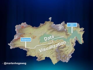
- 1. Art Science • @martenhogeweg
- 2. Location Integrates Functional Areas… Science/Modeling Natural Resources Conservation Land Management Crime Defense/Security Congestion Pollution Water Agriculture/Forestry Business Efficiency Energy Economic Recovery Global Warming Human Health Land Use Population Facility Biodiversity Education Public Safety Logistics Management Development Environmental Protection Urbanization Humanitarian Relief Law Enforcement National Security Energy Emergency Management Oceans …at All Levels of Government…
- 3. …and Forces Governments to Share Data Source: http://inspire.jrc.ec.europa.eu/reports/position_papers/inspire_ast_pp_v4_3_en.pdf
- 4. Geodata.gov > Data.gov > Geo.Data.gov 6/2003 Geodata.gov launched as e-Gov initiative. 3/2009 Data.gov – promotes transparent government. 6/2009 Data.gov connects to Geodata.gov web service and grows from 50 to 300,000 resources overnight. 10/2011 Geodata.gov becomes Geo.Data.gov. 7/2012 Geo.Data.gov includes 850,000+ resources.
- 5. Open Government Gone Wild?
- 6. Open Government Made Useful Recovery.gov Expenditures vs. Need Haiti AID Funding World Bank Projects
- 7. Visualize Data From Agency-specific API Climate Change and African Political Stability Program World Bank Data Mapper
- 8. HOWEVER: Open Data Comes In Layers… • Data on Employee Desktops • Scanned Reports without Data Access • Sprouting API
- 9. Can We Get Some Direction Please?
- 10. From Stove-pipe Applications to Platforms… Web Client Desktop Web Mobile • RESTful Services Client Client Client • Easily Discovered • Open Standards • Application Programming Interfaces Web Services Highest Point Service Health Data Demographic Point-to-Point Services Loosely Coupled and Orchestrated Services
- 11. Opening Data Is Not Rocket Science • Publish API: - FCC.gov, Aiddata.org, Worldbank.org, Recovery.gov… - Open Geospatial Consortium - Product API • Find Geospatial Content At: - Data.gov/Geo.Data.gov - Geoplatform.gov - ArcGIS.com • Bottom Line: - Web Services - Web Services - Web Services Unlike Predicting the End of the World…
- 12. The Art of Open Data Visualization is in the API • Simple • Stable • Forgiving • Useful • Meaningful
- 13. The Result: Informed Users http://storymaps.esri.com/stories/feedingtheworld/