Cyclescape - cyclenation presentation
•
0 likes•417 views

Presentation (soft-launch) of Cyclescape at the Cyclenation conference, October 2012.

Recommended
Recommended
More Related Content
Viewers also liked
Viewers also liked (6)
Similar to Cyclescape - cyclenation presentation
Similar to Cyclescape - cyclenation presentation (20)
More from CycleStreets
More from CycleStreets (7)
Cyclescape - cyclenation presentation
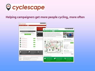
- 1. Helping campaigners get more people cycling, more often
- 2. CycleStreets - who are we? CycleStreets runs the UK-wide cycle journey planner at www.cyclestreets.net 5 million journeys planned (as of this week!)
- 4. What’s the problem? Fixing cycle-unfriendly streets needs local pressure As voluntary groups we all face difficulties of time, getting people involved, knowing about guidance, etc.
- 5. Typical problems Lots of issues, hard to keep track of E-mail lists can be hard work Being involved is either all or nothing Don’t know where all places in city are
- 6. Typical problems Miss planning applications Hard to get new people involved Guidance and official rules hard to find Easy to miss deadlines
- 7. Typical problems Easy to forget recent issues that are more difficult Collision data not easily at hand Time-consuming to match people with locations Hard to prioritise when lots of issues
- 8. Typical problems E-mail lists rapidly go off-topic No proper archive of previous discussions No real categorisation of issues Generally high barrier to volunteer involvement
- 9. Cyclescape aims to tackle these Members watch areas Subscribed when issues added Discuss, in geographical context Propose solutions
- 10. Features designed for groups
- 11. An ambitious project Funding of £27k from GeoVation Other grants from Cambridge City Council, Lush, CTC Almost ready for groups to use Cyclenation: “This will be a valuable tool, helping local campaigners focus on barriers to cycling and ultimately generating extra cycling trips.”
- 12. Where are we now? Cambridge group testing: Usage high New people involved Roughly 0% off-topic discussion! Some usability problems due to unfinished things
- 13. Where are we now? Most of the features in place Usability work and finishing-off Let us know if you’re ready to try out! + blog.cyclescape.org