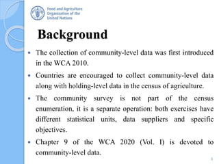
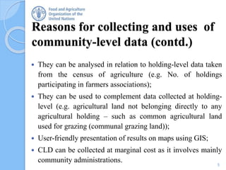
Regional Roundtable on
World Programme for the Census of Agriculture 2020
Nairobi, Kenya
18th - 22nd September 2017
Community level data
Technical session 16
1
Jairo Castano
Senior Statistician
Leader, Agricultural Census and Survey Team
FAO Statistics Division
2
Contents
• Background
• Reasons for collecting and uses of community-level data
• Methodological considerations
• Items
• Tabulation
• Country experiences
• Conclusions
Background
3
 The collection of community-level data was first introduced
in the WCA 2010.
 Countries are encouraged to collect community-level data
along with holding-level data in the census of agriculture.
 The community survey is not part of the census
enumeration, it is a separate operation: both exercises have
different statistical units, data suppliers and specific
objectives.
 Chapter 9 of the WCA 2020 (Vol. I) is devoted to
community-level data.
Reasons for collecting and uses of
community-level data (CLD)
Community-level data are of interest for:
 Planning, monitoring and evaluation of agricultural and rural development and
of food security policy (e.g. to support the solution of problems related to
food-shortages, infrastructure problems of farmers and communities in
general);
 Development partners to support rural development programs at national and
subnational levels;
 Businesses;
 Identification of:
 areas where agricultural market or commercial network are needed;
 areas where agricultural services or processing facilities should be
encouraged;
 vulnerable areas where there is a risk of food insecurity due to natural
disasters;
4
5
Reasons for collecting and uses of
community-level data (contd.)
 They can be analysed in relation to holding-level data taken
from the census of agriculture (e.g. No. of holdings
participating in farmers associations);
 They can be used to complement data collected at holding-
level (e.g. agricultural land not belonging directly to any
agricultural holding – such as common agricultural land
used for grazing (communal grazing land));
 User-friendly presentation of results on maps using GIS;
 CLD can be collected at marginal cost as it involves mainly
community administrations.
Methodological considerations
What is a community?
A community is a self-contained unit of social and economic activities.
What statistical units should be chosen for a community survey?
Unit chosen for community survey depends on:
• Data collected: sometimes, the lowest admin. unit has no substantial admin.
function, and the community unit may need to be defined at a higher level.
• Cost: may influence whether to collect data at, for example, the commune or
village level.
• Identifying community units: ready access to lists of community units needed.
• Stability of community units: difficulties when changes in admin. units are
common and not well-coordinated.
• Census coverage: Countries should endeavour to cover the communities
where census enumeration is conducted.
6
Community data collection
 How to collect community-level data will depend on the organization of
field work for the collection of holding-level data. Informants will be
community officials or other relevant persons.
 The most experienced of the supervisors or enumerators in charge of
census data collection could be assigned in advance to administer the
community questionnaire.
• Could take place when the community administration prepares the list
of households or holdings for the agricultural census.
• Often, community officials help locate each household or help as
translators. Community questionnaire can then be collected.
• Consideration should be given to the suitability of collecting
community-level data by mail, rather than by interview. 7
Recommendations of WCA 2020 on
Community Level Data
DOs
 Link agricultural census with existing community databases and
other available reliable administrative and statistical data sources
to avoid duplication.
 CLD should be limited to key admin. information that are well-
known to people in the community such as weather conditions,
economic activities, presence of infrastructure and services.
 The number of community-level items should be kept to a
minimum, normally, 10-20 items.
 In designing the community survey, tabulation needs should
always be considered. Community-level data are only useful if
they can be presented in statistical summaries
8
Recommendations of WCA 2020 on
Community Level Data (cont.)
DON’Ts
 The community survey should not be used for collecting:
data available from other reliable statistical and administrative
data sources;
that are better collected directly from holdings.
 Communities should not be asked to report the same data as
holdings. The only exception could be land use data from
community records. If they are deemed to be of good quality and
their concepts and definitions are compatible with those adopted
for the agricultural census, they could be used for checking at the
aggregate level the land use data reported by holdings.
9
Community-level items
Geography
 Location, agro-ecological, climatic, topographical or soil types;
land use; area of communal grazing land; area of communal
forest; communal area under water used for aquaculture;
travelling time and mode of travel to the major nearest urban
centre; whether the community has a year-round access to the
nearest urban centre; whether the community is prone to natural
disasters.
Socio-economic conditions
 Population according to population group; number of
households; economic status, main economic activities; whether
there are seasonal food shortages.
10
Community-level items (contd.)
Community infrastructure and services
 Presence of (or travelling time to the nearest): fertilizer dealer; pesticide dealer; seed
dealer; credit institution; agricultural produce market; food storage facilities; agricultural
processing facilities; facilities for maintaining agricultural machinery; extension services;
primary school, health facility
 Presence of irrigation facilities & area equipped for irrigation
 Availability of (or travelling time to the nearest) veterinary services.
 Whether the community is covered by agricultural produce collection network
 Existence of farmers’ associations, cooperatives and other supporting bodies.
 Whether electricity is connected.
 Presence of radio, telephone and internet services
 Availability of public transport
Development programmes
 Presence of specific development projects in the community, for example an irrigation or
an rural electrification project.
11
TABULATION
12
Community level data can be tabulated in 2 ways:
1. Summarize the characteristics of communities;
2. To use as classification variables for tabulations
of census holding-level data (crucial to be able
to link each holding with its community).
TABULATION (contd.)
For the second case, typical community level classification
variables are:
 Access to urban centre
 Risk of natural disasters
 Economic status
 Occurrence of seasonal food shortages
 Presence of periodic or permanent agricultural produce market
 Access to veterinary services
 Access to farm input trading centre
 Access to credit institutions
 Access to farmers’ association
 Presence of specific development projects.
13
Conclusions
 Advantageous to conduct community survey along
with the agricultural census.
 Limited additional cost, but results are much useful
for planning of targeted development programmes
at national and subnational levels and appreciated
by development partners.
 CLD are important for both short-term and long-
term policies in food security and agricultural and
rural development.
 User-friendly presentation using GIS.
14
Country experiences
The community survey in 2011 the National Agricultural Census in Malawi
 Scope: : Villages were sampled based on the sampling frame of the 1998 Population and
Housing Census. All villages found within the sampled EAs were included in the sample,
even if only part of the village was located inside the EA.
 Items covered 5 Sections:
1. Physical infrastructure
2. Access to financial institutions
3. Access to marketing agents in agriculture
4. Access to marketing agents in agriculture
5. Transportation of produce to markets
6. Migration to and from villages
7. Types of marriage and payment of lobola*
8. Conflict over land
15* Bride price
Scope: Community-level data were collected for Gambia by interviewing the
village heads using the Village Questionnaire. Data from some 450 villages were
captured, processed and analysed.
Items covered 5 sections:
 Identification
 Agricultural land, irrigation facility and ongoing projects
 Source of main food, cash and food crops cultivated and rearing of livestock
and poultry
 Market, storage, road access
 Disasters.
16
Country experiences (cont’d.)
Gambia - Census of Agriculture 2011/2012
Village questionnaire (Form 5)
MANY THANKS
17

Community-level data

  • 1.
    Regional Roundtable on WorldProgramme for the Census of Agriculture 2020 Nairobi, Kenya 18th - 22nd September 2017 Community level data Technical session 16 1 Jairo Castano Senior Statistician Leader, Agricultural Census and Survey Team FAO Statistics Division
  • 2.
    2 Contents • Background • Reasonsfor collecting and uses of community-level data • Methodological considerations • Items • Tabulation • Country experiences • Conclusions
  • 3.
    Background 3  The collectionof community-level data was first introduced in the WCA 2010.  Countries are encouraged to collect community-level data along with holding-level data in the census of agriculture.  The community survey is not part of the census enumeration, it is a separate operation: both exercises have different statistical units, data suppliers and specific objectives.  Chapter 9 of the WCA 2020 (Vol. I) is devoted to community-level data.
  • 4.
    Reasons for collectingand uses of community-level data (CLD) Community-level data are of interest for:  Planning, monitoring and evaluation of agricultural and rural development and of food security policy (e.g. to support the solution of problems related to food-shortages, infrastructure problems of farmers and communities in general);  Development partners to support rural development programs at national and subnational levels;  Businesses;  Identification of:  areas where agricultural market or commercial network are needed;  areas where agricultural services or processing facilities should be encouraged;  vulnerable areas where there is a risk of food insecurity due to natural disasters; 4
  • 5.
    5 Reasons for collectingand uses of community-level data (contd.)  They can be analysed in relation to holding-level data taken from the census of agriculture (e.g. No. of holdings participating in farmers associations);  They can be used to complement data collected at holding- level (e.g. agricultural land not belonging directly to any agricultural holding – such as common agricultural land used for grazing (communal grazing land));  User-friendly presentation of results on maps using GIS;  CLD can be collected at marginal cost as it involves mainly community administrations.
  • 6.
    Methodological considerations What isa community? A community is a self-contained unit of social and economic activities. What statistical units should be chosen for a community survey? Unit chosen for community survey depends on: • Data collected: sometimes, the lowest admin. unit has no substantial admin. function, and the community unit may need to be defined at a higher level. • Cost: may influence whether to collect data at, for example, the commune or village level. • Identifying community units: ready access to lists of community units needed. • Stability of community units: difficulties when changes in admin. units are common and not well-coordinated. • Census coverage: Countries should endeavour to cover the communities where census enumeration is conducted. 6
  • 7.
    Community data collection How to collect community-level data will depend on the organization of field work for the collection of holding-level data. Informants will be community officials or other relevant persons.  The most experienced of the supervisors or enumerators in charge of census data collection could be assigned in advance to administer the community questionnaire. • Could take place when the community administration prepares the list of households or holdings for the agricultural census. • Often, community officials help locate each household or help as translators. Community questionnaire can then be collected. • Consideration should be given to the suitability of collecting community-level data by mail, rather than by interview. 7
  • 8.
    Recommendations of WCA2020 on Community Level Data DOs  Link agricultural census with existing community databases and other available reliable administrative and statistical data sources to avoid duplication.  CLD should be limited to key admin. information that are well- known to people in the community such as weather conditions, economic activities, presence of infrastructure and services.  The number of community-level items should be kept to a minimum, normally, 10-20 items.  In designing the community survey, tabulation needs should always be considered. Community-level data are only useful if they can be presented in statistical summaries 8
  • 9.
    Recommendations of WCA2020 on Community Level Data (cont.) DON’Ts  The community survey should not be used for collecting: data available from other reliable statistical and administrative data sources; that are better collected directly from holdings.  Communities should not be asked to report the same data as holdings. The only exception could be land use data from community records. If they are deemed to be of good quality and their concepts and definitions are compatible with those adopted for the agricultural census, they could be used for checking at the aggregate level the land use data reported by holdings. 9
  • 10.
    Community-level items Geography  Location,agro-ecological, climatic, topographical or soil types; land use; area of communal grazing land; area of communal forest; communal area under water used for aquaculture; travelling time and mode of travel to the major nearest urban centre; whether the community has a year-round access to the nearest urban centre; whether the community is prone to natural disasters. Socio-economic conditions  Population according to population group; number of households; economic status, main economic activities; whether there are seasonal food shortages. 10
  • 11.
    Community-level items (contd.) Communityinfrastructure and services  Presence of (or travelling time to the nearest): fertilizer dealer; pesticide dealer; seed dealer; credit institution; agricultural produce market; food storage facilities; agricultural processing facilities; facilities for maintaining agricultural machinery; extension services; primary school, health facility  Presence of irrigation facilities & area equipped for irrigation  Availability of (or travelling time to the nearest) veterinary services.  Whether the community is covered by agricultural produce collection network  Existence of farmers’ associations, cooperatives and other supporting bodies.  Whether electricity is connected.  Presence of radio, telephone and internet services  Availability of public transport Development programmes  Presence of specific development projects in the community, for example an irrigation or an rural electrification project. 11
  • 12.
    TABULATION 12 Community level datacan be tabulated in 2 ways: 1. Summarize the characteristics of communities; 2. To use as classification variables for tabulations of census holding-level data (crucial to be able to link each holding with its community).
  • 13.
    TABULATION (contd.) For thesecond case, typical community level classification variables are:  Access to urban centre  Risk of natural disasters  Economic status  Occurrence of seasonal food shortages  Presence of periodic or permanent agricultural produce market  Access to veterinary services  Access to farm input trading centre  Access to credit institutions  Access to farmers’ association  Presence of specific development projects. 13
  • 14.
    Conclusions  Advantageous toconduct community survey along with the agricultural census.  Limited additional cost, but results are much useful for planning of targeted development programmes at national and subnational levels and appreciated by development partners.  CLD are important for both short-term and long- term policies in food security and agricultural and rural development.  User-friendly presentation using GIS. 14
  • 15.
    Country experiences The communitysurvey in 2011 the National Agricultural Census in Malawi  Scope: : Villages were sampled based on the sampling frame of the 1998 Population and Housing Census. All villages found within the sampled EAs were included in the sample, even if only part of the village was located inside the EA.  Items covered 5 Sections: 1. Physical infrastructure 2. Access to financial institutions 3. Access to marketing agents in agriculture 4. Access to marketing agents in agriculture 5. Transportation of produce to markets 6. Migration to and from villages 7. Types of marriage and payment of lobola* 8. Conflict over land 15* Bride price
  • 16.
    Scope: Community-level datawere collected for Gambia by interviewing the village heads using the Village Questionnaire. Data from some 450 villages were captured, processed and analysed. Items covered 5 sections:  Identification  Agricultural land, irrigation facility and ongoing projects  Source of main food, cash and food crops cultivated and rearing of livestock and poultry  Market, storage, road access  Disasters. 16 Country experiences (cont’d.) Gambia - Census of Agriculture 2011/2012 Village questionnaire (Form 5)
  • 17.