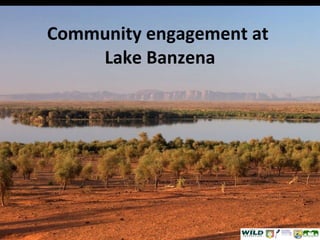
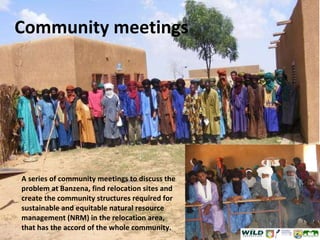
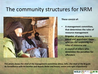
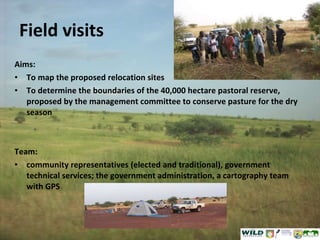
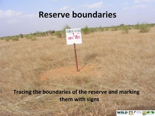
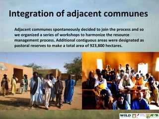
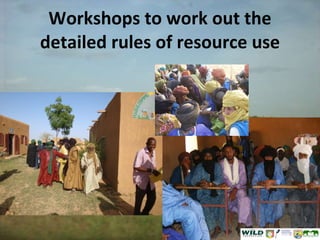
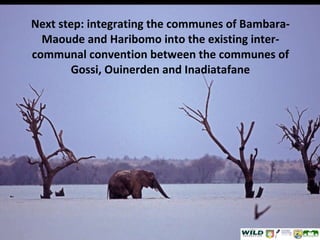
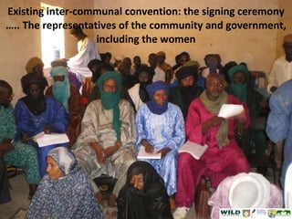
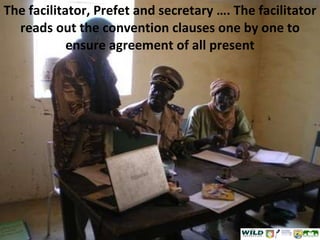
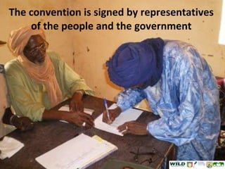
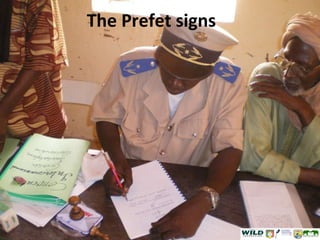
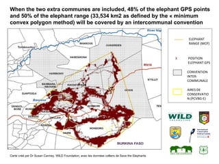
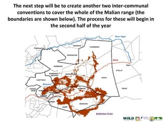
Community engagement at  Lake Banzena
Community meetings A series of community meetings to discuss the problem at Banzena, find relocation sites and create the community structures required for sustainable and equitable natural resource management (NRM) in the relocation area, that has the accord of the whole community.
The community structures for NRM These consist of: A management committee, that determines the rules of resource management Brigades  of young men to patrol and apprehend those who are not respecting the rules of resource use A council of elders who determine the penalties for offenders This photo shows the chief of the management committee (Aliou, left) ; the chief of the Brigade de Surveillance with his brother and deputy (Bebe and Kouna, centre and right respectively)
Field visits Aims: To map the proposed relocation sites  To determine the boundaries of the 40,000 hectare pastoral reserve, proposed by the management committee to conserve pasture for the dry season Team: community representatives (elected and traditional), government technical services; the government administration, a cartography team with GPS
Reserve boundaries Tracing the boundaries of the reserve and marking them with signs
Integration of adjacent communes Adjacent communes spontaneously decided to join the process and so we organized a series of workshops to harmonize the resource management process. Additional contiguous areas were designated as pastoral reserves to make a total area of 923,800 hectares.
Workshops to work out the detailed rules of resource use
Next step: integrating the communes of Bambara-Maoude and Haribomo into the existing inter-communal convention between the communes of Gossi, Ouinerden and Inadiatafane
Existing inter-communal convention: the signing ceremony ….. The representatives of the community and government, including the women
The facilitator, Prefet and secretary …. The facilitator reads out the convention clauses one by one to ensure agreement of all present
The convention is signed by representatives of the people and the government
The Prefet signs
Spontaneous discourse by the Chief of Ebanguimallen, welcoming the initiative “ If all projects acted as this one, the Gourma would not be in the state it is in today”
Carte créé par Dr Susan Canney, WILD Foundation, avec les données colliers de Save the Elephants  When the two extra communes are included, 48% of the elephant GPS points and 50% of the elephant range ( 33,534 km2 as defined by the « minimum convex polygon method)   will be covered by an intercommunal convention ELEPHANT RANGE (MCP) AIRES DE CONSERVATION (PCVBG-E) X  POSITION ELEPHANT GPS CONVENTION INTER-COMMUNALE
The next step will be to create another two inter-communal conventions to cover the whole of the Malian range (the boundaries are shown below). The process for these will begin in the second half of the year

Mali Elephant Project - Community Engagement at Lake Banzena, 2011

  • 1.
  • 2.
    Community meetings Aseries of community meetings to discuss the problem at Banzena, find relocation sites and create the community structures required for sustainable and equitable natural resource management (NRM) in the relocation area, that has the accord of the whole community.
  • 3.
    The community structuresfor NRM These consist of: A management committee, that determines the rules of resource management Brigades of young men to patrol and apprehend those who are not respecting the rules of resource use A council of elders who determine the penalties for offenders This photo shows the chief of the management committee (Aliou, left) ; the chief of the Brigade de Surveillance with his brother and deputy (Bebe and Kouna, centre and right respectively)
  • 4.
    Field visits Aims:To map the proposed relocation sites To determine the boundaries of the 40,000 hectare pastoral reserve, proposed by the management committee to conserve pasture for the dry season Team: community representatives (elected and traditional), government technical services; the government administration, a cartography team with GPS
  • 5.
    Reserve boundaries Tracingthe boundaries of the reserve and marking them with signs
  • 6.
    Integration of adjacentcommunes Adjacent communes spontaneously decided to join the process and so we organized a series of workshops to harmonize the resource management process. Additional contiguous areas were designated as pastoral reserves to make a total area of 923,800 hectares.
  • 7.
    Workshops to workout the detailed rules of resource use
  • 8.
    Next step: integratingthe communes of Bambara-Maoude and Haribomo into the existing inter-communal convention between the communes of Gossi, Ouinerden and Inadiatafane
  • 9.
    Existing inter-communal convention:the signing ceremony ….. The representatives of the community and government, including the women
  • 10.
    The facilitator, Prefetand secretary …. The facilitator reads out the convention clauses one by one to ensure agreement of all present
  • 11.
    The convention issigned by representatives of the people and the government
  • 12.
  • 13.
    Spontaneous discourse bythe Chief of Ebanguimallen, welcoming the initiative “ If all projects acted as this one, the Gourma would not be in the state it is in today”
  • 14.
    Carte créé parDr Susan Canney, WILD Foundation, avec les données colliers de Save the Elephants When the two extra communes are included, 48% of the elephant GPS points and 50% of the elephant range ( 33,534 km2 as defined by the « minimum convex polygon method) will be covered by an intercommunal convention ELEPHANT RANGE (MCP) AIRES DE CONSERVATION (PCVBG-E) X POSITION ELEPHANT GPS CONVENTION INTER-COMMUNALE
  • 15.
    The next stepwill be to create another two inter-communal conventions to cover the whole of the Malian range (the boundaries are shown below). The process for these will begin in the second half of the year