Circles and Squares
•Download as PPTX, PDF•
1 like•286 views
This document discusses the evolution of William Penn's original grid plan for Philadelphia over three centuries. Penn based the grid on plans for rebuilding London, with squares meant for public use similar to London's Moorfields. In the 19th century, most squares became public parks. In the 20th century, traffic needs led two squares to be reconfigured as circles. The plan shows how Penn's original grid endured but the uses and meanings of the squares changed over time to accommodate new transportation and recreation needs.
Report
Share
Report
Share

Recommended
Many-to-Many: Interactions in Artifact-Centric Choreographies
A talk given by Dirk Fahland at the 3rd Central European Workshop on Services and their Composition (ZEUS'11) in Karlsruhe, February 22, 2011. The talk explains behavioral phenomena in services choreographies where several service instances interact with each other.
geo_flowchart
The document outlines the registration and login process for a website called GEOPALETE.COM. It includes setting up a user ID and password, secure payment options, credit verification, and establishing credit limits. The main pages of the site are described, including differentiating between public and professional users. Features for both public users like salon searches and professional users like license verification and product lines are mentioned. The process for moving new professional clients from a staging area to full access after data and credit verification is approved is also summarized.
Content Dev Portfolio
The document discusses the benefits of meditation for reducing stress and anxiety. Regular meditation practice can help calm the mind and body by lowering heart rate and blood pressure. Studies have shown that meditating for just 10-20 minutes per day can have significant positive impacts on both mental and physical health over time.
Media diary x2
This document contains a media diary from Monday to Friday detailing the types of media the person was exposed to each day, including the time, duration, location and whether exposure was intentional. Some of the main types of media exposures included social media like Facebook and Instagram, music, news, advertisements on various platforms like TV, radio, apps and public transport. The diary provides insights into the person's daily media diet and how advertisements are encountered intentionally and unintentionally throughout the day.
Opensim technology
The document discusses alternative virtual world options to Second Life such as Kitely, an open-source virtual world platform. Kitely allows users to visit worlds created by others similar to Second Life and also provides options to create your own virtual worlds for prices starting at $15 per month. Kitely does not have the large community of Second Life but is presented as perfect for educators to host private meetings, trainings, simulations, and roleplays without requiring high technical skills. The presentation uses Kitely as an example to illustrate the benefits of alternative virtual world platforms.
Servicio de apoyo a la investigación en la Biblioteca de Ciències de la Salut...
Servicio de apoyo a la investigación en la Biblioteca de Ciències de la Salut...Servei de Biblioteques i Documentacio. Universitat de Valencia
El documento describe el origen y desarrollo del servicio de apoyo a la investigación de la Biblioteca de Ciencias de la Salud "Pelegrí Casanova". Se crearon grupos de trabajo para detectar las necesidades de los investigadores, mejorar la comunicación, definir un catálogo de servicios, elaborar perfiles de investigador y colaborar con otros servicios. El objetivo es ofrecer recursos y formación para apoyar todas las etapas del proceso de investigación.Using social science and design methods for social change
Did you know that design methods can be used to social problems, not just to create beautiful campaign and functional products? Slide through what we in InWithForward have learned in blending design methods and social science in the social context, with people in their homes, staff workers in social service and government agencies.
This slide deck also touched on designing social welfare for a context like Indonesia. The question that we ask ourselves is: how would it look like if we bring this method to a developing country like Indonesia? Is it ready for a social welfare system that looks more like a trampoline and less like a safety net.
Sir Terry Farrell - Shaping London
This document outlines Sir Terry Farrell's career accomplishments including publications, commissions, and roles serving on public bodies and organizations. It discusses many of his urban planning and design projects focused around London and the Thames River, addressing issues like transportation, housing, green space, and managing growth. Examples discussed include redeveloping areas like London Docklands, proposals to connect communities across the Thames with new bridges, and advocating to make London a "National Park City." The document emphasizes Farrell's approach of organically shaping cities through collaborative place-making rather than rigid master plans.
Early Urban CIty Environmental Plann - Copy.pptx
Early urban planning began with the Sumerians in Mesopotamia around 4000 BC. They built walled cities that served as fortresses and marketplaces. Hippodamus of Miletus is considered the father of formal city planning in the 5th century BC, developing the grid plan. The Romans expanded this approach throughout their empire, building standardized cities connected by roads. During the medieval period, cities grew radially around a central cathedral. The Renaissance and Baroque periods saw a return to grid plans and grand boulevards. The industrial revolution led to overcrowding and pollution in cities until reformers like Ebenezer Howard proposed garden cities. In the late 19th/early 20th century, figures
London Society - history of London planning
Roman London was first established in AD 43 under Emperor Claudius. It was rebuilt after being burned down by Boudicca in AD 60. The city expanded within defensive walls in the 2nd century AD. Throughout the medieval period and after the Great Fire of 1666, various plans were proposed to rebuild and improve London, including establishing building codes and minimum road widths. In the 18th-19th centuries, plans focused on highway improvements and public health. The 20th century saw plans for reducing overcrowding through population dispersal and new towns. More recent plans in the 2000s emphasized growth, densification and establishing London as a global city, though suburban intensification remains a challenge.
Renaissance
The Renaissance began in Florence, Italy in the 15th century and spread across Europe over the next two centuries. City planning during this period was influenced by a revival of classical Roman styles and an emphasis on order, symmetry, and harmony. Notable examples include Florentine architects like Brunelleschi designing buildings based on mathematical proportions and symmetrical facades, and the multi-century project to rebuild St. Peter's Basilica in Rome according to Renaissance precepts. This new approach to architecture and city planning had a significant impact across Italy and eventually the rest of Europe.
A red, red rose by Robert Burns
The poem "A Red, Red Rose" by Robert Burns expresses the poet's deep love for his beloved in exaggerated terms. He compares his love to a newly bloomed rose in June and sweet melodies. He vows to love her still until all the seas dry up and the rocks melt in the sun. In the last stanza, the poet bids his love farewell for a while but promises to return even if it means traveling ten thousand miles. Burns uses vivid imagery and hyperbole to convey the infinite and enduring nature of his love in this celebrated love poem.
Ch18 – Early 18th century in Italy & France
1) In the early 18th century, Europe saw political changes as strong centralized states like France and Britain gained power over smaller territories. Italy and France remained centers of music and culture.
2) In Italy, Naples, Rome, and Venice were still principal musical centers, and opera flourished. Antonio Vivaldi was a highly prolific and popular composer based in Venice. His concertos, especially The Four Seasons, expanded the ritornello form.
3) In France, Paris was the sole cultural center, and venues like the Opéra premiered new works. Composers blended French and Italian styles, like François Couperin in his harpsichord suites. Jean-Philippe R
The us library of congress
The US Library of Congress has around 90 million items including books, manuscripts, maps and photographs. It was started in 1800 to help Congressmen but is now open to the public. The Russian State Library in Moscow has over 40 million items in 247 languages and was opened in the 18th century based on a private collection, receiving around 4,000 visitors daily.
Digitally (Re)Publishing Franklin’s 1734 Edition of
James Anderson’s Constit...
A presentation about the origin, typography, and design of the 2006 digital edition of James Anderson's The Constitutions of the Free-Masons and about the online reception of a work that has turned out to be the single most popular document in the University of Nebraska-Lincoln's institutional repository.
The first part is a discussion of how an 18th-century printed work is presented in a 21st-century electronic format, including design and editorial principles.
The second part discusses 1) the intentional outreach or marketing efforts by the developer, and 2) the viral or non-intentional links and adoptions created by internet users.
The third part is a recruitment invitation for editors of other 18th-century texts that might be included in the electronic texts series.
Industrial Revolution and 19th century
Industrial Revolution and 19th centuryGraphic Design History @ Mahidol University International College
The document discusses the impact of the Industrial Revolution on graphic design in the 19th century. It notes how steam power allowed for faster printing presses, mass producing goods and information. This led to a need for graphic designs that could be more easily reproduced at larger scale for advertising and posters to communicate with more literate urban populations. Many new typeface designs emerged during this time including styles like fat-face, Tuscan, and Egyptian inspired designs that featured thick, high-contrast letters suited for the faster communication needs of industrial society. Major type founders like William Caslon, Vincent Figgins, and American foundries innovated new typeface styles during this transformative period.London then and now
this presentation is based on the changes in various aspects of development.. If you like it, then please like and share and follow me.!!! :)
Washington & paris- history of town planning
Paris before the renovations of Baron Haussmann was overcrowded, unsanitary, and prone to disease outbreaks. The narrow, winding streets of medieval Paris had changed little and population density in the city center was extremely high, facilitating the rapid spread of cholera epidemics. Traffic circulation was also a major problem due to the narrow streets. The crowded center of Paris was a source of social unrest. In the late 1840s, Napoleon III commissioned Baron Haussmann to completely redesign and modernize Paris through wide boulevards, public works, and standardized building facades to address these issues of public health, order, and control.
William Shakespeare
William Shakespeare was an English poet and playwright born in 1564 who is regarded as the greatest writer in the English language. He wrote many renowned plays including Macbeth, Romeo and Juliet, Hamlet, and The Tempest. Shakespeare received little formal education and began his career as an actor before becoming a playwright around 1592. He drew inspiration from history, nature, and previous plays in crafting his profound works, which were highly received during his time in Elizabethan England.
Romantic_Poetry.ppt
Romantic poetry first emerged in 1798 with the publication of Lyrical Ballads by William Wordsworth and Samuel Taylor Coleridge. It was characterized by an emphasis on imagination and emotion, individual experience over universal themes, and a love of nature. Major romantic poets included Wordsworth, Coleridge, Lord Byron, Percy Bysshe Shelley, and John Keats. They sought to incorporate ordinary language and focus on the "essential passions of the heart." The second generation including Byron, Shelley, and Keats had short but influential lives and addressed feelings of alienation.
urbanDESIGN.pdf
1. The document provides a history of settlements from ancient times to contemporary world urbanization, covering theories and practices in city planning.
2. It discusses early Neolithic cities like Jericho and Catalhoyuk, as well as ancient cities in Mesopotamia, Egypt, Indus Valley, and China. Greek, Roman, and medieval cities are also covered.
3. Theories and practices in the Renaissance, Industrial Revolution, and modern eras are summarized, including thinkers like Howard, Wright, Le Corbusier, and concepts like garden cities, neighborhoods, and megalopolises. Settlement planning in the Philippines is also briefly mentioned.
Vi 20th century
This document provides a summary of key developments in music during the 20th century. It discusses major events like the two world wars and technological advancements. Regarding music, it describes the rejection of traditional rules by composers and the emergence of diverse styles like Impressionism, Neoclassicism, and atonality. Major figures discussed include Debussy, Stravinsky, and the influence of jazz. Overall it gives a high-level overview of the radical changes in music during this period through the lens of technological, social, and artistic developments.
URBAN DESIGN ARCHITECTS
Walter Gropius and Peter Hall were influential figures in planning theory and urban design. Gropius was a pioneer of modern architecture who developed the Bauhaus school. He emphasized simple geometries, modern materials like steel and glass, and the integration of architecture and machine design. Hall developed the concept of the neighborhood unit, where residential areas are organized around an elementary school and other local amenities within a quarter mile radius. Critics argue the neighborhood unit concept can lead to social segregation and that schools may be too small. Ashdod, Israel provides an example where the city is organized into 17 disconnected neighborhood units, and plans are underway to better connect them.
Classicism
Classicism refers to the admiration and imitation of ancient Greek and Roman styles and forms. During the Renaissance, classicism saw a revival as humanists collected and studied classical works. This led to the formation of schools of art and music applying classical orders of architecture and proportions. In the 17th-18th centuries, classicism strongly influenced French and English literature, exemplified by playwrights like Shakespeare, Jonson, and Racine adhering to Aristotle's rules of drama. In architecture, classicism developed during the Renaissance based on the writings of Alberti and Brunelleschi's works, employing classical columns and orders.
Simiolus, volume 37-1,2013-2014, Dutch Migrant Artists in London, Sander Karst
This document discusses the migration of Dutch artists to London in the late 17th century due to economic hardship in the Netherlands. It provides context for the decline of the Dutch art market starting in 1660 as economic gravity shifted to Britain, whose art market flourished under King Charles II after the Restoration. Many Dutch artists emigrated to London in search of patrons and sales, introducing new genres of painting. Auction catalogs from the 1680s-90s reveal the activity of Dutch migrants in the English art market. The document aims to shed light on these lesser-known artists who contributed greatly to the development of painting in England.
Dealing With Urban Archaeological Finds, an Example from Philadelphia
This document discusses an archaeological discovery made during a transportation enhancement project in Logan Square, Philadelphia. During excavation, archaeologists uncovered 58 grave shafts clustered together from an old burial ground. This presented challenges as disturbing the burials had legal and ethical issues. The solution was to work with architects to modify the project design and limit excavation depths to avoid the burials. Archaeological monitoring during construction further ensured the burials were protected. Through collaboration rather than full excavation, the project could continue while preserving the archaeological finds.
History of libraries modern era
The document provides a history of libraries from 1500-1899 CE. It discusses the growth of libraries during this period, from the Vatican library in the 1500s to the establishment of national libraries and the development of public libraries in the 1800s. It notes key developments like the introduction of the printing press, the spread of free public libraries in the 1600s, the establishment of the first card catalog system during the French Revolution, and the emergence of librarianship as a profession in the late 1800s. The document also outlines common departments in modern public libraries like circulation, reference, stacks maintenance, collections, and technological services.
More Related Content
Similar to Circles and Squares
Sir Terry Farrell - Shaping London
This document outlines Sir Terry Farrell's career accomplishments including publications, commissions, and roles serving on public bodies and organizations. It discusses many of his urban planning and design projects focused around London and the Thames River, addressing issues like transportation, housing, green space, and managing growth. Examples discussed include redeveloping areas like London Docklands, proposals to connect communities across the Thames with new bridges, and advocating to make London a "National Park City." The document emphasizes Farrell's approach of organically shaping cities through collaborative place-making rather than rigid master plans.
Early Urban CIty Environmental Plann - Copy.pptx
Early urban planning began with the Sumerians in Mesopotamia around 4000 BC. They built walled cities that served as fortresses and marketplaces. Hippodamus of Miletus is considered the father of formal city planning in the 5th century BC, developing the grid plan. The Romans expanded this approach throughout their empire, building standardized cities connected by roads. During the medieval period, cities grew radially around a central cathedral. The Renaissance and Baroque periods saw a return to grid plans and grand boulevards. The industrial revolution led to overcrowding and pollution in cities until reformers like Ebenezer Howard proposed garden cities. In the late 19th/early 20th century, figures
London Society - history of London planning
Roman London was first established in AD 43 under Emperor Claudius. It was rebuilt after being burned down by Boudicca in AD 60. The city expanded within defensive walls in the 2nd century AD. Throughout the medieval period and after the Great Fire of 1666, various plans were proposed to rebuild and improve London, including establishing building codes and minimum road widths. In the 18th-19th centuries, plans focused on highway improvements and public health. The 20th century saw plans for reducing overcrowding through population dispersal and new towns. More recent plans in the 2000s emphasized growth, densification and establishing London as a global city, though suburban intensification remains a challenge.
Renaissance
The Renaissance began in Florence, Italy in the 15th century and spread across Europe over the next two centuries. City planning during this period was influenced by a revival of classical Roman styles and an emphasis on order, symmetry, and harmony. Notable examples include Florentine architects like Brunelleschi designing buildings based on mathematical proportions and symmetrical facades, and the multi-century project to rebuild St. Peter's Basilica in Rome according to Renaissance precepts. This new approach to architecture and city planning had a significant impact across Italy and eventually the rest of Europe.
A red, red rose by Robert Burns
The poem "A Red, Red Rose" by Robert Burns expresses the poet's deep love for his beloved in exaggerated terms. He compares his love to a newly bloomed rose in June and sweet melodies. He vows to love her still until all the seas dry up and the rocks melt in the sun. In the last stanza, the poet bids his love farewell for a while but promises to return even if it means traveling ten thousand miles. Burns uses vivid imagery and hyperbole to convey the infinite and enduring nature of his love in this celebrated love poem.
Ch18 – Early 18th century in Italy & France
1) In the early 18th century, Europe saw political changes as strong centralized states like France and Britain gained power over smaller territories. Italy and France remained centers of music and culture.
2) In Italy, Naples, Rome, and Venice were still principal musical centers, and opera flourished. Antonio Vivaldi was a highly prolific and popular composer based in Venice. His concertos, especially The Four Seasons, expanded the ritornello form.
3) In France, Paris was the sole cultural center, and venues like the Opéra premiered new works. Composers blended French and Italian styles, like François Couperin in his harpsichord suites. Jean-Philippe R
The us library of congress
The US Library of Congress has around 90 million items including books, manuscripts, maps and photographs. It was started in 1800 to help Congressmen but is now open to the public. The Russian State Library in Moscow has over 40 million items in 247 languages and was opened in the 18th century based on a private collection, receiving around 4,000 visitors daily.
Digitally (Re)Publishing Franklin’s 1734 Edition of
James Anderson’s Constit...
A presentation about the origin, typography, and design of the 2006 digital edition of James Anderson's The Constitutions of the Free-Masons and about the online reception of a work that has turned out to be the single most popular document in the University of Nebraska-Lincoln's institutional repository.
The first part is a discussion of how an 18th-century printed work is presented in a 21st-century electronic format, including design and editorial principles.
The second part discusses 1) the intentional outreach or marketing efforts by the developer, and 2) the viral or non-intentional links and adoptions created by internet users.
The third part is a recruitment invitation for editors of other 18th-century texts that might be included in the electronic texts series.
Industrial Revolution and 19th century
Industrial Revolution and 19th centuryGraphic Design History @ Mahidol University International College
The document discusses the impact of the Industrial Revolution on graphic design in the 19th century. It notes how steam power allowed for faster printing presses, mass producing goods and information. This led to a need for graphic designs that could be more easily reproduced at larger scale for advertising and posters to communicate with more literate urban populations. Many new typeface designs emerged during this time including styles like fat-face, Tuscan, and Egyptian inspired designs that featured thick, high-contrast letters suited for the faster communication needs of industrial society. Major type founders like William Caslon, Vincent Figgins, and American foundries innovated new typeface styles during this transformative period.London then and now
this presentation is based on the changes in various aspects of development.. If you like it, then please like and share and follow me.!!! :)
Washington & paris- history of town planning
Paris before the renovations of Baron Haussmann was overcrowded, unsanitary, and prone to disease outbreaks. The narrow, winding streets of medieval Paris had changed little and population density in the city center was extremely high, facilitating the rapid spread of cholera epidemics. Traffic circulation was also a major problem due to the narrow streets. The crowded center of Paris was a source of social unrest. In the late 1840s, Napoleon III commissioned Baron Haussmann to completely redesign and modernize Paris through wide boulevards, public works, and standardized building facades to address these issues of public health, order, and control.
William Shakespeare
William Shakespeare was an English poet and playwright born in 1564 who is regarded as the greatest writer in the English language. He wrote many renowned plays including Macbeth, Romeo and Juliet, Hamlet, and The Tempest. Shakespeare received little formal education and began his career as an actor before becoming a playwright around 1592. He drew inspiration from history, nature, and previous plays in crafting his profound works, which were highly received during his time in Elizabethan England.
Romantic_Poetry.ppt
Romantic poetry first emerged in 1798 with the publication of Lyrical Ballads by William Wordsworth and Samuel Taylor Coleridge. It was characterized by an emphasis on imagination and emotion, individual experience over universal themes, and a love of nature. Major romantic poets included Wordsworth, Coleridge, Lord Byron, Percy Bysshe Shelley, and John Keats. They sought to incorporate ordinary language and focus on the "essential passions of the heart." The second generation including Byron, Shelley, and Keats had short but influential lives and addressed feelings of alienation.
urbanDESIGN.pdf
1. The document provides a history of settlements from ancient times to contemporary world urbanization, covering theories and practices in city planning.
2. It discusses early Neolithic cities like Jericho and Catalhoyuk, as well as ancient cities in Mesopotamia, Egypt, Indus Valley, and China. Greek, Roman, and medieval cities are also covered.
3. Theories and practices in the Renaissance, Industrial Revolution, and modern eras are summarized, including thinkers like Howard, Wright, Le Corbusier, and concepts like garden cities, neighborhoods, and megalopolises. Settlement planning in the Philippines is also briefly mentioned.
Vi 20th century
This document provides a summary of key developments in music during the 20th century. It discusses major events like the two world wars and technological advancements. Regarding music, it describes the rejection of traditional rules by composers and the emergence of diverse styles like Impressionism, Neoclassicism, and atonality. Major figures discussed include Debussy, Stravinsky, and the influence of jazz. Overall it gives a high-level overview of the radical changes in music during this period through the lens of technological, social, and artistic developments.
URBAN DESIGN ARCHITECTS
Walter Gropius and Peter Hall were influential figures in planning theory and urban design. Gropius was a pioneer of modern architecture who developed the Bauhaus school. He emphasized simple geometries, modern materials like steel and glass, and the integration of architecture and machine design. Hall developed the concept of the neighborhood unit, where residential areas are organized around an elementary school and other local amenities within a quarter mile radius. Critics argue the neighborhood unit concept can lead to social segregation and that schools may be too small. Ashdod, Israel provides an example where the city is organized into 17 disconnected neighborhood units, and plans are underway to better connect them.
Classicism
Classicism refers to the admiration and imitation of ancient Greek and Roman styles and forms. During the Renaissance, classicism saw a revival as humanists collected and studied classical works. This led to the formation of schools of art and music applying classical orders of architecture and proportions. In the 17th-18th centuries, classicism strongly influenced French and English literature, exemplified by playwrights like Shakespeare, Jonson, and Racine adhering to Aristotle's rules of drama. In architecture, classicism developed during the Renaissance based on the writings of Alberti and Brunelleschi's works, employing classical columns and orders.
Simiolus, volume 37-1,2013-2014, Dutch Migrant Artists in London, Sander Karst
This document discusses the migration of Dutch artists to London in the late 17th century due to economic hardship in the Netherlands. It provides context for the decline of the Dutch art market starting in 1660 as economic gravity shifted to Britain, whose art market flourished under King Charles II after the Restoration. Many Dutch artists emigrated to London in search of patrons and sales, introducing new genres of painting. Auction catalogs from the 1680s-90s reveal the activity of Dutch migrants in the English art market. The document aims to shed light on these lesser-known artists who contributed greatly to the development of painting in England.
Dealing With Urban Archaeological Finds, an Example from Philadelphia
This document discusses an archaeological discovery made during a transportation enhancement project in Logan Square, Philadelphia. During excavation, archaeologists uncovered 58 grave shafts clustered together from an old burial ground. This presented challenges as disturbing the burials had legal and ethical issues. The solution was to work with architects to modify the project design and limit excavation depths to avoid the burials. Archaeological monitoring during construction further ensured the burials were protected. Through collaboration rather than full excavation, the project could continue while preserving the archaeological finds.
History of libraries modern era
The document provides a history of libraries from 1500-1899 CE. It discusses the growth of libraries during this period, from the Vatican library in the 1500s to the establishment of national libraries and the development of public libraries in the 1800s. It notes key developments like the introduction of the printing press, the spread of free public libraries in the 1600s, the establishment of the first card catalog system during the French Revolution, and the emergence of librarianship as a profession in the late 1800s. The document also outlines common departments in modern public libraries like circulation, reference, stacks maintenance, collections, and technological services.
Similar to Circles and Squares (20)
Digitally (Re)Publishing Franklin’s 1734 Edition of
James Anderson’s Constit...
Digitally (Re)Publishing Franklin’s 1734 Edition of
James Anderson’s Constit...
Simiolus, volume 37-1,2013-2014, Dutch Migrant Artists in London, Sander Karst
Simiolus, volume 37-1,2013-2014, Dutch Migrant Artists in London, Sander Karst
Dealing With Urban Archaeological Finds, an Example from Philadelphia
Dealing With Urban Archaeological Finds, an Example from Philadelphia
Circles and Squares
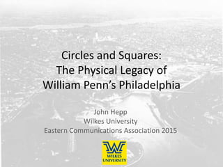
- 1. Circles and Squares: The Physical Legacy of William Penn’s Philadelphia John Hepp Wilkes University Eastern Communications Association 2015
- 2. Three centuries of William Penn’s “Green Country Town” • The founding myth • London as the basis for Penn’s “Green Country Town” • Philadelphia’s grid • Three centuries of evolving usage
- 3. London models for the grid Robert Hooke’s plan for rebuilding the city, 1666 (this edition circa 1670) Richard Newcourt’s plan for rebuilding the city, 1666
- 4. Philadelphia’s grid Holme’s plan for Philadelphia, 1683 Historical Society of Pennsylvania
- 5. The evolution of the grid • Phase one: What did the squares mean in 17th and 18th centuries? • Phase two: During the 19th century, most of the squares become public parks • Phase three: In the 20th century, two of the five squares become circles • Phase four: Squaring the circles • Penn’s grid over time: A similar map but different uses and meanings
- 6. What did the squares mean in 17th and 18th centuries? • Commonly used land • “for the like Uses, as the Moore-fields in London” London, 1776 Birch print, circa 1800
- 7. During the 19th century, most of the squares become public parks • Center Square (between 1799 and 1828 there was a pumping station) • The squares were landscaped like those in London Birch’s Views, 1800
- 8. In the 20th century, two of the five squares become circles • The city accommodates the automobile – The Parkway (Logan) – Traffic flow around City Hall (Centre) – The Delaware River Bridge (Franklin) 1925 1926 Plan Philly
- 9. Squaring the circles • The Four Seasons Hotel adopts Logan Square • Franklin Square becomes an amusement park • Philadelphia becomes more pedestrian friendly in the 21st century Trip Advisor Historic Philadelphia
- 10. Penn’s grid over time • A similar map but different uses and meanings
- 11. Circles and Squares: The Physical Legacy of William Penn’s Philadelphia John Hepp Wilkes University Eastern Communications Association 2015