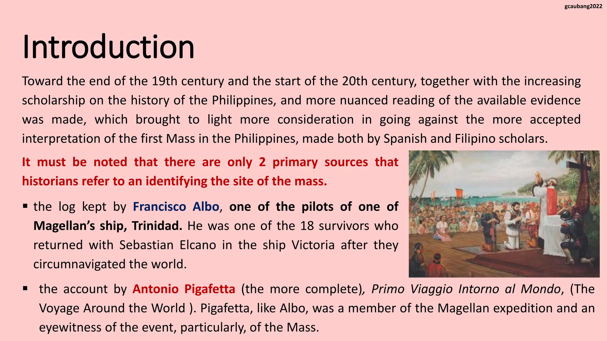
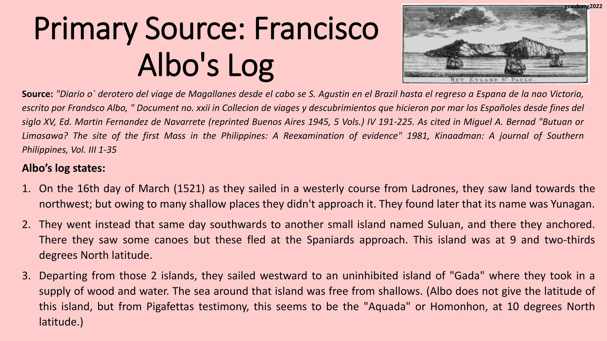
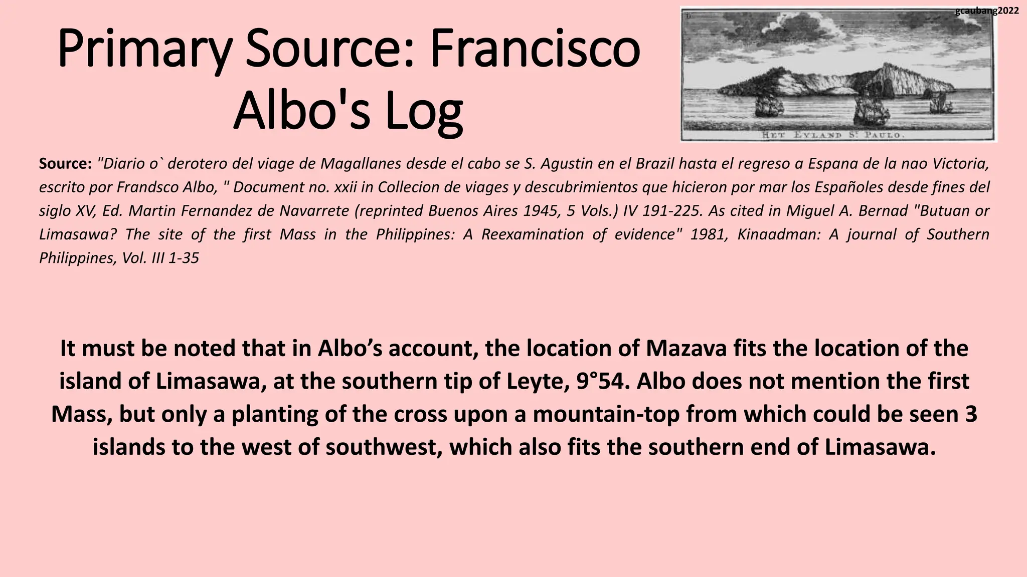
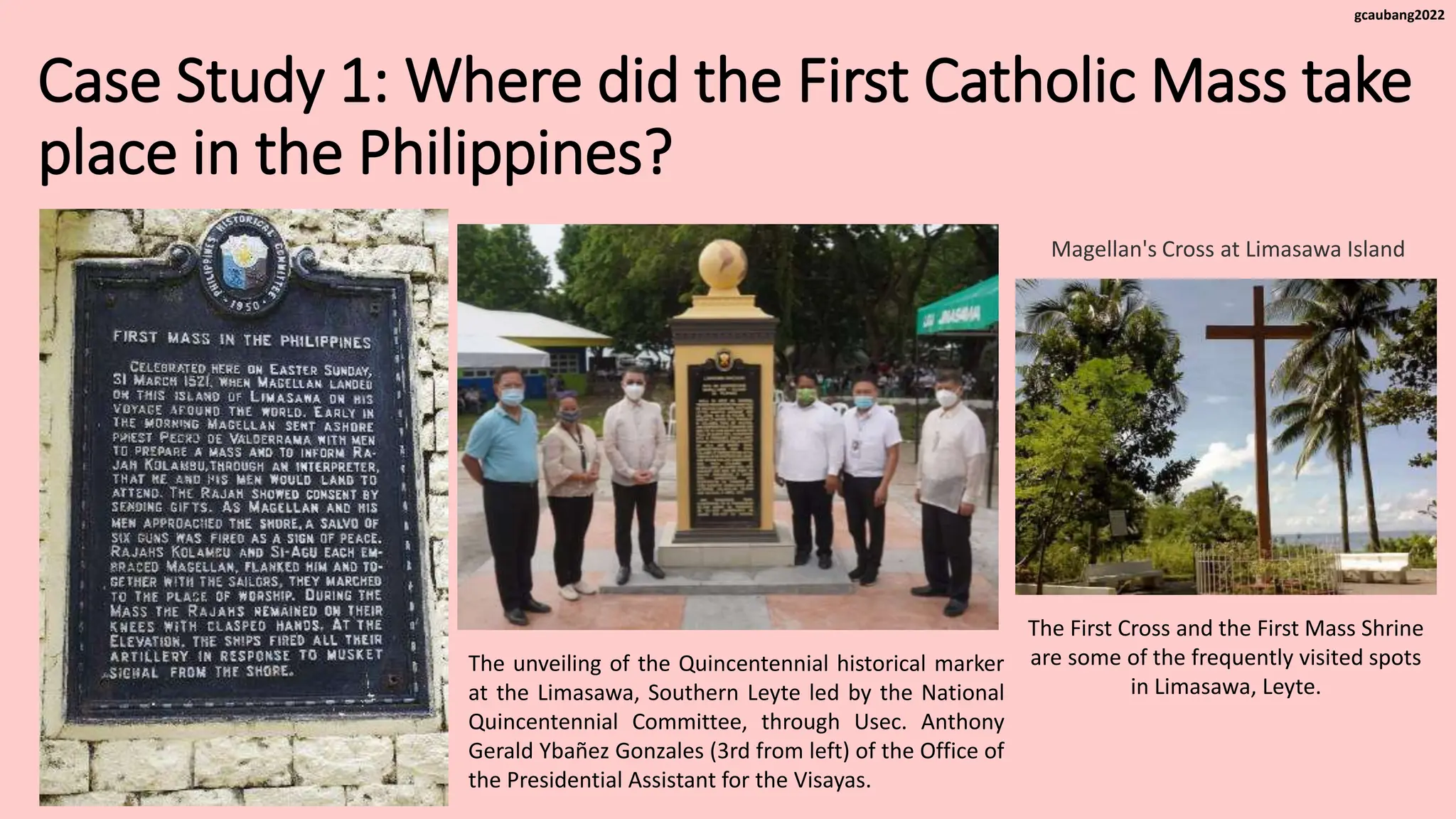
Content and Contextual Analysis of
Selected Primary Sources in Philippine
History
Case Study 1: Where did the
First Catholic Mass take place
in the Philippines?
gcaubang2022
Introduction
• Initially, the goal was to find alternative routes by sea to get to
Asian the main source of spices and other commodities.
• Existing routes to Asian we're mainly by land and cost very
expensive and sea route to Asia means that Europeans could
access the spice trade directly, greatly reducing costs for
traders.
Spain’s major foray into the exploration was through Christopher
Columbus, who proposed to sail westward to find a shortcut to Asia.
• He was able to reach the Americans, which was then cut off
from the rest of the known world.
The Age of Exploration is a period of competition
among European rulers to conquer and colonize
lands outside their original domain.
gcaubang2022
Introduction
• Butuan has long been believed as the site of the
first Mass. In fact, this has been the case for three
centuries, culminating in the erection of a monument
in 1872 near Agusan River, which commemorate the
expedition arrival and celebration of Mass on April 8,
1521.
• The Butuan claim has been based on a rather
elementary reading of primary sources from the
event.
The popularity of knowing where the first mass happened in history has been an easy way
to trivialize history, but this case study will not focus on the significance of the site of the
First Catholic Mass in the Philippines, but rather, use it as a historiographical exercise in
the utilization of evidence and interpretation in reading historical event.
gcaubang2022
Introduction
It must be noted that there are only 2 primary sources that
historians refer to an identifying the site of the mass.
 the log kept by Francisco Albo, one of the pilots of one of
Magellan’s ship, Trinidad. He was one of the 18 survivors who
returned with Sebastian Elcano in the ship Victoria after they
circumnavigated the world.
Toward the end of the 19th century and the start of the 20th century, together with the increasing
scholarship on the history of the Philippines, and more nuanced reading of the available evidence
was made, which brought to light more consideration in going against the more accepted
interpretation of the first Mass in the Philippines, made both by Spanish and Filipino scholars.
 the account by Antonio Pigafetta (the more complete), Primo Viaggio Intorno al Mondo, (The
Voyage Around the World ). Pigafetta, like Albo, was a member of the Magellan expedition and an
eyewitness of the event, particularly, of the Mass.
gcaubang2022
Primary Source: Francisco
Albo's Log
Albo’s log states:
1. On the 16th day of March (1521) as they sailed in a westerly course from Ladrones, they saw land towards the
northwest; but owing to many shallow places they didn't approach it. They found later that its name was Yunagan.
2. They went instead that same day southwards to another small island named Suluan, and there they anchored.
There they saw some canoes but these fled at the Spaniards approach. This island was at 9 and two-thirds
degrees North latitude.
3. Departing from those 2 islands, they sailed westward to an uninhibited island of "Gada" where they took in a
supply of wood and water. The sea around that island was free from shallows. (Albo does not give the latitude of
this island, but from Pigafettas testimony, this seems to be the "Aquada" or Homonhon, at 10 degrees North
latitude.)
Source: "Diario o` derotero del viage de Magallanes desde el cabo se S. Agustin en el Brazil hasta el regreso a Espana de la nao Victoria,
escrito por Frandsco Albo, " Document no. xxii in Collecion de viages y descubrimientos que hicieron por mar los Españoles desde fines del
siglo XV, Ed. Martin Fernandez de Navarrete (reprinted Buenos Aires 1945, 5 Vols.) IV 191-225. As cited in Miguel A. Bernad "Butuan or
Limasawa? The site of the first Mass in the Philippines: A Reexamination of evidence" 1981, Kinaadman: A journal of Southern
Philippines, Vol. III 1-35
gcaubang2022
Primary Source: Francisco
Albo's Log
Albo’s log states:
4. From that island they sailed westwards towards a large island names Seilani that was inhabited and was known
to have gold. (Seilani-or, as Pigafetta calls it, Ceylon-was the island of Leyte)
5. Sailing southwards along the coast of that large island of Seilani, they turned southwest to a small island called
"Mazava". That island is also at latitude of 9 and two-thirds degrees north.
6. The people of that island of Mazava we're very good. There the Spaniards planted a cross upon a mountain top,
and from there they were shown three islands to the west and Southwest, where they were told there was
much gold. They showed us how the gold was gathered, which came in small pieces like peas and lentils.
7. From Mazava they sailed northwards Seilani. They followed the coast of Seilani in a Northwesterly direction,
ascending up to 10 degrees of latitude where they saw three small islands.
Source: "Diario o` derotero del viage de Magallanes desde el cabo se S. Agustin en el Brazil hasta el regreso a Espana de la nao Victoria,
escrito por Frandsco Albo, " Document no. xxii in Collecion de viages y descubrimientos que hicieron por mar los Españoles desde fines del
siglo XV, Ed. Martin Fernandez de Navarrete (reprinted Buenos Aires 1945, 5 Vols.) IV 191-225. As cited in Miguel A. Bernad "Butuan or
Limasawa? The site of the first Mass in the Philippines: A Reexamination of evidence" 1981, Kinaadman: A journal of Southern
Philippines, Vol. III 1-35
gcaubang2022
Primary Source: Francisco
Albo's Log
Albo’s log states:
8. From there they sailed westwards some 10 leagues, and there they saw 3 islets, where they dropped anchor for
the night. In the morning they sailed southwest some 12 leagues, down to latitude of 10 and one-third degrees.
There they entered a channel between 2 islands, one of which was called "Matan" and the other "Subu".
9. They sailed down that channel and then turned westward, anchored at the town (la villa) of Subu where they
stayed more days and obtained provisions and entered into a peace-pact the local king.
10. The town of Subu was on an east-west direction with the island of Suluan and Mazava. But between Mazava
and Subu, there were so many shallows that the boats could not go westward directly, has to go in a
roundabout way.
Source: "Diario o` derotero del viage de Magallanes desde el cabo se S. Agustin en el Brazil hasta el regreso a Espana de la nao Victoria,
escrito por Frandsco Albo, " Document no. xxii in Collecion de viages y descubrimientos que hicieron por mar los Españoles desde fines del
siglo XV, Ed. Martin Fernandez de Navarrete (reprinted Buenos Aires 1945, 5 Vols.) IV 191-225. As cited in Miguel A. Bernad "Butuan or
Limasawa? The site of the first Mass in the Philippines: A Reexamination of evidence" 1981, Kinaadman: A journal of Southern
Philippines, Vol. III 1-35
gcaubang2022
Primary Source: Francisco
Albo's Log
It must be noted that in Albo’s account, the location of Mazava fits the location of the
island of Limasawa, at the southern tip of Leyte, 9°54. Albo does not mention the first
Mass, but only a planting of the cross upon a mountain-top from which could be seen 3
islands to the west of southwest, which also fits the southern end of Limasawa.
Source: "Diario o` derotero del viage de Magallanes desde el cabo se S. Agustin en el Brazil hasta el regreso a Espana de la nao Victoria,
escrito por Frandsco Albo, " Document no. xxii in Collecion de viages y descubrimientos que hicieron por mar los Españoles desde fines del
siglo XV, Ed. Martin Fernandez de Navarrete (reprinted Buenos Aires 1945, 5 Vols.) IV 191-225. As cited in Miguel A. Bernad "Butuan or
Limasawa? The site of the first Mass in the Philippines: A Reexamination of evidence" 1981, Kinaadman: A journal of Southern
Philippines, Vol. III 1-35
gcaubang2022
Primary Source: Pigafetta's
Testimony on the Route of
Magellan's Expedition
Pigafetta’s account states:
1. Saturday, March 16, 1521 - Magellan’s expedition sighted a high land named "Zamal" which was some 300
leagues westward Ladrones (now Marianas/Guam) island.
2. Sunday, March 17 - "The following day after sighting Zamal Island, they landed on another island which was
uninhabited and which lay" to the right "of the above-mentioned island of Zamal". (To the right here would
mean on their starboard going southwest.) There they set up 2 tents for the sick members, the crew and had
and sow killed for them. The name of this island was" Humunu" (Homonhon). This island was located at 10
degrees North latitude.
Source: Emma Blair and James Alexander Robertson, The Philippine Islands, Vols. 33 and 34, as cited in Miguel A. Bernard, "Butuan or
Limasawa? The site of the first Mass in the Philippines: Reexamination of evidence 1981, Kinaadman:Ah Journal of Southeast Philippines,
Vol. III, 1-35.
gcaubang2022
Primary Source: Pigafetta's
Testimony on the Route of
Magellan's Expedition
Pigafetta’s account states:
On that same day (Sunday, March 17), Magellan named the entire archipelago the "Islands of Saint Lazarus", the reason
being that it was Sunday in the Lenten season when the gospel assigned for the Mass and the liturgical office was the
11th chapter of St. John, which tells of the raising of Lazarus from the dead.
3. Monday, March 18 - In the afternoon of their second day on that island, they saw about coming towards them with
9 men in it. And exchange of gifts was affected. Magellan asked for food supplies, and the men went away,
promising to bring rice and other supplies in four days.
4. There were 2 springs of water on that island of Homonhon. Also they saw there some indications that there was
gold in these islands. Consequently Magellan renamed the island and called it the "Watering Place of the Good
Omen" (Acquada la di bouni segniali).
Source: Emma Blair and James Alexander Robertson, The Philippine Islands, Vols. 33 and 34, as cited in Miguel A. Bernard, "Butuan or
Limasawa? The site of the first Mass in the Philippines: Reexamination of evidence 1981, Kinaadman:Ah Journal of Southeast Philippines,
Vol. III, 1-35.
gcaubang2022
Primary Source: Pigafetta's
Testimony on the Route of
Magellan's Expedition
Pigafetta’s account states:
5. Friday, March 22 - At noon the natives returned. This time they were in 2 boats, and they brought food supplies.
Magellan’s expedition stayed 8 days at Homonhon: from Sunday, March 17, to the Monday of the following week, 25 of
March.
6. Monday, March 25 - In the afternoon, the expedition weighed anchor and left the island of Homonhon. In the
ecclesiastical calendar, this day was the feast day of the Incarnation, also called the feast of the Annunciation and
therefore "Our Lady’s Day". On this day, as they were about to weigh anchor, and accident happened to Pigafetta: he
fell into the water but was rescued. He attributed his narrow escape from death as grace obtained through the
intercession of the Blessed Virgin Mary on her feast day.
Source: Emma Blair and James Alexander Robertson, The Philippine Islands, Vols. 33 and 34, as cited in Miguel A. Bernard, "Butuan or
Limasawa? The site of the first Mass in the Philippines: Reexamination of evidence 1981, Kinaadman:Ah Journal of Southeast Philippines,
Vol. III, 1-35.
gcaubang2022
Primary Source: Pigafetta's
Testimony on the Route of
Magellan's Expedition
Pigafetta’s account states:
The route taken by the expedition after leaving Homonhon was toward the west southwest, between 4 islands: namely
Cenalo, Hiunanghan, Ibusson and Albarien.
• Very probably "Cenalo" is a misspelling in the Italian manuscript for what Pigafetta in his map calls "Ceilon" and "Albo"
calls "Seilano": namely the island of Leyte.“
• Hiunanghan seemed to Pigafetta to be a separate island, but is actually on the mainland of Leyte (Ceilon).
• On the other hand, Hibuson (Pigafetta’s Ibusson) is an island east of Leytes southern tip..
• Thus, it is easy to see what Pigafetta meant by sailing "towards west towards" past those islands.
• They left Homonhon said westward towards Leyte, then followed the Leyte coast southwest passing between the
island of Hibuson on their portside Hiunangan Bay on their starboard, and then continued southwest then turning
westward to "Mazaua ".
gcaubang2022
Primary Source: Pigafetta's
Testimony on the Route of
Magellan's Expedition
Pigafetta’s account states:
7. Thursday, March 28 - In the morning of Holy Thursday, March 28, they anchored off an island where the previous
night they seen a light or a bonfire. That island lies in a latitude of 9 two-thirds towards the Arctic Pole (North) and in
a longitude of 162 degrees from the line of demarcation. It is 25 leagues from the Aquada, and is called Mazaua.
8. They remained 7 days on Mazaua Island.
9. Thursday, April 4 - They left Mazaua, bound for Cebu. They went guided thither by the king of Mazaua who sailed in
his own boat. Their route took them past 5 islands namely: Ceylon, Bohol, Canighan, Baibai, and Gatighan.
Source: Emma Blair and James Alexander Robertson, The Philippine Islands, Vols. 33 and 34, as cited in Miguel A. Bernard, "Butuan or
Limasawa? The site of the first Mass in the Philippines: Reexamination of evidence 1981, Kinaadman:Ah Journal of Southeast Philippines,
Vol. III, 1-35.
gcaubang2022
Primary Source: Pigafetta's
Testimony on the Route of
Magellan's Expedition
Pigafetta’s account states:
At Gatighan, they sailed westward to the 3 islands of Camotes Group, namely: Poro, Pasihan and Ponson. Here the
Spanish ships stopped to allow the king of Mazaua to catch with them, since them, since the Spanish ships were
much faster than native Balanghai - a thing that excited the admiration of the king of Mazaua. From the Camotes
Islands they sailed southwards towards "Zubu".
10. Sunday, April 7 - At noon they entered the harbor of Zubu (Cebu). It had taken them 3 days to negotiate the
journey from Mazaua northwards to the Camotes Islands and then southward to Cebu.
It must be pointed out that both Albo and Pigafetta testimony coincide and corroborate each other.
Pigafetta gave more details on what they did during their weeklong stay at Mazaua.
Source: Emma Blair and James Alexander Robertson, The Philippine Islands, Vols. 33 and 34, as cited in Miguel A. Bernard, "Butuan or
Limasawa? The site of the first Mass in the Philippines: Reexamination of evidence 1981, Kinaadman:Ah Journal of Southeast Philippines,
Vol. III, 1-35.
gcaubang2022
Case Study 1: Where did the First
Catholic Mass take place in the
Philippines?
Using the primary sources available, Filipino Jesuit priest Miguel A. Bernard his work Butuan or Limasawa:
The Site of the First Mass in the Philippines: And Reexamination of Evidence (1981) lays down the
argument that in the Pigafettas account, and crucial aspect of Butuan was not mentioned - the river of
Butuan is a riverine settlement, situated on the Agusan River. The beach Masao is in the delta of said river.
It is a curious omission in the account of the river, which makes part of distinct characteristics of Butuan’s
geography that seemed to be too important to be missed.
• It must also be pointed out that later on, after Magellan’s death, the survivors of his expedition went
to Mindanao, and seemingly went to Butuan.In this instance, Pigafetta vividly describe a trip in a
river. But note that this account already happened after Magellan’s death.
• Mazava (Albo) and Mazaua (Pigafetta) islands are of the same island where the first mass in the
Philippines happened.
gcaubang2022
Case Study 1: Where did the First Catholic Mass take
place in the Philippines?
The unveiling of the Quincentennial historical marker
at the Limasawa, Southern Leyte led by the National
Quincentennial Committee, through Usec. Anthony
Gerald Ybañez Gonzales (3rd from left) of the Office of
the Presidential Assistant for the Visayas.
Magellan's Cross at Limasawa Island
The First Cross and the First Mass Shrine
are some of the frequently visited spots
in Limasawa, Leyte.
gcaubang2022

Case Study 1 - Where did the First Catholic Mass Happened.pptx

  • 1.
    Content and ContextualAnalysis of Selected Primary Sources in Philippine History Case Study 1: Where did the First Catholic Mass take place in the Philippines? gcaubang2022
  • 2.
    Introduction • Initially, thegoal was to find alternative routes by sea to get to Asian the main source of spices and other commodities. • Existing routes to Asian we're mainly by land and cost very expensive and sea route to Asia means that Europeans could access the spice trade directly, greatly reducing costs for traders. Spain’s major foray into the exploration was through Christopher Columbus, who proposed to sail westward to find a shortcut to Asia. • He was able to reach the Americans, which was then cut off from the rest of the known world. The Age of Exploration is a period of competition among European rulers to conquer and colonize lands outside their original domain. gcaubang2022
  • 3.
    Introduction • Butuan haslong been believed as the site of the first Mass. In fact, this has been the case for three centuries, culminating in the erection of a monument in 1872 near Agusan River, which commemorate the expedition arrival and celebration of Mass on April 8, 1521. • The Butuan claim has been based on a rather elementary reading of primary sources from the event. The popularity of knowing where the first mass happened in history has been an easy way to trivialize history, but this case study will not focus on the significance of the site of the First Catholic Mass in the Philippines, but rather, use it as a historiographical exercise in the utilization of evidence and interpretation in reading historical event. gcaubang2022
  • 4.
    Introduction It must benoted that there are only 2 primary sources that historians refer to an identifying the site of the mass.  the log kept by Francisco Albo, one of the pilots of one of Magellan’s ship, Trinidad. He was one of the 18 survivors who returned with Sebastian Elcano in the ship Victoria after they circumnavigated the world. Toward the end of the 19th century and the start of the 20th century, together with the increasing scholarship on the history of the Philippines, and more nuanced reading of the available evidence was made, which brought to light more consideration in going against the more accepted interpretation of the first Mass in the Philippines, made both by Spanish and Filipino scholars.  the account by Antonio Pigafetta (the more complete), Primo Viaggio Intorno al Mondo, (The Voyage Around the World ). Pigafetta, like Albo, was a member of the Magellan expedition and an eyewitness of the event, particularly, of the Mass. gcaubang2022
  • 5.
    Primary Source: Francisco Albo'sLog Albo’s log states: 1. On the 16th day of March (1521) as they sailed in a westerly course from Ladrones, they saw land towards the northwest; but owing to many shallow places they didn't approach it. They found later that its name was Yunagan. 2. They went instead that same day southwards to another small island named Suluan, and there they anchored. There they saw some canoes but these fled at the Spaniards approach. This island was at 9 and two-thirds degrees North latitude. 3. Departing from those 2 islands, they sailed westward to an uninhibited island of "Gada" where they took in a supply of wood and water. The sea around that island was free from shallows. (Albo does not give the latitude of this island, but from Pigafettas testimony, this seems to be the "Aquada" or Homonhon, at 10 degrees North latitude.) Source: "Diario o` derotero del viage de Magallanes desde el cabo se S. Agustin en el Brazil hasta el regreso a Espana de la nao Victoria, escrito por Frandsco Albo, " Document no. xxii in Collecion de viages y descubrimientos que hicieron por mar los Españoles desde fines del siglo XV, Ed. Martin Fernandez de Navarrete (reprinted Buenos Aires 1945, 5 Vols.) IV 191-225. As cited in Miguel A. Bernad "Butuan or Limasawa? The site of the first Mass in the Philippines: A Reexamination of evidence" 1981, Kinaadman: A journal of Southern Philippines, Vol. III 1-35 gcaubang2022
  • 6.
    Primary Source: Francisco Albo'sLog Albo’s log states: 4. From that island they sailed westwards towards a large island names Seilani that was inhabited and was known to have gold. (Seilani-or, as Pigafetta calls it, Ceylon-was the island of Leyte) 5. Sailing southwards along the coast of that large island of Seilani, they turned southwest to a small island called "Mazava". That island is also at latitude of 9 and two-thirds degrees north. 6. The people of that island of Mazava we're very good. There the Spaniards planted a cross upon a mountain top, and from there they were shown three islands to the west and Southwest, where they were told there was much gold. They showed us how the gold was gathered, which came in small pieces like peas and lentils. 7. From Mazava they sailed northwards Seilani. They followed the coast of Seilani in a Northwesterly direction, ascending up to 10 degrees of latitude where they saw three small islands. Source: "Diario o` derotero del viage de Magallanes desde el cabo se S. Agustin en el Brazil hasta el regreso a Espana de la nao Victoria, escrito por Frandsco Albo, " Document no. xxii in Collecion de viages y descubrimientos que hicieron por mar los Españoles desde fines del siglo XV, Ed. Martin Fernandez de Navarrete (reprinted Buenos Aires 1945, 5 Vols.) IV 191-225. As cited in Miguel A. Bernad "Butuan or Limasawa? The site of the first Mass in the Philippines: A Reexamination of evidence" 1981, Kinaadman: A journal of Southern Philippines, Vol. III 1-35 gcaubang2022
  • 7.
    Primary Source: Francisco Albo'sLog Albo’s log states: 8. From there they sailed westwards some 10 leagues, and there they saw 3 islets, where they dropped anchor for the night. In the morning they sailed southwest some 12 leagues, down to latitude of 10 and one-third degrees. There they entered a channel between 2 islands, one of which was called "Matan" and the other "Subu". 9. They sailed down that channel and then turned westward, anchored at the town (la villa) of Subu where they stayed more days and obtained provisions and entered into a peace-pact the local king. 10. The town of Subu was on an east-west direction with the island of Suluan and Mazava. But between Mazava and Subu, there were so many shallows that the boats could not go westward directly, has to go in a roundabout way. Source: "Diario o` derotero del viage de Magallanes desde el cabo se S. Agustin en el Brazil hasta el regreso a Espana de la nao Victoria, escrito por Frandsco Albo, " Document no. xxii in Collecion de viages y descubrimientos que hicieron por mar los Españoles desde fines del siglo XV, Ed. Martin Fernandez de Navarrete (reprinted Buenos Aires 1945, 5 Vols.) IV 191-225. As cited in Miguel A. Bernad "Butuan or Limasawa? The site of the first Mass in the Philippines: A Reexamination of evidence" 1981, Kinaadman: A journal of Southern Philippines, Vol. III 1-35 gcaubang2022
  • 8.
    Primary Source: Francisco Albo'sLog It must be noted that in Albo’s account, the location of Mazava fits the location of the island of Limasawa, at the southern tip of Leyte, 9°54. Albo does not mention the first Mass, but only a planting of the cross upon a mountain-top from which could be seen 3 islands to the west of southwest, which also fits the southern end of Limasawa. Source: "Diario o` derotero del viage de Magallanes desde el cabo se S. Agustin en el Brazil hasta el regreso a Espana de la nao Victoria, escrito por Frandsco Albo, " Document no. xxii in Collecion de viages y descubrimientos que hicieron por mar los Españoles desde fines del siglo XV, Ed. Martin Fernandez de Navarrete (reprinted Buenos Aires 1945, 5 Vols.) IV 191-225. As cited in Miguel A. Bernad "Butuan or Limasawa? The site of the first Mass in the Philippines: A Reexamination of evidence" 1981, Kinaadman: A journal of Southern Philippines, Vol. III 1-35 gcaubang2022
  • 9.
    Primary Source: Pigafetta's Testimonyon the Route of Magellan's Expedition Pigafetta’s account states: 1. Saturday, March 16, 1521 - Magellan’s expedition sighted a high land named "Zamal" which was some 300 leagues westward Ladrones (now Marianas/Guam) island. 2. Sunday, March 17 - "The following day after sighting Zamal Island, they landed on another island which was uninhabited and which lay" to the right "of the above-mentioned island of Zamal". (To the right here would mean on their starboard going southwest.) There they set up 2 tents for the sick members, the crew and had and sow killed for them. The name of this island was" Humunu" (Homonhon). This island was located at 10 degrees North latitude. Source: Emma Blair and James Alexander Robertson, The Philippine Islands, Vols. 33 and 34, as cited in Miguel A. Bernard, "Butuan or Limasawa? The site of the first Mass in the Philippines: Reexamination of evidence 1981, Kinaadman:Ah Journal of Southeast Philippines, Vol. III, 1-35. gcaubang2022
  • 10.
    Primary Source: Pigafetta's Testimonyon the Route of Magellan's Expedition Pigafetta’s account states: On that same day (Sunday, March 17), Magellan named the entire archipelago the "Islands of Saint Lazarus", the reason being that it was Sunday in the Lenten season when the gospel assigned for the Mass and the liturgical office was the 11th chapter of St. John, which tells of the raising of Lazarus from the dead. 3. Monday, March 18 - In the afternoon of their second day on that island, they saw about coming towards them with 9 men in it. And exchange of gifts was affected. Magellan asked for food supplies, and the men went away, promising to bring rice and other supplies in four days. 4. There were 2 springs of water on that island of Homonhon. Also they saw there some indications that there was gold in these islands. Consequently Magellan renamed the island and called it the "Watering Place of the Good Omen" (Acquada la di bouni segniali). Source: Emma Blair and James Alexander Robertson, The Philippine Islands, Vols. 33 and 34, as cited in Miguel A. Bernard, "Butuan or Limasawa? The site of the first Mass in the Philippines: Reexamination of evidence 1981, Kinaadman:Ah Journal of Southeast Philippines, Vol. III, 1-35. gcaubang2022
  • 11.
    Primary Source: Pigafetta's Testimonyon the Route of Magellan's Expedition Pigafetta’s account states: 5. Friday, March 22 - At noon the natives returned. This time they were in 2 boats, and they brought food supplies. Magellan’s expedition stayed 8 days at Homonhon: from Sunday, March 17, to the Monday of the following week, 25 of March. 6. Monday, March 25 - In the afternoon, the expedition weighed anchor and left the island of Homonhon. In the ecclesiastical calendar, this day was the feast day of the Incarnation, also called the feast of the Annunciation and therefore "Our Lady’s Day". On this day, as they were about to weigh anchor, and accident happened to Pigafetta: he fell into the water but was rescued. He attributed his narrow escape from death as grace obtained through the intercession of the Blessed Virgin Mary on her feast day. Source: Emma Blair and James Alexander Robertson, The Philippine Islands, Vols. 33 and 34, as cited in Miguel A. Bernard, "Butuan or Limasawa? The site of the first Mass in the Philippines: Reexamination of evidence 1981, Kinaadman:Ah Journal of Southeast Philippines, Vol. III, 1-35. gcaubang2022
  • 12.
    Primary Source: Pigafetta's Testimonyon the Route of Magellan's Expedition Pigafetta’s account states: The route taken by the expedition after leaving Homonhon was toward the west southwest, between 4 islands: namely Cenalo, Hiunanghan, Ibusson and Albarien. • Very probably "Cenalo" is a misspelling in the Italian manuscript for what Pigafetta in his map calls "Ceilon" and "Albo" calls "Seilano": namely the island of Leyte.“ • Hiunanghan seemed to Pigafetta to be a separate island, but is actually on the mainland of Leyte (Ceilon). • On the other hand, Hibuson (Pigafetta’s Ibusson) is an island east of Leytes southern tip.. • Thus, it is easy to see what Pigafetta meant by sailing "towards west towards" past those islands. • They left Homonhon said westward towards Leyte, then followed the Leyte coast southwest passing between the island of Hibuson on their portside Hiunangan Bay on their starboard, and then continued southwest then turning westward to "Mazaua ". gcaubang2022
  • 13.
    Primary Source: Pigafetta's Testimonyon the Route of Magellan's Expedition Pigafetta’s account states: 7. Thursday, March 28 - In the morning of Holy Thursday, March 28, they anchored off an island where the previous night they seen a light or a bonfire. That island lies in a latitude of 9 two-thirds towards the Arctic Pole (North) and in a longitude of 162 degrees from the line of demarcation. It is 25 leagues from the Aquada, and is called Mazaua. 8. They remained 7 days on Mazaua Island. 9. Thursday, April 4 - They left Mazaua, bound for Cebu. They went guided thither by the king of Mazaua who sailed in his own boat. Their route took them past 5 islands namely: Ceylon, Bohol, Canighan, Baibai, and Gatighan. Source: Emma Blair and James Alexander Robertson, The Philippine Islands, Vols. 33 and 34, as cited in Miguel A. Bernard, "Butuan or Limasawa? The site of the first Mass in the Philippines: Reexamination of evidence 1981, Kinaadman:Ah Journal of Southeast Philippines, Vol. III, 1-35. gcaubang2022
  • 14.
    Primary Source: Pigafetta's Testimonyon the Route of Magellan's Expedition Pigafetta’s account states: At Gatighan, they sailed westward to the 3 islands of Camotes Group, namely: Poro, Pasihan and Ponson. Here the Spanish ships stopped to allow the king of Mazaua to catch with them, since them, since the Spanish ships were much faster than native Balanghai - a thing that excited the admiration of the king of Mazaua. From the Camotes Islands they sailed southwards towards "Zubu". 10. Sunday, April 7 - At noon they entered the harbor of Zubu (Cebu). It had taken them 3 days to negotiate the journey from Mazaua northwards to the Camotes Islands and then southward to Cebu. It must be pointed out that both Albo and Pigafetta testimony coincide and corroborate each other. Pigafetta gave more details on what they did during their weeklong stay at Mazaua. Source: Emma Blair and James Alexander Robertson, The Philippine Islands, Vols. 33 and 34, as cited in Miguel A. Bernard, "Butuan or Limasawa? The site of the first Mass in the Philippines: Reexamination of evidence 1981, Kinaadman:Ah Journal of Southeast Philippines, Vol. III, 1-35. gcaubang2022
  • 15.
    Case Study 1:Where did the First Catholic Mass take place in the Philippines? Using the primary sources available, Filipino Jesuit priest Miguel A. Bernard his work Butuan or Limasawa: The Site of the First Mass in the Philippines: And Reexamination of Evidence (1981) lays down the argument that in the Pigafettas account, and crucial aspect of Butuan was not mentioned - the river of Butuan is a riverine settlement, situated on the Agusan River. The beach Masao is in the delta of said river. It is a curious omission in the account of the river, which makes part of distinct characteristics of Butuan’s geography that seemed to be too important to be missed. • It must also be pointed out that later on, after Magellan’s death, the survivors of his expedition went to Mindanao, and seemingly went to Butuan.In this instance, Pigafetta vividly describe a trip in a river. But note that this account already happened after Magellan’s death. • Mazava (Albo) and Mazaua (Pigafetta) islands are of the same island where the first mass in the Philippines happened. gcaubang2022
  • 16.
    Case Study 1:Where did the First Catholic Mass take place in the Philippines? The unveiling of the Quincentennial historical marker at the Limasawa, Southern Leyte led by the National Quincentennial Committee, through Usec. Anthony Gerald Ybañez Gonzales (3rd from left) of the Office of the Presidential Assistant for the Visayas. Magellan's Cross at Limasawa Island The First Cross and the First Mass Shrine are some of the frequently visited spots in Limasawa, Leyte. gcaubang2022